GITNUXSOFTWARE ADVICE
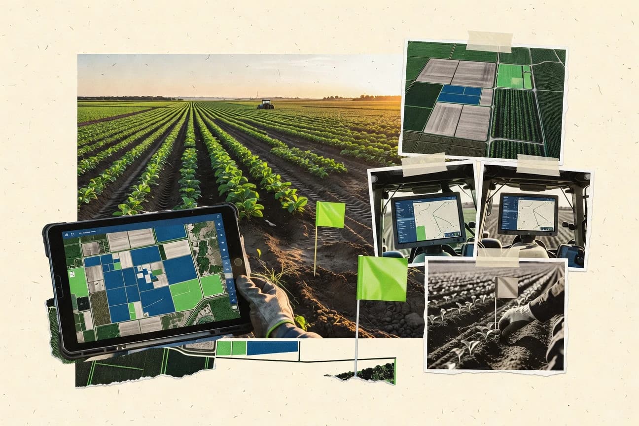
Agriculture FarmingTop 10 Best Farm Field Mapping Software of 2026
Discover top 10 farm field mapping software to optimize crop management. Compare features, find the best fit, and boost productivity – start here

How we ranked these tools
Core product claims cross-referenced against official documentation, changelogs, and independent technical reviews.
Analyzed video reviews and hundreds of written evaluations to capture real-world user experiences with each tool.
AI persona simulations modeled how different user types would experience each tool across common use cases and workflows.
Final rankings reviewed and approved by our editorial team with authority to override AI-generated scores based on domain expertise.
Score: Features 40% · Ease 30% · Value 30%
Gitnux may earn a commission through links on this page — this does not influence rankings. Editorial policy
Editor picks
Three quick recommendations before you dive into the full comparison below — each one leads on a different dimension.
PrecisionMapper
PrecisionMapper field polygon editor for accurate boundary refinement and exports
Built for farm teams mapping fields repeatedly with clean boundaries for planning and records.
AgriWebb
Runner UpPaddock-based field recordkeeping that ties map locations to farm activities
Built for farm teams needing practical field mapping tied to operational records.
Cropio
Also GreatField boundary mapping that drives linked field operations and agronomic record tracking
Built for agronomy teams needing field maps linked to operations, scouting, and planning.
Related reading
Comparison Table
This comparison table evaluates farm field mapping software such as PrecisionMapper, AgriWebb, Cropio, FarmIQ, Taranis, and other popular platforms used to plan, visualize, and manage field operations. The entries are organized to help readers compare core mapping and analytics features, supported data sources, collaboration workflows, and deployment options across different farm sizes and use cases.
PrecisionMapper
farm GISMaps farm fields, tracks field operations, and manages prescriptions using GIS and mobile-enabled workflow tools for agricultural tasks.
PrecisionMapper field polygon editor for accurate boundary refinement and exports
PrecisionMapper centers farm field mapping around rapid creation and editing of field boundaries, then ties those shapes into practical mapping outputs for operations. Core capabilities include importing geospatial data, drawing and refining polygons, and organizing assets by farm or field for repeatable use.
The workflow supports exporting deliverables for field planning and documentation rather than only viewing maps. This focus on production-ready field geometry makes it distinct from general-purpose GIS tools used for broad analysis.
- +Fast polygon creation and boundary editing tailored for farm fields
- +Import and reuse existing geospatial boundaries for consistent mapping
- +Clear organization of fields for repeatable seasonal workflows
- +Export-ready mapping outputs support field documentation and planning
- –Limited advanced agronomic analysis compared with full GIS platforms
- –Fewer automation options for large farms with highly repetitive edits
- –Collaboration features are less robust than tools built for teams
Best for: Farm teams mapping fields repeatedly with clean boundaries for planning and records
More related reading
AgriWebb
farm operationsProvides mobile field mapping and paddock management with farm recordkeeping, compliance documentation, and operational analytics.
Paddock-based field recordkeeping that ties map locations to farm activities
AgriWebb stands out for combining farm field mapping with on-farm records so field work connects to practical operational data. The field mapping view supports managing paddocks and visualizing boundaries, which helps standardize how land areas are referenced across tasks.
Field operations and compliance-oriented recordkeeping can be tied back to those mapped areas for clearer audit trails. Workflow centers on using maps to drive day-to-day documentation rather than treating mapping as a standalone GIS tool.
- +Field mapping links directly to farm records and operational workflows
- +Paddock and boundary management supports consistent land referencing
- +Map-driven documentation improves traceability for field tasks
- –Advanced GIS-style analysis and overlays are limited compared with dedicated mapping suites
- –Best results depend on disciplined data setup for paddocks and records
- –Bulk mapping changes can feel slower when managing many land parcels
Best for: Farm teams needing practical field mapping tied to operational records
Cropio
satellite mappingCreates farm field boundaries and agronomic map layers to support monitoring, recommendations, and variable-rate planning workflows.
Field boundary mapping that drives linked field operations and agronomic record tracking
Cropio focuses on farm field mapping paired with task execution, crop records, and agronomic planning in one workflow. The platform supports field delineation on maps, then ties those boundaries to operations, activities, and seasonal data.
Users can visualize management across plots and track work at the field level instead of managing maps and agronomy separately. The result is more operational than atlas-style mapping, with mapping acting as the anchor for day-to-day field management.
- +Field boundary mapping connects directly to field activities and records
- +Map-first workflow keeps plot context while planning agronomic operations
- +Field-level visibility helps standardize how work is tracked across teams
- –Advanced mapping and integration depth can require onboarding support
- –Field management workflows may feel heavier for simple mapping-only needs
- –Customization options for complex farm structures can be limiting
Best for: Agronomy teams needing field maps linked to operations, scouting, and planning
FarmIQ
field operationsUses interactive maps to plan, track, and visualize farm activities across fields with task execution and location-aware records.
Field polygon management linked to map-based operational activities
FarmIQ centers on field-level mapping workflows that connect field boundaries to farm operations tasks. Core capabilities include digitizing and managing field polygons and tracking map-based activities tied to those fields.
The tool also supports export-ready outputs that teams can use for planning and operational execution. Visual field organization is the main workflow driver rather than standalone GIS analysis.
- +Field polygon mapping keeps boundaries tied to operational work.
- +Map-based activity tracking reduces ambiguity during field execution.
- +Field organization supports repeatable planning and operational updates.
- –Advanced GIS analysis tools are limited compared with full GIS platforms.
- –Onboarding can feel slow for teams without mapping process discipline.
- –Some workflows rely on consistent field naming and structure.
Best for: Teams needing practical field boundary mapping and execution tracking
Taranis
AI agronomyBuilds field-level maps and agronomic insights by combining field boundaries with AI-driven scouting and remote sensing signals.
AI crop stress detection mapped onto field polygons for zone-level prioritization
Taranis stands out with automated detection and tracking of crop issues using AI from field imagery. The platform centers on farm field mapping that connects observations to geospatial field zones for actionable scouting and monitoring. It supports repeatable workflows that help teams compare conditions over time and prioritize interventions.
- +AI-driven lesion and stress detection tied to field locations
- +Repeatable monitoring that helps track changes across scouting cycles
- +Geospatial mapping for prioritizing field zones for intervention
- +Centralized job and observation workflow for agronomy teams
- –Setup and calibration work can take time before maps are accurate
- –Interpretation of AI signals may require agronomic expertise
- –Workflow configuration can feel heavy for small operations
Best for: Agronomy teams needing AI-assisted field mapping for ongoing crop monitoring
Sentera
imagery platformSupports farm field mapping and management of imagery-driven insights for variable-rate and decision support use cases.
Ag intelligence mapping that turns imagery and sensor signals into actionable field zones
Sentera stands out for turning field imagery into practical agronomy outputs with a workflow built around capture, analysis, and action. The platform supports variable data layers like soil and crop indicators derived from onboard sensors and aerial imagery. It emphasizes mapping and management views that help standardize field monitoring across seasons and farms.
- +Converts aerial and sensor inputs into field-ready agronomic layers for decision support
- +Multi-layer mapping helps teams compare zones across crops and time
- +Designed for operational field monitoring workflows instead of raw geodata only
- –Field setup and data prep can require more technical involvement than simple mapping tools
- –Mapping outputs depend heavily on consistent capture quality and sensor alignment
- –Advanced analysis workflow feels less streamlined than GIS-first field map builders
Best for: Farm teams needing sensor-driven field zones and map layers for agronomy actions
Farmbrite
Farm records mappingFarmbrite maps, organizes, and documents farm fields and work activities in a unified platform for planning and traceability across seasons.
Field boundary–anchored field activity tracking for parcel-level execution records
Farmbrite focuses on mapping and managing farm fields with a visual workspace for planning and tracking field activities. The tool supports field boundary capture and organization so operations teams can attach tasks, notes, and records to specific parcels. It also connects field-level information to wider farm workflows, which helps standardize execution across seasons.
- +Visual field mapping ties activities and records to specific boundaries
- +Clear organization of parcels and field data supports day-to-day farm planning
- +Field-level context reduces miscommunication across crews and operations
- –Setup of boundaries can be time-consuming for large farms
- –Advanced reporting and analytics feel limited versus dedicated agronomy systems
- –Workflow configuration requires careful attention to keep records consistent
Best for: Operations teams needing parcel-based field planning and traceable execution
Agworld
Field scouting platformAgworld provides field mapping alongside agronomic task planning, field scouting data capture, and farm documentation.
Location-linked agronomy workflows that attach activities and records to mapped field blocks
Agworld stands out for combining farm field mapping with agronomy-style task workflows tied to specific blocks and activities. It supports creating and managing field boundaries and linking operational data to those mapped areas for planning and execution.
The platform also supports data capture around crop management, including records that can be reviewed by location and season. Field mapping is most useful when mapping is treated as a hub for ongoing agronomic execution rather than a standalone GIS tool.
- +Field and block mapping ties locations to agronomic tasks and records
- +Location-based history supports reviewing actions by mapped area
- +Operational workflow structure reduces disconnected notes across seasons
- –Advanced GIS workflows and analysis depth are limited versus dedicated mapping tools
- –Mapping can feel workflow-first rather than field-data management-first
- –Relies on structured processes that can constrain atypical mapping use cases
Best for: Farm teams managing tasks and records by mapped fields and blocks
Avenza Maps
Offline GIS mappingAvenza Maps enables field boundary mapping and offline geospatial workflows using custom map data and GPS capture.
Offline map support for editing and collecting geospatial features without cell service
Avenza Maps stands out for turning offline-capable mobile map viewing into a field capture workflow using built-in tools. It supports creating and managing geospatial data layers like points, lines, and polygons for field boundary mapping and treatment areas.
The app emphasizes map hosting and offline use for locations with weak connectivity, which fits farm fieldwork schedules. Data can be exported to common GIS formats for review and continuation in desktop mapping tools.
- +Offline map access supports field mapping in low-connectivity areas
- +Mobile layer editing enables quick boundary and management zone creation
- +Exports geodata for downstream GIS analysis and reporting
- –Advanced GIS workflows require external tools for deeper analytics
- –Layer and symbology management can feel rigid during complex projects
- –Capture accuracy depends heavily on device GPS quality and settings
Best for: Farm teams needing offline mobile field boundary and zone mapping
GeoGage Field Mapping
Land measurement mappingGeoGage offers field mapping workflows for land measurement and field boundary documentation using GPS-enabled capture.
Field boundary and geotagged point collection for creating usable field maps
GeoGage Field Mapping focuses on capturing and visualizing farm field data as mapped assets that support on-field decision making. It provides field boundary mapping, point collection, and map-based organization for growers and agronomy teams coordinating field operations. The workflow is oriented toward practical mapping outcomes rather than broad enterprise GIS tooling, which keeps results usable for day-to-day farm tasks.
- +Field boundary and point mapping supports operational planning in mapped context
- +Map-first interface makes it easier to review field records quickly
- +Field data organization helps keep locations associated with field work
- –Limited evidence of advanced analytics like yield modeling and zone prescriptions
- –Collaboration and role controls appear less comprehensive than farm GIS suites
- –Integration depth for other farm systems is not a primary strength
Best for: Farms needing simple map capture and field record organization
Conclusion
After evaluating 10 agriculture farming, PrecisionMapper stands out as our overall top pick — it scored highest across our combined criteria of features, ease of use, and value, which is why it sits at #1 in the rankings above.
Use the comparison table and detailed reviews above to validate the fit against your own requirements before committing to a tool.
How to Choose the Right Farm Field Mapping Software
This buyer’s guide explains how to choose farm field mapping software that fits field boundary creation, operational recordkeeping, and agronomy workflows. It covers PrecisionMapper, AgriWebb, Cropio, FarmIQ, Taranis, Sentera, Farmbrite, Agworld, Avenza Maps, and GeoGage Field Mapping with concrete selection criteria. It also highlights common setup and workflow pitfalls seen across these tools so buyers can avoid rework.
What Is Farm Field Mapping Software?
Farm Field Mapping Software lets farm teams capture field boundaries and zones on maps, then attach field work to those mapped areas. It solves problems like inconsistent land referencing, unclear audit trails, and difficulty turning raw location data into field-ready planning and documentation. Most users digitize polygons or edit management zones, then connect those shapes to tasks, records, and imagery-derived insights. Tools like PrecisionMapper and Farmbrite show this category’s focus on production-ready boundaries and parcel-anchored activity tracking rather than broad GIS exploration.
Key Features to Look For
The right features determine whether mapped boundaries stay usable for operations, compliance, scouting, and variable-rate decision support.
Farm-ready field polygon creation and boundary refinement
PrecisionMapper emphasizes fast creation and accurate refinement of field polygons with a field polygon editor built for boundary cleanup. FarmIQ also centers on field polygon management tied to map-based operational activities so teams can keep boundaries aligned to execution.
Import, reuse, and organization of geospatial boundaries
PrecisionMapper supports importing geospatial data and reusing existing boundaries for consistent mapping across seasons. PrecisionMapper also organizes fields for repeatable seasonal workflows, while GeoGage Field Mapping and Avenza Maps help keep field assets structured for day-to-day map review.
Location-linked field recordkeeping and traceable work logs
AgriWebb ties paddock-based mapping to compliance documentation and farm recordkeeping so mapped areas connect to audit trails. Farmbrite anchors tasks, notes, and records to specific parcel boundaries to reduce miscommunication across crews.
Map-first workflows that drive linked field operations
Cropio uses field boundary mapping as an anchor for linked field operations, activities, and agronomic records. FarmIQ provides a similar map-to-execution flow by connecting field polygons to location-aware activity tracking during field execution.
AI scouting and imagery mapping mapped onto field zones
Taranis converts field imagery into AI-driven lesion and stress signals mapped onto field polygons for zone-level prioritization. Sentera builds imagery and sensor-driven agronomic layers into field-ready zones for decision support and variable-rate workflows.
Offline capture and exportable geodata for downstream GIS
Avenza Maps supports offline mobile map access for editing and collecting geospatial features without cell service. It also exports geodata for downstream GIS work, while GeoGage Field Mapping provides GPS-enabled capture of boundaries and geotagged points for practical map outputs.
How to Choose the Right Farm Field Mapping Software
Selection should start with how mapping must feed daily operations or agronomy decisions, then move to data capture constraints and zone intelligence requirements.
Choose mapping that matches operational execution, not just viewing
For boundary-heavy, production-ready mapping, PrecisionMapper is built around polygon creation and boundary refinement with export-ready mapping outputs for field planning and records. For teams that need mapping to drive activities and task execution, Cropio and FarmIQ tie field boundaries and field polygons to linked field operations so map context stays with work.
Match the land structure model to how the farm actually operates
If the farm runs on paddocks and needs documentation tied to those land units, AgriWebb’s paddock-based field recordkeeping connects map locations to farm activities. For parcel-based execution and planning traceability, Farmbrite focuses on field boundary anchored activity tracking on specific parcels.
Plan for zone intelligence level based on imagery and sensor needs
If imagery-driven crop stress detection is a requirement, Taranis maps AI-derived stress signals onto field polygons for ongoing monitoring cycles. If decision support layers from aerial imagery and sensor inputs are needed for variable-rate actions, Sentera turns imagery and sensor signals into actionable field zones.
Validate offline capture requirements for fieldwork connectivity
If connectivity gaps are common during boundary capture, Avenza Maps enables offline map access for mobile layer editing and geospatial feature collection without cell service. If GPS-enabled point and boundary capture for usable field maps is the priority, GeoGage Field Mapping provides field boundary and geotagged point collection oriented toward operational planning.
Confirm collaboration and workflow complexity limits for the team size
If multi-crew collaboration is required, PrecisionMapper notes collaboration features are less robust than tools built for teams, so this area needs a fit check. If onboarding needs to be light, Cropio and FarmIQ can feel heavier when process discipline is missing, while Agworld and AgriWebb rely on structured processes to keep mapped tasks consistent.
Who Needs Farm Field Mapping Software?
Farm Field Mapping Software benefits teams that must keep field boundaries consistent, connect work to mapped locations, and sometimes turn imagery into actionable zones.
Farm teams mapping fields repeatedly with clean boundaries for planning and records
PrecisionMapper fits this segment because it emphasizes fast polygon creation and accurate boundary refinement with export-ready mapping outputs. FarmIQ also suits this workflow when the goal is field polygon management linked to map-based operational activities.
Farm teams needing practical mapping tied to compliance and audit-ready records
AgriWebb is built for paddock-based field recordkeeping that ties mapped locations to compliance-oriented documentation. Farmbrite complements this need with parcel-based field activity tracking that keeps tasks, notes, and records attached to field boundaries.
Agronomy teams that must run scouting, monitoring, and planning using field zones
Cropio serves agronomy teams that want field boundary mapping to drive linked field operations, crop records, and seasonal planning. Taranis adds AI crop stress detection mapped onto field polygons for zone-level prioritization during ongoing monitoring.
Teams requiring sensor- and imagery-driven decision support layers for variable-rate actions
Sentera is designed for turning imagery and sensor signals into actionable field zones that support variable data layers. It also supports multi-layer mapping so teams compare zones across crops and time during agronomy actions.
Operations teams that need offline mobile capture and exportable geodata
Avenza Maps supports offline map access for editing and collecting geospatial features without cell service and exports geodata for downstream GIS review. GeoGage Field Mapping supports GPS-enabled boundary and geotagged point collection for simple map capture and field record organization.
Common Mistakes to Avoid
These pitfalls repeatedly show up when mapping tools are selected without matching the software to the farm’s workflow reality.
Buying a GIS-first platform when day-to-day field execution is the real goal
Many tools in this category focus on map-first operational workflows rather than deep GIS analysis, so teams needing advanced GIS-style analysis should avoid assuming all mapping layers support heavy overlay workflows. PrecisionMapper, FarmIQ, and Agworld prioritize operational mapping and location-linked tasks, while Sentera focuses on imagery and sensor layers for action.
Underestimating boundary setup time for large farms
Farmbrite flags that boundary setup can be time-consuming for large farms, which can slow initial onboarding for parcel-heavy operations. PrecisionMapper and Avenza Maps reduce friction with boundary editing and offline editing, but any tool still requires disciplined polygon setup for consistent outputs.
Ignoring process discipline for field naming and land-structure consistency
FarmIQ notes some workflows rely on consistent field naming and structure, which can break map-to-activity tracking when conventions are not enforced. AgriWebb also depends on disciplined data setup for paddocks and records, so inconsistent land referencing creates audit-trail gaps.
Choosing an AI or sensor workflow without planning for setup and calibration effort
Taranis requires setup and calibration before maps become accurate, and AI signal interpretation can demand agronomic expertise. Sentera’s mapping outputs depend heavily on consistent capture quality and sensor alignment, so poor data acquisition can undermine actionable zones.
How We Selected and Ranked These Tools
We score every tool on three sub-dimensions with features weighted at 0.40, ease of use weighted at 0.30, and value weighted at 0.30. The overall rating is the weighted average computed as overall = 0.40 × features + 0.30 × ease of use + 0.30 × value. PrecisionMapper separated itself from lower-ranked options by combining farm-ready field polygon editor capabilities with strong feature scoring, which supports fast boundary refinement and export-ready mapping outputs used for planning and documentation. Lower-ranked tools tend to excel in narrower niches like offline capture in Avenza Maps or geotagged point collection in GeoGage Field Mapping rather than end-to-end production-ready boundary workflows.
Frequently Asked Questions About Farm Field Mapping Software
Which farm field mapping tool is best for repeatedly creating clean polygon boundaries for planning and records?
Which option connects mapped fields directly to operational records for audit-ready documentation?
Which tool is strongest when mapping must drive day-to-day agronomic task execution?
What software best supports AI-assisted scouting by mapping crop stress or issues into field zones?
Which platform turns imagery and sensor signals into actionable variable management layers?
Which tools support parcel-level tracking where tasks and notes must attach to specific boundaries?
Which option is best for organizing agronomy work by blocks with location-linked records across seasons?
How do teams capture field boundaries when connectivity is unreliable?
What problem do users typically face when moving from simple map viewing to production-ready field outputs?
Which tool is a good fit for starting with lightweight field mapping and gradually adding more structured data capture?
Tools reviewed
Primary sources checked during evaluation.
Referenced in the comparison table and product reviews above.
Keep exploring
Comparing two specific tools?
Software Alternatives
See head-to-head software comparisons with feature breakdowns, pricing, and our recommendation for each use case.
Explore software alternatives→In this category
Agriculture Farming alternatives
See side-by-side comparisons of agriculture farming tools and pick the right one for your stack.
Compare agriculture farming tools→FOR SOFTWARE VENDORS
Not on this list? Let’s fix that.
Our best-of pages are how many teams discover and compare tools in this space. If you think your product belongs in this lineup, we’d like to hear from you—we’ll walk you through fit and what an editorial entry looks like.
Apply for a ListingWHAT THIS INCLUDES
Where buyers compare
Readers come to these pages to shortlist software—your product shows up in that moment, not in a random sidebar.
Editorial write-up
We describe your product in our own words and check the facts before anything goes live.
On-page brand presence
You appear in the roundup the same way as other tools we cover: name, positioning, and a clear next step for readers who want to learn more.
Kept up to date
We refresh lists on a regular rhythm so the category page stays useful as products and pricing change.