GITNUXSOFTWARE ADVICE
Business FinanceTop 10 Best Mapping Drone Software of 2026
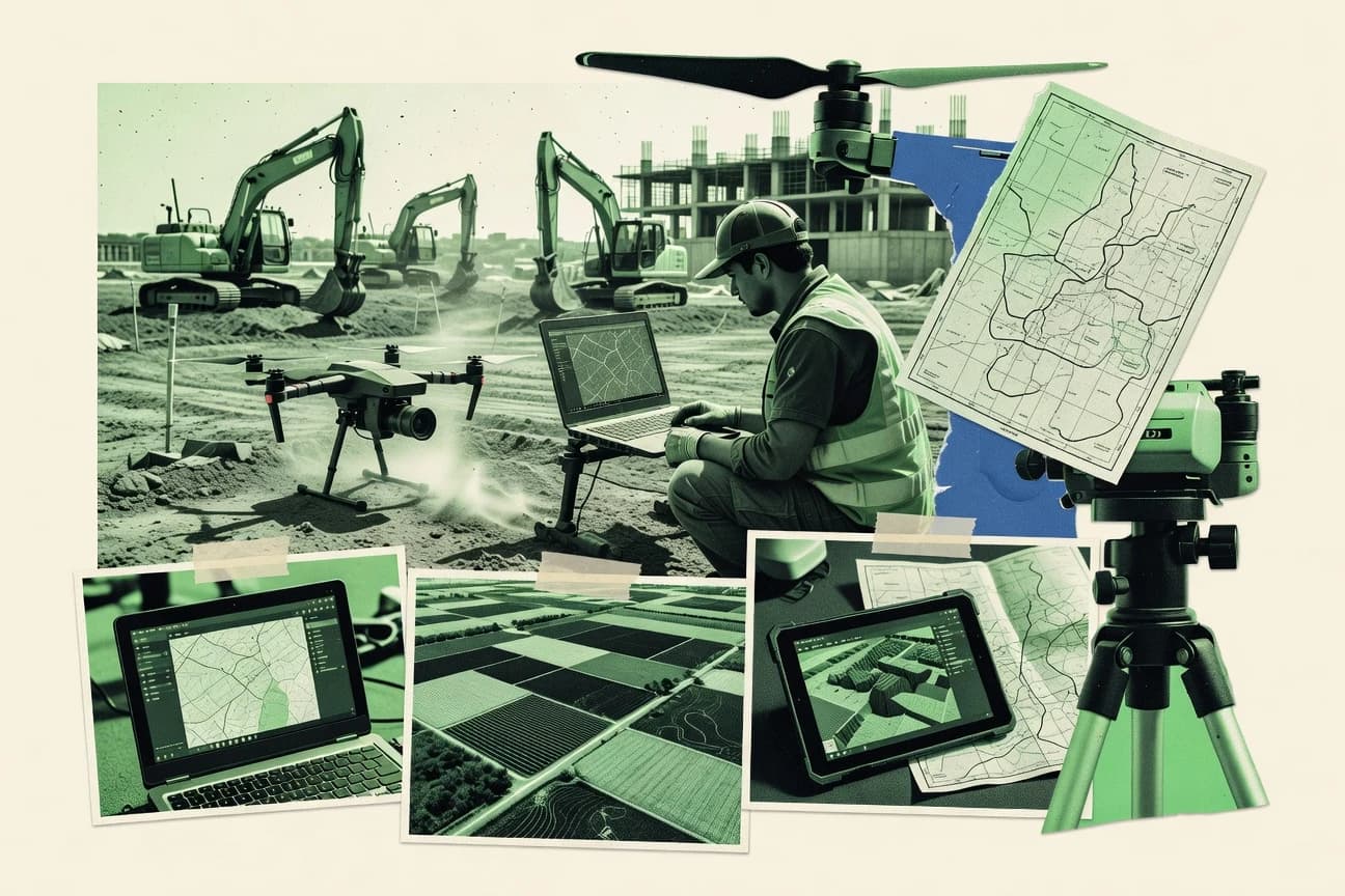
Discover the best mapping drone software for precise aerial data. Find tools to simplify your mapping projects today.

How we ranked these tools
Core product claims cross-referenced against official documentation, changelogs, and independent technical reviews.
Analyzed video reviews and hundreds of written evaluations to capture real-world user experiences with each tool.
AI persona simulations modeled how different user types would experience each tool across common use cases and workflows.
Final rankings reviewed and approved by our editorial team with authority to override AI-generated scores based on domain expertise.
Score: Features 40% · Ease 30% · Value 30%
Gitnux may earn a commission through links on this page — this does not influence rankings. Editorial policy
Editor’s top 3 picks
Three quick recommendations before you dive into the full comparison below — each one leads on a different dimension.
Pix4Dfields
NDVI and vegetation index mapping integrated into photogrammetric field products
Built for precision agriculture teams producing field maps and vegetation indices from drones.
Pix4Dmapper
Editor pickReprojection error reporting with QA visualization for alignment confidence
Built for survey teams generating accurate orthomosaics and 3D models from drone imagery.
DroneDeploy
Editor pickGuided mission planning with automated orthomosaic and model generation
Built for construction, agriculture, and infrastructure teams needing consistent drone mapping workflows.
Related reading
Comparison Table
This comparison table benchmarks mapping drone software used to turn drone imagery into accurate orthomosaics, point clouds, and 3D models. It covers platforms such as Pix4Dfields, Pix4Dmapper, DroneDeploy, Propeller Aero, and Bentley ContextCapture so readers can compare capabilities like data processing workflows, output types, and project management features.
Pix4Dfields
agriculture mappingProcesses drone images into georeferenced orthomosaics and 3D maps for crop and farm analytics.
NDVI and vegetation index mapping integrated into photogrammetric field products
Pix4Dfields stands out for producing georeferenced crop and surface insights directly from drone imagery using photogrammetry workflows. It generates orthomosaics, elevation models, and vegetation indices like NDVI alongside measurement tools such as area and volume calculations.
The software supports common mapping outputs used for precision agriculture reporting, with project templates that streamline repeat field captures. Pix4Dfields also emphasizes field-scale consistency through quality checks and standardized processing steps.
- +End-to-end photogrammetry outputs for orthomosaics, DSM, and point clouds
- +Vegetation index maps like NDVI for precision agriculture field monitoring
- +Field measurement tools for areas, statistics, and change-focused reporting
- –Processing can be slow on large captures without strong hardware
- –Workflow guidance still requires careful mission planning for best results
- –Advanced analysis capabilities are less tailored than specialized GIS platforms
Best for: Precision agriculture teams producing field maps and vegetation indices from drones
More related reading
Pix4Dmapper
photogrammetryGenerates photogrammetry-based point clouds, 3D models, and orthomosaics from drone or camera imagery.
Reprojection error reporting with QA visualization for alignment confidence
Pix4Dmapper stands out for producing survey-grade photogrammetry outputs from drone image blocks and for its established pipeline from alignment to dense point cloud. Core capabilities include automated image alignment, dense point cloud generation, orthomosaics, and georeferenced 3D models with coordinate system handling.
The software supports multiple sensor and camera workflows and enables quality control through inspection tools like reprojection error reporting and coverage visualization. Export options cover common GIS and CAD formats for downstream analysis and measurement.
- +End-to-end photogrammetry pipeline with alignment, dense cloud, and orthomosaics
- +Survey-focused outputs with strong georeferencing and coordinate system support
- +Quality reports like reprojection error help validate image alignment
- –Dense reconstruction and orthomosaics require significant compute and time
- –Workflow tuning can be complex for mixed flight conditions and camera setups
- –Advanced QA and processing choices demand practice to avoid rework
Best for: Survey teams generating accurate orthomosaics and 3D models from drone imagery
DroneDeploy
cloud mappingPlans drone missions and delivers cloud-processed orthomosaics, 3D maps, and measurements for field teams.
Guided mission planning with automated orthomosaic and model generation
DroneDeploy stands out for turning drone flights into shareable, map-ready outputs through guided capture workflows and automated processing. Core capabilities include web-based mission planning, flight execution guidance, and generation of orthomosaics, surface models, and progress analytics.
The platform also supports stakeholder-friendly sharing so teams can review results inside a browser without specialist GIS tooling. Designed for mapping and inspection workflows, it emphasizes repeatability and consistent reporting across sites.
- +Browser-based mapping pipeline produces orthomosaics and 3D models from captured flights
- +Guided mission planning supports repeatable capture across sites and projects
- +Web sharing streamlines review for non-specialists
- +Automated progress analytics helps track changes between survey dates
- –Workflow relies on DroneDeploy-centric capture and processing steps
- –Advanced geospatial customization is limited versus full GIS tools
- –Large datasets can increase processing and turnaround time
Best for: Construction, agriculture, and infrastructure teams needing consistent drone mapping workflows
Propeller Aero
construction mappingUses cloud photogrammetry to generate orthomosaics, surface models, and progress insights from drone data.
Automated mission-to-deliverable workflow for generating orthomosaics and terrain surfaces
Propeller Aero focuses on end-to-end drone mapping deliverables built around flight capture and automated processing tied to survey use cases. The workflow emphasizes mission planning, photogrammetry-based reconstruction, and delivering mapped outputs for field projects.
Teams get practical site deliverables such as orthomosaics and surfaces designed for planning and progress review rather than research-grade customization. Integration details are narrower than general-purpose photogrammetry stacks, which limits deep tuning for specialized pipelines.
- +Streamlined mapping workflow that covers flight capture through mapped deliverables
- +Automated photogrammetry processing geared toward orthomosaics and surfaces
- +Designed for fast project turnaround with outputs usable for site review
- –Less flexible than advanced photogrammetry tools for custom processing pipelines
- –Limited visibility into low-level reconstruction parameters for expert tuning
- –Workflow fits specific use cases less broadly than general mapping suites
Best for: Field and small survey teams needing repeatable mapping outputs without heavy configuration
Bentley ContextCapture
reality modelingCreates high-detail 3D reality meshes and textured models from aerial imagery and LiDAR for engineering workflows.
ContextCapture’s automated large-scale photogrammetry pipeline with rigorous georeferencing and accuracy reporting
Bentley ContextCapture stands out for its end-to-end photogrammetry workflow that produces metric 3D models and textured outputs from aerial and drone imagery. It emphasizes automated image alignment, dense reconstruction, and accuracy reporting using controllable georeferencing.
For mapping drone projects, it supports large datasets, tiling, and downstream delivery via common digital twin and GIS-adjacent pipelines. It pairs well with Bentley ecosystems where engineering-grade control and repeatable production are required.
- +Strong automated photogrammetry for accurate, metric 3D reconstruction
- +Georeferencing and control workflows support engineering-grade output requirements
- +Scales to large drone image sets with production-focused processing options
- +Dense reconstruction and textured outputs support visual verification and measurement
- –Advanced setup for inputs, coordinate systems, and control can slow new users
- –Workflow depends on image quality and flight planning discipline for best results
- –Collaboration and review tooling can feel less streamlined than dedicated mapping stacks
Best for: Engineering and mapping teams producing accurate 3D models from drone imagery
Agisoft Metashape
desktop photogrammetryPerforms photogrammetry to produce dense point clouds, meshes, orthomosaics, and accurate models from images.
Dense point cloud and mesh reconstruction with orthomosaic export from georeferenced imagery
Agisoft Metashape stands out for detailed photogrammetry workflows that turn overlapping drone imagery into dense point clouds, meshes, and textured models. It supports processing pipelines for alignment, dense reconstruction, and orthomosaic generation with options like camera calibration and georeferencing. The software also offers tools for measuring distances and areas on reconstructed surfaces, which fits mapping deliverables beyond visualization.
- +Strong photogrammetry pipeline for dense clouds, meshes, and textured outputs
- +Flexible georeferencing using GCPs, GPS priors, and coordinate system settings
- +Measurement tools support distances, areas, and volume workflows on models
- –Workflow setup and parameter tuning can be complex for new teams
- –Large datasets require substantial CPU, RAM, and storage for stable processing
- –Automation is limited compared with drone-centric production platforms
Best for: Teams needing high-fidelity photogrammetry deliverables from drone imagery
RealityCapture
high-speed photogrammetryReconstructs large-scale 3D scenes and orthophotos from drone images with fast, high-accuracy processing.
Reprojection error–driven optimization with ground control for metric alignment
RealityCapture stands out for its speed-focused photogrammetry pipeline that turns overlapping drone imagery into dense geometry and textured outputs. It supports aerial image alignment, dense point cloud reconstruction, and automated generation of digital elevation models, orthomosaics, and textured meshes.
The workflow integrates ground control through georeferencing so surveyed projects can produce metric results with defined coordinate systems. It also provides export options for common GIS and engineering deliverables, including formats for point clouds, meshes, and orthomosaics.
- +Fast alignment and dense reconstruction for high-volume drone image sets
- +Strong georeferencing with ground control and coordinate system support
- +Generates meshes, dense point clouds, DEMs, and orthomosaics in one project
- –Steeper setup for high-accuracy workflows than simpler mapping tools
- –Project tuning can require experience to avoid noisy reconstructions
- –Resource-heavy dense processing can overwhelm modest workstations
Best for: Teams producing accurate orthomosaics, DEMs, and dense models from drone photogrammetry
Trimble Inpho UASMaster
survey processingAutomates aerial photogrammetry processing with GNSS and camera data for survey-grade orthomosaics and DSMs.
Automated photogrammetry processing workflow with QA checks for georeferenced deliverables
Trimble Inpho UASMaster stands out for production-grade photogrammetry workflows aimed at mapping, inspection, and survey deliverables. It supports end-to-end processing steps from flight imagery through alignment, dense point cloud generation, and derived products tied to geospatial coordinate systems.
UASMaster is built to handle automated processing chains and QA outputs that map teams can standardize across projects. The software is strongest when consistent capture conditions and survey control data are available for reliable georeferencing.
- +Strong photogrammetry pipeline for generating mapping-grade outputs from UAV imagery
- +Geospatial workflows support coordinate system handling for survey-ready deliverables
- +Automated processing helps standardize multi-project processing chains
- +QA outputs support checking alignment quality and downstream product reliability
- –Workflow setup and parameter tuning require survey-grade experience
- –Automation still depends on consistent capture and good control data quality
- –Processing can be compute-intensive for large image sets
Best for: Survey and mapping teams producing georeferenced outputs from consistent UAV captures
Trimble TerraFlex
field survey managementManages field survey workflows and measurements that can be paired with geospatial mapping outputs.
Task-based review and annotation against georeferenced data for structured field progress tracking
Trimble TerraFlex stands out for end-to-end field-to-cloud workflows that connect map data collection and operational reporting. It supports georeferenced viewing, collaborative plan-and-progress marking, and task-based data capture tied to assets. The workflow focuses on translating drone-derived results into actionable field observations rather than only producing deliverable maps.
- +Field-to-office workflow that links mapping outputs to task and progress management
- +Georeferenced collaboration for reviewing, annotating, and tracking findings in one environment
- +Asset-centric workflows fit recurring survey programs and operational monitoring
- –Advanced configuration can feel heavy for teams that only need quick map delivery
- –Workflow benefits depend on consistent project setup and disciplined data organization
- –Not positioned as a pure drone photogrammetry engine for standalone processing
Best for: Survey teams standardizing drone-to-field workflows for recurring asset inspections
Pix4Dsurvey
survey-grade mappingProvides survey-grade mapping and automation for accurate 2D and 3D products from aerial imagery.
Ground control point integration for georeferenced orthomosaics and 3D models
Pix4Dsurvey distinguishes itself with an end-to-end photogrammetry workflow for processing drone imagery into survey-grade outputs. The software supports automated camera calibration and bundle adjustment, then produces dense point clouds, orthomosaics, and georeferenced 3D models.
It also includes measurement tools and exports designed for downstream GIS and CAD use. Strong control comes from its ground control point and coordinate system handling for repeatable survey outputs.
- +Automated photogrammetry pipeline produces orthomosaics, point clouds, and 3D models
- +Ground control and coordinate system workflows support accurate georeferenced deliverables
- +Survey-grade measurement and annotation tools support onsite validation
- +Export options fit common GIS and CAD analysis workflows
- –Dense reconstruction settings can require tuning for consistent results
- –Workflow setup around GCPs and outputs adds steps for simple projects
- –Large datasets can increase processing time and demand strong hardware
Best for: Survey teams needing accurate, georeferenced drone photogrammetry deliverables
Conclusion
After evaluating 10 business finance, Pix4Dfields stands out as our overall top pick — it scored highest across our combined criteria of features, ease of use, and value, which is why it sits at #1 in the rankings above.
Use the comparison table and detailed reviews above to validate the fit against your own requirements before committing to a tool.
How to Choose the Right Mapping Drone Software
This buyer’s guide helps teams choose mapping drone software by matching deliverables, accuracy controls, and workflow style to real project needs across Pix4Dfields, Pix4Dmapper, DroneDeploy, Propeller Aero, Bentley ContextCapture, Agisoft Metashape, RealityCapture, Trimble Inpho UASMaster, Trimble TerraFlex, and Pix4Dsurvey. It also covers decision points for georeferencing, QA reporting, and dataset scaling so that processing time and rework risk stay under control. Each section uses named tools and specific capabilities such as NDVI mapping, reprojection error QA, GNSS-centered automation, and ground control workflows.
What Is Mapping Drone Software?
Mapping drone software turns overlapping drone imagery into georeferenced outputs like orthomosaics, DSMs, DEMs, and textured 3D models. It solves two core problems: creating survey-grade spatial products from photos and standardizing how teams plan, process, validate, and export those products for downstream work. Pix4Dmapper and Agisoft Metashape represent photogrammetry-focused production stacks that generate dense point clouds, meshes, and orthomosaics from image blocks. DroneDeploy and Propeller Aero represent guided or mission-to-deliverable platforms that emphasize repeatable capture, browser-based review, and automated generation of orthomosaics and surface insights.
Key Features to Look For
Mapping drone software should match deliverables, accuracy validation, and workflow automation to the organization’s data capture discipline and output expectations.
Vegetation index mapping inside photogrammetry field deliverables
Pix4Dfields generates NDVI and other vegetation index maps as part of field-scale photogrammetric products. This matters for precision agriculture reporting because NDVI turns raw surface reconstruction into actionable crop monitoring maps tied to area measurement and repeatable field workflows.
Reprojection error reporting and QA visualization
Pix4Dmapper and RealityCapture provide quality confidence through reprojection error-driven optimization and alignment validation. This matters because reprojection error reporting and coverage or inspection views help prevent exporting inaccurate geometry when image alignment quality is weak.
Guided mission planning and automated orthomosaic generation
DroneDeploy and Propeller Aero include guided capture workflows that drive consistent inputs into automated processing. This matters because repeatable mission planning reduces variability that leads to longer turnaround times and rework when teams must deliver site-ready orthomosaics and surface models on schedule.
Georeferencing workflow with ground control points and coordinate system support
Pix4Dsurvey and Pix4Dmapper focus on ground control point integration and coordinate system handling to produce survey-grade orthomosaics and georeferenced 3D models. This matters for projects that must align to real-world coordinates for measurement, CAD integration, or GIS analysis.
Production-grade automation with GNSS-aware QA checks
Trimble Inpho UASMaster automates photogrammetry processing using GNSS and camera data and adds QA outputs for georeferenced deliverables. This matters when a survey workflow depends on consistent capture conditions and reliable control inputs across many repeated mapping jobs.
Dense reconstruction and large-scale reality modeling that scales
RealityCapture, Bentley ContextCapture, and Agisoft Metashape produce dense point clouds and orthomosaics from drone imagery, and Bentley ContextCapture adds large-scale production options with accuracy reporting. This matters for high-volume projects because tiling, dense reconstruction pipelines, and metric georeferencing workflows determine whether outputs stay consistent across large datasets.
How to Choose the Right Mapping Drone Software
The right choice starts with deliverable type and accuracy workflow, then matches the processing style to the team’s capture discipline and tolerance for setup complexity.
Start from the deliverables that must be produced
Select software that directly generates the outputs needed for the end use, such as orthomosaics, DSMs, DEMs, and 3D models. Pix4Dfields is built for vegetation index deliverables like NDVI alongside orthomosaic and surface products, while RealityCapture and Pix4Dmapper produce dense geometry plus orthomosaics and coordinate-ready exports for survey measurement.
Match the georeferencing method to how control data is collected
If projects use ground control points and must land in a strict coordinate system, Pix4Dsurvey and Pix4Dmapper emphasize ground control point integration and coordinate system handling for survey-grade products. If GNSS and camera metadata drive automation, Trimble Inpho UASMaster aligns with automated processing chains that rely on consistent capture conditions and QA checks.
Choose the validation depth based on risk and downstream use
For teams that need alignment confidence before exporting measurement-ready outputs, prioritize reprojection error reporting and QA visualization like Pix4Dmapper and RealityCapture. For engineering-grade delivery at scale with accuracy reporting, Bentley ContextCapture provides controllable georeferencing and accuracy reporting that supports metric 3D production.
Decide whether capture guidance matters more than photogrammetry tuning
If consistent field capture and fast stakeholder review matter, DroneDeploy and Propeller Aero provide guided mission planning plus automated orthomosaic and model generation for repeatable outcomes. If the workflow requires deeper control of reconstruction parameters and dense processing decisions, Agisoft Metashape and ContextCapture support flexible georeferencing and detailed photogrammetry pipelines that demand parameter tuning practice.
Plan for dataset scale and processing capacity
Large image sets can require compute and time, so match the software pipeline to available workstation resources and project volume. RealityCapture emphasizes speed-focused dense reconstruction for high-volume inputs, while ContextCapture and Agisoft Metashape support scalable production workflows that still depend on image quality and sufficient hardware to sustain stable dense processing.
Who Needs Mapping Drone Software?
Mapping drone software benefits teams that must convert drone image capture into spatial products for measurement, planning, engineering review, or repeatable site monitoring.
Precision agriculture teams producing vegetation index and field analytics
Pix4Dfields fits precision agriculture because it integrates NDVI and vegetation index mapping into photogrammetric field products and supports measurement tools for areas and change-focused reporting. DroneDeploy can also support agriculture mapping teams that need consistent stakeholder-friendly orthomosaic and 3D review in a browser.
Survey teams producing orthomosaics and metric 3D models
Pix4Dmapper and RealityCapture serve survey work because both produce georeferenced dense outputs and include reprojection error-driven alignment optimization or QA reporting. Pix4Dsurvey and Trimble Inpho UASMaster further align with survey requirements through ground control workflows and GNSS-centered automated processing plus QA checks.
Construction and infrastructure teams that need repeatable mapping workflows and fast review
DroneDeploy is designed for construction and infrastructure teams because it includes guided mission planning, automated orthomosaic and model generation, and web sharing so non-specialists can review results inside a browser. Propeller Aero supports similar repeatable mission-to-deliverable mapping workflows focused on orthomosaics and terrain surfaces.
Engineering and mapping teams that require large-scale accuracy reporting and metric reality meshes
Bentley ContextCapture is built for engineering-grade output because it emphasizes automated large-scale photogrammetry with rigorous georeferencing and accuracy reporting. Agisoft Metashape can also serve engineering teams that need high-fidelity dense point clouds and meshes with flexible georeferencing options like GCPs and GPS priors.
Common Mistakes to Avoid
Frequent buying missteps come from selecting the wrong georeferencing approach, underestimating processing requirements, or choosing a workflow style that does not match capture discipline.
Buying a dense photogrammetry tool without planning for QA validation
Dense reconstruction pipelines can produce outputs that still require alignment confidence checks, so QA matters for measurement-grade work. Pix4Dmapper and RealityCapture address this with reprojection error reporting and alignment optimization tied to ground control or georeferencing.
Expecting vegetation analytics from general orthomosaic production tools
NDVI and vegetation index deliverables depend on software-specific field product workflows, not just orthomosaics. Pix4Dfields integrates NDVI mapping directly into photogrammetric field products, while Pix4Dmapper focuses on photogrammetry outputs rather than agriculture index workflows.
Choosing capture guidance that conflicts with the team’s current workflow
Platforms built around guided capture and automated delivery can require DroneDeploy-centric or similar capture steps to maintain repeatability. Pix4Dmapper and Agisoft Metashape offer more flexible photogrammetry setup for teams that already manage capture discipline and processing parameters.
Ignoring the compute and time costs of dense reconstruction on large datasets
Dense point clouds and orthomosaics increase processing time and can overwhelm modest workstations, especially for large captures. RealityCapture emphasizes fast processing for high-volume drone sets, while Bentley ContextCapture and Agisoft Metashape support scalable production pipelines that still depend on sufficient hardware and image quality.
How We Selected and Ranked These Tools
We evaluated every tool on three sub-dimensions: features with weight 0.4, ease of use with weight 0.3, and value with weight 0.3. The overall score is the weighted average of those three sub-dimensions using overall = 0.40 × features + 0.30 × ease of use + 0.30 × value. Pix4Dfields separated itself with a feature set that directly supports precision agriculture needs, especially NDVI and vegetation index mapping integrated into photogrammetric field products, while still delivering an end-to-end workflow for orthomosaics, DSMs, and measurement outputs.
Frequently Asked Questions About Mapping Drone Software
Which mapping drone software best produces NDVI and vegetation indices from drone imagery?
Which tool is strongest for survey-grade orthomosaics with explicit QA of alignment quality?
What software is best when repeatable, guided capture workflows and browser-based review matter?
Which option is best for engineering-grade, large datasets that require accuracy reporting and georeferencing control?
Which mapping drone software handles end-to-end processing with strong ground control and repeatable georeferenced deliverables?
Which tool is best for high-fidelity dense point clouds, meshes, and measurement-ready surface outputs?
Which software is most suitable for teams that want automated mission-to-deliverable outputs for planning and progress review?
Which mapping drone software supports connecting drone-derived map data to task-based field inspection and progress tracking?
What are common causes of poor alignment and which tools provide the most direct diagnostics?
Which software is best for repeat mapping workflows when consistent capture conditions are available?
Tools reviewed
Primary sources checked during evaluation.
Referenced in the comparison table and product reviews above.
Keep exploring
Comparing two specific tools?
Software Alternatives
See head-to-head software comparisons with feature breakdowns, pricing, and our recommendation for each use case.
Explore software alternatives→In this category
Business Finance alternatives
See side-by-side comparisons of business finance tools and pick the right one for your stack.
Compare business finance tools→FOR SOFTWARE VENDORS
Not on this list? Let’s fix that.
Our best-of pages are how many teams discover and compare tools in this space. If you think your product belongs in this lineup, we’d like to hear from you—we’ll walk you through fit and what an editorial entry looks like.
Apply for a ListingWHAT THIS INCLUDES
Where buyers compare
Readers come to these pages to shortlist software—your product shows up in that moment, not in a random sidebar.
Editorial write-up
We describe your product in our own words and check the facts before anything goes live.
On-page brand presence
You appear in the roundup the same way as other tools we cover: name, positioning, and a clear next step for readers who want to learn more.
Kept up to date
We refresh lists on a regular rhythm so the category page stays useful as products and pricing change.