GITNUXSOFTWARE ADVICE
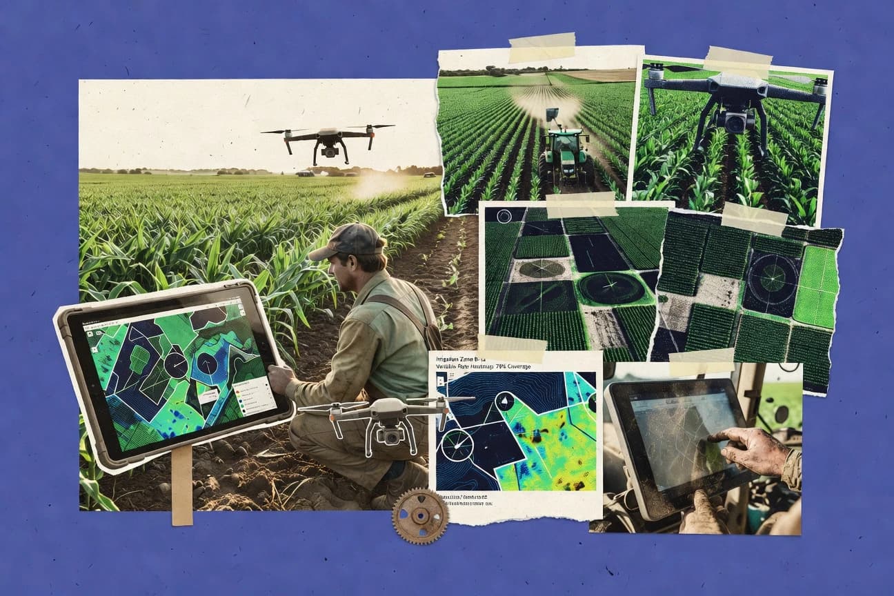
Agriculture FarmingTop 10 Best Agriculture Mapping Software of 2026
Discover top 10 agriculture mapping software for precision farming. Explore tools to boost efficiency—find your best fit today.

How we ranked these tools
Core product claims cross-referenced against official documentation, changelogs, and independent technical reviews.
Analyzed video reviews and hundreds of written evaluations to capture real-world user experiences with each tool.
AI persona simulations modeled how different user types would experience each tool across common use cases and workflows.
Final rankings reviewed and approved by our editorial team with authority to override AI-generated scores based on domain expertise.
Score: Features 40% · Ease 30% · Value 30%
Gitnux may earn a commission through links on this page — this does not influence rankings. Editorial policy
Editor picks
Three quick recommendations before you dive into the full comparison below — each one leads on a different dimension.
GeoCision Grower Intelligence
Grower Intelligence reporting that links mapped field data to agronomic outcomes
Built for agronomy teams needing field mapping tied to grower reporting workflows.
AgriWebb
Runner UpMap-linked traceability that ties farm inputs and activities to paddocks.
Built for farming teams needing mapped paddock records and traceability in one system.
Taranis
Also GreatAI anomaly detection that surfaces vegetation stress hotspots with severity scoring for each field
Built for agronomy teams needing AI crop scouting maps with actionable parcel insights.
Related reading
Comparison Table
This comparison table covers agriculture mapping software across key workflows like field mapping, satellite or aerial analytics, variable-rate planning, and grower reporting. You will see how GeoCision Grower Intelligence, AgriWebb, Taranis, Trimble Ag Software, Climate FieldView, and other tools differ by feature set, data sources, integration options, and typical use cases.
GeoCision Grower Intelligence
farm mappingCentralizes farm mapping, field boundary management, and crop data workflows for growers and agronomy teams.
Grower Intelligence reporting that links mapped field data to agronomic outcomes
GeoCision Grower Intelligence stands out by combining farm mapping with actionable grower insights built around field operations and results tracking. It supports geospatial field visualization alongside agronomic performance reporting so teams can connect mapping outputs to practical decisions. The system focuses on structured workflows for planting, scouting, and compliance-oriented documentation rather than generic GIS dashboards.
- +Field mapping ties directly to grower performance reporting
- +Workflow-oriented recordkeeping for scouting and operational documentation
- +Designed for agricultural use cases rather than general GIS
- –Advanced analysis depends on setup by implementation specialists
- –Limited flexibility for custom layers compared with full GIS platforms
- –Collaboration tools feel less robust than purpose-built farm management suites
Best for: Agronomy teams needing field mapping tied to grower reporting workflows
More related reading
AgriWebb
agronomy mappingProvides field mapping and paddock tracking with mobile-first agronomy execution and management visibility.
Map-linked traceability that ties farm inputs and activities to paddocks.
AgriWebb stands out with farm-first workflows that connect paddock records to map-based field tracking. It supports cropping tasks, activity logging, and traceability tied to specific land units so mapping feeds daily operations.
Its spatial view is strong for monitoring paddocks over time, while report outputs focus more on farming records than advanced geospatial analysis. Best results come from teams that manage work diaries and compliance records alongside map context.
- +Paddock mapping connects directly to field activities and records
- +Strong traceability trail from tasks to land units
- +Practical mobile-friendly workflow for on-farm data capture
- +Time-based field monitoring supports operational planning
- –Geospatial tools like analysis and overlays are less advanced than GIS suites
- –Setup of farms and mapping structure can take time for new teams
- –Reporting is more farming-centric than agronomy modeling
- –Advanced permissions and admin controls may feel limited for large orgs
Best for: Farming teams needing mapped paddock records and traceability in one system
Taranis
satellite analyticsUses satellite and AI to map crop health, detect stress, and generate field-ready agronomic insights.
AI anomaly detection that surfaces vegetation stress hotspots with severity scoring for each field
Taranis stands out with an AI-driven crop monitoring workflow that turns satellite and drone imagery into field-level insights. The platform highlights vegetation stress and growth anomalies using automated detection and severity scoring.
It supports map-based collaboration so agronomists and farm teams can review issues by parcel and track operational follow-up. Reporting is geared toward agronomy actions, with exportable summaries tied to detected hotspots.
- +AI detects vegetation stress hotspots across fields from imagery
- +Parcel-level maps link findings to agronomy review workflows
- +Severity scoring helps prioritize scouting and treatment actions
- –Workflow setup and field data onboarding can take administrator effort
- –Results quality depends on imagery frequency and coverage for each farm
- –Advanced users may still want deeper GIS editing tools
Best for: Agronomy teams needing AI crop scouting maps with actionable parcel insights
Trimble Ag Software
precision agricultureDelivers integrated mapping and precision agriculture tools that support field boundaries, prescription workflows, and task visibility.
Integration-driven Ag mapping workflow that aligns field data capture with precision planning outputs
Trimble Ag Software stands out with a tightly connected workflow that spans field data capture, mapping, and farm management tasks built around Trimble hardware. Core capabilities include precision ag mapping outputs, prescription-style planning, and data sharing tied to field and machine operations.
The product suite emphasizes operational continuity from collection to use, with collaboration tools for teams managing multiple farms and crews. The result is strong for organizations that already standardize on Trimble equipment and want consistent mapping outputs across the work cycle.
- +End-to-end workflow from field data to practical mapping outputs
- +Strong fit for teams standardized on Trimble hardware and data formats
- +Facilitates cross-team sharing of field and mapping datasets
- +Supports precision ag planning workflows tied to field operations
- –Setup complexity rises for users not already in Trimble ecosystems
- –Mapping and planning capabilities depend heavily on connected hardware
- –Learning curve can be steep for new operators and farm teams
Best for: Farms needing consistent precision mapping workflows with Trimble hardware
Climate FieldView
farm operationsConnects farm data to field maps and agronomic decision tools for analyzing variability and operational history.
Mobile FieldView data capture that syncs into actionable field maps for team review
Climate FieldView stands out for mapping-driven agronomy workflows that connect field data, scouting insights, and variable-rate guidance in one place. It supports field boundary and layer-based analysis with weather, soil, and crop history context, then turns those layers into decisions for planting, seeding, and application planning.
The mobile-to-desktop workflow helps teams capture observations in the field and sync results for map review and team collaboration. Exportable map outputs fit operational needs when you must move prescription or guidance information into equipment and farm systems.
- +Strong field-layer mapping for agronomy decisions across seasons
- +Mobile capture and sync supports consistent scouting and task data
- +Variable-rate oriented mapping supports prescription-style workflows
- –Onboarding layers and assets can require careful setup time
- –Advanced workflows feel more complex than basic map viewers
- –Value depends on whether your operations use the full agronomy stack
Best for: Crop teams needing mobile-to-map workflow for field decisions and variable-rate planning
MAPS App
GIS field appOffers web mapping and GIS tools designed for farm parcel mapping, field data capture, and offline-friendly workflows.
Layer-based agricultural mapping workflows for organizing plot and survey data
MAPS App stands out with a GIS-driven workflow built specifically for field mapping and geospatial data capture. It supports map creation, layer management, and location-based data organization so agricultural teams can track plots and survey results in one place. The app emphasizes practical map sharing and operational use rather than advanced desktop-only analysis.
- +Field-focused mapping workflow for agricultural plot and survey tracking
- +Layer management supports structured geospatial data organization
- +Map sharing streamlines collaboration across farm teams
- –Advanced agronomic analytics are limited compared with specialized platforms
- –Customization depth for complex GIS projects is moderate
- –Offline field data capture capabilities are not clearly emphasized
Best for: Agriculture teams needing plot mapping, layer management, and map sharing
Agrivi
farm managementCombines farm management with field mapping and task planning so growers can track operations across seasons.
Geo-referenced field mapping linked to task workflows and crop planning.
Agrivi stands out with agronomic field management tied directly to spatial views of farm blocks. It supports mapping and field operations planning using geo-referenced field data, crop calendars, and task workflows.
The solution also focuses on analytics for inputs, yields, and season progress so you can track farm performance across multiple fields. Collaboration features help teams coordinate activities alongside the mapped data.
- +Field mapping connects locations to crops, tasks, and season planning.
- +Farm analytics supports tracking inputs and progress across fields.
- +Workflow tools help coordinate field activities with mapped context.
- –Advanced GIS workflows are limited compared with dedicated mapping tools.
- –Setup for accurate boundaries and crop structure can require time.
- –Reporting depth for custom agronomic models is not as flexible.
Best for: Farm teams needing mapped field workflows plus agronomic tracking
My John Deere
equipment-connectedProvides connected farm mapping and field insights for Deere equipment users to visualize operations by field.
MyOperations records that link mapped fields to equipment-driven tasks and activities
My John Deere stands out by tying mapping and field data workflows directly to John Deere equipment and MyOperations records. It supports field boundary mapping, prescription and task planning workflows, and farm record management in one place.
It also emphasizes data organization across acres, seasons, and devices tied to the same operator profile. The result is a practical agriculture mapping experience for users who already run John Deere hardware.
- +Integrates mapping and operations records with John Deere equipment
- +Field boundaries and job history stay organized across seasons
- +Browser access supports quick review without installing mapping software
- +Farm-level context helps reduce data hunting and duplicate files
- –Mapping capabilities are strongest inside John Deere-centric workflows
- –Less flexible for non-Deere farms needing third-party GIS tools
- –Advanced analysis and exports can lag behind dedicated GIS platforms
Best for: John Deere operators needing field mapping and operational history in one system
QField
GIS field mappingRuns field mapping workflows on mobile devices for capturing agricultural layers and updating maps in the field.
Offline editing of QGIS projects on mobile with sync back to QGIS.
QField stands out for offline-first field data capture using QGIS projects on mobile devices. It supports map-based surveying with geotagged observations, editable layers, and form-driven workflows that match agriculture mapping use cases like plot boundaries and crop annotations.
The tool enables reliable data collection without connectivity and focuses on syncing edits back to a desktop QGIS workflow for mapping and reporting. It is a strong fit when teams already rely on QGIS styles, layers, and project definitions.
- +Offline QGIS project support for field mapping and edits
- +Attribute forms enable consistent crop and plot data capture
- +Layer styling and symbology carry over from QGIS projects
- –Setup complexity is higher if you do not use QGIS already
- –Advanced analysis and reporting are limited inside the mobile app
- –Multi-user synchronization workflows can require desktop coordination
Best for: Teams using QGIS who need offline agriculture plot mapping and consistent data capture
QGIS
open-source GISEnables end-to-end agricultural mapping with desktop GIS for boundary digitizing, spatial analysis, and map production.
Processing toolbox plus Model Builder automates raster and vector geoprocessing workflows.
QGIS stands out for its strong desktop GIS toolkit that supports agriculture mapping workflows without forcing a proprietary data model. It delivers core capabilities like raster and vector editing, spatial joins, geoprocessing, and map layout export for field maps.
You can georeference imagery, manage coordinate reference systems, and build repeatable analysis using models and processing scripts. Its value is highest when you already have datasets like field boundaries, soils layers, and satellite imagery ready for GIS processing.
- +Free, full-feature desktop GIS for agricultural mapping and analysis
- +Strong raster workflows for georeferencing, mosaics, and vegetation index mapping
- +Flexible vector tools for boundaries, parcels, and soil layer integration
- +Model Builder and processing toolbox support repeatable field analysis
- +High-quality cartography with advanced labeling and layout export
- –No built-in farm operations stack like scheduling, work orders, and agronomy records
- –Advanced tools require GIS skills for correct projections and data preparation
- –Collaboration and permissions require external processes and file management
- –Automated report generation needs scripting or careful layout automation
- –Large rasters can become slow without tuned hardware and careful caching
Best for: Agronomists needing desktop mapping, raster analysis, and cartography.
Conclusion
After evaluating 10 agriculture farming, GeoCision Grower Intelligence stands out as our overall top pick — it scored highest across our combined criteria of features, ease of use, and value, which is why it sits at #1 in the rankings above.
Use the comparison table and detailed reviews above to validate the fit against your own requirements before committing to a tool.
How to Choose the Right Agriculture Mapping Software
This buyer's guide helps you choose Agriculture Mapping Software by matching field mapping workflows to real farm and agronomy use cases across GeoCision Grower Intelligence, AgriWebb, Taranis, Trimble Ag Software, Climate FieldView, MAPS App, Agrivi, My John Deere, QField, and QGIS. It focuses on the mapping outcomes these tools drive, the way teams capture data in the field, and how results connect back to decisions. Use it to pick software that fits your operational workflow instead of forcing a general GIS approach.
What Is Agriculture Mapping Software?
Agriculture Mapping Software is used to create field boundaries and map land units and to attach agronomy observations, operational records, and decision outputs to those mapped locations. It solves problems like coordinating scouting and compliance documentation, tracking tasks to specific paddocks, and turning spatial variability into variable-rate or prescription-style guidance. Tools like GeoCision Grower Intelligence centralize farm mapping and workflow-based recordkeeping tied to agronomic outcomes. Tools like QGIS provide the desktop GIS foundation for boundary digitizing, raster analysis, and map production when you already manage agricultural datasets.
Key Features to Look For
These features determine whether mapping becomes operationally useful for agronomy teams or stays a static visualization.
Mapping-to-decision reporting workflows
Look for tools that connect mapped field data to agronomy actions and results tracking. GeoCision Grower Intelligence ties field mapping to Grower Intelligence reporting that links mapped field data to agronomic outcomes, and Climate FieldView connects field-layer mapping to variable-rate oriented decision workflows for planting and application planning.
Parcel-level or land-unit traceability
Choose software that ties tasks, inputs, and activities to specific paddocks or parcels so history is auditable. AgriWebb delivers map-linked traceability that connects farm inputs and activities to paddocks, and My John Deere links mapped fields to MyOperations records and equipment-driven tasks.
AI-assisted crop stress detection and prioritization
If you need fast agronomy scouting, prioritize platforms that generate hotspot maps from imagery with severity scoring. Taranis uses satellite and AI to detect vegetation stress hotspots per field and provides parcel-level maps that support agronomy review workflows.
Mobile-first capture with reliable sync into maps
Field teams need mobile capture that syncs into review-ready maps for collaboration. Climate FieldView emphasizes mobile-to-desktop workflow where observations captured on mobile sync into actionable field maps, and QField runs offline-first mobile mapping on QGIS projects with edits that sync back to a desktop QGIS workflow.
Variable-rate or prescription-style planning support
For operations that translate mapping into equipment guidance, select tools designed around prescription workflows. Trimble Ag Software provides an integration-driven workflow that aligns field data capture with precision planning outputs, and Climate FieldView supports variable-rate oriented mapping designed for prescription-style guidance.
GIS-grade boundary digitizing, spatial analysis, and cartography
If your organization needs full GIS control over projections, raster workflows, and map layout, prioritize desktop GIS capabilities. QGIS includes raster and vector editing, georeferencing, spatial joins, and map layout export, and it supports automation via Model Builder and the processing toolbox for repeatable agriculture mapping workflows.
How to Choose the Right Agriculture Mapping Software
Pick the tool whose mapping workflow matches how your teams capture data, review issues, and turn maps into operational actions.
Start with the agronomy outcome you need from mapping
If mapping must directly support agronomy performance reporting, prioritize GeoCision Grower Intelligence because it links mapped field data to Grower Intelligence reporting tied to outcomes. If your goal is AI crop scouting and action prioritization, choose Taranis because it produces field-ready crop health maps with vegetation stress hotspots and severity scoring.
Match the tool to your land-unit structure and recordkeeping needs
If your operation runs on paddock-level daily activity and compliance traceability, AgriWebb fits because it ties map-based paddock tracking to task activity logging and traceability. If you run a Deere-centric equipment workflow and want operations history attached to mapped fields, My John Deere fits because it organizes field boundaries and job history through MyOperations records.
Decide whether you need mobile offline capture or connected field capture
If you work where connectivity is unreliable and you want editable layers with geotagged observations, choose QField because it supports offline editing of QGIS projects on mobile and sync back to QGIS. If you want mobile-to-desktop capture for variable-rate oriented agronomy decisions, choose Climate FieldView because it syncs FieldView mobile data into actionable field maps for team review.
Evaluate how prescriptive planning and hardware integration should work
If you already standardize on Trimble equipment and need consistent collection-to-planning continuity, choose Trimble Ag Software because mapping outputs connect to precision planning workflows. If you need variable-rate guidance within an agronomy stack that includes weather, soil, and crop history context, choose Climate FieldView because it turns those layers into planting, seeding, and application planning decisions.
Pick the mapping depth that matches your team’s GIS maturity
If you want structured agricultural plot and layer management with practical map sharing and you do not need deep custom GIS modeling inside the app, choose MAPS App because it emphasizes layer-based agricultural mapping workflows. If you require full desktop GIS for advanced raster analysis, projections, and automation, choose QGIS because it includes geoprocessing tools, map layout export, and Model Builder to automate field mapping workflows.
Who Needs Agriculture Mapping Software?
Different mapping tools target different operational styles such as scouting workflows, traceability, AI scouting, hardware-first planning, and GIS-heavy analysis.
Agronomy teams that want mapping tied to grower performance reporting
GeoCision Grower Intelligence is built for agronomy teams that need field mapping tied to Grower Intelligence reporting that links mapped field data to agronomic outcomes. Climate FieldView also fits because it connects field-layer mapping to variable-rate oriented agronomy decision tools across seasons.
Farming teams that need paddock traceability linked to daily activities
AgriWebb fits teams that manage work diaries and compliance records alongside map context because it provides map-linked traceability tied to paddocks. Agrivi also fits because it links geo-referenced field mapping to task workflows and crop planning for season progress.
Agronomy teams that want AI-generated stress maps with severity scoring
Taranis is the fit when you want AI anomaly detection that surfaces vegetation stress hotspots per field with severity scoring. This is designed to support agronomy review workflows by parcel so teams can prioritize scouting and treatment actions.
Operators already standardized on specific hardware and record workflows
Trimble Ag Software fits farms standardized on Trimble hardware because mapping and planning workflows align field data capture with precision planning outputs. My John Deere fits operators using John Deere equipment because it ties mapping to MyOperations records and job history organized across acres, seasons, and devices.
GIS-focused teams that need offline mobile mapping or full desktop analysis
QField fits teams using QGIS already because it runs offline-first field mapping workflows on mobile using QGIS projects and syncs edits back to QGIS for reporting. QGIS fits agronomists who need desktop GIS for boundary digitizing, spatial analysis, raster georeferencing, and cartography with automated processing via Model Builder.
Common Mistakes to Avoid
These pitfalls recur when teams buy mapping software that does not match their operational workflow or their GIS capability level.
Treating mapping as a standalone dashboard
If you need scouting notes, compliance documentation, and outcomes linked to fields, choose workflow-first systems like GeoCision Grower Intelligence and Climate FieldView instead of generic visualization-only thinking. AgriWebb also avoids this mistake by connecting mapped paddocks to daily activities and traceability rather than only showing map layers.
Buying AI mapping without planning for onboarding and data coverage realities
Taranis can surface stress hotspots with severity scoring, but workflow setup and field data onboarding require administrator effort and results quality depends on imagery frequency and coverage. Pairing AI outputs with consistent operational follow-up plans reduces the risk of maps that cannot be acted on.
Ignoring offline field capture needs for plots and layers
If crews need to edit boundaries and annotations without connectivity, QField provides offline-first editing of QGIS projects on mobile with sync back to QGIS. MAPS App supports offline-friendly workflows but its offline capture emphasis is not clearly defined, so teams that rely on disconnected work should validate offline performance around their exact plot-edit routines.
Assuming advanced GIS analysis is available in all farm mapping apps
MAPS App and AgriWebb focus on farm parcel mapping, layer management, and operational records, but their advanced geospatial analysis and overlays are less advanced than full GIS platforms. QGIS addresses this mismatch with its processing toolbox, spatial analysis tools, and Model Builder automation for repeatable raster and vector workflows.
How We Selected and Ranked These Tools
We evaluated GeoCision Grower Intelligence, AgriWebb, Taranis, Trimble Ag Software, Climate FieldView, MAPS App, Agrivi, My John Deere, QField, and QGIS across overall capability, feature depth, ease of use, and value for agriculture mapping use cases. We separated tools that translate field boundaries and observations into operational agronomy outcomes from tools that focus primarily on visualization or basic farm records. GeoCision Grower Intelligence ranked highest because it combines farm mapping and field boundary management with Grower Intelligence reporting that links mapped field data to agronomic outcomes in a workflow-oriented way. Lower-ranked tools typically required more external setup for advanced analysis, offered limited flexibility for custom layers compared with full GIS platforms, or depended on connected hardware ecosystems to deliver consistent mapping-to-planning outputs.
Frequently Asked Questions About Agriculture Mapping Software
Which agriculture mapping tool links field mapping to agronomic reporting and task outcomes?
What’s the best option if I need paddock or plot traceability tied to land units and daily records?
Which software is designed for AI-driven crop monitoring and anomaly maps by parcel?
Which tools integrate best with existing precision ag workflows and hardware ecosystems?
How do I choose between mobile-to-map agronomy decision workflows versus offline field capture?
If my team already runs QGIS, which tool helps me keep the same GIS model and styles?
Which agriculture mapping platform is strongest for variable-rate guidance and decision layers like weather and soil context?
Which option is best for survey-style mapping with editable layers and geotagged observations?
What’s a common workflow problem in crop mapping, and which tools address it directly?
Tools reviewed
Primary sources checked during evaluation.
Referenced in the comparison table and product reviews above.
Keep exploring
Comparing two specific tools?
Software Alternatives
See head-to-head software comparisons with feature breakdowns, pricing, and our recommendation for each use case.
Explore software alternatives→In this category
Agriculture Farming alternatives
See side-by-side comparisons of agriculture farming tools and pick the right one for your stack.
Compare agriculture farming tools→FOR SOFTWARE VENDORS
Not on this list? Let’s fix that.
Our best-of pages are how many teams discover and compare tools in this space. If you think your product belongs in this lineup, we’d like to hear from you—we’ll walk you through fit and what an editorial entry looks like.
Apply for a ListingWHAT THIS INCLUDES
Where buyers compare
Readers come to these pages to shortlist software—your product shows up in that moment, not in a random sidebar.
Editorial write-up
We describe your product in our own words and check the facts before anything goes live.
On-page brand presence
You appear in the roundup the same way as other tools we cover: name, positioning, and a clear next step for readers who want to learn more.
Kept up to date
We refresh lists on a regular rhythm so the category page stays useful as products and pricing change.