GITNUXSOFTWARE ADVICE
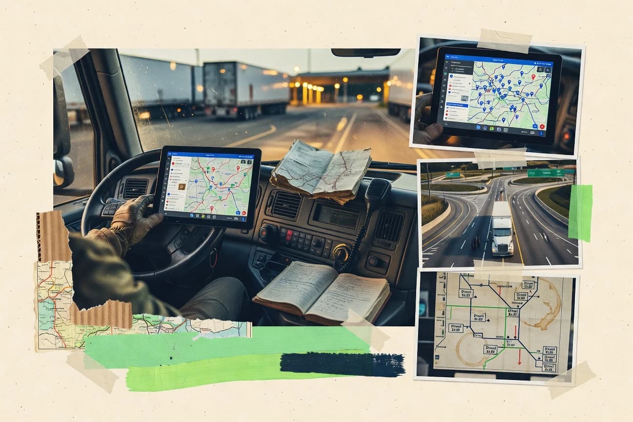
Transportation LogisticsTop 10 Best Trucking Mapping Software of 2026
Discover top 10 trucking mapping software to streamline routes, save time, boost efficiency – explore options now!

How we ranked these tools
Core product claims cross-referenced against official documentation, changelogs, and independent technical reviews.
Analyzed video reviews and hundreds of written evaluations to capture real-world user experiences with each tool.
AI persona simulations modeled how different user types would experience each tool across common use cases and workflows.
Final rankings reviewed and approved by our editorial team with authority to override AI-generated scores based on domain expertise.
Score: Features 40% · Ease 30% · Value 30%
Gitnux may earn a commission through links on this page — this does not influence rankings. Editorial policy
Editor’s top 3 picks
Three quick recommendations before you dive into the full comparison below — each one leads on a different dimension.
Samsara
Geofencing alerts combined with live vehicle tracking on the same map workspace
Built for fleets needing live truck mapping tied to telematics and compliance signals.
Geotab
Editor pickEvent-based trip playback that links vehicle location history to telematics events
Built for trucking fleets needing dispatch-grade map views from telematics data.
Verra Mobility
Editor pickMobility operations mapping that turns vehicle movement data into actionable geospatial status views
Built for fleets needing mapped location visibility and operational monitoring with integrations.
Related reading
Comparison Table
This comparison table reviews trucking mapping and fleet visibility tools such as Samsara, Geotab, Verra Mobility, Azuga, and KeepTruckin alongside other major vendors. It breaks down route planning, live vehicle tracking, and workflow features so teams can compare how each platform supports dispatch, driver operations, and operational reporting.
Samsara
telematics mappingProvides GPS-based vehicle tracking and route visibility that supports dispatch workflows for trucking and field operations.
Geofencing alerts combined with live vehicle tracking on the same map workspace
Samsara stands out in trucking mapping by combining live vehicle location with driver, sensor, and operational telemetry in one navigational experience. The system maps trucks with real-time tracking and supports route planning and geofenced workflows for on-time performance.
Data from telematics, camera events, and equipment sensors ties map views to compliance signals and operational alerts. Fleet leaders can investigate incidents, monitor stops, and audit activity using timeline-style operational views connected to locations.
- +Real-time truck map with geofencing for location-based alerts
- +Telematics and camera events linked to specific places and time
- +Strong operational visibility with driver behavior signals
- –Advanced configuration can slow adoption for smaller fleets
- –Map-centric workflows still require discipline to keep data consistent
- –Integration depth creates dependency on correct device setup
Best for: Fleets needing live truck mapping tied to telematics and compliance signals
More related reading
Geotab
fleet telematicsDelivers vehicle tracking with live maps, driving behavior analytics, and routing visibility for commercial fleets.
Event-based trip playback that links vehicle location history to telematics events
Geotab stands out with its telematics-to-mapping workflow built on a strong fleet data engine. It supports real-time vehicle location, route and trip visualization, and event-based location history for dispatch and operations. The platform also ties mapping outputs to broader fleet telematics signals used across safety and utilization workflows.
- +Real-time vehicle locations with detailed trip and stop visualization
- +Event-based playback ties location history to operational events
- +Strong integration of telematics signals with mapping views
- +Broad device and data support for mixed fleets
- –Setup and data integration require solid admin effort
- –Mapping configuration can feel complex for non-technical teams
- –Advanced use often depends on ecosystem components and partners
Best for: Trucking fleets needing dispatch-grade map views from telematics data
Verra Mobility
dispatch visibilitySupports fleet location tracking and logistics visibility with mapping for dispatch and route monitoring.
Mobility operations mapping that turns vehicle movement data into actionable geospatial status views
Verra Mobility stands out with mapping and geospatial services tied to mobility operations, especially for commercial fleet workflows that need location visibility and tracking. Core capabilities focus on route and location mapping, vehicle and trip location data handling, and operational views that support dispatch and fleet managers.
The solution also aligns with broader mobility and compliance programs, which can matter for trucking teams that integrate location data into operational decisions. For trucking mapping needs, the strongest fit is workflows centered on monitored movement and geospatial status rather than lightweight route planning alone.
- +Geospatial visibility supports live fleet and movement status across mapped areas
- +Designed for operations that combine location data with dispatch-style workflows
- +Integration-oriented approach fits trucking environments with existing systems
- –Best results depend on implementation and integration depth with other tools
- –Less tailored for ad hoc, self-serve trucking route planning compared with mapping-first vendors
- –Mapping features can feel secondary to broader mobility and compliance use cases
Best for: Fleets needing mapped location visibility and operational monitoring with integrations
Azuga
fleet trackingUses GPS tracking with interactive maps to manage fleet locations, routes, and driver activity.
Real-time geofencing alerts tied to vehicle movement events
Azuga focuses on live vehicle tracking paired with route and mapping workflows built for fleet operations. The platform supports driver and asset visibility with geofencing and event-based monitoring for operational awareness.
Its mapping experience targets dispatch and safety teams that need rapid location context and exception handling rather than pure GIS customization. For trucking use cases, it emphasizes actionable telemetry on top of map visuals.
- +Live vehicle tracking updates location and status on operational maps
- +Geofencing supports automated alerts for entry and exit events
- +Event logs help investigate route deviations and driving behavior
- +Dispatch workflows connect map visibility with fleet operations
- –Map-heavy dashboards can feel dense for smaller teams
- –Advanced routing and optimization needs stronger specialized tools
- –Configuration effort increases with complex territory and event rules
Best for: Trucking fleets needing live tracking, geofencing alerts, and dispatch-ready map visibility
KeepTruckin
trucking dispatchOffers GPS tracking with route history and trip management maps for trucking fleets and owner-operators.
Live GPS map with geofencing alerts and stop-level ETA visibility
KeepTruckin stands out for combining trucking mapping with dispatch and live driver visibility in one operational console. The platform provides route-level GPS tracking so managers can monitor vehicle locations, stops, and progress against planned travel.
Mapping views connect operational updates like ETAs and event reporting to day-of-work decision-making. Workflow features support core fleet coordination tasks without requiring a separate dispatching system.
- +Live vehicle tracking on map with event-driven progress updates
- +Dispatch and routing workflows tied directly to tracked assets
- +Geofencing supports automated alerts for customer and yard locations
- –Mapping depth can feel complex for small teams
- –Customization requires more setup than basic tracking views
Best for: Fleets needing mapped tracking tied to dispatch and operational workflows
TruckX
shipment visibilityProvides logistics tools with load and driver tracking components that include mapping for shipment visibility.
Stop and route map visualization that shows shipment position across multiple waypoints
TruckX focuses on route visibility for trucking operations with map-based planning and shipment tracking views. The tool emphasizes lane and stop visualization so dispatchers and drivers can see where loads sit on a geographic map.
It supports route review for multiple stops and helps teams compare planned versus actual movement using location data presented on the map. It is best suited for organizations that want clearer spatial context during dispatch and day-of-route management rather than deep operations automation.
- +Map-first route and stop visualization improves dispatch situational awareness
- +Planned versus actual location context helps spot deviation during execution
- +Lane and geographic grouping supports faster operational scanning
- –Limited advanced optimization tools compared with route-optimization specialists
- –Workflow depth for dispatch, routing rules, and automation is not the primary focus
- –Setup and data onboarding can require manual attention for reliable tracking views
Best for: Dispatch teams needing clear shipment mapping for day-of-route monitoring
Route4Me
route optimizationOptimizes multi-stop delivery routes and presents them on maps for planning and dispatch execution.
Multi-stop route optimization on the map with stop sequence adjustment for delivery fleets
Route4Me stands out for visual route planning aimed at frequent stops and delivery workflows, not just point-to-point navigation. The platform combines route optimization, live map visualization, and practical dispatch-style planning tools for trucking and field logistics.
It also supports multi-stop planning that helps teams reduce mileage and improve stop sequencing across daily runs. Reporting and operational exports support performance review after planning and execution.
- +Multi-stop route optimization with a map-first workflow for trucking routes
- +Dispatch-friendly planning view that visualizes stop order and route geography clearly
- +Operational exports support handoffs to drivers and downstream execution tools
- +Works well for high-frequency deliveries with many addresses per day
- –Advanced optimization controls can feel heavy for small planning teams
- –Geocoding or address cleanup issues can impact planning quality and accuracy
- –Live execution details are less central than planning and visualization
- –Scales best with structured workflows rather than ad hoc single trips
Best for: Logistics teams planning optimized multi-stop trucking runs
OptimoRoute
route optimizationOptimizes delivery routes and displays planned itineraries on a map for efficient stop sequencing.
Multi-stop route optimization that recalculates efficient stop sequences on a map
OptimoRoute focuses on route planning for commercial fleets with map-based optimization and practical routing for multi-stop deliveries. The workflow centers on building stops, selecting optimization objectives, and generating turn-by-turn routes that can be compared across scenarios. Core capabilities include route optimization, ETA visibility, and map visualization designed for dispatch and driver routing tasks.
- +Optimization targets support multi-stop routing decisions
- +Map visualization helps dispatchers validate stop order quickly
- +Scenario comparisons make it easier to iterate routing plans
- –Advanced constraint tuning can feel less intuitive for new users
- –Real-world fleet constraints may require manual workarounds
- –Collaboration and permissions features are not emphasized for team workflows
Best for: Dispatch teams needing optimized multi-stop routing with map-first planning
Onfleet
last-mile logisticsTracks deliveries on maps with dispatch tooling and delivery status updates for logistics teams.
Geofenced delivery status triggers tied to real-time driver check-ins
Onfleet stands out for live delivery tracking that overlays driver activity on a dispatch map and updates status in near real time. It combines route planning, geofenced check-ins, and proof of delivery workflows with automated messaging to reduce manual coordination.
The system supports multi-stop routing and visual progress tracking for fleets, with optional integrations for common logistics and warehouse operations. The trucking mapping experience centers on operational visibility from dispatch to final delivery rather than deep maintenance or asset management.
- +Live map tracking with continuous driver location updates
- +Geofencing enables automatic arrival and delivery status changes
- +Proof of delivery captures signatures, photos, and notes
- +Multi-stop routing shows progress across the delivery sequence
- –Advanced routing controls are less flexible than dedicated optimization suites
- –Integration depth can require setup work for complex workflows
- –Reporting is operationally focused and less suited for deep analytics
Best for: Logistics teams needing real-time delivery visibility with geofenced check-ins
Mapbox
API-first mappingProvides mapping, routing, and geocoding APIs that support custom trucking route visualization in fleet apps.
Vector tile map rendering with Mapbox Studio styling
Mapbox stands out with highly customizable mapping for route-centric products, not just static maps. It offers vector tile rendering, geocoding, and routing so trucking teams can build dispatch, ETA, and field navigation experiences in their own applications.
Mapbox Studio and style tooling support brand-aligned map visuals across fleet and customer views. Strong API coverage helps integrate maps into logistics workflows, while direct out-of-the-box trucking-specific execution is limited compared with purpose-built TMS add-ons.
- +Vector map styling and tile-based rendering enable branded trucking experiences
- +Routing and geocoding APIs support dispatch, ETA, and address validation workflows
- +Good developer tooling for integrating maps into custom fleet and customer apps
- –Trucking-specific features like driver status views require custom build effort
- –Implementation complexity is high for teams without GIS and API experience
- –Advanced optimization for multi-stop trucking can need additional external logic
Best for: Logistics teams building custom trucking maps, routing, and dispatch UIs
Conclusion
After evaluating 10 transportation logistics, Samsara stands out as our overall top pick — it scored highest across our combined criteria of features, ease of use, and value, which is why it sits at #1 in the rankings above.
Use the comparison table and detailed reviews above to validate the fit against your own requirements before committing to a tool.
How to Choose the Right Trucking Mapping Software
This buyer’s guide explains what to look for in trucking mapping software and how to match capabilities to real dispatch and delivery workflows. It covers Samsara, Geotab, Verra Mobility, Azuga, KeepTruckin, TruckX, Route4Me, OptimoRoute, Onfleet, and Mapbox. The guide focuses on map-based visibility, geofenced operations, and multi-stop planning differences that change day-to-day execution.
What Is Trucking Mapping Software?
Trucking mapping software combines geographic visualization with operational signals like live vehicle location, stops, trip history, and route plans. Teams use it to monitor movement against plans, trigger events when vehicles enter or leave locations, and coordinate dispatch decisions from map views. Samsara and Geotab show what trucking mapping looks like when telematics events and location history are tied directly to map timelines and trip playback. Route planning tools like Route4Me and OptimoRoute show a planning-first approach where multi-stop stop order is optimized and visualized on maps.
Key Features to Look For
The most valuable mapping capabilities connect locations to actionable operational decisions, not just visual maps.
Live truck location on a map with geofencing alerts
Geofencing alerts tied to live vehicle movement reduce manual checking for yard, customer, or territory entry and exit. Samsara and Azuga combine geofencing workflows with real-time tracking on the same map workspace. KeepTruckin also pairs live GPS map visibility with geofencing and stop-level ETA visibility for daily execution.
Event-linked trip playback and timeline-based incident investigation
Event-based playback ties what happened to where it happened so dispatchers and safety teams can reconstruct trips. Geotab links event-based location history to telematics events for dispatch-grade trip visualization. Samsara connects camera events and telematics signals to specific places and time inside location-aware operational views.
Driver and delivery workflow status updates driven by geofenced check-ins
Geofenced check-ins automate delivery or stop status changes when field activity reaches defined locations. Onfleet uses geofenced delivery status triggers tied to real-time driver check-ins. This workflow supports proof of delivery captures like signatures, photos, and notes tied to the delivery sequence.
Multi-stop route optimization visualized on maps with stop sequence control
Multi-stop optimization matters when daily work involves many addresses and changing constraints. Route4Me optimizes multi-stop delivery routes and presents stop sequence adjustments directly on the map. OptimoRoute recalculates efficient stop sequences with scenario comparisons so dispatchers can validate turn order before execution.
Shipment and waypoint map visualization for planned versus actual movement
Day-of-route monitoring needs map views that show where loads sit across multiple waypoints and how actual movement deviates from plans. TruckX provides stop and route map visualization that shows shipment position across multiple waypoints. It also emphasizes planned versus actual location context to help spot deviations during execution.
Map customization and API control for building custom dispatch and ETA experiences
Teams building branded dispatch UIs need vector rendering, geocoding, and routing APIs instead of fixed dashboards. Mapbox supports vector tile map rendering with Mapbox Studio styling and provides routing and geocoding APIs. This enables custom trucking route visualization experiences where trucking-specific features must be implemented inside the application.
How to Choose the Right Trucking Mapping Software
The right choice depends on whether the primary need is live operational visibility, multi-stop planning, or custom map integration into an existing product.
Define the operational moment the map must support
If dispatch needs live tracking plus location-triggered actions, Samsara and Azuga map vehicles with geofencing alerts for entry and exit events. If logistics needs delivery status updates as drivers reach stops, Onfleet ties geofenced check-ins to delivery status changes and proof of delivery. If the requirement is shipping day visibility across multiple waypoints, TruckX emphasizes planned versus actual shipment position on a route map.
Match geofencing depth to the workflows that drive exceptions
Geofencing depth should align with the number of territories, yards, and customer locations that need automated alerts. KeepTruckin supports geofencing for customer and yard locations and adds stop-level ETA visibility on the map. Samsara and Azuga provide geofencing alerts combined with live tracking so exception handling happens in the same map workspace.
Choose how trip history and investigations should work for the team
For incident investigation and driver behavior review, Geotab’s event-based trip playback links location history to telematics events. For linking camera events and operational telemetry to geographic context, Samsara connects telematics and camera events to specific places and time. For mobility-style location monitoring as part of broader integrations, Verra Mobility turns vehicle movement data into actionable geospatial status views.
Select a planning engine only when stop sequencing is the priority
When the core challenge is building optimized multi-stop delivery runs, Route4Me and OptimoRoute focus on route optimization with map-first planning. Route4Me provides multi-stop route optimization with stop sequence adjustment and operational exports for handoffs. OptimoRoute supports scenario comparisons and recalculates efficient stop sequences on a map so planners can iterate routing decisions.
Decide between purpose-built trucking mapping and custom-built map infrastructure
If the goal is a trucking-focused console with driver, trip, and event workflows, Samsara, Geotab, and Onfleet cover mapping with operational signals baked into the product experience. If the goal is embedding map controls into a custom dispatch app, Mapbox provides routing, geocoding, and vector tile rendering with styling tools. Mapbox requires building trucking-specific driver status views and routing logic in the application layer.
Who Needs Trucking Mapping Software?
Different trucking mapping products fit different operational jobs, from live dispatch visibility to multi-stop planning and custom map-powered apps.
Fleets that need live truck mapping tied to telematics and compliance signals
Samsara is the strongest match when live vehicle location must be combined with driver, sensor, and operational telemetry plus geofencing alerts on a single map workspace. Geotab also fits when dispatch-grade map views come from telematics signals and event-linked trip playback for operational review.
Dispatch and logistics teams that need dispatch-grade location visibility with integration-first operations
Verra Mobility fits teams focused on mapped location visibility and operational monitoring where geospatial status views plug into broader systems. Azuga can also serve dispatch teams that need rapid location context and exception handling using geofencing tied to vehicle movement events.
Owner-operators and mid-sized fleets that want dispatch workflows tied to route history and stops
KeepTruckin supports live GPS maps with route-level tracking so managers can monitor vehicle locations, stops, and progress against planned travel. It also pairs geofencing for customer and yard locations with stop-level ETA visibility to keep decision-making grounded in map context.
Delivery planners and route managers building optimized multi-stop runs
Route4Me is built for multi-stop route optimization where stop sequencing and map visualization are central. OptimoRoute supports multi-stop routing with map-first planning and scenario comparisons for iterating stop orders before dispatch execution.
Common Mistakes to Avoid
Common buying errors come from selecting the wrong mapping workflow for the day-to-day job the map must perform.
Buying a mapping tool that is too map-centric without operational discipline
Samsara’s map workspace ties geofencing and operational views to live data, but advanced configuration can slow adoption for smaller fleets. Azuga’s map-heavy dashboards can feel dense for smaller teams, so selecting a tool that matches team workflow density prevents adoption stalls.
Overestimating how easily complex integrations will set up without admin effort
Geotab’s mapping configuration can feel complex for non-technical teams and advanced use often depends on ecosystem components and partners. Verra Mobility’s strongest results depend on implementation and integration depth, which can slow rollout for teams without systems ownership.
Choosing a multi-stop optimizer when the real requirement is proof of delivery and geofenced status automation
Route4Me and OptimoRoute focus on multi-stop planning and map-based stop sequencing, which leaves execution details less central than in delivery-focused tools. Onfleet is designed for live delivery tracking with geofenced check-ins and proof of delivery artifacts like signatures and photos.
Selecting a generic mapping API when trucking-specific execution workflows are the goal
Mapbox is highly customizable for map rendering and routing APIs but it does not provide trucking-specific driver status views out of the box. This forces custom build effort for fleet execution features that Samsara, Azuga, and Onfleet deliver as integrated map-and-operations workflows.
How We Selected and Ranked These Tools
we score every tool on three sub-dimensions. Features get a weight of 0.4, ease of use gets a weight of 0.3, and value gets a weight of 0.3. The overall rating is the weighted average of those three components using overall = 0.40 × features + 0.30 × ease of use + 0.30 × value. Samsara separated from lower-ranked tools because it combines live vehicle tracking, geofencing alerts, and location-linked operational telemetry like camera events on the same map workspace, which raises the features score through tighter workflow connectivity.
Frequently Asked Questions About Trucking Mapping Software
Which trucking mapping platform best combines live vehicle location with telematics and compliance signals?
What tool supports dispatch-grade map views based on telematics events and replay?
Which option is strongest for delivery status tracking using geofenced check-ins?
Which trucking mapping software is most appropriate for shipment positioning across multiple stops during day-of-route management?
Which product is designed for dispatch workflows that connect ETAs and event reporting to mapped tracking?
Which platform excels at multi-stop route optimization with stop-sequence adjustments on a map?
What software is best when routing needs are embedded into custom trucking applications with heavy map customization?
Which option prioritizes operational mobility-style geospatial status views rather than lightweight routing?
Which trucking mapping tool is best for rapid exception handling with real-time geofencing alerts?
Tools reviewed
Primary sources checked during evaluation.
Referenced in the comparison table and product reviews above.
Keep exploring
Comparing two specific tools?
Software Alternatives
See head-to-head software comparisons with feature breakdowns, pricing, and our recommendation for each use case.
Explore software alternatives→In this category
Transportation Logistics alternatives
See side-by-side comparisons of transportation logistics tools and pick the right one for your stack.
Compare transportation logistics tools→FOR SOFTWARE VENDORS
Not on this list? Let’s fix that.
Our best-of pages are how many teams discover and compare tools in this space. If you think your product belongs in this lineup, we’d like to hear from you—we’ll walk you through fit and what an editorial entry looks like.
Apply for a ListingWHAT THIS INCLUDES
Where buyers compare
Readers come to these pages to shortlist software—your product shows up in that moment, not in a random sidebar.
Editorial write-up
We describe your product in our own words and check the facts before anything goes live.
On-page brand presence
You appear in the roundup the same way as other tools we cover: name, positioning, and a clear next step for readers who want to learn more.
Kept up to date
We refresh lists on a regular rhythm so the category page stays useful as products and pricing change.