GITNUXSOFTWARE ADVICE
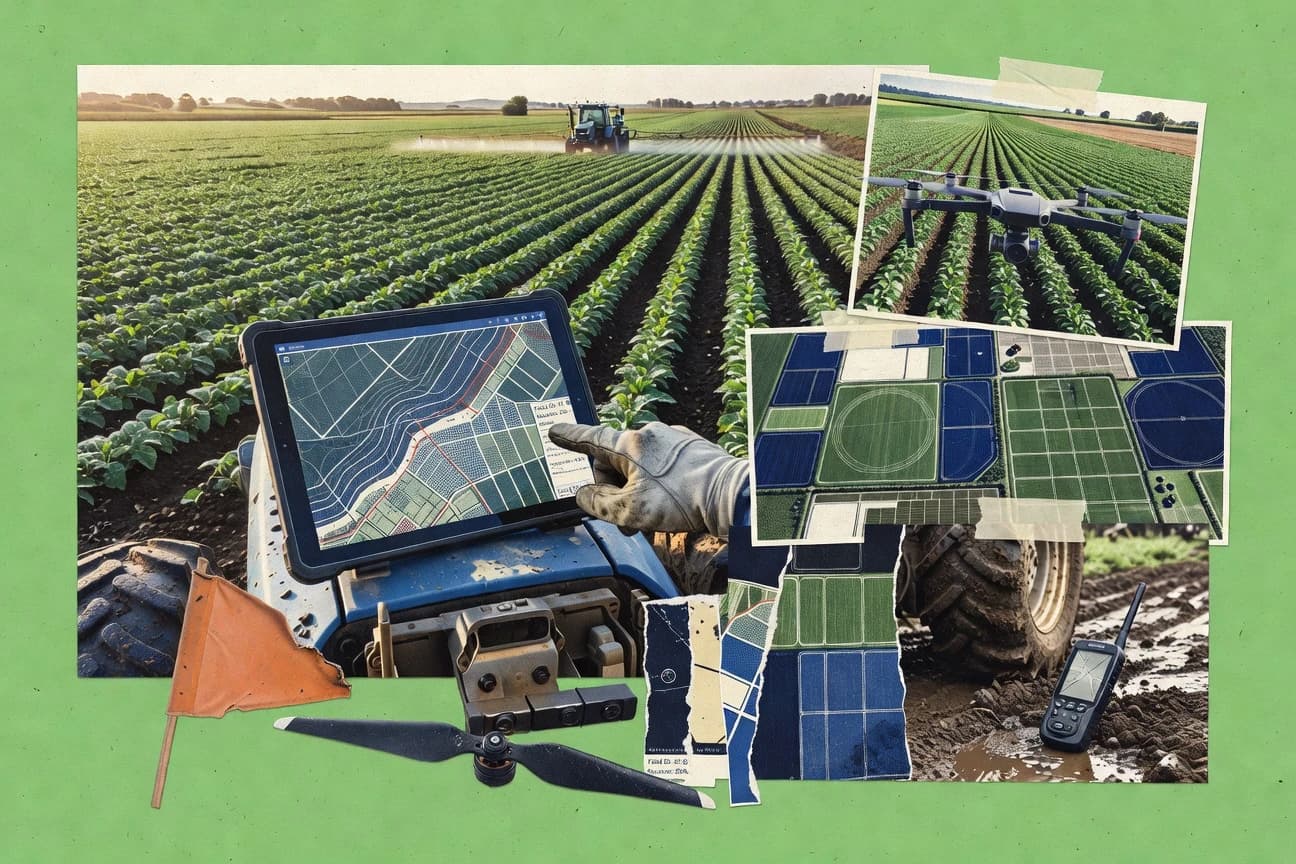
Agriculture FarmingTop 10 Best Farm Mapping Software of 2026
Explore top farm mapping software to boost crop management efficiency—find your ideal tool here.

How we ranked these tools
Core product claims cross-referenced against official documentation, changelogs, and independent technical reviews.
Analyzed video reviews and hundreds of written evaluations to capture real-world user experiences with each tool.
AI persona simulations modeled how different user types would experience each tool across common use cases and workflows.
Final rankings reviewed and approved by our editorial team with authority to override AI-generated scores based on domain expertise.
Score: Features 40% · Ease 30% · Value 30%
Gitnux may earn a commission through links on this page — this does not influence rankings. Editorial policy
Editor picks
Three quick recommendations before you dive into the full comparison below — each one leads on a different dimension.
Agrian
Map-based field and zone management that links spatial boundaries to agronomic records
Built for growers and agronomy teams managing field boundaries with action-oriented farm records.
Trimble Ag Software
Runner UpPrescription-ready mapping tied to field boundaries and management zones for variable-rate operations
Built for farm teams using Trimble hardware that need prescription-ready mapping workflows.
FarmERP
Also GreatFarm mapping integrated with farm operations records and parcel-based organization
Built for farm teams needing practical mapping for planning and recordkeeping.
Related reading
Comparison Table
This comparison table evaluates farm mapping software used for field visualization, boundary management, and prescription workflows across tools like Agrian, Trimble Ag Software, FarmERP, Climate FieldView, and John Deere Operations Center. You will compare core mapping capabilities, data import and accuracy, task planning features, and integration points so you can match software to your equipment, agronomy process, and operational scale.
Agrian
agronomic platformAgrian provides field planning and mapping tools that support agronomic workflows for farms and agribusinesses.
Map-based field and zone management that links spatial boundaries to agronomic records
Agrian stands out with agronomy-first farm mapping that ties fields to practical crop inputs and operational decision-making. It provides map-based field boundaries, zone views, and recordkeeping features that support consistent grower workflows across seasons.
The tool focuses on translating spatial information into agronomic action rather than offering only generic GIS viewing. Agrian is strongest when farm data is managed at the field level with an emphasis on planning, scouting context, and yield-related inputs.
- +Agronomy-focused mapping connects fields to operational farm records
- +Zone and field boundary tools support better localized management planning
- +Field-level organization keeps multi-season data easier to review
- –Mapping workflows can feel dense for users seeking basic area viewing
- –Advanced spatial workflows are less broad than full GIS platforms
- –Integrations and automation options can require more setup effort
Best for: Growers and agronomy teams managing field boundaries with action-oriented farm records
More related reading
Trimble Ag Software
precision agricultureTrimble Ag Software delivers precision agriculture mapping capabilities tied to farm data, field boundaries, and guidance workflows.
Prescription-ready mapping tied to field boundaries and management zones for variable-rate operations
Trimble Ag Software stands out by tying farm mapping workflows to Trimble hardware and field data capture. Core capabilities include field boundary mapping, variable-rate prescription support, and data management that integrates with common Trimble platforms and export workflows.
Users can build maps from spatial layers like soils and management zones, then move that information into operational tasks across the season. The suite is strongest when your operation already uses Trimble guidance, sensors, or data services.
- +Deep integration with Trimble field hardware and guidance systems
- +Supports prescription workflows using mapped zones and spatial layers
- +Strong data management for field boundaries and recurring mapping projects
- +Facilitates exporting mapped information into downstream farm operations
- –Best results require existing Trimble ecosystem and consistent data capture
- –Mapping setup can feel complex without prior GIS or farm data experience
- –Interoperability with non-Trimble workflows can require extra configuration
- –Costs increase quickly with multi-module needs across teams
Best for: Farm teams using Trimble hardware that need prescription-ready mapping workflows
FarmERP
farm managementFarmERP includes farm mapping and field management features alongside operations tracking for crop and livestock management.
Farm mapping integrated with farm operations records and parcel-based organization
FarmERP stands out for combining farm mapping needs with a broader farm management workflow in one system. It supports land parcel tracking and farm structure organization so field work and resources can map to the right areas.
The mapping experience is geared toward operational planning and recordkeeping rather than advanced GIS analysis. Teams can use saved farm layouts to stay consistent across seasons and staff.
- +Farm mapping tied directly to operational farm records
- +Parcel and farm structure organization supports consistent planning
- +Useful for standard workflows like field tracking and documentation
- –Mapping tools are not built for deep GIS modeling or analytics
- –Setup and structure alignment take time before work flows
- –Limited flexibility for highly customized spatial workflows
Best for: Farm teams needing practical mapping for planning and recordkeeping
Climate FieldView
data visualizationClimate FieldView maps field zones and visualizes agronomic data to support variable-rate decisions and farm operations.
Variable-rate prescription mapping using management zones and application-ready field boundaries
Climate FieldView stands out for its tight connection to in-field data collection from growers and advisors, including prescription-ready workflows. It supports map-based field operations with guidance for planning, scouting, and applying agronomic actions across zones and management areas.
You can visualize layers like yield, soil, and variable-rate prescriptions, then organize work so teams can execute the same field plan consistently. Mapping is strongest when you already collect data in the FieldView ecosystem and want repeatable, map-driven decision support.
- +Map-driven planning links agronomy decisions to actionable field operations
- +Strong zone management for prescriptions and variable-rate workflows
- +Clear layer-based visualization for yield, soil, and scouting context
- +Workflow organization supports advisor and grower collaboration
- –Learning curve is steep for teams new to management-zone mapping
- –Value depends on consistent in-field data capture and compatible hardware
- –Some reporting and export workflows feel less flexible than dedicated BI tools
Best for: Teams using FieldView data capture who want prescription-ready farm mapping
John Deere Operations Center
connected farmJohn Deere Operations Center provides map-based field management and farm performance visualization for connected equipment data.
Machine-to-field map generation from connected John Deere equipment activity
John Deere Operations Center stands out for its tight tie-in to John Deere equipment data, which turns machine telemetry into usable maps and field views. It supports field boundary management, section and grid overlays, and task and prescription document handling for planning and work tracking.
The platform also offers performance reporting by field and machine, which helps connect mapping outputs to operational results. Its map sharing and collaboration features work best inside a Deere-led workflow across connected machines.
- +Connects connected John Deere machines to field maps and tasks
- +Supports prescription and job workflows tied to actual operations
- +Field boundary, grid, and layer tools make mapping practical
- +Field performance reporting links maps to agronomic results
- –Best results depend on Deere equipment and connected data
- –Advanced mapping customization feels limited versus standalone GIS tools
- –Collaboration controls can be cumbersome for multi-vendor teams
Best for: John Deere-focused farms needing operational mapping with prescription workflows
eLeaf
agronomy mappingeLeaf offers agronomy mapping and prescription support with field scouting, analytics, and variable-rate planning workflows.
Location-linked field records that attach notes and activities directly to mapped areas
eLeaf stands out with a farm-mapping workflow that centers on field visualization, tasking, and in-field record capture. It supports creating and managing field maps, attaching agronomic notes, and organizing activities around locations.
The platform fits farms and advisors who need consistent spatial documentation across seasons rather than one-off mapping exports. Integration depth and advanced analytics are more limited than full GIS platforms that specialize in deep geospatial processing.
- +Field mapping workflow ties records to locations for consistent documentation
- +Task and activity organization matches how farms plan field work
- +Usable interface for day-to-day mapping and data capture in the field
- –Advanced GIS editing and geospatial analysis are limited versus full GIS tools
- –Reporting depth for agronomy insights is less robust than specialist analytics stacks
- –Value can drop for small farms needing only occasional mapping
Best for: Agronomy teams needing location-based field records and simple mapping workflows
Agrobase
mobile mappingAgrobase provides farm mapping with field planning and farm documentation tools for day-to-day agronomic work.
Location-linked work planning that keeps tasks tied to mapped fields.
Agrobase stands out with map-driven farm operations built around field and crop visualization. The software supports field boundary management, crop planning, and seasonal task organization tied to locations.
Agrobase also provides tools to track work activities across paddocks so teams can align execution with the mapped plan. The experience feels geared toward farm teams that want geographic context in daily operations rather than advanced GIS customization.
- +Field mapping supports clear visualization of farm parcels and boundaries.
- +Crop and seasonal planning connects decisions to specific locations.
- +Work tracking ties activities to mapped fields for operational clarity.
- –Advanced GIS analysis is limited compared with specialist mapping platforms.
- –Setup and data import can require more admin effort than expected.
- –Reporting depth for complex agronomy programs is not as strong as top tools.
Best for: Farm teams needing mapped field planning and task tracking without heavy GIS.
QField
mobile GISQField is a mobile GIS field-mapping app that supports offline geodata collection for farm boundaries and parcel surveys.
Offline-first QGIS project support with editable layers and forms in the mobile app
QField stands out for offline-first field mapping using a mobile app built around QGIS projects. It supports collecting geodata with GNSS, GPS tracks, and forms, then syncing back to a QGIS-ready workflow. Farm mapping teams use it to capture parcels, field boundaries, crop notes, and attribute edits while disconnected from the network.
- +Offline project-driven mapping with QGIS layers for reliable field capture
- +Configurable forms and attribute editing for consistent parcel and crop data entry
- +Strong GPS tracking support for boundary walks and field survey routes
- +Round-trip workflow with QGIS helps keep symbology and data structure aligned
- –Initial setup relies on QGIS project preparation and layer configuration
- –Offline edits can feel complex when syncing conflicts occur across devices
- –Advanced automation requires extra QGIS work instead of in-app tooling
Best for: Farm teams needing offline field data capture mapped through QGIS projects
QGIS
desktop GISQGIS enables desktop farm mapping with geospatial layers, parcel boundaries, and exportable map outputs.
Georeferencer plus digitizing and attribute editing for creating and maintaining farm boundary datasets
QGIS stands out with its open-source desktop GIS engine and rich support for geospatial formats like GeoJSON, Shapefile, and GeoTIFF. For farm mapping, it can load boundary layers, soil and elevation rasters, and weather or remote sensing products while providing measurement tools, attribute tables, and map layouts.
It supports georeferencing and digitizing workflows for field boundaries and crop blocks, and it integrates with web map tiles for basemaps. QGIS is strongest when farms need customized mapping and analysis rather than turn-key agronomy features.
- +Free and open-source GIS with powerful geospatial data handling
- +Digitize and measure field boundaries with accurate snapping tools
- +Map layout designer for printable field and report outputs
- +Supports raster and vector workflows for soils and terrain layers
- +Large plugin ecosystem for specialized mapping extensions
- –No built-in farm-specific planning, scouting, or task management
- –Layer styling and analysis setup can be complex for new users
- –Multi-user collaboration requires external tooling and server setup
- –Mobile capture workflows are not native, so field data entry needs workarounds
Best for: Farms needing flexible GIS mapping, custom analysis, and printable field outputs
GeoQlik
mapping dashboardsGeoQlik supports custom farm and parcel mapping visuals using geospatial data models and dashboard-style exploration.
Interactive geo-mapping project workflows that turn field locations into managed tasks
GeoQlik stands out by combining interactive farm map visualization with GIS-driven project workflows for field data collection and management. It supports geospatial layers for fields and assets plus map-based updates that help teams coordinate mapping tasks without spreadsheet-only processes. GeoQlik focuses on operational mapping use cases such as creating, reviewing, and sharing farm location insights for day-to-day decisions.
- +Map-first workflows for field operations and location-based decisioning
- +Supports geospatial layers for farms, assets, and field-related context
- +Project-oriented mapping coordination for multi-step work tracking
- –More GIS knowledge is needed to set up layers and workflows
- –Limited evidence of deep agronomy analytics compared with top specialists
- –Collaboration and automation features feel less mature than leaders
Best for: Farm teams needing map-based task workflows for fields and assets
Conclusion
After evaluating 10 agriculture farming, Agrian stands out as our overall top pick — it scored highest across our combined criteria of features, ease of use, and value, which is why it sits at #1 in the rankings above.
Use the comparison table and detailed reviews above to validate the fit against your own requirements before committing to a tool.
How to Choose the Right Farm Mapping Software
This buyer’s guide helps you pick farm mapping software by mapping your operational goals to the specific capabilities of Agrian, Trimble Ag Software, FarmERP, Climate FieldView, John Deere Operations Center, eLeaf, Agrobase, QField, QGIS, and GeoQlik. You will learn which feature sets fit field-boundary work, management-zone prescription workflows, offline boundary capture, and advanced GIS analysis. You will also get a short checklist of selection steps and common mistakes drawn from the strengths and limitations of these tools.
What Is Farm Mapping Software?
Farm mapping software helps farms create and maintain field boundaries, visualize agronomic data by location, and connect maps to operational workflows like planning, scouting, and prescription execution. These tools solve problems like keeping multi-season field layouts consistent, organizing work at the paddock or management-zone level, and turning spatial layers into action-ready tasks. Agrian shows this category when it links map-based field and zone management to agronomic records. QGIS shows this category when it supports custom digitizing, georeferencing, and exportable map layouts with geospatial formats like GeoJSON and Shapefile.
Key Features to Look For
The right features determine whether your team gets repeatable, map-driven field operations or ends up doing GIS work outside the tool.
Field and management-zone boundary management tied to farm records
Agrian excels at map-based field and zone management that links spatial boundaries to agronomic records. Climate FieldView also emphasizes zone management for prescription-ready workflows tied to actionable field operations.
Prescription-ready mapping for variable-rate decisions
Trimble Ag Software is designed for prescription workflows using mapped zones and spatial layers. Climate FieldView provides variable-rate prescription mapping using management zones and application-ready field boundaries.
Operational tasking and work tracking connected to mapped locations
eLeaf attaches agronomic notes and activities directly to mapped areas so teams keep field records consistent across seasons. Agrobase ties work activities across paddocks to the mapped plan and supports location-linked work planning.
Hardware-connected mapping and job outputs from connected equipment
John Deere Operations Center generates machine-to-field map views from connected John Deere equipment activity and connects maps to field performance reporting. This reduces manual map assembly when your operation already runs Deere equipment workflows.
Offline-first boundary capture with QGIS-backed round-trip workflows
QField supports offline project-driven mapping using QGIS projects, editable layers, and configurable forms. This makes it well-suited for boundary walks and parcel surveys in areas with limited connectivity.
Custom GIS digitizing, georeferencing, and analysis with exportable layouts
QGIS provides georeferencer plus digitizing and attribute editing tools for creating and maintaining farm boundary datasets. It also supports raster and vector workflows plus a map layout designer for printable field and report outputs.
How to Choose the Right Farm Mapping Software
Pick the tool that matches your workflow focus, either agronomy-first operations, prescription-ready variable-rate mapping, offline capture, or custom GIS analysis.
Start with your workflow target: records, prescriptions, or custom GIS
If your priority is connecting field maps to agronomic records and repeatable layouts, Agrian and FarmERP fit because they organize mapping around field-level or parcel-based farm structures with operational planning and recordkeeping. If your priority is variable-rate and prescription-ready mapping, Trimble Ag Software and Climate FieldView fit because they map management zones into application-ready workflows.
Match the tool to your data capture and hardware environment
Choose John Deere Operations Center when you want machine-to-field map generation from connected John Deere equipment activity and field performance reporting tied to operations. Choose Trimble Ag Software when your operation uses Trimble field data capture and wants mapping that flows into downstream operational tasks tied to mapped zones.
Check whether you need location-linked field records and activity tasking
Choose eLeaf when you need field visualization plus tasking and location-linked record capture that attaches notes and activities to mapped areas. Choose Agrobase when you need location-linked work planning that keeps tasks tied to mapped fields for day-to-day paddock execution.
Plan for field connectivity and boundary walk requirements
Choose QField when you need offline-first field mapping that edits parcel and boundary attributes through QGIS-ready project structures. If you need custom digitizing and dataset maintenance for boundary creation, choose QGIS and pair it with QField for offline collection via QGIS projects.
Decide how much GIS depth you truly need inside the mapping tool
Choose QGIS when you need deep control over spatial layers, georeferencing, digitizing, snapping, and layout design for printable outputs. Choose Agrian, Climate FieldView, or FarmERP when you want mapping that is optimized for operational planning and scouting context rather than advanced GIS modeling.
Who Needs Farm Mapping Software?
Farm mapping software fits teams that manage land at the field or zone level and need spatial organization for agronomic decisions and operational execution.
Growers and agronomy teams managing field boundaries with action-oriented farm records
Agrian is the best match because it links map-based field and zone management to agronomic records and keeps field-level organization easier to review across seasons. FarmERP also fits because it integrates farm mapping with operational farm records and parcel-based organization for consistent planning and documentation.
Operations built around variable-rate prescription workflows
Trimble Ag Software fits when your team uses Trimble field hardware and needs prescription-ready mapping tied to field boundaries and management zones. Climate FieldView fits when you already collect in-field data in the FieldView ecosystem and want variable-rate prescription mapping using management zones for application-ready boundaries.
John Deere-focused farms that want connected equipment to drive map outputs
John Deere Operations Center fits because it turns connected John Deere machine telemetry into usable maps and field views and supports prescription and job workflows tied to actual operations. It also supports field boundary, grid, and layer tools plus field and machine performance reporting linked to maps.
Field teams that capture boundaries and attributes offline and sync through GIS projects
QField fits because it uses an offline-first mobile app built around QGIS projects with editable layers, configurable forms, and GPS tracking for boundary walks. QGIS fits when you need the underlying dataset creation tools like georeferencing, snapping digitizing, and exportable map layouts that keep mobile edits aligned.
Common Mistakes to Avoid
The most frequent failures come from choosing a tool that does not match your workflow depth, data capture method, or team collaboration needs.
Buying for advanced GIS analysis when you really need agronomic tasking and recordkeeping
Agrian, eLeaf, and Agrobase are optimized for operational planning and location-linked documentation instead of deep GIS modeling and analytics. QGIS provides the GIS depth for digitizing, georeferencing, and analysis when you truly need custom spatial processing.
Assuming variable-rate prescription mapping works without your ecosystem aligning
Trimble Ag Software delivers prescription-ready mapping best when your setup uses Trimble hardware and consistent field data capture. Climate FieldView also depends on compatible in-field data capture within the FieldView ecosystem for repeatable map-driven decisions.
Skipping offline capture planning for boundary work in low-connectivity areas
QField supports offline-first mapping with editable layers and forms driven by QGIS projects, so teams can collect boundary and parcel edits without network access. QGIS alone is a desktop tool, so you must plan an offline mobile workflow like QField when field capture requires disconnected operation.
Overestimating cross-vendor collaboration when collaboration is not the core strength
John Deere Operations Center collaboration controls can feel cumbersome for multi-vendor teams because map sharing works best inside a Deere-led workflow. GeoQlik supports project-oriented mapping coordination but needs more GIS knowledge to set up layers and workflows, which can slow cross-team execution.
How We Selected and Ranked These Tools
We evaluated Agrian, Trimble Ag Software, FarmERP, Climate FieldView, John Deere Operations Center, eLeaf, Agrobase, QField, QGIS, and GeoQlik across overall capability, feature completeness, ease of use, and value. We separated leaders from lower-ranked tools by checking whether field and zone boundaries translate into practical agronomic actions or operational workflows, not just visual maps. Agrian stands out because its mapping ties directly to agronomic records through field-level zone and boundary management, which supports consistent multi-season review. QGIS ranks lower for farm mapping completeness because it lacks built-in farm-specific planning and scouting task management, even though it excels at georeferencing, digitizing, and exportable layouts.
Frequently Asked Questions About Farm Mapping Software
Which farm mapping tool is best when I need prescription-ready variable-rate workflows tied to field boundaries?
What’s the fastest way to keep field boundary layers consistent across seasons and staff members?
If my operation already uses Deere equipment, which mapping platform turns telemetry into actionable field maps?
Which option fits farms that want map-linked field notes and location-based activity capture without deep GIS work?
I need offline mapping in the field with editable layers and forms. Which tool is designed for that workflow?
When should I choose QGIS instead of an agronomy-focused farm mapping suite?
How do I build maps from environmental layers like soils, weather products, and rasters, then turn them into farm work?
What tool is strongest for tying spatial planning to practical agronomy inputs at the field level?
I manage field assets like infrastructure and want map-based coordination of who updates what. Which platform fits that task workflow?
Tools reviewed
Primary sources checked during evaluation.
Referenced in the comparison table and product reviews above.
Keep exploring
Comparing two specific tools?
Software Alternatives
See head-to-head software comparisons with feature breakdowns, pricing, and our recommendation for each use case.
Explore software alternatives→In this category
Agriculture Farming alternatives
See side-by-side comparisons of agriculture farming tools and pick the right one for your stack.
Compare agriculture farming tools→FOR SOFTWARE VENDORS
Not on this list? Let’s fix that.
Our best-of pages are how many teams discover and compare tools in this space. If you think your product belongs in this lineup, we’d like to hear from you—we’ll walk you through fit and what an editorial entry looks like.
Apply for a ListingWHAT THIS INCLUDES
Where buyers compare
Readers come to these pages to shortlist software—your product shows up in that moment, not in a random sidebar.
Editorial write-up
We describe your product in our own words and check the facts before anything goes live.
On-page brand presence
You appear in the roundup the same way as other tools we cover: name, positioning, and a clear next step for readers who want to learn more.
Kept up to date
We refresh lists on a regular rhythm so the category page stays useful as products and pricing change.