GITNUXSOFTWARE ADVICE
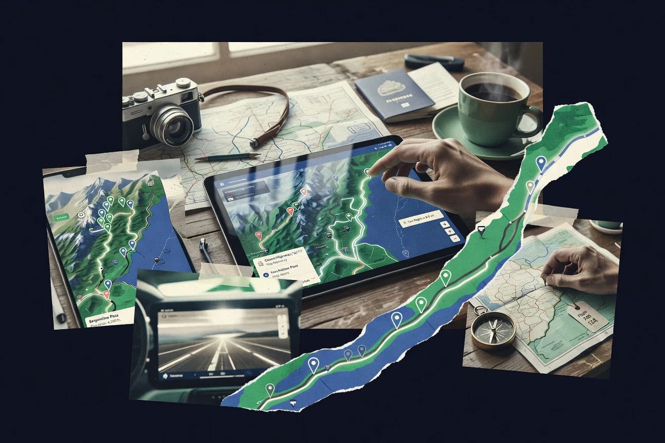
Tourism HospitalityTop 10 Best Trip Mapping Software of 2026
Discover top 10 trip mapping software for custom routes, real-time tracking & seamless travel planning. Explore best picks now.

How we ranked these tools
Core product claims cross-referenced against official documentation, changelogs, and independent technical reviews.
Analyzed video reviews and hundreds of written evaluations to capture real-world user experiences with each tool.
AI persona simulations modeled how different user types would experience each tool across common use cases and workflows.
Final rankings reviewed and approved by our editorial team with authority to override AI-generated scores based on domain expertise.
Score: Features 40% · Ease 30% · Value 30%
Gitnux may earn a commission through links on this page — this does not influence rankings. Editorial policy
Editor’s top 3 picks
Three quick recommendations before you dive into the full comparison below — each one leads on a different dimension.
Mapbox
Mapbox Directions API for waypoint routing with customizable map rendering via Mapbox GL
Built for teams building embedded trip maps that need custom routes and geospatial styling.
Google Maps Platform
Editor pickDirections API with multi-mode route planning for trip legs
Built for teams building custom trip maps with routing, stop search, and embedded UX.
HERE Technologies
Editor pickRouting and turn-by-turn navigation via HERE APIs for itinerary planning and display
Built for logistics and field-service teams building API-driven trip mapping into software.
Related reading
Comparison Table
This comparison table evaluates trip mapping software for custom route generation, route optimization, and real-time or on-demand tracking workflows. It compares core map and routing capabilities across Mapbox, Google Maps Platform, HERE Technologies, OpenRouteService, GraphHopper, and other providers so teams can match tooling to planning depth, API coverage, and deployment needs.
Mapbox
API-first mappingBuild custom trip maps with route rendering, geocoding, and interactive mapping using Mapbox APIs and SDKs.
Mapbox Directions API for waypoint routing with customizable map rendering via Mapbox GL
Mapbox stands out for combining interactive map rendering with geospatial APIs that support custom trip visualization. It enables route planning and waypoint-based map interactions using geocoding, directions, and vector styling.
Trip experiences can be tailored with custom basemaps, overlays, and real-time data feeds for live movement and POI context. The platform is strongest when trip maps must be embedded into a product or workflow with tight control over layout and data layers.
- +High control over custom trip map styling with vector tiles and layers
- +Directions and geocoding APIs support waypoint-based trip planning
- +Scales for production apps with strong performance on large map datasets
- –Custom trip workflows require engineering for data prep and integration
- –Advanced layer styling has a steeper learning curve than turn-key builders
- –Offline or low-connectivity trip use is not as turnkey as simpler tools
Best for: Teams building embedded trip maps that need custom routes and geospatial styling
More related reading
Google Maps Platform
enterprise routingPlan and visualize trips with Directions, Routes, Maps, and Geocoding services for custom routing and map embedding.
Directions API with multi-mode route planning for trip legs
Google Maps Platform stands out with production-grade map rendering and geospatial APIs built on Google’s global map data. Trip mapping workflows benefit from Places and Geocoding for enrichment, Directions for route planning, and Maps JavaScript API for custom, interactive map experiences. The platform supports route visualization and marker-based tours across web and mobile apps, with options for accuracy and performance tuning.
- +High-quality routing with Directions API for driving, transit, and walking
- +Places and Geocoding APIs enable strong trip stop enrichment
- +Custom map UI via Maps JavaScript API supports interactive trip journeys
- +Scalable architecture for embedding maps into trip planning applications
- +Broad data coverage across many countries and major cities
- –Trip-first mapping requires development work for itinerary logic and UI
- –Managing complex multi-stop routes can require careful request design
- –Limited built-in itinerary features compared with dedicated trip mapping tools
Best for: Teams building custom trip maps with routing, stop search, and embedded UX
HERE Technologies
routing APIsDeliver route planning and mapping for tourism and hospitality apps using HERE geocoding, routing, and traffic-aware navigation APIs.
Routing and turn-by-turn navigation via HERE APIs for itinerary planning and display
HERE Technologies stands out for combining high-accuracy geospatial data with mapping and routing services geared toward operational use. It supports trip mapping through route planning, turn-by-turn navigation, and spatial APIs that can visualize itineraries on custom maps.
The platform also enables geofencing, location context enrichment, and route optimization inputs for planning workflows. Integration through APIs supports embedding trip maps into logistics tools and internal dashboards.
- +Strong routing and route-visualization support for itinerary mapping workflows
- +Geofencing and location context features support operational trip planning use cases
- +API-first design fits custom trip maps inside logistics and field-service systems
- –API-centric setup requires engineering effort for polished trip map experiences
- –Out-of-the-box trip dashboards are limited compared with dedicated mapping UI tools
- –Complex optimization scenarios may need additional tooling and careful configuration
Best for: Logistics and field-service teams building API-driven trip mapping into software
OpenRouteService
routing serviceGenerate travel routes and iso-lines with open-source routing backed by a managed OpenStreetMap-based service.
Routing profiles for cycling and driving with profile-specific constraints
OpenRouteService stands out with map-based route computation built on OpenStreetMap data and multiple routing profiles. It supports driving, cycling, and walking with route options that reflect vehicle or rider constraints through different profiles. Its trip mapping workflow is strongest for generating routes and sharing or embedding map views, while advanced itinerary planning and timeline editing remain limited compared with dedicated trip management tools.
- +Multiple routing profiles for walking, cycling, and driving
- +Strong route flexibility using alternative path generation
- +Map visualization works well for route sharing and embedding
- +API access supports automation for trip mapping workflows
- –Trip-level planning tools like schedules and stop management are minimal
- –Route customization requires API knowledge for advanced use cases
- –Performance can vary with complex queries and large batch jobs
Best for: Teams needing route generation and map visualization for trip planning workflows
GraphHopper
routing APIsCreate fast routing for custom trips using GraphHopper routing APIs with support for different profiles and travel modes.
Flexible routing profiles and constraints driven by GraphHopper’s routing engine
GraphHopper stands out for its routing engine that powers fast trip planning with turn-by-turn directions. It supports multiple travel modes, vehicle profiles, and routing constraints that fit real-world logistics and travel scenarios. Map outputs and route computations help convert raw addresses or coordinates into usable itineraries for trip mapping and route analysis.
- +Fast route computation using a mature routing engine
- +Supports multiple travel profiles for cars, bikes, and other routing needs
- +Returns practical navigation paths suitable for trip mapping workflows
- +Routing constraints enable realistic itineraries and logistics planning
- –Setup requires technical integration to fully realize trip mapping outputs
- –Advanced configuration can be complex without GIS and routing experience
Best for: Teams integrating routing APIs into trip maps and logistics workflows
Esri ArcGIS
GIS trip mapsBuild shared trip maps and route layers with ArcGIS Online and routing workflows for hospitality field operations.
Network analysis and routing built on Esri’s Network Analyst capabilities
ArcGIS stands out with a full GIS stack that mixes trip planning, mapping, and spatial analysis in one environment. Route design and visualization are supported through Esri’s ArcGIS Online and ArcGIS Enterprise ecosystems with configurable apps and web maps.
It enables route-based analysis using network and geoprocessing tools, plus shareable results through maps, dashboards, and story-style web experiences. Trip mapping works best when location data, travel constraints, and analysis outputs must align with broader GIS data management.
- +Network-based routing and analysis tools support constraints beyond basic distance
- +Web maps, dashboards, and StoryMaps share trip results with consistent cartography
- +ArcGIS integrates trip layers with broader GIS data, geocoding, and geometry editing
- –Advanced routing and analysis workflows can require GIS configuration expertise
- –Simple trip maps may feel heavyweight compared with lightweight trip planners
- –Managing data layers and permissions across environments adds operational overhead
Best for: GIS-focused teams building routable trip maps with analysis and governed sharing
Strava Routes
route sharingCurate and publish route maps for guided trips and tourism experiences with GPX-backed route sharing and live activity context.
Route creation and visualization directly on Strava route detail pages
Strava Routes turns ride and run planning into route creation inside a widely used activity platform. It supports map-based route building and integrates route visualization with turn-by-turn style previews on the route details pages.
It also ties routes to Strava segments and activity history so planned paths can be compared against past performance. Route sharing is centered on Strava profiles and route links rather than standalone trip itineraries.
- +Fast map routing aligned with Strava’s activity and segment data
- +Route pages surface elevation and distance in a format built for athletes
- +Sharing routes through Strava links makes route discovery frictionless
- –Trip-style multi-day planning and waypoint management are limited
- –Deep offline planning tools like export formats and itinerary views are not the focus
- –Route customization beyond standard mapping controls is comparatively narrow
Best for: Athletes mapping single-day workouts with Strava segment context
Sygic Travel
traveler planningPlan multi-stop itineraries and offline-friendly route tours for travelers with curated content and trip planning features.
Offline map support paired with turn-by-turn navigation for saved multi-stop routes
Sygic Travel stands out for combining offline-ready trip planning with map-first navigation and a strong place discovery workflow. Users can build multi-stop routes, save locations, and navigate with turn-by-turn guidance while using map content designed to work without constant connectivity.
The solution also supports itinerary organization through saved places and route planning tools that fit day-by-day travel layouts. Its trip mapping focus centers on personal travel itineraries rather than team routing, permissions, or business workflow automation.
- +Offline navigation supports continuous travel without relying on constant connectivity
- +Route building for multiple stops works well for personal multi-day itineraries
- +Map-first interface makes saving places and revising routes straightforward
- +Turn-by-turn guidance reduces friction when following planned paths
- –Limited collaboration features restrict mapping workflows for teams
- –Few enterprise trip mapping capabilities like role-based access and approvals
- –Trip analytics and export options are less robust than dedicated mapping suites
- –Route optimization favors planning over advanced scheduling constraints
Best for: Solo travelers mapping multi-stop trips with offline-friendly navigation
Waze
real-time navigationSupport real-time driving navigation with traffic-aware guidance that can be used for trip coordination and live updates.
Community-driven incident alerts that trigger real-time route re-planning
Waze stands out by turning real-time road reports from drivers into route guidance and live trip routing. Core capabilities include turn-by-turn navigation, incident reporting like accidents and hazards, and automatic re-routing to avoid delays. Trip mapping is strongest for driving journeys that benefit from community-tracked traffic conditions rather than for planning complex multi-stop itineraries.
- +Live incident reporting improves route accuracy during driving trips
- +Automatic re-routing reduces delays when road conditions change
- +Fast turn-by-turn guidance supports quick trip execution
- –Trip mapping for multi-stop planning is limited compared to routing-focused tools
- –Navigation depends heavily on active community reporting coverage
- –Route sharing and map-based annotation are not designed for workflow collaboration
Best for: Drivers and sales crews needing live trip routing around road incidents
MapQuest
consumer routingPlan and visualize routes with trip directions and map tools suitable for multi-stop travel planning workflows.
Interactive route planning with draggable waypoints and on-map directions
MapQuest focuses on route planning with interactive mapping, turn-by-turn navigation, and travel directions displayed directly on the map. It supports trip creation and route customization for car travel, with options that help refine start and end points and reorder waypoints. The platform also includes map-based search for addresses and places, which speeds building an itinerary from real locations.
- +Interactive map editing makes itinerary building fast with drag-and-drop adjustments
- +Turn-by-turn driving directions help verify route choices without leaving the map
- +Address and place search streamlines adding stops to a trip
- –Limited multi-stop trip optimization versus dedicated trip planning workflows
- –Exporting or sharing itinerary data is less robust than route management tools
- –Collaboration and team itinerary management features are minimal
Best for: Individual travelers needing quick driving trip routes with map-based stop editing
Conclusion
After evaluating 10 tourism hospitality, Mapbox stands out as our overall top pick — it scored highest across our combined criteria of features, ease of use, and value, which is why it sits at #1 in the rankings above.
Use the comparison table and detailed reviews above to validate the fit against your own requirements before committing to a tool.
How to Choose the Right Trip Mapping Software
This buyer’s guide explains how to choose trip mapping software for custom route planning, embedded map experiences, and trip execution. It covers Mapbox, Google Maps Platform, HERE Technologies, OpenRouteService, GraphHopper, Esri ArcGIS, Strava Routes, Sygic Travel, Waze, and MapQuest. Each section ties key decisions to concrete capabilities like waypoint routing, offline navigation, network analysis, and real-time traffic incident re-planning.
What Is Trip Mapping Software?
Trip mapping software produces map-based routes and turn-by-turn journey views for multi-stop itineraries, saved trips, or live driving reroutes. It helps solve problems like converting addresses into usable stops, visualizing routes with markers and overlays, and updating guidance as conditions change. Tools like Mapbox and Google Maps Platform focus on embedding custom trip maps into an application using directions, geocoding, and interactive map rendering. Tools like Sygic Travel and Waze focus more on trip execution with offline navigation or community-driven incident-aware rerouting.
Key Features to Look For
Trip mapping outcomes depend on route computation, map rendering control, and the workflow around itinerary logic.
Waypoint-based routing with multi-stop support
Mapbox uses the Mapbox Directions API for waypoint routing so trips with multiple stops can be planned and rendered in a custom map view. Google Maps Platform provides Directions API planning for trip legs so multi-mode route visualization can be built into an embedded trip UI.
Custom map rendering with layers and interactive controls
Mapbox is built for custom styling with vector tiles and layer control through Mapbox GL so trip maps can match a product design system. Google Maps Platform supports a custom interactive trip journey experience via the Maps JavaScript API.
Traffic-aware navigation and live rerouting
Waze turns real-time road reports into route re-planning so guidance adapts automatically when conditions change. HERE Technologies supports traffic-aware navigation via HERE APIs so itinerary display can align with operational travel needs.
Routing profiles and constraints for specific travel modes
OpenRouteService uses multiple routing profiles for driving, cycling, and walking so route selection can reflect vehicle or rider constraints. GraphHopper provides flexible routing profiles and routing constraints so realistic logistics and travel scenarios can be modeled for trip mapping.
GIS-grade network analysis and governed sharing
Esri ArcGIS supports network-based routing and routing analysis built on Esri Network Analyst so constraints beyond basic distance can be applied to trip layers. ArcGIS Online and ArcGIS Enterprise also support shareable web maps and StoryMaps-style experiences for consistent cartography.
Offline-friendly trip execution and content-based navigation
Sygic Travel combines offline map support with turn-by-turn guidance for saved multi-stop routes. Strava Routes connects route visualization to route detail pages and GPX-backed sharing so users can curate and publish routes for guided activity experiences.
How to Choose the Right Trip Mapping Software
Selection should start with the route workflow and the experience target, then match tool strengths like routing APIs, map control, offline execution, or real-time rerouting.
Define the trip workflow type before comparing map features
Embedded trip planning inside an app requires an API-first approach like Mapbox or Google Maps Platform because both support Directions and geocoding workflows with a custom UI surface. Operational trip mapping inside logistics tools also aligns with HERE Technologies because it provides routing and turn-by-turn navigation via APIs plus geofencing and location context features.
Match your routing needs to routing profiles and waypoint routing
Trips with complex stop order and waypoint logic fit Mapbox Directions API because waypoint-based trip planning maps cleanly to multi-stop route rendering. Cycling or walking constrained routes fit OpenRouteService and GraphHopper because both offer profile-specific constraints and travel-mode routing that better matches real rider and vehicle needs.
Choose the map rendering depth based on how customized the UI must be
If trip maps must match custom layouts and layer designs, Mapbox is the strongest fit because vector tiles and layer control enable deep styling and overlay control. If trip maps need strong production-grade rendering with a simpler route embed path, Google Maps Platform supports interactive trip journeys with the Maps JavaScript API and Places and Geocoding for stop enrichment.
Plan for offline execution or real-time rerouting only when those are required
For continuous travel in weak connectivity, Sygic Travel targets offline navigation tied to saved multi-stop routes. For driving routes that must adapt during incidents, Waze uses community-driven incident reporting and automatic re-routing so guidance changes as road hazards appear.
Confirm whether GIS analysis or itinerary management is the main deliverable
Teams that need routing layers aligned to a broader GIS environment should evaluate Esri ArcGIS because it supports network analysis and governed sharing with web maps, dashboards, and StoryMaps-style outputs. Teams focused on route creation and athlete-context route pages should evaluate Strava Routes because route pages tie planned paths to route details and segment context rather than full itinerary operations.
Who Needs Trip Mapping Software?
Trip mapping software spans embedded developer workflows, logistics routing APIs, consumer offline navigation, and live incident driving guidance.
Teams building embedded trip maps with custom styling and waypoint routes
Mapbox is the best match because it is designed for custom trip map rendering with vector tiles, layers, and the Mapbox Directions API for waypoint routing. Google Maps Platform is also a strong fit because Directions and geocoding plus Maps JavaScript API enable custom embedded trip UX with stop enrichment.
Logistics and field-service teams integrating trip mapping into software systems
HERE Technologies fits this segment because its API-driven design supports route planning, turn-by-turn navigation, geofencing, and location context enrichment for operational trip workflows. GraphHopper fits when fast route computation and multiple routing profiles with constraints must power logistics itineraries.
GIS-focused teams that need network analysis and governed sharing
Esri ArcGIS is the best fit because its Network Analyst-based routing supports constraints beyond distance and produces consistent cartography across ArcGIS web maps and StoryMaps-style sharing. This segment also benefits from the broader GIS data management that ArcGIS ecosystems provide.
Travelers who need offline multi-stop navigation or live driving guidance
Sygic Travel is designed for solo multi-stop trips with offline map support plus turn-by-turn navigation. Waze fits driving trips that require real-time incident-aware rerouting powered by community road reports.
Common Mistakes to Avoid
Common buying failures come from mismatching the tool to the trip workflow like itinerary management, offline execution, or real-time rerouting.
Buying an API-first routing tool and expecting turn-key itinerary management
API-centric setups like Mapbox and HERE Technologies excel at routing and map embedding but they require engineering for polished trip map workflows and itinerary logic. Tools like OpenRouteService and GraphHopper also provide routing automation but keep trip-level schedules and stop management limited compared with dedicated trip planning workflows.
Choosing a driving-centric solution for multi-stop trip planning
Waze is strongest for live incident-aware driving reroutes and not for complex multi-stop itinerary planning. MapQuest can help with draggable waypoint planning and on-map directions, but it has limited multi-stop trip optimization compared with dedicated trip management workflows.
Assuming offline planning and collaboration will be built-in for every trip mapping tool
Sygic Travel provides offline-ready navigation paired with turn-by-turn guidance for saved multi-stop routes, but it limits collaboration and enterprise role-based workflows. Strava Routes similarly emphasizes route sharing through route detail pages and segment context, which limits multi-day itinerary controls and waypoint management.
Ignoring GIS governance and permissions needs in organizations that already run GIS processes
Esri ArcGIS is heavyweight compared to lightweight trip planners because it requires GIS configuration expertise for advanced routing and analysis. Teams that skip that operational overhead risk underusing network analysis and governed sharing features that ArcGIS Online and ArcGIS Enterprise provide.
How We Selected and Ranked These Tools
we evaluated every tool on three sub-dimensions. Features carry weight 0.4 because routing capabilities, map embedding depth, offline execution, and analysis outputs determine what a trip mapping solution can actually produce. Ease of use carries weight 0.3 because teams must translate stops and itineraries into usable route outputs without excessive integration friction. Value carries weight 0.3 because the tool should reduce time spent building around routing and visualization needs. The overall rating is the weighted average of those three dimensions so overall = 0.40 × features + 0.30 × ease of use + 0.30 × value. Mapbox separated from lower-ranked tools because it combined high-control custom trip map rendering with the Mapbox Directions API for waypoint routing via Mapbox GL, which boosted the features dimension while still enabling embedding for production map experiences.
Frequently Asked Questions About Trip Mapping Software
Which trip mapping tools are best for embedding custom itineraries into a product UI?
How do routing engines differ when building multi-stop routes with constraints?
What tool set supports route planning plus deeper GIS analysis for the same trip map?
Which option is best for real-time driving guidance that adapts to road incidents?
Which tools support turn-by-turn navigation and on-the-go itinerary refinement?
Which trip mapping software works best for offline-first personal travel itineraries?
What’s the best choice for athletes planning routes with performance context and segment data?
Which tool is most suitable for logistics teams that need geofencing and workflow-ready mapping outputs?
Why do route results sometimes look different across tools, even with the same start and end points?
What’s the fastest workflow for creating a driving trip with editable stops directly on the map?
Tools reviewed
Primary sources checked during evaluation.
Referenced in the comparison table and product reviews above.
Keep exploring
Comparing two specific tools?
Software Alternatives
See head-to-head software comparisons with feature breakdowns, pricing, and our recommendation for each use case.
Explore software alternatives→In this category
Tourism Hospitality alternatives
See side-by-side comparisons of tourism hospitality tools and pick the right one for your stack.
Compare tourism hospitality tools→FOR SOFTWARE VENDORS
Not on this list? Let’s fix that.
Our best-of pages are how many teams discover and compare tools in this space. If you think your product belongs in this lineup, we’d like to hear from you—we’ll walk you through fit and what an editorial entry looks like.
Apply for a ListingWHAT THIS INCLUDES
Where buyers compare
Readers come to these pages to shortlist software—your product shows up in that moment, not in a random sidebar.
Editorial write-up
We describe your product in our own words and check the facts before anything goes live.
On-page brand presence
You appear in the roundup the same way as other tools we cover: name, positioning, and a clear next step for readers who want to learn more.
Kept up to date
We refresh lists on a regular rhythm so the category page stays useful as products and pricing change.