GITNUXSOFTWARE ADVICE
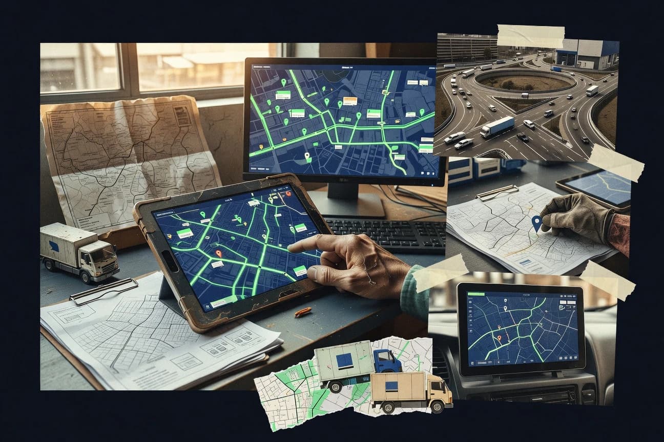
Transportation LogisticsTop 10 Best Transportation Mapping Software of 2026
Discover top 10 transportation mapping software to optimize routes, track assets & boost efficiency.

How we ranked these tools
Core product claims cross-referenced against official documentation, changelogs, and independent technical reviews.
Analyzed video reviews and hundreds of written evaluations to capture real-world user experiences with each tool.
AI persona simulations modeled how different user types would experience each tool across common use cases and workflows.
Final rankings reviewed and approved by our editorial team with authority to override AI-generated scores based on domain expertise.
Score: Features 40% · Ease 30% · Value 30%
Gitnux may earn a commission through links on this page — this does not influence rankings. Editorial policy
Editor’s top 3 picks
Three quick recommendations before you dive into the full comparison below — each one leads on a different dimension.
Mapbox
Mapbox GL custom rendering with style specification controls and high-performance vector tiles
Built for transportation teams building custom, interactive maps with GIS and routing layers.
Google Maps Platform
Editor pickDirections API for route planning with traffic-aware routing and turn-by-turn navigation data
Built for transportation teams building routing and location enrichment into web apps.
HERE Technologies
Editor pickHERE Routing with traffic-aware turn-by-turn and route calculation APIs
Built for transportation teams building API-driven routing, traffic, and map visualizations.
Related reading
Comparison Table
This comparison table benchmarks transportation mapping software that supports routing, geocoding, and real-time location services across road, fleet, and logistics use cases. It covers Mapbox, Google Maps Platform, HERE Technologies, TomTom, Azure Maps, and other leading providers, with side-by-side details on core mapping capabilities, integration fit, and typical deployment considerations.
Mapbox
API-firstBuild custom transport-focused maps and route visualizations with geocoding, routing, and navigation APIs.
Mapbox GL custom rendering with style specification controls and high-performance vector tiles
Mapbox stands out for giving teams low-level control over custom map styling and rendering through Mapbox Studio and Mapbox GL. Transportation mapping workflows benefit from high-performance vector basemaps, route-aware geocoding, and building blocks for turn-by-turn navigation experiences. The platform also supports indoor layers, custom tiles, and geospatial APIs that fit transportation visibility and operations use cases.
- +Highly customizable map styling with Mapbox Studio and JSON style control
- +Fast vector rendering for interactive transportation map layers
- +Geocoding supports operational workflows and consistent place matching
- +Rich data layer support for routes, markers, and dynamic overlays
- –Advanced setup requires solid GIS and web map engineering skills
- –Complex routing and data pipelines can increase implementation effort
- –Indoor and specialized layers demand careful data preparation
Best for: Transportation teams building custom, interactive maps with GIS and routing layers
More related reading
Google Maps Platform
enterprise mappingUse routing, directions, and Maps APIs to power transportation route planning and fleet map visualizations.
Directions API for route planning with traffic-aware routing and turn-by-turn navigation data
Google Maps Platform stands out for combining mature map visualization with a large set of transportation-focused geospatial services. Routes and directions can be embedded into applications using Maps JavaScript and Directions APIs for driving, transit, and walking use cases.
Real-time traffic layers and route-aware styling help teams support dispatch and field navigation workflows. Strong geocoding and Places data support logistics datasets with consistent location enrichment.
- +Directions and route embedding fit dispatch apps with minimal custom UI
- +Traffic signals integrate into map layers for near-time routing decisions
- +Geocoding and Places enrich fleet locations and stops quickly
- +Robust JavaScript tooling supports polished interactive maps
- –Complex routing constraints require more integration work than simple maps
- –Transit detail quality varies by region and data availability
- –Usage governance and API limits can complicate peak-hour scaling
- –Implementing offline maps and offline routing needs separate design effort
Best for: Transportation teams building routing and location enrichment into web apps
HERE Technologies
routing & trafficIntegrate routing, traffic, and location services to compute optimized routes and visualize movements across maps.
HERE Routing with traffic-aware turn-by-turn and route calculation APIs
HERE Technologies stands out with deep map data coverage and standardized APIs for routing, traffic, and geocoding across multiple regions. Core capabilities include HERE Routing for trip planning, HERE Maps for map visualization, and traffic and incident layers for near-real-time updates.
The platform also supports fleet and logistics workflows through turn-by-turn navigation, route optimization inputs, and event-aware mapping for operational dashboards. Implementation typically centers on API integration rather than a self-contained drag-and-drop mapping editor.
- +Strong routing and geocoding APIs support production-grade transportation workflows
- +Traffic and incident layers improve route awareness for dynamic operations
- +Flexible map layers and developer tooling fit custom logistics dashboards
- +High-quality global map coverage supports cross-region deployments
- –API-first approach increases integration effort for non-developer teams
- –Advanced workflow automation needs custom engineering around routing primitives
- –Large data and visualization configurations require careful performance tuning
Best for: Transportation teams building API-driven routing, traffic, and map visualizations
TomTom
mapping & routingProvide map data, routing, and traffic capabilities for fleet route planning and delivery tracking dashboards.
Traffic-aware route planning and recalculated ETAs using live congestion data
TomTom stands out for combining live traffic intelligence with turn-by-turn mapping and navigation data used in routing and fleet workflows. It supports route planning and traffic-aware ETA calculations that help transportation teams optimize delivery sequences and timing.
The platform also provides map data and APIs used to power location search, geocoding, and route computation in logistics applications. Delivery orchestration typically benefits when TomTom data is integrated with a dispatch system that manages stops and driver workflows.
- +Traffic-aware routing improves ETAs using live road conditions and speed data.
- +Strong map data coverage for routing, geocoding, and place-based lookups.
- +API-first design fits fleet, dispatch, and delivery apps needing programmatic route computation.
- +ETA and route recalculation support dynamic re-routing when conditions change.
- –Stops, vehicle constraints, and dispatch logic require building around the routing APIs.
- –Operational tooling is API-centric, so non-developers need integration or internal tooling.
- –Complex multi-stop optimization quality depends on how route requests are modeled.
Best for: Transportation teams building routing and ETA services into logistics apps
Azure Maps
cloud mappingCreate mapping and route solutions with geospatial APIs for traffic-aware route guidance and asset tracking.
Traffic-aware route planning API for vehicle routing and ETA calculations
Azure Maps stands out by pairing mapping and geospatial APIs with Azure cloud services for transportation routing, fleet, and location intelligence workflows. It provides route planning, geocoding and reverse geocoding, traffic-aware routing options, and spatial analytics for operational map layers.
The platform integrates Azure identity, networking, and event infrastructure to support geospatial data ingestion and downstream logistics logic. Azure Maps is best suited for teams building custom transportation apps with API-driven control over routing, search, and visualization layers.
- +API-driven routing with support for route optimization scenarios
- +Geocoding, reverse geocoding, and place search for operational locations
- +Azure-native integration options for secure, cloud-first deployments
- –Requires engineering effort to design end-to-end transportation workflows
- –Advanced visualization setup takes more work than turn-key dispatch tools
- –Browser map rendering choices need careful tuning for performance
Best for: Transportation teams building custom fleet and logistics mapping apps
AWS Location Service
cloud geospatialAdd geocoding, places search, and routing-style map features to transportation systems on AWS.
Place Indexes for scalable proximity and bounding-box searches over geospatial data
AWS Location Service distinguishes itself by pairing mapping and geocoding APIs with managed, security-aligned infrastructure in the AWS ecosystem. Core capabilities include geocoding and reverse geocoding, route planning for travel time and distance, and place indexes for scalable location lookups.
It also supports tracking via device position updates and search-friendly data for bounding-box and proximity queries. Transportation mapping workflows get a full pipeline from textual addresses to map-renderable results and moving-asset locations.
- +Managed geocoding, reverse geocoding, and place indexing for address and POI lookups
- +Routing APIs provide distance and travel-time estimates for transportation use cases
- +Location tracking supports device position updates with event-driven integration patterns
- –Building map visuals requires additional front-end mapping integration
- –Complex geospatial query tuning can require deeper AWS and GIS knowledge
- –Harmonizing routing results with custom constraints often needs extra application logic
Best for: Logistics teams building AWS-native mapping, routing, and tracking pipelines
Samsara
fleet trackingTrack vehicle locations, optimize routes with operational workflows, and visualize trips on fleet maps for logistics teams.
Samsara dashcam event review linked to live vehicle location and driving events
Samsara stands out with real-time fleet visibility built from dashcams, IoT sensors, and GPS tracking, then mapped into actionable transportation workflows. Core capabilities include route progress visibility, driver behavior scoring, asset and trailer tracking, and automated alerts for events like idling, speeding, harsh driving, and geofence entry. It also supports dispatch-ready operations with live statuses, incident review, and exports for compliance and performance analysis across transportation operations.
- +Live map view ties vehicle location to events like geofence and driver incidents
- +Dashcam footage and sensor alerts speed incident investigation and coaching
- +Asset and trailer tracking adds end-to-end visibility beyond vehicles
- –Initial setup for cameras and devices requires careful installation and configuration
- –Advanced reporting can feel complex for teams focused on basic map visibility
- –Alert volume needs tuning to prevent dispatch teams from ignoring signals
Best for: Mid-size fleets needing real-time mapping plus dashcam and sensor driven operations
Verizon Connect
fleet operationsRun vehicle tracking and route planning workflows with live maps and fleet operations visibility for transportation logistics.
Real-time vehicle and driver tracking with live map updates tied to dispatch and jobs
Verizon Connect stands out with real-time fleet visibility built on telematics and location data. It provides transportation mapping for route planning, dispatch workflows, and live driver and asset tracking on a shared map.
The solution also supports compliance-oriented operations with alerts and mobile field tools that keep job status synchronized. Integration with existing fleet data streams helps reduce manual updates across dispatch, routing, and reporting.
- +Live fleet tracking updates driver positions and job status in near real time.
- +Route guidance and dispatch workflows reduce back-and-forth between map and operations.
- +Mobile field tools support job progress capture from the vehicle or device.
- –Advanced routing configuration can feel heavy for small teams with simple needs.
- –Map-centric workflows still require disciplined data setup for clean results.
- –Reporting depth may require extra tuning to match specialized operational KPIs.
Best for: Mid-size fleets needing live mapping, dispatch workflows, and field job updates
Locus (Locus Logistics Platform)
route optimizationPlan, optimize, and track last-mile and multi-stop routes with map-based execution for transportation networks.
Route optimization with live tracking and exception alerts for multi-stop shipments
Locus Logistics Platform stands out for turning shipment execution into route-based workflows with live tracking and exception handling. The solution supports transportation mapping with route optimization, driver or vehicle assignment, and status updates across multi-stop deliveries.
It also emphasizes operational visibility through dashboards that show service coverage, milestones, and delays. Integration with common logistics systems helps teams synchronize orders, consignments, and planned routes.
- +Route planning with stop sequencing improves delivery efficiency
- +Live tracking and milestones strengthen operational visibility
- +Exception alerts help teams respond to delays quickly
- –Setup effort can be high for complex, multi-warehouse operations
- –Advanced tuning requires logistics process alignment and data cleanliness
- –Mapping output can feel dense for small teams
Best for: Logistics teams needing mapping-backed execution and exception-driven dispatch workflows
Onfleet
last-mile deliveryDispatch drivers, plan delivery routes, and track shipments on maps with customer and operations visibility.
Proof of delivery with photo and signature captured from the mobile app
Onfleet stands out with real-time delivery and field execution visibility built around map-driven operations. It combines route planning, live driver tracking, and automated delivery status capture using mobile workflows and event triggers. Teams can manage dispatch, obtain proof of delivery, and coordinate exceptions with a centralized operations dashboard.
- +Real-time driver and job tracking on an operations map
- +Automated delivery status updates from field mobile workflows
- +Proof of delivery capture with photos and signatures
- –Advanced optimization capabilities can feel limited versus full TMS suites
- –Exception handling workflows require setup to match complex operations
- –Collaboration and reporting depth are weaker than enterprise dispatch platforms
Best for: Last-mile and dispatch teams needing live tracking and delivery proof
Conclusion
After evaluating 10 transportation logistics, Mapbox stands out as our overall top pick — it scored highest across our combined criteria of features, ease of use, and value, which is why it sits at #1 in the rankings above.
Use the comparison table and detailed reviews above to validate the fit against your own requirements before committing to a tool.
How to Choose the Right Transportation Mapping Software
This buyer's guide explains how to choose transportation mapping software that supports route visualization, traffic-aware routing, and live fleet operations. It covers developer-first platforms like Mapbox, Google Maps Platform, HERE Technologies, TomTom, Azure Maps, and AWS Location Service alongside workflow and tracking tools like Samsara, Verizon Connect, Locus Logistics Platform, and Onfleet. The guide maps real transportation use cases to specific tool capabilities so teams can shortlist faster and implement with fewer rework cycles.
What Is Transportation Mapping Software?
Transportation mapping software connects maps, routing, and operational data to help teams plan trips, execute delivery work, and monitor movement in real time. It typically powers workflows such as route visualization, geocoding and stop matching, traffic-aware ETA updates, and dispatch-ready tracking. Tools like Mapbox provide custom map styling and interactive layers using Mapbox GL, while Google Maps Platform focuses on routing, directions, geocoding, and traffic layers embedded into web applications.
Key Features to Look For
The features below determine whether a transportation map becomes an operational tool or just a visualization layer.
Traffic-aware routing and recalculated ETAs
Traffic-aware routing drives better ETAs when road conditions change. TomTom delivers traffic-aware route planning with live congestion inputs and supports recalculated ETAs, and HERE Technologies provides traffic-aware turn-by-turn route calculation APIs.
Directions and route planning APIs for embedded trip workflows
Directions APIs let transportation teams embed route planning into dispatch or logistics applications without rebuilding route logic. Google Maps Platform emphasizes the Directions API for route planning with traffic-aware routing data, and Azure Maps pairs routing APIs with traffic-aware route guidance for vehicle routing and ETA calculations.
Geocoding, reverse geocoding, and Places enrichment for operational accuracy
Reliable location enrichment reduces errors when matching addresses to stops and assets. Google Maps Platform combines geocoding and Places support for enriching fleet locations and stops, and Azure Maps offers geocoding, reverse geocoding, and place search for operational locations.
Real-time vehicle, driver, and asset tracking on live maps
Live tracking turns mapping into an operations control surface by showing where vehicles and jobs actually are. Verizon Connect provides real-time vehicle and driver tracking with live map updates tied to dispatch and jobs, and Samsara links live vehicle location to dashcam and sensor-driven driving and event signals.
Multi-stop route optimization with exception handling and milestones
Last-mile execution needs route sequencing, tracking progress, and alerts when work slips. Locus Logistics Platform offers route optimization with stop sequencing plus live tracking and exception alerts, and Samsara supports route progress visibility alongside automated alerts for events like idling, speeding, harsh driving, and geofence entry.
Custom interactive mapping and high-performance vector rendering
Custom map rendering matters when route overlays, markers, and dynamic operational layers must look and perform a certain way. Mapbox stands out with Mapbox GL custom rendering using style specification controls and high-performance vector tiles, while AWS Location Service focuses on routing-style map features built for AWS-native pipelines.
How to Choose the Right Transportation Mapping Software
The selection process matches intended workflows to specific capabilities, then filters out tools that require heavy engineering for the team size and skill set.
Decide between API-first mapping platforms and operations-first fleet workflow tools
API-first platforms like Mapbox, Google Maps Platform, HERE Technologies, TomTom, Azure Maps, and AWS Location Service provide routing and map primitives that teams embed into custom dispatch or logistics applications. Operations-first tools like Samsara, Verizon Connect, Locus Logistics Platform, and Onfleet provide a more complete execution workflow with live job status mapping and event-driven operations.
Require traffic-aware routing if ETAs must remain stable during congestion
If delivery timing changes during peak traffic, select tools that explicitly support traffic-aware routing and recalculation. TomTom supports traffic-aware route planning with live congestion data and recalculated ETAs, and HERE Technologies provides traffic-aware turn-by-turn routing and route calculation APIs.
Validate location enrichment before building stop sequencing and dispatch logic
Stop accuracy depends on geocoding and place matching that works for real addresses and operational locations. Google Maps Platform combines geocoding and Places support for fast fleet location enrichment, and Azure Maps includes geocoding, reverse geocoding, and place search for operational locations.
Align live tracking needs to the tool’s event and evidence model
Teams that need incident investigation and coaching should prioritize tools that tie events to location and media. Samsara links dashcam event review to live vehicle location and driving events, and Onfleet supports proof of delivery with photo and signature captured from the mobile app.
Stress-test multi-stop complexity using stop sequencing and exception workflows
Multi-stop operations need more than route display because stop sequencing, milestones, and exception handling drive daily execution. Locus Logistics Platform includes route optimization with stop sequencing, live tracking milestones, and exception alerts, while Verizon Connect focuses on dispatch workflows and job status synchronization on a shared map.
Who Needs Transportation Mapping Software?
Transportation mapping tools serve both custom developers building routing and map layers and operators running daily fleet or delivery execution.
Custom GIS and routing teams that need full control over interactive map styling
Mapbox excels when teams want custom, interactive transportation maps using Mapbox Studio and Mapbox GL style specification controls. Mapbox GL supports high-performance vector basemaps and route-aware overlays, which fits transportation teams building GIS and routing layers.
Web application teams embedding routing into dispatch or planning workflows
Google Maps Platform fits teams that embed directions and route planning directly into their web applications. Directions and route embedding with traffic-aware routing supports dispatch apps that need route visualization and turn-by-turn navigation data.
API-driven logistics platforms that require global coverage for routing and traffic
HERE Technologies is built for teams integrating routing, traffic, and geocoding via APIs rather than managing a drag-and-drop editor. HERE Routing with traffic-aware turn-by-turn route calculation supports production-grade transportation workflows across regions.
Mid-size fleets that need real-time tracking plus event intelligence for drivers and assets
Samsara and Verizon Connect fit fleets that need live vehicle visibility tied to operational alerts. Samsara connects dashcam event review and sensor-driven driving events to live vehicle location, while Verizon Connect provides real-time vehicle and driver tracking tied to dispatch jobs and live job status updates.
Common Mistakes to Avoid
Several implementation pitfalls recur across transportation mapping products because teams underestimate data alignment and workflow fit.
Building a custom map without planning for the routing and data pipeline effort
Mapbox can require solid GIS and web map engineering skills because custom styling and routing layers depend on careful setup of interactive overlays. HERE Technologies, Azure Maps, and AWS Location Service also emphasize API-first integration, which increases engineering effort when workflows and constraints are not already modeled.
Assuming simple route display covers multi-stop execution needs
Onfleet can feel limited for advanced optimization compared with full TMS suites because last-mile exception handling and deeper collaboration require additional configuration. Locus Logistics Platform is designed for route optimization with live tracking and exception alerts, so it fits multi-stop execution more directly.
Ignoring traffic dynamics and relying on static ETAs
Tools that do not explicitly support traffic-aware routing can lead to stale ETAs during congestion. TomTom recalculates ETAs using live congestion data, and Azure Maps and HERE Technologies provide traffic-aware route planning and traffic-aware turn-by-turn routing APIs.
Overloading dispatch teams with alert volume without aligning events to outcomes
Samsara requires alert tuning because alert volume can be high enough that dispatch teams ignore signals. Verizon Connect can also require disciplined data setup on map-centric workflows so job and route context stays clean.
How We Selected and Ranked These Tools
We evaluated every tool on three sub-dimensions. Features account for 0.40 of the overall score, ease of use accounts for 0.30, and value accounts for 0.30. The overall rating equals 0.40 × features plus 0.30 × ease of use plus 0.30 × value. Mapbox separated itself on features by delivering Mapbox GL custom rendering with style specification controls and high-performance vector tiles, which directly supports interactive transportation overlays and rendering performance for route visualization layers.
Frequently Asked Questions About Transportation Mapping Software
Which transportation mapping software is best for building custom interactive maps with routing and GIS layers?
How do Google Maps Platform and HERE Technologies differ for traffic-aware route planning and ETA accuracy?
Which tools fit workflows that require geocoding and proximity searches at scale?
What transportation mapping option supports dashcam-linked event review tied to vehicle location?
Which software is strongest for dispatch coordination with live job status updates on a shared map?
Which platform is best suited for multi-stop shipment execution with route-based exceptions and milestone tracking?
Which mapping platform is most appropriate when routing is integrated into a logistics or fleet system rather than handled in a drag-and-drop editor?
What mapping solution supports indoor layer visualization for transportation facilities like warehouses and transit hubs?
Why might TomTom be chosen for delivery sequencing and recalculated ETAs during congestion changes?
Which toolset is a strong fit for building a custom fleet and location intelligence stack within Microsoft Azure?
Tools reviewed
Primary sources checked during evaluation.
Referenced in the comparison table and product reviews above.
Keep exploring
Comparing two specific tools?
Software Alternatives
See head-to-head software comparisons with feature breakdowns, pricing, and our recommendation for each use case.
Explore software alternatives→In this category
Transportation Logistics alternatives
See side-by-side comparisons of transportation logistics tools and pick the right one for your stack.
Compare transportation logistics tools→FOR SOFTWARE VENDORS
Not on this list? Let’s fix that.
Our best-of pages are how many teams discover and compare tools in this space. If you think your product belongs in this lineup, we’d like to hear from you—we’ll walk you through fit and what an editorial entry looks like.
Apply for a ListingWHAT THIS INCLUDES
Where buyers compare
Readers come to these pages to shortlist software—your product shows up in that moment, not in a random sidebar.
Editorial write-up
We describe your product in our own words and check the facts before anything goes live.
On-page brand presence
You appear in the roundup the same way as other tools we cover: name, positioning, and a clear next step for readers who want to learn more.
Kept up to date
We refresh lists on a regular rhythm so the category page stays useful as products and pricing change.