GITNUXSOFTWARE ADVICE
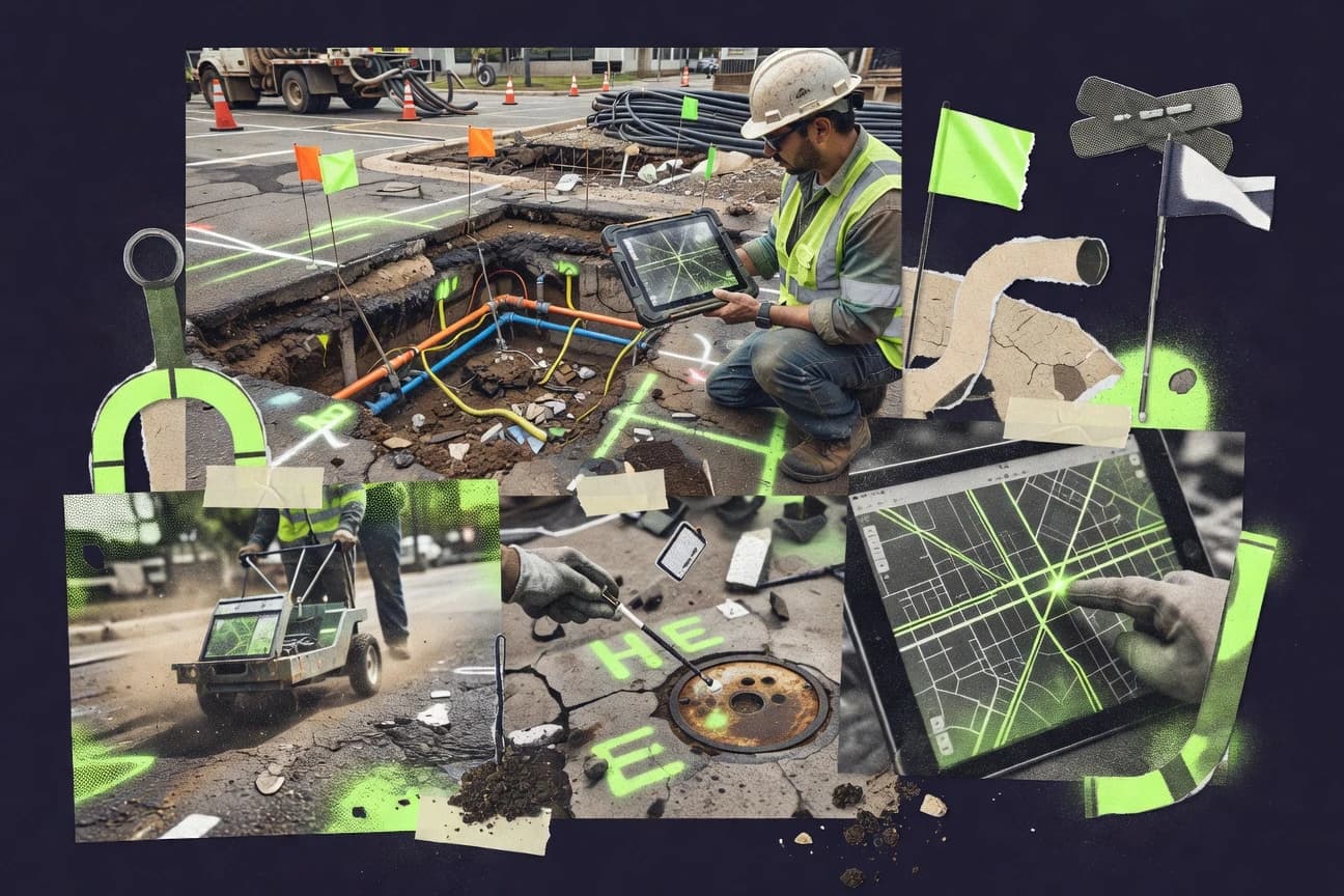
Construction InfrastructureTop 10 Best Underground Utility Mapping Software of 2026
Discover the top 10 underground utility mapping software tools for precise, efficient mapping. Find your best fit and streamline projects today.

How we ranked these tools
Core product claims cross-referenced against official documentation, changelogs, and independent technical reviews.
Analyzed video reviews and hundreds of written evaluations to capture real-world user experiences with each tool.
AI persona simulations modeled how different user types would experience each tool across common use cases and workflows.
Final rankings reviewed and approved by our editorial team with authority to override AI-generated scores based on domain expertise.
Score: Features 40% · Ease 30% · Value 30%
Gitnux may earn a commission through links on this page — this does not influence rankings. Editorial policy
Editor picks
Three quick recommendations before you dive into the full comparison below — each one leads on a different dimension.
A+ Mapping
Structured utility record management for locating and GIS-ready map deliverables
Built for utility mapping teams producing repeatable underground deliverables from field-collected data.
Nexus Utility Mapping
Runner UpInteractive job-based mapping for underground locate documentation
Built for utility mapping teams needing map-first job tracking and documentation.
ClickSoftware
Also GreatReal-time field dispatching and scheduling for time-critical utility work orders
Built for utility operators managing crew dispatch and scheduling around underground locate and repair.
Related reading
Comparison Table
This comparison table evaluates underground utility mapping software, including A+ Mapping, Nexus Utility Mapping, ClickSoftware, ArcGIS Utility Network, and QGIS. You’ll see how each tool handles core capabilities like data capture, network modeling, asset management workflows, spatial analysis, and interoperability for utility-grade mapping deliverables.
A+ Mapping
utility GISA+ Mapping provides field-ready GIS and utility locating workflows with asset mapping, records management, and map-based documentation for underground utilities.
Structured utility record management for locating and GIS-ready map deliverables
A+ Mapping stands out with underground utility mapping workflows built around field-to-digital consistency for GIS deliverables. It supports creating and managing utility records tied to mapped assets, including document and plan organization for traceable outputs.
The system is designed for teams that need repeatable locating documentation and construction-ready map production. It also emphasizes structured data capture so mapped features stay usable for ongoing project work.
- +Utility data capture structured for locating and map production workflows
- +Project document organization supports traceable underground utility deliverables
- +GIS-friendly asset records help keep mapped information consistent
- +Workflow supports repeatable mapping tasks across ongoing projects
- –Advanced configuration requires discipline to keep data consistent
- –UI can feel dense for users focused only on quick edits
- –Less suited for teams needing deep custom GIS analytics
Best for: Utility mapping teams producing repeatable underground deliverables from field-collected data
More related reading
Nexus Utility Mapping
utility GISNexus Utility Mapping delivers underground utility GIS mapping with CAD integration, field data capture, and utility asset record management.
Interactive job-based mapping for underground locate documentation
Nexus Utility Mapping stands out with map-first utility workflows that center field mapping, locating, and record keeping around visual jobs. It supports underground asset documentation with tools for marking, organizing, and reporting utility locations on interactive maps.
The system emphasizes collaboration between dispatch and field teams through job-based tracking and shared project data. It is best suited for organizations that need repeatable mapping processes tied to specific work orders and deliverables.
- +Map-centered job workflow links field marks to deliverables
- +Supports collaborative tracking across dispatch and field teams
- +Practical reporting for underground utility documentation
- –Advanced workflows can require setup to match team processes
- –Limited evidence of deep GIS automation compared with top-tier platforms
- –Collaboration features may not cover complex multi-agency sharing
Best for: Utility mapping teams needing map-first job tracking and documentation
ClickSoftware
field operationsClickSoftware offers enterprise dispatch and field workforce management that supports utility locate and construction workflows tied to underground asset records.
Real-time field dispatching and scheduling for time-critical utility work orders
ClickSoftware focuses on field operations optimization that supports underground utility work orders with dispatching, scheduling, and real-time execution tracking. The platform’s work management workflows help coordinate survey, locate, and repair tasks across crews while enforcing assignment rules and priority handling.
Its routing and scheduling capabilities can reduce travel time and downtime by sequencing jobs and monitoring field progress. For mapping-heavy teams, ClickSoftware ties operational outcomes to location data rather than replacing a full GIS or CAD mapping stack.
- +Strong dispatch and scheduling for time-critical utility work orders
- +Real-time field tracking supports faster status updates for locate tasks
- +Workflow rules help standardize crew assignment and job priorities
- –Utility mapping depth depends on external GIS or CAD integration
- –Configuration complexity rises when modeling detailed field processes
- –More focused on operations than on editing and maintaining spatial utility assets
Best for: Utility operators managing crew dispatch and scheduling around underground locate and repair
ArcGIS Utility Network
GIS platformArcGIS Utility Network provides a utility-focused GIS data model for mapping, tracing, and managing underground assets and relationships.
Network tracing with connectivity results driven by Utility Network topology and associations.
ArcGIS Utility Network stands out for modeling underground assets and their connectivity in a shared GIS network dataset. It supports topology rules, device-to-device relationships, and trace-based workflows for locating, validating, and analyzing utility service paths.
The solution integrates tightly with ArcGIS Enterprise and ArcGIS Pro so utility teams can map network behavior and manage changes across layers of pipes, valves, and junctions. It is strongest when your utility mapping process depends on consistent network connectivity and repeatable trace operations rather than standalone CAD drafting.
- +Connectivity-aware network modeling for underground utility assets
- +Trace tools support isolation, connectivity analysis, and downstream path checks
- +Enterprise workflows with ArcGIS Pro and ArcGIS Enterprise integrations
- +Topology rules help detect invalid joins and network integrity issues
- –Data model setup requires careful schema design and utility domain rules
- –Trace configuration and network behavior tuning can be complex
- –Costs rise quickly with enterprise deployments and required licenses
- –Less suited for lightweight mapping needs without full GIS infrastructure
Best for: Utility GIS teams needing traceable underground network models
QGIS
open-source GISQGIS supports underground utility mapping using extensible GIS tools for digitizing, editing, and spatial analysis of utility features.
Advanced symbology and layer styling with rule-based rendering for utility map standardization
QGIS stands out for being a flexible open-source GIS desktop that handles underground utility layers with strong map styling and analysis workflows. It supports digitizing assets, editing spatial features, and running geoprocessing tools for tasks like buffer zones, proximity checks, and network preparation.
With support for common formats like DXF, Shapefile, GeoPackage, and PostGIS layers, teams can move utility data between CAD, mapping, and database systems without vendor lock-in. Its ecosystem of processing plugins and symbology tools helps standardize utility map outputs for construction and asset management use cases.
- +Open-source desktop GIS with deep spatial editing and cartography tools
- +Strong geoprocessing for buffers, overlays, and validation of underground utility layers
- +Works with CAD and GIS data via DXF, Shapefile, GeoPackage, and PostGIS connectors
- +Plugin ecosystem expands utility workflows like tracing, QA, and export automation
- –Utility-specific workflows require setup for data models, templates, and QA rules
- –Multi-user editing and version control need extra infrastructure beyond core QGIS
- –Advanced configuration and plugin selection can slow onboarding for new teams
Best for: Teams needing customizable utility mapping workflows with GIS analysis
FME (Feature Manipulation Engine)
data integrationFME automates conversion and integration of utility mapping data from CAD, GIS, and surveying sources into consistent underground utility records.
FME feature processing and transformation workflows using hundreds of built-in transformers
FME stands out for turning utility GIS data workflows into configurable automation rather than manual edits. It supports ingesting, cleaning, validating, transforming, and exporting mapping datasets needed for underground utility work.
You can model network and asset updates through repeatable transformations and coordinate system handling across many data sources. Its strength is workflow engineering for complex geospatial ETL, not field-ready utility locate operations.
- +Extensive geospatial transformation toolbox for utility GIS ETL workflows
- +Repeatable data validation and cleanup rules reduce mapping rework
- +Strong format support for moving utility assets between systems
- –Workflow building has a steep learning curve for mapping teams
- –Real-time locate workflows require external field tools and coordination
- –Licensing and scaling costs can strain smaller utility departments
Best for: Utility teams automating underground asset data prep and migration pipelines
Intergraph SmartPlant Foundation
infrastructure modelingHexagon’s Intergraph plant and infrastructure data platform supports creating and managing engineering models that can feed underground utility mapping processes.
Project-wide data model governance with traceable relationships between utility assets and engineering documents
Intergraph SmartPlant Foundation focuses on disciplined infrastructure data management for utilities assets tied to design, engineering, and construction workflows. It supports structured model and document linking so underground utility mapping teams can maintain consistent as-built context across projects.
Its core value comes from governance of asset data and traceable relationships rather than standalone field capture. Expect best results when you already run Hexagon ecosystem workflows for design and geospatial model integration.
- +Strong data governance for underground utility assets and engineering artifacts
- +Traceable links between models, documents, and project records
- +Works well in Hexagon-centered design and geospatial workflows
- +Supports long-term asset information continuity across lifecycle phases
- –Mapping-centric workflows require integration with other geospatial tools
- –Configuration and data model setup can be time intensive
- –User experience can feel heavy for simple mapping tasks
Best for: Utility owner-operators managing governed as-built data across engineering programs
AutoCAD Utility Design
CAD utilitiesAutoCAD Utility Design supports underground utility layout and utility design workflows with established drafting and utility-specific tools.
AutoCAD Utility Design command set for modeling underground utilities directly in CAD drawings
AutoCAD Utility Design focuses on underground utility design by extending AutoCAD workflows with utility-specific drawing and modeling tools. It supports structured utility mapping for assets like pipes, conduits, and related features using Autodesk-style command and data integration in CAD.
Core capabilities include utility network modeling, labeling support, and layout tools that streamline producing deliverables from CAD-based projects. It is best suited for teams that already operate in AutoCAD and want tighter utility drafting and documentation than generic CAD.
- +Utility-focused modeling tools build underground datasets inside AutoCAD
- +Strong labeling and documentation workflows for utility drawings
- +Fits teams already standardized on AutoCAD production processes
- –CAD-first workflow can be slower than GIS tools for field-heavy mapping
- –Utility setup requires data standards and disciplined layer practices
- –Collaboration and data services lag behind dedicated utility GIS platforms
Best for: AutoCAD-centric teams producing underground utility drawings and deliverables
Bentley OpenUtilities Substation
engineering CADBentley OpenUtilities Substation supports utility infrastructure modeling and engineering deliverables that integrate into mapping workflows for underground networks.
Substation-oriented underground asset modeling that aligns data and documentation to engineering deliverables
Bentley OpenUtilities Substation focuses on engineering workflows for underground electrical and substation environments, not just generic GIS viewing. It supports importing and organizing underground utility assets with data structures aligned to substation and cable network design deliverables.
The tool’s strength is model-driven coordination with Bentley ecosystems, which helps teams keep geometry, attributes, and documentation consistent. It is less strong as a standalone lightweight mapping product because its workflow assumes engineering modeling and Bentley-centric processes.
- +Model-driven underground utility and substation asset management with strong design alignment
- +Structured data supports consistent attributes for engineering deliverables
- +Better fit for Bentley-centric workflows than generic mapping tools
- +Supports coordination between underground elements and substation context
- –Not a lightweight GIS-style mapping tool for quick field viewing
- –Setup and modeling workflows require engineering process maturity
- –Value drops for teams that only need simple underground map outputs
Best for: Engineering teams coordinating underground substation and cable design deliverables
Google Earth Pro
mapping viewerGoogle Earth Pro enables geospatial visualization for underground utility context and map-based review using high-resolution imagery and GIS overlays.
3D globe visualization with KML and KMZ overlays for immediate geospatial context
Google Earth Pro stands out for turning real-world imagery and terrain into a fast, intuitive geospatial canvas for underground utility visualization. It supports importing GIS files such as KML, KMZ, and shapefiles so utility teams can overlay assets, align alignments, and share views with stakeholders.
Its 3D globe and measuring tools help estimate cover, offsets, and corridor extents visually when exact subsurface data is limited. It is strong for planning, locating, and communication, but it lacks dedicated subsurface modeling and utility design workflows found in purpose-built utility mapping systems.
- +Quickly visualizes utility overlays on high-resolution imagery and 3D terrain
- +Imports KML, KMZ, and shapefiles for mapping existing GIS assets
- +Built-in measuring tools support fast corridor and offset estimates
- +Easy sharing of locations through exported KML packages
- –Not a dedicated utility database for managing status, inspections, and records
- –Subsurface modeling and conflict detection are not provided as core workflows
- –Collaboration and multi-user editing depend on external processes
- –Large datasets can strain performance during browsing and rendering
Best for: Field-to-office visualization of utility corridors using imagery overlays
Conclusion
After evaluating 10 construction infrastructure, A+ Mapping stands out as our overall top pick — it scored highest across our combined criteria of features, ease of use, and value, which is why it sits at #1 in the rankings above.
Use the comparison table and detailed reviews above to validate the fit against your own requirements before committing to a tool.
How to Choose the Right Underground Utility Mapping Software
This section helps you choose Underground Utility Mapping Software for field-to-GIS deliverables, job-based locate documentation, network tracing, and CAD-based utility drafting. It covers A+ Mapping, Nexus Utility Mapping, ClickSoftware, ArcGIS Utility Network, QGIS, FME, Intergraph SmartPlant Foundation, AutoCAD Utility Design, Bentley OpenUtilities Substation, and Google Earth Pro. You will see which tool strengths match your workflow and which limitations to plan around.
What Is Underground Utility Mapping Software?
Underground Utility Mapping Software captures, edits, organizes, and publishes utility location data for underground assets and associated deliverables. It solves problems like keeping mapped features consistent, producing traceable records and drawings, and linking field work to GIS or CAD outputs. Tools like A+ Mapping support structured utility record management for locating and GIS-ready map deliverables. ArcGIS Utility Network supports connectivity-aware network modeling with topology rules and trace-based workflows for validating underground service paths.
Key Features to Look For
Choose features that directly match how your crews collect data, how your GIS or CAD teams standardize it, and how your organization proves record traceability.
Structured utility record management for locating-ready deliverables
A+ Mapping structures utility record management so mapped assets stay usable for ongoing locating and construction-ready GIS deliverables. It combines asset records with project document organization so outputs remain traceable from captured data to published maps.
Interactive, job-based mapping tied to locate documentation
Nexus Utility Mapping centers interactive mapping on job-based tracking so field marks connect to deliverables for underground documentation. It supports collaboration between dispatch and field teams through job-oriented workflows rather than standalone map editing.
Real-time dispatching and scheduling for locate and repair work orders
ClickSoftware focuses on dispatch and scheduling that coordinates survey, locate, and repair tasks across crews. It helps time-critical underground work by enforcing assignment rules and priority handling tied to operational job execution and real-time field tracking.
Connectivity-aware network tracing with topology rules
ArcGIS Utility Network models underground assets in a utility network dataset so topology rules detect invalid joins and network integrity issues. It also provides trace tools whose connectivity results drive isolation, connectivity analysis, and downstream path checks.
Rule-based symbology and layer styling for consistent utility map outputs
QGIS supports advanced symbology and layer styling with rule-based rendering for utility map standardization. This helps teams produce consistent underground utility outputs even when they customize templates and geoprocessing workflows.
Repeatable geospatial transformation and validation pipelines for utility data
FME provides feature processing and transformation workflows using hundreds of transformers for utility GIS ETL workflows. It supports ingesting, cleaning, validating, and exporting data so underground asset updates follow repeatable rules instead of manual edits.
How to Choose the Right Underground Utility Mapping Software
Pick the tool that matches your highest-value workflow, then confirm it can integrate with your existing GIS, CAD, or engineering systems without forcing a rewrite.
Start from your deliverable type: GIS maps, CAD drawings, or engineered models
If you produce repeatable locating documentation and GIS-ready map deliverables, A+ Mapping is built around structured utility record management tied to mapped assets. If your workflow is built on ArcGIS Enterprise and ArcGIS Pro network behavior, ArcGIS Utility Network provides traceable connectivity modeling with topology rules.
Match the tool to field-to-office execution instead of only map creation
If dispatch needs to coordinate time-critical underground work orders, ClickSoftware connects operational routing and scheduling to real-time field progress tracking. If your priority is map-first job documentation where field marks connect to deliverables, Nexus Utility Mapping provides interactive job-based mapping for underground locate documentation.
Choose data governance and connectivity depth based on whether you need trace operations
If your underground data must answer connectivity and service-path questions, ArcGIS Utility Network supports connectivity-aware network models and trace tools driven by utility network topology. If you manage governed as-built engineering artifacts and need traceable relationships between assets and documents, Intergraph SmartPlant Foundation focuses on project-wide data model governance.
Plan for standardization and repeatability across teams and projects
If multiple users must produce consistent underground map symbology, QGIS provides advanced symbology and rule-based rendering that helps enforce map standardization. If you need repeatable data cleanup and validation before assets become usable, FME supports transformation pipelines with built-in geospatial validation and cleanup rules.
Use visualization tools only as supplements to a utility data system
If you need fast geospatial visualization for corridor context with imagery overlays and KML or KMZ sharing, Google Earth Pro provides a 3D globe canvas with measuring tools. If you need utility modeling directly in CAD drawings for teams already standardized on AutoCAD production, AutoCAD Utility Design adds utility-focused command sets for modeling underground utilities in CAD.
Who Needs Underground Utility Mapping Software?
Underground Utility Mapping Software serves utility operators, mapping teams, and engineering organizations that must turn underground field and network information into traceable deliverables.
Utility mapping teams producing repeatable locating and GIS deliverables
A+ Mapping is tailored for teams producing repeatable underground deliverables from field-collected data with structured utility record management and project document organization. This fit is stronger than Nexus Utility Mapping when deliverables need GIS-ready traceability rather than just job-based map tracking.
Dispatch and operations teams coordinating time-critical locate and repair work
ClickSoftware is built for dispatching, scheduling, and real-time field execution tracking for underground work orders. It fits best when crew assignment rules and priority handling matter more than deep spatial asset editing.
Utility GIS teams that must trace underground connectivity
ArcGIS Utility Network supports network tracing with connectivity results driven by utility network topology and associations. It suits organizations that need trace-based workflows for locating, validating, and analyzing service paths.
Engineering programs managing governed as-built data and document-linked assets
Intergraph SmartPlant Foundation provides project-wide data model governance with traceable relationships between utility assets and engineering documents. It aligns with utility owner-operators who require long-term asset information continuity across lifecycle phases.
Common Mistakes to Avoid
Underground utility mapping projects commonly fail when teams buy for map editing only, ignore data governance requirements, or underestimate workflow setup work.
Buying a tool that is not aligned to your execution workflow
If your core need is scheduling and dispatch execution for locate and repair, ClickSoftware fits better than GIS-first utilities because it focuses on dispatching, scheduling, and real-time field tracking. If you buy a mapping-only tool for operations, you will still need external processes to coordinate work orders.
Underestimating setup discipline for structured data models
A+ Mapping requires discipline to keep structured utility data consistent across projects because it is designed for repeatable locating and map production workflows. ArcGIS Utility Network also needs careful schema design and utility domain rules because topology rules and trace configuration depend on correct network modeling.
Treating ETL as a one-time import instead of a pipeline
FME is strongest when you build repeatable data validation and transformation rules for ongoing underground asset updates. Teams that use FME only for initial conversion often face ongoing rework because coordinate handling, cleanup, and validation remain manual.
Using visualization tools as your system of record
Google Earth Pro provides fast geospatial visualization with KML and KMZ overlays and 3D measuring, but it lacks a dedicated utility database for managing status, inspections, and records. Teams that rely on it alone typically end up with incomplete underground records that cannot support traceable deliverables.
How We Selected and Ranked These Tools
We evaluated each tool on an overall fit for underground utility mapping deliverables, then scored features depth, ease of use for the intended operators, and value based on what the tool automates versus what it offloads to other systems. We used the same evaluation lens across A+ Mapping, Nexus Utility Mapping, ClickSoftware, ArcGIS Utility Network, QGIS, FME, Intergraph SmartPlant Foundation, AutoCAD Utility Design, Bentley OpenUtilities Substation, and Google Earth Pro. A+ Mapping separated itself by tying structured utility record management directly to locating and GIS-ready map deliverables, which directly reduces deliverable rework when projects repeat. Lower-ranked tools scored closer to operational dispatch, engineering governance, CAD drafting, or visualization because they either depend on external GIS or CAD stacks or they do not provide a full subsurface utility record workflow.
Frequently Asked Questions About Underground Utility Mapping Software
Which tool is best when your field team needs repeatable, construction-ready underground utility deliverables?
How do A+ Mapping and Nexus Utility Mapping differ for daily locate documentation and collaboration?
If you manage crews and need dispatching and scheduling tied to underground work, which platform fits best?
Which software supports underground network connectivity and trace-based workflows in a shared GIS network model?
Which option is free to use for underground utility mapping, and what are its practical tradeoffs?
When should a team choose FME over a utility mapping app?
Which tool is best for governing as-built underground utility data with traceable relationships to engineering documents?
If your organization drafts in AutoCAD, which tool should you consider for underground utility drawing consistency?
What should an electrical or substation-focused team use when underground assets are part of a cable and substation deliverable?
Which tool is better for quick visualization from imagery when subsurface details are limited, and what can it not do?
Tools reviewed
Primary sources checked during evaluation.
Referenced in the comparison table and product reviews above.
Keep exploring
Comparing two specific tools?
Software Alternatives
See head-to-head software comparisons with feature breakdowns, pricing, and our recommendation for each use case.
Explore software alternatives→In this category
Construction Infrastructure alternatives
See side-by-side comparisons of construction infrastructure tools and pick the right one for your stack.
Compare construction infrastructure tools→FOR SOFTWARE VENDORS
Not on this list? Let’s fix that.
Our best-of pages are how many teams discover and compare tools in this space. If you think your product belongs in this lineup, we’d like to hear from you—we’ll walk you through fit and what an editorial entry looks like.
Apply for a ListingWHAT THIS INCLUDES
Where buyers compare
Readers come to these pages to shortlist software—your product shows up in that moment, not in a random sidebar.
Editorial write-up
We describe your product in our own words and check the facts before anything goes live.
On-page brand presence
You appear in the roundup the same way as other tools we cover: name, positioning, and a clear next step for readers who want to learn more.
Kept up to date
We refresh lists on a regular rhythm so the category page stays useful as products and pricing change.