GITNUXSOFTWARE ADVICE
Technology Digital MediaTop 10 Best Indoor Mapping Software of 2026
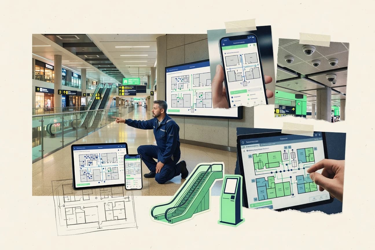
Discover top 10 indoor mapping software tools to streamline space visualization. Find the best fit for your needs—explore now.

How we ranked these tools
Core product claims cross-referenced against official documentation, changelogs, and independent technical reviews.
Analyzed video reviews and hundreds of written evaluations to capture real-world user experiences with each tool.
AI persona simulations modeled how different user types would experience each tool across common use cases and workflows.
Final rankings reviewed and approved by our editorial team with authority to override AI-generated scores based on domain expertise.
Score: Features 40% · Ease 30% · Value 30%
Gitnux may earn a commission through links on this page — this does not influence rankings. Editorial policy
Editor’s top 3 picks
Three quick recommendations before you dive into the full comparison below — each one leads on a different dimension.
Mapbox
Custom map styles with vector tiles for floor plan and POI layer rendering
Built for teams building custom indoor maps and navigation with their own data pipeline.
HERE Technologies
Editor pickIndoor routing on managed indoor map layers within HERE navigation and location APIs
Built for large venues needing scalable indoor navigation integrated with geospatial apps.
Esri ArcGIS
Editor pickIndoor mapping support within ArcGIS Web GIS using indoor layers in ArcGIS Online and ArcGIS Enterprise
Built for gIS-led teams building governed indoor maps with analytics and enterprise publishing.
Related reading
Comparison Table
This comparison table evaluates indoor mapping software for building-scale navigation and spatial analytics across major platforms including Mapbox, HERE Technologies, Esri ArcGIS, Google Maps Platform, and Teameyes. It contrasts mapping data sources, indoor-specific capabilities, developer tooling, and integration paths so you can match each product to your deployment needs. Use it to quickly compare features that affect map accuracy, update workflow, and app performance.
Mapbox
SDK-drivenBuild indoor mapping experiences with custom vector tile styling, search and routing integrations, and SDKs for web, iOS, and Android.
Custom map styles with vector tiles for floor plan and POI layer rendering
Mapbox stands out with production-grade custom map rendering that supports indoor-ready cartography like room-level layers and geospatial styling. Core capabilities include map SDKs for iOS, Android, Web, and Unity, plus vector tile and style management that help you deliver consistent indoor experiences across platforms.
You can integrate indoor navigation data by combining your floor plans and POIs with custom basemaps, then update visuals in near real time. Platform flexibility makes it stronger for teams building their own indoor workflows than for teams seeking a fully packaged indoor mapping app.
- +Vector tile and custom styling support room and POI layer design
- +SDKs for web, mobile, and Unity enable consistent indoor experiences
- +Real-time style updates help keep indoor layers current during changes
- +Robust geospatial tooling fits complex venue and campus data models
- –Indoor mapping requires more implementation work than packaged indoor platforms
- –Accurate floor alignment depends on your own data processing pipeline
- –Advanced setup and theming take time for non-technical teams
Best for: Teams building custom indoor maps and navigation with their own data pipeline
More related reading
HERE Technologies
navigation platformsDeliver indoor navigation and mapping capabilities for venues using indoor maps, developer SDKs, and location intelligence services.
Indoor routing on managed indoor map layers within HERE navigation and location APIs
HERE Technologies stands out with strong geospatial depth from a long-running mapping ecosystem that pairs well with indoor-ready basemaps. Its indoor mapping capabilities focus on enabling digital navigation through managed indoor data for venues, campuses, and multi-building locations.
The solution integrates with location-based workflows using HERE’s developer APIs and tools to handle indoor layers on top of street context. Teams typically use HERE to deliver consistent indoor experiences across devices while relying on structured venue and map data management.
- +Production-grade geospatial foundation improves indoor context and navigation quality
- +Developer-focused APIs support indoor layers and route integration across applications
- +Scales for multi-building venues with centralized map data management
- +Supports consistent visual and routing experiences using structured indoor data
- –Setup requires GIS and integration effort for venue-specific indoor layers
- –Less turnkey than purpose-built indoor apps for non-technical teams
- –Costs rise quickly when you need frequent updates across many locations
Best for: Large venues needing scalable indoor navigation integrated with geospatial apps
Esri ArcGIS
enterprise GISCreate, publish, and serve indoor maps and wayfinding layers using GIS tools, indoor data models, and web mapping services.
Indoor mapping support within ArcGIS Web GIS using indoor layers in ArcGIS Online and ArcGIS Enterprise
ArcGIS stands out for indoor mapping workflows that integrate directly with GIS data, web maps, and enterprise platforms. It supports indoor dataset authoring with map building, feature management, and indoor layer visualization inside ArcGIS Online and ArcGIS Enterprise.
You can publish indoor-aware web experiences and leverage existing spatial analysis and dashboards for operational use cases. Real-time device tracking and high-fidelity indoor positioning depend on third-party location sources and integration design.
- +Indoor mapping layers integrate with existing GIS datasets and geospatial tools
- +Supports publishing indoor maps through ArcGIS web maps and configurable apps
- +Strong enterprise governance with ArcGIS Enterprise publishing and security controls
- +Enables spatial analytics and dashboards on the same indoor feature layers
- –Indoor setup and schema design require GIS expertise and careful data modeling
- –Indoor positioning quality depends on connected tracking hardware and data feeds
- –Advanced indoor experiences can require custom app configuration and development
Best for: GIS-led teams building governed indoor maps with analytics and enterprise publishing
Google Maps Platform
platform APIsEnable indoor-aware mapping and wayfinding features in venues using platform APIs for maps, places, and location-based experiences.
Maps SDK indoor map support integrated with venue and floor layers
Google Maps Platform stands out for bringing indoor maps into the same familiar map and search experience used for global location discovery. It supports indoor positioning data through Maps SDK and related services so apps can render floors, venues, and navigable indoor spaces.
You get flexible developer controls over map styling, markers, and custom layers, but you must build the indoor experience in your own app. Indoor coverage quality depends on how you supply and manage venues and floor data in your implementation.
- +Deep integration with the mainstream Google Maps UI and user expectations
- +Indoor map rendering via Maps SDK with developer-controlled overlays
- +Strong ecosystem for venue search, geocoding, and map styling
- –Indoor mapping setup requires developer work and venue data management
- –Limited built-in indoor authoring tools compared with indoor-focused suites
- –Ongoing usage costs can rise with map loads and SDK traffic
Best for: Apps needing branded indoor maps tied to Google-scale search and navigation
Teameyes (Indoor Navigation)
managed navigationProvide venue-focused indoor mapping and navigation for assets and people using a managed indoor wayfinding solution.
Indoor navigation using floor maps with point-of-interest routing
Teameyes focuses on indoor mapping and navigation workflows for large buildings, using floor maps and navigable space layers. It supports asset and location visibility so teams can find points of interest inside campuses and facilities.
The platform emphasizes operational use cases like wayfinding, visitor guidance, and internal navigation rather than advanced indoor GIS authoring. Setup and content preparation are central to results, since map quality and spatial data determine navigation performance.
- +Indoor wayfinding built around floor maps and navigable points
- +Location and asset organization supports practical navigation use cases
- +Designed for multi-room and multi-level facilities
- –Navigation quality depends heavily on map setup and spatial data
- –Less oriented toward deep indoor GIS tooling and automation
- –Authoring effort can be significant for large estates
Best for: Facilities and campuses needing reliable internal navigation without custom mapping builds
Zonar (Indoor Mapping)
location-aware opsSupport indoor mapping workflows and operational visibility with software tools used for location-aware asset and facility management.
Indoor map authoring with floor and location data built for navigation
Zonar differentiates itself with indoor mapping built around practical venue navigation and operational needs for facilities like schools and healthcare. It supports map creation and updates for indoor spaces, including floor-level structure and wayfinding content. The solution focuses on keeping location data usable for end-users rather than offering broad GIS analytics or deep integrations with custom building systems.
- +Practical indoor maps designed for wayfinding across multi-floor spaces
- +Streamlined workflows for creating and maintaining venue map data
- +Clear focus on navigation use cases for facilities and public venues
- –Limited visibility into advanced building analytics compared with GIS platforms
- –Customization options can feel constrained for highly tailored workflows
- –Integrations are more focused than broad ecosystem support for enterprise tools
Best for: Facilities teams needing maintainable indoor wayfinding maps with minimal complexity
NavVis
digital twinGenerate indoor digital twins and accurate indoor navigation-ready maps using mobile scanning and downstream mapping tools.
NavVis Indoor Mapping workflow for turning captured scans into navigable 3D models linked to floorplans
NavVis stands out for end-to-end indoor mapping workflows built around capture systems, visual inspection, and enterprise-ready data delivery. It supports 3D point cloud generation, georeferenced floorplan linking, and interactive visualization so teams can navigate sites and inspect measurements.
The platform emphasizes operational use cases like facilities documentation, digital twins, and asset verification with repeatable capture and review processes across large portfolios. Its strength is high-fidelity spatial data and review tooling rather than lightweight browser-only mapping.
- +High-accuracy indoor 3D mapping with interactive navigation
- +Enterprise visualization for facilities teams and engineering workflows
- +Repeatable capture-to-delivery pipeline for multi-site projects
- –Implementation is heavy and typically needs specialist capture support
- –Workflow setup and data management can feel complex for small teams
- –Costs scale with deployments and user access rather than project size
Best for: Enterprises mapping large building portfolios for engineering and asset verification
Matterport
3D captureCreate immersive indoor spaces with photogrammetry and provide indoor 3D experiences that can be used for navigation and inspection.
Digital twin publishing with a web-based interactive 3D walkthrough viewer
Matterport focuses on 3D indoor capture with photogrammetry that turns spaces into navigable digital twins. Its core workflow centers on scanning, publishing interactive spaces, and sharing room-by-room views inside a web-based viewer.
It also supports basic analytics and integrations that help teams use scans for sales enablement, documentation, and training. Collaboration features make it easier to manage multi-user access to the same mapped property.
- +Interactive 3D space viewer supports walkthroughs and spatial context
- +Photogrammetry produces detailed indoor models suitable for marketing and inspections
- +Publishing and sharing streamline review for stakeholders across locations
- +Team access controls support collaborative projects and reusability of assets
- –Capture hardware and setup add cost and operational overhead
- –Large-scale projects require careful planning to maintain model quality
- –Advanced analytics and automation are limited versus full enterprise platforms
Best for: Real estate, facilities, and contractors needing high-fidelity 3D indoor twins
OpenStreetMap (Indoor routing via plugins)
open dataUse community map data and indoor routing extensions to model indoor spaces for navigation and wayfinding workflows.
Plugin-based indoor routing built on community OpenStreetMap indoor tags
OpenStreetMap stands out because indoor routing is delivered through third-party plugins and community-maintained map data rather than a proprietary indoor map product. Core capabilities include mapping indoor features via tagging and rendering, then using plugins for navigation logic that can route between connected spaces like rooms and corridors.
The platform supports collaborative edits across open data, so indoor coverage grows as venues and contributors add connectivity and POIs. Indoor routing quality depends heavily on how accurately buildings are modeled with indoor tags and how reliably routes are connected.
- +Indoor data grows through community edits and reusable venue contributions
- +Flexible tagging enables rooms, corridors, stairs, and POIs representation
- +Third-party plugins can provide indoor routing without a closed vendor stack
- –Indoor navigation depends on consistent building connectivity tags and geometry quality
- –No unified vendor workflow for indoor routing setup across plugins
- –Setup and troubleshooting require mapper skill and routing configuration knowledge
Best for: Teams mapping indoor spaces with community contributors and plugin-based routing needs
Maplat
indoor mappingCreate indoor maps and navigation layers using a web-based tooling approach designed for indoor location services.
Multi-floor indoor map configuration for navigation across building levels
Maplat focuses on turning scanned interior spaces into interactive indoor maps for navigation and asset viewing. It supports multi-floor indoor mapping so you can organize locations by building level and move users through corridors and rooms.
The workflow emphasizes map creation and layer management tied to real-world spaces rather than standalone diagramming. It fits teams that need indoor map experiences for office, retail, or facility use cases.
- +Multi-floor indoor mapping supports building-level navigation
- +Indoor location layer management helps organize rooms and points
- +Interactive map delivery works for navigation and facility viewing
- –Indoor mapping setup feels process-heavy without strong self-serve guidance
- –Limited standout analytics and operational tooling for large deployments
- –Integration options feel narrower than broader indoor platforms
Best for: Facilities and retail teams needing interactive multi-floor indoor maps
Conclusion
After evaluating 10 technology digital media, Mapbox stands out as our overall top pick — it scored highest across our combined criteria of features, ease of use, and value, which is why it sits at #1 in the rankings above.
Use the comparison table and detailed reviews above to validate the fit against your own requirements before committing to a tool.
How to Choose the Right Indoor Mapping Software
This buyer’s guide helps you choose Indoor Mapping Software with concrete comparisons across Mapbox, HERE Technologies, Esri ArcGIS, Google Maps Platform, Teameyes, Zonar, NavVis, Matterport, OpenStreetMap indoor routing via plugins, and Maplat. It focuses on features that directly impact indoor cartography, navigation reliability, data governance, and project execution. It also grounds decisions in each tool’s stated strengths, limitations, and pricing model.
What Is Indoor Mapping Software?
Indoor Mapping Software creates navigable indoor spaces by combining floor plans, rooms, POIs, and routing or visualization layers for web and mobile experiences. It solves problems like venue-level wayfinding, multi-floor navigation, indoor visualization for operations, and digital twin sharing for inspection or marketing. Tools like Mapbox and Google Maps Platform support indoor mapping through developer SDKs and custom layers, but you build much of the indoor workflow yourself. Esri ArcGIS and HERE Technologies provide deeper geospatial and indoor navigation foundations that fit teams managing venue layers at scale.
Key Features to Look For
Indoor mapping success depends on whether the tool handles data modeling, indoor rendering, and navigation logic in a way that matches your team’s workflow.
Vector tile indoor styling for floor plans and POI layers
Mapbox is built for custom map rendering with vector tile styling that supports room-level layers and POI layer design. This matters when you need consistent indoor cartography across web, iOS, Android, and Unity through shared styling and layer rules.
Managed indoor routing on structured venue layers
HERE Technologies focuses on indoor routing on managed indoor map layers within HERE navigation and location APIs. This matters when you want consistent routing behavior across multi-building venues without assembling every routing rule yourself.
GIS-native indoor layer authoring and governed publishing
Esri ArcGIS integrates indoor mapping into ArcGIS Online and ArcGIS Enterprise using indoor layers. This matters when your organization already uses GIS datasets and needs enterprise governance, security controls, dashboards, and spatial analytics on the same indoor features.
Brand-aligned indoor map rendering inside the Google Maps ecosystem
Google Maps Platform supports indoor map rendering via Maps SDK with developer-controlled overlays for floors and navigable indoor spaces. This matters when your indoor experience must match mainstream Google search and user expectations while you control what indoor layers appear.
Turnkey floor-map wayfinding with POI routing
Teameyes delivers indoor navigation using floor maps with point-of-interest routing for asset and people guidance. This matters for facilities and campuses that need operational wayfinding without deep indoor GIS authoring work.
Interactive indoor 3D digital twin publishing
Matterport publishes interactive indoor digital twins using photogrammetry and provides a web-based interactive 3D walkthrough viewer. This matters when walkthrough sharing and collaborative access for stakeholders across locations matter more than lightweight indoor overlays.
Capture-to-model indoor digital twin workflows with linked floorplans
NavVis provides an end-to-end indoor mapping workflow that turns mobile scanning into navigable 3D models linked to floorplans using its Indoor Mapping workflow. This matters when you need high-accuracy spatial data for engineering and asset verification across large portfolios.
Plugin-based indoor routing using community OpenStreetMap tags
OpenStreetMap enables indoor routing through third-party plugins built on community-maintained indoor tagging for rooms, corridors, stairs, and POIs. This matters when you want to scale indoor coverage through community edits and keep the base map free while you manage routing configuration and hosting.
Web-based multi-floor indoor map configuration for facilities and retail
Maplat provides multi-floor indoor mapping and indoor location layer management designed for indoor location services. This matters when you need interactive navigation across building levels with an approach centered on map creation and layer management rather than diagramming.
Operational indoor map authoring focused on maintainable wayfinding
Zonar supports indoor map creation and updates with floor-level structure and wayfinding content for facility navigation use cases. This matters when your goal is maintainable navigation maps with streamlined workflows and you prioritize usability over deep GIS analytics.
How to Choose the Right Indoor Mapping Software
Pick based on the balance between how much indoor mapping workflow you want to build yourself and how much routing and publishing should be managed by the vendor.
Match the tool to your indoor data and implementation responsibility
If you already have an indoor data pipeline and developers to implement layers, Mapbox provides custom vector tile styling for floor plans and POIs and supports SDKs for web, iOS, Android, and Unity. If you want managed indoor navigation and routing using structured venue layers through APIs, choose HERE Technologies for indoor routing on managed indoor map layers.
Decide whether you need GIS governance and analytics on indoor layers
For organizations using GIS datasets and requiring enterprise publishing controls, Esri ArcGIS integrates indoor mapping into ArcGIS Online and ArcGIS Enterprise and supports dashboards and spatial analytics on indoor feature layers. If you do not have GIS expertise, Zonar and Teameyes focus on operational wayfinding maps and maintainable navigation content instead of GIS schema design.
Choose the right user experience style for your stakeholders
If your requirement is a familiar branded map experience tied to mainstream discovery, Google Maps Platform supports indoor floors and navigable spaces via Maps SDK with developer-controlled overlays. If stakeholders need room-by-room walkthroughs and interactive digital twins, Matterport provides a web-based interactive 3D walkthrough viewer after photogrammetry capture.
Plan for capture-heavy digital twin needs with NavVis or Matterport
For high-fidelity 3D mapping that uses mobile scanning and produces navigable 3D models linked to floorplans, NavVis fits engineering and asset verification workflows. For photogrammetry-led digital twins that emphasize sharing and collaboration in a web viewer, Matterport fits real estate, facilities, and contractors.
Validate routing readiness and ongoing map maintenance effort
If indoor navigation depends on your own floor alignment and tagging accuracy, Mapbox and Google Maps Platform will require careful venue and floor data management and theming setup. For plugin-based indoor routing that relies on consistent indoor connectivity tags and geometry quality, OpenStreetMap can work well when you have mapper skill to configure routing plugins and maintain indoor connectivity.
Who Needs Indoor Mapping Software?
Indoor Mapping Software fits teams that need navigable indoor space experiences for operations, navigation, analytics, or digital twin visualization.
Custom indoor mapping teams with developers and an indoor data pipeline
Mapbox is a direct fit because it provides production-grade custom vector tile styling and SDKs for web, iOS, Android, and Unity so teams can deliver consistent indoor experiences from their own data. Google Maps Platform also fits teams building branded indoor maps because Maps SDK supports indoor map rendering through developer-controlled overlays tied to your venue and floor data.
Large venues that need scalable indoor routing across multi-building footprints
HERE Technologies fits because it focuses on indoor routing on managed indoor map layers within HERE navigation and location APIs. ArcGIS can also fit GIS-led programs that require governance and analytics while publishing indoor maps through ArcGIS web GIS for large venues.
Facilities and campuses that need reliable wayfinding without deep GIS authoring
Teameyes is built around indoor navigation using floor maps with POI routing so facilities teams can support internal navigation for assets and visitors. Zonar matches teams that want streamlined indoor map authoring and update workflows with floor-level structure and wayfinding content.
Engineering, asset verification, and portfolio documentation teams
NavVis fits enterprises that need accurate indoor 3D mapping and interactive visualization through an Indoor Mapping workflow linked to floorplans. Matterport also fits teams that want interactive digital twin publishing and a web-based interactive 3D walkthrough viewer for inspection and sharing.
Community-driven indoor routing efforts that can manage plugin configuration
OpenStreetMap indoor routing via plugins fits teams that can model indoor connectivity with consistent tags and maintain routing configurations. This approach works when contributors want to scale coverage through community edits while the base mapping remains free.
Facilities and retail teams that want interactive multi-floor indoor maps
Maplat fits office, retail, and facility use cases by focusing on interactive indoor maps with multi-floor organization and indoor location layer management. It matches teams that want navigation across building levels through web-based map and layer configuration.
Common Mistakes to Avoid
Indoor mapping failures usually come from mismatched workflows, underplanned data alignment, and underestimated maintenance effort across floors, POIs, and routing connectivity.
Underestimating floor alignment and indoor data preparation
Mapbox and Google Maps Platform both depend on your own floor alignment and venue data management, so misalignment directly impacts indoor navigation quality. OpenStreetMap indoor routing also depends heavily on consistent indoor connectivity tags and geometry quality, which makes bad modeling break routing between rooms and corridors.
Choosing GIS-heavy tooling without GIS skills for schema design
Esri ArcGIS requires indoor setup and schema design that needs GIS expertise and careful data modeling. If your team lacks GIS authoring capacity, Teameyes and Zonar center operational wayfinding map workflows with floor-level structure and POI routing.
Overbuilding custom implementations when a managed indoor navigation workflow is the goal
Mapbox and Google Maps Platform provide SDK flexibility but require implementation work and advanced setup for theming and indoor layer behavior. HERE Technologies is designed for managed indoor routing on structured indoor map layers inside HERE navigation and location APIs.
Selecting a digital twin capture workflow without planning capture overhead
NavVis and Matterport both add operational overhead because they require capture hardware and a repeatable capture-to-delivery or photogrammetry workflow. If your priority is fast wayfinding with POI routing, Teameyes and Zonar focus on indoor navigation built from floor maps and navigable space layers.
How We Selected and Ranked These Tools
We evaluated indoor mapping tools using four dimensions: overall fit for indoor mapping, feature depth for indoor layers and navigation, ease of use for getting from setup to working indoor experiences, and value based on how much workflow the tool provides versus what you must build. We prioritized capabilities that directly affect indoor navigation and visualization such as vector tile indoor styling in Mapbox, managed indoor routing on structured layers in HERE Technologies, and indoor publishing through ArcGIS web GIS in Esri ArcGIS. Mapbox ranked highest in this set because it combines custom vector tile and styling for room and POI layers with SDKs across web, iOS, Android, and Unity, which supports consistent indoor experiences across multiple platforms. Lower-ranked tools in this set generally trade away either turnkey indoor GIS workflows or deep integration flexibility, which pushes more mapping setup effort onto the customer in tools like Teameyes, Zonar, and Maplat.
Frequently Asked Questions About Indoor Mapping Software
Which indoor mapping option is best when we need to build our own indoor navigation app?
What tool should we choose for large venues that need scalable indoor routing on managed datasets?
If our team already runs GIS publishing and dashboards, which indoor mapping software fits best?
Which option is strongest for end-to-end capture and high-fidelity indoor data delivery?
Which software is more practical for facilities teams that need maintainable wayfinding maps instead of deep GIS authoring?
Which tools have a free plan, and which require paid subscriptions for indoor mapping features?
What technical inputs do we need to make indoor maps render correctly, especially for floors and POIs?
Why do indoor routes sometimes fail even when floor plans look correct?
How should we start building an indoor mapping workflow depending on our goal: digital twin, navigation, or interactive 3D maps?
Tools reviewed
Primary sources checked during evaluation.
Referenced in the comparison table and product reviews above.
Keep exploring
Comparing two specific tools?
Software Alternatives
See head-to-head software comparisons with feature breakdowns, pricing, and our recommendation for each use case.
Explore software alternatives→In this category
Technology Digital Media alternatives
See side-by-side comparisons of technology digital media tools and pick the right one for your stack.
Compare technology digital media tools→FOR SOFTWARE VENDORS
Not on this list? Let’s fix that.
Our best-of pages are how many teams discover and compare tools in this space. If you think your product belongs in this lineup, we’d like to hear from you—we’ll walk you through fit and what an editorial entry looks like.
Apply for a ListingWHAT THIS INCLUDES
Where buyers compare
Readers come to these pages to shortlist software—your product shows up in that moment, not in a random sidebar.
Editorial write-up
We describe your product in our own words and check the facts before anything goes live.
On-page brand presence
You appear in the roundup the same way as other tools we cover: name, positioning, and a clear next step for readers who want to learn more.
Kept up to date
We refresh lists on a regular rhythm so the category page stays useful as products and pricing change.