GITNUXSOFTWARE ADVICE
Technology Digital MediaTop 10 Best Indoor Map Software of 2026
Discover top indoor map software for businesses. Compare features, find the best fit, and enhance navigation.

How we ranked these tools
Core product claims cross-referenced against official documentation, changelogs, and independent technical reviews.
Analyzed video reviews and hundreds of written evaluations to capture real-world user experiences with each tool.
AI persona simulations modeled how different user types would experience each tool across common use cases and workflows.
Final rankings reviewed and approved by our editorial team with authority to override AI-generated scores based on domain expertise.
Score: Features 40% · Ease 30% · Value 30%
Gitnux may earn a commission through links on this page — this does not influence rankings. Editorial policy
Editor picks
Three quick recommendations before you dive into the full comparison below — each one leads on a different dimension.
Depix
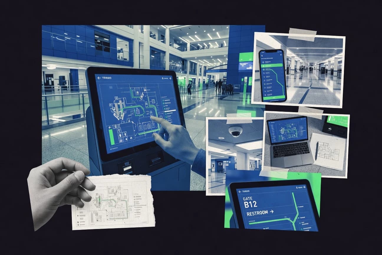
Interactive indoor navigation with points of interest and guided multi-floor directions
Built for facilities and teams needing multi-floor indoor guidance without heavy engineering.
Zebra MotionWorks
Runner UpIndoor map and zone configuration for running location-aware warehouse workflows.
Built for warehouse teams standardizing indoor location workflows with Zebra devices.
RoomScan
Also GreatIndoor scanning workflow that generates room and wayfinding map assets for shared navigation
Built for facilities teams needing indoor wayfinding maps without full GIS complexity.
Related reading
Comparison Table
This comparison table benchmarks indoor mapping software for deploying maps, tracking users, and supporting building-scale navigation. It contrasts tools such as Depix, Zebra MotionWorks, RoomScan, Naver Maps Platform for indoor mapping, and HERE Location Services for indoor location, along with other common options, across key capabilities. Use it to quickly identify which platforms fit your data sources, integration requirements, and target indoor use case.
Depix
indoor analyticsDepix provides indoor mapping and wayfinding with a platform for interactive indoor spaces and deployment-ready indoor maps.
Interactive indoor navigation with points of interest and guided multi-floor directions
Depix focuses on indoor mapping delivered through shareable, interactive 3D-like wayfinding experiences rather than static floorplans. It supports uploading and managing indoor maps, placing points of interest, and guiding users across floors for navigation workflows.
The tool emphasizes fast setup for teams that need an indoor space layer on top of existing facilities and signage. Depix is a strong fit for visitor guidance and internal navigation where people need clear, map-based directions.
- +Indoor maps enable clear point-of-interest wayfinding
- +Multi-floor navigation supports building-scale deployments
- +Shareable experiences reduce friction for visitors and staff
- +Quick map publishing supports frequent updates
- –Advanced integrations can require setup beyond basic map publishing
- –Highly customized UI workflows may be limited by configuration options
Best for: Facilities and teams needing multi-floor indoor guidance without heavy engineering
More related reading
Zebra MotionWorks
robot positioningZebra MotionWorks supports indoor positioning and mapping workflows for mobile robots using sensor data and mapping pipelines.
Indoor map and zone configuration for running location-aware warehouse workflows.
Zebra MotionWorks stands out as Zebra’s indoor location and mapping suite built around Zebra device ecosystems, including RFID and mobile computer deployments. It focuses on creating indoor maps and running location-aware experiences that use tracked signals rather than relying on a generic map-only tool.
Core capabilities include indoor map configuration, zone definitions, and location workflows that support warehouse and facility navigation use cases. It is strongest when you want tight alignment between mapping data and Zebra hardware behavior.
- +Strong indoor location workflow support for Zebra device deployments.
- +Zone and map configuration built for facility navigation use cases.
- +Helps standardize tracking behaviors across warehouses and sites.
- –Workflow setup depends on Zebra hardware and integration choices.
- –Indoor map tuning can require technical effort and operator training.
- –Less flexible for non-Zebra tracking stacks and custom signals.
Best for: Warehouse teams standardizing indoor location workflows with Zebra devices
RoomScan
map captureRoomScan creates indoor maps from mobile device capture and produces structured indoor map assets for search and navigation experiences.
Indoor scanning workflow that generates room and wayfinding map assets for shared navigation
RoomScan focuses on converting indoor spaces into navigable map assets that teams can share and use for wayfinding. It supports scanning workflows and produces indoor map views designed for locating rooms and points of interest.
The platform targets organizations that need faster map creation and updates than manual drawing. It works best when you have consistent floor plans and defined locations to map.
- +Indoor scanning workflow speeds up map creation from existing spaces
- +Room and point-of-interest mapping supports practical navigation needs
- +Sharing indoor map assets helps teams standardize location references
- +Designed for indoor wayfinding rather than generic diagramming
- –Map quality depends heavily on input coverage and scanning consistency
- –Fewer advanced analytics tools than enterprise indoor GIS systems
- –Limited customization for complex multi-building enterprise deployments
- –Onboarding can require hands-on setup for accurate location data
Best for: Facilities teams needing indoor wayfinding maps without full GIS complexity
Naver Maps Platform (Indoor Map)
mapping platformNaver Maps Platform includes indoor map support and provides map rendering and location features for indoor browsing experiences.
Naver Maps Platform Indoor Map data integration for indoor wayfinding on Naver-based experiences
Naver Maps Platform’s Indoor Map focuses on embedding indoor routing and location experiences into web and mobile apps using Naver’s mapping ecosystem. It supports indoor map layers and building data so businesses can guide users inside large venues like malls, offices, and campuses.
The platform is a strong fit when you want a Korean-language friendly, map-centric experience integrated with Naver services rather than a standalone indoor GIS tool. Implementation typically depends on Naver map data workflows and developer integration for rendering and interaction.
- +Indoor map rendering built for Naver Maps integration
- +Supports indoor navigation experiences for large venues
- +Strong fit for services targeting Korea and Naver users
- –Indoor content setup requires specialized mapping workflows
- –Developer integration is needed for best user experiences
- –Less suited for teams wanting a standalone indoor mapping admin
Best for: Teams building indoor wayfinding on Naver Maps for Korean audiences
HERE Location Services (Indoor)
API-first indoorHERE Location Services delivers indoor location data and indoor mapping capabilities via APIs for routing and positioning use cases.
Indoor navigation with location positioning across multi-floor environments
HERE Location Services for Indoor delivers indoor navigation and location positioning built on mapped indoor spaces and supporting technologies. It provides indoor maps, routing, and location-based experiences that integrate with external applications using standard location and mapping interfaces.
The product is stronger for deployment-ready indoor use cases than for quick DIY floor plan authoring, because it relies on curated indoor data and positioning capabilities. Teams using HERE for indoor can extend geofencing and wayfinding patterns across large facilities where accuracy and consistency matter.
- +Reliable indoor positioning and routing for navigation workflows
- +Indoor map coverage supports wayfinding in complex multi-floor venues
- +Integration options fit location apps, dashboards, and mobile experiences
- +Consistent location data supports geofencing and analytics use cases
- –Setup and data onboarding are heavier than DIY indoor mapping tools
- –Indoor map customization depends on the underlying data availability
- –Implementation effort increases when accuracy requirements are strict
Best for: Large venues needing dependable indoor navigation and location positioning
Mapbox (Indoor-style building maps)
custom-renderingMapbox provides map rendering, vector styling, and geospatial APIs that support indoor map experiences with custom building layers.
Vector tiles with fully customizable Mapbox styling for indoor layers
Mapbox stands out for delivering indoor map rendering through vector map tiles and customizable styling rather than a closed indoor-only editor. It supports precise indoor visualization using vector sources, label styling, and interactive map components via its Maps and related SDKs.
Teams can use the same mapping stack for wayfinding-style experiences by layering indoor geometries over a unified map canvas. The platform focuses more on map rendering and geospatial tooling than on turnkey indoor data authoring workflows.
- +Vector-tile indoor rendering with full control of styling and labels
- +Interactive SDKs let you build indoor navigation interfaces on one map canvas
- +Reuses the same geospatial pipeline for indoor and outdoor map consistency
- +Strong performance with GPU-friendly vector maps at multiple zoom levels
- –Indoor data preparation and integration require significant mapping and GIS work
- –No turnkey indoor building editor for room-level asset creation
- –Advanced customization increases implementation complexity for non-mapping teams
Best for: Teams building custom indoor maps and wayfinding using a vector map stack
Esri ArcGIS Indoors
GIS enterpriseEsri ArcGIS Indoors supports indoor GIS workflows for floor-aware navigation, location layers, and building-centric analytics.
Indoor data model for buildings, floors, and navigable spaces that fits ArcGIS workflows
ArcGIS Indoors stands out for connecting indoor GIS with Esri’s broader geospatial ecosystem, including web maps, data models, and location services. It supports indoor dataset creation for buildings and levels, routing-ready floor plans, and integration with ArcGIS web apps for map-based experiences.
It also includes operational tools for managing indoor network assets and distributing interactive indoor maps to stakeholders. The solution is best when you already use ArcGIS for authoritative spatial data and need consistent indoor mapping across sites.
- +Leverages ArcGIS data, maps, and web apps for consistent indoor deployments
- +Provides indoor data modeling for buildings, floors, and navigable spaces
- +Supports operational indoor updates through GIS workflows tied to asset data
- –Setup and data preparation require GIS expertise and structured indoor datasets
- –Advanced experiences depend on ArcGIS components and integration work
- –Licensing cost can be high versus simpler indoor-only mapping tools
Best for: Organizations standardizing indoor GIS across multiple sites within ArcGIS
Navisens Indoor Navigation
wayfinding platformNavisens Indoor Navigation offers indoor mapping and wayfinding tools that integrate indoor positioning and guidance for facilities.
Indoor wayfinding navigation built for destination guidance within managed indoor spaces
Navisens Indoor Navigation focuses on delivering a complete indoor mapping and guidance experience for sites that need people to find destinations reliably. It supports indoor location use cases tied to real spaces such as buildings and campuses, with navigation and map content designed for end-user wayfinding.
The offering is best evaluated on how quickly you can get indoor assets and navigation flows live for visitors and staff. It is less compelling when you need highly customized map rendering logic or deep integration into bespoke GIS pipelines.
- +Designed specifically for indoor wayfinding on real premises
- +Indoor navigation experience fits visitor and staff destination journeys
- +Navigation flows align with practical building and campus use cases
- –Setup and map onboarding require more effort than lightweight map viewers
- –Less suited for teams needing deep GIS customization
- –Customization depth for UI and logic is limited compared with custom builds
Best for: Sites needing reliable indoor wayfinding and navigation with minimal custom development
FUGA Open Indoor Maps
open indoor dataFUGA offers indoor mapping resources and tooling for creating indoor map data for navigation and facility use.
Open indoor map layers built for interoperability and reuse across indoor navigation applications
FUGA Open Indoor Maps stands out for running open, standards-based indoor map layers over real world building data. It supports interactive indoor navigation surfaces such as floor plans and wayfinding paths, with data import and map configuration for venues.
The solution also emphasizes interoperability so indoor map content can be reused across different tools and integrations. It is a solid fit when indoor mapping needs to be deployed as a map dataset and served to applications rather than as a closed, single-purpose dashboard.
- +Open indoor map data approach supports reuse across applications and workflows
- +Floor plan and wayfinding surfaces enable practical navigation experiences
- +Indoor map configuration supports venue-specific layout mapping
- –Setup and configuration require more technical effort than GUI-first products
- –Advanced features like real-time analytics and A/B testing are limited compared to top tools
- –Collaboration and content workflows are less streamlined than mainstream platforms
Best for: Teams publishing indoor maps as reusable datasets for navigation experiences
osmdroid (OpenStreetMap Android indoor map rendering)
mobile mappingosmdroid provides Android map rendering for OpenStreetMap layers that can be used to build indoor-like map experiences with custom overlays.
Configurable custom tile sources for venue map layers
osmdroid focuses on rendering OpenStreetMap data on Android and supports map tiles from external sources, making it a practical indoor-style mapping base. It can be configured to load custom tile servers and works well for venue maps where you provide the tile layer.
Its feature set stays close to map display rather than full indoor positioning, routing, or venue management. For indoor use, you typically pair it with your own tile generation workflow and app logic for overlays.
- +Supports OpenStreetMap tiles and custom tile sources on Android
- +Lightweight map rendering suited for apps needing direct tile control
- +Strong developer control for overlays and indoor-specific UI layers
- –No built-in indoor navigation or positioning features
- –Indoor-specific workflows rely on your own tiling and overlay logic
- –Requires Android development effort to integrate cleanly
Best for: Android teams building custom indoor map apps from provided tiles
Conclusion
After evaluating 10 technology digital media, Depix stands out as our overall top pick — it scored highest across our combined criteria of features, ease of use, and value, which is why it sits at #1 in the rankings above.
Use the comparison table and detailed reviews above to validate the fit against your own requirements before committing to a tool.
How to Choose the Right Indoor Map Software
This buyer’s guide helps you choose Indoor Map Software by mapping your real use case to capabilities found in Depix, Zebra MotionWorks, RoomScan, Naver Maps Platform (Indoor Map), HERE Location Services (Indoor), Mapbox (Indoor-style building maps), Esri ArcGIS Indoors, Navisens Indoor Navigation, FUGA Open Indoor Maps, and osmdroid. You will learn which features matter most, how to evaluate implementation effort, and which tools fit common operational goals like multi-floor wayfinding and zone-based location workflows.
What Is Indoor Map Software?
Indoor Map Software creates indoor map layers and navigation experiences that work inside buildings and campuses where GPS outdoors is not sufficient. It solves wayfinding problems by enabling point-of-interest guidance across floors, and it solves location and routing problems by tying map data to positioning signals, zones, or destination journeys. Tools like Depix deliver interactive indoor navigation experiences with multi-floor directions. Tools like HERE Location Services (Indoor) focus on indoor routing and location positioning using indoor maps and APIs for dependable navigation across complex venues.
Key Features to Look For
The fastest way to narrow choices is to evaluate these capabilities against the indoor experience you need to deliver.
Interactive indoor navigation with points of interest and guided multi-floor directions
Choose this capability when visitors must follow clear on-map directions to rooms and destinations across floors. Depix stands out for interactive navigation with points of interest and guided multi-floor routing workflows. Navisens Indoor Navigation also focuses on destination journeys for visitor and staff wayfinding within managed indoor spaces.
Indoor map and zone configuration for location-aware workflows
Pick this feature when you want navigation tied to zones and tracked signals rather than map-only display. Zebra MotionWorks is built for indoor map and zone configuration for warehouse workflows that run location-aware experiences. HERE Location Services (Indoor) supports dependable indoor navigation with location positioning across multi-floor environments.
Indoor map creation from mobile scanning workflows
Choose scanning and asset generation when you need to turn real spaces into usable map content faster than manual drawing. RoomScan focuses on a mobile device capture workflow that generates structured room and wayfinding map assets for shared navigation. This approach supports practical indoor wayfinding without requiring full indoor GIS complexity.
Platform-native integration for indoor browsing and routing experiences
Select this feature when you want indoor maps embedded into a specific mapping ecosystem rather than a standalone authoring system. Naver Maps Platform (Indoor Map) provides indoor map rendering and indoor navigation experiences for web and mobile integrations in Naver’s ecosystem. Mapbox (Indoor-style building maps) supports custom indoor rendering through vector tiles and interactive SDKs on one map canvas.
Vector-tile indoor rendering with fully customizable styling
Choose Mapbox (Indoor-style building maps) when you need control over labels, geometry, and interactivity for indoor layers. Mapbox provides vector tiles and customizable styling for indoor visualization and GPU-friendly performance at multiple zoom levels. This is a strong fit when your team builds bespoke indoor navigation interfaces with its Maps and SDKs.
Indoor GIS data models for buildings, floors, and navigable spaces
Choose an indoor GIS approach when you must standardize indoor datasets across multiple sites and layers. Esri ArcGIS Indoors provides an indoor data model for buildings, floors, and navigable spaces that fits ArcGIS workflows. This is the right direction when indoor map updates and analytics must stay consistent with a broader GIS pipeline.
How to Choose the Right Indoor Map Software
Match your requirements for navigation, data creation, positioning, and integration to the tool whose capabilities align with your operational reality.
Start with the indoor experience you must deliver
If your primary goal is visitor wayfinding with clear directions to rooms across floors, prioritize Depix because it provides interactive indoor navigation with points of interest and guided multi-floor directions. If you need destination guidance built for visitor journeys with managed indoor spaces, evaluate Navisens Indoor Navigation. If your goal is indoor navigation that depends on location positioning across multi-floor venues, evaluate HERE Location Services (Indoor) and focus on routing tied to positioning.
Decide whether you need map-only navigation or position-aware workflows
Map-only indoor navigation works when the experience can be driven from indoor maps and user selection. Zebra MotionWorks is designed for zone and map configuration that supports location-aware warehouse navigation using Zebra device ecosystems. HERE Location Services (Indoor) supports indoor positioning and routing workflows that connect indoor navigation to dependable location positioning.
Choose your map data path: scanning, authoring, open layers, or vector rendering
If you need faster creation of indoor map assets from real spaces, RoomScan generates room and wayfinding map assets using mobile scanning workflows. If your team wants open, reusable indoor map layers that can be served to multiple applications, FUGA Open Indoor Maps emphasizes interoperability and reuse. If you need fully customized indoor rendering on top of a unified map canvas, Mapbox (Indoor-style building maps) supports vector-tile indoor layers with advanced label and styling control.
Align integration requirements with your existing ecosystem
For teams building inside Naver’s ecosystem for Korean audiences, Naver Maps Platform (Indoor Map) provides indoor map rendering and routing experiences integrated with Naver services. For teams already standardized on ArcGIS for authoritative spatial data, Esri ArcGIS Indoors provides a building and floor indoor GIS data model that ties into ArcGIS web maps. For teams controlling an Android mapping stack with OpenStreetMap tiles, osmdroid provides Android rendering with configurable custom tile sources and overlay-friendly indoor UI.
Validate setup effort against your operational constraints
Depix emphasizes quick map publishing for teams needing multi-floor indoor guidance without heavy engineering. RoomScan can depend on scanning coverage and scanning consistency, so you should plan for capture quality when you adopt it. Zebra MotionWorks and HERE Location Services (Indoor) both require tighter integration and tuning because indoor map workflows depend on the hardware and positioning requirements you target.
Who Needs Indoor Map Software?
Indoor Map Software fits different groups based on whether you need wayfinding for people, location-aware navigation for equipment, or reusable indoor map datasets for multiple apps.
Facilities teams that need multi-floor wayfinding without heavy engineering
Depix provides interactive indoor navigation with points of interest and guided multi-floor directions that reduce friction for visitors and staff. RoomScan also targets facilities that want indoor wayfinding maps without full GIS complexity by generating navigable assets from scanning workflows.
Warehouse teams standardizing location-aware navigation workflows with Zebra devices
Zebra MotionWorks is built around Zebra device ecosystems and supports indoor map and zone configuration for running location-aware warehouse navigation. This is strongest when you align mapping behavior with Zebra hardware and tracking signals.
Large venues that need dependable indoor routing tied to positioning across floors
HERE Location Services (Indoor) focuses on indoor navigation with location positioning across multi-floor environments and supports integration via APIs. This fits teams that must deliver consistent indoor routing accuracy for complex venues.
App developers who want custom indoor rendering on a vector map canvas
Mapbox (Indoor-style building maps) supports vector-tile indoor rendering with fully customizable styling and interactive SDKs on one map canvas. osmdroid is a fit when your Android team controls tiles and overlays for indoor-like map experiences without built-in indoor positioning.
Common Mistakes to Avoid
These pitfalls show up when teams pick software by map appearance alone instead of by navigation workflow, data pipeline, and integration depth.
Choosing map-only rendering when your use case requires location positioning and zones
If you need location-aware navigation tied to zone behavior, Zebra MotionWorks supports indoor map and zone configuration built for location workflows. If you need reliable indoor routing tied to positioning, HERE Location Services (Indoor) provides indoor navigation across multi-floor environments using indoor positioning capabilities.
Underestimating how much map data creation effort depends on capture quality
RoomScan can generate useful indoor room and wayfinding map assets faster than manual drawing, but map quality depends on input coverage and scanning consistency. Plan capture coverage before you rely on RoomScan for destination-level accuracy.
Expecting turnkey indoor GIS modeling without GIS expertise
Esri ArcGIS Indoors provides an indoor data model for buildings, floors, and navigable spaces, but it requires structured indoor datasets and GIS expertise to prepare correctly. If your team cannot support that data modeling workflow, Depix or Navisens Indoor Navigation aligns better with managed indoor wayfinding workflows.
Trying to make a standalone authoring workflow work inside a different mapping ecosystem without planning integration
Naver Maps Platform (Indoor Map) delivers value through indoor map rendering integrated with Naver services, so implementation requires developer integration for best results. Mapbox (Indoor-style building maps) also expects vector layer integration and customization work because it focuses on rendering and geospatial APIs rather than room-level turnkey authoring.
How We Selected and Ranked These Tools
We evaluated each Indoor Map Software tool using four rating dimensions: overall capability, features coverage, ease of use, and value for delivering indoor mapping and navigation outcomes. We prioritize tools that connect indoor map content to a usable navigation workflow like Depix interactive indoor navigation or Navisens Indoor Navigation destination guidance. We also account for implementation readiness, because tools such as Zebra MotionWorks and HERE Location Services (Indoor) depend on positioning workflows that must be configured around the signals and environments you deploy in. Depix separated from lower-ranked options by emphasizing interactive indoor navigation with points of interest and guided multi-floor directions while still supporting quick map publishing for facilities and visitor guidance use cases.
Frequently Asked Questions About Indoor Map Software
Which indoor map tools are best when I need multi-floor visitor wayfinding without building a full GIS pipeline?
How do Zebra MotionWorks and HERE Location Services differ for location accuracy inside warehouses or large venues?
Which tools support faster indoor map updates than manual floorplan drawing?
Which indoor map software is most suitable for embedding indoor routing into a web or mobile app?
What option should I choose if I already maintain authoritative indoor GIS data in Esri?
Which tools emphasize interoperability and reusable indoor map datasets rather than a closed dashboard?
Do any of these tools focus more on rendering indoor maps than on full positioning and routing pipelines?
Which product is a better fit when I need zone-based indoor navigation and workflows tied to equipment signals?
What common implementation workflow should I expect when using Naver Maps Platform (Indoor Map) versus HERE Location Services for Indoor?
Tools reviewed
Primary sources checked during evaluation.
Referenced in the comparison table and product reviews above.
Keep exploring
Comparing two specific tools?
Software Alternatives
See head-to-head software comparisons with feature breakdowns, pricing, and our recommendation for each use case.
Explore software alternatives→In this category
Technology Digital Media alternatives
See side-by-side comparisons of technology digital media tools and pick the right one for your stack.
Compare technology digital media tools→FOR SOFTWARE VENDORS
Not on this list? Let’s fix that.
Our best-of pages are how many teams discover and compare tools in this space. If you think your product belongs in this lineup, we’d like to hear from you—we’ll walk you through fit and what an editorial entry looks like.
Apply for a ListingWHAT THIS INCLUDES
Where buyers compare
Readers come to these pages to shortlist software—your product shows up in that moment, not in a random sidebar.
Editorial write-up
We describe your product in our own words and check the facts before anything goes live.
On-page brand presence
You appear in the roundup the same way as other tools we cover: name, positioning, and a clear next step for readers who want to learn more.
Kept up to date
We refresh lists on a regular rhythm so the category page stays useful as products and pricing change.