GITNUXSOFTWARE ADVICE
Technology Digital MediaTop 10 Best Indoor Positioning Software of 2026
Discover top 10 indoor positioning software solutions. Compare features, find the right fit for your needs.

How we ranked these tools
Core product claims cross-referenced against official documentation, changelogs, and independent technical reviews.
Analyzed video reviews and hundreds of written evaluations to capture real-world user experiences with each tool.
AI persona simulations modeled how different user types would experience each tool across common use cases and workflows.
Final rankings reviewed and approved by our editorial team with authority to override AI-generated scores based on domain expertise.
Score: Features 40% · Ease 30% · Value 30%
Gitnux may earn a commission through links on this page — this does not influence rankings. Editorial policy
Editor’s top 3 picks
Three quick recommendations before you dive into the full comparison below — each one leads on a different dimension.
Zebra MotionWorks Edge
Edge positioning engine that produces low-latency coordinates and zone-triggered events
Built for facilities teams deploying Zebra-based tracking across warehouses and hospitals.
VersaSense
Editor pickConfigurable indoor calibration workflow for reference data and zone-based positioning
Built for facilities teams needing calibrated indoor positioning for navigation and asset flows.
Ekahau Positioning System
Editor pickEkahau Site Survey with live coverage and accuracy test validation
Built for enterprises needing accurate Wi‑Fi indoor positioning across multi-room environments.
Related reading
Comparison Table
This comparison table benchmarks leading indoor positioning software across Zebra MotionWorks Edge, VersaSense, Ekahau Positioning System, AisleLabs, BlueDot, and other widely used platforms. Each entry summarizes deployment approach, supported sensing and tags, calibration and mapping workflow, and core capabilities for asset tracking, navigation, and location analytics.
Zebra MotionWorks Edge
enterprise hardware-readyUses Zebra Wi-Fi sensing and location analytics to provide real-time indoor positioning and visibility for enterprise operations.
Edge positioning engine that produces low-latency coordinates and zone-triggered events
Zebra MotionWorks Edge stands out by turning Zebra UWB and Bluetooth location signals into usable indoor positioning data at the edge. It supports real-time asset and worker tracking use cases by running positioning logic close to the Wi-Fi and sensor environment.
The solution includes mapping, zone and rules-based location events, and integration points for dispatching actions to other enterprise systems. MotionWorks Edge is best suited for environments that need low-latency location updates without sending all raw signals to a central server.
- +Edge-based processing reduces latency for live location and zone events
- +Strong support for Zebra UWB and Bluetooth sensor-based positioning inputs
- +Zone and rules-driven workflows convert coordinates into actionable signals
- –Best results depend on careful RF and sensor placement planning
- –Integration setup can require more engineering effort than dashboard-only platforms
- –Scalability and performance tuning vary with site layout complexity
Best for: Facilities teams deploying Zebra-based tracking across warehouses and hospitals
More related reading
VersaSense
indoor positioning softwareDelivers Wi-Fi and sensor-based indoor positioning software that maps device locations inside facilities and supports location events.
Configurable indoor calibration workflow for reference data and zone-based positioning
VersaSense distinguishes itself with a focus on turning indoor sensor data into location-aware services using a configurable positioning pipeline. It supports deploying indoor positioning across environments by mapping signals, calibrating zones, and producing position estimates for downstream applications.
Core capabilities include managing reference data and enabling location workflows that integrate with enterprise systems. The solution is strongest where teams can maintain site-specific tuning and want consistent outputs rather than rapid, fully automated accuracy.
- +Strong configuration for site calibration and localization zones
- +Clear pipeline from signal collection to position outputs for applications
- +Practical support for multi-area indoor navigation workflows
- –Setup requires careful tuning of environment and reference data
- –Integration effort can rise for complex enterprise data flows
- –Less suited for fully plug-and-play accuracy without on-site work
Best for: Facilities teams needing calibrated indoor positioning for navigation and asset flows
Ekahau Positioning System
Wi-Fi positioningProvides site surveys and Wi-Fi positioning configuration to deliver accurate indoor location determination for tags and assets.
Ekahau Site Survey with live coverage and accuracy test validation
Ekahau Positioning System stands out for its closed-loop workflow that combines site surveys, Wi-Fi modeling, and location validation in one toolchain. It supports packet-based calibration for Wi‑Fi and integrates with Ekahau hardware and third-party access points for fingerprinting-based positioning.
The system emphasizes measurable accuracy through test runs and heatmap outputs tied to coverage predictions. Ekahau also enables operational location features such as presence, tracking, and room-level analytics from configured deployments.
- +End-to-end survey to deployment workflow with accuracy validation
- +High-fidelity heatmaps and coverage predictions for planning
- +Strong fingerprinting engine tuned for Wi-Fi indoor accuracy
- +Practical tools for measuring tracking stability and performance
- –Training and site knowledge required to build accurate models
- –Planning workflows can be time-consuming on large multi-floor sites
- –Limited positioning source variety outside Wi-Fi-centric setups
- –Dense deployments demand careful AP selection and placement
Best for: Enterprises needing accurate Wi‑Fi indoor positioning across multi-room environments
Aislelabs
retail location analyticsImplements privacy-aware indoor location and people analytics using computer vision and sensor fusion for retail measurement.
Location analytics built for movement and dwell-time insights from continuous indoor tracks
Aislelabs stands out for operationalizing indoor positioning into deployable, site-specific tracking workflows rather than treating location as a standalone map feature. The platform supports Wi-Fi and Bluetooth beacon based positioning with configurable anchors, calibration, and coverage tuning for retail and similar venues. It also focuses on downstream use cases like people movement analytics and asset visibility that rely on consistent, low-latency location updates.
- +Supports beacon and Wi-Fi positioning with configurable site tuning
- +Strong focus on analytics and movement insights tied to location streams
- +Designed for retail workflows that require stable tracking coverage
- –Deployment and calibration effort rises with floor complexity
- –Advanced configurations require more systems integration than basic setup
- –Location quality depends heavily on anchor placement and environment
Best for: Retail operators needing location analytics and tracking across multiple zones
BlueDot
location servicesSupplies indoor location services and location-aware analytics for venues using sensor data and location algorithms.
Zone-based indoor analytics for footfall, dwell time, and movement trends
BlueDot stands out with fast indoor location and analytics aimed at retail and public-venue deployments. It supports beacons and other radio signals to determine visitor or asset location inside buildings.
Its workflow centers on configuring indoor maps, managing sensors, and using location data for counting, routing, and operational insights. The platform emphasizes deployment practicality for mixed site layouts over deep developer-centric control.
- +Indoor map and sensor setup supports real-world venue deployments
- +Location analytics enable footfall and movement insights by zone
- +Workflow focuses on operational use cases like wayfinding and counting
- –Advanced custom location logic requires more integration effort
- –Multi-building scaling can demand careful configuration management
- –Limited visibility into low-level signal tuning compared with developer tools
Best for: Retail and venue teams needing indoor location for analytics and guidance
InnerSpace
SDK and servicesOffers indoor positioning software that computes user and device locations using beacons, Wi-Fi, and other signals.
Zone and event mapping on indoor layouts for direct operational triggers
InnerSpace focuses on indoor positioning for assets and people by combining map-based configuration with location and zone awareness. It supports visual placement workflows for defining spaces, routes, and reference elements, then uses device signals to compute positions inside buildings.
The platform emphasizes practical deployment for warehouses and similar environments where accuracy depends on correct calibration and site setup. Core capabilities center on indoor mapping, zone logic, and live positioning outputs for operational workflows.
- +Indoor map and zone setup ties directly to location use cases
- +Positioning outputs support operational routing, alerts, and zone events
- +Deployment workflow is built for site calibration rather than generic demos
- –Accuracy relies heavily on careful reference planning and calibration
- –Complex multi-building setups can increase configuration effort
Best for: Operations teams needing zone-based indoor positioning for warehouses and facilities
AirtagX
beacon trackingDelivers beacon-based indoor positioning and asset tracking software with device location updates for facility workflows.
Zone presence alerting for AirTag-based indoor assets
AirtagX focuses on indoor positioning workflows built around AirTag-based tracking hardware. The core capabilities center on mapping tagged assets indoors, monitoring movement, and supporting location-driven alerts. It also emphasizes operational visibility for facilities teams that need device-level location context rather than general fleet analytics.
- +Indoor asset tracking built specifically for AirTag-like devices
- +Supports location monitoring workflows for facilities and operations teams
- +Alerting can trigger on position changes and zone presence
- +Asset-to-location context reduces manual status checks
- –Setup and calibration can be more hands-on than typical BLE stacks
- –Location accuracy depends heavily on tag placement and environment
- –Limited visibility into fine-grained tracking health versus enterprise systems
Best for: Teams needing lightweight indoor asset tracking with zone alerts for facilities
Minew Indoor Positioning
BLE positioningProvides indoor positioning solutions using BLE beacons and gateway software to locate tags within warehouses and facilities.
Minew positioning stack that turns beacon or tag detections into zone and location outputs
Minew Indoor Positioning focuses on deploying indoor localization with Minew hardware and providing a complete stack from tag or beacon signals to usable location outputs. The solution supports typical indoor use cases like asset tracking, people tracking, and zone-based triggers by converting detected wireless signals into positions and event data. Admin tooling centers on configuring reference devices, managing calibration-like workflows, and integrating positioning outputs into downstream systems.
- +End-to-end indoor positioning workflow built around Minew hardware signals
- +Zone and event style outputs fit common tracking and alerting needs
- +Configuration and deployment tooling reduces manual localization effort
- –Best results depend on careful reference device placement and environment tuning
- –Integration depth outside Minew ecosystem can require additional engineering work
- –Limited insight into positioning quality metrics and per-area performance tuning
Best for: Teams deploying Minew hardware for asset tracking with zone-level actions
Aqua Signal Indoor Positioning
indoor navigationDelivers indoor navigation and positioning using multi-sensor signal processing to support accurate indoor wayfinding.
Fixed-beacon indoor localization designed for operational zone tracking with predictable coverage
Aqua Signal Indoor Positioning emphasizes infrastructure-supported indoor localization for mobile assets and people using fixed beacons and a managed software layer. Core capabilities center on collecting positioning signals, computing indoor locations, and displaying results for operations through a control interface.
The solution is oriented toward environments where consistent coverage is achievable with planned hardware placement. Accuracy and stability depend heavily on beacon layout, floor materials, and commissioning quality across each zone.
- +Beacon-based localization supports stable indoor positioning in planned zones
- +Central interface for viewing live locations and managing indoor areas
- +Commissioning can be reused across floors with consistent beacon layouts
- –Indoor accuracy degrades when beacon placement misses high-traffic paths
- –Setup requires more site work than pure software-only positioning tools
- –Limited flexibility for dynamic environments without revalidation of zones
Best for: Facilities teams needing reliable zone-based indoor tracking with managed deployment
Samsara Indoor Positioning
fleet and asset visibilityUses location-aware asset tracking data to support indoor visibility and operational execution for facilities.
Zone-based indoor positioning tied to operational alerts and safety workflows
Samsara Indoor Positioning stands out for combining indoor location with operational workflows in a unified asset and workforce visibility system. It supports visual floorplan setup to map zones and uses installed hardware to generate near real-time location signals. The solution emphasizes actionable location data for safety, compliance, and logistics operations rather than standalone mapping analytics.
- +Zone-based indoor location supports practical operational alerts and workflows
- +Strong integration with Samsara asset and workforce visibility features
- +Floorplan mapping enables quick conversion of physical spaces into usable zones
- –Initial hardware installation effort is required for consistent location accuracy
- –Setup complexity rises for multi-building deployments and dense environments
- –Indoor positioning adds value only when paired with broader Samsara operations
Best for: Sites needing actionable indoor zones integrated with operational visibility workflows
Conclusion
After evaluating 10 technology digital media, Zebra MotionWorks Edge stands out as our overall top pick — it scored highest across our combined criteria of features, ease of use, and value, which is why it sits at #1 in the rankings above.
Use the comparison table and detailed reviews above to validate the fit against your own requirements before committing to a tool.
How to Choose the Right Indoor Positioning Software
This buyer’s guide explains how to select indoor positioning software for real-time tracking, zone-triggered workflows, and location-aware analytics. It covers Zebra MotionWorks Edge, VersaSense, Ekahau Positioning System, Aislelabs, BlueDot, InnerSpace, AirtagX, Minew Indoor Positioning, Aqua Signal Indoor Positioning, and Samsara Indoor Positioning. It also maps key feature requirements to the teams that each tool is best suited for.
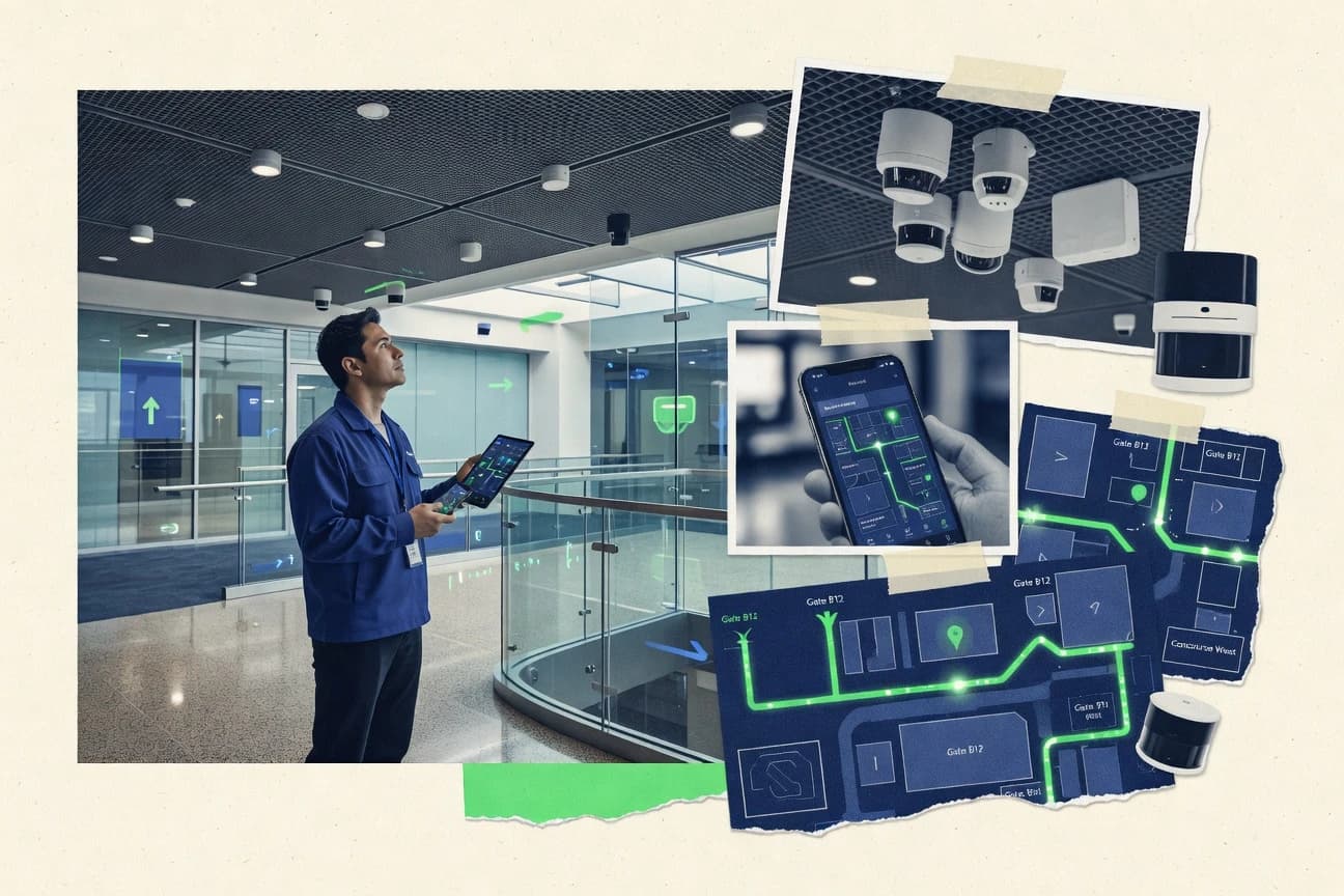
What Is Indoor Positioning Software?
Indoor Positioning Software calculates indoor device or people locations from radio signals like Wi-Fi and Bluetooth, or from fixed beacon infrastructure, then turns those locations into zones, events, and operational workflows. These tools solve problems like asset visibility in warehouses, safety and compliance location alerts, and retail analytics such as footfall and dwell-time by zone. Some platforms also include site survey and calibration workflows so location outputs can be validated before deployment. Tools like Ekahau Positioning System focus on Wi-Fi positioning planning and validation, while Zebra MotionWorks Edge focuses on low-latency edge processing for zone-triggered events.
Key Features to Look For
Indoor positioning success depends on how well a tool converts raw signals into reliable coordinates, zones, and actions under real site conditions.
Edge-based low-latency positioning and zone events
For live tracking where delays break workflows, edge compute that produces near real-time coordinates and zone-triggered events matters. Zebra MotionWorks Edge runs positioning logic at the edge to reduce latency for live asset and worker tracking, and it supports zone and rules-based location events.
Configurable calibration and reference data workflows
Indoor accuracy depends on reference data and tuned models, so software that guides calibration and allows zone configuration is essential. VersaSense provides a configurable indoor calibration workflow for reference data and zone-based positioning outputs, and it is designed for consistent outputs that rely on site tuning.
Closed-loop site survey, Wi-Fi modeling, and accuracy validation
When location accuracy must be measurable before scaling across multi-room areas, a survey and validation workflow reduces guesswork. Ekahau Positioning System combines site surveys, Wi-Fi modeling, and live accuracy test validation, and it generates high-fidelity heatmaps tied to coverage predictions.
Location-to-analytics pipelines for movement, dwell time, and footfall
Retail and venue use cases need continuous location tracks converted into measurable movement insights by zone. Aislelabs operationalizes location into movement and dwell-time analytics from continuous indoor tracks, while BlueDot focuses on zone-based analytics for footfall, dwell time, and movement trends.
Zone and event mapping directly onto indoor layouts
Operational teams benefit when indoor maps and zone rules translate immediately into alerts, routing logic, and zone presence triggers. InnerSpace ties indoor map configuration to live positioning outputs for operational alerts and zone events, and it emphasizes zone and event mapping on indoor layouts.
Hardware-aligned beacon tracking workflows and ecosystem integrations
Some deployments succeed by using a tool built around a specific sensing stack rather than expecting generic signal handling. AirtagX provides beacon-based indoor positioning workflows built around AirTag-style tracking for zone presence alerts, while Minew Indoor Positioning offers an end-to-end stack built around Minew hardware signals for zone and event style outputs.
Fixed-beacon commissioning with predictable zone coverage
When the environment supports planned coverage, fixed-beacon localization can deliver stable zone tracking through controlled commissioning. Aqua Signal Indoor Positioning uses fixed beacons with a managed software layer and a central interface for viewing live locations, and it emphasizes predictable coverage where beacon layouts are planned for high-traffic paths.
Operational integration with floorplan zones and real-world workflows
Facilities programs often need indoor zones linked to broader operational execution and safety actions. Samsara Indoor Positioning uses floorplan mapping to convert spaces into zones and ties zone-based indoor location to operational alerts and safety workflows, and it is strongest when paired with Samsara asset and workforce visibility features.
How to Choose the Right Indoor Positioning Software
Selection should start from the sensing approach, then align zone and event outputs to the operational workflow that needs to act on location data.
Match the positioning engine to your latency and real-time needs
If zone-triggered actions must react immediately, Zebra MotionWorks Edge is designed to produce low-latency coordinates using an edge positioning engine. If the priority is consistent indoor positioning outputs that come from a tuned calibration pipeline, VersaSense fits teams that want configurable reference data and zone-based positioning rather than dashboard-only automation.
Choose the sensing and deployment model that fits your site
Ekahau Positioning System is built around Wi-Fi fingerprinting and uses site survey and live test validation to plan for multi-room deployments. Aqua Signal Indoor Positioning is built around fixed-beacon localization with a managed software layer and depends on planned beacon placement to preserve coverage along high-traffic paths.
Map your outcomes to zone and event outputs
Warehouses and facilities that need operational triggers should evaluate InnerSpace for zone and event mapping on indoor layouts and live positioning outputs for alerts and routing. Teams focused on operational alerting for AirTag-like assets should evaluate AirtagX because it centers on zone presence alerting tied to beacon-based tracking.
Plan for analytics requirements if location becomes a measurement system
Retail operators that need dwell time and movement analytics from continuous location tracks should evaluate Aislelabs because it is built for movement and dwell-time insights. Venue and retail teams focused on footfall and movement trends by zone should evaluate BlueDot because it supplies zone-based indoor analytics.
Account for calibration and integration effort before committing
If the organization cannot support tuning work, avoid assuming any platform will be fully plug-and-play because VersaSense depends on careful environment tuning and reference data. If deeper engineering support is limited, Zebra MotionWorks Edge can require integration setup work beyond edge processing, while Minew Indoor Positioning can need additional engineering when integration depth is required outside the Minew ecosystem.
Who Needs Indoor Positioning Software?
Indoor positioning software benefits teams whenever indoor zones and locations must drive real actions like alerts, navigation, analytics, or operational execution.
Facilities teams deploying warehouse or hospital tracking with low-latency zone events
Zebra MotionWorks Edge fits facilities teams because it is built for edge-based positioning with low-latency coordinates and zone-triggered events, which supports real-time asset and worker tracking. This tool also supports zone and rules-driven workflows that convert coordinates into actionable signals for enterprise operations.
Facilities teams that need calibrated indoor navigation and asset flows
VersaSense fits teams that want consistent outputs from site calibration because it provides a configurable indoor calibration workflow for reference data and zone-based positioning. It also supports location workflows that integrate with downstream applications for navigation and asset flow use cases.
Enterprises that require accurate Wi-Fi indoor positioning across multi-room environments
Ekahau Positioning System fits enterprises because it offers a closed-loop site survey, Wi-Fi modeling, and accuracy validation workflow with coverage heatmaps. It emphasizes fingerprinting-based positioning tuned for Wi-Fi indoor accuracy and supports operational presence, tracking, and room-level analytics.
Retail operators and venues that need dwell time, footfall, and movement analytics by zone
Aislelabs fits retail operators because it operationalizes location streams into movement and dwell-time insights for continuous indoor tracks. BlueDot fits venue and retail teams that need zone-based analytics for footfall, dwell time, and movement trends with practical guidance and counting style workflows.
Operations teams that need zone-based positioning to drive warehouse routing, alerts, and operational triggers
InnerSpace fits operations teams because it provides indoor map configuration tied directly to live positioning outputs and zone events for operational routing and alerts. Its zone and event mapping on indoor layouts makes it practical for facilities workflows that depend on zone presence.
Teams seeking lightweight indoor asset tracking with zone alerts using AirTag-like devices
AirtagX fits teams that want asset-to-location context with zone presence alerting built for AirTag-like tracking hardware. It supports location monitoring workflows for facilities operations teams that need alerts when assets enter or change zones.
Teams deploying Minew hardware where zone-level actions must be derived from beacon or tag detections
Minew Indoor Positioning fits deployments built around Minew hardware signals because it provides an end-to-end indoor localization workflow that converts detected wireless signals into zone and location outputs. It also provides admin tooling for configuring reference devices and calibration-like deployment steps.
Facilities teams that can commission fixed beacons and want predictable zone coverage for tracking
Aqua Signal Indoor Positioning fits facilities teams needing reliable zone-based indoor tracking through planned beacon layouts. It provides a central control interface for viewing live locations and managing indoor areas where commissioning can be reused across floors with consistent beacon layouts.
Sites that want indoor zones integrated into a broader operational visibility and safety workflow
Samsara Indoor Positioning fits sites needing actionable indoor zones tied to operational alerts and safety workflows. It supports visual floorplan setup to map zones and emphasizes value when paired with Samsara asset and workforce visibility features.
Common Mistakes to Avoid
Indoor positioning deployments often fail when teams underestimate tuning requirements, misalign sensing technology to their environment, or treat indoor location as a standalone dashboard instead of an operational system.
Assuming indoor accuracy works without site planning and calibration
VersaSense depends on careful tuning of the environment and reference data, and AirtagX accuracy depends heavily on tag placement and environment. Ekahau Positioning System also requires training and site knowledge to build accurate models, and Aqua Signal Indoor Positioning requires commissioning quality and correct beacon layout for stable coverage.
Choosing the wrong radio technology for the site constraints
Ekahau Positioning System is Wi-Fi-centric and dense deployments demand careful AP selection and placement for best outcomes. Aqua Signal Indoor Positioning is fixed-beacon oriented, and its indoor accuracy degrades when beacon placement misses high-traffic paths.
Building workflows that require low latency without edge-capable processing
Live zone-triggered workflows that need fast reactions should be evaluated against Zebra MotionWorks Edge, which produces low-latency coordinates at the edge. Tools focused more on configuration and validation, like Ekahau Positioning System and VersaSense, can still be strong but need workflow alignment with responsiveness requirements.
Underestimating integration and engineering effort outside the core ecosystem
Zebra MotionWorks Edge can require more engineering effort for integration setup than dashboard-only platforms, and Minew Indoor Positioning can require additional engineering when integration is needed outside the Minew ecosystem. BlueDot also needs more integration effort for advanced custom location logic, which can slow deployment if application-specific behavior is not planned early.
How We Selected and Ranked These Tools
we evaluated each indoor positioning software tool on three sub-dimensions. features carry weight 0.4, ease of use carries weight 0.3, and value carries weight 0.3. The overall rating is the weighted average calculated as overall = 0.40 × features + 0.30 × ease of use + 0.30 × value. Zebra MotionWorks Edge separated itself from lower-ranked tools through its edge positioning engine that supports low-latency coordinates and zone-triggered events, which maps directly to stronger feature performance for real-time operational use.
Frequently Asked Questions About Indoor Positioning Software
Which indoor positioning software is best for low-latency edge tracking in warehouses and hospitals?
What tool supports a closed-loop workflow for surveying, calibration, and validation of Wi‑Fi accuracy?
Which platform is strongest for retail location analytics like footfall, dwell time, and movement trends?
Which software is designed around a configurable indoor positioning pipeline with repeatable outputs?
What are the most common workflow steps when deploying indoor positioning for operational zone triggers?
Which solutions rely on fixed beacons or planned infrastructure for predictable coverage?
Which indoor positioning software targets lightweight asset tracking using AirTag hardware?
Which option is best when the deployment uses Minew tags or beacons and needs zone-level event outputs?
What integration and action patterns differentiate these tools for enterprise operations?
Why do indoor positioning deployments often deliver inconsistent accuracy, and which tools highlight commissioning quality?
Tools reviewed
Primary sources checked during evaluation.
Referenced in the comparison table and product reviews above.
Keep exploring
Comparing two specific tools?
Software Alternatives
See head-to-head software comparisons with feature breakdowns, pricing, and our recommendation for each use case.
Explore software alternatives→In this category
Technology Digital Media alternatives
See side-by-side comparisons of technology digital media tools and pick the right one for your stack.
Compare technology digital media tools→FOR SOFTWARE VENDORS
Not on this list? Let’s fix that.
Our best-of pages are how many teams discover and compare tools in this space. If you think your product belongs in this lineup, we’d like to hear from you—we’ll walk you through fit and what an editorial entry looks like.
Apply for a ListingWHAT THIS INCLUDES
Where buyers compare
Readers come to these pages to shortlist software—your product shows up in that moment, not in a random sidebar.
Editorial write-up
We describe your product in our own words and check the facts before anything goes live.
On-page brand presence
You appear in the roundup the same way as other tools we cover: name, positioning, and a clear next step for readers who want to learn more.
Kept up to date
We refresh lists on a regular rhythm so the category page stays useful as products and pricing change.