GITNUXSOFTWARE ADVICE
Business FinanceTop 10 Best Mapper Software of 2026
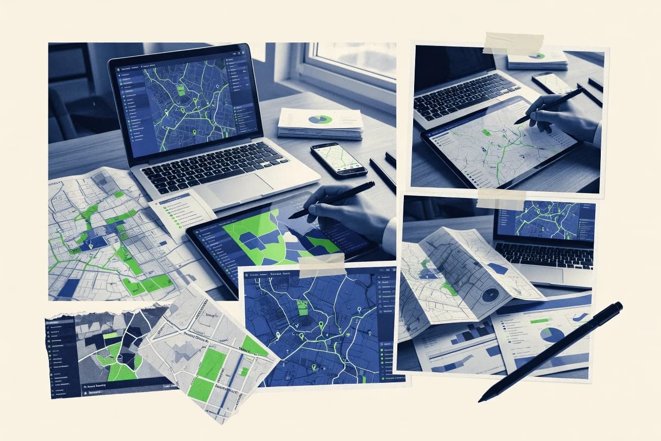
Discover top 10 mapper software tools to streamline mapping needs.

How we ranked these tools
Core product claims cross-referenced against official documentation, changelogs, and independent technical reviews.
Analyzed video reviews and hundreds of written evaluations to capture real-world user experiences with each tool.
AI persona simulations modeled how different user types would experience each tool across common use cases and workflows.
Final rankings reviewed and approved by our editorial team with authority to override AI-generated scores based on domain expertise.
Score: Features 40% · Ease 30% · Value 30%
Gitnux may earn a commission through links on this page — this does not influence rankings. Editorial policy
Editor’s top 3 picks
Three quick recommendations before you dive into the full comparison below — each one leads on a different dimension.
ArcGIS Online
Hosted feature layers with querying, symbology, and web editing support
Built for teams building and sharing repeatable web mapping workflows at scale.
QGIS
Editor pickQGIS Processing Toolbox with model-based and scriptable geoprocessing
Built for gIS analysts needing desktop mapping, analysis, and layout production.
Mapbox
Editor pickVector tile hosting and custom map styles for high-performance, brand-ready map rendering
Built for teams building custom mapping applications with developer-led workflows.
Related reading
Comparison Table
This comparison table evaluates leading mapper software tools, including ArcGIS Online, QGIS, Mapbox, Google Maps Platform, and Microsoft Power BI, alongside additional options for different workflows. It helps map data teams and analysts compare core capabilities like map creation, data integration, visualization features, deployment style, and collaboration options so the best fit is clear before adoption.
ArcGIS Online
enterprise GISCreate interactive maps and share web maps, feature layers, and analytics dashboards using a managed GIS platform.
Hosted feature layers with querying, symbology, and web editing support
ArcGIS Online stands out with a mature, cloud-native geospatial content platform that supports publishing and consuming maps, apps, and datasets in one place. It delivers strong mapping capabilities through web maps, web scenes, analysis tools, and a rich catalog of layers and services.
Collaboration and governance features like shared items, groups, and configurable user workflows help teams manage GIS content at scale. Its deep integration with ArcGIS ecosystem tooling and standards makes it practical for building repeatable mapping workflows.
- +Web maps and web scenes support rich 2D and 3D visualization workflows
- +Built-in analysis tools enable common GIS geoprocessing without extra tooling
- +Item sharing, groups, and access control support structured collaboration
- +Smart layer creation and hosted feature layers streamline data publishing
- +App building templates help convert maps into shareable web experiences
- –Advanced analysis workflows can feel limited compared with full desktop GIS tools
- –Performance can degrade with very large datasets and complex styling
- –Content governance relies on careful configuration of item ownership and sharing
Best for: Teams building and sharing repeatable web mapping workflows at scale
More related reading
QGIS
desktop GISBuild, edit, and publish geospatial data layers with desktop mapping, styling, and analysis tools in an open source GIS application.
QGIS Processing Toolbox with model-based and scriptable geoprocessing
QGIS stands out for its open-source GIS stack that supports desktop mapping, editing, and spatial analysis in one workspace. It combines a mature map composer for layouts with strong data ingestion for common vector and raster formats. It also provides an extensive processing toolbox that automates geoprocessing workflows and supports Python-based customization for repeatable tasks.
- +Comprehensive processing toolbox with repeatable geoprocessing workflows
- +High-quality map composer for print and export-ready layouts
- +Broad file format support for raster, vector, and geodatabases
- +Python scripting and plugins enable automation and custom tooling
- +Strong symbology options for thematic mapping and legends
- –Layer styling and projections require careful setup
- –Complex projects can feel slower and require tuning
- –Some advanced tasks have steep learning curves
- –Collaboration and versioning are limited compared to web-first tools
Best for: GIS analysts needing desktop mapping, analysis, and layout production
Mapbox
API-first mappingDevelop custom maps with vector tiles and geospatial APIs for routing, geocoding, and map rendering in business finance workflows.
Vector tile hosting and custom map styles for high-performance, brand-ready map rendering
Mapbox stands out for its developer-first mapping stack built around vector tiles, custom map styling, and fast geospatial rendering. Core capabilities include map hosting, offline-capable basemaps via vector tiles, and rich geospatial visualization APIs for custom layers. Teams can integrate geocoding and routing services to power interactive maps within their own applications and dashboards.
- +Vector tile rendering supports smooth zoom and detailed custom styling
- +Geocoding and routing APIs enable end-to-end location-aware app features
- +Layering and custom basemap workflows support branded map experiences
- +Performance-focused SDKs reduce latency for map interactions
- –Mapper workflows often require software engineering to integrate effectively
- –Complex styling and layer configuration can slow early setup
- –Offline and data pipeline patterns require additional implementation work
Best for: Teams building custom mapping applications with developer-led workflows
Google Maps Platform
enterprise location servicesIntegrate Google’s mapping, geocoding, and place services into applications for location-based views and routing needs.
Places API provides place autocomplete plus rich place details
Google Maps Platform stands out with deep global map data coverage and mature geocoding and routing services. Teams can build location-aware apps using Maps JavaScript API for maps display, Places API for search and details, and Routes API for turn-by-turn paths. It also supports Maps Static and Dynamic map capabilities plus tools for managing usage of geospatial assets in custom workflows.
- +World-scale map coverage with reliable geocoding and search results
- +Routes API supports path computation for real-world driving use cases
- +Places API adds place details, categories, and autocomplete for location workflows
- +Comprehensive developer tooling for JavaScript and web map rendering
- +Strong mapping primitives for markers, overlays, and interactive maps
- –Advanced features require careful API setup and data handling
- –Usage management can become complex in high-volume mapping deployments
- –Customization depth can be limited for highly specialized GIS layers
Best for: Apps needing accurate routing, place search, and fast map rendering
Microsoft Power BI
BI mappingCreate business maps and location-based visualizations by binding geospatial data to interactive reports for finance analysis.
DAX-driven semantic modeling with row-level security for governed metrics
Power BI stands out for its tight integration with the Microsoft ecosystem, including Excel, Azure, and Microsoft 365. It delivers interactive dashboards, semantic modeling with DAX measures, and scheduled refresh for keeping reports current. Collaboration features like app workspaces and row-level security help teams share curated insights with controlled access.
- +Strong DAX modeling for precise measures and calculated KPIs
- +Interactive dashboard visuals with drill-through and cross-filtering
- +Row-level security supports controlled access to shared reports
- +Scheduled refresh keeps datasets up to date for ongoing reporting
- –Advanced modeling and performance tuning often require specialist knowledge
- –Less flexible geospatial tooling than dedicated GIS mapping platforms
- –Data preparation can become complex across multiple sources
Best for: Teams needing governed BI dashboards and analytics without custom mapping code
Tableau
BI mappingProduce interactive business dashboards with map visualizations that combine geographic dimensions with finance KPIs.
Geographic map sheets with parameter-driven, cross-filtered interactivity
Tableau stands out for turning geospatial measures into interactive dashboards through drag-and-drop visual analytics. It supports map visualizations backed by filters, parameters, and computed fields that connect location context to charts and tables. It also integrates with common data sources and enables sharing through web-based views and governed workbooks.
- +Strong interactive mapping with coordinated filters across dashboard elements
- +Fast dashboard authoring using drag-and-drop and reusable calculated fields
- +Broad data connectivity for blending location data with business metrics
- –Geospatial workflows remain limited compared with dedicated GIS tools
- –Complex spatial logic and custom map behaviors can require workarounds
- –Dashboard governance and performance tuning take more setup for large datasets
Best for: Teams building interactive map dashboards from business data without heavy GIS needs
Kepler.gl
web map visualizationRender fast, interactive web maps from large geospatial datasets using deck.gl powered visualization and exploratory tooling.
Deck.gl-powered layer system with real-time interactive styling and brushing
Kepler.gl stands out with map-first visual analytics built around interactive layers and powerful styling controls. It supports ingesting spatial data like GeoJSON and tabular datasets, then binding fields to map encodings through linked views. The tool also enables time and animation workflows using deck.gl layers, plus custom map rendering for advanced cartography.
- +Layer-based visualizations with flexible styling and interactive tooltips
- +Direct support for GeoJSON and multiple data encodings on maps
- +Linked views and brushing for exploratory analysis workflows
- +Deck.gl rendering enables advanced visualization performance and controls
- –Complex layer configuration can slow down first-time setup
- –Large datasets can strain browser performance and memory
- –Export and sharing workflows can feel less streamlined than dedicated products
Best for: Teams exploring geospatial data interactively with minimal custom code
OpenLayers
developer mapping libraryBuild custom map viewers in the browser with modular geospatial rendering and layer control capabilities.
Feature styling and interaction system for vector layers with selectable and editable geometry
OpenLayers stands out as a JavaScript mapping library that powers interactive web maps with fine-grained control over rendering, layers, and interactions. Core capabilities include custom map projections, tile layer support, vector styling, and GIS interaction patterns for drawing, selecting, and editing features. The library integrates well with OGC standards via common geospatial data sources, and it supports building full mapping experiences rather than single visualization widgets.
- +Highly configurable layer stack for raster tiles and vector feature rendering
- +Strong interaction support for selection, drawing, and editing workflows
- +Flexible projection handling for advanced geospatial use cases
- –JavaScript architecture requires development effort for production mapping apps
- –Complex styling and interaction composition can be difficult to debug
- –Out-of-the-box admin and workflow tools are limited compared to full platforms
Best for: Engineering teams building custom web mapping and editing experiences
Leaflet
developer mapping libraryCreate lightweight interactive maps in web applications using tile layers, markers, and geographic overlays.
Event-driven interactivity using onEachFeature with GeoJSON layers
Leaflet stands out by staying lightweight and web-focused, letting teams build custom interactive maps with minimal overhead. It provides core mapping primitives like tile layers, vector overlays, markers, popups, and event handling. Leaflet’s plugin ecosystem expands capabilities for geospatial visualization while keeping the core API small and predictable.
- +Lightweight JavaScript API with predictable map rendering and controls
- +Robust support for markers, popups, tooltips, and polygon and polyline layers
- +Flexible tile-layer integration for multiple basemap sources and projections
- –Manual integration required for advanced GIS workflows like routing and geocoding
- –Performance tuning is needed for large GeoJSON datasets in the browser
- –No built-in data governance features for permissions, editing history, or audit trails
Best for: Developers embedding interactive web maps into existing apps and dashboards
GeoPandas
data mapping toolkitManipulate geospatial data and generate mappings from Python by extending Pandas with spatial operations and plotting.
Spatial join with CRS-aware alignment using sjoin
GeoPandas stands out by turning geospatial data into a Pandas-like workflow using GeoDataFrame objects. It supports reading and writing common vector formats, running spatial joins, and transforming coordinate reference systems for map-ready datasets.
The library also enables geometry operations like buffering, overlays, and distance calculations, and it pairs with Matplotlib and other plotting tools for quick visualization. For Mapper Software use cases, it supports reproducible, code-driven map creation and spatial data pipelines rather than a point-and-click mapping UI.
- +GeoDataFrame model makes vector operations feel like Pandas workflows
- +Spatial joins, overlays, and buffers cover core mapper analytics tasks
- +CRS-aware operations reduce errors when combining datasets
- –Focused on vector data, so raster-heavy mapping needs other tools
- –Lacks built-in interactive dashboard authoring for non-coders
- –Large datasets can be slow without careful indexing and geometry handling
Best for: Code-first teams building repeatable vector map workflows and spatial analysis
Conclusion
After evaluating 10 business finance, ArcGIS Online stands out as our overall top pick — it scored highest across our combined criteria of features, ease of use, and value, which is why it sits at #1 in the rankings above.
Use the comparison table and detailed reviews above to validate the fit against your own requirements before committing to a tool.
How to Choose the Right Mapper Software
This buyer’s guide helps teams choose the right mapper software by mapping needs to concrete capabilities across ArcGIS Online, QGIS, Mapbox, Google Maps Platform, Power BI, Tableau, Kepler.gl, OpenLayers, Leaflet, and GeoPandas. It covers workflows for web publishing, desktop analysis, developer-built map experiences, and code-first spatial pipelines. It also highlights common implementation mistakes drawn from the strengths and limitations of these specific tools.
What Is Mapper Software?
Mapper software turns geographic data into interactive maps, analysis outputs, and shareable spatial visuals. It solves problems like publishing feature layers for web querying, producing repeatable cartography layouts, and building location-aware apps with geocoding and routing. Tools like ArcGIS Online focus on managed web map sharing with hosted feature layers and web editing support. Desktop and code-first options like QGIS and GeoPandas support spatial analysis and geoprocessing pipelines using model-based workflows or CRS-aware spatial operations.
Key Features to Look For
The right mapper features determine whether teams can publish maps, run spatial analysis, and embed location experiences without rebuilding the workflow.
Hosted feature layers with querying and web editing
ArcGIS Online supports hosted feature layers with querying, symbology controls, and web editing support for repeatable sharing workflows. This directly supports governed collaboration through configurable item sharing, groups, and access control patterns.
Processing toolbox for repeatable geoprocessing
QGIS includes the Processing Toolbox with model-based and scriptable geoprocessing so analysts can automate multi-step workflows. GeoPandas provides CRS-aware spatial operations and spatial joins to build repeatable vector analytics in a Python pipeline.
Vector tile hosting and custom map styles for performance
Mapbox delivers vector tile hosting and custom map styles to render smooth zooming experiences with brand-ready cartography. Kepler.gl complements this idea with deck.gl-powered layer rendering for real-time interactive styling and brushing in a web environment.
Routing and place services with app-ready primitives
Google Maps Platform provides the Places API for place autocomplete and rich place details plus the Routes API for turn-by-turn path computation. This pairing supports fast integration of accurate search and routing behaviors into custom applications.
Geospatial visualization tied to governed BI metrics
Power BI connects maps to business reporting through DAX-driven semantic modeling with row-level security for controlled access. Tableau adds parameter-driven, cross-filtered geographic map sheets so location context can drive interactive KPI exploration.
Vector interactions for selecting and editing geometries
OpenLayers provides a feature styling and interaction system that supports selectable and editable geometry in browser mapping apps. Leaflet adds event-driven interactivity with GeoJSON layers using handlers like onEachFeature, which supports custom interaction logic in lightweight web maps.
How to Choose the Right Mapper Software
Pick a tool by matching the required workflow type, from managed web publishing to developer embedding to code-first spatial pipelines.
Start with the workflow type and output format
For repeatable web mapping at organizational scale, ArcGIS Online supports web maps, web scenes, and hosted feature layers that include querying, symbology, and web editing. For desktop analysis and layout production, QGIS combines editing, a strong map composer for export-ready layouts, and a Processing Toolbox for automating geoprocessing.
Decide whether the team needs GIS analysis tools or app-ready APIs
If the goal is to compute routing paths and search places inside applications, Google Maps Platform provides the Places API and the Routes API for location-aware features. If the goal is to build branded map experiences inside apps, Mapbox focuses on vector tile rendering and custom map styles, with geocoding and routing services that fit developer-led workflows.
Match data exploration and interactivity needs to the tool’s rendering model
For exploratory, layer-driven visual analysis in a browser with linked views, Kepler.gl uses deck.gl layer system for real-time interactive styling and brushing. For lightweight interactive overlays inside existing dashboards, Leaflet focuses on tile layers, markers, and GeoJSON event handling without built-in governance or audit features.
Choose the governance and collaboration model that fits the organization
ArcGIS Online supports collaboration through shared items, groups, and configurable user workflows that manage GIS content at scale. Power BI uses row-level security with DAX-driven semantic modeling so location-based dashboards can enforce controlled access to governed metrics.
Align “who builds” with the tool’s expected development effort
Engineering teams that need full control over browser rendering and editing should evaluate OpenLayers for feature interactions and projection handling. Code-first teams should evaluate GeoPandas for CRS-aware spatial joins using sjoin and spatial operations that fit a Pandas-like workflow.
Who Needs Mapper Software?
Mapper software benefits different teams based on whether they need web publishing, desktop geoprocessing, BI mapping, or developer-embedded map experiences.
GIS teams publishing repeatable web mapping workflows
ArcGIS Online is built for teams that share web maps and web scenes backed by hosted feature layers that support querying, symbology, and web editing. Its item sharing, groups, and configurable access controls help teams manage GIS content without building every workflow from scratch.
GIS analysts producing desktop layouts and automating spatial processing
QGIS fits analysts who need desktop mapping, editing, and spatial analysis with export-ready map composer output. Its Processing Toolbox supports model-based and scriptable geoprocessing for repeatable workflows.
Developers building custom location-aware applications
Mapbox supports developer-led workflows with vector tile hosting and custom map styles plus geocoding and routing services that power interactive app features. OpenLayers and Leaflet help teams implement interactive web mapping experiences when tight client-side control is required.
Business teams building governed map dashboards from KPIs
Power BI supports map-based visualization tied to DAX semantic modeling and row-level security for controlled access to metrics. Tableau supports parameter-driven geographic map sheets with cross-filtered interactivity so location context connects to the rest of the dashboard.
Common Mistakes to Avoid
Common failures happen when teams pick a tool for the wrong workflow type, underestimate configuration complexity, or expect governance features where none exist.
Choosing a developer-first map SDK without planning for engineering integration
Mapbox and OpenLayers can require substantial software engineering to integrate production mapping apps, especially for complex interaction composition and debugging. Leaflet avoids heavy overhead but still requires manual integration for advanced GIS workflows like routing and geocoding.
Expecting GIS-grade analysis from BI mapping tools
Power BI supports location-based visualizations tied to semantic modeling and row-level security but offers less flexible geospatial tooling than dedicated GIS platforms like QGIS. Tableau also supports interactive map dashboards but keeps geospatial workflows limited compared with GIS-focused tools.
Underestimating dataset performance and browser memory constraints
ArcGIS Online performance can degrade with very large datasets and complex styling, and Kepler.gl can strain browser performance and memory with large datasets. Leaflet also needs performance tuning for large GeoJSON datasets in the browser.
Skipping careful setup for styling and projections in desktop and visualization tools
QGIS requires careful layer styling and projection setup for correct thematic mapping and legend quality. OpenLayers offers projection handling for advanced cases, but complex styling and interaction composition can be difficult to debug when projection logic and interaction logic are mixed.
How We Selected and Ranked These Tools
we evaluated every tool on three sub-dimensions. Features received a weight of 0.4, ease of use received a weight of 0.3, and value received a weight of 0.3. The overall rating is the weighted average of those three calculations using overall = 0.40 × features + 0.30 × ease of use + 0.30 × value. ArcGIS Online separated itself by scoring highly on features for hosted feature layers that combine querying, symbology control, and web editing support, which directly strengthens managed web mapping workflows at scale.
Frequently Asked Questions About Mapper Software
Which mapper tool fits teams that must publish and govern web maps and layers at scale?
What mapper software is best for desktop GIS editing, analysis, and repeatable processing?
Which tool is most suitable for building a custom web mapping application with brand-controlled styling?
How do teams choose between Google Maps Platform and Mapbox for location search and turn-by-turn routing?
Which mapper option supports interactive geospatial dashboards without building a GIS app from scratch?
What mapper software handles exploratory spatial visualization with minimal custom coding?
Which library is best when engineering teams need full control over rendering, projections, and feature editing in a web app?
What lightweight mapper tool works well for embedding interactive maps inside existing web dashboards?
Which software supports code-driven spatial data pipelines using Python for map-ready outputs?
What common problem occurs when building maps across tools, and how do these tools address it?
Tools reviewed
Primary sources checked during evaluation.
Referenced in the comparison table and product reviews above.
Keep exploring
Comparing two specific tools?
Software Alternatives
See head-to-head software comparisons with feature breakdowns, pricing, and our recommendation for each use case.
Explore software alternatives→In this category
Business Finance alternatives
See side-by-side comparisons of business finance tools and pick the right one for your stack.
Compare business finance tools→FOR SOFTWARE VENDORS
Not on this list? Let’s fix that.
Our best-of pages are how many teams discover and compare tools in this space. If you think your product belongs in this lineup, we’d like to hear from you—we’ll walk you through fit and what an editorial entry looks like.
Apply for a ListingWHAT THIS INCLUDES
Where buyers compare
Readers come to these pages to shortlist software—your product shows up in that moment, not in a random sidebar.
Editorial write-up
We describe your product in our own words and check the facts before anything goes live.
On-page brand presence
You appear in the roundup the same way as other tools we cover: name, positioning, and a clear next step for readers who want to learn more.
Kept up to date
We refresh lists on a regular rhythm so the category page stays useful as products and pricing change.