GITNUXSOFTWARE ADVICE
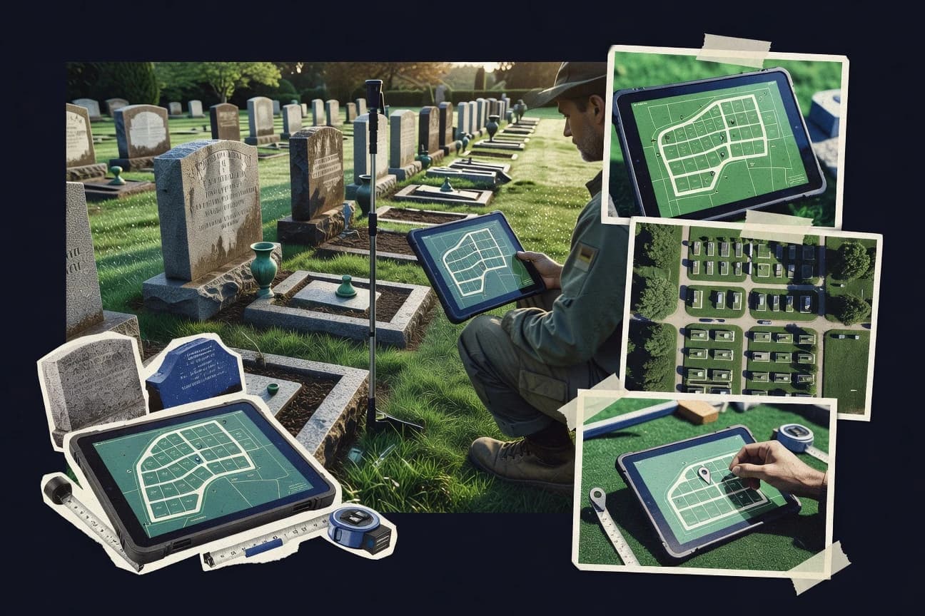
Death Care Funeral ServicesTop 10 Best Cemetery Mapping Software of 2026
Explore the top 10 cemetery mapping software tools.

How we ranked these tools
Core product claims cross-referenced against official documentation, changelogs, and independent technical reviews.
Analyzed video reviews and hundreds of written evaluations to capture real-world user experiences with each tool.
AI persona simulations modeled how different user types would experience each tool across common use cases and workflows.
Final rankings reviewed and approved by our editorial team with authority to override AI-generated scores based on domain expertise.
Score: Features 40% · Ease 30% · Value 30%
Gitnux may earn a commission through links on this page — this does not influence rankings. Editorial policy
Editor’s top 3 picks
Three quick recommendations before you dive into the full comparison below — each one leads on a different dimension.
Caretech Cemetery Management
Integrated plot mapping linked to burial and lot records for location-accurate administration
Built for cemetery teams needing map-driven record accuracy and fast location lookup.
Cemetery Pro
Editor pickPlot map management that links cemetery sections and lots to burial or lot data
Built for cemetery offices needing plot maps tied to burial records and daily access.
PlanIT Geo
Editor pickPlot and marker mapping workflows built on GIS for cemetery layout management
Built for cemetery teams needing GIS-based plot visualization and spatially driven records.
Related reading
Comparison Table
This comparison table reviews top cemetery mapping and cemetery management tools, including Caretech Cemetery Management, Cemetery Pro, PlanIT Geo, QGIS, and ArcGIS. It summarizes core capabilities such as GIS data capture and editing, map viewing and sharing, cemetery layout and plot workflows, import and export support, and typical integration needs so teams can match software to specific mapping and records requirements.
Caretech Cemetery Management
cemetery managementManages cemetery and funeral service operations with mapping, plots, lots, and headstone inventory workflows.
Integrated plot mapping linked to burial and lot records for location-accurate administration
Caretech Cemetery Management stands out by combining cemetery mapping with broader cemetery administration workflows in one system. Core capabilities center on parcel and plot mapping, record-linked location management, and maintenance of burial and plot data tied to the map.
The tool supports operational tasks like searching, updating records, and standardizing how locations are handled across staff and workflows. This tight coupling between the visual map and the underlying cemetery records supports traceable location updates during day-to-day administration.
- +Plot and burial data connect directly to mapped cemetery locations.
- +Record search and location lookup streamline day-to-day operations.
- +Mapping workflow supports consistent updates across staff tasks.
- –Setup and map structuring work can require careful configuration.
- –Advanced visualization beyond standard mapping workflows is limited.
- –Bulk changes to mapped locations may feel slower than expected.
Best for: Cemetery teams needing map-driven record accuracy and fast location lookup
More related reading
Cemetery Pro
plot mappingProvides cemetery plot and lot management with mapping tools for searching available spaces and tracking placements.
Plot map management that links cemetery sections and lots to burial or lot data
Cemetery Pro focuses specifically on cemetery mapping workflows instead of general-purpose GIS. It supports creating and managing plot maps, recording burial and lot information, and producing layout-ready views for staff and stakeholders.
The system emphasizes organized location data and visual planning so teams can track locations without manual spreadsheets. Map updates and records stay tied together to reduce inconsistencies during ongoing maintenance and new entries.
- +Built for cemetery plot mapping with location-first data structure
- +Visual map views connect plot layout to burial or lot records
- +Organized recordkeeping reduces lookup time for specific sections
- +Workflow supports ongoing map maintenance alongside new entries
- –Mapping setup and data modeling require careful upfront planning
- –Limited evidence of advanced GIS tooling for complex spatial analysis
- –Bulk edits and large-map performance are harder to assess
Best for: Cemetery offices needing plot maps tied to burial records and daily access
PlanIT Geo
GIS mappingEnables GIS-based cemetery map building and visualization for locating plots and assets using geospatial layers.
Plot and marker mapping workflows built on GIS for cemetery layout management
PlanIT Geo stands out by combining GIS mapping with a workflow tailored to land and cemetery record keeping. It supports creation of cemetery plots, headstone or lot point capture, and visualization of burial layouts for operational planning.
The software focuses on spatial data management, letting users maintain accurate locations and reference them across reports. It is best suited for teams that need mapping-backed record workflows rather than simple list-based registries.
- +GIS-first mapping supports plot-level spatial accuracy for cemetery layouts
- +Structured lot and marker data ties locations to operational records
- +Visual output helps planwork, field verification, and layout review
- –GIS concepts can slow adoption for non-technical cemetery staff
- –Setup and data modeling require careful upfront configuration
- –Advanced customization depends on mapping workflow discipline
Best for: Cemetery teams needing GIS-based plot visualization and spatially driven records
QGIS
GIS desktopCreates and edits geospatial cemetery maps using shapefiles and geodata workflows for plot and boundary layer management.
Editing and symbology of layered spatial features with attribute-driven labeling and search
QGIS stands out for its powerful GIS workflows that support detailed cemetery mapping with real spatial data. It enables layer-based editing of points, lines, and polygons for graves, plots, paths, and boundary extents.
Symbology, labels, and attribute tables help create searchable registers tied to map features. Data import and export support common GIS formats for sharing maps with other tools and stakeholders.
- +Strong layer model for graves, plots, and plot boundaries in one project
- +Attribute tables support structured grave records tied to map geometry
- +Extensive symbology and labeling for consistent cemetery map design
- +Robust import and export across common GIS formats
- –Desktop GIS complexity can slow setup for simple cemetery maps
- –No built-in cemetery-specific data model for common grave scenarios
- –Multi-user syncing and permissions require external systems
- –Offline field workflows need added configuration and discipline
Best for: Teams needing accurate, editable cemetery maps with full GIS control
ArcGIS
enterprise GISBuilds interactive cemetery maps with geodatabase layers for boundaries, plots, and asset locations.
Spatial joins and relationships that connect burial records to cemetery map features
ArcGIS stands out with a full GIS stack for building interactive cemetery maps, not just static floorplan visuals. It supports parcel and site base mapping, geocoding workflows, and spatial editing to manage plot boundaries, sections, and monument features. Automated analysis and data joins can link burial records to map symbols, while web publishing enables sharing read-only or editable views for staff and visitors.
- +Strong spatial editing for plots, sections, and boundaries with GIS precision
- +Web map publishing supports interactive cemetery maps for staff and public viewers
- +Spatial joins link burial records to map features for fast retrieval
- +Analysis tools support planning workflows like capacity and access modeling
- –Setup and data modeling require GIS expertise for clean cemetery schemas
- –Custom symbol design and workflows take time when requirements are specific
- –Large datasets can slow editing without careful layer and indexing choices
Best for: GIS-ready teams needing interactive cemetery mapping with linked burial data
Google Maps Platform
web mappingHosts custom cemetery map experiences by placing plot data on interactive maps through the Maps Platform APIs.
Map JavaScript API for polygon and marker overlays over Google basemaps
Google Maps Platform stands out for turning cemetery site information into navigable, interactive maps using familiar Google map interfaces. It supports geocoding, custom markers, polygon overlays, and route-style navigation patterns that fit cemetery layouts like sections, rows, and plots. The platform also provides APIs for maps, places, and static map images, which helps teams integrate mapping into existing web tools and internal workflows.
- +Rich map controls for markers, polygons, and custom overlays
- +Strong geocoding and location search for quickly resolving cemetery addresses
- +Reliable basemap and satellite imagery to support accurate site context
- +Works well with web and mobile apps through map, places, and static image APIs
- –No cemetery-specific data model for plots, burials, and headstone records
- –Building search, workflows, and editing tools requires custom development
- –Managing dense marker rendering across large sites can add engineering complexity
Best for: Teams building custom cemetery mapping interfaces on top of Google basemaps
Esri StoryMaps
public mappingPublishes cemetery map stories that combine maps with plot-related content for public-facing map views.
Interactive map integration inside story templates for georeferenced memorial and section storytelling
Esri StoryMaps stands out for turning cemetery records into scrollable, map-centric narratives using configurable templates and multimedia. It supports embedding interactive maps with geocoded points, paths, and polygons, so burial locations and section layouts can be published with context.
Organizations can link photos, documents, and text to map elements to create individual memorial pages and section overviews. The biggest constraint is that cemetery data management and editing workflows are limited compared with dedicated GIS data systems and custom field collection tools.
- +Narrative layout combines text, images, and embedded interactive maps for burial storytelling
- +Map pins and sections can be published as web layers for shared cemetery navigation
- +Templates speed creation of memorial pages and section-level overviews
- +Geospatial context ties records to specific coordinates and map features
- –Best suited for publishing, not for heavy cemetery record editing workflows
- –Advanced data QA, duplicate detection, and form logic require external GIS steps
- –Complex cemetery datasets can feel rigid compared with custom applications
- –Custom cemetery search and reporting needs additional tooling beyond StoryMaps
Best for: Cemetery organizations publishing map-led memorial stories without building custom apps
OpenLayers
mapping libraryBuilds custom cemetery map interfaces by rendering plot layers in the browser with client-side map controls.
Vector layer styling and interaction controls via JavaScript map events
OpenLayers stands out for delivering low-level, embeddable web mapping capabilities through a flexible JavaScript library rather than a fixed cemetery workflow system. It supports interactive maps with vector layers, raster base maps, projections, and event-driven interactions that fit cemetery boundary digitizing, lot overlays, and search-by-location experiences.
For cemetery mapping, it can power responsive web viewers, custom symbology, and drawing or editing tools when paired with suitable UI code. Core strengths include fine-grained control of map rendering and data styling, while limitations include the need to build or integrate non-mapping cemetery features like records management and administrative workflows.
- +Highly customizable interactive maps with vector and raster layer support
- +Strong support for projections and geospatial rendering control
- +Works well for public viewers and internal digitizing when custom UI is added
- –No built-in cemetery records, grave management, or approval workflows
- –Requires JavaScript development to implement editing, attribution, and UX
- –Data modeling and database integrations must be built externally
Best for: Teams building custom cemetery map viewers and lot digitizing tools
Leaflet
mapping libraryRenders interactive cemetery maps in web pages using marker and polygon layers for plots and sections.
Layered interactive markers with popups for plot-level cemetery annotations
Leaflet stands out as a lightweight JavaScript mapping library that renders interactive maps in the browser. It supports custom markers, popups, and layers that work well for plotting cemetery plots, sections, and memorial locations.
Core mapping features include panning, zooming, and overlay management that can be extended with plugins for geocoding, clustering, and drawing. Leaflet provides no built-in cemetery data model, workflow, or reporting, so cemetery-specific systems require custom development around the map.
- +Lightweight web maps with fast panning and zooming for plot visualization
- +Layer and popup support make plot details accessible directly on the map
- +Markers, shapes, and styling enable section layouts without heavy UI frameworks
- –No cemetery-specific features like searches, assignments, or audit trails
- –Requires custom backend and data modeling for burial records management
- –Advanced tools depend on external plugins and custom integration work
Best for: Small teams building custom cemetery map viewers with JavaScript
Mapbox
web mappingProvides customizable map rendering so cemetery plot and boundary data can be displayed in internal or public map views.
Vector tiles and data-driven styling in Mapbox GL
Mapbox stands out for building custom, high-performance maps using vector tiles and WebGL rendering. It supports place-based geospatial workflows needed for cemetery mapping, including geocoding, custom markers, and interactive web map layers.
Teams can model grave locations as points or polygons and style them with data-driven rules for consistent field-to-map visualization. The platform focuses on map infrastructure and visualization rather than cemetery-specific recordkeeping or cemetery-domain compliance tooling.
- +Highly customizable map styling with data-driven layers and vector tiles
- +Interactive web mapping works well for grave and section visualization
- +Strong geocoding and map services support location enrichment
- –No built-in cemetery database schema for graves, lots, and records
- –Requires engineering effort to integrate workflows and data management
- –Geospatial setup and tuning can be complex for non-developers
Best for: Teams building custom cemetery maps with interactive web visualization
Conclusion
After evaluating 10 death care funeral services, Caretech Cemetery Management stands out as our overall top pick — it scored highest across our combined criteria of features, ease of use, and value, which is why it sits at #1 in the rankings above.
Use the comparison table and detailed reviews above to validate the fit against your own requirements before committing to a tool.
How to Choose the Right Cemetery Mapping Software
This buyer’s guide section explains how to choose cemetery mapping software using real capabilities from Caretech Cemetery Management, Cemetery Pro, PlanIT Geo, QGIS, ArcGIS, Google Maps Platform, Esri StoryMaps, OpenLayers, Leaflet, and Mapbox. It focuses on how each option links maps to plot, burial, and asset records, how teams build or edit layers and symbology, and how organizations publish map views to staff or the public. It also highlights setup and workflow gaps that commonly affect day-to-day administration and field use.
What Is Cemetery Mapping Software?
Cemetery mapping software turns cemetery layout information into editable or publishable map layers for plots, sections, boundaries, and grave or headstone locations. It is used to connect visual locations to underlying records so staff can search, update, and maintain burial and placement data without losing alignment between the map and the registry. Systems like Caretech Cemetery Management combine plot mapping tied to burial and lot records for location-accurate administration. GIS-first tools like QGIS and ArcGIS use layered spatial data and attribute-driven labeling to keep records tied to map geometry.
Key Features to Look For
These features determine whether mapped locations stay consistent with burial or lot records and whether staff can use the map for daily work instead of only viewing it.
Direct link between plot locations and burial or lot records
Caretech Cemetery Management connects plot and burial data directly to mapped cemetery locations so record-linked lookups stay accurate during administration. Cemetery Pro also links plot map management to burial or lot data so staff can maintain a location-first structure without spreadsheets.
GIS layer editing for graves, plots, boundaries, and assets
QGIS provides a strong layer model for graves, plots, and plot boundaries using point, line, and polygon editing with attribute tables. ArcGIS supports spatial editing for plots, sections, and monument features with geodatabase layers for interactive mapping and record linkage.
Structured plot and marker workflows built on GIS concepts
PlanIT Geo supports GIS-based plot and marker mapping workflows that tie locations to operational records for layout management. This design fits teams that need plot-level spatial accuracy and field verification outputs tied to record workflows.
Attribute-driven search, labeling, and symbology
QGIS enables symbology and labels driven by attributes so map features can act as searchable registers for grave records. OpenLayers also supports vector layer styling and interaction controls via JavaScript events for custom symbology and click-to-inspect map behavior.
Spatial joins that connect burial data to map features
ArcGIS supports spatial joins and relationships that connect burial records to cemetery map features for fast retrieval. This capability is useful when burial data must be tied to geometry and when operational reporting depends on map-linked attributes.
Publishable interactive map experiences for staff and public viewers
Google Maps Platform enables polygon and marker overlays on top of familiar basemaps using the Map JavaScript API for navigable cemetery map interfaces. Esri StoryMaps integrates interactive maps inside scrollable story templates for map-led memorial pages and section overviews.
How to Choose the Right Cemetery Mapping Software
The right fit comes from matching the tool’s map-to-record linkage model and editing workflow to the organization’s actual operational tasks and publishing needs.
Start with the required linkage between map features and records
If day-to-day operations require map-driven accuracy with burial and lot records tied to location, Caretech Cemetery Management is built for integrated plot mapping linked to burial and lot records. If the priority is plot maps tied to burial or lot records for daily access and ongoing map maintenance, Cemetery Pro uses a location-first structure that connects map layout to recordkeeping.
Choose GIS depth based on who will edit and how maps must be maintained
For teams that need full control over layered editing of points, lines, polygons, symbology, and attribute tables, QGIS is a direct fit because it supports attribute-driven labeling and robust import and export workflows. For organizations that need an end-to-end GIS stack with web map publishing and spatial relationships, ArcGIS supports spatial editing plus web publishing and record joins.
Decide whether the goal is operational administration or custom interactive visualization
If operational administration and consistent location updates matter more than building a custom interface, Caretech Cemetery Management and Cemetery Pro keep records tightly connected to mapped locations. If the goal is custom visualization and interactive embedding, OpenLayers, Leaflet, Mapbox, and Google Maps Platform focus on rendering and UI integration while requiring external record management and workflow buildout.
Plan for how the cemetery will publish maps to staff and the public
For map-led public memorial storytelling that combines maps with photos and documents, Esri StoryMaps provides templates that embed interactive maps into scrollable narrative pages. For building a navigable interface on top of Google basemaps using polygons and markers, Google Maps Platform supplies the Map JavaScript API capabilities that map teams can integrate into existing web tools.
Validate setup complexity against the team’s data discipline
If the team lacks GIS expertise, Mapbox and Google Maps Platform can still succeed for visualization but they do not provide a cemetery-specific data model for plots and burial records, which means mapping search and editing workflows must be engineered. If the team can support GIS layer discipline, PlanIT Geo, QGIS, and ArcGIS provide plot and marker workflows built around GIS concepts, which makes spatial accuracy and attribute-driven labeling achievable.
Who Needs Cemetery Mapping Software?
Cemetery mapping software fits distinct operational models, from plot-and-record administration to GIS layer editing to custom web visualization for navigation and memorial pages.
Cemetery teams needing map-driven record accuracy and fast location lookup
Caretech Cemetery Management is the strongest match because it integrates plot mapping linked to burial and lot records for location-accurate administration and streamlined record search. This segment benefits from the direct coupling between visual map locations and underlying cemetery records that supports traceable updates during daily administration.
Cemetery offices that maintain plot maps tied to daily burial or lot entry
Cemetery Pro fits this operational model by focusing on plot map management that links sections and lots to burial or lot data. It emphasizes organized recordkeeping that reduces lookup time for specific sections while maintaining ongoing map maintenance alongside new entries.
GIS-focused teams that need plot-level spatial accuracy and spatially driven records
PlanIT Geo is built for GIS-based plot and marker mapping workflows that support spatial visualization for locating plots and assets. QGIS and ArcGIS are also strong fits when the organization needs layered spatial editing and attribute-driven labeling tied to structured records.
Organizations building custom map viewers or public navigation experiences
OpenLayers, Leaflet, Mapbox, and Google Maps Platform provide embeddable browser mapping capabilities using vector layers, markers, polygons, and interactive controls. Esri StoryMaps adds an editorial publishing layer that combines interactive maps with memorial and section content for public-facing storytelling.
Common Mistakes to Avoid
Several predictable pitfalls appear when teams choose tools that do not match how cemetery staff edits records, searches locations, and publishes map views.
Selecting a visualization tool without a cemetery record model
Google Maps Platform, Leaflet, and OpenLayers provide interactive polygon and marker rendering but they do not include a cemetery-specific data model for plots, burials, or headstone records. This leads to custom development for search, workflow logic, and data modeling that teams may underestimate.
Underestimating setup and data modeling effort for GIS-ready mapping
QGIS and ArcGIS offer strong layer editing and attribute-driven labeling, but desktop GIS complexity and cemetery schema design add setup overhead for clean grave, plot, and boundary models. PlanIT Geo also requires careful upfront configuration because GIS concepts can slow adoption for non-technical cemetery staff.
Building editing workflows that depend on discipline rather than guided administration
OpenLayers and Leaflet require JavaScript development to implement editing, attribution, and UX, which can create friction if cemetery staff expects a complete administrative workflow out of the box. Mapbox also focuses on map infrastructure and visualization, so teams must build external integrations for grave, lot, and record management.
Choosing a publishing-first tool for heavy operational record editing
Esri StoryMaps is designed for publishing map stories with templates and multimedia, and it is best suited for content-led memorial storytelling rather than heavy cemetery record editing. If operational administration and QA workflows like duplicate detection and form logic are required, tools like Caretech Cemetery Management, Cemetery Pro, QGIS, or ArcGIS better align with record-centric workflows.
How We Selected and Ranked These Tools
We evaluated every tool on three sub-dimensions: features with a weight of 0.4, ease of use with a weight of 0.3, and value with a weight of 0.3. The overall score for each tool is the weighted average of those three sub-dimensions using overall = 0.40 × features + 0.30 × ease of use + 0.30 × value. Caretech Cemetery Management separated itself with tightly integrated plot mapping linked to burial and lot records, which directly improves daily operational workflow quality on the features dimension. Lower-ranked tools tended to excel at map rendering or publishing, like OpenLayers and Leaflet, while requiring external integrations for cemetery records and administrative workflows.
Frequently Asked Questions About Cemetery Mapping Software
Which cemetery mapping tools best keep burial records tightly linked to the map?
What’s the difference between a dedicated cemetery mapping system and a general GIS editor?
Which option is best for digitizing cemetery boundaries and plotting graves as editable spatial features?
What tools work well for building a custom web map for public viewing or internal navigation?
Which software supports plot-level planning and layout-ready views for staff operations?
Which tools help create memorial pages or section storytelling centered on maps?
Which option is best when the cemetery team needs GIS-backed spatial records and marker capture workflows?
What’s a common workflow setup for searching by location and updating a plot’s associated records?
Which tools are strongest for attribute-driven labeling, searchable registers, and export-ready map data?
Tools reviewed
Primary sources checked during evaluation.
Referenced in the comparison table and product reviews above.
Keep exploring
Comparing two specific tools?
Software Alternatives
See head-to-head software comparisons with feature breakdowns, pricing, and our recommendation for each use case.
Explore software alternatives→In this category
Death Care Funeral Services alternatives
See side-by-side comparisons of death care funeral services tools and pick the right one for your stack.
Compare death care funeral services tools→FOR SOFTWARE VENDORS
Not on this list? Let’s fix that.
Our best-of pages are how many teams discover and compare tools in this space. If you think your product belongs in this lineup, we’d like to hear from you—we’ll walk you through fit and what an editorial entry looks like.
Apply for a ListingWHAT THIS INCLUDES
Where buyers compare
Readers come to these pages to shortlist software—your product shows up in that moment, not in a random sidebar.
Editorial write-up
We describe your product in our own words and check the facts before anything goes live.
On-page brand presence
You appear in the roundup the same way as other tools we cover: name, positioning, and a clear next step for readers who want to learn more.
Kept up to date
We refresh lists on a regular rhythm so the category page stays useful as products and pricing change.