GITNUXSOFTWARE ADVICE
Technology Digital MediaTop 10 Best Aerial Map Software of 2026
Discover top 10 aerial map software tools for accurate mapping & analysis. Compare features & find your best fit today.

How we ranked these tools
Core product claims cross-referenced against official documentation, changelogs, and independent technical reviews.
Analyzed video reviews and hundreds of written evaluations to capture real-world user experiences with each tool.
AI persona simulations modeled how different user types would experience each tool across common use cases and workflows.
Final rankings reviewed and approved by our editorial team with authority to override AI-generated scores based on domain expertise.
Score: Features 40% · Ease 30% · Value 30%
Gitnux may earn a commission through links on this page — this does not influence rankings. Editorial policy
Editor’s top 3 picks
Three quick recommendations before you dive into the full comparison below — each one leads on a different dimension.
Esri ArcGIS Pro
Integrated photogrammetry workflow with Orthomosaic and elevation generation tools in one Pro project
Built for mapping teams producing repeated orthomosaics, elevation, and GIS feature outputs.
Esri ArcGIS Online
Editor pickHosted imagery and scene layers for web-based aerial map visualization
Built for teams publishing aerial imagery maps and collaborating through web GIS apps.
QGIS
Editor pickGeoreferencer tool with control points and warping for aligning imagery
Built for gIS-focused teams producing aerial maps and analysis workflows.
Related reading
Comparison Table
This comparison table evaluates leading aerial mapping and geospatial analysis tools, including Esri ArcGIS Pro, Esri ArcGIS Online, QGIS, Global Mapper, and ENVI. It summarizes how each platform handles data ingestion, geoprocessing and analysis workflows, visualization, and export capabilities so readers can match tool strength to mapping and analytical requirements.
Esri ArcGIS Pro
enterprise GISArcGIS Pro is desktop GIS software that supports aerial imagery mapping, georeferencing, advanced spatial analysis, and publishing map products.
Integrated photogrammetry workflow with Orthomosaic and elevation generation tools in one Pro project
ArcGIS Pro stands out with a tightly integrated geospatial authoring environment for processing, visualizing, and publishing aerial data from end to end. It supports photogrammetry and aerial mapping workflows using tools for orthomosaics, elevation products, and feature extraction in a single project workspace.
Strong 2D and 3D scene capabilities help analysts inspect imagery draped on terrain and manage map series and layouts for stakeholder-ready outputs. Data management, symbology, and geoprocessing automation scale well for repeatable aerial map production.
- +Unified 2D and 3D project workspace for aerial imagery, orthomosaics, and terrain
- +Powerful geoprocessing tools for photogrammetry, elevation modeling, and feature extraction
- +Map layouts, map series, and publishing workflows for consistent deliverables
- –Workflow setup and dataset preparation can be complex for non-GIS specialists
- –Large aerial datasets demand careful system tuning to keep exports responsive
- –Many advanced tasks require specialized training to use effectively
Best for: Mapping teams producing repeated orthomosaics, elevation, and GIS feature outputs
More related reading
Esri ArcGIS Online
cloud GISArcGIS Online is a cloud mapping platform that hosts aerial imagery layers, enables map authoring, and provides sharing and analysis through web apps.
Hosted imagery and scene layers for web-based aerial map visualization
ArcGIS Online stands out for integrating hosted aerial imagery with a full web GIS workflow and analysis. It supports interactive map viewing, sharing, and web app creation around imagery layers for both field and office review. Core capabilities include imagery hosting, layer styling, geospatial search, and publishable views that can feed dashboards and operational apps.
- +Hosted imagery layers with tiled performance for fast aerial map navigation
- +Web maps and scene layers support consistent sharing across teams
- +Built-in analysis tools for imagery-driven workflows like change and enrichment
- –Advanced aerial processing requires additional ArcGIS capabilities outside the web UI
- –Large, custom imagery pipelines can feel constrained by hosted service patterns
- –Data governance and performance tuning demand GIS administration skills
Best for: Teams publishing aerial imagery maps and collaborating through web GIS apps
QGIS
open-source GISQGIS is an open-source desktop GIS tool that supports importing aerial imagery, digitizing features, and running spatial analysis workflows.
Georeferencer tool with control points and warping for aligning imagery
QGIS stands out for its open-source, desktop-first GIS workflow with deep support for spatial data processing and map production. It handles aerial use cases through georeferencing tools, orthorectification pipelines via external processing integration, and robust raster layer handling for imagery-heavy projects.
Cartographic output is strong with styling, labeling, and print layout capabilities that suit field review and deliverable maps. Its core strength comes from combining aerial imagery with analysis-ready vector and raster layers in a single project workspace.
- +Comprehensive raster and vector workflows for aerial imagery mapping
- +Advanced georeferencing and projection tools for aligning aerial data
- +Highly customizable symbology and layout export for map deliverables
- –Steeper learning curve for geospatial processing and project setup
- –Ortho workflows often require external plugins or processing tools
- –Large aerial datasets can stress performance without careful configuration
Best for: GIS-focused teams producing aerial maps and analysis workflows
Global Mapper
data processingGlobal Mapper is a desktop mapping and data processing application that works with aerial imagery, elevation data, and geospatial formats for analysis and export.
LiDAR point cloud to terrain and contours with extensive filtering controls
Global Mapper stands out for its single-workstation pipeline that ingests many geospatial formats and produces elevation-ready deliverables quickly. It supports aerial mapping workflows with tools for orthorectification, terrain modeling, LiDAR point processing, and vector editing tied to real-world coordinates. The software is strong for analysts who need fast inspection, re-projection, mosaicking, and export to common GIS and CAD outputs.
- +Broad import support for raster, vector, and point cloud datasets in one workspace
- +Powerful LiDAR point filtering and terrain generation for accurate elevation products
- +Fast mosaicking, reprojection, and elevation workflows for aerial imagery delivery
- –Many advanced tools require training to use efficiently
- –Less streamlined photogrammetry automation than dedicated aerial processing suites
- –Complex projects can feel heavy when handling large point clouds
Best for: GIS and mapping teams processing aerial imagery, LiDAR, and deliverables
ENVI
remote sensingENVI is remote sensing software that analyzes aerial and satellite imagery for classification, change detection, and spectral analysis.
Orthorectification and mosaicking pipeline for aerial imagery production
ENVI stands out with strong geospatial and remote sensing processing depth for aerial map workflows. It supports importing imagery, orthorectifying data, and producing analysis-ready outputs like mosaics and classified layers.
The tool’s strengths center on photogrammetric-style preparation and robust raster analysis, which suits mapping projects that need more than visualization. Aerial mapping teams using ENVI can build repeatable processing chains, then export results for downstream GIS and cartographic use.
- +Deep raster analysis tools for aerial imagery and derived products
- +Orthorectification and mosaicking workflows tailored to mapping deliverables
- +Repeatable processing via scripting and batch-style operations
- +Strong integration points for GIS-ready export of geospatial outputs
- –Workflow setup can feel heavy for small mapping teams
- –Learning curve is steep for users focused only on map viewing
- –Project configuration overhead increases time for simple outputs
Best for: Remote sensing and mapping teams needing high-control aerial processing
Pix4Dmapper
drone photogrammetryPix4Dmapper generates georeferenced aerial mapping outputs from drone imagery, including orthomosaics and digital surface models.
Quality reports with visual diagnostics for alignments, densification, and reconstruction accuracy
Pix4Dmapper stands out for producing photogrammetric outputs optimized for orthomosaics, digital surface models, and 3D point clouds from drone imagery. The software supports structured workflows for planning-like acquisition through georeferenced processing and dense reconstruction refinement.
It also provides survey-focused deliverables such as ground control integration and measurement-ready outputs for downstream GIS use. Strong automation and quality-control views help reduce manual troubleshooting during large reconstructions.
- +Fast dense reconstruction tuned for orthomosaics, DSMs, and 3D point clouds
- +Ground control and georeferencing tools support survey-grade alignment workflows
- +Quality reports highlight processing issues before exporting final products
- +Well-defined outputs for GIS integration and mapping pipelines
- –Complex projects can require parameter tuning beyond default presets
- –Large reconstructions demand high RAM and storage for stability
- –Advanced editing and reprocessing steps add operator overhead
Best for: Survey teams and GIS users needing repeatable drone photogrammetry deliverables
Agisoft Metashape
photogrammetryMetashape is photogrammetry software that produces orthomosaics, point clouds, and textured 3D models from aerial or drone imagery.
Dense point cloud reconstruction with tiled processing and quality metrics for aerial scenes
Agisoft Metashape distinguishes itself with a photogrammetry-first workflow that turns overlapping aerial imagery into dense point clouds and survey-grade outputs. The core capabilities cover photo alignment, dense reconstruction, mesh generation, texturing, and automated orthomosaic and digital elevation surface production.
Processing supports control points and georeferencing, plus export formats used in mapping and GIS pipelines. Metashape also provides quality tools for reporting reconstruction confidence, which helps teams validate aerial mapping results.
- +Strong photogrammetry pipeline for aerial alignment through dense cloud generation
- +Control points and georeferencing support practical surveying workflows
- +Exports orthomosaics, DEMs, and meshes for GIS and mapping use cases
- +Quality and confidence indicators help validate aerial reconstruction results
- –Large datasets need careful hardware planning and preprocessing discipline
- –Advanced settings can slow setup for first-time aerial mapping projects
- –Dense reconstruction tuning can be time-consuming for varied flight conditions
Best for: Mapping teams producing photogrammetric orthomosaics and DEMs from drone imagery
DroneDeploy
cloud mappingDroneDeploy is a cloud platform that turns drone flights into aerial maps like orthomosaics and 3D models for review and field collaboration.
Volumetric measurement tools tied to survey projects and map outputs
DroneDeploy stands out for pairing flight planning with automated aerial map production from drone captures. The platform generates orthomosaics, 2D and 3D models, and volumetric measurements designed for field workflows.
Collaboration tools support sharing outputs with stakeholders and building project documentation around each survey run. The solution also includes managed mapping guidance features that reduce repeat mistakes across missions.
- +End-to-end workflow from flight planning through map generation
- +Volumetric measurement workflows for construction and earthwork planning
- +Built-in sharing for project outputs and stakeholder review
- –Complex projects can require deeper setup than simple mapping tools
- –Processing outcomes can vary with capture settings and coverage
- –Collaboration features are strong but not a full replacement for GIS
Best for: Engineering and construction teams producing repeatable survey maps with collaboration
AutoCAD Civil 3D
engineering mappingCivil 3D is engineering GIS-capable CAD software that supports aerial imagery basemaps, coordinate system management, and mapping for site analysis.
Dynamic corridor modeling that drives earthwork surfaces tied to coordinate-based alignments
AutoCAD Civil 3D stands out with a civil-model-first workflow that turns terrain, alignments, and parcels into map-ready deliverables. It supports geospatial survey-to-model pipelines using surface creation, corridor modeling, and grading tools tied to real-world coordinates.
Aerial mapping gains from tight integration with Autodesk CAD data management and standard labeling and plotting for field-aligned visualization. The software remains stronger for engineering surfaces and corridors than for purely image-centric photogrammetry workflows.
- +Civil modeling tools generate precise terrains from survey and GIS-aligned data.
- +Corridor and grading workflows keep aerial map context tied to design intent.
- +Strong labeling, symbology, and plotting support consistent deliverables.
- –Less specialized for direct aerial image processing and photogrammetry pipelines.
- –Data preparation for georeferencing can be time-consuming for raw imagery sets.
- –Complex object model raises the learning curve for map-only teams.
Best for: Engineering teams producing aerial-referenced terrain, grading, and corridor deliverables
Trimble Business Center
survey processingTrimble Business Center processes geospatial survey and aerial data to produce mapped outputs, including orthophotos and terrain models.
Integrated point cloud and survey processing with control-based QA and coordinate management
Trimble Business Center stands out for tight integration of GNSS, total station, and photogrammetry workflows into a single processing and mapping workspace. It covers aerial mapping tasks like point cloud and imagery processing, feature extraction, and survey-grade plan and profile production.
Strong coordinate system handling and QA tools help manage control points, align datasets, and validate outputs for engineering deliverables. The software remains geared toward survey and CAD deliverables, not consumer-friendly rapid map publishing.
- +Survey-grade coordinate transformation tools for multi-source aerial and control alignment
- +Point cloud processing and editing workflows for cleaning, classification, and measurement
- +Robust plan and profile generation for engineering deliverables from survey data
- –Complex toolchain can slow teams that need quick, lightweight aerial mapping
- –Feature extraction workflows require careful setup to avoid manual cleanup
- –CAD-heavy output options can add steps for GIS-first publishing workflows
Best for: Survey and engineering teams producing deliverable-ready aerial maps and profiles
Conclusion
After evaluating 10 technology digital media, Esri ArcGIS Pro stands out as our overall top pick — it scored highest across our combined criteria of features, ease of use, and value, which is why it sits at #1 in the rankings above.
Use the comparison table and detailed reviews above to validate the fit against your own requirements before committing to a tool.
How to Choose the Right Aerial Map Software
This buyer’s guide covers aerial map software workflows and outputs across Esri ArcGIS Pro, Esri ArcGIS Online, QGIS, Global Mapper, ENVI, Pix4Dmapper, Agisoft Metashape, DroneDeploy, AutoCAD Civil 3D, and Trimble Business Center. It explains which tools fit orthomosaics and elevation generation, LiDAR and point cloud terrain extraction, remote sensing analysis, and drone photogrammetry from capture to deliverables. It also calls out concrete feature checks tied to typical deliverables like orthomosaic maps, DEMs, DSMs, contours, change-ready layers, and engineering surfaces.
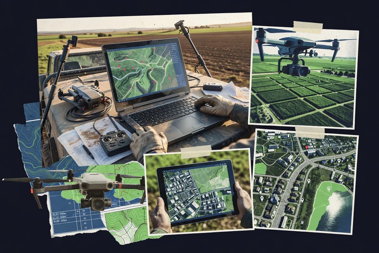
What Is Aerial Map Software?
Aerial map software processes aerial imagery and geospatial data into map-ready outputs like orthomosaics, elevation surfaces, and analysis-ready raster or vector layers. These tools solve problems like georeferencing imagery to real-world coordinates, producing consistent mosaics, and generating terrain or surface products for measurement and mapping. Esri ArcGIS Pro and QGIS cover end-to-end GIS-centric aerial mapping workflows with raster handling, project workspaces, and layout-ready outputs. Pix4Dmapper and Agisoft Metashape focus on photogrammetry pipelines that convert overlapping drone or aerial photos into dense reconstructions such as orthomosaics and elevation models.
Key Features to Look For
The best aerial mapping choices hinge on whether key workflow components match the deliverables needed for GIS, remote sensing, surveying, or engineering.
Integrated photogrammetry to orthomosaic and elevation in one project
Esri ArcGIS Pro supports an integrated photogrammetry workflow with Orthomosaic and elevation generation tools inside a unified 2D and 3D project workspace. Pix4Dmapper and Agisoft Metashape also produce orthomosaics and surface outputs, with Pix4Dmapper generating DSMs and 3D point clouds and Metashape producing dense point clouds plus DEM and mesh products.
Quality reports and visual diagnostics for reconstruction accuracy
Pix4Dmapper provides quality reports with visual diagnostics for alignments, densification, and reconstruction accuracy. Agisoft Metashape includes quality and confidence indicators that validate aerial reconstruction results before export.
Georeferencing and control-point warping for aligning imagery
QGIS includes a Georeferencer tool with control points and warping to align imagery to a real coordinate system. QGIS also supports projection and raster workflows that support analysis-ready maps when control points drive the alignment.
LiDAR and point cloud processing for terrain, contours, and elevation products
Global Mapper excels at LiDAR point cloud to terrain and contours with extensive filtering controls. Trimble Business Center adds point cloud processing and editing with survey-grade coordinate transformation tools and control-based QA to validate outputs for engineering deliverables.
Orthorectification and mosaicking pipelines for remote sensing workflows
ENVI supports orthorectification and mosaicking workflows tailored to aerial imagery production with deep raster analysis capabilities. ENVI also supports repeatable processing through scripting and batch-style operations, which helps teams standardize derived product creation.
Engineering deliverables tied to corridors, grading, and survey-grade coordinate systems
AutoCAD Civil 3D provides dynamic corridor modeling that drives earthwork surfaces tied to coordinate-based alignments, which keeps aerial context connected to design intent. DroneDeploy focuses on engineering-friendly outputs with volumetric measurement tools tied to survey projects, while Trimble Business Center targets plan and profile generation from survey-grade processing.
How to Choose the Right Aerial Map Software
Selection should start with the exact deliverables needed, then confirm that each workflow stage like alignment, reconstruction, and output publishing is supported end to end.
Match the software to the required deliverable type
Choose Esri ArcGIS Pro when orthomosaics, elevation products, and GIS feature outputs must be produced in a single Pro project workspace with strong 2D and 3D scene capabilities. Choose Pix4Dmapper or Agisoft Metashape when the priority is photogrammetry-first outputs like orthomosaics plus dense point clouds, DSMs, meshes, and DEMs. Choose Global Mapper when LiDAR-derived terrain and contours with filtering controls are required in a single workstation workflow.
Verify the alignment and georeferencing workflow
If imagery needs control-point-driven warping, QGIS provides a Georeferencer with control points and warping that aligns imagery to real-world coordinates. If accuracy reporting is a priority during reconstruction, Pix4Dmapper supplies quality reports with visual diagnostics, while Agisoft Metashape provides quality and confidence indicators for reconstruction validation.
Confirm the accuracy and QA mechanisms for large aerial projects
Large aerial reconstructions benefit from explicit QA views, and Pix4Dmapper offers quality reports that highlight processing issues before final export. Global Mapper and Trimble Business Center both provide control-centric validation patterns, with Global Mapper offering extensive LiDAR filtering controls and Trimble Business Center providing coordinate system handling plus QA for control point alignment.
Plan the output pipeline for GIS, CAD, or field collaboration
If outputs must become GIS-ready layers and be shared through web maps, Esri ArcGIS Online supports hosted imagery and scene layers for web-based aerial map visualization. If engineering surfaces like earthwork based on alignments are needed, AutoCAD Civil 3D provides corridor and grading workflows that keep aerial-referenced context tied to design intent.
Choose the workflow environment that fits the team’s skill set
Esri ArcGIS Pro offers powerful geoprocessing automation and layout and publishing workflows, but dataset preparation and workflow setup can be complex for non-GIS specialists. QGIS delivers strong raster and vector workflows with customizable symbology and print layouts, but orthorectification workflows often require external plugins or processing tools. ENVI supports deep remote sensing processing with scripting and batch operations, yet project configuration overhead increases time for teams seeking quick map viewing.
Who Needs Aerial Map Software?
Aerial map software benefits teams that must turn aerial or drone imagery into georeferenced, measurement-ready products for GIS, surveying, remote sensing, or engineering workflows.
Mapping teams producing repeated orthomosaics and elevation products for GIS and deliverable publishing
Esri ArcGIS Pro fits this audience because it combines orthomosaic and elevation generation tools with unified 2D and 3D project workspaces plus map series and publishing workflows. QGIS also suits teams focused on producing analysis-ready aerial maps with strong georeferencing and customizable cartographic outputs.
Teams publishing aerial imagery for stakeholder collaboration through web maps
Esri ArcGIS Online fits teams that need hosted imagery and scene layers for fast aerial map navigation and consistent sharing across web apps. This choice supports imagery-driven operational review when the aerial products must be accessed outside desktop GIS.
Remote sensing and raster analysis teams needing orthorectification plus classification-ready processing
ENVI fits teams needing deep raster analysis beyond visualization, including orthorectification and mosaicking tailored to aerial imagery production. Its scripting and batch-style operations support repeatable processing chains for derived products that feed GIS and cartographic use.
Survey and construction teams requiring survey-grade reconstruction, measurements, and engineering-ready outputs
Pix4Dmapper fits survey teams and GIS users needing repeatable drone photogrammetry deliverables with ground control and quality reports for alignments and densification. DroneDeploy fits engineering and construction teams that want end-to-end workflow from flight planning through automated orthomosaic and 3D model outputs with volumetric measurement tools for earthwork planning.
Common Mistakes to Avoid
Recurring pitfalls across aerial mapping tools come from choosing the wrong workflow depth, underestimating dataset complexity, or expecting web publishing to replace dedicated processing.
Expecting web-only mapping to replace dedicated aerial processing
Esri ArcGIS Online supports hosted imagery and scene layers for web-based aerial map visualization, but advanced aerial processing needs additional ArcGIS capabilities outside the web interface. For actual orthomosaic and elevation creation, Esri ArcGIS Pro, Pix4Dmapper, or Agisoft Metashape are built around processing pipelines rather than only web viewing.
Skipping control-point discipline during georeferencing
QGIS can align imagery using control points and warping, so weak control-point coverage leads directly to misaligned outputs. Pix4Dmapper and Agisoft Metashape also rely on ground control and georeferencing workflows, so neglecting control setup reduces reconstruction reliability.
Underestimating hardware and performance needs for large reconstructions
Pix4Dmapper notes that large reconstructions demand high RAM and storage for stability, and oversized projects may require parameter tuning beyond default presets. Esri ArcGIS Pro and QGIS can also stress performance with large aerial datasets, so system tuning becomes necessary for responsive exports.
Choosing engineering CAD tools for image-centric photogrammetry tasks
AutoCAD Civil 3D provides corridor and earthwork surfaces tied to coordinate-based alignments, so it is stronger for engineering surfaces than for direct aerial image processing. For dense reconstruction and orthomosaic production from imagery, Pix4Dmapper, Agisoft Metashape, or ENVI fit the photogrammetry or raster processing requirements better.
How We Selected and Ranked These Tools
We evaluated every tool on three sub-dimensions with explicit weights of features at 0.4, ease of use at 0.3, and value at 0.3, then computed overall as 0.40 × features plus 0.30 × ease of use plus 0.30 × value. Esri ArcGIS Pro separated itself because its feature set combines an integrated photogrammetry workflow with orthomosaic and elevation generation in one Pro project workspace while also supporting map layouts, map series, and publishing workflows for consistent deliverables. Tools that excel in a narrower workflow area, like Global Mapper for LiDAR terrain and contours or ENVI for orthorectification and raster analysis, ranked lower when teams needed end-to-end aerial production plus GIS publishing from a unified authoring environment.
Frequently Asked Questions About Aerial Map Software
Which tool fits a full end-to-end aerial mapping workflow inside one environment?
What’s the best choice for publishing aerial maps through a web GIS workflow?
Which software handles orthorectification and georeferencing when imagery alignment is the main problem?
Which tool is strongest for LiDAR point cloud processing tied to terrain and contours?
Which photogrammetry tool produces survey-grade orthomosaics, DEMs, and QA reporting?
Which option is designed for drone survey teams that need automated quality diagnostics?
Which platform is best when aerial mapping must be tied to project documentation and volumetric measurements?
Which tool is best for engineering surfaces, grading, and corridor-based earthwork workflows using aerial-referenced terrain?
What common output workflow benefits come from raster-first analysis tools used for remote sensing?
Tools reviewed
Primary sources checked during evaluation.
Referenced in the comparison table and product reviews above.
Keep exploring
Comparing two specific tools?
Software Alternatives
See head-to-head software comparisons with feature breakdowns, pricing, and our recommendation for each use case.
Explore software alternatives→In this category
Technology Digital Media alternatives
See side-by-side comparisons of technology digital media tools and pick the right one for your stack.
Compare technology digital media tools→FOR SOFTWARE VENDORS
Not on this list? Let’s fix that.
Our best-of pages are how many teams discover and compare tools in this space. If you think your product belongs in this lineup, we’d like to hear from you—we’ll walk you through fit and what an editorial entry looks like.
Apply for a ListingWHAT THIS INCLUDES
Where buyers compare
Readers come to these pages to shortlist software—your product shows up in that moment, not in a random sidebar.
Editorial write-up
We describe your product in our own words and check the facts before anything goes live.
On-page brand presence
You appear in the roundup the same way as other tools we cover: name, positioning, and a clear next step for readers who want to learn more.
Kept up to date
We refresh lists on a regular rhythm so the category page stays useful as products and pricing change.