GITNUXSOFTWARE ADVICE
Technology Digital MediaTop 10 Best Imaging System Software of 2026
Explore top 10 imaging system software for efficient digital workflows. Discover trusted tools to enhance your process today.

How we ranked these tools
Core product claims cross-referenced against official documentation, changelogs, and independent technical reviews.
Analyzed video reviews and hundreds of written evaluations to capture real-world user experiences with each tool.
AI persona simulations modeled how different user types would experience each tool across common use cases and workflows.
Final rankings reviewed and approved by our editorial team with authority to override AI-generated scores based on domain expertise.
Score: Features 40% · Ease 30% · Value 30%
Gitnux may earn a commission through links on this page — this does not influence rankings. Editorial policy
Editor’s top 3 picks
Three quick recommendations before you dive into the full comparison below — each one leads on a different dimension.
Agisoft Metashape
Dense point cloud and textured mesh generation with configurable reconstruction settings
Built for teams producing accurate 3D models from image captures for mapping and inspection.
Pix4Dmapper
Editor pickGeoreferenced orthomosaic and DSM generation with ground control point integration
Built for survey teams producing orthomosaics and DSMs from aerial or close-range imagery.
RealityCapture
Editor pickFast image alignment and dense reconstruction optimized for large photogrammetry datasets
Built for teams producing photogrammetry meshes and textures for surveying or inspection workflows.
Related reading
Comparison Table
This comparison table evaluates leading imaging system software used for photogrammetry and reality capture, including Agisoft Metashape, Pix4Dmapper, RealityCapture, Bentley ContextCapture, and Autodesk ReCap. It highlights how these tools differ in supported data sources, alignment and reconstruction workflows, output formats, processing performance, and typical use cases for mapping, surveying, and asset digitization.
Agisoft Metashape
PhotogrammetryProcesses photos into dense point clouds, meshes, and georeferenced models for imaging workflows like photogrammetry and 3D reconstruction.
Dense point cloud and textured mesh generation with configurable reconstruction settings
Agisoft Metashape stands out for producing dense 3D reconstruction and metrically accurate outputs from standard photogrammetry imagery. It supports full structure-from-motion alignment, dense point cloud generation, mesh building, and texture mapping with control over key processing parameters.
It also enables georeferencing with common coordinate workflows and includes tools for quality assessment and repeatable batch processing. The software is widely used for imaging system workflows that need reliable automation from image sets to usable 3D deliverables.
- +End-to-end photogrammetry pipeline from alignment to textured meshes
- +Dense point cloud and mesh generation with strong parameter control
- +Georeferencing workflow supports coordinate system driven outputs
- +Quality tools help validate coverage, reprojection error, and alignment
- +Batch processing supports repeatable imaging system runs
- –Dense reconstruction tuning can be time consuming for new users
- –Hardware requirements for large image sets can be demanding
- –Managing complex projects may require careful project organization
- –Not a single-click solution for low-texture or challenging scenes
Best for: Teams producing accurate 3D models from image captures for mapping and inspection
More related reading
Pix4Dmapper
MappingBuilds georeferenced maps, orthomosaics, and 3D models from drone or camera imagery for field imaging projects.
Georeferenced orthomosaic and DSM generation with ground control point integration
Pix4Dmapper stands out for turning photogrammetry image sets into survey-grade outputs across mapping workflows. It supports 2D and 3D reconstruction with dense point clouds, textured meshes, orthomosaics, and digital surface models for geospatial sites.
The software integrates control points, georeferencing, and report generation to support repeatable processing from capture to delivery. Quality settings and processing modes help tune results for different camera setups and terrain complexities.
- +Survey-ready outputs like orthomosaics, DSM, and dense point clouds from photos
- +Ground control point support for improved georeferencing and measurement accuracy
- +Processing reports streamline QA and project documentation
- –Large datasets require strong hardware and careful workflow planning
- –Parameter tuning can be challenging for mixed quality image captures
- –Relies on proper photo overlap and consistent capture to avoid artifacts
Best for: Survey teams producing orthomosaics and DSMs from aerial or close-range imagery
RealityCapture
3D reconstructionGenerates accurate 3D reconstructions and dense meshes from image sets with an imaging-to-model pipeline.
Fast image alignment and dense reconstruction optimized for large photogrammetry datasets
RealityCapture stands out for fast, automated photogrammetry-to-mesh workflows with strong handling of large photo sets. It supports aligning images, generating dense point clouds, building high-detail meshes, and producing textures suitable for measurement and visualization tasks.
The tool integrates control points and georeferencing options to improve metric accuracy. Processing is tuned for throughput with configurable reconstruction, meshing, and texturing steps that fit scanning-style imaging pipelines.
- +High-detail dense reconstruction from large image collections
- +Control points and georeferencing for improved metric alignment
- +Flexible export options for meshes, textures, and point outputs
- –Advanced settings can be unintuitive for consistent results
- –Scene-dependent tuning is often required for best reconstructions
- –Handling of challenging imagery can require extra preprocessing
Best for: Teams producing photogrammetry meshes and textures for surveying or inspection workflows
Bentley ContextCapture
Enterprise mappingCreates large-scale reality meshes, textured models, and maps from aerial and ground imagery for digital reconstruction workflows.
ContextCapture processing pipelines for automated aerial and terrestrial photogrammetry reconstruction
Bentley ContextCapture stands out for photogrammetry workflows that generate accurate 3D reality models from images. It supports automated alignment, dense point cloud generation, and textured mesh creation for large-scale sites.
The tool emphasizes georeferenced outputs that integrate into Bentley environments and downstream engineering deliverables. Strong processing automation reduces manual steps during capture-to-model conversion.
- +High-fidelity photogrammetry producing textured meshes and dense point clouds
- +Automation handles large image sets with consistent reconstruction workflows
- +Georeferencing supports site-scale accuracy for engineering and mapping outputs
- +Outputs fit common reality-capture pipelines and Bentley-based downstream tools
- –Quality depends heavily on capture geometry and consistent image overlap
- –Project configuration and compute sizing can be complex for small teams
- –Processing can be resource-intensive and time-consuming on large datasets
Best for: Infrastructure and engineering teams generating georeferenced 3D models from photos
Autodesk ReCap
Point cloudConverts point clouds and reality capture imagery into usable 3D data for design and documentation workflows.
Point cloud registration and cleanup for aligning multi-scan projects
Autodesk ReCap stands out for converting real-world point clouds and captured imagery into usable 3D geometry for engineering workflows. It supports point cloud ingestion, registration, and cleanup, then exports projects to downstream Autodesk tools for review and coordination. ReCap also enables measurement-centric inspection through structured outputs like mesh and aligned scans.
- +Strong point cloud alignment tools for multi-scan capture projects
- +Reliable cleanup workflows like noise reduction and region cropping
- +Exports scan data for use in common Autodesk design and review flows
- +Supports inspection-style measurements using reconstructed geometry
- –Workflow complexity rises when scans need heavy reprocessing
- –Large datasets can slow editing and visualization on mid-range systems
- –Advanced results often require tuning of scan settings and filters
Best for: Engineering teams processing scans into review-ready 3D for coordination
OpenDroneMap
Open-source mappingTransforms drone imagery into orthophotos, meshes, and point clouds using a configurable open-source photogrammetry toolchain.
Configurable photogrammetry pipeline that generates orthophotos, DSM, and meshes
OpenDroneMap stands out for turning raw drone imagery into georeferenced mapping outputs using open, script-driven photogrammetry pipelines. It supports end-to-end workflows that generate orthophotos, textured meshes, and digital surface models from common camera image sets.
The system emphasizes extensibility through containerized processing and configurable steps rather than a single closed interface. Results integrate well with GIS and web mapping stacks through standard export formats.
- +Automates full photogrammetry pipeline from images to orthomosaics and DSM
- +Container-friendly tooling supports repeatable processing across machines
- +Exports common GIS-ready formats like orthophotos and meshes
- –Command-line configuration can slow onboarding for non-technical teams
- –Advanced parameter tuning is required for consistent results across datasets
- –Large projects demand careful compute planning and storage
Best for: Geospatial teams producing orthomosaics and 3D models at scale
Meshroom
Node-based photogrammetryRuns AliceVision’s node-based photogrammetry pipeline to generate 3D reconstructions from images.
Node-based reconstruction graph that links feature extraction, matching, and meshing
Meshroom stands out for building a full photogrammetry pipeline using AliceVision, where image sets drive automatic depth, camera alignment, and dense reconstruction. It generates textured 3D meshes and point clouds from overlapping photos, with configurable reconstruction parameters for different scene types.
The tool runs as a processing graph, which makes complex workflows repeatable and easier to rerun after parameter changes. Exported outputs support common visualization and downstream steps like measuring or asset creation.
- +Graph-based photogrammetry pipeline with configurable alignment and reconstruction stages
- +Produces dense point clouds, textured meshes, and standard artifacts for visualization workflows
- +Consistent reprocessing model via node settings and saved parameter configurations
- –Requires careful capture overlap and image quality to avoid reconstruction failures
- –Graph configuration and parameter tuning add friction for non-technical imaging users
- –Heavy CPU and storage usage can slow iteration on large photo sets
Best for: Teams needing reproducible photogrammetry without custom imaging code
Zeiss ZEN
Microscopy imagingControls microscope imaging hardware and manages acquisition, visualization, and analysis for scientific imaging workflows.
Multi-dimensional acquisition and analysis with instrument-connected ZEN workflows
ZEISS ZEN stands out for its tight integration with ZEISS microscopy and imaging hardware, which streamlines acquisition and analysis in one environment. It covers key workflows such as image acquisition, multi-channel processing, measurement and annotation, and project-based organization of datasets.
ZEN also supports scripts and extensibility for repeatable analysis across imaging experiments. Strong automation is often tied to specific ZEISS instrument ecosystems and configuration.
- +Integrated acquisition and analysis for ZEISS microscopes reduces workflow handoffs
- +Measurement, annotation, and multi-channel processing support complete image evaluation
- +Project-based organization helps keep protocols and outputs traceable
- +Scripting options enable reproducible pipelines for routine imaging tasks
- –Advanced configuration and panel setup can feel heavy for simple use cases
- –Automation depth depends on instrument integration and available drivers
- –File interoperability with non-ZEISS ecosystems can require careful handling
Best for: Labs standardizing microscope imaging workflows on ZEISS instrumentation
ImageJ
Open-source image analysisProvides extensible image processing and analysis tools for segmentation, measurement, and custom imaging workflows.
Macro recorder and ImageJ macro language for repeatable batch image analysis
ImageJ stands out for its extensibility through a large plugin ecosystem and a scriptable ImageJ API. Core capabilities include image viewing, slicing, segmentation tools, measurements, and batch processing workflows.
It also supports common microscopy and scientific image formats and provides results tables for quantitative analysis. Users can automate repetitive steps with macros and plugins while reusing the same processing pipeline across many datasets.
- +Extensive plugin library expands microscopy analysis beyond built-in tools
- +Macros and scripting automate batch image processing reliably
- +Strong measurement and results table support for quantitative workflows
- +Wide format support fits mixed imaging pipelines
- –UI and workflows feel dated for guided imaging system operations
- –Advanced pipelines require manual setup and plugin knowledge
- –Large datasets can strain performance without careful tuning
- –Scripting learning curve slows new teams
Best for: Microscopy labs needing flexible image analysis and automation without proprietary lock-in
Fiji
Scientific image processingDelivers a bundled ImageJ distribution with preinstalled plugins for scientific image processing and batch workflows.
Metadata-driven imaging asset linking that ties images to system components for faster review
Fiji focuses on imaging-system documentation, visualization, and workflow support with a centralized library of imaging assets. Core capabilities center on managing image catalogs, linking images to system components, and guiding review processes with consistent metadata. The tool supports repeatable review workflows and collaboration around imaging outputs and their associated context.
- +Centralized image library with structured metadata for traceable review workflows
- +Clear linking between imaging assets and related system context reduces lookup time
- +Repeatable review process design supports consistent validation across projects
- –Limited depth for advanced imaging analysis compared with specialized imaging tools
- –Collaboration features feel stronger for review than for high-volume annotation
- –Customization options for image workflows appear narrower than broader document platforms
Best for: Teams managing imaging assets and review workflows with strong traceability needs
Conclusion
After evaluating 10 technology digital media, Agisoft Metashape stands out as our overall top pick — it scored highest across our combined criteria of features, ease of use, and value, which is why it sits at #1 in the rankings above.
Use the comparison table and detailed reviews above to validate the fit against your own requirements before committing to a tool.
How to Choose the Right Imaging System Software
This buyer's guide helps teams choose imaging system software for photo and scan workflows that produce dense 3D outputs, orthomosaics, or microscope-ready analysis. It covers Agisoft Metashape, Pix4Dmapper, RealityCapture, Bentley ContextCapture, Autodesk ReCap, OpenDroneMap, Meshroom, Zeiss ZEN, ImageJ, and Fiji with concrete capability checks for each use case. It also maps common failure points like dataset sensitivity, project complexity, and configuration friction to the specific tools that handle them best.
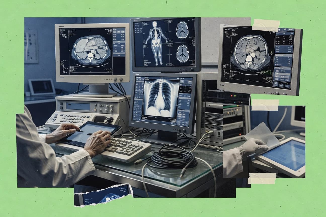
What Is Imaging System Software?
Imaging system software turns captured images or point clouds into usable datasets like dense point clouds, textured meshes, orthophotos, and measurement-ready geometry. It solves capture-to-deliverable problems by running alignment, reconstruction, and quality workflows that convert raw media into 2D maps or 3D models. Tools like Pix4Dmapper and OpenDroneMap focus on georeferenced outputs such as orthomosaics and DSMs from drone imagery. Tools like ZEISS ZEN and ImageJ focus on instrument-connected or extensible analysis workflows for scientific microscopy datasets.
Key Features to Look For
Feature fit determines whether an imaging workflow delivers consistent outputs or creates expensive rework across large datasets and complex scenes.
Dense point cloud and textured mesh generation
Agisoft Metashape excels at dense point cloud and textured mesh creation with configurable reconstruction settings, which supports metric 3D modeling from standard photogrammetry imagery. RealityCapture also generates dense meshes and textures optimized for throughput on large photo sets.
Georeferenced orthomosaics and DSM outputs
Pix4Dmapper produces georeferenced orthomosaics and DSMs with ground control point support for measurement accuracy. OpenDroneMap generates orthophotos and DSMs using a configurable pipeline that outputs GIS-ready products.
Control points and georeferencing workflows
Pix4Dmapper integrates ground control points to improve georeferencing and measurement accuracy in survey workflows. RealityCapture and Agisoft Metashape also include control points and georeferencing options to improve metric alignment.
Automated, repeatable processing pipelines
Bentley ContextCapture emphasizes automation for large-scale photogrammetry reconstruction with consistent site workflows. Meshroom provides a node-based reconstruction graph that links feature extraction, matching, and meshing so reruns can reuse parameterized stages.
Quality assessment and alignment validation
Agisoft Metashape includes quality tools that help validate coverage, reprojection error, and alignment before committing to dense reconstruction. Pix4Dmapper generates processing reports that streamline QA and project documentation.
Instrument-connected acquisition and analysis or extensible analysis tooling
ZEISS ZEN supports multi-channel acquisition and measurement and annotation inside instrument-connected microscope workflows. ImageJ supports an extensive plugin ecosystem plus an ImageJ macro language so microscopy labs can automate batch image processing across datasets.
How to Choose the Right Imaging System Software
A reliable selection process maps the deliverable type, the required level of georeferencing, and the operating environment to tool-specific strengths.
Match the software to the deliverable type
Choose Agisoft Metashape when dense point clouds and textured meshes are needed from photo sets with controllable reconstruction parameters. Choose Pix4Dmapper or OpenDroneMap when the deliverable must be a georeferenced orthomosaic plus a DSM for mapping and inspection workflows.
Confirm the georeferencing and measurement approach
Choose Pix4Dmapper when ground control point integration is required for survey-grade orthomosaics and DSMs. Choose RealityCapture or Agisoft Metashape when control points and georeferencing options must improve metric alignment for 3D measurement tasks.
Plan for dataset scale and automation needs
Choose RealityCapture or Bentley ContextCapture for high-throughput reconstructions on large image collections that need fast alignment and dense processing pipelines. Choose Bentley ContextCapture when automation for large-scale aerial and terrestrial sites reduces manual steps during capture-to-model conversion.
Evaluate how project complexity will be managed
Choose OpenDroneMap or Meshroom when the workflow must be reproducible through container-friendly or node-graph processing even if command-line or graph configuration adds friction. Choose Autodesk ReCap when the main challenge is point cloud registration and cleanup for aligning multi-scan capture projects into review-ready 3D.
Select the right environment for microscope imaging or microscopy analysis
Choose ZEISS ZEN when microscope imaging workflows must stay inside a ZEISS instrument-connected environment with multi-dimensional acquisition and built-in measurement and annotation. Choose ImageJ or Fiji when microscopy analysis needs a macro-driven automation model with broad format support and plugin-based segmentation and measurement.
Who Needs Imaging System Software?
Different imaging system software tools serve distinct capture-to-deliverable paths, from drone mapping to scientific microscopy analysis.
Survey teams producing orthomosaics and DSMs from aerial or close-range imagery
Pix4Dmapper is a strong fit because it builds georeferenced orthomosaics and DSMs and integrates ground control points for improved measurement accuracy. OpenDroneMap fits teams that want a configurable pipeline that generates orthophotos, meshes, and DSMs with GIS-ready outputs.
Teams producing dense photogrammetry meshes and textures for surveying or inspection
RealityCapture fits teams that need fast image alignment and dense reconstruction optimized for large photogrammetry datasets. Agisoft Metashape fits teams that need dense point cloud and textured mesh generation with configurable reconstruction settings for metrically accurate outputs.
Infrastructure and engineering teams generating large-scale georeferenced 3D reality models
Bentley ContextCapture fits large-scale site reconstruction because it emphasizes automated alignment, dense point cloud generation, and textured mesh creation with georeferenced outputs. Autodesk ReCap fits teams that start with point clouds and need registration and cleanup to produce review-ready 3D for coordination.
Microscopy labs standardizing acquisition and analysis or building flexible analysis pipelines
ZEISS ZEN fits labs standardizing microscope imaging workflows on ZEISS instrumentation because it combines image acquisition, multi-channel processing, measurement, and annotation in one project environment. ImageJ and Fiji fit microscopy workflows needing extensible analysis and automation because ImageJ provides an ImageJ macro language and plugin ecosystem and Fiji bundles preinstalled plugins for repeatable batch processing and imaging asset workflows.
Common Mistakes to Avoid
Common failure points usually come from misaligned expectations about scene sensitivity, configuration overhead, or how quickly the workflow converts to usable deliverables.
Assuming every tool is equally hands-off for challenging capture geometry
Agisoft Metashape and RealityCapture both require scene-dependent tuning for best results, which makes low-texture or challenging scenes harder without careful capture planning. Bentley ContextCapture depends heavily on capture geometry and consistent image overlap, which can degrade quality when overlaps are inconsistent.
Skipping ground control or control points when measurement accuracy matters
Pix4Dmapper’s ground control point support is built for survey-grade georeferencing and measurement accuracy, so omitting control points can undermine final map fidelity. RealityCapture and Agisoft Metashape support georeferencing and control points as well, which helps metric alignment for measurement-focused deliverables.
Underestimating hardware and storage requirements for dense reconstructions and large datasets
RealityCapture and Bentley ContextCapture are optimized for large photo sets but can still demand compute planning and time on large datasets. Meshroom and OpenDroneMap also rely on heavy CPU and storage usage for full photogrammetry pipeline execution.
Choosing a review-focused or asset-trace tool when deep reconstruction or acquisition is required
Fiji is centered on metadata-driven image asset linking and repeatable review workflows, so it does not replace specialized photogrammetry reconstruction when dense 3D deliverables are needed. ZEISS ZEN is instrument-connected for microscope imaging, so it is not a substitute for aerial or close-range geospatial photogrammetry outputs like orthomosaics and DSMs.
How We Selected and Ranked These Tools
we evaluated each tool by scoring features (weight 0.4), ease of use (weight 0.3), and value (weight 0.3), then computed overall as 0.40 × features + 0.30 × ease of use + 0.30 × value. Agisoft Metashape separated from lower-ranked options because it scored exceptionally on dense point cloud and textured mesh generation with configurable reconstruction settings, which directly supports end-to-end photogrammetry output quality for teams producing metrically accurate 3D models. Pix4Dmapper’s strong feature fit for georeferenced orthomosaic and DSM generation with ground control point integration also pushed it high for survey delivery workflows.
Frequently Asked Questions About Imaging System Software
Agisoft Metashape vs Pix4Dmapper for georeferenced survey deliverables
RealityCapture and Bentley ContextCapture both generate dense meshes. Which workflow is faster for large photo sets?
OpenDroneMap vs Pix4Dmapper for drone imagery to orthophotos and DSMs
Which tool is best for repeatable photogrammetry pipelines without custom code?
Autodesk ReCap vs Agisoft Metashape when the input is point clouds instead of photos
Zeiss ZEN and ImageJ both support measurement workflows. How do they differ for microscopy labs?
When an imaging workflow needs scripting and reproducibility across datasets, which tools fit best?
What is the most common cause of bad reconstructions, and how do tools help diagnose it?
How do imaging systems handle integrations for downstream engineering or GIS work?
For teams that need imaging traceability and consistent review metadata, which option is designed for that?
Tools reviewed
Primary sources checked during evaluation.
Referenced in the comparison table and product reviews above.
Keep exploring
Comparing two specific tools?
Software Alternatives
See head-to-head software comparisons with feature breakdowns, pricing, and our recommendation for each use case.
Explore software alternatives→In this category
Technology Digital Media alternatives
See side-by-side comparisons of technology digital media tools and pick the right one for your stack.
Compare technology digital media tools→FOR SOFTWARE VENDORS
Not on this list? Let’s fix that.
Our best-of pages are how many teams discover and compare tools in this space. If you think your product belongs in this lineup, we’d like to hear from you—we’ll walk you through fit and what an editorial entry looks like.
Apply for a ListingWHAT THIS INCLUDES
Where buyers compare
Readers come to these pages to shortlist software—your product shows up in that moment, not in a random sidebar.
Editorial write-up
We describe your product in our own words and check the facts before anything goes live.
On-page brand presence
You appear in the roundup the same way as other tools we cover: name, positioning, and a clear next step for readers who want to learn more.
Kept up to date
We refresh lists on a regular rhythm so the category page stays useful as products and pricing change.