GITNUXSOFTWARE ADVICE
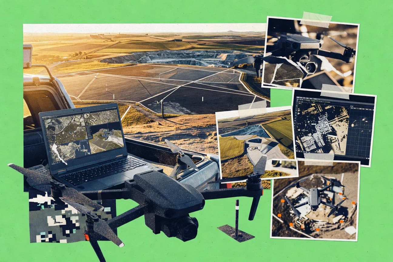
Technology Digital MediaTop 10 Best Drone Image Processing Software of 2026
Discover the top 10 best drone image processing software to enhance your aerial shots. Compare tools, pick your ideal one, and elevate your photography today.

How we ranked these tools
Core product claims cross-referenced against official documentation, changelogs, and independent technical reviews.
Analyzed video reviews and hundreds of written evaluations to capture real-world user experiences with each tool.
AI persona simulations modeled how different user types would experience each tool across common use cases and workflows.
Final rankings reviewed and approved by our editorial team with authority to override AI-generated scores based on domain expertise.
Score: Features 40% · Ease 30% · Value 30%
Gitnux may earn a commission through links on this page — this does not influence rankings. Editorial policy
Editor picks
Three quick recommendations before you dive into the full comparison below — each one leads on a different dimension.
DroneDeploy
One-click publish of processed orthomosaics and 3D reconstructions into a shared web workspace
Built for geospatial teams needing fast, shareable drone deliverables without heavy GIS overhead.
Pix4D
Runner UpQuality report panels with alignment and reprojection diagnostics for drone photogrammetry validation
Built for surveying and mapping teams needing accurate orthomosaics and 3D models.
Agisoft Metashape
Also GreatDense point cloud and textured mesh generation from drone imagery with robust alignment controls
Built for drone mapping teams needing accurate photogrammetry with controllable outputs.
Related reading
Comparison Table
This comparison table evaluates drone image processing software across photogrammetry and map generation workflows, including DroneDeploy, Pix4D, Agisoft Metashape, RealityCapture, and OpenDroneMap. It highlights practical differences in data ingestion, processing output types, accuracy and control options, compute requirements, and automation so teams can match tool capabilities to project constraints.
DroneDeploy
cloud mappingDroneDeploy processes drone imagery into maps, orthomosaics, and 3D models for inspection and analytics workflows.
One-click publish of processed orthomosaics and 3D reconstructions into a shared web workspace
DroneDeploy stands out for turning drone data into usable deliverables through an end-to-end image processing workflow built around capture planning and automated outputs. The platform supports photogrammetry processing for orthomosaics, digital surface models, and 3D reconstructions, then publishes results in an interactive web workspace. Collaboration tools add review and sharing of processed outputs, which reduces time spent moving files between teams and tools.
- +Automated photogrammetry outputs including orthomosaics and 3D models
- +Interactive web workspace for reviewing measurements and assets
- +Workflow alignment with drone capture planning reduces rework
- –Less flexible than standalone photogrammetry tools for custom pipelines
- –Large-area processing can bottleneck on compute and turnaround time
- –Advanced analysis workflows may require external tooling
Best for: Geospatial teams needing fast, shareable drone deliverables without heavy GIS overhead
More related reading
Pix4D
photogrammetryPix4D turns drone image sets into georeferenced orthomosaics, point clouds, and textured 3D reconstructions.
Quality report panels with alignment and reprojection diagnostics for drone photogrammetry validation
Pix4D stands out for turning drone imagery into metric outputs like orthomosaics, DSMs, and dense 3D point clouds using a guided photogrammetry pipeline. Its core capabilities include automated calibration, georeferencing support, and quality reporting with reprojection and coverage diagnostics.
Projects scale from single flights to repeatable site workflows with consistent processing steps. Exports cover common GIS and CAD needs through formats for maps, models, and point clouds.
- +Strong photogrammetry pipeline outputs orthomosaics, DSMs, and dense point clouds
- +Georeferencing and calibration tools support metric site workflows
- +Quality reports surface coverage, alignment, and residual issues for troubleshooting
- –Processing complexity can require tuning to avoid slow runs on large datasets
- –Workflow can be heavy for quick-look deliverables without deeper project setup
- –Advanced outputs demand familiarity with capture settings and coordinate systems
Best for: Surveying and mapping teams needing accurate orthomosaics and 3D models
Agisoft Metashape
desktop photogrammetryAgisoft Metashape reconstructs 3D models and dense point clouds from drone imagery and supports orthomosaic production.
Dense point cloud and textured mesh generation from drone imagery with robust alignment controls
Agisoft Metashape stands out with a full photogrammetry pipeline that turns overlapping drone images into dense point clouds, textured meshes, and orthomosaics. The software includes strong camera calibration and tie-point matching controls, which helps improve reconstruction quality for surveys and mapping workflows.
It also supports automation through scripting and repeatable processing steps for larger image sets. Metashape integrates well with geospatial outputs like DSM and orthomosaics for direct GIS and measurement use.
- +End-to-end photogrammetry for dense clouds, meshes, and textured outputs
- +Georeferencing tools support GCP and coordinate system workflows
- +Batch processing and scripting enable repeatable reconstruction runs
- –Processing setup and parameter tuning can be complex for new users
- –High-resolution jobs can demand substantial RAM and compute resources
- –Some QA and automated error reporting relies on user interpretation
Best for: Drone mapping teams needing accurate photogrammetry with controllable outputs
RealityCapture
photogrammetry engineRealityCapture computes accurate 3D reconstructions from drone photos and generates high-resolution point clouds and textured meshes.
RealityCapture alignment and reconstruction workflow with high-density mesh and texture generation
RealityCapture focuses on fast photogrammetry and dense reconstruction from drone images, with an emphasis on accurate alignment and efficient processing. It supports typical photogrammetry workflows including camera pose estimation, sparse reconstruction, and generating dense point clouds and textured meshes.
The software also provides tools for large datasets and export-ready outputs for GIS, visualization, and engineering use. Its workflow relies on strong input preparation and parameter choices to achieve consistent results.
- +High-accuracy alignment and dense reconstruction from large drone image sets
- +Strong control over reconstruction settings for repeatable outputs
- +Exports textured meshes and point clouds for downstream GIS and CAD workflows
- +Efficient processing pipeline for photogrammetry projects with many images
- –Achieving consistent results requires careful input and parameter tuning
- –Dense model quality can vary significantly with coverage and image quality
- –Workflow complexity increases for users without prior photogrammetry experience
Best for: Teams producing photogrammetry models that require consistent, high-detail outputs
OpenDroneMap
open-source photogrammetryOpenDroneMap generates orthomosaics, digital surface models, and textured 3D outputs from drone imagery using open-source pipelines.
Automated orthomosaic and DEM generation from drone image sets using OpenDroneMap’s processing pipeline
OpenDroneMap stands out by turning drone photos into geospatial outputs through an open processing toolchain built around photogrammetry. It supports automated reconstruction, orthomosaics, and digital elevation model generation from standard image sets. The project emphasizes map-ready results like GeoTIFF elevation products and web map visualization via exported tiles.
- +Full photogrammetry pipeline from photos to orthomosaics and DEMs
- +Extensive command-line controls for processing parameters and accuracy tuning
- +Exports geospatial products suitable for GIS workflows and tiling
- –Setup and parameter tuning can be complex without expert photogrammetry knowledge
- –Less turnkey for repeatable GUI-based drone processing compared with commercial suites
- –Large datasets can be demanding on compute, memory, and storage
Best for: GIS teams needing photogrammetry outputs with strong control over processing parameters
ODM (OpenDroneMap Server)
self-hosted processingOpenDroneMap Server runs web and API-based processing jobs to produce maps and 3D assets from uploaded drone imagery.
OpenDroneMap Server job processing with configurable photogrammetry pipeline
ODM turns drone photo datasets into georeferenced outputs like orthomosaics, textured meshes, and point clouds. It is distinct because it runs as a server you can self-host, then manage multiple jobs through a web interface and job configuration.
Core capabilities include photogrammetry reconstruction with camera calibration, configurable processing pipelines, and export of common mapping products for GIS use. Tight integration with common drone image sets makes it a strong fit for repeatable reconstruction workflows.
- +Self-hosted server enables full control over processing workflow and resources
- +Exports orthomosaics, point clouds, and meshes for common mapping and GIS pipelines
- +Configurable photogrammetry steps support repeatable results across multiple projects
- +Web-based job management simplifies dataset processing without custom code
- –Setup and tuning depend on correct hardware, storage, and compute sizing
- –Large datasets can require careful queue planning and long processing times
- –Quality troubleshooting often needs log review and parameter adjustments
Best for: Teams running repeatable photogrammetry jobs with self-hosted infrastructure
PTGui
image stitchingPTGui creates panoramas and stitched image composites that support drone imagery workflows for large-area viewing products.
Advanced Control Points with optimization for precise alignment and reduced distortion
PTGui focuses on photogrammetry processing for stitching aerial image sets into accurate panoramas and orthographic outputs from overlapping shots. It supports multi-image alignment, projection mapping, and advanced control for lens calibration and geometry refinement.
Users can handle challenging drone datasets by combining manual and automatic optimization controls in a single workflow. Export options support common panorama deliverables for sharing and downstream use.
- +Strong multi-image alignment with robust optimization controls
- +Lens calibration workflows help stabilize results across drone cameras
- +High-resolution panorama outputs support professional deliverables
- +Manual control points refine geometry when automation struggles
- +Batch-capable processing streamlines repetitive drone sessions
- –Dense workflows can feel complex during first-time setup
- –Not a dedicated drone workflow tool for maps and GIS pipelines
- –Advanced adjustments require careful parameter tuning for best results
- –Large datasets can increase processing time and memory usage
Best for: Aerial photographers needing accurate panoramic stitching from drone imagery
WebODM
web-based processingWebODM provides a web interface and processing interface for running drone image reconstruction jobs and exporting map products.
End-to-end photogrammetry in Web UI using OpenDroneMap processing pipeline and exports
WebODM stands out for producing orthomosaics, point clouds, and dense reconstructions from drone imagery through an open-source, locally runnable workflow. The core capabilities include image calibration, structure-from-motion alignment, dense point cloud generation, and exporting deliverables such as GeoTIFF orthomosaics and digital elevation models. It also supports task queues and projects so teams can process multiple datasets with consistent settings, including optional georeferencing when GNSS and camera data are available.
- +Generates orthomosaics, DEMs, and point clouds from drone imagery
- +Runs locally with project-based task queues for repeatable processing
- +Supports georeferencing using GNSS and camera metadata when provided
- –Dense reconstruction settings require tuning for best results
- –Setup and dependencies can be harder than hosted processing tools
- –Advanced customization is easier for technical users than operators
Best for: Teams running local photogrammetry pipelines needing GIS-ready outputs
ContextCapture
enterprise photogrammetryContextCapture performs dense image-based reconstruction into textured models and mapping outputs for survey and asset contexts.
Automated dense reconstruction and georeferencing from drone imagery with production-grade scalability
ContextCapture focuses on high-fidelity photogrammetry and automated reconstruction from drone imagery with strong scalability for large projects. It generates georeferenced outputs such as dense point clouds and textured meshes, while supporting end-to-end workflows from image alignment through final products. Processing is designed to handle varied image quality and capture overlaps, which matters for real-world drone missions with inconsistent coverage.
- +Automated dense reconstruction with reliable alignment for drone image sets
- +Produces dense point clouds, textured meshes, and georeferenced deliverables
- +Handles large datasets with scalable processing designed for production use
- –Workflow setup and parameter management can be complex for non-experts
- –Best results depend on consistent capture overlap and imagery quality control
- –Export and downstream integration still require practical pipeline knowledge
Best for: Teams producing accurate 3D models from drone missions for surveying workflows
Pix4Dmatic
aerial mappingPix4Dmatic processes drone imagery into orthomosaics and 3D outputs with support for ground sampling distance targets.
Integrated ground control point georeferencing within the photogrammetry processing workflow
Pix4Dmatic stands out for its mission oriented photogrammetry workflow that turns overlapping drone images into georeferenced outputs. The software supports processing pipelines for mapping products such as orthomosaics, dense point clouds, and textured 3D models. It also includes tools for ground control integration, camera calibration management, and export formats used in CAD and GIS environments.
- +Produces orthomosaics, dense point clouds, and textured models from drone imagery
- +Georeferencing workflow supports ground control point integration for mapping accuracy
- +Camera and processing settings can be managed for consistent results across projects
- –Setup and parameter tuning require experience to avoid slow or unstable runs
- –Large datasets can increase processing time and demand strong hardware performance
- –Workspace is oriented to full projects, which can feel heavy for quick checks
Best for: Surveying and mapping teams needing reliable photogrammetry outputs
Conclusion
After evaluating 10 technology digital media, DroneDeploy stands out as our overall top pick — it scored highest across our combined criteria of features, ease of use, and value, which is why it sits at #1 in the rankings above.
Use the comparison table and detailed reviews above to validate the fit against your own requirements before committing to a tool.
How to Choose the Right Drone Image Processing Software
This buyer’s guide section explains how to select drone image processing software for maps, orthomosaics, and 3D models. It covers tools including DroneDeploy, Pix4D, Agisoft Metashape, RealityCapture, and the OpenDroneMap family. It also addresses infrastructure options like ODM and WebODM, plus specialized workflows like PTGui panoramas and ContextCapture large-project reconstruction.
What Is Drone Image Processing Software?
Drone image processing software converts overlapping drone photos into georeferenced outputs like orthomosaics, digital surface models, dense point clouds, and textured 3D meshes. These tools solve common field problems like turning raw image sets into deliverables that measurement and GIS workflows can consume. Many teams also use built-in QA views and export packages to validate alignment and share results. Tools like DroneDeploy and Pix4D represent turnkey map and model generation workflows, while OpenDroneMap tools like WebODM and ODM focus on locally runnable pipelines.
Key Features to Look For
The right features determine whether results are accurate, repeatable, and easy to deliver to downstream GIS, survey, and engineering workflows.
Automated orthomosaic and 3D reconstruction outputs
Look for software that produces orthomosaics, digital surface models, and textured or point-cloud outputs without manual rework. DroneDeploy excels at automated photogrammetry deliverables and publishing into a shared workspace. Pix4Dmatic also focuses on orthomosaics plus dense point clouds and textured models in a mission-oriented workflow.
Quality reporting for alignment and reprojection diagnostics
Quality reports reduce wasted time by highlighting coverage, alignment, and residual issues. Pix4D provides quality report panels with alignment and reprojection diagnostics for drone photogrammetry validation. RealityCapture and Metashape also rely on strong alignment control, which supports repeatable dense reconstruction when inputs are consistent.
Georeferencing and calibration tools for metric accuracy
Georeferencing support matters when outputs must align to coordinate systems for surveying and mapping. Pix4D and Pix4Dmatic include georeferencing and camera calibration workflows designed for metric site processing. ContextCapture and Metashape support georeferencing workflows that work with GCP and coordinate system setups.
Ground control point integration workflow
GCP integration streamlines accuracy for projects that need tight alignment to surveyed control. Pix4Dmatic includes integrated ground control point georeferencing inside its processing workflow. Metashape also supports GCP and coordinate system workflows through georeferencing tools.
Repeatable pipelines through configuration and automation
Repeatability matters for multi-site programs where the same processing steps must run consistently. Agisoft Metashape enables automation through scripting and repeatable processing steps for larger image sets. ODM and WebODM support project-based task queues and configurable photogrammetry steps for repeatable local processing.
Collaboration and publish-ready deliverable sharing
Delivery speed matters when teams need to review results without file transfers and tool switching. DroneDeploy stands out with one-click publish of processed orthomosaics and 3D reconstructions into a shared web workspace. OpenDroneMap tools export geospatial products for GIS tiling and visualization when collaborative review happens in downstream mapping systems.
How to Choose the Right Drone Image Processing Software
Selecting the right tool requires matching deliverables, accuracy needs, workflow control level, and how teams intend to review and export results.
Match your required deliverables to tool output capabilities
Start by listing deliverables that must ship from processing, such as orthomosaics, DSMs, dense point clouds, or textured meshes. DroneDeploy is built around orthomosaics and 3D reconstructions with automated outputs. Pix4D and Pix4Dmatic target georeferenced orthomosaics plus dense point clouds and textured models, while RealityCapture and ContextCapture emphasize dense reconstruction for high-detail textured outputs.
Choose the right accuracy workflow for your mapping environment
If projects require coordinate system alignment and validation, prioritize tools with strong georeferencing and calibration workflows. Pix4D and Pix4Dmatic include georeferencing and camera calibration designed for metric workflows. Metashape and ContextCapture support georeferencing tools that work with GCP and coordinate system setups, which helps teams keep site outputs consistent.
Decide how much pipeline control is needed versus how much turnkey automation is acceptable
Teams that want a guided, guided photogrammetry pipeline often prefer Pix4D, RealityCapture, or DroneDeploy because processing is driven by established workflows. Teams that need deep control over processing parameters often choose OpenDroneMap, WebODM, or ODM because they expose configurable pipelines and task processing steps. OpenDroneMap and WebODM also rely on parameter tuning for dense reconstruction settings, so operators must be comfortable managing dependencies and processing choices.
Plan for compute scale and turnaround time based on dataset size
Large datasets can bottleneck compute and increase turnaround time, which makes scaling strategy part of the selection. DroneDeploy can bottleneck during large-area processing on compute and turnaround time, while Pix4D also notes that processing complexity can slow runs on large datasets without tuning. ODM and WebODM support queue planning through server or project-based task queues, which helps teams manage longer processing times for bigger jobs.
Select how results will be validated and shared across stakeholders
If stakeholders need fast review in a browser, DroneDeploy provides interactive web workspace viewing and one-click publish into shared spaces. If validation must be evidence-led, Pix4D’s quality report panels with alignment and reprojection diagnostics support troubleshooting. If teams prefer local pipelines, WebODM and ODM enable exports like GeoTIFF orthomosaics plus point clouds for GIS workflows.
Who Needs Drone Image Processing Software?
Drone image processing software fits teams that must convert drone imagery into measurement-grade maps and 3D models with consistent workflows and usable exports.
Geospatial and inspection teams that need fast, shareable deliverables
DroneDeploy is a fit because it converts imagery into orthomosaics and 3D reconstructions and publishes results into a shared web workspace for review. This reduces time spent moving files between teams and tools during ongoing inspection and analytics workflows.
Surveying and mapping teams that require metric accuracy and validation
Pix4D and Pix4Dmatic support georeferencing and camera calibration workflows designed for orthomosaics plus dense point clouds and textured models. Pix4D adds quality report panels with alignment and reprojection diagnostics to validate coverage and troubleshoot residual issues.
Mapping teams that want controllable outputs and repeatable photogrammetry runs
Agisoft Metashape is a fit because it generates dense point clouds, textured meshes, and orthomosaics with robust alignment controls. It also supports scripting and batch processing so teams can repeat reconstruction steps across large image sets.
Teams running local or self-hosted photogrammetry pipelines
ODM and WebODM are built for local processing with web and job management, including configurable photogrammetry steps. OpenDroneMap and WebODM support automated orthomosaic and DEM generation and export geospatial products for GIS workflows.
Common Mistakes to Avoid
Common selection and deployment errors show up across both commercial drone processing suites and open processing pipelines.
Expecting turnkey tools to handle custom photogrammetry pipelines
DroneDeploy emphasizes automated outputs and web publishing, so it can feel less flexible for custom pipelines compared with standalone photogrammetry tools. OpenDroneMap and ODM provide deeper command-line or server-side configurability, which better matches teams that require custom photogrammetry steps.
Skipping quality diagnostics on large or inconsistent capture
Pix4D’s quality report panels surface alignment and reprojection diagnostics, which helps prevent shipping incorrect reconstructions. ContextCapture notes that results depend on consistent capture overlap and imagery quality control, so operators must validate coverage rather than assume output is correct.
Overlooking georeferencing and GCP integration requirements
Pix4Dmatic includes integrated ground control point georeferencing inside its workflow, which helps avoid downstream coordinate misalignment. Metashape also supports GCP and coordinate system workflows, so projects needing metric alignment should choose tools with explicit georeferencing workflows.
Underestimating compute and turnaround time for dense reconstruction
DroneDeploy and Pix4D can bottleneck on large-area processing and slow runs when datasets grow. ODM and WebODM help teams manage longer processing times through self-hosted job processing and project task queues, which reduces surprise delays.
How We Selected and Ranked These Tools
we evaluated every tool on three sub-dimensions that match how teams buy and operate drone photogrammetry software: features with a weight of 0.4, ease of use with a weight of 0.3, and value with a weight of 0.3. The overall rating is the weighted average computed as overall = 0.40 × features + 0.30 × ease of use + 0.30 × value. DroneDeploy separated itself with a concrete deliverable workflow advantage in the features dimension through one-click publish of processed orthomosaics and 3D reconstructions into a shared web workspace.
Frequently Asked Questions About Drone Image Processing Software
Which drone image processing tool is best for producing shareable deliverables without exporting files into separate review apps?
What software should be chosen for survey-grade orthomosaics and dense 3D outputs with alignment diagnostics?
Which option supports the most controllable photogrammetry workflow for dense point clouds and textured meshes?
Which tool is fastest for dense reconstruction when the input dataset is large?
Which tools are best when the workflow needs to produce georeferenced GeoTIFF elevation products and tiles for mapping?
Which software supports self-hosted server processing for multiple photogrammetry jobs?
Which tool is suited for aerial stitching and panorama outputs rather than full 3D reconstruction deliverables?
What tool handles ground control and georeferencing integration most directly inside the processing workflow?
Why do results sometimes degrade on inconsistent drone coverage, and which tool is built to handle that situation?
How should a team choose between local open-source pipelines and enterprise-style guided workflows?
Tools reviewed
Primary sources checked during evaluation.
Referenced in the comparison table and product reviews above.
Keep exploring
Comparing two specific tools?
Software Alternatives
See head-to-head software comparisons with feature breakdowns, pricing, and our recommendation for each use case.
Explore software alternatives→In this category
Technology Digital Media alternatives
See side-by-side comparisons of technology digital media tools and pick the right one for your stack.
Compare technology digital media tools→FOR SOFTWARE VENDORS
Not on this list? Let’s fix that.
Our best-of pages are how many teams discover and compare tools in this space. If you think your product belongs in this lineup, we’d like to hear from you—we’ll walk you through fit and what an editorial entry looks like.
Apply for a ListingWHAT THIS INCLUDES
Where buyers compare
Readers come to these pages to shortlist software—your product shows up in that moment, not in a random sidebar.
Editorial write-up
We describe your product in our own words and check the facts before anything goes live.
On-page brand presence
You appear in the roundup the same way as other tools we cover: name, positioning, and a clear next step for readers who want to learn more.
Kept up to date
We refresh lists on a regular rhythm so the category page stays useful as products and pricing change.