GITNUXSOFTWARE ADVICE
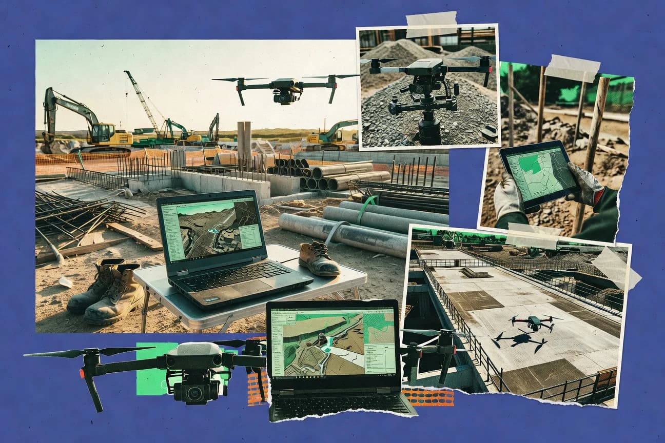
Construction InfrastructureTop 10 Best Drone Construction Software of 2026
Discover the best drone construction software to streamline projects. Compare top tools, features & tips to boost efficiency.

How we ranked these tools
Core product claims cross-referenced against official documentation, changelogs, and independent technical reviews.
Analyzed video reviews and hundreds of written evaluations to capture real-world user experiences with each tool.
AI persona simulations modeled how different user types would experience each tool across common use cases and workflows.
Final rankings reviewed and approved by our editorial team with authority to override AI-generated scores based on domain expertise.
Score: Features 40% · Ease 30% · Value 30%
Gitnux may earn a commission through links on this page — this does not influence rankings. Editorial policy
Editor picks
Three quick recommendations before you dive into the full comparison below — each one leads on a different dimension.
DroneDeploy
Progress tracking with time-based visual comparisons for site changes
Built for construction teams needing repeatable drone mapping, progress tracking, and stakeholder review.
Pix4D
Runner UpVolume computation from orthomosaics and surface models for earthworks and progress comparisons
Built for construction teams needing reliable photogrammetry outputs and measurement-grade deliverables.
Trimble SiteVision
Also GreatVisual field review with project context for inspecting drone-derived orthomosaics and models
Built for trimble-aligned contractors needing measurement and QA from drone photogrammetry.
Related reading
Comparison Table
This comparison table evaluates drone construction software used to plan flights, process aerial imagery, and produce deliverables for jobsite reporting. It contrasts common platforms such as DroneDeploy, Pix4D, Trimble SiteVision, Autodesk Construction Cloud, BIM 360, and other key tools across capabilities that affect surveying workflows. Readers can use the table to compare outputs, data handling, and collaboration features that determine which platform fits specific construction projects.
DroneDeploy
drone mappingProvides web-based drone data capture workflows and automated mapping outputs for construction sites including orthomosaics and volumetrics.
Progress tracking with time-based visual comparisons for site changes
DroneDeploy stands out by turning drone captures into construction-ready outputs with a mission-to-report workflow. It supports photogrammetry mapping for sites, including progress views over time and automated deliverables like orthomosaics and 3D models.
Collaboration features keep stakeholders aligned through shareable web outputs and field-friendly review loops. The platform focuses on repeatable survey capture and actionable reporting rather than general-purpose drone piloting.
- +Automated mapping deliverables like orthomosaics and 3D models from captured imagery
- +Repeatable progress views support construction schedule tracking across survey dates
- +Web-based sharing enables rapid stakeholder review without installing specialist software
- –Workflow depends on consistent capture settings to avoid mapping quality issues
- –Advanced configuration can feel complex for teams without survey specialists
- –High-volume projects can require careful planning of processing and review steps
Best for: Construction teams needing repeatable drone mapping, progress tracking, and stakeholder review
More related reading
Pix4D
photogrammetryGenerates photogrammetry-derived maps, models, and measurements from drone imagery for construction progress tracking and earthwork volume calculations.
Volume computation from orthomosaics and surface models for earthworks and progress comparisons
Pix4D stands out with its photogrammetry workflow that turns drone imagery into survey-grade outputs for construction progress and QA. Core capabilities include automated alignment, dense point clouds, orthomosaics, and digital surface models with measurement tools for areas and volumes.
The platform also supports outputs tailored for GIS and CAD-style pipelines through common export options and inspection-style deliverables. Collaboration and project management are built around repeatable processing and consistent datasets across sites.
- +Strong photogrammetry engine produces dense point clouds and accurate DSMs
- +Volume and area measurement tools support construction progress tracking
- +Exports to common formats fit GIS and CAD-based workflows
- +Repeatable project processing helps standardize deliverables across sites
- –Advanced accuracy tuning requires expertise to avoid survey-grade errors
- –Large projects can be compute heavy and slow without strong hardware
- –Workflow flexibility can feel limited compared with highly modular stacks
- –Some verification steps still depend on manual checks of results
Best for: Construction teams needing reliable photogrammetry outputs and measurement-grade deliverables
Trimble SiteVision
field workflowsSupports real-time drone-to-site workflows by pairing captured imagery and 3D context with construction field operations on Trimble systems.
Visual field review with project context for inspecting drone-derived orthomosaics and models
Trimble SiteVision stands out for its integration with Trimble survey and construction workflows, tying drone capture outputs to project-ready documentation. It supports automated photogrammetry processing that produces site models, orthomosaics, and measurements for progress and quality checks.
The platform emphasizes visual field review so teams can inspect results, compare changes, and communicate findings on active jobsites. Collaboration and role-based access help keep survey-grade outputs aligned with construction timelines.
- +Tight Trimble workflow alignment from drone capture to construction documentation
- +Generates deliverables like orthomosaics and models for measurement and progress reviews
- +Visual site review supports fast inspection of results with project context
- +Change tracking helps validate progress against expectations
- –Best results depend on established Trimble survey processes and data discipline
- –Advanced measurement and QA workflows can feel heavy for small teams
- –File-to-project setup complexity can slow first-time deployments
- –Collaboration is strong, but review depends on consistent data structure
Best for: Trimble-aligned contractors needing measurement and QA from drone photogrammetry
Autodesk Construction Cloud
construction platformCentralizes construction project delivery data and construction progress reporting with integrations that bring in drone-derived mapping outputs.
Model-linked issue tracking that ties drone evidence to coordination tasks
Autodesk Construction Cloud stands out by connecting drone capture outputs to a wider construction data workflow centered on BIM-based collaboration and field-to-office traceability. It supports reality capture processing integrations, then pushes results into issue management and document-centric review so stakeholders can act on visual evidence. Strong model-linked workflows and configurable approvals make it practical for teams managing progress, inspections, and coordination artifacts tied to project work packages.
- +Links drone-derived visuals to model-based coordination workflows
- +Integrates review, approvals, and issue tracking around shared artifacts
- +Provides traceable documentation for inspections and progress evidence
- +Supports consistent project data handling across disciplines
- –Drone capture processing setup can feel heavy for small teams
- –Workflows require disciplined data structure to stay usable at scale
- –Some drone-specific automation stays limited without add-on configuration
Best for: Mid-size teams needing BIM-linked drone capture reviews and issue workflows
BIM 360
construction collaborationManages construction documents, issue tracking, and field reporting while supporting workflows that use drone survey outputs for coordination.
Construction issue tracking that links field findings from drone captures to project workflows
BIM 360 stands out by centering drone deliverables inside connected project workflows built around Autodesk Construction Cloud. It supports uploading drone imagery and linking data to project recordkeeping so teams can manage submittals, issues, and approvals alongside field evidence.
Core capabilities include cloud document management, workflow tasks for review and coordination, and issue tracking that helps connect visual findings from drone captures to model and project artifacts. Its drone-specific processing and analytics are limited compared with dedicated photogrammetry platforms.
- +Cloud document management keeps drone outputs organized per project and location
- +Issue tracking ties drone observations to actionable workflows for teams
- +Review and approval workflows support formal handoffs for visual evidence
- –Drone photogrammetry processing and measurements are not the primary strength
- –Linking drone outputs to assets can feel manual without strict team discipline
- –Workflow setup overhead increases for smaller crews and short projects
Best for: Teams needing governed storage and review workflows for drone evidence
eBee
mapping workflowBuilds photogrammetry workflows for drone-like mapping capture using Sensefly platforms to produce site models and measurements.
Automated photogrammetry pipeline that converts drone imagery into orthomosaics and 3D surface models
eBee stands out for connecting professional drone mapping missions to construction-ready deliverables through SenseFly’s photogrammetry workflow. The platform supports flight planning and automatic processing of aerial imagery into orthomosaics, surface models, and other survey outputs.
It fits teams that need repeatable site documentation with consistent data products for progress monitoring and measurement. The construction workflow depends heavily on a compatible hardware and software ecosystem for best results.
- +Automates photogrammetry processing from captured imagery into survey-grade outputs
- +Generates orthomosaics and surface models for construction measurement workflows
- +Integrates planning to delivery so teams can repeat missions across sites
- –Workflow quality depends on sensor and capture consistency from compatible hardware
- –Advanced outputs and QA still require operator judgment and validation
- –Collaboration features for multi-party project review are limited compared with full project suites
Best for: Construction teams needing repeatable drone survey deliverables with minimal manual processing
Agisoft Metashape
desktop photogrammetryProcesses drone imagery into dense point clouds, orthomosaics, and 3D models for construction measurement and surveying deliverables.
Ground Control Point georeferencing integrated with multi-camera alignment and calibration
Agisoft Metashape stands out for producing georeferenced 3D models from drone and ground imagery using a mature photogrammetry workflow. It supports dense cloud generation, mesh reconstruction, texture mapping, and orthomosaic creation for construction progress and survey outputs.
The software offers configurable camera models, ground control integration, and export options for common GIS and CAD workflows. Data quality depends heavily on image capture planning and consistent overlap across flight lines.
- +End-to-end photogrammetry pipeline from alignment to orthomosaics and meshes
- +Strong georeferencing using ground control points and camera calibration workflows
- +High-quality dense point clouds with configurable reconstruction settings
- +Export options for GIS layers and engineering-grade deliverables
- –Dense reconstruction can be slow and memory intensive on large projects
- –Quality control often requires manual tuning and iterative reprocessing
- –Processing workflows feel technical for teams lacking photogrammetry expertise
Best for: Surveying and construction teams needing accurate photogrammetry deliverables
RealityCapture
high-performance photogrammetryCreates high-detail photogrammetric reconstructions from drone imagery for construction site documentation and measurement.
RealityCapture’s reconstruction pipeline for generating textured dense meshes and orthomosaics from drone photos
RealityCapture stands out for high-accuracy photogrammetry workflows that can process large image sets into dense meshes and orthomosaics. It supports drone-style inputs such as RGB photos with optional georeferencing, then automates alignment, reconstruction, and export to common GIS and CAD formats.
The software is strong for surveying-grade outputs like textured models, elevation products, and measurements derived from reconstructed geometry. It is less focused on end-to-end construction site project management and collaboration tooling compared with dedicated construction workflows.
- +Fast dense reconstruction from large drone photo sets with robust texturing.
- +Georeferencing options support survey-grade workflows and consistent site outputs.
- +Exports deliver orthomosaics, meshes, and model products for downstream analysis.
- –Workflow tuning and data prep are required to avoid alignment failures.
- –Limited built-in construction collaboration and annotation controls.
- –Manual control is needed to manage outputs and quality across many missions.
Best for: Survey and construction teams needing accurate photogrammetry outputs from drone imagery
Mapware
progress analyticsTurns drone-captured data into construction-ready deliverables with progress comparison, measurement, and map-based reporting.
Interactive map visualization for drone deliverables organized by site and location
Mapware stands out with map-first project organization that turns drone capture outputs into an interactive spatial workflow. It supports importing and visualizing drone imagery and deliverables on a map so stakeholders can review sites by location. The core experience centers on collecting, managing, and sharing geospatial documentation tied to field assets and dates.
- +Map-centric project navigation makes site review faster than folder-only workflows.
- +Geospatial visualization keeps deliverables tied to exact locations.
- +Sharing workflows support stakeholder review without manual exports.
- –Advanced automation and custom QA workflows are limited compared to specialized platforms.
- –Data prep control for raw processing steps is not as deep as dedicated photogrammetry tools.
- –Integration depth for enterprise systems is narrower than best-in-class construction ecosystems.
Best for: Construction teams needing map-based drone deliverables review and stakeholder sharing
OpenDroneMap
open-source pipelineOpen-source pipeline that converts drone photos into georeferenced orthomosaics, point clouds, and meshes for construction use.
ODM’s command-driven reconstruction pipeline with configurable settings for orthophotos and 3D models
OpenDroneMap stands out for turning drone imagery into map-ready outputs through an open geospatial pipeline. It supports common photogrammetry workflows and can generate orthomosaics, textured meshes, and digital surface models. The project emphasizes reproducible processing and dataset export for downstream GIS and construction planning uses.
- +Open photogrammetry pipeline that produces GIS-ready orthomosaics and surface models
- +Batch-friendly processing workflow for multi-flight projects
- +Supports reconstruction outputs like textured meshes for visual site reviews
- –Setup and tuning require photogrammetry and compute familiarity
- –Georeferencing quality depends heavily on input camera and flight metadata
- –Less tailored UX for construction-specific deliverables and QA steps
Best for: Teams producing GIS outputs from drone imagery using repeatable, pipeline-based processing
Conclusion
After evaluating 10 construction infrastructure, DroneDeploy stands out as our overall top pick — it scored highest across our combined criteria of features, ease of use, and value, which is why it sits at #1 in the rankings above.
Use the comparison table and detailed reviews above to validate the fit against your own requirements before committing to a tool.
How to Choose the Right Drone Construction Software
This buyer’s guide explains how to choose drone construction software for mapping outputs, construction progress tracking, and site documentation workflows. It covers platforms like DroneDeploy, Pix4D, Trimble SiteVision, Autodesk Construction Cloud, and BIM 360 alongside photogrammetry pipelines such as Agisoft Metashape, RealityCapture, OpenDroneMap, and Mapware. It also includes purpose-built SenseFly workflows with eBee to help teams match the tool to their jobsite process.
What Is Drone Construction Software?
Drone construction software converts drone imagery into construction-ready deliverables like orthomosaics, 3D models, and surface measurements. These tools solve the gap between field capture and construction decision-making by producing repeatable visual evidence for progress, QA, and documentation. Construction teams typically use these outputs to track change over time, compute volumes for earthworks, and route findings through review and issue workflows. DroneDeploy and Pix4D show this in practice by combining automated mapping outputs with measurement-focused deliverables for construction progress and reporting.
Key Features to Look For
Choosing the right tool depends on whether the software can produce the exact construction deliverables and workflows that fit the site’s review and measurement needs.
Time-based progress tracking with visual comparisons
Progress tracking across survey dates lets teams see site changes and validate construction sequences using consistent outputs. DroneDeploy delivers time-based visual comparisons that support construction schedule tracking across repeatable surveys.
Volume and surface measurement for earthworks and progress
Accurate volume computation matters for earthworks, pay apps, and progress validation. Pix4D focuses on volume computation from orthomosaics and surface models, which supports earthwork comparisons.
Field review with project context
Field-ready review workflows reduce turnaround time between capture and construction decisions. Trimble SiteVision provides visual site review with project context so teams can inspect drone-derived orthomosaics and models.
Model-linked issue tracking tied to drone evidence
Issue workflows that connect visuals to coordination artifacts make drone findings actionable. Autodesk Construction Cloud ties drone-derived visuals to BIM-linked coordination through model-linked issue tracking.
Construction document and approval workflows for drone evidence
Document-centric review and approvals help teams manage drone outputs as controlled records. BIM 360 centers cloud document management, review, and approval workflows so drone-derived findings can link to project issue tracking.
End-to-end photogrammetry processing pipeline with georeferencing
Georeferenced reconstruction is required for measurements that align with survey-grade workflows. Agisoft Metashape integrates ground control point georeferencing into alignment and calibration, while OpenDroneMap offers a command-driven pipeline for orthomosaics and 3D models.
How to Choose the Right Drone Construction Software
Selection should match the tool’s strengths in deliverable automation, measurement outputs, and collaboration workflows to the actual jobsite process.
Start with the deliverables that the jobsite requires
Define whether deliverables must include orthomosaics, 3D models, dense point clouds, and surface models for measurements. DroneDeploy emphasizes automated mapping deliverables like orthomosaics and 3D models from captured imagery, while Pix4D produces orthomosaics and digital surface models with measurement tools.
Match measurement needs to the tool’s measurement workflow
If earthworks volumes and area measurements are central, select software built around volume and surface computation. Pix4D provides volume computation from orthomosaics and surface models, while Trimble SiteVision includes orthomosaic and measurement generation aligned to Trimble workflows.
Choose the collaboration model that teams will actually use
Pick workflows that align with how stakeholders review deliverables and create actions. DroneDeploy supports web-based sharing for rapid stakeholder review, while Autodesk Construction Cloud provides model-linked issue tracking that ties drone evidence to coordination tasks.
Plan for repeatability and dataset discipline across multiple missions
Repeatability depends on consistent capture settings and consistent project data structure across survey dates. DroneDeploy requires capture consistency to protect mapping quality, while Pix4D emphasizes repeatable project processing for standardized datasets across sites.
Fit the capture and processing ecosystem to the team’s skills
If the organization wants a guided construction mapping pipeline, DroneDeploy or eBee is built for repeatable missions that convert imagery into orthomosaics and surface models. If the organization can manage technical photogrammetry workflows, Agisoft Metashape and RealityCapture provide configurable reconstruction and georeferencing options, but they require operator judgment and tuning.
Who Needs Drone Construction Software?
Drone construction software fits organizations that need construction-grade mapping outputs, progress evidence, and review-ready deliverables tied to real jobsite work.
Construction teams that must track progress over multiple survey dates
DroneDeploy fits this need because it provides repeatable progress views with time-based visual comparisons for site changes. It is also well suited for stakeholder review through shareable web outputs without specialist desktop software.
Construction teams that must compute earthwork volumes and measurement-grade surfaces
Pix4D fits this need because it delivers dense point clouds, digital surface models, orthomosaics, and volume and area measurement tools. The tool is designed for measurement-grade deliverables used to validate construction progress.
Trimble-aligned contractors needing measurement and QA within existing survey workflows
Trimble SiteVision fits this need because it integrates drone-to-site workflows with Trimble survey and construction operations. It emphasizes visual field review with project context for inspecting orthomosaics and models.
Mid-size teams that want BIM-linked drone evidence routed into issue and coordination workflows
Autodesk Construction Cloud fits this need because it ties drone-derived visuals to BIM-based collaboration and model-linked issue tracking. It supports traceable documentation for inspections and progress evidence.
Teams that need governed storage, formal review, and approvals for drone evidence
BIM 360 fits this need because it centers cloud document management and review and approval workflows connected to project issue tracking. It supports managing drone outputs as part of construction recordkeeping and formal handoffs.
Construction teams that want repeatable orthomosaic and surface deliverables with minimal manual processing
eBee fits this need because it automates photogrammetry processing from captured imagery into orthomosaics and 3D surface models. The workflow depends on compatible SenseFly hardware and software for best results.
Surveying and construction teams that need ground control point georeferencing and configurable photogrammetry reconstruction
Agisoft Metashape fits this need because it integrates ground control point georeferencing into multi-camera alignment and calibration. It produces dense point clouds, meshes, orthomosaics, and configurable export options for GIS and CAD pipelines.
Survey and construction teams that prioritize fast dense reconstruction from large image sets
RealityCapture fits this need because it is strong for high-detail photogrammetric reconstructions that generate dense meshes and orthomosaics. It supports georeferencing options and exports deliverables for downstream GIS and CAD analysis.
Construction teams that want map-based project navigation and location-centric review
Mapware fits this need because it uses interactive map-first project organization to connect deliverables to exact locations on a map. It supports stakeholder review and sharing through geospatial visualization tied to sites and dates.
Teams producing GIS outputs who want an open, batch-friendly reconstruction pipeline
OpenDroneMap fits this need because it uses a command-driven reconstruction pipeline for orthophotos and 3D models. It is designed to produce georeferenced orthomosaics, point clouds, and meshes in a reproducible way for downstream GIS and construction planning.
Common Mistakes to Avoid
Several recurring failure modes come from mismatches between deliverable expectations, processing skill requirements, and workflow integration.
Choosing a tool without defining the required deliverables
Teams that need orthomosaics and 3D models for construction reporting should compare DroneDeploy and Pix4D, because both produce mapping deliverables but with different measurement emphasis. RealityCapture also generates orthomosaics and dense meshes, but it is less focused on construction collaboration tooling.
Assuming consistent results without enforcing capture and dataset discipline
DroneDeploy requires consistent capture settings to avoid mapping quality issues, which directly affects progress tracking across dates. Pix4D depends on repeatable processing and consistent datasets, so teams must standardize capture and project setup to prevent manual cleanup.
Expecting construction issue workflows from a pure photogrammetry tool
RealityCapture and OpenDroneMap concentrate on reconstruction and export, which means built-in construction collaboration and annotation controls are limited. Autodesk Construction Cloud and BIM 360 provide issue tracking and review workflows tied to project artifacts and approvals.
Underestimating the configuration effort for accuracy and georeferencing
Agisoft Metashape uses ground control point georeferencing integrated with camera calibration workflows, which makes accuracy dependent on operator choices. RealityCapture and Pix4D also require tuning and data prep to avoid alignment failures and measurement errors.
How We Selected and Ranked These Tools
we evaluated every tool on three sub-dimensions with features weighted at 0.4, ease of use weighted at 0.3, and value weighted at 0.3. The overall rating is the weighted average using overall = 0.40 × features + 0.30 × ease of use + 0.30 × value. DroneDeploy separated itself from lower-ranked tools on the features dimension by combining automated mapping deliverables like orthomosaics and 3D models with progress tracking using time-based visual comparisons for construction schedule validation. This delivery of construction-ready outputs plus repeatable progress visibility drives stronger feature scoring than tools that focus mainly on photogrammetry reconstruction without construction-specific progress or issue workflows.
Frequently Asked Questions About Drone Construction Software
Which drone construction software provides the strongest progress tracking over time?
What’s the most reliable choice for measurement-grade orthomosaics and volume computations?
Which tool best fits contractors already using Trimble survey and construction workflows?
How do construction platforms like Autodesk Construction Cloud handle drone evidence for issue workflows?
What option supports governed storage and review workflows for drone deliverables in a connected project environment?
Which software is designed for repeatable mapping with minimal manual processing steps?
Which tool is best for georeferenced 3D modeling using Ground Control Points?
Which platform handles large image sets well for dense meshes and orthomosaics?
Which tool is best for map-based stakeholder review organized by location and date?
Tools reviewed
Primary sources checked during evaluation.
Referenced in the comparison table and product reviews above.
Keep exploring
Comparing two specific tools?
Software Alternatives
See head-to-head software comparisons with feature breakdowns, pricing, and our recommendation for each use case.
Explore software alternatives→In this category
Construction Infrastructure alternatives
See side-by-side comparisons of construction infrastructure tools and pick the right one for your stack.
Compare construction infrastructure tools→FOR SOFTWARE VENDORS
Not on this list? Let’s fix that.
Our best-of pages are how many teams discover and compare tools in this space. If you think your product belongs in this lineup, we’d like to hear from you—we’ll walk you through fit and what an editorial entry looks like.
Apply for a ListingWHAT THIS INCLUDES
Where buyers compare
Readers come to these pages to shortlist software—your product shows up in that moment, not in a random sidebar.
Editorial write-up
We describe your product in our own words and check the facts before anything goes live.
On-page brand presence
You appear in the roundup the same way as other tools we cover: name, positioning, and a clear next step for readers who want to learn more.
Kept up to date
We refresh lists on a regular rhythm so the category page stays useful as products and pricing change.