GITNUXSOFTWARE ADVICE
Technology Digital MediaTop 10 Best Drone Inspection Software of 2026
Find the best drone inspection software to streamline inspections—compare top tools for efficiency and accuracy today.

How we ranked these tools
Core product claims cross-referenced against official documentation, changelogs, and independent technical reviews.
Analyzed video reviews and hundreds of written evaluations to capture real-world user experiences with each tool.
AI persona simulations modeled how different user types would experience each tool across common use cases and workflows.
Final rankings reviewed and approved by our editorial team with authority to override AI-generated scores based on domain expertise.
Score: Features 40% · Ease 30% · Value 30%
Gitnux may earn a commission through links on this page — this does not influence rankings. Editorial policy
Editor’s top 3 picks
Three quick recommendations before you dive into the full comparison below — each one leads on a different dimension.
Pix4D
Georeferenced dense point clouds and orthomosaics for measurable inspection deliverables
Built for engineering teams producing repeatable 3D inspection outputs from drone imagery.
DroneDeploy
Editor pickWeb-based inspection review with shareable maps, measurements, and job-centric collaboration
Built for industrial teams running repeat inspections that need map outputs and web sharing.
Maptek AEROS
Editor pickTemplate-driven inspection reporting tied to georeferenced project deliverables
Built for mining and infrastructure teams standardizing recurring drone inspections.
Related reading
Comparison Table
This comparison table evaluates drone inspection software for photogrammetry and site mapping workflows, including Pix4D, DroneDeploy, Maptek AEROS, Bentley iTwin Capture Modeler, and Agisoft Metashape. You’ll compare key capabilities such as data processing, 2D-to-3D outputs, measurement and inspection tooling, and how each platform supports field-to-office collaboration for asset and progress documentation.
Pix4D
photogrammetryPix4D processes drone imagery into georeferenced orthomosaics, 3D models, and analytics for inspection workflows.
Georeferenced dense point clouds and orthomosaics for measurable inspection deliverables
Pix4D stands out with its photogrammetry workflow that turns drone imagery into survey-grade 2D maps, dense point clouds, and 3D models for inspection teams. It supports automated processing, georeferencing, and measurement outputs that fit asset condition and progress reporting use cases.
Strong project repeatability helps standardize inspections across sites and flight campaigns. Exports for analysis and reporting integrate into common inspection pipelines without requiring custom code.
- +Survey-grade outputs including orthomosaics, DSM, and dense point clouds
- +Automated processing and reliable georeferencing for inspection consistency
- +Measurement and reporting exports support documentation and handover
- –Workflow setup can be complex for teams without photogrammetry experience
- –Processing performance depends heavily on input quality and hardware
Best for: Engineering teams producing repeatable 3D inspection outputs from drone imagery
More related reading
DroneDeploy
cloud inspectionDroneDeploy turns drone flights into inspection-ready maps, measurements, and reporting from a guided planning and capture workflow.
Web-based inspection review with shareable maps, measurements, and job-centric collaboration
DroneDeploy stands out with end-to-end drone-to-inspection workflows that turn captured flights into shareable orthomosaics, 2D maps, and measurement-ready outputs. It supports automated flight planning, preflight checks, and controlled data capture from common industrial drones.
The platform includes asset-focused field management tools for teams that need repeat inspections, document histories, and client-ready exports. Collaboration is built around web access for viewing results, comments, and stakeholder sharing tied to specific jobs.
- +Automated flight planning for consistent capture across recurring inspections
- +2D maps, orthomosaics, and measurements designed for inspection workflows
- +Web sharing supports client review without sending raw datasets
- +Job-based history helps track assets and results over time
- –Advanced processing and collaboration can feel feature-heavy for small teams
- –Pricing scales with users and can pressure budgets for occasional use
- –Best results require disciplined flight planning and consistent ground coverage
Best for: Industrial teams running repeat inspections that need map outputs and web sharing
Maptek AEROS
enterprise surveyMaptek AEROS supports drone-based data capture and generation of high-fidelity survey and progress outputs for industrial inspections.
Template-driven inspection reporting tied to georeferenced project deliverables
Maptek AEROS stands out for connecting drone capture planning, photogrammetry processing, and asset-focused reporting in one inspection workflow. It supports creating georeferenced outputs for site surveys, monitoring, and recurring inspections using structured project deliverables.
AEROS emphasizes repeatability through standardized templates and configurable views for reviewing change over time. It fits organizations that need consistent results across multiple sites and operators.
- +End-to-end workflow from drone planning to inspection deliverables
- +Georeferenced photogrammetry outputs for survey and monitoring use
- +Supports repeatable reporting with standardized templates
- –Setup and workflow configuration can feel heavy for small teams
- –Review and reporting depth is stronger with guided project standards
- –Less ideal if you only need lightweight manual image processing
Best for: Mining and infrastructure teams standardizing recurring drone inspections
Bentley iTwin Capture Modeler
reality modelingBentley iTwin Capture Modeler converts reality capture data into structured models for inspection pipelines that connect to the iTwin platform.
iTwin Capture Modeler guided capture workflows integrated with iTwin digital twin delivery
Bentley iTwin Capture Modeler stands out for turning photogrammetry and LiDAR captures into an iTwin-ready, structured model workflow that supports asset documentation. It focuses on guided capture, automated processing orchestration, and review steps that help teams keep large survey projects consistent. For drone inspections, it supports point-cloud and mesh outputs that feed downstream digital twin workflows for visualization and engineering review.
- +Guided capture-to-model workflow improves consistency across drone survey teams
- +Produces outputs usable in iTwin digital twin pipelines for inspection context
- +Review and validation steps support QA before delivering inspection deliverables
- +Automation reduces manual stitching and repetitive processing setup tasks
- –Workflow setup can feel heavy without existing Bentley iTwin conventions
- –Higher dependence on enterprise infrastructure for best results
- –Less ideal for teams needing quick, one-off deliverables only
- –Learning curve rises with complex projects and large datasets
Best for: Enterprises standardizing drone survey capture into digital twin-ready inspection models
Agisoft Metashape
desktop photogrammetryAgisoft Metashape generates dense point clouds, textured meshes, and orthomosaics from drone imagery for inspection grade outputs.
Ground Control Point alignment with georeferencing for measurement-grade models
Agisoft Metashape stands out with a full photogrammetry pipeline for turning drone images into metrically accurate 3D models. It supports dense point clouds, mesh reconstruction, and texture generation needed for inspection deliverables like orthomosaics and surface measurements.
The software also offers control point alignment, georeferencing workflows, and quality reporting that support engineering review and documentation. Metashape is often chosen when teams need detailed modeling control rather than a lightweight inspection dashboard.
- +Strong photogrammetry toolkit for dense clouds, meshes, and textured outputs
- +Control-point georeferencing supports metric inspection workflows
- +Orthomosaic and measurement outputs fit documentation and survey-style tasks
- –Workflow complexity adds setup time versus inspection-first platforms
- –Large datasets can require heavy compute and storage planning
- –Automation and reporting are less inspection-dashboard oriented
Best for: Survey and engineering teams needing precise photogrammetry outputs for inspections
Litchi
mission planningLitchi provides automated drone mission planning and execution for inspection flights that capture consistent imagery.
Mission planning for consistent inspection capture across repeat runs
Litchi focuses on drone inspection workflows built around repeatable flight planning and on-site capture review. It supports mission generation for structured acquisition, including consistent camera settings across survey runs.
The platform provides inspection-oriented deliverables like annotated photo organization and measurement-friendly exports. It is a practical choice for teams that want less manual coordination between pilots and reviewers.
- +Inspection workflow centers on repeatable missions and consistent capture
- +Organized visual review supports faster team handoffs
- +Measurement-friendly outputs help standardize field documentation
- –Advanced analysis depth is limited versus full enterprise inspection suites
- –Collaboration controls feel less robust for large multi-site programs
- –Pricing can be less cost-effective for small fleets
Best for: Field teams running repeatable inspections who need consistent capture and review
PrecisionHawk DataMapper
enterprise analyticsDataMapper creates actionable inspection maps and insights from drone data for teams managing asset condition.
Repeatable inspection workflow with map and measurement deliverables generated from captured flight data
PrecisionHawk DataMapper focuses on repeatable drone inspection workflows with planning, mission execution, and automated site documentation. It centers on image processing outputs like orthomosaics, maps, and measurement-ready deliverables for asset and construction teams. The software is designed for teams that need consistent data capture across flights and projects rather than ad hoc photogrammetry only.
- +Strong inspection workflow structure from flight setup to deliverables
- +Generates measurement-oriented maps and orthomosaics for recurring sites
- +Supports multi-project consistency for teams managing many assets
- +Designed for operational reporting, not just raw photogrammetry
- –Workflow setup and data organization can feel complex
- –Less flexible than general-purpose processing tools for custom pipelines
- –Interoperability with non-PrecisionHawk workflows is limited
- –Collaboration features lag behind inspection-suite leaders
Best for: Teams needing standardized drone inspection documentation across multiple sites
DJI Pilot 2
flight controlDJI Pilot 2 supports mission planning and autonomous flight control for repeatable drone inspections with DJI enterprise hardware.
Waypoint mission execution with live monitoring for repeatable, standardized inspection runs
DJI Pilot 2 stands out with a purpose-built inspection workflow for DJI enterprise drones and mission execution in the field. It supports waypoint flight planning, live mission monitoring, and consistent data capture across industrial sites.
The app emphasizes repeatable acquisition using DJI aircraft telemetry and camera settings tied to supported payloads, which helps standardize inspection runs. It is strongest for visual inspections that rely on captured imagery and operator-driven mission control rather than deep analytics inside the app.
- +Waypoint mission planning tailored for DJI enterprise inspection workflows
- +Live telemetry and mission status improve operator control during data capture
- +Repeatable camera and flight setup supports consistent inspections across sites
- +Smooth integration with DJI aircraft reduces setup friction on site
- –Inspection analysis and reporting features are limited inside Pilot 2
- –Workflow depends on supported DJI hardware and specific payload capabilities
- –Collaborative review and centralized asset management are not a core strength
Best for: Teams running repeatable DJI drone inspections needing in-flight mission control
Skyward
inspection workflowSkyward provides drone inspection workflows that include flight planning, data processing, and delivery of inspection outputs for teams.
Inspection project workflow with centralized review and deliverable organization
Skyward stands out with its mission-focused drone inspection workflow that ties field data capture to structured review and deliverables. It supports managed inspection projects with role-based access, photo and report organization, and a repeatable process for teams running recurring site checks. The platform emphasizes operational visibility through status tracking and centralized documentation for stakeholders who need consistent outputs.
- +Project-based inspection workflows that standardize captures and reviews
- +Centralized asset and report management for multiple stakeholders
- +Status tracking helps teams monitor progress across inspections
- +Role-based access supports controlled sharing of deliverables
- –Workflow setup can feel heavy for small one-off inspections
- –Limited advanced analytics compared with inspection-specific image platforms
- –Collaboration features require some admin configuration
Best for: Operations teams running recurring drone inspections with stakeholder reporting
Pix4Dmatterport
3D documentationPix4D supports immersive 3D capture workflows that can be used for inspection documentation where walkthrough and spatial context matter.
Matterport-compatible publishing of photogrammetry outputs for shareable 3D inspection views
Pix4Dmatterport combines Pix4D photogrammetry workflows with Matterport-style capture and sharing to help teams produce inspected 3D spaces. It supports automated image processing for measurements and models suitable for facility documentation, progress tracking, and inspection reporting.
The workflow is strongest when you need consistent 3D deliverables that stakeholders can review without deep GIS expertise. It can be less efficient when you only need quick defect annotations instead of full reconstruction and spatial measurement.
- +Generates inspection-grade 3D models with measurement support
- +Integrates Pix4D processing with Matterport-style deliverables
- +Centralizes model review for stakeholders and documentation workflows
- –Full photogrammetry workflows can take longer than simple annotation tools
- –Less suited for rapid defect tagging without 3D reconstruction
- –Setup and capture requirements demand tighter planning
Best for: Teams producing 3D facility documentation and measurement-driven inspection reports
Conclusion
After evaluating 10 technology digital media, Pix4D stands out as our overall top pick — it scored highest across our combined criteria of features, ease of use, and value, which is why it sits at #1 in the rankings above.
Use the comparison table and detailed reviews above to validate the fit against your own requirements before committing to a tool.
How to Choose the Right Drone Inspection Software
This buyer’s guide explains how to choose drone inspection software for mapping, measurements, reporting, and repeatable capture workflows. It covers tools including Pix4D, DroneDeploy, Maptek AEROS, Bentley iTwin Capture Modeler, Agisoft Metashape, Litchi, PrecisionHawk DataMapper, DJI Pilot 2, Skyward, and Pix4Dmatterport. Use it to match the tool’s workflow strength to the deliverables your inspection teams actually need.
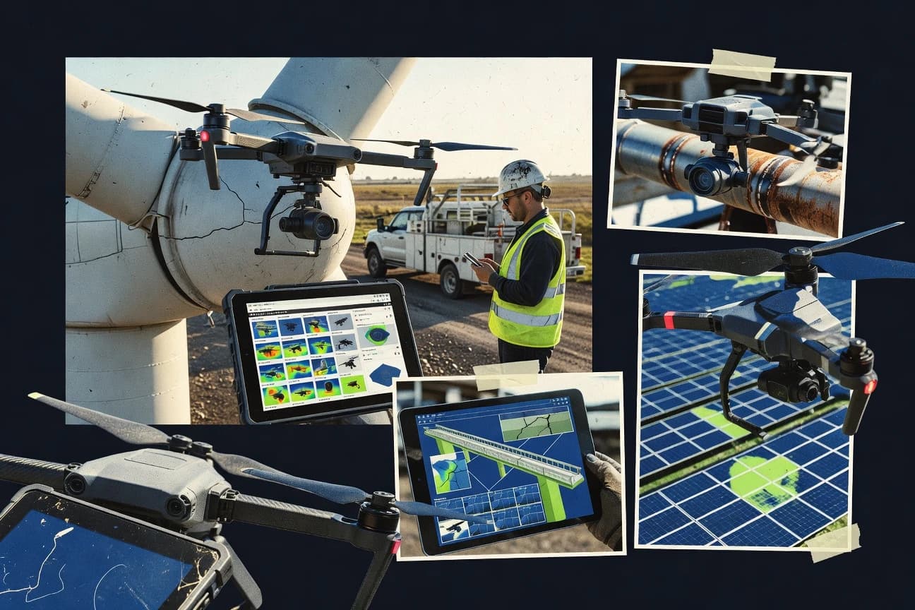
What Is Drone Inspection Software?
Drone inspection software turns drone imagery or laser data into inspection-ready deliverables such as orthomosaics, dense point clouds, 3D models, maps, measurement outputs, and organized project documentation. It also supports planning and capture workflows so inspections stay consistent across sites and repeated flight campaigns. Teams use these platforms to standardize documentation, reduce manual processing steps, and share results with stakeholders. Pix4D represents the photogrammetry and measurable deliverables workflow, while DroneDeploy represents drone-to-web inspection review with job-centric collaboration.
Key Features to Look For
The fastest path to inspection-grade outcomes depends on matching software capabilities to how your team captures data, processes it, and delivers evidence.
Georeferenced orthomosaics and dense point clouds for measurable outputs
Look for tools that produce georeferenced orthomosaics plus dense point clouds so inspections can be measured and documented. Pix4D is built around georeferenced dense point clouds and orthomosaics, and Pix4Dmatterport adds Matterport-style publishing when immersive spatial context matters.
End-to-end flight planning and consistent capture workflows
Choose software that standardizes mission setup so repeated inspections capture comparable coverage and camera settings. DroneDeploy automates flight planning and preflight checks, while Litchi centers on mission generation for consistent inspection imagery.
Inspection-oriented reporting and job history
Prioritize platforms that organize deliverables by inspection job so teams can track results and document histories. DroneDeploy provides job-based history with web sharing of maps and measurements, and Skyward provides project-based inspection workflows with centralized asset and report management.
Template-driven, repeatable inspection deliverables tied to georeferenced projects
For multi-site programs, standardized reporting reduces operator variability. Maptek AEROS uses template-driven inspection reporting tied to georeferenced project deliverables, and PrecisionHawk DataMapper focuses on repeatable inspection workflow structure with measurement-oriented maps and orthomosaics.
Guided capture-to-model workflows integrated into digital twin pipelines
If your inspection outputs must feed a digital twin ecosystem, select software that orchestrates capture, processing, and QA into structured models. Bentley iTwin Capture Modeler provides guided capture workflows and produces iTwin-ready structured models that connect to iTwin digital twin delivery.
Control-point georeferencing and metric photogrammetry controls
For survey-grade measurement confidence, select tools with explicit georeferencing and alignment controls. Agisoft Metashape includes ground control point alignment and georeferencing workflows that support measurement-grade models for inspection engineering.
How to Choose the Right Drone Inspection Software
Pick a tool by mapping your required deliverables and collaboration needs to the specific workflow strengths each platform is built for.
Start from deliverables, not from the drone footage
Decide whether you need georeferenced orthomosaics and dense point clouds, inspection-first maps with web review, or immersive 3D walkthrough views. Pix4D is the best match when your inspection team requires measurable orthomosaics and georeferenced dense point clouds, while DroneDeploy fits when you need shareable maps and measurements delivered through web-based inspection review.
Choose a workflow depth level that matches your team’s capability
If your team runs photogrammetry processing with defined control, Agisoft Metashape offers dense point clouds, meshes, textured models, and ground control point georeferencing for metric inspection workflows. If you need guided, standardized operations with less manual processing overhead, DroneDeploy and Skyward emphasize inspection workflow structure and centralized documentation instead of deep photogrammetry controls.
Verify capture repeatability for your flight campaigns
For recurring inspections, select software that controls planning and capture consistency. DroneDeploy automates flight planning and preflight checks, DJI Pilot 2 provides waypoint mission execution with live telemetry and mission status for DJI enterprise workflows, and Litchi supports mission generation for consistent capture across repeat runs.
Align reporting and collaboration with stakeholder expectations
If stakeholders need to view and comment on maps and measurement outputs without downloading datasets, DroneDeploy’s web sharing is designed for this job-centric inspection review. If your organization needs role-based review and centralized deliverable organization across multi-stakeholder inspections, Skyward provides centralized asset and report management with role-based access.
Match your enterprise pipeline and interoperability requirements
When inspections must become structured digital twin inputs, Bentley iTwin Capture Modeler guides capture and processing into iTwin-ready models. When your deliverables are primarily engineering survey outputs with strong metric georeferencing controls, Pix4D and Agisoft Metashape focus on measurable outputs, while Maptek AEROS and PrecisionHawk DataMapper emphasize repeatable inspection deliverables and templates.
Who Needs Drone Inspection Software?
These tools serve different inspection maturity levels, from field capture repeatability to photogrammetry production to stakeholder-ready delivery.
Engineering and surveying teams producing measurement-grade 3D inspection outputs
Pix4D is a strong fit for teams that need georeferenced dense point clouds and orthomosaics for measurable inspection deliverables. Agisoft Metashape is a strong fit when teams need control-point georeferencing and deeper photogrammetry controls for metric inspection workflows.
Industrial operators running recurring inspections that require web-based review and job histories
DroneDeploy supports guided planning and capture plus web sharing of maps and measurements tied to specific jobs, which suits teams that want client-ready review without handling raw datasets. Skyward fits operations teams that need centralized inspection project workflows with stakeholder reporting and role-based access.
Mining and infrastructure programs standardizing inspection templates across sites
Maptek AEROS supports end-to-end drone planning through photogrammetry processing and template-driven reporting tied to georeferenced project deliverables. PrecisionHawk DataMapper supports repeatable inspection documentation across multiple sites with measurement-oriented maps and orthomosaics.
Enterprise digital twin teams converting reality capture into iTwin-ready structured models
Bentley iTwin Capture Modeler is built for guided capture-to-model workflows that produce iTwin-ready outputs for inspection context and digital twin delivery. Pix4D can also support 3D deliverables, while iTwin Capture Modeler targets the structured pipeline into iTwin rather than standalone inspection review.
Common Mistakes to Avoid
The recurring failure modes across these platforms come from mismatching workflow complexity, capture repeatability, and delivery expectations.
Underestimating photogrammetry workflow setup complexity
Pix4D and Agisoft Metashape both generate dense point clouds and georeferenced or control-point aligned outputs, which means teams without photogrammetry experience can face complex workflow setup. If your priority is fast inspection review and standardized job delivery, DroneDeploy or Skyward offers an inspection-first workflow with web review and centralized documentation.
Expecting lightweight defect tagging from full 3D reconstruction tools
Pix4Dmatterport is designed for full photogrammetry workflows that produce immersive, walkthrough-ready 3D inspection views, which can be slower than simple annotation tools for rapid defect tagging. If you mainly need mission repeatability and organized field documentation, Litchi and DJI Pilot 2 focus on structured capture and in-field mission control rather than full reconstruction.
Capturing inconsistent imagery and then trying to fix it during processing
Tools like DroneDeploy, Litchi, and DJI Pilot 2 emphasize repeatable mission planning to maintain consistent capture and comparable imagery coverage. Without disciplined flight planning and consistent ground coverage, even strong processing tools like Pix4D can produce outputs that depend heavily on input quality.
Choosing a tool that does not match your stakeholder delivery needs
DroneDeploy is built for web-based inspection review with shareable maps and measurements, so expecting centralized stakeholder organization like Pix4D outputs alone can leave review gaps. Skyward provides project-based inspection workflows with role-based access and centralized asset and report management for controlled sharing.
How We Selected and Ranked These Tools
We evaluated each tool across overall capability, feature strength, ease of use, and value for inspection workflows using drone-to-inspection deliverable outcomes. Pix4D separated itself by combining automated processing with reliable georeferencing and survey-grade deliverables such as orthomosaics and georeferenced dense point clouds that support measurable inspection documentation. DroneDeploy ranked strongly because it connects guided planning and capture to web-based inspection review with job-centric collaboration and stakeholder sharing. We placed Maptek AEROS, Bentley iTwin Capture Modeler, and Agisoft Metashape where they fit best: structured reporting templates for standardized programs, iTwin pipeline integration for enterprise digital twins, and ground control point aligned metric photogrammetry for survey-grade models.
Frequently Asked Questions About Drone Inspection Software
Which drone inspection software is best for producing survey-grade 3D deliverables from drone imagery?
What tool is strongest for repeatable inspection workflows with web-based review and stakeholder collaboration?
Which option works best for template-driven reporting that stays consistent across multiple sites and operators?
How do I choose software for digital twin-ready inspection models instead of just orthomosaics?
Which software is best when my team wants consistent flight planning and capture settings across survey runs?
Which tool should I use if my deliverable needs include measurement-ready outputs like orthomosaics and maps?
What software is best for quality reporting and georeferencing workflows in photogrammetry processing?
Which option helps when I need controlled inspection project organization instead of only image processing?
What is a practical choice for sharing 3D inspected spaces with stakeholders who do not need GIS expertise?
Tools reviewed
Primary sources checked during evaluation.
Referenced in the comparison table and product reviews above.
Keep exploring
Comparing two specific tools?
Software Alternatives
See head-to-head software comparisons with feature breakdowns, pricing, and our recommendation for each use case.
Explore software alternatives→In this category
Technology Digital Media alternatives
See side-by-side comparisons of technology digital media tools and pick the right one for your stack.
Compare technology digital media tools→FOR SOFTWARE VENDORS
Not on this list? Let’s fix that.
Our best-of pages are how many teams discover and compare tools in this space. If you think your product belongs in this lineup, we’d like to hear from you—we’ll walk you through fit and what an editorial entry looks like.
Apply for a ListingWHAT THIS INCLUDES
Where buyers compare
Readers come to these pages to shortlist software—your product shows up in that moment, not in a random sidebar.
Editorial write-up
We describe your product in our own words and check the facts before anything goes live.
On-page brand presence
You appear in the roundup the same way as other tools we cover: name, positioning, and a clear next step for readers who want to learn more.
Kept up to date
We refresh lists on a regular rhythm so the category page stays useful as products and pricing change.