GITNUXSOFTWARE ADVICE
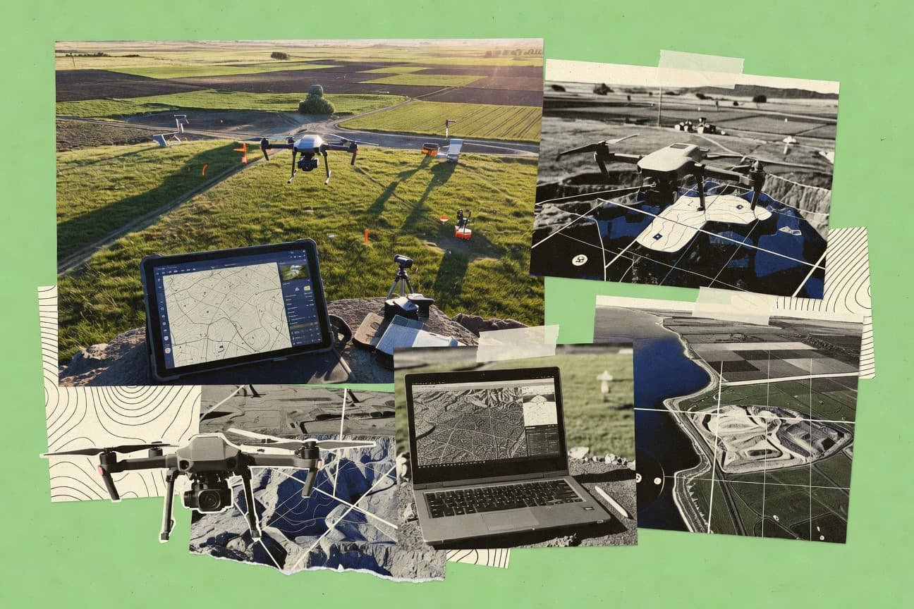
Technology Digital MediaTop 10 Best Drone Mapping Software of 2026
Discover the top 10 drone mapping software for accurate surveys & analysis.

How we ranked these tools
Core product claims cross-referenced against official documentation, changelogs, and independent technical reviews.
Analyzed video reviews and hundreds of written evaluations to capture real-world user experiences with each tool.
AI persona simulations modeled how different user types would experience each tool across common use cases and workflows.
Final rankings reviewed and approved by our editorial team with authority to override AI-generated scores based on domain expertise.
Score: Features 40% · Ease 30% · Value 30%
Gitnux may earn a commission through links on this page — this does not influence rankings. Editorial policy
Editor’s top 3 picks
Three quick recommendations before you dive into the full comparison below — each one leads on a different dimension.
Pix4Dmapper
Reprojection error and accuracy reports for validating GCP and georeferencing quality
Built for survey teams needing accurate orthomosaics and 3D outputs from drone imagery.
Agisoft Metashape
Editor pickAdvanced camera alignment and dense reconstruction with configurable quality and filtering parameters
Built for teams generating high-accuracy photogrammetry deliverables with parametric control.
DroneDeploy
Editor pickAutomated flight planning paired with web deliverables for rapid orthomosaic and volumetrics review
Built for construction and surveying teams needing repeatable drone mapping and collaboration.
Related reading
Comparison Table
This comparison table evaluates drone mapping software across photogrammetry workflows, output quality, and project handoff features for survey, construction, and mining use cases. You’ll compare tools such as Pix4Dmapper, Agisoft Metashape, DroneDeploy, RealityCapture, and Trimble Inpho to see which platforms fit specific hardware, data processing, and collaboration needs.
Pix4Dmapper
photogrammetryGenerates georeferenced orthomosaics, 2D maps, DSMs, and point clouds from drone imagery with automation for photogrammetry workflows.
Reprojection error and accuracy reports for validating GCP and georeferencing quality
Pix4Dmapper stands out for producing survey-grade outputs from photogrammetry with strong control over processing settings. It supports georeferencing with GPS and manual ground control points, then exports orthomosaics, dense point clouds, and textured 3D models.
The workflow includes quality assessment tools like reprojection error reports and coverage checks to help you validate accuracy before delivering results. It also integrates with Pix4Dfields for map management and with many common drone camera workflows through project import and standard image formats.
- +High-accuracy photogrammetry with adjustable processing parameters
- +Reliable georeferencing with GPS support and ground control point workflows
- +Exports orthomosaics, dense point clouds, and textured 3D models
- –Learning the processing settings takes time for precise survey results
- –Hardware requirements can become heavy on large image sets
Best for: Survey teams needing accurate orthomosaics and 3D outputs from drone imagery
More related reading
Agisoft Metashape
photogrammetryProcesses aerial and drone imagery to produce dense point clouds, meshes, orthomosaics, and measurements with scripting and model controls.
Advanced camera alignment and dense reconstruction with configurable quality and filtering parameters
Agisoft Metashape stands out for producing photogrammetry outputs from overlapping drone imagery with tight control over camera alignment and reconstruction settings. It supports dense point clouds, textured meshes, orthomosaics, and DEM generation from the same image dataset.
Processing handles large projects with tiled exporting and configurable quality settings for different hardware limits. It also integrates with common georeferencing workflows using coordinate systems, GCPs, and camera priors to improve metric accuracy.
- +High-fidelity dense point clouds from raw drone imagery and flexible reconstruction settings
- +Accurate metric workflows using GCPs, camera calibration, and coordinate system support
- +Exports textured meshes, orthomosaics, DEMs, and tiled deliverables for production pipelines
- +Strong performance controls for quality, filtering, and memory management on large surveys
- –Photogrammetry quality depends on image coverage and parameter tuning skill
- –UI and workflow steps feel complex versus simpler one-click mapping tools
- –Requires substantial compute and storage for dense reconstructions
- –Automation for large batch jobs is less streamlined than dedicated cloud mappers
Best for: Teams generating high-accuracy photogrammetry deliverables with parametric control
DroneDeploy
cloud platformTurns drone flights into processed orthomosaics and deliverables in a cloud workflow with project management for mapping data.
Automated flight planning paired with web deliverables for rapid orthomosaic and volumetrics review
DroneDeploy stands out with an end-to-end drone-to-map workflow that turns captured flights into shareable inspection outputs. It supports automated capture planning, photogrammetry processing, and measurements inside a web workspace.
Teams can generate deliverables such as orthomosaics, 2D maps, 3D models, and volumetrics for construction and surveying use cases. It also emphasizes collaboration by letting stakeholders review and comment on projects without downloading GIS software.
- +Automated mission planning and consistent mapping workflows reduce setup time
- +Web-based outputs support stakeholder review without specialized GIS tooling
- +Strong photogrammetry deliverables for orthomosaics and 3D models
- +Volumetric measurement workflows fit construction progress tracking
- –Processing and rendering complexity can slow results for large projects
- –Export flexibility is limited compared with full GIS and CAD ecosystems
- –Workflow tuning for best accuracy can require operator practice
- –Collaboration features add cost at scale for multi-site operations
Best for: Construction and surveying teams needing repeatable drone mapping and collaboration
RealityCapture
reconstructionCreates high-detail reconstructions from drone images using fast alignment, dense reconstruction, and scalable export options.
High-speed photogrammetry reconstruction with dense point clouds and textured meshes
RealityCapture is a photogrammetry engine focused on fast, high-accuracy reconstruction from drone imagery. It provides dense point clouds, meshes, and textured models with survey-grade outputs when calibrated camera metadata and ground control points are used.
The workflow supports aligning images, optimizing camera parameters, and generating orthophotos and digital surface models from the same project. Its key differentiator is performance-oriented processing and strong reconstruction quality for large datasets.
- +High-quality dense reconstructions from large drone image sets
- +Survey-grade georeferencing with camera calibration and ground control
- +Reliable orthophoto and DSM generation from a single processing project
- +Fast compute performance for photogrammetry workflows
- –Setup and parameter tuning require experienced photogrammetry users
- –Workspace and controls can feel complex for first-time operators
- –License costs can be high for small teams with occasional projects
Best for: Survey and AEC teams needing accurate photogrammetry outputs
Trimble Inpho
enterprise mappingProvides photogrammetry software for aerial image processing and automated mapping with rigorous georeferencing workflows.
Integrated ground control and georeferencing workflow for survey-accurate photogrammetry outputs
Trimble Inpho stands out for end-to-end photogrammetry workflows built around precise ground control and survey-grade output. It supports aerial and terrestrial image processing, dense point cloud and mesh generation, and georeferenced orthomosaics tied to coordinate systems.
The software fits survey and mapping teams that need repeatable processing across multiple projects and deliverables. It also requires careful data prep and hardware capacity management for consistent reconstruction quality.
- +Survey-grade georeferencing with coordinate system and ground control integration
- +Robust photogrammetry pipeline for dense clouds, meshes, and orthomosaics
- +Batch-friendly processing for consistent multi-project production workflows
- +Strong handling of aerial and terrestrial datasets in one toolchain
- –Workflow setup and parameter tuning take training and mapping experience
- –Hardware demands rise quickly for large image sets and dense outputs
- –User interface can feel technical compared with lighter cloud map tools
- –Licensing and deployment complexity can raise total project overhead
Best for: Survey teams producing control-driven orthomosaics, meshes, and point clouds
OpenDroneMap
open-sourceProcesses drone imagery into orthophotos, point clouds, and DSM outputs using an open-source pipeline and command-line automation.
Open-source photogrammetry pipeline that generates orthomosaics and DSM and DTM outputs
OpenDroneMap stands out for turning drone imagery into geospatial outputs without heavy proprietary lock-in. It supports common SfM and MVS pipelines to generate orthophotos, digital surface models, and digital elevation models.
The workflow centers on a command-line processing engine and an exportable results set that fits GIS and photogrammetry toolchains. It also provides dataset publishing through the OpenDroneMap ecosystem for sharing processed maps.
- +Produces orthomosaics plus surface and terrain models from standard drone photo sets
- +Open-source pipeline supports advanced photogrammetry runs and repeatable processing
- +Export-friendly outputs integrate into GIS workflows for further analysis
- –Command-line workflow adds setup effort compared with GUI-first mapping tools
- –Requires careful input configuration to avoid poor alignment and noisy models
- –Limited built-in collaboration features compared with full SaaS mapping suites
Best for: Cost-focused teams processing imagery locally into GIS-ready orthomosaics and terrain models
DJI Terra
DJI-focusedGenerates orthomosaics and 3D models from DJI drone images with survey-ready outputs for field mapping workflows.
One-click reconstruction workflow that turns DJI imagery into orthomosaics, point clouds, and 3D models
DJI Terra focuses on end-to-end drone mapping with DJI hardware workflows that support photogrammetry and terrain generation. It provides ground control workflows, point cloud outputs, and map deliverables for surveying, inspection, and planning.
The software emphasizes reconstruction speed and practical exports over deep customization of processing algorithms. Collaboration is mainly driven through project files and exported datasets rather than browser-based review.
- +Direct integration with DJI drones for capture-to-processing workflows
- +Fast photogrammetry reconstruction and terrain generation outputs
- +Ground control support helps improve georeferenced accuracy
- +Exports point clouds, meshes, and orthomosaics for downstream CAD or GIS
- –Processing options are less configurable than specialized photogrammetry tools
- –Team review and markup are limited compared with cloud mapping platforms
- –Higher accuracy workflows require careful flight planning and control setup
- –Cost can be high for small teams compared with broader value mapping suites
Best for: Surveying and inspection teams using DJI drones for quick reconstructions
Propeller Aero
managed mappingProduces drone mapping deliverables and managed geospatial processing services for orthomosaics and 3D models.
Automated photogrammetry processing pipeline that turns captured imagery into mapping deliverables
Propeller Aero focuses on drone-to-delivery mapping by running photogrammetry and producing project-ready outputs tied to fieldwork. It supports mission data ingestion and processing pipelines for orthomosaics, 3D models, and measurement workflows used in asset and construction contexts.
The platform emphasizes repeatable results for teams that need consistent deliverables across sites. It is better viewed as an end-to-end mapping workflow system than a manual processing toolbox.
- +End-to-end drone mapping workflow with consistent deliverable generation
- +Processes imagery into orthomosaics and 3D outputs for measurement use
- +Project management supports repeatable work across multiple sites
- –Setup and processing workflow can feel heavier than simpler mapping portals
- –Less flexible for teams wanting highly customized photogrammetry controls
- –Collaboration and review tooling is not as comprehensive as top enterprise suites
Best for: Mid-size mapping teams needing consistent deliverables across recurring projects
Pix4Dcloud
cloud collaborationCollaborative cloud platform for processing and sharing Pix4D deliverables with team review and geospatial outputs.
Web-based Pix4D processing with cloud computation for photogrammetric outputs
Pix4Dcloud focuses on web-based photogrammetry processing from standard drone imagery, with cloud computation for faster turnaround. It provides automated alignment, dense point cloud generation, and orthomosaic and DSM outputs using Pix4D’s photogrammetry pipeline.
Project sharing and collaboration are built into the cloud workflow, which reduces the need for local processing hardware. The platform is strongest when teams want consistent processing for recurring mapping projects and standardized deliverable generation.
- +Cloud processing accelerates orthomosaic and DSM production without local GPU requirements
- +Automated photogrammetry pipeline generates deliverables with consistent settings
- +Built-in project sharing supports review and collaboration across teams
- +Works well for repeatable mapping workflows with standardized outputs
- –Uploading large drone datasets can be slow on limited internet connections
- –Advanced control options are less direct than desktop-only Pix4D workflows
- –Cost increases with team usage and recurring processing needs
- –Export and downstream integration can require extra manual steps
Best for: Teams needing consistent cloud drone mapping deliverables with collaboration
Map Pilot
web mappingCreates map outputs from drone imagery using a guided workflow for orthomosaics and 3D models with browser-based review.
Web-based project workflow that manages drone mapping processing jobs and deliverable exports
Map Pilot focuses on end-to-end drone mapping workflows that turn flight outputs into shareable mapping deliverables. It supports common photogrammetry and geospatial deliverable creation with a web-based project workflow that reduces tool switching.
Users get organized processing jobs and review-friendly exports for stakeholders who need finished maps and models. The solution is best evaluated by teams who want consistent project handling more than custom pipelines or deep automation scripting.
- +Web workflow organizes drone projects from upload to deliverable creation
- +Processing job management keeps teams aligned during map generation
- +Exports are positioned for straightforward stakeholder sharing
- –Advanced customization for bespoke processing pipelines is limited
- –Collaboration and review tooling feels basic versus top workflow suites
- –Value drops for small teams needing low-volume processing
Best for: Teams standardizing drone mapping deliverables with minimal pipeline customization
Conclusion
After evaluating 10 technology digital media, Pix4Dmapper stands out as our overall top pick — it scored highest across our combined criteria of features, ease of use, and value, which is why it sits at #1 in the rankings above.
Use the comparison table and detailed reviews above to validate the fit against your own requirements before committing to a tool.
How to Choose the Right Drone Mapping Software
This buyer's guide helps you choose drone mapping software for photogrammetry, orthomosaics, DSMs, dense point clouds, and 3D model deliverables. It covers Pix4Dmapper, Agisoft Metashape, DroneDeploy, RealityCapture, Trimble Inpho, OpenDroneMap, DJI Terra, Propeller Aero, Pix4Dcloud, and Map Pilot. You will get feature checklists, “who needs what” recommendations, pricing expectations, and common buying mistakes mapped to concrete tool strengths and weaknesses.
What Is Drone Mapping Software?
Drone mapping software turns overlapping drone images into geospatial deliverables like orthomosaics, DSMs, dense point clouds, and textured 3D models. It solves the workflow gap between image capture and production mapping by handling camera alignment, reconstruction, and georeferencing with GPS and ground control points. Tools like Pix4Dmapper and Agisoft Metashape are desktop photogrammetry solutions that produce survey-grade outputs with adjustable reconstruction settings. Cloud and workflow platforms like Pix4Dcloud and DroneDeploy focus on processing and collaboration around standardized deliverables without requiring local GPU-heavy work.
Key Features to Look For
These features determine whether your software can produce accurate, deliverable-ready maps at the speed and operational complexity your team can sustain.
Georeferencing validation with accuracy and reprojection reporting
Pix4Dmapper includes reprojection error and accuracy reports that help you validate GCP and georeferencing quality before delivery. RealityCapture also supports survey-grade georeferencing when you use calibrated camera metadata and ground control points.
Survey-grade control workflows with GCPs and coordinate systems
Trimble Inpho is built around integrated ground control and georeferencing workflows that produce orthomosaics tied to coordinate systems. Agisoft Metashape supports coordinate systems, GCPs, and camera priors to improve metric accuracy for orthomosaics, DEMs, and measurements.
Dense reconstruction controls and quality tuning
Agisoft Metashape provides configurable quality and filtering parameters for dense point clouds, meshes, orthomosaics, and DEM generation. RealityCapture differentiates with fast alignment and dense reconstruction performance for large drone image sets.
Deliverable coverage for orthomosaics, DSMs, DEMs, and textured 3D models
Pix4Dmapper exports orthomosaics, dense point clouds, and textured 3D models from the same photogrammetry workflow. Agisoft Metashape and OpenDroneMap both generate terrain and surface outputs like orthomosaics plus surface models and terrain models, with OpenDroneMap producing orthophotos plus DSM and DTM outputs.
Repeatable drone-to-map workflows with project collaboration
DroneDeploy combines automated flight planning with a web workspace for orthomosaic and volumetrics review and stakeholder collaboration. Pix4Dcloud and Map Pilot emphasize web-based processing and project sharing so teams can review deliverables without local processing hardware.
Cloud processing to reduce local hardware constraints
Pix4Dcloud runs photogrammetry in the cloud to accelerate orthomosaic and DSM production without requiring local GPU compute. Desktop options like Pix4Dmapper and Agisoft Metashape can become hardware heavy on large image sets, so cloud processing becomes a practical fit when you want faster turnaround without local scaling.
How to Choose the Right Drone Mapping Software
Pick the tool that matches your accuracy requirements, your deliverable format needs, and your team’s tolerance for local compute complexity versus managed cloud workflows.
Start with the exact deliverables you must produce
If you need survey-grade orthomosaics plus dense point clouds and textured 3D models, Pix4Dmapper is a direct fit because it exports orthomosaics, dense point clouds, and textured models. If you also need DEM generation in the same pipeline, Agisoft Metashape produces orthomosaics and DEMs while RealityCapture generates orthophotos and DSMs from one project.
Choose your georeferencing and control level
For teams that must verify accuracy using reprojection error, Pix4Dmapper’s reprojection error and accuracy reports align with that requirement. For rigorous control-driven workflows tied to coordinate systems, Trimble Inpho integrates ground control and georeferencing into a production pipeline.
Match processing flexibility to your operator skill and time
If your team can tune processing settings for optimal results, Agisoft Metashape and RealityCapture offer deep control via camera alignment and reconstruction settings. If you want less operational friction, DroneDeploy and Map Pilot focus on guided web workflows that organize capture-to-deliverable steps without demanding expert parameter tuning every time.
Decide between local processing and managed cloud computation
If you want local execution with strong control, Pix4Dmapper and Agisoft Metashape run photogrammetry on your compute and can become heavy on large image sets. If you want orthomosaic and DSM production accelerated without local GPU needs, Pix4Dcloud uses cloud computation and keeps the photogrammetry pipeline standardized.
Select collaboration and review based on your stakeholder workflow
If multiple stakeholders must review outputs in a web workspace, DroneDeploy provides web-based deliverables and supports comment and collaboration without downloading GIS software. If you rely on repeatable project processing and internal team review, Pix4Dcloud and Map Pilot emphasize web-based sharing and browser-accessible project handling.
Who Needs Drone Mapping Software?
Different mapping teams buy drone mapping software for different constraints like survey accuracy, deliverable consistency, collaboration needs, and local compute cost.
Survey teams needing accurate orthomosaics and 3D outputs
Pix4Dmapper is a strong match because it supports GPS and manual GCP workflows and provides reprojection error and accuracy reports for validation. RealityCapture and Trimble Inpho also fit survey and AEC requirements with survey-grade georeferencing using camera calibration and ground control points.
Teams that want parametric control over high-accuracy photogrammetry outputs
Agisoft Metashape is built for advanced control with configurable quality and filtering parameters plus detailed camera alignment settings. Teams using it typically benefit from its dense reconstruction flexibility, tiled exporting, and robust memory management for large surveys.
Construction and surveying teams that need repeatable workflows plus collaboration
DroneDeploy is optimized for automated mission planning and web deliverables that support rapid orthomosaic and volumetrics review. Pix4Dcloud is a strong option when you want standardized deliverables from consistent cloud processing and built-in project sharing for teams.
Cost-focused teams processing imagery locally into GIS-ready outputs
OpenDroneMap is free to use and focuses on an open-source command-line pipeline that produces orthophotos plus DSM and DTM outputs for GIS integration. This segment usually accepts command-line setup effort to avoid recurring SaaS processing costs.
Common Mistakes to Avoid
Common buying mistakes come from mismatching accuracy validation needs, deliverable expectations, and operational complexity between desktop, cloud, and guided workflow tools.
Ignoring georeferencing validation and delivery accuracy checks
If you need proof of georeferencing quality, Pix4Dmapper’s reprojection error and accuracy reports support that validation step before you deliver. Tools like DroneDeploy can produce orthomosaics and volumetrics, but you should not assume they provide the same depth of accuracy reporting as Pix4Dmapper for control-driven survey work.
Picking a tool with insufficient export flexibility for your downstream stack
DroneDeploy limits export flexibility compared with full GIS and CAD ecosystems, which can slow integration when you need multiple downstream formats. Pix4Dmapper and Agisoft Metashape provide broader deliverable exports like orthomosaics, dense point clouds, textured 3D models, and DEMs that support more varied pipelines.
Overestimating how much automation removes operator responsibility for accuracy
DJI Terra provides a one-click reconstruction workflow for DJI images, but higher accuracy still requires careful flight planning and ground control setup. RealityCapture and Agisoft Metashape can deliver survey-grade results only when you invest in camera metadata quality and ground control workflows.
Choosing a command-line open-source pipeline without planning for setup effort
OpenDroneMap uses command-line automation, which adds setup effort compared with GUI-first mapping portals. If your team cannot support careful input configuration, you may get poor alignment and noisy models, so evaluate a guided web workflow like Map Pilot or DroneDeploy instead.
How We Selected and Ranked These Tools
We evaluated Pix4Dmapper, Agisoft Metashape, DroneDeploy, RealityCapture, Trimble Inpho, OpenDroneMap, DJI Terra, Propeller Aero, Pix4Dcloud, and Map Pilot across overall performance, feature depth, ease of use, and value. We prioritized tools that produce survey-relevant outputs like georeferenced orthomosaics, DSMs, dense point clouds, and textured 3D models while supporting GCP and coordinate system workflows when required. Pix4Dmapper separated itself with strong accuracy validation because it includes reprojection error and accuracy reports tied to GCP and georeferencing quality. Lower-ranked tools typically traded away either deep processing control or accuracy reporting for guided workflows, lighter operational complexity, or more limited export and customization options.
Frequently Asked Questions About Drone Mapping Software
Which tools are best for survey-grade accuracy with ground control and error reporting?
How do Pix4Dmapper and RealityCapture differ when you need fast dense reconstruction from large drone datasets?
Which software is most suitable for teams that want collaboration and review without switching to GIS tools?
What are the main differences between Pix4Dcloud and OpenDroneMap when computing on local hardware vs cloud?
Do I need a free option if my project is cost-sensitive, and which tool supports that?
Which tool is best when you need consistent deliverables across recurring sites with repeatable processing?
Which software is most appropriate if my workflow depends on DJI hardware and quick reconstructions?
What common data-prep and hardware limitations should I plan for with desktop photogrammetry tools?
If I need to generate both 3D models and terrain outputs, which tools cover the full deliverable set?
Tools reviewed
Primary sources checked during evaluation.
Referenced in the comparison table and product reviews above.
Keep exploring
Comparing two specific tools?
Software Alternatives
See head-to-head software comparisons with feature breakdowns, pricing, and our recommendation for each use case.
Explore software alternatives→In this category
Technology Digital Media alternatives
See side-by-side comparisons of technology digital media tools and pick the right one for your stack.
Compare technology digital media tools→FOR SOFTWARE VENDORS
Not on this list? Let’s fix that.
Our best-of pages are how many teams discover and compare tools in this space. If you think your product belongs in this lineup, we’d like to hear from you—we’ll walk you through fit and what an editorial entry looks like.
Apply for a ListingWHAT THIS INCLUDES
Where buyers compare
Readers come to these pages to shortlist software—your product shows up in that moment, not in a random sidebar.
Editorial write-up
We describe your product in our own words and check the facts before anything goes live.
On-page brand presence
You appear in the roundup the same way as other tools we cover: name, positioning, and a clear next step for readers who want to learn more.
Kept up to date
We refresh lists on a regular rhythm so the category page stays useful as products and pricing change.