GITNUXSOFTWARE ADVICE
Technology Digital MediaTop 10 Best Drone Measurement Software of 2026
Discover the top 10 best drone measurement software for accurate mapping and surveying. Find the best tools to streamline your projects.

How we ranked these tools
Core product claims cross-referenced against official documentation, changelogs, and independent technical reviews.
Analyzed video reviews and hundreds of written evaluations to capture real-world user experiences with each tool.
AI persona simulations modeled how different user types would experience each tool across common use cases and workflows.
Final rankings reviewed and approved by our editorial team with authority to override AI-generated scores based on domain expertise.
Score: Features 40% · Ease 30% · Value 30%
Gitnux may earn a commission through links on this page — this does not influence rankings. Editorial policy
Editor picks
Three quick recommendations before you dive into the full comparison below — each one leads on a different dimension.
DroneDeploy
Automated volume measurement for stockpiles, earthwork, and progress comparisons
Built for teams needing fast drone mapping and volume measurement with collaborative review.
Pix4Dfields
Runner UpCrop health map generation from field imagery with support for time-based comparisons
Built for agronomy teams producing repeatable field maps and measurements from drone imagery.
Agisoft Metashape
Also GreatGeoreferencing and scaling with control points and coordinate system support
Built for survey and mapping teams needing accurate photogrammetric reconstructions.
Related reading
Comparison Table
This comparison table contrasts drone measurement software used for mapping, orthomosaics, and 3D reconstruction across platforms such as DroneDeploy, Pix4Dfields, Pix4Dmapper, Agisoft Metashape, and DJI Terra. It highlights practical differences in drone workflow, data processing capabilities, output types, and typical best-fit use cases so buyers can match each tool to project requirements.
DroneDeploy
cloud mappingCloud platform that processes drone imagery into maps, orthomosaics, and volumetric measurements for field workflows.
Automated volume measurement for stockpiles, earthwork, and progress comparisons
DroneDeploy stands out by turning drone flights into shareable measurement outputs with a guided, browser-based workflow. It supports mapping and progress analysis through orthomosaics, 3D models, and volume calculations for construction and surveying use cases.
Collaboration features like commenting and exportable deliverables help teams move from capture to decision without stitching together separate tools. The platform also integrates with common drone models to streamline data capture and processing.
- +Generates orthomosaics, 3D models, and volume measurements from a guided pipeline
- +Web collaboration supports review, sharing, and export of measurement outputs
- +Built-in flight planning reduces setup friction for repeatable surveys
- +Works with multiple drone platforms for consistent capture-to-deliver workflow
- +Progress and site comparisons support construction and asset tracking workflows
- –Advanced parameter control can feel limited compared with full desktop photogrammetry
- –Large datasets can require more planning for processing and review performance
- –Measurement accuracy depends heavily on capture settings and ground control choices
Best for: Teams needing fast drone mapping and volume measurement with collaborative review
More related reading
Pix4Dfields
photogrammetryAgriculture-focused drone photogrammetry software that generates georeferenced maps and delivers yield, coverage, and measurement outputs.
Crop health map generation from field imagery with support for time-based comparisons
Pix4Dfields stands out for turning drone imagery into agronomic deliverables like crop health maps and field-level analytics. It supports common photogrammetry workflows with dense point clouds, orthomosaics, and metric outputs tied to georeferenced accuracy. The platform emphasizes repeatable field processing and measurement exports for agronomy teams managing multiple flights.
- +Crop-ready outputs including orthomosaics and thematic field maps for agronomy workflows
- +Georeferenced metric products support measurement and site-wide comparisons across flights
- +Reliable photogrammetry pipeline for dense point clouds and accurate terrain reconstruction
- –Advanced processing settings require training for consistent results
- –Large-area projects can stress hardware and lengthen end-to-end processing time
- –Collaboration and review workflows feel lighter than dedicated enterprise GIS platforms
Best for: Agronomy teams producing repeatable field maps and measurements from drone imagery
Pix4Dmapper
desktop photogrammetryDesktop photogrammetry suite that turns overlapping drone images into orthomosaics, 3D models, and measurement layers.
Integrated ground control points and georeferencing for measurement-grade orthomosaics and DSMs
Pix4Dmapper turns overlapping drone photos into photogrammetry outputs like orthomosaics, dense point clouds, and textured 3D models. Its distinct strength is a mature workflow that supports control points and georeferencing for measurement-grade deliverables.
Automated processing steps help reduce manual intervention from image import through alignment, densification, and DSM or orthomosaic generation. Export options support common GIS and survey deliverable formats used in construction, mapping, and inspection projects.
- +Strong georeferencing with ground control points for survey-grade outputs
- +Exports include orthomosaics, DSM, dense point clouds, and textured 3D models
- +Reliable photogrammetry pipeline with automated alignment and reconstruction steps
- –Workflow can require calibration choices to avoid alignment quality issues
- –Processing performance depends heavily on hardware and dataset size
- –Advanced measurement outputs need careful setup to match project accuracy goals
Best for: Survey and construction teams needing accurate georeferenced photogrammetry deliverables
Agisoft Metashape
desktop photogrammetryPhotogrammetry application that reconstructs 3D scenes from drone images and supports distance, area, and volume measurement.
Georeferencing and scaling with control points and coordinate system support
Agisoft Metashape stands out for dense photogrammetry workflows that convert overlapping imagery into metrically scaled 3D models, point clouds, and orthomosaics. It supports processing chains like tie-point generation, camera alignment, dense reconstruction, and georeferencing workflows for survey and mapping deliverables.
The software is well suited for repeatable reconstruction across sites, with exports for GIS and CAD oriented deliverables. It can be resource intensive on large datasets and relies on careful input image quality and coverage planning for reliable metric results.
- +Strong dense reconstruction that outputs textured meshes and dense point clouds
- +Georeferencing and scaling using control points for survey grade outputs
- +Flexible processing pipeline with intermediate products for QC and reprocessing
- –Large projects require substantial RAM, GPU, and storage for smooth processing
- –Accuracy depends heavily on capture overlap, calibration quality, and ground control
- –Workflow complexity can slow teams without photogrammetry experience
Best for: Survey and mapping teams needing accurate photogrammetric reconstructions
DJI Terra
survey processingDrone imagery processing tool that produces orthomosaics and DSM outputs and exports measurement-ready results for surveys.
Volume calculation tools on reconstructed terrain surfaces
DJI Terra stands out by turning DJI drone data into measurement-ready outputs through a workflow tightly aligned to DJI imaging and mission exports. It supports photogrammetry processing for orthomosaics, 3D models, and point clouds, then enables measurement and annotation on the generated results.
The software also includes terrain and volume-oriented tools that support quantity takeoffs from reconstructed surfaces. Output quality and repeatability depend on capture settings and ground control usage rather than only on processing automation.
- +Photogrammetry workflow produces orthomosaics, 3D models, and point clouds from drone imagery
- +Measurement and annotation tools work directly on generated reconstructions
- +Terrain and volume tools support practical earthwork and stockpile calculations
- +Processing pipeline is consistent with DJI mission exports for predictable results
- –Capture quality and ground control affect measurements more than the interface implies
- –Less suitable for non-DJI datasets compared with broader third-party photogrammetry tools
- –Advanced quality controls require more operator attention to avoid processing artifacts
Best for: DJI drone teams needing rapid photogrammetry, measurement, and volume reports
OpenDroneMap
open-source pipelineOpen-source photogrammetry pipeline that generates orthomosaics, 3D meshes, and survey products from drone images.
Automated SfM and MVS photogrammetry to generate orthophotos and DEMs
OpenDroneMap stands out for processing raw drone imagery into georeferenced mapping outputs using open-source photogrammetry workflows. It supports dense point clouds, orthophotos, and digital elevation models built from standard SfM and MVS pipelines.
The tool also enables exports for GIS use, including common raster and vector-ready deliverables depending on chosen processing steps. Its core strength is repeatable, scriptable processing rather than a single guided measurement interface.
- +Open-source photogrammetry pipeline for orthophotos and elevation models
- +Produces dense point clouds, DEMs, and related GIS-friendly outputs
- +Works well with automated, repeatable processing via command-line workflows
- –Setup and parameter tuning can be complex for non-technical users
- –Measurement validation and accuracy reporting require extra workflow steps
- –Geospatial QA steps are not integrated into a single guided interface
Best for: Survey teams needing reproducible photogrammetry processing for mapping outputs
CloudCompare
point cloud analysisPoint cloud processing software that compares and measures 3D data generated from drone capture workflows.
Cloud-to-cloud distance computation with scalar field outputs for deviation and change maps
CloudCompare stands out for fast, desktop-based point cloud processing with a plugin ecosystem. It supports common drone outputs like LAS and PLY, including alignment workflows and dense cloud inspection. Built-in tools enable ground classification, cloud-to-mesh distance, and change comparison through scalar field operations.
- +Strong point cloud processing for LiDAR and photogrammetry outputs using LAS and PLY
- +Robust alignment and registration tools for multi-scan workflows and residual inspection
- +Accurate distance and deviation measurements via cloud-to-mesh and scalar distance tools
- +Change detection using cloud differencing and colorized error maps
- –No end-to-end drone photogrammetry pipeline such as image-to-orthomosaic export
- –UI complexity slows adoption for users expecting guided measurement workflows
- –Limited automated reporting compared with survey-focused stacks
- –Large datasets demand tuning and can strain typical workstation resources
Best for: Survey analysts needing interactive point cloud QA, differencing, and deviation measurement
Global Mapper
GIS measurementsGeospatial data processing tool that supports measuring terrain and extracting metrics from raster and point cloud outputs.
Point cloud to surfaces with contouring and profiling for survey-ready terrain outputs
Global Mapper stands out as a GIS-centric workflow for drone-derived terrain, orthomosaics, and measurement tasks. It supports LAS and point cloud processing, raster and vector editing, and robust georeferencing to align drone outputs for accurate surveying.
Users can generate derivatives like contours, profiles, and surface models from point clouds, then measure directly within the GIS environment. The software emphasizes repeatable geospatial processing over purpose-built flight planning or automated photogrammetry.
- +Strong point cloud and surface modeling from LAS and derived surfaces
- +Versatile geospatial data handling with raster and vector editing
- +Direct measurement tools tied to GIS layers for consistent results
- –Drone-specific automation is limited compared with photogrammetry-first platforms
- –Advanced workflows require GIS familiarity and careful setup of coordinate systems
- –Less focused tools for survey deliverables than dedicated drone measurement suites
Best for: Survey teams needing GIS-grade measurement from drone point clouds and rasters
QGIS
GIS open-sourceGIS desktop platform that loads drone-derived rasters and vector layers and provides measurement tools for distances and areas.
Advanced coordinate reference system support for precise distance and area measurements
QGIS stands out for combining drone survey outputs with a full GIS toolset for editing, measurement, and geospatial analysis. It supports loading common photogrammetry outputs like orthomosaics and point clouds, then measuring distances, areas, and elevations within a mapped coordinate system.
Styling, vector digitizing, and geoprocessing tools enable repeatable workflows for terrain and change analysis. Export options help produce shareable maps, reports, and derived layers for stakeholders.
- +Rich geospatial analysis tools for orthomosaics, rasters, and vector layers
- +Accurate measurements using coordinate reference systems and snapping tools
- +Extensible with plugins for workflows beyond core GIS functions
- –Drone-specific processing like alignment and dense reconstruction is not included
- –Point-cloud and 3D workflows require setup and careful layer management
- –Steeper learning curve for users expecting guided drone survey panels
Best for: Survey teams turning drone datasets into mapped measurements and GIS layers
ArcGIS Pro
enterprise GISEsri desktop GIS application that calculates measurements and manages drone-derived imagery layers for analysis workflows.
Geoprocessing tools and models that operationalize drone-derived products into GIS measurements
ArcGIS Pro stands out for turning drone imagery into GIS-ready outputs inside a robust desktop geospatial workflow. It supports photogrammetry-based processing, including point clouds, orthomosaics, and surface models, then manages measurements with spatial analysis tools.
It excels when measurement results must live alongside parcels, basemaps, and operational layers for downstream mapping and reporting. Built-in layouts and geoprocessing models help standardize repeatable measurement pipelines across sites and projects.
- +GIS-native measurements tied to coordinate systems and feature layers
- +Integrated photogrammetry outputs like orthomosaics and surfaces for measurement baselines
- +Geoprocessing models enable repeatable drone measurement workflows
- +Robust editing, QA, and visualization tools for validating measured features
- –Higher setup complexity than purpose-built drone measurement apps
- –Workflow spans multiple toolsets, which increases training needs for teams
- –Requires desktop-scale computing and data management discipline for large surveys
Best for: Survey and GIS teams needing measurement outputs directly in geospatial projects
Conclusion
After evaluating 10 technology digital media, DroneDeploy stands out as our overall top pick — it scored highest across our combined criteria of features, ease of use, and value, which is why it sits at #1 in the rankings above.
Use the comparison table and detailed reviews above to validate the fit against your own requirements before committing to a tool.
How to Choose the Right Drone Measurement Software
This buyer's guide explains how to pick drone measurement software for orthomosaics, 3D models, and volume or terrain quantities using tools like DroneDeploy, Pix4Dmapper, and Agisoft Metashape. It also compares GIS-centric workflows in ArcGIS Pro and QGIS with point cloud QA in CloudCompare and Global Mapper. The guide covers common accuracy drivers like ground control choices and capture settings across DJI Terra, OpenDroneMap, and Pix4Dfields.
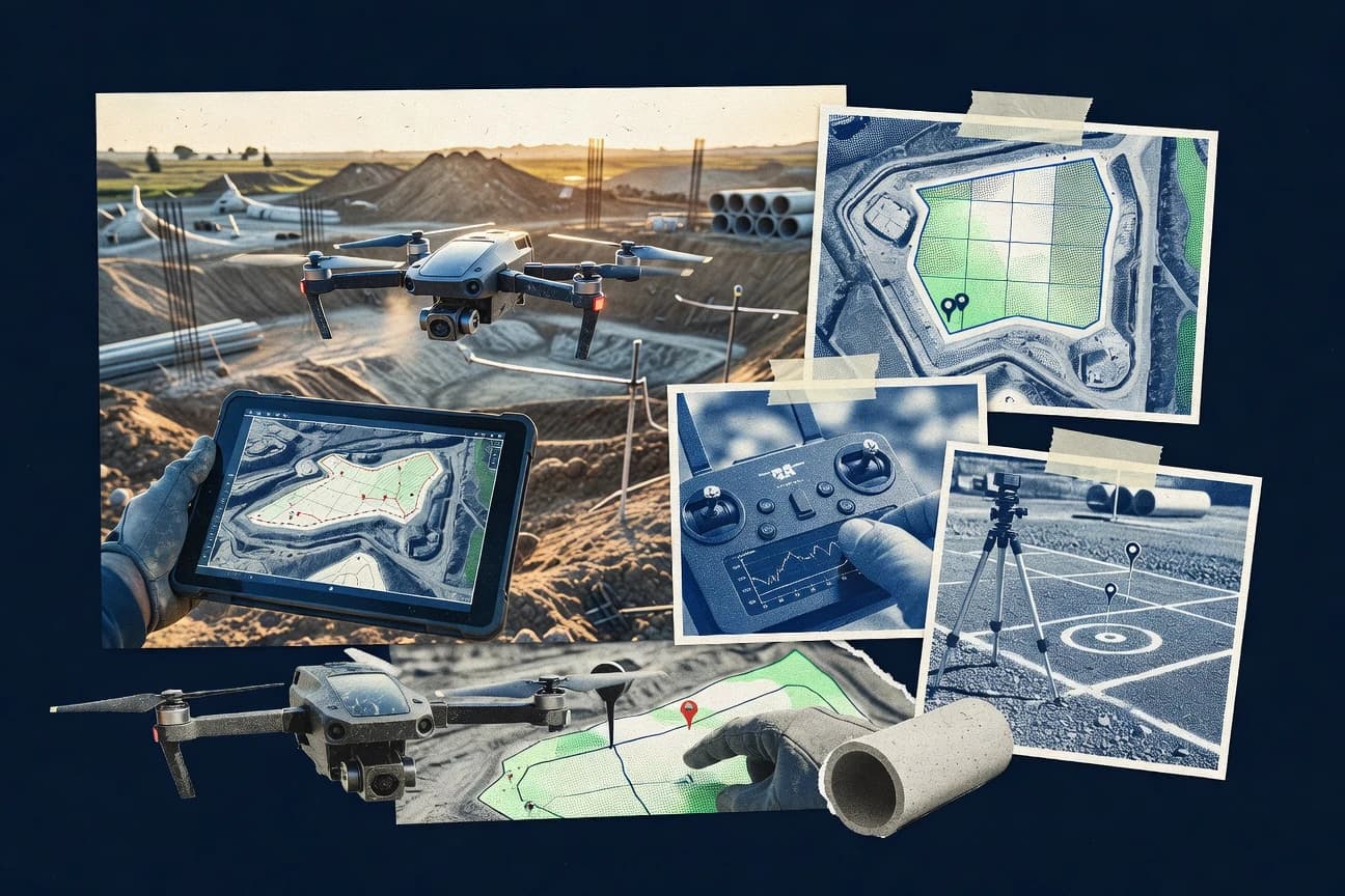
What Is Drone Measurement Software?
Drone measurement software turns drone imagery or point clouds into measurement-ready outputs like orthomosaics, DSMs, dense point clouds, and 3D models. It supports workflows for distance, area, and volume calculations or terrain derivatives, so survey and construction teams can quantify real surfaces instead of relying on raw photos. Some tools focus on guided capture-to-deliver pipelines and collaborative review, like DroneDeploy. Other tools focus on mature photogrammetry reconstruction with georeferencing and control points, like Pix4Dmapper and Agisoft Metashape.
Key Features to Look For
The best choices match the software workflow to the required measurement output, the operating team, and the dataset size and repeatability needs.
Guided orthomosaic and 3D generation pipeline
A guided pipeline reduces setup friction from import to orthomosaic or 3D outputs. DroneDeploy uses a browser-based guided workflow that turns flights into orthomosaics, 3D models, and volume-ready deliverables with less manual orchestration than desktop-only toolchains like Agisoft Metashape.
Automated volume measurement for earthwork, stockpiles, and progress
Volume tools should support quantity takeoffs on reconstructed surfaces for earthwork planning and asset tracking. DroneDeploy specializes in automated volume measurement for stockpiles, earthwork, and progress comparisons, while DJI Terra provides volume calculation tools directly on reconstructed terrain surfaces.
Georeferencing and ground control for measurement-grade outputs
Measurement accuracy depends on how the tool handles scaling and georeferencing with control points. Pix4Dmapper and Agisoft Metashape emphasize integrated ground control points and control-point scaling to produce survey-grade orthomosaics and DSMs. DJI Terra also relies on capture settings and ground control to deliver predictable measurement outputs on DJI mission exports.
Crop-ready thematic mapping and time-based comparisons
Agronomy measurement workflows need more than orthomosaics and must support crop-focused analytics. Pix4Dfields produces crop health maps from field imagery and supports time-based comparisons across flights for agronomic decision-making and repeatable field measurement outputs.
Repeatable, scriptable processing for reproducible mapping
Teams that need repeatability at scale often prefer pipeline control and automation over guided panels. OpenDroneMap strengthens reproducible output generation through automated, scriptable SfM and MVS photogrammetry workflows that produce orthophotos and DEMs from standard processing steps.
Point cloud QA and change detection for deviation and inspections
Some workflows require measuring and comparing 3D data quality after capture, not just producing orthomosaics. CloudCompare provides cloud-to-cloud distance computation with scalar field outputs for deviation and change maps. Global Mapper supports point cloud to surfaces with contouring and profiling so measured terrain derivatives can be validated inside a GIS environment.
How to Choose the Right Drone Measurement Software
Picking the right tool means matching output type, measurement method, and workflow style to the project deliverables and operational constraints.
Start from the exact deliverable type, not from the drone dataset
If the project needs fast orthomosaics plus 3D models and stockpile or earthwork volumes with reviewable outputs, DroneDeploy fits that capture-to-deliver workflow. If the deliverable requires survey-grade georeferenced orthomosaics and DSMs with ground control points, Pix4Dmapper and Agisoft Metashape align better with measurement-grade reconstruction needs.
Choose the measurement workflow that matches your accuracy drivers
For control-point-driven accuracy, prioritize tools built around georeferencing with integrated control workflows like Pix4Dmapper and Agisoft Metashape. For DJI teams using DJI mission exports, DJI Terra provides a consistent photogrammetry workflow with measurement and terrain and volume tools, but capture quality and ground control choices still drive results.
Match the tool to team collaboration and delivery requirements
If measurement results need collaborative review, sharing, commenting, and exportable deliverables, DroneDeploy supports web collaboration designed for field workflows. If the deliverables must feed GIS layers and measurement pipelines inside an enterprise mapping environment, ArcGIS Pro and QGIS can integrate drone-derived rasters and surfaces into coordinate-system-based measurement and reporting workflows.
Plan for dataset size and processing performance early
If large datasets and longer processing times can disrupt field schedules, focus on tools that provide guided pipelines and practical review performance like DroneDeploy and Pix4Dfields. For heavy reconstructions that demand more RAM, GPU, and storage, Agisoft Metashape and OpenDroneMap workflows require careful hardware planning for smooth processing.
Add a dedicated QA workflow when measurement confidence requires inspection
If QA and change detection must produce deviation and error maps from LAS or PLY outputs, use CloudCompare for cloud differencing and scalar field outputs. For survey-ready terrain derivatives like contours and profiles from point clouds, Global Mapper complements photogrammetry outputs with direct measurement tools tied to GIS layers.
Who Needs Drone Measurement Software?
Drone measurement software benefits teams that convert captured imagery into quantified spatial outputs for construction, surveying, agriculture, and geospatial analysis.
Construction and surveying teams needing fast measurement deliverables with collaborative review
DroneDeploy supports orthomosaics, 3D models, and automated volume measurement with web collaboration for review, sharing, and export. DJI Terra also suits teams working specifically from DJI mission exports by producing orthomosaics and enabling measurement and volume reports on reconstructed terrain surfaces.
Survey and construction teams that require measurement-grade georeferenced orthomosaics and DSMs
Pix4Dmapper emphasizes ground control points and georeferencing for accurate, measurement-grade deliverables including orthomosaics, DSM, and dense point clouds. Agisoft Metashape similarly provides control-point scaling and coordinate system support, but it requires more operator experience and more computing resources on large projects.
Agronomy teams producing repeatable crop analytics across time
Pix4Dfields specializes in crop health map generation and uses georeferenced metric outputs to enable measurement and site comparisons across flights. Its time-based comparison support makes it a strong fit for field-level analytics and recurring agronomic monitoring.
GIS teams and analysts who need measurement outputs inside mapped projects
ArcGIS Pro operationalizes drone-derived orthomosaics and surface models into GIS measurements using built-in layouts and geoprocessing models. QGIS provides advanced coordinate reference system support for precise distance and area measurements on orthomosaics and vector layers, while Global Mapper focuses on point cloud to surfaces with contouring and profiling.
Common Mistakes to Avoid
Several failure modes repeat across drone measurement tools when teams mismatch accuracy goals, workflow depth, or validation needs.
Assuming processing quality alone fixes measurement accuracy
Measurement accuracy in DJI Terra and DroneDeploy depends heavily on capture settings and ground control usage, not only on automated photogrammetry. Pix4Dmapper and Agisoft Metashape also require careful calibration and overlap choices for consistent alignment and metric scaling.
Choosing a desktop QA tool when the deliverable needs orthomosaics and volume outputs
CloudCompare is built for point cloud QA, differencing, and deviation measurement using LAS and PLY workflows rather than end-to-end image-to-orthomosaic deliverables. DroneDeploy and DJI Terra better match teams that need orthomosaics plus volumetric quantities for earthwork and stockpiles.
Overlooking workflow complexity when the team lacks photogrammetry experience
Agisoft Metashape and OpenDroneMap provide flexible, dense reconstruction chains that can slow teams without photogrammetry experience. Pix4Dmapper also requires calibration choices to avoid alignment quality issues, so training or standardized capture and settings are needed.
Forgetting coordinate system discipline and GIS layer setup
QGIS and ArcGIS Pro deliver accurate distance and area measurements only when coordinate reference systems and layer management are handled consistently. Global Mapper also relies on careful georeferencing to align drone-derived point clouds and rasters for reliable terrain measurements.
How We Selected and Ranked These Tools
we evaluated every tool on three sub-dimensions that map to buyer outcomes: features with weight 0.4, ease of use with weight 0.3, and value with weight 0.3. the overall rating for each product is the weighted average of those three sub-dimensions using overall = 0.40 × features + 0.30 × ease of use + 0.30 × value. DroneDeploy separated itself from lower-ranked tools because its features score reflects an end-to-end capture-to-deliver workflow with automated volume measurement and web collaboration that directly supports construction and field review. That same guided workflow also supports a higher ease-of-use score than more complex parameter-driven pipelines that rely on control steps and desktop-centric setup.
Frequently Asked Questions About Drone Measurement Software
Which tools are best for volume measurement workflows from drone flights?
What software is most suitable for measurement-grade georeferenced outputs using ground control?
Which options focus on agronomy-specific measurement outputs like crop health maps?
How do GIS-centric workflows differ between Global Mapper, QGIS, and ArcGIS Pro for drone measurements?
Which tools are strongest for interactive point cloud QA and change detection?
What is the typical workflow for turning drone images into orthomosaics and 3D models across these tools?
Which software is more appropriate when repeatability and automation matter more than a guided UI?
How should users choose between drone-to-cloud mapping tools and desktop GIS measurement tools?
What common technical issues cause measurement inaccuracies, and which tools help validate results?
Which toolchains support collaboration and stakeholder-friendly review of drone measurement outputs?
Tools reviewed
Primary sources checked during evaluation.
Referenced in the comparison table and product reviews above.
Keep exploring
Comparing two specific tools?
Software Alternatives
See head-to-head software comparisons with feature breakdowns, pricing, and our recommendation for each use case.
Explore software alternatives→In this category
Technology Digital Media alternatives
See side-by-side comparisons of technology digital media tools and pick the right one for your stack.
Compare technology digital media tools→FOR SOFTWARE VENDORS
Not on this list? Let’s fix that.
Our best-of pages are how many teams discover and compare tools in this space. If you think your product belongs in this lineup, we’d like to hear from you—we’ll walk you through fit and what an editorial entry looks like.
Apply for a ListingWHAT THIS INCLUDES
Where buyers compare
Readers come to these pages to shortlist software—your product shows up in that moment, not in a random sidebar.
Editorial write-up
We describe your product in our own words and check the facts before anything goes live.
On-page brand presence
You appear in the roundup the same way as other tools we cover: name, positioning, and a clear next step for readers who want to learn more.
Kept up to date
We refresh lists on a regular rhythm so the category page stays useful as products and pricing change.