GITNUXSOFTWARE ADVICE
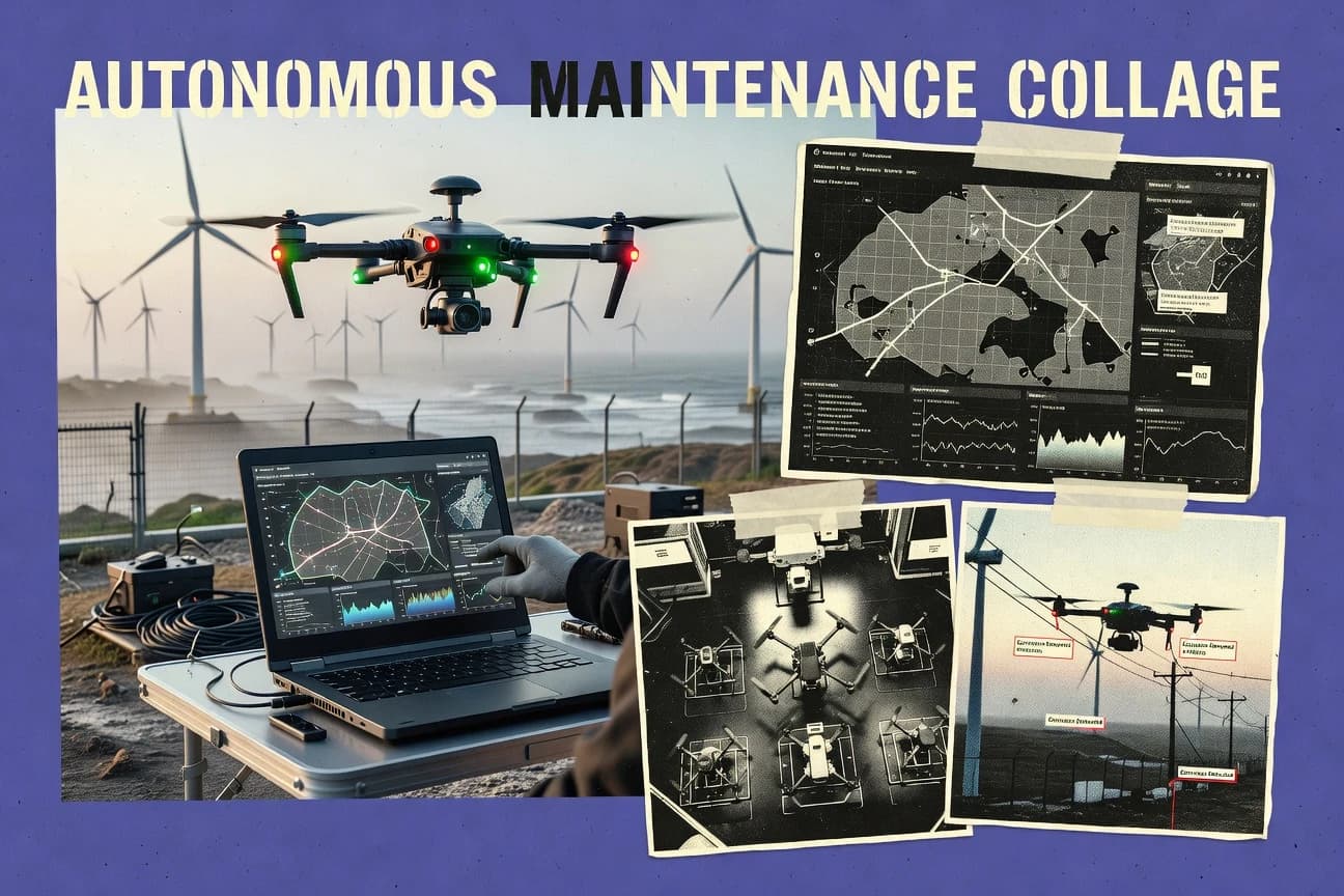
Technology Digital MediaTop 10 Best Autonomous Drone Software of 2026
Discover the top autonomous drone software tools to streamline operations and enhance performance.

How we ranked these tools
Core product claims cross-referenced against official documentation, changelogs, and independent technical reviews.
Analyzed video reviews and hundreds of written evaluations to capture real-world user experiences with each tool.
AI persona simulations modeled how different user types would experience each tool across common use cases and workflows.
Final rankings reviewed and approved by our editorial team with authority to override AI-generated scores based on domain expertise.
Score: Features 40% · Ease 30% · Value 30%
Gitnux may earn a commission through links on this page — this does not influence rankings. Editorial policy
Editor’s top 3 picks
Three quick recommendations before you dive into the full comparison below — each one leads on a different dimension.
DroneDeploy
Automated flight planning that produces ready-to-fly survey missions and project-ready maps
Built for teams running repeatable site surveys needing fast mapping outputs and collaboration.
Pix4Dcapture
Editor pickAutonomous flight mission planner with overlap targets for grid and corridor mapping
Built for survey and mapping teams needing guided autonomous image capture.
Pixhawk with ArduPilot
Editor pickWaypoint navigation with geofence and failsafe RTL behavior
Built for teams building autonomous missions on Pixhawk hardware with MAVLink integration.
Related reading
Comparison Table
This comparison table maps leading autonomous drone software across mission planning, automated flight execution, mapping and photogrammetry workflows, and supported hardware. It contrasts platforms such as DroneDeploy, Pix4Dcapture, Pixhawk with ArduPilot, PX4 Autopilot, and OpenDroneMap so teams can match capabilities to site requirements, data outputs, and operational constraints.
DroneDeploy
mapping operationsDroneDeploy plans autonomous drone mapping missions, automates flight execution, and produces inspection and mapping deliverables in a managed workflow.
Automated flight planning that produces ready-to-fly survey missions and project-ready maps
DroneDeploy distinguishes itself with an end-to-end drone mapping workflow built around automated flight planning and instant project outputs. It supports mission creation with map-based boundaries, then turns captured imagery into orthomosaics, 3D models, and measurable results inside a centralized project space.
Collaboration tools and export options help teams review findings without manual stitching or separate photogrammetry tooling. The platform is strongest for repeatable site surveys where consistent imagery collection and quick turnarounds matter.
- +Automated mission planning with map-based area selection reduces setup time
- +Rapid generation of orthomosaics and 3D models from collected imagery
- +Centralized projects streamline review, annotations, and stakeholder collaboration
- –Autonomous mission reliability depends on compatible hardware and field conditions
- –Advanced survey workflows can require training to optimize accuracy and consistency
Best for: Teams running repeatable site surveys needing fast mapping outputs and collaboration
More related reading
Pix4Dcapture
mission planningPix4Dcapture creates autonomous flight plans for capture missions and supports consistent data acquisition for mapping workflows.
Autonomous flight mission planner with overlap targets for grid and corridor mapping
Pix4Dcapture distinguishes itself with mission planning and guided autonomy tailored for mapping flights using Pix4D workflows. The app supports automatic flight capture with overlap targets, grid and corridor patterns, and real-time guidance during missions.
It focuses on turning scheduled imagery acquisition into consistent datasets for downstream processing. Pix4Dcapture’s strength is reliable capture management more than advanced on-drone autonomy logic.
- +Automatic capture missions enforce consistent overlap for mapping accuracy
- +Grid and corridor flight patterns cover common photogrammetry use cases
- +Clear on-screen mission guidance reduces missed shots during capture
- +Integrates tightly with Pix4D photogrammetry processing workflows
- –Autonomy is focused on capture planning, not complex real-time navigation
- –Advanced survey constraints require more setup than simple point-and-fly
- –Best results depend on correct GCP and flight parameter configuration
- –Mixed environments can still require manual intervention for planning
Best for: Survey and mapping teams needing guided autonomous image capture
Pixhawk with ArduPilot
autopilot open-sourceArduPilot runs on Pixhawk-class autopilots and enables autonomous navigation with configurable missions, failsafes, and scripting.
Waypoint navigation with geofence and failsafe RTL behavior
Pixhawk with ArduPilot ties a flight controller to a mature autopilot stack for autonomous multirotors and fixed-wing aircraft. ArduPilot supports GPS waypoint navigation, obstacle avoidance integrations, and onboard mission execution with failsafe behaviors like geofence and return-to-launch.
The software also runs flight stabilization and control loops, actuator mixing, and telemetry-driven operations using standard MAVLink links. This combination is distinct for deeply hardware-centric autonomy that scales from manual assist to fully autonomous waypoint missions.
- +Waypoint missions, loiter, and RTL behaviors with robust onboard failsafes
- +MAVLink telemetry supports integration with companion computers and ground control
- +Strong flight stabilization with detailed parameterization for many airframe layouts
- +Extensive scripting and mission tooling options for advanced autonomy behaviors
- –Setup and tuning require careful calibration and configuration of many parameters
- –Autonomous obstacle avoidance depends on external sensors and integration work
- –Complexity increases sharply when moving from waypoint missions to autonomy stacks
Best for: Teams building autonomous missions on Pixhawk hardware with MAVLink integration
PX4 Autopilot
autopilot open-sourcePX4 provides an open-source autopilot stack that supports autonomous flight modes, mission execution, and vehicle-specific control.
SITL and MAVLink-based offboard control for rapid autonomy development and testing
PX4 Autopilot stands out as an open-source flight stack that supports many vehicle types and mission styles. It provides flight control for multirotors, fixed-wing, and hybrid platforms, plus autonomy primitives like waypoint navigation and offboard control interfaces. Strong tooling surrounds development with simulation, parameter configuration, and firmware support through the PX4 ecosystem.
- +Open-source flight stack with wide hardware and vehicle support
- +Mission capabilities include waypoints, loiter, and RTL behaviors
- +Mature simulation workflow with SITL and hardware-in-the-loop options
- +Extensive tuning parameters for controller and sensor configuration
- +Reliable interfaces for companion computer offboard control
- –Setup and tuning require strong robotics and control knowledge
- –Autonomy features depend on accurate sensors and navigation inputs
- –Production integration can take time across autopilot, payload, and datalinks
Best for: Teams building custom drone autonomy on supported autopilot hardware
OpenDroneMap
geospatial processingOpenDroneMap turns drone imagery into geospatial outputs using a set of open-source processing tools for photogrammetry pipelines.
End-to-end photogrammetry workflow that generates georeferenced orthomosaics and 3D models
OpenDroneMap turns raw drone imagery into georeferenced products through an open, workflow-driven mapping pipeline. It supports photogrammetry processing that outputs maps, orthomosaics, and textured 3D models suitable for field survey and planning. The project also centers on OpenStreetMap-ready feature export and repeatable processing that can be integrated into automated data capture workflows.
- +Open photogrammetry pipeline for orthomosaics, DEMs, and textured 3D models
- +Command-line driven processing enables repeatable automation for drone survey runs
- +Exports geospatial outputs that integrate well with mapping and GIS tooling
- +Strong community adoption supports common drone-to-mapping workflows
- –Setup and processing parameters can be complex for new operators
- –Quality control depends heavily on image capture practices and consistency
- –Large datasets can demand significant compute, storage, and time
Best for: Autonomous survey pipelines needing repeatable photogrammetry outputs for GIS
QGroundControl
ground controlQGroundControl provides mission planning, telemetry, and ground-station control for autonomous drone systems using common MAVLink targets.
Mission Planner and editor with MAVLink-compatible vehicle control and live telemetry
QGroundControl stands out for direct ground-station control and mission planning support across common autopilot stacks. It combines a waypoint and mission editor, real-time telemetry, and a live vehicle status view into one operator workflow.
Advanced users get configurable parameters, sensor calibration tools, and flexible geofencing and safety-related mission items. The tool also supports multi-vehicle mission operations in a single interface for teams coordinating repeated autonomous flights.
- +Strong waypoint and mission item editing with simulation-friendly workflow
- +Live telemetry and vehicle state monitoring designed for operator visibility
- +Deep autopilot parameter and calibration support for tuning and maintenance
- +Geofencing and safety-related mission items for constrained operations
- +Multi-vehicle planning and control from a single ground-station UI
- –Complex setup and configuration can overwhelm new drone operators
- –UI workflows feel more technical than modern consumer mission apps
- –Advanced mission logic can require more planning than simple waypoint runs
Best for: Teams running MAVLink-based missions who need deep configuration and monitoring
Mission Planner
ground controlMission Planner is a ground-control station used to design autonomous missions, tune parameters, and monitor MAVLink-based drones.
Mission planning with waypoint, RTL, loiter, and geofence workflows for ArduPilot vehicles
Mission Planner stands out by pairing an operator-focused mission planning interface with deep ArduPilot autopilot support. It enables waypoint missions, guided flight behaviors, and parameter management through a ground-station workflow.
Simulation and log analysis support sit alongside mapping and telemetry views for iterative tuning and troubleshooting. The tool is strongest for hands-on flight planning and diagnostics rather than full drone fleet orchestration.
- +Strong ArduPilot autopilot integration for missions, parameters, and vehicle setup
- +Waypoint and geofence planning workflows with practical ground-station telemetry views
- +Built-in simulation and flight log analysis for faster tuning and debugging
- –Requires autopilot and mission concepts knowledge to configure vehicles correctly
- –User experience can feel complex with many advanced planning and safety options
- –Less focused on multi-drone fleet management and enterprise workflows
Best for: ArduPilot-focused operators needing mission planning and flight diagnostics
Agisoft Metashape
3D reconstructionMetashape processes drone image datasets into dense 3D models and orthomosaics to support autonomous inspection and capture planning.
Dense point cloud generation with depth-maps reconstruction and configurable quality settings
Agisoft Metashape stands out for photogrammetry-first processing that turns drone imagery into georeferenced 3D models. It supports end-to-end workflows including camera alignment, dense point cloud generation, mesh reconstruction, and texture baking.
The software offers scale control via ground control points and coordinate system setup for mapping-grade outputs. Processing is driven by configurable reconstruction parameters that support both quick concept models and higher-accuracy survey deliverables.
- +Strong photogrammetry pipeline for dense point clouds, meshes, and textured models
- +Georeferencing with ground control points and coordinate system management for survey workflows
- +Configurable reconstruction settings for balancing speed versus accuracy
- +Export options for common GIS and 3D formats
- –Automation is limited for fully autonomous mission-to-model pipelines
- –Higher accuracy often requires manual parameter tuning and quality checks
- –Processing hardware and memory needs can be significant for large datasets
Best for: Survey teams producing accurate 3D reconstructions from drone imagery
Kespry
enterprise mappingKespry supports autonomous drone capture workflows for site intelligence with managed planning and production of inspection outputs.
Automated mission execution for consistent aerial capture during recurring inspections
Kespry distinctively targets autonomous drone operations by focusing on end-to-end mission execution and aerial data capture workflows rather than only camera control. The system supports flight planning, repeated inspections, and automated mapping outputs built for consistent site coverage. Kespry also emphasizes operational reliability with managed workflows that reduce manual intervention between flights and deliverable production.
- +Mission-centric workflow reduces handoffs between planning and deliverables
- +Autonomous capture helps standardize site coverage across repeat runs
- +Mapping outputs are geared toward inspection and recurring field use
- –Best results depend on strong preplanning of coverage and constraints
- –Enterprise setup and operational tuning can add time for new teams
- –Output customization for niche workflows is limited without process alignment
Best for: Field operations teams running repeat drone inspections with standardized deliverables
PrecisionHawk
enterprise analyticsPrecisionHawk delivers autonomous drone data acquisition workflows and analytics for industrial inspections and mapping use cases.
Automated mission execution for consistent photogrammetry data capture and mapping
PrecisionHawk stands out for turning drone capture into workflow-ready deliverables for surveying and inspection teams. It supports mission planning and automated flight execution designed for consistent mapping results.
Data processing centers on photogrammetry outputs like orthomosaics and surface models, with tools for monitoring progress over time. The platform is best suited to organizations with established geospatial processes and repeatable survey requirements.
- +Mission planning and flight execution tailored for consistent mapping workflows
- +Photogrammetry outputs include orthomosaics and surface models for field deliverables
- +Supports repeatable projects for progress tracking across survey runs
- –Configuration and workflow setup can be complex for new teams
- –Less suited to rapid ad hoc missions without established geospatial standards
- –Limited fit for teams needing highly custom computer-vision automation
Best for: Survey and inspection teams needing repeatable drone mapping workflows
Conclusion
After evaluating 10 technology digital media, DroneDeploy stands out as our overall top pick — it scored highest across our combined criteria of features, ease of use, and value, which is why it sits at #1 in the rankings above.
Use the comparison table and detailed reviews above to validate the fit against your own requirements before committing to a tool.
How to Choose the Right Autonomous Drone Software
This buyer’s guide covers autonomous drone software workflows spanning mission planning, flight execution, and photogrammetry outputs. It specifically references DroneDeploy, Pix4Dcapture, Pixhawk with ArduPilot, PX4 Autopilot, OpenDroneMap, QGroundControl, Mission Planner, Agisoft Metashape, Kespry, and PrecisionHawk. The guide helps teams match the right tool to repeatable mapping and inspection operations, custom autonomy development, or open photogrammetry automation.
What Is Autonomous Drone Software?
Autonomous drone software plans missions, manages guided or onboard execution, and turns captured imagery into usable deliverables like orthomosaics and 3D models. It solves problems where manual flight setup and inconsistent capture lead to wasted flights and unusable data. Some tools focus on end-to-end survey workflows and deliverables in a centralized workspace, like DroneDeploy. Other tools focus on guided capture planning, like Pix4Dcapture, while autopilot stacks and ground control tools like PX4 Autopilot and QGroundControl provide autonomy primitives and mission execution control.
Key Features to Look For
The right feature set determines whether missions stay consistent, outputs stay georeferenced, and operators can maintain safe autonomy across repeated runs.
Automated mission planning that generates ready-to-fly survey routes
DroneDeploy excels at automated flight planning that produces ready-to-fly survey missions from map-based area selection. Pix4Dcapture also automates flight mission planning for capture missions using overlap targets in grid and corridor patterns.
Capture consistency controls like overlap targets and guided on-screen mission execution
Pix4Dcapture is built around consistent data acquisition using automatic capture missions and overlap targets for photogrammetry. DroneDeploy also reduces variability by centralizing the workflow from mission setup to project-ready orthomosaics and 3D models.
Waypoint missions plus onboard failsafes and safety items
Pixhawk with ArduPilot supports waypoint missions with geofence and return-to-launch failsafe behaviors. Mission Planner and QGroundControl complement these autonomy safety workflows by providing mission item editing, geofencing support, and operator visibility through telemetry.
Open autopilot development tooling with simulation and offboard control
PX4 Autopilot supports simulation workflows like SITL and hardware-in-the-loop options and provides offboard control interfaces over MAVLink. PX4 and QGroundControl pair well when autonomy logic must be developed and tested before production deployment.
End-to-end photogrammetry pipeline that outputs georeferenced orthomosaics and 3D models
DroneDeploy produces project-ready orthomosaics and 3D models from captured imagery inside a centralized project space. OpenDroneMap generates georeferenced products like orthomosaics and textured 3D models using an open, command-line driven pipeline.
Georeferencing controls and dense reconstruction quality knobs for mapping-grade outputs
Agisoft Metashape provides ground control point georeferencing plus coordinate system management for survey workflows and configurable reconstruction settings. Agisoft Metashape is also strong at dense point cloud generation using depth-maps reconstruction, while OpenDroneMap enables repeatable processing via automation-friendly execution.
How to Choose the Right Autonomous Drone Software
Pick the tool that matches the required level of autonomy control and the exact deliverable pipeline the operation needs.
Define the deliverable pipeline first
If the mission goal is rapid mapping deliverables with collaboration and project organization, choose DroneDeploy because it automates flight planning and produces orthomosaics and 3D models inside a centralized project space. If the mission goal is consistent image capture for later processing inside Pix4D workflows, choose Pix4Dcapture because it enforces overlap targets for grid and corridor mapping patterns.
Match autonomy depth to the team’s engineering model
If the operation builds autonomy on Pixhawk-class hardware, choose Pixhawk with ArduPilot because it runs waypoint navigation with geofence and return-to-launch failsafe behaviors with MAVLink telemetry integration. If the operation builds custom autonomy and needs rapid testing, choose PX4 Autopilot because it provides SITL and MAVLink-based offboard control for companion computer development.
Choose the right ground control layer for monitoring and mission editing
If mission operators need live telemetry visibility and mission item editing for MAVLink vehicles, choose QGroundControl because it combines waypoint and mission editor, live vehicle status, and geofencing support in one interface. If the team is ArduPilot-focused and needs mission planning plus parameter management and flight log analysis for tuning, choose Mission Planner.
Select photogrammetry software based on automation and compute realities
If repeatability and automation through a pipeline matters more than operator-friendly interfaces, choose OpenDroneMap because it runs photogrammetry processing that outputs maps, orthomosaics, and textured 3D models using command-line automation. If accuracy control through manual reconstruction parameters and dense reconstruction quality is the priority, choose Agisoft Metashape because it provides dense point cloud generation plus configurable quality settings.
Use enterprise workflow tools for recurring inspections with managed outputs
If the operation is built around recurring inspections that require standardized site coverage and automated mapping outputs, choose Kespry because it focuses on mission-centric autonomous capture with managed workflows and consistent coverage. If the operation needs repeatable photogrammetry data acquisition with monitoring of progress over time, choose PrecisionHawk because it supports automated mission execution and photogrammetry outputs like orthomosaics and surface models.
Who Needs Autonomous Drone Software?
Autonomous drone software benefits teams that must repeat the same flight tasks reliably, convert imagery into geospatial outputs, or develop and test autonomy logic on autopilot hardware.
Teams running repeatable site surveys with fast mapping outputs and collaboration
DroneDeploy fits this profile because it automates flight planning using map-based area selection and produces project-ready orthomosaics and 3D models for centralized review and stakeholder collaboration. PrecisionHawk also fits when repeated mapping runs must produce orthomosaics and surface models with progress tracking across survey projects.
Survey and mapping teams that need guided autonomous capture with consistent overlap
Pix4Dcapture is the closest match because it creates autonomous flight plans with overlap targets and provides real-time guidance during capture missions. DroneDeploy is also strong when the required workflow includes centralized project outputs rather than only capture scheduling.
Teams building autonomous missions on Pixhawk-class hardware with failsafes and MAVLink integration
Pixhawk with ArduPilot fits teams that need waypoint navigation and geofence plus return-to-launch behaviors. QGroundControl and Mission Planner fit as operator-facing mission planning and monitoring tools that edit MAVLink-compatible mission items and expose telemetry and calibration details.
Teams developing custom drone autonomy with simulation and offboard control
PX4 Autopilot fits teams building custom autonomy because it supports SITL and MAVLink-based offboard control for companion computer testing. QGroundControl complements this workflow by providing live vehicle status monitoring and mission planning and editor capabilities for MAVLink systems.
Common Mistakes to Avoid
Several recurring pitfalls show up across the tools because autonomy behavior, mapping accuracy, and operator workflows depend on correct inputs and the right software layer for the job.
Using a capture-planning tool for complex autonomy needs without the right navigation stack
Pix4Dcapture is designed for guided autonomous capture planning with overlap targets and grid or corridor patterns, so it is not the right core tool for complex real-time navigation behaviors. For complex autonomy, pair waypoint and failsafe capabilities from Pixhawk with ArduPilot or PX4 Autopilot with mission editing and telemetry monitoring from QGroundControl.
Skipping georeferencing and quality controls before running photogrammetry
Agisoft Metashape relies on ground control point georeferencing and coordinate system setup to produce mapping-grade outputs. OpenDroneMap also depends on consistent image capture practices because quality control is heavily tied to the input imagery dataset.
Attempting mission planning without planning for parameter tuning and calibration
Pixhawk with ArduPilot and PX4 Autopilot both require careful setup and tuning because autonomy depends on accurate sensors and configured parameters. QGroundControl and Mission Planner help teams manage calibration and parameter workflows for safer mission execution.
Choosing a photogrammetry pipeline without aligning with compute and dataset size requirements
OpenDroneMap can demand significant compute, storage, and time for large datasets because the pipeline is command-line driven and processes imagery into geospatial products. Agisoft Metashape also requires substantial processing resources for dense point cloud generation and mesh reconstruction, so capacity planning is necessary to avoid stalled mapping runs.
How We Selected and Ranked These Tools
we evaluated every tool on three sub-dimensions, features with weight 0.4, ease of use with weight 0.3, and value with weight 0.3. The overall rating for each tool is computed as overall = 0.40 × features + 0.30 × ease of use + 0.30 × value. DroneDeploy separated from lower-ranked tools by combining end-to-end autonomous flight planning with ready-to-fly missions and fast mapping deliverables, which directly strengthened the features dimension with an end-to-end workflow that reduces manual handoffs.
Frequently Asked Questions About Autonomous Drone Software
Which software best automates repeatable survey capture from mission planning to deliverables?
What tools provide guided autonomous image capture with overlap control for mapping grids and corridors?
How do open-source and controller-centric options compare to mapping platforms for full autonomy?
Which application supports multi-vehicle mission planning and live telemetry monitoring in one interface?
What software is best for producing georeferenced GIS-ready maps and orthomosaics from drone imagery?
Which tools help troubleshoot autonomy by analyzing logs and iterating on mission behavior?
Which platforms handle mission planning and mapping deliverables end-to-end with minimal manual stitching or extra photogrammetry tooling?
What is the typical workflow difference between Pix4Dcapture and photogrammetry-first processors like Metashape and OpenDroneMap?
Which software is most suitable for teams building custom autonomy logic and testing autonomy quickly before deployment?
Tools reviewed
Primary sources checked during evaluation.
Referenced in the comparison table and product reviews above.
Keep exploring
Comparing two specific tools?
Software Alternatives
See head-to-head software comparisons with feature breakdowns, pricing, and our recommendation for each use case.
Explore software alternatives→In this category
Technology Digital Media alternatives
See side-by-side comparisons of technology digital media tools and pick the right one for your stack.
Compare technology digital media tools→FOR SOFTWARE VENDORS
Not on this list? Let’s fix that.
Our best-of pages are how many teams discover and compare tools in this space. If you think your product belongs in this lineup, we’d like to hear from you—we’ll walk you through fit and what an editorial entry looks like.
Apply for a ListingWHAT THIS INCLUDES
Where buyers compare
Readers come to these pages to shortlist software—your product shows up in that moment, not in a random sidebar.
Editorial write-up
We describe your product in our own words and check the facts before anything goes live.
On-page brand presence
You appear in the roundup the same way as other tools we cover: name, positioning, and a clear next step for readers who want to learn more.
Kept up to date
We refresh lists on a regular rhythm so the category page stays useful as products and pricing change.