GITNUXSOFTWARE ADVICE
Technology Digital MediaTop 10 Best Drone Stockpile Measurement Software of 2026
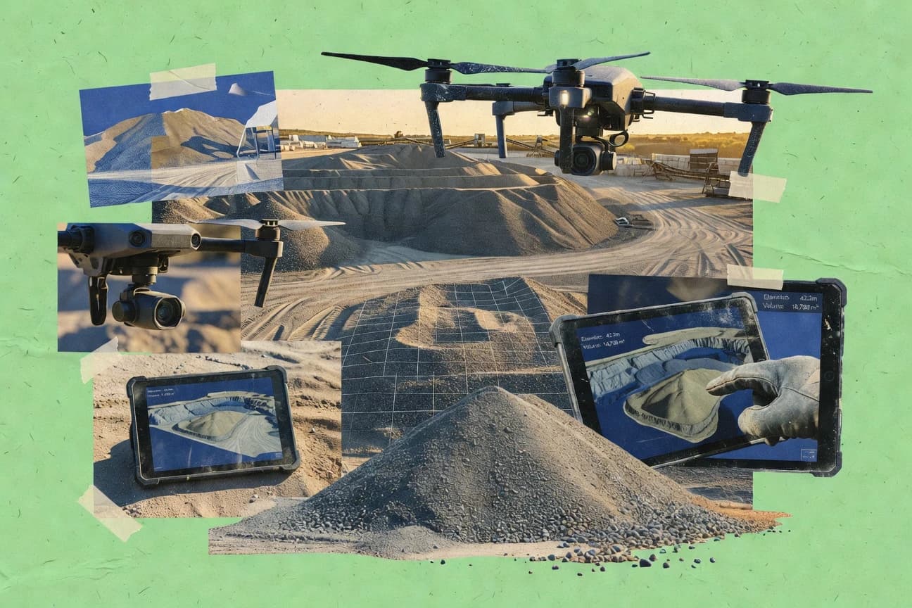
Discover top drone stockpile measurement software for accurate inventory tracking. Explore tools to optimize workflow – check our picks now.

How we ranked these tools
Core product claims cross-referenced against official documentation, changelogs, and independent technical reviews.
Analyzed video reviews and hundreds of written evaluations to capture real-world user experiences with each tool.
AI persona simulations modeled how different user types would experience each tool across common use cases and workflows.
Final rankings reviewed and approved by our editorial team with authority to override AI-generated scores based on domain expertise.
Score: Features 40% · Ease 30% · Value 30%
Gitnux may earn a commission through links on this page — this does not influence rankings. Editorial policy
Editor’s top 3 picks
Three quick recommendations before you dive into the full comparison below — each one leads on a different dimension.
Pix4Dsurvey
Cut-and-fill volume measurement directly on photogrammetric surfaces
Built for teams needing accurate drone-derived stockpile volumes with repeatable survey workflows.
DroneDeploy
Editor pickStockpile volume measurement using DroneDeploy’s processed orthomosaic and 3D model outputs
Built for operations teams needing repeatable stockpile volume reporting from drone surveys.
Mapware
Editor pickMap-based measurement views that tie drone outputs to coordinates for stockpile volume validation
Built for mining and aggregates teams needing consistent map-based stockpile measurement outputs.
Related reading
Comparison Table
This comparison table evaluates drone stockpile measurement software across photogrammetry, mapping, and volumetric inventory workflows, including Pix4Dsurvey, DroneDeploy, Mapware, Agisoft Metashape, and OpenDroneMap. It highlights practical differences in data capture requirements, processing outputs like orthomosaics and point clouds, and how each tool supports stockpile volume measurement and reporting.
Pix4Dsurvey
photogrammetryGenerates accurate orthomosaics and 3D models from drone imagery to measure and quantify stockpiles in the field or office.
Cut-and-fill volume measurement directly on photogrammetric surfaces
Pix4Dsurvey stands out for turning drone imagery into survey-grade outputs with an end-to-end photogrammetry workflow. It supports block processing, tie-point densification, and precise georeferencing to generate orthomosaics and surface models usable for stockpile measurement.
The measurement toolkit enables volume calculations by comparing surfaces or creating cut and fill bounds over the modeled terrain. Strong project organization helps repeat surveys and keep outputs consistent across multiple flights.
- +Survey-grade photogrammetry pipeline for orthomosaics and dense point clouds
- +Robust georeferencing from GCPs and RTK workflows for reliable volume baselines
- +Built-in volume and cut-fill measurement tools over generated surfaces
- +Project templates support repeatable processing across recurring stockpile surveys
- –Dense reconstruction can demand high compute and storage for large sites
- –Advanced settings require workflow discipline to avoid inaccurate measurements
- –Collaboration and review tooling depend on external processes for handoff
Best for: Teams needing accurate drone-derived stockpile volumes with repeatable survey workflows
More related reading
DroneDeploy
cloud mappingCreates measurement outputs from drone flights and supports volume and stockpile reporting workflows in a cloud platform.
Stockpile volume measurement using DroneDeploy’s processed orthomosaic and 3D model outputs
DroneDeploy specializes in aerial capture to deliver repeatable stockpile measurements from drone imagery. The platform supports survey flights that produce orthomosaics and 3D models used for volume calculations.
It also enables sharing and exporting measurement outputs for field teams and stakeholders. Compared with tools focused only on mapping, DroneDeploy emphasizes end-to-end capture, processing, and measurement review in one workflow.
- +Stockpile volume workflows from captured imagery through processed outputs
- +Automated generation of maps and 3D models used for measurement review
- +Collaborative sharing of survey results for fast stakeholder signoff
- –Stockpile accuracy depends heavily on consistent flight planning and camera setup
- –Advanced measurement customization can require more workflow familiarity
Best for: Operations teams needing repeatable stockpile volume reporting from drone surveys
Mapware
stockpile analyticsMeasures stockpile volumes from drone or sensor data using web-based workflows for repeatable inventory and reporting.
Map-based measurement views that tie drone outputs to coordinates for stockpile volume validation
Mapware stands out by focusing on map-based workflows for drone-derived stockpile measurements, with the measurement process anchored to spatial context. The platform supports creating repeatable measurement views from captured survey data and delivers outputs suitable for ongoing stockpile tracking.
It is positioned for teams that want measurement results tied to coordinates and visible map overlays rather than spreadsheet-only summaries. The core strength is turning imagery into practical measurement deliverables for stockpile volume and change monitoring across sites.
- +Map-tied measurement outputs make stockpile results easy to validate visually
- +Repeatable measurement views support consistent comparisons across survey periods
- +Spatial overlays help reduce ambiguity about what area the volume represents
- –Stockpile-specific workflows depend on correct data preparation and alignment
- –Advanced survey customization can require more training than simple reporting tools
- –Integration depth with existing drone pipelines is limited by workflow fit
Best for: Mining and aggregates teams needing consistent map-based stockpile measurement outputs
Agisoft Metashape
desktop photogrammetryPerforms photogrammetric reconstruction and supports volume and measurement workflows for stockpiles from drone imagery.
Ground control and camera calibration support for metrically accurate orthomosaics and surfaces
Agisoft Metashape stands out with its full photogrammetry pipeline for turning drone imagery into metrically useful 3D models. It supports dense point clouds, textured meshes, and orthomosaics that feed volumetric stockpile calculations workflows.
The software emphasizes control points, camera calibration, and survey-grade outputs rather than only lightweight visualization. Metashape is a strong fit for repeatable monitoring when sites have stable capture geometry and clear ground control strategy.
- +Generates dense point clouds, meshes, and orthomosaics from drone imagery
- +Survey-style workflows using ground control to improve metric accuracy
- +Supports volumetrics by comparing surfaces and producing earthwork-ready outputs
- +Multiple export formats for GIS, CAD, and reporting pipelines
- –Processing setup and alignment tuning require photogrammetry expertise
- –Large projects can demand high RAM and strong GPU or CPU throughput
- –Automation for recurring stockpile runs is less turnkey than specialized platforms
Best for: Teams needing accurate, survey-grade photogrammetry and volumetrics, not just dashboards
OpenDroneMap
open-sourceProcesses drone imagery into orthomosaics and 3D surfaces so downstream workflows can compute stockpile volumes.
Integrated photogrammetry pipeline producing DSM and orthomosaics for volumetric comparison
OpenDroneMap focuses on turning drone imagery into geospatial outputs like orthomosaics, point clouds, and digital surface models for measurable site assessment. Its distinct strength is a pipeline-driven workflow that supports common photogrammetry inputs and exports used for stockpile measurement workflows.
The software also connects to visualization and analysis steps through generated products such as DSM and orthomosaics that can feed volumetrics. For stockpile work, it performs best when consistent capture plans and ground control or strong georeferencing are available.
- +Generates DSM, orthomosaic, and point clouds needed for repeatable volumetrics
- +Pipeline-based photogrammetry supports batch processing across multiple flights
- +Exports align with common downstream GIS and measurement tools
- –Georeferencing quality depends heavily on capture and control point coverage
- –Workflow setup can require technical comfort with processing parameters
- –Less specialized stockpile measurement tools than dedicated volumetric platforms
Best for: Teams needing photogrammetry outputs for stockpile volumetrics in GIS-driven workflows
DJI Terra
DJI workflowReconstructs 3D models and surfaces from DJI drone captures and supports measurement tasks used for stockpile analysis.
Stockpile volume calculation from Terra photogrammetry 3D models
DJI Terra stands out by turning DJI drone imagery into stockpile and earthwork deliverables through an integrated processing workflow. It supports photogrammetry-based 2D mapping and 3D reconstruction with outputs used for volume calculations and progress tracking. The tool focuses on repeatable site workflows, exporting measurement products for field review and stakeholder reporting.
- +End-to-end photogrammetry workflow for mapping, reconstruction, and volume outputs
- +Stockpile volume measurement tools built around consistent project processing
- +Tight alignment with DJI flight data reduces preprocessing friction
- +Exports structured outputs for site review and operational reporting
- –Accuracy depends heavily on capture quality and consistent flight planning
- –Processing can become time-consuming for large sites and high-resolution imagery
- –Limited collaboration features for multi-user review and version control
- –Less flexible than non-DJI-centric pipelines for custom measurement approaches
Best for: DJI-centric teams needing reliable stockpile volume measurement from recurring drone surveys
Autodesk ReCap
point cloudTransforms aerial imagery into point clouds and usable 3D datasets for measurement workflows that support stockpile quantification.
ReCap point cloud registration and cleanup for producing measurement-ready datasets
Autodesk ReCap stands out by turning point clouds and reality-capture outputs into usable 3D models for engineering workflows. It supports point cloud viewing, registration, and export into common formats for measurement tasks tied to volumetrics and stockpile change detection.
For drone stockpile measurement, it excels when raw LiDAR or photogrammetry point clouds need cleaning, alignment, and repeatable surfaces for volume computations in downstream tools. Its core strength is the point-cloud pipeline rather than turn-key stockpile analytics.
- +Point cloud registration tools help align multi-scan drone datasets
- +Fast desktop viewing supports inspection of dense terrain surfaces
- +Exports integrate into Autodesk workflows for measurement and reporting
- –Stockpile volume calculations require external workflows beyond ReCap
- –Large datasets can be demanding on system resources and storage
- –Precise measurement setup takes practice to avoid surface errors
Best for: Teams preparing drone point clouds for volumetric measurement workflows
QGIS
GIS analysisUses geospatial analysis tools and plugins to compute volumes from raster or surface layers derived from drone surveys.
Model Builder for repeatable geoprocessing chains used in stockpile measurement workflows
QGIS stands out for turning drone-derived point clouds, orthomosaics, and survey outputs into disciplined measurement layers using a GIS-first workflow. It supports geospatial analysis tools, symbology, and surface modeling so stockpile boundaries and volume calculations can be built from mapped data.
Its ecosystem of plugins expands capabilities such as point cloud handling, terrain analysis, and automation via processing models. The software is strongest when measurements need reproducible spatial logic across multiple datasets and revisions.
- +Robust geospatial analysis for stockpile boundaries, change maps, and QA layers
- +Flexible integration of orthomosaics, DEMs, and point clouds into consistent workflows
- +Model Builder enables repeatable processing chains for survey-to-measurement runs
- +Extensive plugin ecosystem for terrain tools and point cloud workflows
- –Stockpile volume computation requires careful setup of DEM and reference surfaces
- –Point cloud workflows can feel technical without dedicated preprocessing tools
- –Reproducibility depends on disciplined layer management and processing settings
Best for: Teams needing GIS-grade stockpile analytics and audit-ready spatial workflows
Global Mapper
GIS terrain analysisImports terrain models from drone-derived surfaces and calculates measurements that support stockpile volume workflows.
Multi-surface cut-and-fill volumetrics from user-defined reference planes
Global Mapper is distinct because it combines drone photogrammetry and LiDAR oriented GIS processing in one desktop workflow. It supports orthomosaics, DSM and DTM generation, and volumetric calculations that translate terrain surfaces into stockpile quantities.
The software also provides robust coordinate system handling, including reprojection and data alignment across multiple survey datasets. For stockpile measurement, it works best when users already manage control points, surface quality checks, and consistent volume reference planes.
- +Strong volumetrics workflows using gridded surfaces and custom cut and fill
- +Excellent coordinate system and georeferencing tools for aligning survey datasets
- +Versatile surface editing tools for refining DSM and DTM quality
- –Stockpile-specific automation is limited compared with survey-focused platforms
- –Workflows rely on manual surface cleanup and consistent breakline setup
- –Learning curve is steep for teams without GIS and point cloud experience
Best for: Engineering and surveying teams processing stockpile volumes with GIS control
Bentley ContextCapture
enterprise photogrammetryGenerates photogrammetric 3D models and orthomosaics used for accurate earthworks and stockpile volume measurement.
Georeferenced photogrammetry reconstruction for measurement-ready 3D models
Bentley ContextCapture distinguishes itself with photogrammetry designed for large-scale survey processing into georeferenced outputs for measurement workflows. It supports dense 3D reconstruction that can feed volume calculations and change monitoring for stockpiles using aerial and drone imagery.
The tool emphasizes high-throughput processing with automated alignment and reconstruction steps aimed at consistent survey products. It delivers a production-centric pipeline, but it requires careful data preparation and domain knowledge to turn results into accurate stockpile metrics.
- +Georeferenced dense 3D reconstruction supports reliable stockpile volume workflows
- +Automated image alignment and reconstruction reduce manual photogrammetry tuning
- +Scales to large capture sets with production-style processing jobs
- –Stockpile accuracy depends on ground control and survey setup quality
- –Workflow configuration takes specialist knowledge for consistent measurement outputs
- –Iterating on results can be slower due to heavy reconstruction processing
Best for: Survey teams needing accurate photogrammetry-based stockpile volumes from drone imagery
Conclusion
After evaluating 10 technology digital media, Pix4Dsurvey stands out as our overall top pick — it scored highest across our combined criteria of features, ease of use, and value, which is why it sits at #1 in the rankings above.
Use the comparison table and detailed reviews above to validate the fit against your own requirements before committing to a tool.
How to Choose the Right Drone Stockpile Measurement Software
This buyer’s guide explains how to choose Drone Stockpile Measurement Software using concrete capabilities from Pix4Dsurvey, DroneDeploy, Mapware, Agisoft Metashape, OpenDroneMap, DJI Terra, Autodesk ReCap, QGIS, Global Mapper, and Bentley ContextCapture. The guide covers key features that affect volumetric accuracy, repeatability, and workflow speed. It also covers the most common mistakes seen across these platforms and how to prevent them.
What Is Drone Stockpile Measurement Software?
Drone Stockpile Measurement Software converts drone-captured imagery into measured surfaces and calculates stockpile volumes for inventory tracking and change monitoring. This category typically turns orthomosaics and 3D models into cut-and-fill bounds, earthwork-ready outputs, or GIS-grade layers that support volume computations. Teams use these tools to quantify material stockpiles over time with consistent baselines and auditable spatial references. Pix4Dsurvey and DJI Terra show the category in practice by producing photogrammetric surfaces that feed stockpile volume workflows.
Key Features to Look For
The right feature set determines whether outputs are metrically usable, repeatable across flights, and fast enough to support recurring stockpile operations.
Cut-and-fill volume measurement on photogrammetric surfaces
Pix4Dsurvey supports cut-and-fill volume measurement directly on generated photogrammetric surfaces, which streamlines earthwork-style volumetrics. Global Mapper also calculates multi-surface cut-and-fill volumetrics from user-defined reference planes, which is useful for engineering-grade volume definitions.
Survey-grade georeferencing using ground control and RTK workflows
Pix4Dsurvey emphasizes robust georeferencing from GCPs and RTK workflows to create reliable volume baselines. Agisoft Metashape supports ground control and camera calibration to improve metrically accurate orthomosaics and surfaces.
Dense reconstruction outputs for volumetric computation
Pix4Dsurvey generates dense point clouds and surface models that support volume calculations over modeled terrain. Bentley ContextCapture delivers georeferenced dense 3D reconstruction that feeds measurement-ready 3D models for stockpile workflows.
Repeatable project processing for recurring stockpile surveys
Pix4Dsurvey includes project templates that support repeatable processing across recurring stockpile surveys. DJI Terra focuses on repeatable site workflows tied to DJI flight data so teams can run consistent processing jobs for stockpile volume calculation.
Map-tied measurement views for visual validation of volume extents
Mapware anchors measurement views to spatial context so stockpile results are easy to validate visually with map overlays. QGIS supports GIS-grade spatial logic by combining raster or surface layers with symbology and analysis tools for audit-ready boundary and change workflows.
Pipeline-driven photogrammetry with interoperable exports
OpenDroneMap uses a pipeline-driven workflow to produce orthomosaics, point clouds, and DSM outputs that feed volumetric comparisons. Autodesk ReCap strengthens point-cloud workflows by enabling registration and cleanup, then exporting usable 3D datasets for downstream measurement and stockpile change detection.
How to Choose the Right Drone Stockpile Measurement Software
A practical selection process matches required measurement outputs and repeatability needs to the software’s photogrammetry, georeferencing, and volume computation approach.
Start with the exact volumetric method needed
If stockpile measurement depends on cut-and-fill computations over photogrammetric surfaces, Pix4Dsurvey and Global Mapper provide built-in pathways to define reference planes and calculate volumes. If the workflow needs earthwork-style deliverables from dense reconstructions, Bentley ContextCapture produces georeferenced dense 3D models that support measurement-ready outputs.
Confirm the system can produce metrically accurate baselines
If consistent volume baselines require ground control and calibrated imagery, Pix4Dsurvey uses GCP and RTK workflows, and Agisoft Metashape uses control points and camera calibration for survey-style outputs. If project repeatability depends on consistent coordinate handling across survey datasets, Global Mapper provides robust coordinate system and alignment tools for aligning multi-survey terrain surfaces.
Choose outputs that match how measurements get reviewed
For stakeholder signoff and collaborative review built into the stockpile workflow, DroneDeploy creates measurement-ready orthomosaics and 3D model outputs and supports sharing for fast stakeholder signoff. For map overlay validation, Mapware generates map-tied measurement views so teams can visually confirm which coordinates represent the volume footprint.
Match workflow automation and repeatability to survey cadence
For frequent recurring flights where teams need consistent processing, Pix4Dsurvey project templates support repeatable block processing and output consistency. For DJI-centric operations, DJI Terra emphasizes end-to-end processing tied to DJI flight data so teams can run consistent stockpile volume calculations from the same capture workflow.
Pick the right tool role for the broader data pipeline
If the organization needs raw photogrammetry outputs to drive downstream GIS analytics, OpenDroneMap produces DSM and orthomosaics suitable for volumetric comparison pipelines. If the pipeline starts with dense point clouds that require registration and cleanup before volume computation, Autodesk ReCap focuses on point cloud registration and exports into measurement-ready datasets.
Who Needs Drone Stockpile Measurement Software?
Drone Stockpile Measurement Software serves mining, aggregates, and engineering teams that must quantify stockpile volumes from drone imagery with repeatable spatial logic.
Mining and aggregates teams that need map-based stockpile volume outputs
Mapware is built for map-based measurement views that tie results to coordinates so stockpile volumes are validated with spatial overlays. QGIS also supports audit-ready stockpile analytics by combining orthomosaics, DEMs, and point clouds into disciplined geospatial analysis with repeatable processing via Model Builder.
Teams needing survey-grade photogrammetry and metrically accurate volumetrics
Pix4Dsurvey focuses on survey-grade orthomosaics and 3D models with cut-and-fill volume measurement directly on photogrammetric surfaces. Agisoft Metashape adds ground control and camera calibration support for metrically accurate outputs that feed volumetric stockpile workflows.
Operations teams that want an end-to-end cloud workflow for recurring stockpile reporting
DroneDeploy provides stockpile volume workflows from captured imagery through processed orthomosaic and 3D model outputs. It also emphasizes collaborative sharing of survey results for fast stakeholder signoff.
Engineering and surveying teams that manage control points and need GIS-grade volume control
Global Mapper supports multi-surface cut-and-fill volumetrics using user-defined reference planes and strong coordinate system handling for aligning survey datasets. Bentley ContextCapture targets large-scale production-style photogrammetry with georeferenced dense reconstruction that supports accurate earthworks and stockpile volume measurement.
Common Mistakes to Avoid
Several recurring pitfalls affect stockpile measurement accuracy, especially when data capture, georeferencing, and surface computation are not handled consistently.
Skipping consistent georeferencing across flights
Stockpile accuracy depends on consistent flight planning, camera setup, and control coverage in tools like DroneDeploy and OpenDroneMap. Pix4Dsurvey mitigates this with robust georeferencing from GCPs and RTK workflows, and Agisoft Metashape improves metric accuracy using control points and camera calibration.
Using volume boundaries that are hard to validate visually
When volume definitions live only in indirect summaries, validation becomes ambiguous in tools that depend heavily on correct data preparation and alignment, including Mapware. Mapware reduces this risk with map-tied measurement views, and QGIS supports audit-ready spatial layers and change maps so volume extents are reproducible.
Treating raw point clouds as ready for measurement without registration and cleanup
Autodesk ReCap is required for point cloud registration and cleanup when incoming drone-derived point clouds are misaligned. Without that preparation, volumetric results become unreliable because stockpile volume calculations require disciplined surface setup in ReCap downstream workflows.
Overloading compute without planning dense reconstruction resources
Dense reconstruction can demand high compute and storage for large sites in Pix4Dsurvey and can become time-consuming for large datasets in DJI Terra. Projects that need heavy production processing are better structured in Bentley ContextCapture, while QGIS and Global Mapper should be paired with disciplined DEM and surface layer management.
How We Selected and Ranked These Tools
we evaluated each tool on three sub-dimensions with a weighted average. Features carry weight 0.4 because stockpile measurement depends on outputs like orthomosaics, 3D models, and cut-and-fill volumetrics. Ease of use carries weight 0.3 because teams must produce repeatable baselines across recurring flights without constant rework. Value carries weight 0.3 because the workflow should remain practical from capture processing through measurement deliverables. Pix4Dsurvey separated itself by combining a survey-grade photogrammetry pipeline with built-in cut-and-fill volume measurement directly on photogrammetric surfaces, which strengthens both the features dimension and the practical measurement workflow.
Frequently Asked Questions About Drone Stockpile Measurement Software
Which tool is best for cut-and-fill volume measurement directly on photogrammetric surfaces?
What software delivers the most repeatable stockpile volume outputs across recurring flights?
Which option is strongest when measurement results must stay tied to coordinates and map overlays?
Which toolchain is best for survey-grade photogrammetry with ground control and camera calibration?
When should a workflow use OpenDroneMap instead of a DJI-first processing tool?
Which software is most useful for cleaning and aligning point clouds before volume calculations?
What’s the best choice for multi-surface cut-and-fill volumetrics using reference planes?
Which tool is designed for large-scale, high-throughput georeferenced photogrammetry reconstruction?
What common data-prep or capture condition most affects stockpile volume accuracy across tools?
Tools reviewed
Primary sources checked during evaluation.
Referenced in the comparison table and product reviews above.
Keep exploring
Comparing two specific tools?
Software Alternatives
See head-to-head software comparisons with feature breakdowns, pricing, and our recommendation for each use case.
Explore software alternatives→In this category
Technology Digital Media alternatives
See side-by-side comparisons of technology digital media tools and pick the right one for your stack.
Compare technology digital media tools→FOR SOFTWARE VENDORS
Not on this list? Let’s fix that.
Our best-of pages are how many teams discover and compare tools in this space. If you think your product belongs in this lineup, we’d like to hear from you—we’ll walk you through fit and what an editorial entry looks like.
Apply for a ListingWHAT THIS INCLUDES
Where buyers compare
Readers come to these pages to shortlist software—your product shows up in that moment, not in a random sidebar.
Editorial write-up
We describe your product in our own words and check the facts before anything goes live.
On-page brand presence
You appear in the roundup the same way as other tools we cover: name, positioning, and a clear next step for readers who want to learn more.
Kept up to date
We refresh lists on a regular rhythm so the category page stays useful as products and pricing change.