GITNUXSOFTWARE ADVICE
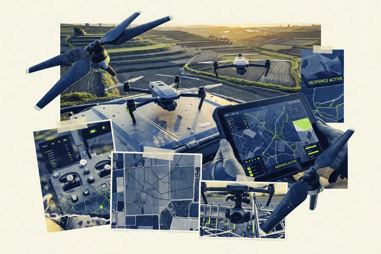
Technology Digital MediaTop 10 Best Drone Flight Planning Software of 2026
Discover top 10 best drone flight planning software to streamline aerial missions.

How we ranked these tools
Core product claims cross-referenced against official documentation, changelogs, and independent technical reviews.
Analyzed video reviews and hundreds of written evaluations to capture real-world user experiences with each tool.
AI persona simulations modeled how different user types would experience each tool across common use cases and workflows.
Final rankings reviewed and approved by our editorial team with authority to override AI-generated scores based on domain expertise.
Score: Features 40% · Ease 30% · Value 30%
Gitnux may earn a commission through links on this page — this does not influence rankings. Editorial policy
Editor picks
Three quick recommendations before you dive into the full comparison below — each one leads on a different dimension.
DroneDeploy
Automated mission planning with coverage area to ensure consistent aerial capture
Built for survey and construction teams needing repeatable drone mapping missions.
uavforecast
Runner UpAltitude-aware wind and weather forecasting used directly for flight timing decisions
Built for flight teams needing forecast-driven mission timing and wind planning at altitude.
Pix4Dcapture
Also GreatGuided capture templates that calculate flight altitude and trigger timing for target overlap.
Built for drone survey teams running repeatable photogrammetry grid and corridor missions.
Related reading
Comparison Table
This comparison table evaluates drone flight planning software used for mission setup, route planning, and operational workflows across tools such as DroneDeploy, uavforecast, Pix4Dcapture, PrecisionHawk Autopilot, and UgCS. You will compare core capabilities, planning and control features, mapping and data capture support, and practical use cases to help match each platform to a specific type of deployment.
DroneDeploy
mission planningPlans autonomous drone missions with flight paths and mapping-ready settings for inspections, construction, and agriculture.
Automated mission planning with coverage area to ensure consistent aerial capture
DroneDeploy stands out for turning drone missions into shareable flight plans with mission-ready mapping outputs. It supports planning with area and waypoint definition, then pairs those plans with automated capture settings for consistent coverage.
The platform also centralizes review by letting teams check mission boundaries and job results in one place, which reduces handoffs between pilots and stakeholders. Field control is supported through in-app mission execution tied to the same planning workspace.
- +Mission planning and execution stay linked in one workflow
- +Coverage-focused tools help teams standardize capture area definitions
- +Job review and sharing streamline stakeholder sign-off
- –Collaboration features add complexity for solo operators
- –Advanced mapping workflows can require more setup to optimize results
- –Pricing can be expensive for low-frequency drone planning
Best for: Survey and construction teams needing repeatable drone mapping missions
More related reading
uavforecast
weather-aware planningGenerates flight planning and drone mission layouts with wind, weather, and safety inputs for efficient route decisions.
Altitude-aware wind and weather forecasting used directly for flight timing decisions
UAV Forecast focuses on drone flight planning by producing mission-ready predictions for weather and wind at flight-relevant altitudes. It supports scenario planning so operators can compare conditions across times and locations before committing to a flight.
The workflow emphasizes practicality for field teams by tying forecasts directly to route and mission planning outputs. You get a planner designed to reduce guesswork on when and where to fly, rather than a general-purpose mapping suite.
- +Altitude-relevant weather and wind forecasts for planning safer flight windows
- +Scenario comparisons help select the best time for the same mission plan
- +Flight planning outputs are geared toward operational decision-making
- +Reduces pre-flight uncertainty by forecasting conditions before travel
- –Less suitable for teams needing full photogrammetry processing tools
- –Planning workflow can feel technical without flight-planning background
- –Route creation and mission optimization features are limited versus mapping suites
Best for: Flight teams needing forecast-driven mission timing and wind planning at altitude
Pix4Dcapture
photogrammetry planningCreates photogrammetry-focused flight plans with structured mission planning for capturing consistent aerial imagery.
Guided capture templates that calculate flight altitude and trigger timing for target overlap.
Pix4Dcapture stands out for turning Pix4D photogrammetry workflows into a guided field mission experience. It builds drone flight plans around camera parameters, grid or corridor capture modes, and automated trigger intervals for consistent overlap.
The app runs on supported mobile controllers and coordinates with Pix4D mapping steps after capture, reducing manual data handling. It is most effective when you want repeatable survey missions that match photogrammetry requirements instead of ad hoc flights.
- +Guided survey capture with overlap-focused planning for photogrammetry
- +Automated camera triggering with configurable interval and flight parameters
- +Consistent mission setups that integrate smoothly with Pix4D image processing
- –Setup takes time for teams unfamiliar with overlap and exposure requirements
- –Limited flexibility for highly customized flight paths beyond standard patterns
- –Requires supported hardware and firmware compatibility for dependable operation
Best for: Drone survey teams running repeatable photogrammetry grid and corridor missions
PrecisionHawk Autopilot
enterprise operationsSupports enterprise drone operations with mission planning, execution, and data collection workflows for scalable mapping.
Geofenced mission planning with waypoint or pattern execution controls
PrecisionHawk Autopilot stands out with workflow automation for repeatable drone missions across planning, dispatch, and field execution. It supports geofenced flight plans, waypoint and pattern missions, and operational review for teams that run consistent survey routes.
The system is designed around enabling pilots and program managers to follow a controlled procedure rather than relying on ad hoc manual flights. It is especially suited for operations that need standardized data capture and centralized mission management.
- +Supports standardized waypoint and pattern mission planning workflows
- +Adds geofencing and operational controls for safer repeatable flights
- +Centralizes mission dispatch and execution tracking for teams
- –Workflow depth can feel heavy for one-off users
- –Automation and controls require process setup and governance
- –Value depends on team scale and ongoing operational use
Best for: Survey and inspection teams standardizing repeatable drone missions
UgCS
advanced mission designProvides advanced mission planning with geofencing-aware routes, swath planning, and offline mission generation.
Automated airspace and geofence compliance checks during mission planning
UgCS stands out with mission planning built around geofencing, airspace awareness, and regulatory checks that help teams plan compliant flights. It supports route-based and area-based missions for common multirotor and fixed-wing workflows, with on-screen validation before execution.
The tool integrates with the UgCS mobile and operator workflow so planned missions can be reviewed, transferred, and updated with clear status indicators. Its planning depth and validation focus make it a strong choice for organizations that need repeatable, auditable mission outputs.
- +Strong geofencing and airspace validation inside the planning flow
- +Mission planning supports complex routes and area coverage efficiently
- +Clear preflight checks reduce the chance of invalid mission setups
- +Workflow support for transferring missions to operators is practical
- –Advanced validation and options can feel heavy for quick casual planning
- –Best results depend on having correct airspace and configuration data
- –Pricing and licensing can be costly for small one-pilot use
Best for: Teams needing compliant, auditable drone missions with advanced airspace checks
Mission Planner
open-source ground stationPlans and simulates drone missions with waypoint routes, automated patterns, and strong ArduPilot integration.
Integrated ArduPilot parameter management and mission upload with live telemetry verification
Mission Planner stands out because it pairs flight planning with direct ArduPilot configuration and mission handling. It supports waypoint, loiter, and complex mission structures with map-based editing and offline-friendly planning workflows.
It also enables preflight setup using parameters, actuator and RC checks, and real-time telemetry when connected. The tool is a strong choice for teams standardizing on ArduPilot driven UAVs rather than generic waypoint editors.
- +Deep ArduPilot mission and parameter workflow reduces external tooling needs
- +Map-based mission editing supports templates and complex waypoint logic
- +Live telemetry and status views help verify missions before field runs
- +Offline planning with later upload supports field connectivity constraints
- –Interface and terminology are heavy for users focused only on waypoint routing
- –Advanced mission logic creation takes time to learn and validate
- –Workflow tightly follows ArduPilot ecosystems and limits non-ArduPilot use
- –Large setup steps can slow repeat missions without templates
Best for: ArduPilot-focused teams planning missions and tuning aircraft from one desktop workflow
QGroundControl
open-source planningPlans missions with waypoint and automation support and provides a flexible ground control system for multiple autopilots.
Mission planning with waypoint-based commands and tight autopilot parameter integration
QGroundControl stands out for supporting multiple autopilot ecosystems with a single ground station workflow. It provides full mission planning with waypoint editing, offline map view, and configurable vehicle parameters tied to the autopilot.
Live telemetry monitoring, status views, and log tools help teams validate missions before and during flight. It is less focused on a polished consumer drone experience and more focused on configurable, developer-friendly mission workflows.
- +Robust mission planning with waypoint editing and parameter-driven behavior
- +Cross-autopilot support through a unified ground control interface
- +Strong telemetry and status monitoring with in-flight situational awareness
- +Useful logging tools for post-flight analysis and troubleshooting
- –UI complexity increases time-to-competence for new users
- –Advanced configuration can feel technical without autopilot knowledge
- –Not optimized for one-click consumer drone workflows
Best for: Technical pilots and teams planning missions for supported autopilots
DJI Pilot 2
manufacturer planningPlans and executes missions for DJI drones with waypoint or route workflows and camera task setup.
Waypoint mission planning with guided execution using DJI aircraft and remote controller.
DJI Pilot 2 stands out by coupling mission planning with DJI remote control and aircraft workflows for repeatable survey operations. It supports flight planning with waypoint-style missions, route editing, and automatic mission execution through DJI flight hardware.
It also provides real-time flight telemetry and camera control tied to the DJI ecosystem, which helps teams coordinate mapping passes and payload captures. The tool is strongest when you already use DJI enterprise-grade drones and DJI control links.
- +Mission planning integrates directly with DJI flight execution for fewer setup breaks
- +Waypoint routes support structured survey and repeatable flight patterns
- +Real-time telemetry and camera control help operators adjust during missions
- –Planning depth is limited compared with full GIS and mission-planning suites
- –Workflow is tightly coupled to DJI hardware and DJI control models
- –Costs rise for teams that need multiple seats or operator devices
Best for: DJI-focused teams running repeatable mapping and survey missions
Litchi
mobile route planningCreates guided flight routes and waypoint missions for supported DJI drones using a mobile-first planning interface.
Waypoint missions with camera actions per point and continuous route execution
Litchi stands out for turning DJI mission planning into a guided workflow with an interface built around repeatable flight profiles. It supports waypoint missions, route planning, and time-based control so users can choreograph camera moves across complex paths.
It also includes automatic return-to-home behavior integration and flexible camera settings for each segment. The tool is tightly oriented around DJI aircraft and Litchi-supported mission types, which limits use for non-DJI fleets.
- +Waypoint missions with smooth path planning for consistent camera movement
- +Repeatable flight profiles using scripted segments and timed actions
- +Strong DJI-focused integration for camera control during automated flights
- –DJI-only orientation limits planning for mixed-vendor drone fleets
- –Advanced mission setups require more planning effort than simpler planners
- –Workflow is less suited for collaborative review and approvals
Best for: DJI-focused creators needing reliable scripted missions and camera choreography
Skyward Flight Planning
operations managementCoordinates drone operations and mission planning workflows with a focus on compliance and operational management.
Structured mission planning workflow that produces operator-ready flight plan outputs
Skyward Flight Planning centers on turning planned drone missions into operational flight plans with structured preflight inputs. It supports mission planning workflows that connect waypoints and mission parameters into a format operators can export and execute.
The platform emphasizes reviewability of planned routes and operational intent before flight. It is best suited to teams that want a planner-focused tool rather than a full flight controller ecosystem.
- +Mission planning workflow turns inputs into structured flight plans
- +Route review is clearer than ad hoc waypoint editing
- +Exportable planning outputs support operational handoff
- –Advanced automation and collaboration feel limited versus top-tier planners
- –Less comprehensive survey, analysis, and reporting tooling than competitors
- –Pricing is high for teams needing only basic route planning
Best for: Operations teams needing structured waypoint missions and cleaner plan handoff
Conclusion
After evaluating 10 technology digital media, DroneDeploy stands out as our overall top pick — it scored highest across our combined criteria of features, ease of use, and value, which is why it sits at #1 in the rankings above.
Use the comparison table and detailed reviews above to validate the fit against your own requirements before committing to a tool.
How to Choose the Right Drone Flight Planning Software
This buyer’s guide helps you choose drone flight planning software by comparing DroneDeploy, uavforecast, Pix4Dcapture, PrecisionHawk Autopilot, UgCS, Mission Planner, QGroundControl, DJI Pilot 2, Litchi, and Skyward Flight Planning. You’ll get concrete key features, selection steps, and role-based recommendations tailored to how these tools actually plan and execute missions. It also covers common planning mistakes that show up across the listed platforms.
What Is Drone Flight Planning Software?
Drone flight planning software turns an intended flight into a mission you can validate, execute, and share across people and devices. It typically covers waypoints or patterns, route or area capture definitions, preflight validation, and mission outputs that pilots can run. Tools like DroneDeploy focus on coverage-driven mission planning and linked execution for repeatable mapping. Tools like Mission Planner focus on building ArduPilot missions with parameter handling and offline-friendly upload for telemetry verification.
Key Features to Look For
The best tools match specific mission goals like coverage overlap, compliance checks, or autopilot parameter control so your plan stays executable in the field.
Coverage-area mission planning with consistent capture
DroneDeploy excels at automated mission planning driven by coverage area so your flight plan targets consistent aerial capture for mapping and inspections. Pix4Dcapture complements this with overlap-focused capture templates that calculate flight altitude and trigger timing for grid or corridor photogrammetry missions.
Altitude-aware wind and weather scenario planning
uavforecast generates flight planning outputs using altitude-relevant wind and weather so you can choose safer flight windows tied to the route you intend to fly. This scenario comparison approach helps operations reduce preflight uncertainty for the same mission plan across different times and locations.
Photogrammetry-ready capture templates with automated triggering
Pix4Dcapture structures missions around camera parameters, grid or corridor capture modes, and automated trigger intervals to maintain overlap. This directly reduces manual setup when you need repeatable survey capture aligned with Pix4D image processing.
Geofenced mission planning with auditable operational controls
UgCS performs geofencing and airspace validation inside the planning workflow to help teams build compliant, auditable missions. PrecisionHawk Autopilot adds geofenced flight plans plus waypoint or pattern execution controls for standardized enterprise operations.
Autopilot parameter integration and mission upload verification
Mission Planner integrates ArduPilot parameter management and mission handling so you can validate missions with live telemetry when connected. QGroundControl extends the same idea across supported autopilots by tying mission behavior to configurable vehicle parameters and providing logs and telemetry tools.
Ecosystem-locked guided waypoint execution with payload control
DJI Pilot 2 couples waypoint mission planning with DJI aircraft execution and provides real-time telemetry and camera control tied to DJI’s workflow. Litchi provides DJI-focused waypoint missions with camera actions per point and continuous timed route execution for scripted camera choreography.
How to Choose the Right Drone Flight Planning Software
Pick the tool that matches your mission type and your operational workflow so planning outputs translate directly into safe execution.
Match the software to your capture goal and required repeatability
If you need repeatable mapping missions defined by coverage area, choose DroneDeploy because it creates mission-ready coverage plans and keeps planning linked to execution. If you need photogrammetry-consistent overlap with altitude and trigger timing, choose Pix4Dcapture because it uses guided capture templates that calculate flight altitude and automated camera triggering.
Decide whether you need weather-driven timing or capture-driven timing
If your mission success depends on when you fly, choose uavforecast because it generates altitude-aware wind and weather outputs and supports scenario comparisons for the same mission. If your success depends on capture consistency, choose Pix4Dcapture so your flight plan is built around camera parameters and overlap requirements.
Require compliance checks inside the planning flow when operations must be auditable
If you need automated airspace and geofence compliance checks while planning, choose UgCS because it validates geofences and airspace before execution. If your organization needs standardized dispatch and geofenced waypoint or pattern execution controls, choose PrecisionHawk Autopilot to centralize mission dispatch and execution tracking.
Choose your autopilot ecosystem based on parameter control and mission handling depth
If you operate ArduPilot aircraft and want one desktop workflow for parameter setup plus mission upload, choose Mission Planner because it manages ArduPilot parameters and supports live telemetry verification. If you need a flexible ground station that supports multiple autopilots with unified parameter-driven mission behavior and strong logging, choose QGroundControl.
Select guided execution tools only when you are aligned to their aircraft ecosystem
If you fly DJI enterprise hardware and want mission execution tightly coupled to DJI control and payload tasks, choose DJI Pilot 2 or Litchi because both provide guided waypoint missions plus camera control. Choose Skyward Flight Planning when you want structured waypoint mission planning that produces operator-ready flight plans for operational handoff instead of a full flight-controller ecosystem.
Who Needs Drone Flight Planning Software?
The right tool depends on whether you are optimizing capture consistency, forecast safety, compliance validation, or autopilot parameter correctness.
Survey and construction teams standardizing repeatable mapping missions
DroneDeploy fits this need because it plans autonomous missions using coverage area definitions and links mission review and stakeholder sign-off to the same workspace. PrecisionHawk Autopilot also fits because it adds geofenced waypoint or pattern execution controls and centralizes dispatch for repeatable survey routes.
Flight teams optimizing mission timing using wind and weather at flight altitude
uavforecast fits because it generates altitude-relevant wind and weather forecasts tied directly to flight planning outputs. This is best when you must compare scenarios across times and locations before travel rather than only editing waypoints.
Photogrammetry operators running repeatable grid and corridor surveys
Pix4Dcapture fits because it creates flight plans around camera parameters, overlap-driven templates, and automated trigger intervals. It is also designed to integrate smoothly with Pix4D capture and processing steps, which reduces manual handling of mission setup.
Organizations that must produce compliant and auditable mission outputs
UgCS fits because it performs automated airspace and geofence compliance checks during mission planning with on-screen validation. PrecisionHawk Autopilot fits because it layers geofencing and operational review on top of standardized dispatch and field execution workflows.
Common Mistakes to Avoid
Common buying mistakes come from choosing planning tools that do not translate into valid execution, consistent capture, or the compliance level your operations require.
Choosing a general waypoint editor when you need coverage and overlap consistency
If you buy software that only edits routes, you can end up with inconsistent capture boundaries. DroneDeploy prevents this by planning with coverage area for standardized aerial capture, and Pix4Dcapture prevents this by using overlap-focused templates that calculate altitude and trigger timing.
Ignoring airspace and geofence validation until after planning is complete
If your team defers compliance checks, you risk invalid mission setups reaching operators. UgCS runs airspace and geofence compliance checks inside the planning flow, and PrecisionHawk Autopilot supports geofenced mission planning with controlled execution.
Selecting a tool that does not match your autopilot ecosystem and parameter workflow
If you plan without the autopilot parameter integration your aircraft needs, you can create missions that require extra conversion steps. Mission Planner integrates ArduPilot parameter management and live telemetry verification, and QGroundControl ties mission behavior to configurable vehicle parameters with logs for troubleshooting.
Buying a DJI-only mission tool for mixed-vendor drone operations
If your fleet includes non-DJI hardware, you lose planning flexibility when the tool is oriented around DJI-supported mission types. Litchi and DJI Pilot 2 are strongest when you are aligned with DJI drones and DJI control links.
How We Selected and Ranked These Tools
We evaluated the top drone flight planning tools across overall capability, feature depth, ease of use, and value for operational use. DroneDeploy separated itself by tying coverage-based mission planning to mission review and stakeholder sharing while keeping planning and execution linked in one workflow. We also prioritized standout differentiators like uavforecast altitude-aware wind and weather planning, UgCS automated airspace and geofence compliance checks, and Mission Planner or QGroundControl parameter-driven mission integration with telemetry and logs.
Frequently Asked Questions About Drone Flight Planning Software
Which drone flight planning tool is best for repeatable mapping missions with consistent coverage?
How do I plan missions using altitude-aware wind and weather instead of general forecasts?
If my team runs ArduPilot-based UAVs, which tool helps me configure and upload missions from the same workflow?
Which option is strongest for airspace-aware, audit-friendly compliance checks during planning?
What should I use if I need centralized review and handoff between pilots and stakeholders?
Which tool is best for teams that want automated mission execution tied to planning, not separate capture steps?
Which software is the most effective choice for photogrammetry surveys that depend on camera parameters and trigger timing?
If I fly multiple autopilot ecosystems, which ground station tool gives unified mission planning and parameter handling?
Which option is best when your operation is tightly coupled to DJI aircraft and you need scripted camera choreography?
How do I produce operator-ready flight plan outputs that are easier to review and hand off than raw waypoint edits?
Tools reviewed
Primary sources checked during evaluation.
Referenced in the comparison table and product reviews above.
Keep exploring
Comparing two specific tools?
Software Alternatives
See head-to-head software comparisons with feature breakdowns, pricing, and our recommendation for each use case.
Explore software alternatives→In this category
Technology Digital Media alternatives
See side-by-side comparisons of technology digital media tools and pick the right one for your stack.
Compare technology digital media tools→FOR SOFTWARE VENDORS
Not on this list? Let’s fix that.
Our best-of pages are how many teams discover and compare tools in this space. If you think your product belongs in this lineup, we’d like to hear from you—we’ll walk you through fit and what an editorial entry looks like.
Apply for a ListingWHAT THIS INCLUDES
Where buyers compare
Readers come to these pages to shortlist software—your product shows up in that moment, not in a random sidebar.
Editorial write-up
We describe your product in our own words and check the facts before anything goes live.
On-page brand presence
You appear in the roundup the same way as other tools we cover: name, positioning, and a clear next step for readers who want to learn more.
Kept up to date
We refresh lists on a regular rhythm so the category page stays useful as products and pricing change.