GITNUXSOFTWARE ADVICE
Technology Digital MediaTop 10 Best Drone Imagery Processing Software of 2026
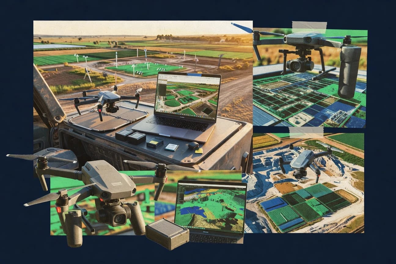
Discover top 10 best drone imagery processing software for accurate analysis & easy editing.

How we ranked these tools
Core product claims cross-referenced against official documentation, changelogs, and independent technical reviews.
Analyzed video reviews and hundreds of written evaluations to capture real-world user experiences with each tool.
AI persona simulations modeled how different user types would experience each tool across common use cases and workflows.
Final rankings reviewed and approved by our editorial team with authority to override AI-generated scores based on domain expertise.
Score: Features 40% · Ease 30% · Value 30%
Gitnux may earn a commission through links on this page — this does not influence rankings. Editorial policy
Editor’s top 3 picks
Three quick recommendations before you dive into the full comparison below — each one leads on a different dimension.
Pix4Dmapper
Quality report generation that flags reconstruction issues and supports measurement-ready deliverables
Built for mapping teams needing accurate photogrammetry outputs with quality checks built in.
Agisoft Metashape
Editor pickGround control integration with accuracy-focused optimization for georeferenced reconstructions
Built for survey and mapping teams needing accurate photogrammetry outputs from drone images.
RealityCapture
Editor pickRealityCapture’s fast, high-detail depth-map and dense reconstruction pipeline
Built for teams needing accurate, large-scale drone photogrammetry with strong control-point workflows.
Related reading
- Technology Digital MediaTop 10 Best Drone Image Processing Software of 2026
- Technology Digital MediaTop 10 Best Drone Flight Planning Software of 2026
- Construction InfrastructureTop 10 Best Drone Roof Inspection Software of 2026
- Technology Digital MediaTop 10 Best Aerial Photography Mapping Software of 2026
Comparison Table
This comparison table evaluates leading drone imagery processing tools, including Pix4Dmapper, Agisoft Metashape, RealityCapture, DJI Terra, and DroneDeploy, across photogrammetry and mapping workflows. Readers can scan feature differences in outputs such as orthomosaics and 3D models, accuracy controls, automation options, and processing performance to find the right fit for field-to-delivery work.
Pix4Dmapper
photogrammetryGenerates georeferenced orthomosaics, DSM, and 3D models from drone imagery using photogrammetry workflows and measurement tools.
Quality report generation that flags reconstruction issues and supports measurement-ready deliverables
Pix4Dmapper stands out for end-to-end photogrammetry that drives from drone imagery to metric deliverables with a repeatable workflow. It supports dense point clouds, textured meshes, orthomosaics, and georeferenced outputs with built-in processing steps for radiometric and geometric consistency.
The software also includes automated quality assessment tools and measurement-ready exports that fit surveying and mapping pipelines. Its workflow is strong for typical mapping projects where accuracy, scale, and visualization both matter.
- +Generates orthomosaics, dense point clouds, meshes, and DSM for complete mapping outputs
- +Automates much of the workflow with project templates for consistent results across jobs
- +Provides quality reports and metrics to validate georeferencing and reconstruction quality
- +Supports GCP and RTK workflows with configurable coordinate systems and exports
- –Requires careful input settings and control coverage to avoid accuracy drift
- –Heavy datasets increase compute time and demand strong workstation hardware
- –Advanced tuning options can overwhelm users who only need basic mosaics
Best for: Mapping teams needing accurate photogrammetry outputs with quality checks built in
More related reading
Agisoft Metashape
desktop photogrammetryProcesses drone photos into dense point clouds, textured meshes, orthomosaics, and elevation products with extensive export options.
Ground control integration with accuracy-focused optimization for georeferenced reconstructions
Agisoft Metashape stands out for producing high-detail photogrammetry outputs from drone imagery using a modular reconstruction pipeline. It supports dense point clouds, textured meshes, orthomosaics, and georeferenced products with control over camera calibration and optimization settings.
Advanced options for tie point filtering, ground control integration, and accuracy-oriented processing make it suitable for survey-grade workflows. Batch processing and a project-based workflow help teams standardize multi-site processing.
- +Dense point clouds and textured meshes with strong reconstruction controls
- +Orthomosaic generation with alignment refinement and camera parameter management
- +Georeferencing support with ground control points and accurate reporting outputs
- +Scales to batch projects and repeatable site processing workflows
- –Workflow requires parameter tuning for best results across different captures
- –Large datasets can demand heavy CPU, GPU, and storage resources
Best for: Survey and mapping teams needing accurate photogrammetry outputs from drone images
RealityCapture
3D reconstructionReconstructs high-detail 3D models and orthomosaics from drone images with GPU-accelerated alignment and reconstruction steps.
RealityCapture’s fast, high-detail depth-map and dense reconstruction pipeline
RealityCapture stands out for speed and accuracy in photogrammetry workflows for aerial drone datasets. The tool supports camera pose estimation, sparse to dense reconstruction, and texture generation in one processing chain.
It also enables scaling and georeferencing using control points or camera calibration inputs. Outputs commonly include high-resolution meshes, orthomosaic exports, and measurement-ready 3D models for mapping and inspection.
- +Fast dense reconstruction tuned for large drone photo sets
- +Robust control-point and georeferencing workflows for metric outputs
- +High-quality mesh and texture generation for mapping deliverables
- –Dense reconstruction settings require technical tuning for best results
- –Georeferencing and scaling can be unforgiving with weak ground control
- –Workflow flexibility exists, but guidance for newcomers is limited
Best for: Teams needing accurate, large-scale drone photogrammetry with strong control-point workflows
DJI Terra
drone ecosystemCreates orthomosaics and 3D models from DJI drone captures with a streamlined workflow for mapping and planning outputs.
Orthomosaic generation with measurement-ready coordinate outputs
DJI Terra turns DJI drone imagery into orthomosaics, 3D maps, and measurement-ready outputs using a capture-to-processing workflow built around mission data. The software supports common photogrammetry processing, including dense point clouds and textured meshes, and it can generate GIS-friendly deliverables for site planning. It stands out when paired with DJI flight planning and data organization, because project structure and processing inputs align well with DJI drone outputs.
- +Strong photogrammetry outputs including orthomosaics, 3D models, and point clouds
- +Workflow matches DJI drone capture structure for smoother project setup
- +Measurement-oriented tools for annotating and extracting usable project intelligence
- –Performance depends heavily on hardware and dataset size
- –Limited flexibility for non-DJI imaging workflows compared with general photogrammetry suites
- –Fine-tuning processing parameters can be confusing for complex missions
Best for: Teams processing DJI drone photogrammetry for mapping and site measurement deliverables
DroneDeploy
cloud mappingProcesses drone imagery into web-based orthomosaics, 3D models, and measurement-ready deliverables for teams.
One-click generation of orthomosaics, surface models, and measurements from captured drone imagery
DroneDeploy stands out with a drone-to-deliverable workflow built around cloud processing for mapping and inspection outputs. It supports automated 2D and 3D deliverables such as orthomosaics, digital surface models, and volumetric analysis for sites and stockpiles. The platform emphasizes guided mission setup and collaborative review of processed results for field and office alignment.
- +Cloud processing produces orthomosaics and 3D models for mapping deliverables
- +Volumetric tools support stockpile and earthwork measurement from processed imagery
- +Web-based sharing enables stakeholders to review outputs without local GIS setup
- +Mission planning and guided capture reduce gaps in coverage and overlap
- –Advanced control over processing parameters can feel limited versus desktop photogrammetry
- –Large projects can require careful planning for upload time and processing turnaround
- –Export flexibility for specialized GIS formats is less compelling than dedicated tools
Best for: Teams needing fast, cloud-based drone mapping outputs with web review
Mapware
cloud processingHosts cloud photogrammetry pipelines that turn drone imagery into orthomosaics, 3D models, and analytics layers for mapping workflows.
Project workflow that bundles drone imagery processing into reviewable mapping deliverables
Mapware focuses on turning drone imagery into mapped outputs through an end-to-end visual workflow tied to GIS-style deliveries. The system supports photogrammetry processing, including orthomosaic and derived elevation products from aerial captures.
It emphasizes collaboration through project-based organization so multiple stakeholders can review and use the same processed results. Mapware’s distinct value is delivering mapping artifacts that fit field and planning workflows rather than only raw reconstructions.
- +Project-based workflow keeps drone datasets, processing, and deliverables organized
- +Generates practical mapping outputs like orthomosaics for field use
- +Collaboration tools speed review of the same processed artifacts
- –Advanced reconstruction tuning is limited for highly specific photogrammetry needs
- –Geospatial export flexibility can feel constrained for specialized GIS pipelines
- –Large projects may require careful input preparation to avoid processing failures
Best for: Teams producing orthomosaics and site maps that need review and repeatable workflows
OpenDroneMap
open-sourceRuns open-source photogrammetry to produce orthophotos, DSMs, and dense point clouds from drone imagery via containerized pipelines.
Command-line photogrammetry pipeline generating orthophotos and surface models
OpenDroneMap stands out for turning drone imagery into map-ready products using an open, scriptable processing pipeline. The software supports photogrammetry workflows that generate orthophotos, digital surface models, and related outputs from input images.
Its command-line execution model fits batch processing and automated production runs across multiple projects. Map-style outputs can then be served through its integrated tooling and compatible data exports.
- +Produces orthophotos and surface models from standard drone image sets
- +Scriptable command-line workflow supports batch photogrammetry automation
- +Extensible processing steps enable repeatable production pipelines
- –Requires command-line usage and workflow tuning for best results
- –Large datasets demand significant compute and storage planning
- –Less guided UX than click-through desktop alternatives
Best for: Teams processing drone imagery into GIS products with automation focus
MicMac
academic open-sourcePerforms photogrammetric reconstruction from aerial images using feature matching, dense matching, and generation of orthographic products.
Dense point cloud and orthomosaic generation from aerial images via configurable MicMac photogrammetry pipelines
MicMac stands out by delivering open photogrammetry pipelines for turning aerial and drone imagery into dense point clouds, orthomosaics, and 3D models. It uses configurable processing steps built around feature matching, camera calibration, and bundle adjustment. The software supports workflows for aerial mapping projects and can ingest typical photogrammetry image sets captured with overlapping coverage.
- +Robust photogrammetry workflow for dense clouds, orthomosaics, and 3D reconstructions
- +Configurable command-driven pipeline supports repeatable processing for large datasets
- +Effective feature matching and bundle adjustment for camera geometry estimation
- –Command-line execution slows setup for non-technical mapping teams
- –Dataset parameter tuning can require iterative runs to reach consistent results
- –Fewer guided UI tools for QC and troubleshooting than turnkey mapping applications
Best for: Teams needing repeatable photogrammetry outputs from drone imagery with parameter control
RealityScan
mobile-to-3DBuilds textured 3D scenes from drone and photo sets using automated image reconstruction and export-ready outputs.
One-click photogrammetry reconstruction that generates textured meshes from image sets
RealityScan stands out by converting drone and mobile imagery into 3D reconstructions and textured models inside the Quixel ecosystem. It supports photogrammetry workflows that can produce meshes, dense point clouds, and high-resolution textures from overlapping images.
The tool also feeds results into downstream asset pipelines through Quixel and Unreal Engine integration. For drone imagery processing, the biggest differentiators are capture-to-model automation and a workflow that emphasizes visual fidelity over heavy manual control.
- +Fast photogrammetry from overlapping drone images into textured 3D assets
- +Good integration with Quixel and Unreal Engine pipelines for practical reuse
- +Dense reconstruction output supports detailed scene and surface work
- –Limited control over reconstruction settings compared with pro photogrammetry suites
- –Dense outputs can require strong hardware for large drone datasets
- –Georeferencing accuracy depends heavily on capture quality and metadata
Best for: Teams producing textured 3D site assets from drone imagery for Unreal workflows
Litchi
capture planningProvides mission capture tooling that supports consistent image acquisition for downstream drone imagery processing workflows.
Waypoint mission planning with automated camera triggering
Litchi stands out by focusing on drone mission planning and in-flight control rather than full photogrammetry processing. It supports repeatable capture workflows that generate consistent image sets for later processing.
Litchi’s mission features emphasize waypoint routes, route automation, and camera triggering for mapping-style datasets. The output quality still depends on image overlap, camera settings, and flight stability before any downstream processing.
- +Waypoint and route missions automate camera triggering for mapping datasets
- +Clear mission planning supports repeatable flight paths and consistent coverage
- +In-flight control reduces manual piloting for structured data capture
- +Works well as the capture layer feeding common imagery pipelines
- –Litchi does not provide built-in photogrammetry or 3D reconstruction processing
- –Complex mission editing can feel rigid for irregular field workflows
- –Dataset quality still hinges on correct overlap and camera configuration
- –Few advanced calibration and processing controls compared with dedicated software
Best for: Teams capturing consistent drone imagery for later mapping workflows
Conclusion
After evaluating 10 technology digital media, Pix4Dmapper stands out as our overall top pick — it scored highest across our combined criteria of features, ease of use, and value, which is why it sits at #1 in the rankings above.
Use the comparison table and detailed reviews above to validate the fit against your own requirements before committing to a tool.
How to Choose the Right Drone Imagery Processing Software
This buyer’s guide covers how to select drone imagery processing software for producing orthomosaics, DSMs, dense point clouds, meshes, and measurement-ready deliverables. It compares tools including Pix4Dmapper, Agisoft Metashape, RealityCapture, and cloud or automation-focused options like DroneDeploy and OpenDroneMap. It also explains capture support with Litchi for teams that want consistent image sets before processing.
What Is Drone Imagery Processing Software?
Drone imagery processing software converts overlapping drone photos into georeferenced mapping outputs like orthomosaics, dense point clouds, meshes, and elevation products. These tools solve the workflow gap between image capture and metric deliverables by running alignment and dense reconstruction steps and generating exports for measurement and GIS use. Pix4Dmapper and Agisoft Metashape represent desktop photogrammetry pipelines that produce orthomosaics, DSMs, and 3D models. RealityCapture provides a GPU-accelerated path that targets fast dense reconstruction and high-detail meshes for large drone photo sets.
Key Features to Look For
The right capabilities determine whether the output is measurement-ready, how much tuning is required, and how quickly teams can move from images to usable maps and models.
Quality reports and reconstruction validation
Pix4Dmapper generates quality report outputs that flag reconstruction issues and supports measurement-ready deliverables. This is a direct fit for teams that need confidence in georeferencing and reconstruction before exporting final products.
Ground control and accuracy-focused georeferencing controls
Agisoft Metashape emphasizes ground control integration with accuracy-oriented optimization settings for georeferenced reconstructions. RealityCapture also supports scaling and georeferencing using control points or camera calibration inputs when control coverage is strong.
Dense point clouds, textured meshes, and complete photogrammetry outputs
Pix4Dmapper produces dense point clouds, textured meshes, orthomosaics, and DSM outputs in a complete end-to-end mapping workflow. Agisoft Metashape focuses on dense reconstruction outputs that include dense point clouds and textured meshes tied to orthomosaic generation.
Fast dense reconstruction for large photo sets
RealityCapture is built for fast dense reconstruction tuned for large drone photo sets and high-detail depth-map generation. This makes it a strong choice for teams processing substantial image volumes where compute time is a daily constraint.
Capture-to-deliverable workflows with mission structure
DJI Terra aligns its processing workflow with DJI mission data structure to produce orthomosaics and 3D maps for mapping and planning outputs. DroneDeploy similarly drives a drone-to-deliverable workflow that converts captured imagery into orthomosaics and surface models with one-click generation.
Automation and batch processing pipelines
OpenDroneMap runs an open, scriptable command-line pipeline that generates orthophotos and surface models for automated production runs. MicMac also uses configurable command-driven pipelines for repeatable processing, which suits teams that can manage parameter tuning across datasets.
How to Choose the Right Drone Imagery Processing Software
A practical selection process starts with the output type needed, then matches that requirement to control workflows, reconstruction speed, and the level of parameter control available.
Match the software output to the deliverable goal
Choose Pix4Dmapper when the deliverables must include orthomosaics plus DSMs and measurement-ready exports backed by quality reporting. Choose RealityCapture when high-detail meshes and fast dense reconstruction from large drone photo sets are the primary requirement.
Decide how georeferencing accuracy will be achieved
Pick Agisoft Metashape for ground control integration that supports accuracy-focused optimization and detailed camera calibration management. Pick RealityCapture when scaling and georeferencing must rely on control points or camera calibration inputs, because weak ground control can reduce scaling reliability.
Align the workflow with the capture platform and project structure
Choose DJI Terra when the capture comes from DJI drones and the mission data structure should carry into processing for smoother project setup. Choose DroneDeploy when fast web-based deliverables and collaborative review matter, because it generates orthomosaics and surface models with guided mission setup.
Plan for compute demands and dataset size behavior
Expect heavier datasets to increase compute and storage needs in desktop photogrammetry tools like Pix4Dmapper and Agisoft Metashape, where large point clouds can increase processing time. Choose RealityCapture to reduce dense reconstruction time for large datasets, while recognizing that dense reconstruction settings still require technical tuning for best results.
Choose the right level of control versus guidance for processing and QC
Select Pix4Dmapper when built-in quality report generation is needed to validate reconstruction and georeferencing output. Select OpenDroneMap or MicMac when repeatable command-line pipelines and parameter control are required, and accept that non-technical workflows need more setup effort.
Who Needs Drone Imagery Processing Software?
Drone imagery processing software fits teams that convert photo captures into mapping products, survey-grade measurements, and textured 3D assets for downstream workflows.
Survey and mapping teams needing accuracy-focused georeferenced outputs
Agisoft Metashape supports ground control integration with accuracy-oriented optimization and georeferenced reporting outputs, which matches survey-grade expectations. RealityCapture also supports control-point and camera calibration workflows for metric outputs when ground control coverage is strong.
Mapping teams that need measurement-ready deliverables plus QC validation
Pix4Dmapper generates orthomosaics, dense point clouds, meshes, and DSM outputs plus quality report generation that flags reconstruction issues. This combination fits teams that must prove reconstruction quality before exporting measurement-ready products.
Teams processing large drone datasets and prioritizing dense reconstruction speed
RealityCapture provides GPU-accelerated alignment and dense reconstruction tuned for large drone photo sets and high-detail depth-map generation. This suits production workflows where turnaround time matters more than maximum manual control.
Organizations that want web review, collaboration, and cloud processing for mapping outputs
DroneDeploy produces cloud-generated orthomosaics and 3D models with volumetric tools for stockpile and earthwork measurements. Mapware adds a project-based workflow that bundles processing into reviewable mapping deliverables, which helps stakeholders review the same artifacts.
GIS automation teams that need batch processing and scriptable pipelines
OpenDroneMap runs a command-line photogrammetry pipeline that generates orthophotos and surface models in an automation-friendly workflow. MicMac offers configurable photogrammetry steps for dense point clouds and orthomosaic generation, which suits teams that can iterate parameters.
Common Mistakes to Avoid
Common failures come from mismatched output goals, weak control coverage, and choosing a workflow that does not fit dataset size or the needed level of processing control.
Proceeding with weak ground control coverage and expecting stable metric scaling
RealityCapture can be unforgiving when georeferencing and scaling rely on control points that are weak or poorly distributed. Agisoft Metashape requires careful ground control integration and optimization tuning to maintain georeferenced reconstruction quality.
Overlooking the compute and storage impact of dense point clouds
Agisoft Metashape and Pix4Dmapper demand strong CPU, GPU, and storage planning for large datasets because dense reconstruction outputs grow quickly. OpenDroneMap and MicMac also require compute and storage planning, but they shift the workload into automated pipeline runs.
Picking a guided or cloud workflow and later needing advanced photogrammetry tuning
DroneDeploy limits advanced control over processing parameters compared with desktop photogrammetry suites, which can constrain specialized needs. Mapware similarly has constrained advanced reconstruction tuning for highly specific photogrammetry requirements.
Using capture planning tools that do not support consistent mapping image sets
Litchi does not perform photogrammetry processing, so it must be paired with downstream processing tools that convert consistent image overlap into orthomosaics and models. If capture overlap and camera triggering are inconsistent, output quality depends heavily on the input set in tools like RealityScan and DJI Terra.
How We Selected and Ranked These Tools
We evaluated every tool on three sub-dimensions with weights of features at 0.40, ease of use at 0.30, and value at 0.30, and the overall rating is the weighted average using overall = 0.40 × features + 0.30 × ease of use + 0.30 × value. Pix4Dmapper separated itself from lower-ranked desktop and workflow options by combining dense photogrammetry deliverables with built-in quality report generation for reconstruction validation, which strongly supports the features dimension. Pix4Dmapper also pairs that mapping completeness with repeatable project templates that help teams keep results consistent across jobs, which lifts practical usability when handling multiple datasets.
Frequently Asked Questions About Drone Imagery Processing Software
Which tool produces metric-usable outputs with built-in quality checks for mapping projects?
What’s the best choice for survey-grade accuracy using ground control in drone photogrammetry?
Which software is optimized for fast large-scale dense reconstruction from drone datasets?
Which option best matches a capture-to-deliverable workflow when processing DJI drone missions?
Which platform accelerates collaboration and review by producing deliverables in the cloud?
What software is geared toward repeatable GIS-style map deliverables rather than only raw 3D models?
Which tool supports automation for batch production using a command-line photogrammetry pipeline?
Which open photogrammetry suite offers configurable processing steps for dense point clouds and orthomosaics?
Which option is most suitable for generating textured 3D assets for Unreal workflows?
How should mission planning be handled before photogrammetry processing to avoid inconsistent datasets?
Tools reviewed
Primary sources checked during evaluation.
Referenced in the comparison table and product reviews above.
Keep exploring
Comparing two specific tools?
Software Alternatives
See head-to-head software comparisons with feature breakdowns, pricing, and our recommendation for each use case.
Explore software alternatives→In this category
Technology Digital Media alternatives
See side-by-side comparisons of technology digital media tools and pick the right one for your stack.
Compare technology digital media tools→FOR SOFTWARE VENDORS
Not on this list? Let’s fix that.
Our best-of pages are how many teams discover and compare tools in this space. If you think your product belongs in this lineup, we’d like to hear from you—we’ll walk you through fit and what an editorial entry looks like.
Apply for a ListingWHAT THIS INCLUDES
Where buyers compare
Readers come to these pages to shortlist software—your product shows up in that moment, not in a random sidebar.
Editorial write-up
We describe your product in our own words and check the facts before anything goes live.
On-page brand presence
You appear in the roundup the same way as other tools we cover: name, positioning, and a clear next step for readers who want to learn more.
Kept up to date
We refresh lists on a regular rhythm so the category page stays useful as products and pricing change.