GITNUXSOFTWARE ADVICE
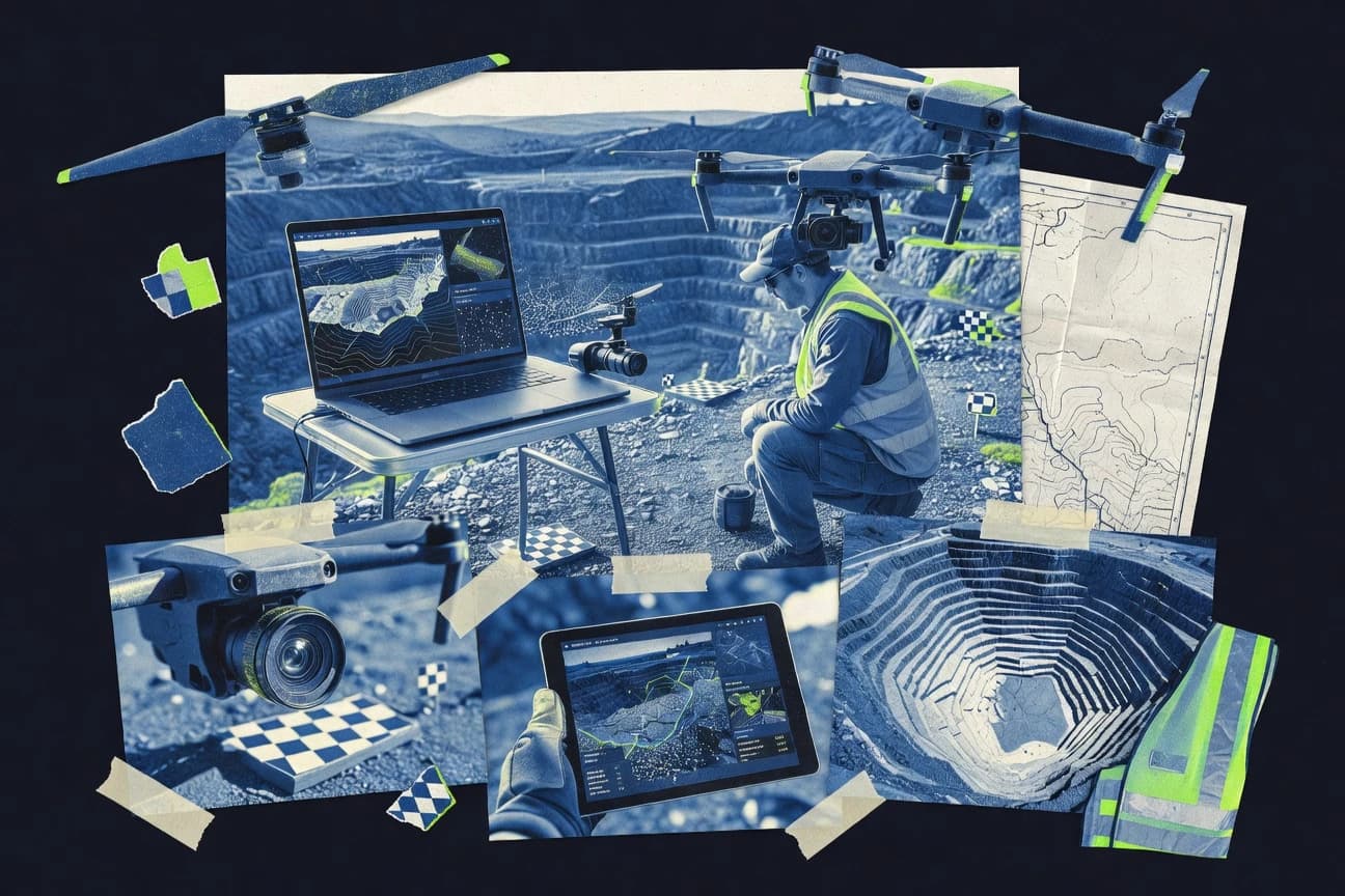
Technology Digital MediaTop 10 Best Uav Photogrammetry Software of 2026
Find the best UAV photogrammetry software for accurate drone mapping. Compare features & get the right tool for your project.

How we ranked these tools
Core product claims cross-referenced against official documentation, changelogs, and independent technical reviews.
Analyzed video reviews and hundreds of written evaluations to capture real-world user experiences with each tool.
AI persona simulations modeled how different user types would experience each tool across common use cases and workflows.
Final rankings reviewed and approved by our editorial team with authority to override AI-generated scores based on domain expertise.
Score: Features 40% · Ease 30% · Value 30%
Gitnux may earn a commission through links on this page — this does not influence rankings. Editorial policy
Editor’s top 3 picks
Three quick recommendations before you dive into the full comparison below — each one leads on a different dimension.
Pix4Dmapper
Quality Report and reconstruction validation for georeferenced orthomosaics and 3D models
Built for teams producing survey deliverables from UAV imagery with repeatable accuracy.
Agisoft Metashape
Editor pickAdvanced camera calibration and georeferencing workflows for GCP-driven orthomosaics
Built for survey teams needing high-fidelity UAV photogrammetry with controllable reconstruction parameters.
Trimble Inpho
Editor pickInpho block-based bundle adjustment and control point workflows for georeferenced outputs
Built for mapping teams needing survey-grade UAV photogrammetry workflows and control integration.
Related reading
Comparison Table
This comparison table ranks leading UAV photogrammetry software for drone mapping accuracy, coverage processing speed, and survey-grade output workflows. It contrasts Pix4Dmapper, Agisoft Metashape, Trimble Inpho, DJI Terra, Esri Drone2Map, and other platforms across key capabilities like camera calibration support, ground control handling, orthomosaic and DSM generation, and export options.
Pix4Dmapper
enterprise mappingPix4Dmapper processes UAV image sets into georeferenced orthomosaics, textured 3D models, and point clouds with configurable mapping workflows.
Quality Report and reconstruction validation for georeferenced orthomosaics and 3D models
Pix4Dmapper stands out for its end-to-end UAV photogrammetry workflow that turns overlapping imagery into metrically reliable outputs. It supports dense point clouds, textured 3D meshes, orthomosaics, and georeferenced deliverables in one processing pipeline.
Advanced options include camera calibration handling, reconstruction controls, and quality reports for repeatable survey results. Processing can leverage configurable computer vision steps for projects that require consistent mapping deliverables.
- +Strong reconstruction pipeline for orthomosaics, meshes, and dense point clouds
- +Quality reports support verification of alignment and output completeness
- +Georeferencing and camera workflow tools support survey-grade results
- –Processing can be hardware-heavy for dense clouds and large areas
- –Advanced configuration requires photogrammetry familiarity for best outcomes
- –Project setup and dataset cleanup can be time-consuming for messy flights
Best for: Teams producing survey deliverables from UAV imagery with repeatable accuracy
More related reading
Agisoft Metashape
pro photogrammetryAgisoft Metashape performs photogrammetry from UAV imagery to produce dense point clouds, textured meshes, and orthomosaics with georeferencing support.
Advanced camera calibration and georeferencing workflows for GCP-driven orthomosaics
Agisoft Metashape stands out for its photogrammetry-first workflow and strong controls over alignment, dense reconstruction, and mesh generation. The software supports common UAV photo inputs and produces textured meshes, orthomosaics, and georeferenced outputs.
Metashape also includes advanced tools like multi-view stereo densification and flexible camera calibration workflows that benefit technical survey deliverables. Its output quality tends to improve with careful parameter tuning and robust ground control or camera metadata.
- +High control over alignment and reconstruction settings for accurate survey outputs
- +Dense point cloud, mesh, and orthomosaic generation with consistent quality
- +Solid georeferencing workflows for GCP and camera calibration driven projects
- +Export options support GIS and visualization pipelines for downstream use
- –Processing parameters require experience to avoid alignment and reconstruction issues
- –Large UAV datasets can demand substantial RAM and long processing times
- –Automation is limited compared with fully guided enterprise workflows
- –Quality tuning can feel iterative for time-sensitive field turnaround
Best for: Survey teams needing high-fidelity UAV photogrammetry with controllable reconstruction parameters
Trimble Inpho
geospatial workflowTrimble Inpho provides photogrammetry workflows for UAV mapping that generate orthomosaics, DSM products, and geospatial deliverables.
Inpho block-based bundle adjustment and control point workflows for georeferenced outputs
Trimble Inpho is a photogrammetry workflow suite built around image orientation, dense reconstruction, and surveying-grade deliverables. It supports UAV photogrammetry projects with blocks, tie-point processing, and coordinate system management aimed at mapping and measurement.
The software emphasizes repeatable processing and integration with Trimble ecosystems for outputs like orthophotos and point clouds. It is powerful for structured pipelines, but it can feel heavy compared with simpler one-click UAV reconstruction tools.
- +Survey-oriented workflows with consistent control and coordinate system handling
- +Strong image block processing for large UAV datasets and repeatable outputs
- +Dense reconstruction and orthomosaic generation suited for measurement deliverables
- –Setup and processing configuration can be complex for new UAV teams
- –Less streamlined than consumer-style photogrammetry for quick recon runs
- –Workflow performance depends on careful data preparation and project configuration
Best for: Mapping teams needing survey-grade UAV photogrammetry workflows and control integration
DJI Terra
DJI ecosystemDJI Terra turns DJI UAV imagery into orthomosaics, point clouds, and 3D models with ground control and mapping tools.
DJI Terra georeferencing workflow that supports ground control for photogrammetry outputs
DJI Terra stands out for photogrammetry workflows tightly aligned with DJI flight data and mapping tasks. It supports automated reconstruction from captured images to produce textured 2D maps and 3D models used for measurement and inspection. The software includes tools for ground control integration and dense point cloud generation, but it remains more focused on DJI-centric field capture than broad multi-vendor autonomy.
- +Automates reconstruction steps from DJI image collections into usable maps and models
- +Dense point cloud and textured outputs support inspection-style visualization
- +Ground control and georeferencing workflows fit common survey capture needs
- –Optimized for DJI ecosystems and workflows rather than generic multi-vendor pipelines
- –Advanced survey customization and processing control are limited versus specialized platforms
- –Large projects can require careful hardware planning to avoid slow processing
Best for: Teams producing DJI-based 2D maps and 3D models for site inspection and measurement
Esri Drone2Map
GIS integrationDrone2Map converts drone photos into orthomosaics, point clouds, and 3D scene products integrated with ArcGIS for geospatial delivery.
Direct ArcGIS integration for orthomosaics, DSMs, and point clouds from UAV imagery
Esri Drone2Map turns UAV imagery into map outputs through an Esri-first photogrammetry workflow that stays tightly aligned with ArcGIS data structures. The tool supports flight planning and provides automated processing steps for generating orthomosaics, digital surface models, and point clouds.
It integrates results into ArcGIS for visualization and further analysis without forcing a separate data pipeline. The distinct value comes from exporting directly to formats and geoprocessing patterns used by GIS teams rather than treating photogrammetry as an isolated deliverable.
- +ArcGIS-ready outputs support smooth handoff into mapping and analysis workflows
- +Automated orthomosaic, DSM, and point cloud generation reduces manual processing steps
- +Flight planning and alignment guidance help standardize data capture for teams
- +Supports common georeferencing workflows used in surveying and mapping projects
- –Less flexible for custom photogrammetry parameters than standalone processing suites
- –Processing quality depends heavily on input capture coverage and sensor metadata
- –Bigger datasets can feel slower during alignment and dense reconstruction steps
Best for: GIS teams needing reliable UAV photogrammetry outputs inside ArcGIS workflows
Litchi + RealityCapture pipeline
workflow builderLitchi provides UAV mission planning and camera triggering, while a RealityCapture photogrammetry step generates mapped 3D and orthographic outputs.
Waypoint missions with programmable capture for consistent photo coverage before RealityCapture processing
Litchi pairs directly with RealityCapture to turn LiDAR-free drone imagery into photogrammetric point clouds and textured meshes with a largely automation-driven workflow. Litchi handles mission planning and repeatable flight capture with waypoint routes and consistent camera triggering behavior. RealityCapture then delivers processing aligned around accurate camera parameters, strong reconstruction, and output formats usable in common GIS and 3D pipelines.
- +Waypoint missions plus consistent capture sequencing for repeatable photogrammetry datasets
- +RealityCapture integration produces high-quality meshes and textures from UAV imagery
- +Supports common output formats for GIS and 3D reuse
- –Workflow requires careful planning of overlap and GCP strategy for best results
- –RealityCapture tuning can be difficult for teams without photogrammetry experience
- –Litchi flight control and processing tools stay separate, increasing handoffs
Best for: Survey teams needing repeatable UAV photo capture feeding RealityCapture
Pix4Dcloud
cloud processingPix4Dcloud processes UAV datasets in the cloud to generate mapping outputs and shareable project results.
Cloud pipeline that produces orthomosaics and 3D models with web result viewing
Pix4Dcloud stands out for running UAV photogrammetry reconstruction and analysis as a cloud workflow. It supports automated image processing pipelines to generate orthomosaics, 3D point clouds, and 3D models.
The platform also emphasizes sharing results through web-based viewing so stakeholders can inspect outputs without installing desktop software. Project organization and report-style exports support field-to-office handoff for surveying and inspection work.
- +Cloud processing turns uploads into photogrammetry outputs without local compute
- +Generates orthomosaics, point clouds, and textured 3D models from UAV imagery
- +Web viewers simplify stakeholder review and result navigation
- –Advanced georeferencing control can feel less direct than desktop workflows
- –Workflow depends on image upload and processing completion timelines
- –High-density results can be harder to manage efficiently at scale
Best for: Teams needing cloud photogrammetry outputs and web-based stakeholder review
BodenLab CloudCompare
point-cloud postCloudCompare aligns, filters, and exports point clouds derived from drone photogrammetry for cleanup and measurement workflows.
CloudCompare-derived point cloud filtering and segmentation for dense reconstruction QA
BodenLab CloudCompare distinguishes itself by delivering a managed, web-first workflow for point cloud processing built around CloudCompare. It supports core photogrammetry deliverables such as point cloud cleanup, classification-friendly segmentation, and surface generation from dense reconstructions.
It also enables QA workflows like colorized point visualization and change assessment using standard point cloud operations. The platform’s strength is point cloud refinement after UAV processing rather than photogrammetry computation itself.
- +Strong point cloud cleanup tools for dense UAV reconstructions
- +Segmentation and classification workflows support repeatable QA checks
- +CloudCompare-based operations produce consistent outputs across projects
- –Not a full UAV photogrammetry engine for alignment and dense matching
- –Web-centric workflows can feel slower than native desktop processing
Best for: Teams needing cloud-based point cloud refinement and QA for UAV photogrammetry
OpenDroneMap
open-sourceOpenDroneMap uses open-source photogrammetry tooling to reconstruct meshes, point clouds, and orthomosaics from drone imagery.
Self-hosted OpenDroneMap pipeline for batch orthomosaics and 3D reconstructions
OpenDroneMap focuses on turning drone imagery into mapping outputs using a pipeline centered on photogrammetry processing. It generates common products like orthophotos and 3D point clouds, then supports exporting to formats used in GIS and 3D workflows.
The project is distinct for its map-centric orientation and for running as a self-hosted, scriptable toolchain rather than a closed desktop photogrammetry app. Its capabilities fit organizations that want consistent processing and automation across many flight datasets.
- +Automates photogrammetry into orthophotos and dense point clouds
- +Supports Docker-based deployments for repeatable processing environments
- +Provides configurable pipeline steps for matching processing to project goals
- +Exports results for GIS and 3D downstream visualization
- –Requires command-line or service setup for full workflow control
- –Quality tuning can be time-consuming for users without prior photogrammetry experience
- –Performance depends heavily on correct compute resources and dataset readiness
- –Fewer guided UI workflows than dedicated turnkey photogrammetry tools
Best for: Teams building automated UAV photogrammetry pipelines without fully GUI-bound tooling
MicMac
open-sourceMicMac is a photogrammetry suite that reconstructs point clouds and 3D models from UAV images with calibration and bundle adjustment steps.
MicMac dense matching and reconstruction workflow using configurable SfM and MVS steps
MicMac stands out for its open photogrammetry pipeline built around detailed command-line workflows for UAV image sets. It provides dense point clouds, mesh reconstruction, and orthomosaic generation from aerial imagery with support for camera models and calibration refinement. The system emphasizes reproducibility through scripted processing steps and granular control of alignment, matching, and surface extraction parameters.
- +Dense matching and orthomosaic generation from UAV images
- +Scriptable pipeline enables repeatable processing across projects
- +Supports calibration and camera modeling refinement workflows
- –Command-line setup increases time to first successful reconstruction
- –Parameter tuning is often required for complex scenes
- –Limited built-in QA visualization compared with point-and-click tools
Best for: Teams needing configurable UAV photogrammetry pipelines with scripting control
Conclusion
After evaluating 10 technology digital media, Pix4Dmapper stands out as our overall top pick — it scored highest across our combined criteria of features, ease of use, and value, which is why it sits at #1 in the rankings above.
Use the comparison table and detailed reviews above to validate the fit against your own requirements before committing to a tool.
How to Choose the Right Uav Photogrammetry Software
This buyer’s guide helps select UAV photogrammetry software for accurate drone mapping using Pix4Dmapper, Agisoft Metashape, Trimble Inpho, DJI Terra, Esri Drone2Map, Litchi plus RealityCapture, Pix4Dcloud, BodenLab CloudCompare, OpenDroneMap, and MicMac. It explains what each tool is built to do, which features matter for mapping accuracy and deliverables, and how to match workflows to team capabilities. It also covers common setup and processing pitfalls that slow down dense reconstruction or degrade georeferenced outputs.
What Is Uav Photogrammetry Software?
UAV photogrammetry software converts overlapping drone images into georeferenced mapping products like orthomosaics, dense point clouds, and textured 3D meshes. It solves the matching and reconstruction problem by aligning images, refining camera parameters, and generating surfaces or points that can be measured. Mapping teams also use it to export products into GIS or 3D workflows, such as ArcGIS-ready datasets from Esri Drone2Map. Tool examples in practice include Pix4Dmapper for an end-to-end orthomosaic and dense point cloud workflow and Agisoft Metashape for controllable camera calibration and georeferencing output generation.
Key Features to Look For
The following capabilities directly determine whether a UAV photogrammetry workflow produces reliable georeferenced deliverables, manageable processing speed, and usable outputs for downstream teams.
Quality report and reconstruction validation for georeferenced deliverables
Quality reports reduce uncertainty by showing alignment and output completeness for Pix4Dmapper projects that generate orthomosaics and 3D models. This validation workflow supports survey-style repeatability where teams need consistent results across repeated flights.
Advanced camera calibration and GCP-driven georeferencing controls
Agisoft Metashape provides advanced camera calibration and georeferencing workflows that improve orthomosaic reliability when ground control points or camera metadata drive accuracy. Trimble Inpho also emphasizes block-based bundle adjustment and control point workflows for georeferenced outputs used for measurement deliverables.
Survey-grade block processing and coordinate system management
Trimble Inpho is built around block-based processing that manages image blocks, tie points, and coordinate systems for repeatable surveying workflows. This structured pipeline is designed for mapping teams that prioritize controlled outputs over quick recon runs.
ArcGIS-ready output integration for GIS-first mapping workflows
Esri Drone2Map converts UAV imagery into orthomosaics, DSMs, and point clouds with direct integration into ArcGIS structures. This reduces handoff friction for GIS teams by aligning photogrammetry outputs with downstream mapping and analysis patterns.
Programmable capture with waypoint missions feeding photogrammetry
Litchi pairs waypoint missions and programmable camera triggering with RealityCapture processing to create repeatable photo coverage. This feature matters because consistent overlap and capture sequencing reduce reconstruction stress when generating mapped 3D and orthographic products.
Cloud or self-hosted processing for managed pipelines and stakeholder review
Pix4Dcloud runs photogrammetry recon in the cloud and provides web-based viewing of orthomosaics and 3D models for stakeholder review without local desktop installs. OpenDroneMap runs as a self-hosted, scriptable pipeline using configurable steps for batch orthomosaics and dense reconstructions where automation and reproducibility matter.
How to Choose the Right Uav Photogrammetry Software
Choosing the right tool comes down to matching deliverable requirements, georeferencing control needs, capture workflow constraints, and whether processing must be desktop, cloud, or self-hosted.
Start with the exact deliverables and accuracy expectations
Select Pix4Dmapper when orthomosaics, textured 3D meshes, and dense point clouds must come from one configurable processing pipeline with quality report validation. Select Agisoft Metashape when the project needs dense point clouds, textured meshes, and orthomosaics with deeper control over alignment, dense reconstruction, and camera calibration for accuracy-focused surveys.
Match georeferencing and control workflows to the project inputs
Choose Agisoft Metashape when GCP-driven orthomosaics require advanced camera calibration and georeferencing workflows. Choose Trimble Inpho when block-based bundle adjustment and control point workflows for coordinate systems are required for measurement-grade outputs.
Decide where the processing must run and who needs to review results
Choose Pix4Dcloud when cloud processing and web-based viewing of outputs matter for fast stakeholder review without local compute. Choose OpenDroneMap when batch automation and self-hosted, scriptable pipelines are required for running consistent photogrammetry steps across many flight datasets.
Align with the ecosystem that will consume the results
Choose Esri Drone2Map when ArcGIS integration is the primary downstream requirement because it outputs orthomosaics, DSMs, and point clouds directly into ArcGIS patterns. Choose DJI Terra when UAV imagery is consistently captured with DJI workflows and the mapping team wants a DJI-aligned georeferencing workflow that supports ground control.
Ensure the capture workflow supports repeatable recon
Choose Litchi plus RealityCapture when mission planning and programmable waypoint capture are required to produce consistent overlap and camera triggering. Choose Pix4Dmapper or Agisoft Metashape when desktop reconstruction flexibility is required to tune parameters for messy flights and then validate outputs with quality reporting.
Who Needs Uav Photogrammetry Software?
Different teams need different reconstruction, georeferencing, and pipeline automation capabilities based on how they capture imagery and how they use mapping deliverables.
Survey deliverables teams that need repeatable accuracy
Pix4Dmapper fits teams producing survey deliverables because it combines orthomosaic and dense point cloud generation with a Quality Report for reconstruction validation. Agisoft Metashape also fits survey workflows where advanced camera calibration and georeferencing controls improve GCP-driven orthomosaic accuracy.
Technical mapping teams that require block-based control and coordinate system handling
Trimble Inpho fits mapping teams needing survey-grade UAV photogrammetry because it uses block-based bundle adjustment and control point workflows. This structure supports repeatable outputs for large UAV datasets where coordinate management impacts measurement quality.
GIS teams that must deliver into ArcGIS workflows
Esri Drone2Map fits GIS teams because it provides direct ArcGIS integration for orthomosaics, DSMs, and point clouds. It also supports flight planning and alignment guidance to standardize capture for GIS-ready delivery.
Stakeholder-driven projects that need fast cloud processing and web review
Pix4Dcloud fits teams that need cloud photogrammetry outputs and stakeholder review through web-based viewing. It supports orthomosaics, point clouds, and textured 3D models while reducing the need for local desktop compute for reconstruction.
Common Mistakes to Avoid
Repeated reconstruction failures and slow field-to-office turnaround usually come from mismatches between data capture quality, georeferencing inputs, and how much user configuration each tool requires.
Under-planning image overlap and GCP strategy before reconstruction
Litchi plus RealityCapture depends on waypoint mission overlap and capture sequencing because RealityCapture reconstruction quality is strongly shaped by input coverage. Teams also need careful planning of GCP strategy when using Agisoft Metashape and Trimble Inpho because georeferencing and camera calibration outcomes rely on correct control input.
Expecting full turnkey control when advanced tuning is required for accuracy
Agisoft Metashape requires parameter tuning expertise to avoid alignment and reconstruction issues on large datasets. MicMac and OpenDroneMap also require configuration discipline because their scripting and parameter controls are powerful but can slow time to first successful reconstruction.
Ignoring hardware and dataset size constraints during dense reconstruction
Pix4Dmapper can become hardware-heavy for dense clouds and large areas because dense reconstruction is computationally demanding. Esri Drone2Map alignment and dense reconstruction steps also slow down on bigger datasets because processing time depends on capture coverage and sensor metadata.
Using a point cloud cleanup tool as a substitute for photogrammetry reconstruction
BodenLab CloudCompare supports point cloud cleanup, segmentation, and QA for dense UAV reconstructions but it is not a full UAV photogrammetry engine for alignment and dense matching. Teams should run photogrammetry in tools like Pix4Dmapper, Agisoft Metashape, OpenDroneMap, or MicMac before using CloudCompare-based refinement workflows.
How We Selected and Ranked These Tools
we evaluated every tool by scoring features (weight 0.4), ease of use (weight 0.3), and value (weight 0.3). The overall rating is computed as overall = 0.40 × features + 0.30 × ease of use + 0.30 × value. Pix4Dmapper separated itself from lower-ranked options through the features dimension by providing a Quality Report that validates reconstruction for georeferenced orthomosaics and 3D models. That kind of deliverable validation matters because it directly reduces rework when producing repeatable survey outputs.
Frequently Asked Questions About Uav Photogrammetry Software
Which UAV photogrammetry software produces the most consistently georeferenced orthomosaics and 3D deliverables for survey-grade workflows?
What software choice best fits teams that need controllable camera calibration and repeatable reconstruction parameters?
Which tool supports a structured, block-based bundle adjustment workflow with explicit control point management?
What option is best for DJI-centric field capture when the same workflow must remain aligned with DJI flight data?
Which software integrates most directly into GIS pipelines built on ArcGIS data structures?
Which pipeline is best for teams that want repeatable waypoint-based image capture before photogrammetry processing?
Which platform supports cloud-based processing with web viewing for stakeholder review without installing desktop software?
What solution is best when the main requirement is point cloud refinement, segmentation, and change-style QA after reconstruction?
Which tool fits organizations that want an automated, scriptable photogrammetry pipeline they can self-host across many datasets?
Which software provides the most granular control and reproducibility through fully configurable command-line processing steps?
Tools reviewed
Primary sources checked during evaluation.
Referenced in the comparison table and product reviews above.
Keep exploring
Comparing two specific tools?
Software Alternatives
See head-to-head software comparisons with feature breakdowns, pricing, and our recommendation for each use case.
Explore software alternatives→In this category
Technology Digital Media alternatives
See side-by-side comparisons of technology digital media tools and pick the right one for your stack.
Compare technology digital media tools→FOR SOFTWARE VENDORS
Not on this list? Let’s fix that.
Our best-of pages are how many teams discover and compare tools in this space. If you think your product belongs in this lineup, we’d like to hear from you—we’ll walk you through fit and what an editorial entry looks like.
Apply for a ListingWHAT THIS INCLUDES
Where buyers compare
Readers come to these pages to shortlist software—your product shows up in that moment, not in a random sidebar.
Editorial write-up
We describe your product in our own words and check the facts before anything goes live.
On-page brand presence
You appear in the roundup the same way as other tools we cover: name, positioning, and a clear next step for readers who want to learn more.
Kept up to date
We refresh lists on a regular rhythm so the category page stays useful as products and pricing change.