GITNUXSOFTWARE ADVICE
Real Estate PropertyTop 10 Best Aerial Property Measurement Software of 2026
Discover the top 10 aerial property measurement software to streamline your property assessment. Compare features & find the best fit today.

How we ranked these tools
Core product claims cross-referenced against official documentation, changelogs, and independent technical reviews.
Analyzed video reviews and hundreds of written evaluations to capture real-world user experiences with each tool.
AI persona simulations modeled how different user types would experience each tool across common use cases and workflows.
Final rankings reviewed and approved by our editorial team with authority to override AI-generated scores based on domain expertise.
Score: Features 40% · Ease 30% · Value 30%
Gitnux may earn a commission through links on this page — this does not influence rankings. Editorial policy
Editor’s top 3 picks
Three quick recommendations before you dive into the full comparison below — each one leads on a different dimension.
DroneDeploy
2D measurements and annotated orthomosaics from captured drone imagery
Built for property teams needing fast drone-to-measurement outputs without heavy GIS work.
Pix4D
Editor pickIntegrated georeferencing with GCP and RTK support for survey-accurate property measurements
Built for survey teams producing measurement-ready drone deliverables for property documentation and GIS workflows.
Propeller Aero
Editor pickProperty measurement deliverables built from drone imagery for ortho-based assessment
Built for property measurement teams needing consistent drone deliverables and review workflows.
Related reading
Comparison Table
This comparison table benchmarks aerial property measurement software used for drone capture workflows, photogrammetry, and measurement-grade mapping. Tools such as DroneDeploy, Pix4D, Propeller Aero, PrecisionHawk, and Global Mapper are evaluated side by side so property teams can compare capabilities like data processing, deliverable outputs, and field-to-report efficiency.
DroneDeploy
drone surveyPlans aerial drone missions, captures georeferenced imagery, and generates measurement and property documentation workflows for real-estate surveys.
2D measurements and annotated orthomosaics from captured drone imagery
DroneDeploy stands out for turning drone capture into property-ready measurement outputs through automated flight planning and guided post-processing. It supports mapping workflows for orthomosaics, 2D measurements, and volumetrics tied to captured imagery. Teams can standardize surveys across sites by using repeatable capture-to-deliverable projects with configurable outputs.
- +Automated mapping pipeline from flight planning to deliverables
- +Strong measurement outputs for land area, distances, and surfaces
- +Clear project organization for repeatable property survey workflows
- +Reliable orthomosaic generation for property documentation
- –Advanced measurement customization can feel limited versus CAD-grade tools
- –Large projects may slow processing and export workflows
- –Property boundary workflows require careful capture setup
Best for: Property teams needing fast drone-to-measurement outputs without heavy GIS work
More related reading
Pix4D
photogrammetryProcesses drone and aerial images into photogrammetry outputs like orthomosaics and 3D models with survey-style measurements for property assessment.
Integrated georeferencing with GCP and RTK support for survey-accurate property measurements
Pix4D stands out for turning drone or survey imagery into georeferenced products used for property measurements. It supports photogrammetry workflows that generate orthomosaics, point clouds, and 3D models for land documentation and change analysis.
The software focuses on delivering measurement-ready outputs like accurate elevations and survey-grade views. It also fits multi-site processing by organizing projects from image capture through exports and downstream GIS or reporting use.
- +Strong photogrammetry pipeline that produces metrically usable orthomosaics and 3D models
- +Point clouds and elevation surfaces support measurement workflows for property boundaries and grading
- +Georeferencing tools help align outputs with real-world coordinates for documentation
- –Workflow setup can require careful control of GCPs, coordinate systems, and quality settings
- –Processing and export steps can feel complex for one-off property measurements
- –Automation for repetitive property deliverables is limited without custom project discipline
Best for: Survey teams producing measurement-ready drone deliverables for property documentation and GIS workflows
Propeller Aero
aerial mappingProvides aerial imaging capture and automated photogrammetry products that include measurement-ready outputs for parcel and property mapping workflows.
Property measurement deliverables built from drone imagery for ortho-based assessment
Propeller Aero focuses on scaling aerial measurements into property-relevant workflows using geospatial outputs from drone missions. The platform centers on inspection-style deliverables like ortho imagery and measurement products that support land boundary and asset assessments.
Team collaboration tools help structure review, approvals, and versioning around captured project data. Measurement outputs are designed to be consumed by downstream survey and property operations rather than only viewed as static images.
- +Drone-to-measurement workflow with property-focused deliverables like orthos
- +Structured project review and collaboration around captured datasets
- +Outputs support downstream property operations and visual verification
- –Geospatial workflows can feel rigid for custom measurement logic
- –Reviewing high-detail outputs requires training to use effectively
- –Measurement interpretation depends on correct mission planning and coverage
Best for: Property measurement teams needing consistent drone deliverables and review workflows
PrecisionHawk
enterprise droneDelivers drone mapping software and analytics that support geospatial measurement outputs used for asset and property inspection documentation.
Survey workflow management that links flight capture through standardized measurement deliverables
PrecisionHawk focuses on using drone-collected imagery for property-scale measurements tied to repeatable survey workflows. Core capabilities include flight data capture, automated processing, and reporting that supports mapping tasks like orthomosaics and measurement outputs.
The platform is geared toward land and asset teams that need consistent deliverables across multiple sites rather than one-off inspection views. It fits aerial property measurement use cases where governance, review trails, and standardized outputs matter.
- +Workflow tools that standardize aerial data capture and measurement deliverables
- +Processing pipeline supports property mapping outputs like orthomosaics and measurements
- +Collaboration features support internal review and client-ready reporting artifacts
- –Setup and operational details can require specialized admin or experienced users
- –Measurement workflows can feel less flexible than more configurable point-and-click platforms
- –Tooling is more oriented toward survey programs than rapid, ad hoc analysis
Best for: Property survey teams running repeatable drone mapping across many sites
Global Mapper
GIS measurementImports aerial and raster data and supports measurement, digitizing, and geospatial analysis needed to derive property boundaries and areas.
Terrain and surface analysis tools for measuring derived areas over georeferenced imagery
Global Mapper stands out with fast geospatial data processing that supports large raster and vector datasets in a single workflow. It combines terrain and orthophoto handling with survey-style measurements, so aerial property boundaries and areas can be computed directly from loaded imagery and surfaces. The software’s core strength is building repeatable geospatial analysis projects that stay consistent across imported coordinate systems and derived layers.
- +Strong import and processing of raster and vector layers for aerial workflows
- +Accurate area and distance measurement tied to georeferenced datasets
- +Flexible coordinate system handling for property boundary projects
- –Aerial property workflows can require more manual setup than dedicated tools
- –Advanced analysis menus can feel complex for first-time measurement users
- –Collaboration and guided property-report outputs are less turnkey
Best for: Survey, mapping, and land teams measuring properties from geospatial imagery
ArcGIS Pro
GIS suiteProvides photogrammetry, 3D reconstruction, and measurement tools for parcel analysis using aerial imagery inside a GIS workspace.
Edit and measure on georeferenced ortho imagery and derived surfaces using ArcGIS measurement tools
ArcGIS Pro stands out for combining photogrammetry workflows with GIS-native property measurement outputs in one desktop environment. It supports aerial data processing via ortho-mapping, point cloud analysis, and map-based measurement tools that tie results to authoritative spatial references. Its core strength is turning imagery into measurable surfaces, then managing parcels, parcels derivatives, and survey-style computations inside a consistent geodatabase workflow.
- +GIS-native measurement tied to projections, datums, and geodatabases
- +Tools support deriving orthomosaics and surfaces for area and distance computations
- +Strong integration with parcel layers, topology validation, and editing workflows
- –Photogrammetry and surface workflows require technical setup and tuning
- –Measurement accuracy depends on correct sensor models, GCPs, and coordinate systems
- –UI complexity slows repeat property-measurement workflows for small teams
Best for: Geospatial teams producing ortho-based property metrics with GIS-managed parcel data
QField
field captureRuns georeferenced field capture workflows that pair with aerial data processing for property measurement and inspection documentation.
Offline-ready mobile GIS project editing with layer workflows for aerial field verification
QField stands out for offline-first field data capture that pairs mobile GIS editing with drone and aerial workflows. It supports viewing, editing, and exporting geospatial project data on tablets and phones, which helps teams move from imagery-derived layers to property measurements.
Core capabilities include map customization, task-based surveys, and integration with desktop GIS projects for consistent spatial data management. It is well suited for property measurement workflows where field validation and annotation are required alongside aerial basemaps.
- +Offline-capable mobile GIS editing for aerial basemap and property boundary validation
- +Works with project data and layers prepared in desktop GIS for measurement consistency
- +Customizable mapping and form-driven field workflows for repeatable survey capture
- –Setup and project preparation require GIS discipline, not a guided wizard
- –Advanced measurement and topology checks depend heavily on how data is modeled
Best for: Property survey teams validating aerial boundaries with offline mobile GIS workflows
Cadasta
land mappingSupports land-rights data collection workflows that integrate with mapping outputs for property boundary capture and measurement workflows.
Property-centric data collection that links parcel boundaries and attributes to map-based context
Cadasta is distinct for combining property-focused data collection with an aerial-first mapping workflow aimed at tenure documentation. The platform supports geospatial capture of parcel information, linking boundaries, attributes, and imagery-based context for field teams.
Cadasta emphasizes structured, shareable records over advanced photogrammetry automation, so aerial measurement output often relies on external workflows or upstream geodata. The core capability is turning spatial observations into usable property records and reports for mapping and governance use cases.
- +Structured parcel data model ties aerial context to consistent property attributes
- +Field-friendly mapping and data capture supports boundary documentation workflows
- +Collaboration and export of mapped results helps drive tenure program reporting
- –Limited built-in aerial measurement and photogrammetry automation compared with geospatial specialists
- –Boundary validation and quality control require careful process design outside the tool
- –Advanced spatial analytics and precision geodesy workflows need external tools
Best for: Tenure teams capturing parcel boundaries with aerial context and structured attributes
OpenDroneMap
open-source photogrammetryGenerates orthomosaics and 3D models from drone images using open-source photogrammetry pipelines that enable measurement outputs.
OpenDroneMap Engine with Dockerized photogrammetry producing orthomosaics and 3D models
OpenDroneMap distinguishes itself with a workflow for turning drone imagery into georeferenced 3D outputs using open, Docker-based processing. It supports photogrammetry pipelines that generate dense point clouds, textured meshes, and orthomosaics suited for measuring land features.
For aerial property measurement, it can produce GIS-ready deliverables once control points and coordinate systems are configured. The main limitation is that accurate results depend heavily on dataset quality and georeferencing discipline.
- +Produces georeferenced orthomosaics and textured 3D meshes from drone images
- +Supports dense point clouds for measurement and volumetric analysis
- +Runs reproducibly via Docker and command-line workflows
- –Georeferencing accuracy depends on control points and camera metadata quality
- –Less direct tooling for cadastral workflows and legal boundary deliverables
- –Operational complexity rises with large datasets and tuning needs
Best for: Property teams needing accurate orthomosaics and 3D measurement outputs
Agisoft Metashape
desktop photogrammetryProcesses aerial photographs into dense point clouds and textured meshes with measurement capabilities for property geometry analysis.
Georeferencing with ground control points and camera calibration for metrically accurate outputs
Agisoft Metashape stands out for turning drone and aerial imagery into metrically usable 3D outputs with strong photogrammetry controls. It supports dense point clouds, textured meshes, and orthomosaics geared toward surveying workflows like topographic mapping and volumetric change analysis.
The software includes camera calibration, georeferencing using ground control points, and export tools for GIS and CAD handoff. It also supports automation through command line processing for repeatable property measurement projects.
- +Dense point clouds and textured meshes with survey-grade georeferencing options
- +Orthomosaic generation with control over camera poses and spatial referencing
- +Command-line automation enables repeatable processing for property measurement batches
- +Tooling for camera calibration and ground control point workflows
- –Processing setup and parameter tuning can be time-consuming for new teams
- –Large datasets require substantial GPU and storage planning for stable runs
- –Editing and QA checks are less streamlined than purpose-built survey suites
- –Photogrammetry quality depends heavily on capture geometry and overlap
Best for: Survey teams producing orthomosaics, DSMs, and property metrics from aerial imagery
Conclusion
After evaluating 10 real estate property, DroneDeploy stands out as our overall top pick — it scored highest across our combined criteria of features, ease of use, and value, which is why it sits at #1 in the rankings above.
Use the comparison table and detailed reviews above to validate the fit against your own requirements before committing to a tool.
How to Choose the Right Aerial Property Measurement Software
This buyer’s guide explains how to evaluate aerial property measurement software using concrete workflows from DroneDeploy, Pix4D, Propeller Aero, PrecisionHawk, Global Mapper, ArcGIS Pro, QField, Cadasta, OpenDroneMap, and Agisoft Metashape. It covers what the tools actually produce, which teams they fit, and how to avoid measurement and georeferencing mistakes that break property outputs. It also maps buying decisions to deliverable types like annotated orthomosaics, survey-grade point clouds, and GIS-ready boundaries and areas.
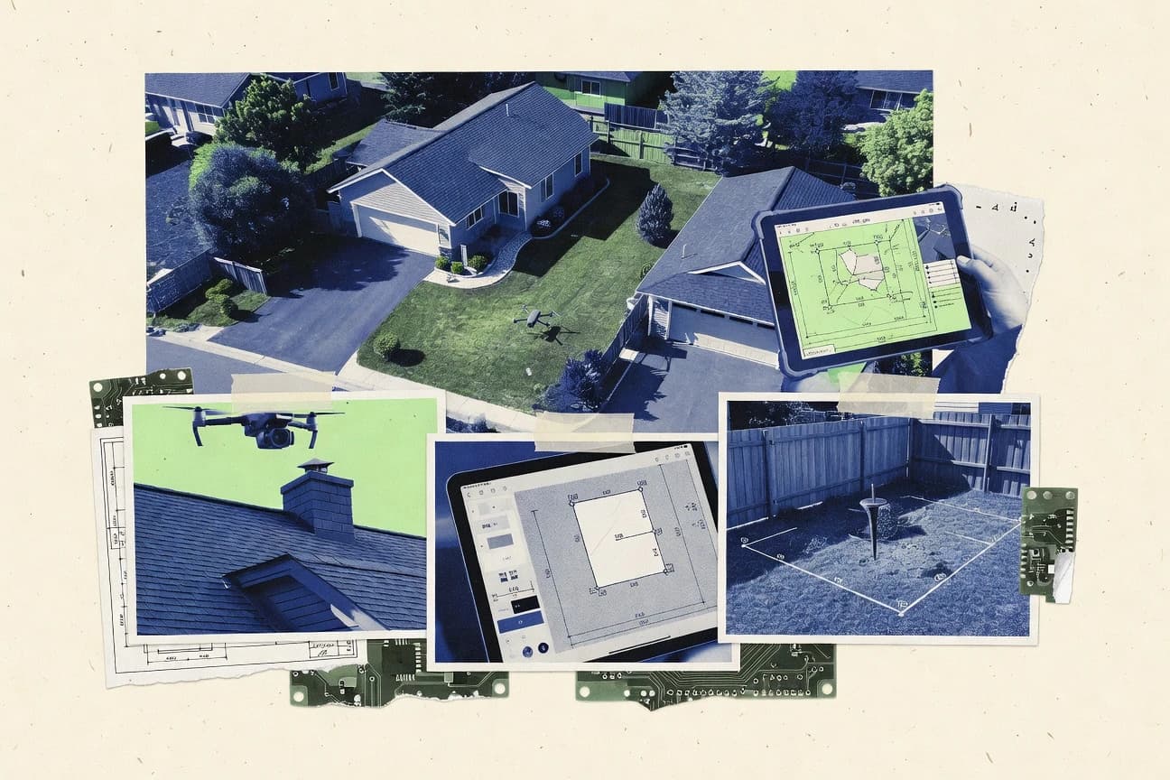
What Is Aerial Property Measurement Software?
Aerial property measurement software turns drone and aerial imagery into property measurement outputs like orthomosaics, 2D measurements, distances, surfaces, and 3D models. It solves the problem of converting captured pixels into georeferenced geometry that land, survey, and property teams can measure for parcel documentation and assessment. Tools like DroneDeploy emphasize guided capture-to-deliverable workflows that generate annotated orthomosaics and 2D measurements. Survey-focused platforms like Pix4D and Agisoft Metashape focus on metrically usable orthomosaics, dense point clouds, and georeferencing controls using GCPs.
Key Features to Look For
The right feature set depends on whether the priority is fast property-ready outputs, survey-grade accuracy, or GIS-integrated parcel workflows.
Capture-to-measurement pipeline that produces property deliverables
DroneDeploy excels at automating flight planning through deliverables, including 2D measurements and annotated orthomosaics for property documentation. PrecisionHawk and Propeller Aero also link capture to standardized measurement deliverables to support repeatable property survey programs across sites.
Georeferencing controls with GCP and RTK support
Pix4D stands out with integrated georeferencing that supports GCP and RTK for survey-accurate property measurements. Agisoft Metashape provides georeferencing using ground control points and camera calibration, which supports metrically accurate orthomosaics and spatial references.
Orthomosaic generation tied to measurement outputs
DroneDeploy delivers reliable orthomosaic generation paired with surface, land area, and distance measurement outputs for property reporting. ArcGIS Pro supports ortho-based property metrics by enabling edits and measurements on georeferenced ortho imagery and derived surfaces inside a GIS workspace.
2D measurement and annotated outputs for faster property assessment
DroneDeploy provides 2D measurements and annotated orthomosaics directly from captured drone imagery, which reduces the need for external CAD-grade interpretation. Propeller Aero packages property measurement deliverables built from drone imagery so teams can review orthos for property-relevant assessment.
Surface and terrain analysis for derived areas
Global Mapper emphasizes terrain and surface analysis tools that measure derived areas over georeferenced imagery. ArcGIS Pro complements that workflow by tying measurement results to GIS-native projections, datums, and geodatabase-managed parcel layers.
Geospatial workflow integration for field validation and governance records
QField provides offline-ready mobile GIS editing for validating aerial boundaries and annotations against captured basemaps, which supports measurement workflows that require field verification. Cadasta focuses on a property-centric data model that links parcel boundaries and attributes to mapped context, which is valuable when records and reporting matter more than built-in photogrammetry automation.
How to Choose the Right Aerial Property Measurement Software
The selection process should start with the required deliverable type and then match the needed georeferencing rigor and workflow structure to the tool.
Define the deliverables the property team must produce
If the deliverable is annotated orthomosaics and straightforward 2D measurements, DroneDeploy is built around that output style with 2D measurements and annotated orthomosaic generation. If the deliverable is survey-grade 3D outputs, Pix4D and Agisoft Metashape produce orthomosaics plus dense point clouds and 3D models suited for property documentation and change analysis.
Match georeferencing needs to the tool’s control workflow
For projects that rely on GCP and RTK alignment, Pix4D provides integrated georeferencing tools that support survey-accurate property measurements. For repeatable calibration and ground control workflows, Agisoft Metashape supports camera calibration and ground control point georeferencing that feeds metrically accurate outputs.
Decide how much GIS and parcel editing must happen inside the software
If parcel topology editing and measurement must occur in a GIS environment with authoritative spatial references, ArcGIS Pro supports editing and measuring on georeferenced ortho imagery and derived surfaces using ArcGIS measurement tools. If the workflow is centered on geospatial analysis after import of raster and vector layers, Global Mapper supports terrain and surface analysis for computing property boundary areas over georeferenced datasets.
Choose the collaboration and field verification workflow model
If property measurement teams need standardized review and approvals around captured datasets, PrecisionHawk and Propeller Aero provide workflow governance and structured collaboration around measurement deliverables. If field validation must happen offline with mobile GIS layer editing, QField supports offline-ready editing and exports so boundaries and annotations can be verified against aerial basemaps.
Select the processing approach for your operational scale
For teams that want automated capture-to-deliverable processing without heavy setup, DroneDeploy focuses on guided post-processing and repeatable property survey projects. For teams that need open, reproducible processing pipelines, OpenDroneMap runs Docker-based photogrammetry via a command-line workflow, and output accuracy depends on control points and dataset quality.
Who Needs Aerial Property Measurement Software?
Aerial property measurement software supports multiple roles across property, survey, GIS, and tenure programs by converting imagery into measurement-ready geospatial outputs.
Property teams needing fast drone-to-measurement outputs without heavy GIS work
DroneDeploy is the best fit because it automates mapping from flight planning to deliverables and produces 2D measurements with annotated orthomosaics. Propeller Aero also fits by generating property-focused ortho-based measurement deliverables that support review and verification workflows.
Survey teams producing measurement-ready orthomosaics and 3D models for documentation
Pix4D suits survey teams because it provides integrated georeferencing with GCP and RTK support for survey-accurate property measurements. Agisoft Metashape supports survey workflows with dense point clouds, textured meshes, orthomosaic generation, camera calibration, and ground control point georeferencing.
Property survey teams running repeatable drone mapping across many sites
PrecisionHawk fits because it standardizes aerial data capture and links flight capture through standardized measurement deliverables with collaboration and reporting artifacts. Propeller Aero also fits by structuring review, approvals, and versioning around captured project datasets for consistent property measurement outputs.
GIS and mapping teams measuring properties from georeferenced imagery and managing parcel layers
ArcGIS Pro fits geospatial teams because it enables measurement and editing on georeferenced ortho imagery and derived surfaces inside a GIS workspace tied to projections and geodatabases. Global Mapper fits mapping teams that need fast import and processing of raster and vector layers to compute accurate area and distance measurements for property boundary projects.
Common Mistakes to Avoid
Common failures across aerial property measurement tools come from mismatched deliverable expectations, weak georeferencing discipline, and workflow setups that are too complex for the intended repeatability.
Treating georeferencing like an optional step
Pix4D accuracy depends on careful control of GCPs, coordinate systems, and quality settings, and weak setup breaks survey-accurate property measurement. Agisoft Metashape also depends on ground control points and capture geometry overlap to produce metrically accurate outputs.
Using photogrammetry tools for workflows they do not optimize
DroneDeploy provides advanced measurement automation that can feel limited compared with CAD-grade tools, so CAD-heavy geometry logic may require other systems. Propeller Aero and PrecisionHawk are geared toward standardized survey programs, so ad hoc analysis may feel less flexible than point-and-click tools.
Skipping field validation when boundaries must be verified
QField exists to support offline boundary validation and annotation workflows, and skipping field verification increases the risk of incorrect boundary interpretation. Cadasta also requires careful boundary validation and quality control process design outside the tool because it focuses on structured parcel records and mapping context rather than built-in precision geodesy.
Overlooking processing complexity for large datasets
OpenDroneMap increases operational complexity because georeferencing accuracy depends on control points and camera metadata quality and tuning is needed for large datasets. Agisoft Metashape can require substantial GPU and storage planning for stable runs on large datasets, which can slow delivery if infrastructure is not prepared.
How We Selected and Ranked These Tools
we evaluated each tool by scoring three sub-dimensions: features with weight 0.4, ease of use with weight 0.3, and value with weight 0.3. The overall rating is the weighted average computed as overall = 0.40 × features + 0.30 × ease of use + 0.30 × value. DroneDeploy separated itself from lower-ranked tools by pairing strong features for measurement deliverables with higher ease of use through its automated mapping pipeline from flight planning to deliverables. This same capture-to-measurement pipeline design supports repeatable property survey workflows, which improves consistency for property teams that cannot spend time on specialized GIS configuration.
Frequently Asked Questions About Aerial Property Measurement Software
Which software turns drone capture into property measurement deliverables with the least manual GIS work?
What tool is best for georeferenced property measurements when GCP and RTK control is required?
Which option suits repeatable multi-site survey workflows with standardized outputs and review trails?
Which platform supports offline-first field validation for aerial property measurement projects?
Which software is strongest for measuring property areas from large geospatial imagery and surfaces?
Which solution is better when the deliverable needs to be consumed by downstream survey and property operations rather than viewed as static images?
Which tool fits a GIS-centric workflow that combines photogrammetry surfaces with parcel data management?
What software is best for generating dense 3D outputs using an open, Docker-based processing pipeline?
Which platform is best for topographic mapping and volumetric change analysis from aerial imagery?
Tools reviewed
Primary sources checked during evaluation.
Referenced in the comparison table and product reviews above.
Keep exploring
Comparing two specific tools?
Software Alternatives
See head-to-head software comparisons with feature breakdowns, pricing, and our recommendation for each use case.
Explore software alternatives→In this category
Real Estate Property alternatives
See side-by-side comparisons of real estate property tools and pick the right one for your stack.
Compare real estate property tools→FOR SOFTWARE VENDORS
Not on this list? Let’s fix that.
Our best-of pages are how many teams discover and compare tools in this space. If you think your product belongs in this lineup, we’d like to hear from you—we’ll walk you through fit and what an editorial entry looks like.
Apply for a ListingWHAT THIS INCLUDES
Where buyers compare
Readers come to these pages to shortlist software—your product shows up in that moment, not in a random sidebar.
Editorial write-up
We describe your product in our own words and check the facts before anything goes live.
On-page brand presence
You appear in the roundup the same way as other tools we cover: name, positioning, and a clear next step for readers who want to learn more.
Kept up to date
We refresh lists on a regular rhythm so the category page stays useful as products and pricing change.