GITNUXSOFTWARE ADVICE
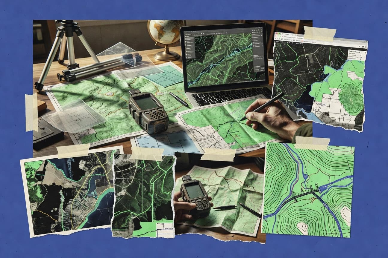
Data Science AnalyticsTop 10 Best Geographic Software of 2026
Discover the top 10 geographic software solutions to streamline mapping & analysis. Explore now to find the best tools for your needs.

How we ranked these tools
Core product claims cross-referenced against official documentation, changelogs, and independent technical reviews.
Analyzed video reviews and hundreds of written evaluations to capture real-world user experiences with each tool.
AI persona simulations modeled how different user types would experience each tool across common use cases and workflows.
Final rankings reviewed and approved by our editorial team with authority to override AI-generated scores based on domain expertise.
Score: Features 40% · Ease 30% · Value 30%
Gitnux may earn a commission through links on this page — this does not influence rankings. Editorial policy
Editor’s top 3 picks
Three quick recommendations before you dive into the full comparison below — each one leads on a different dimension.
ArcGIS Online
ArcGIS Hub-ready content publishing with granular group-based sharing and governance
Built for teams building and sharing interactive GIS maps and dashboards at scale.
QGIS
Editor pickProcessing Toolbox with model building and batch-friendly geoprocessing chains
Built for analysts and teams mapping, editing, and running GIS analysis without vendor lock-in.
Google Earth Engine
Editor pickCode Editor with server-side computation over cloud-hosted image collections
Built for teams building repeatable remote-sensing workflows with automated exports and statistics.
Related reading
Comparison Table
This comparison table evaluates major geographic software options used for mapping, geospatial analysis, and interactive visualization, including ArcGIS Online, QGIS, Google Earth Engine, Mapbox, and Cesium. Readers get a side-by-side view of each tool’s core capabilities, typical workflows, and best-fit use cases for building maps, processing spatial data, and serving geospatial content.
ArcGIS Online
enterprise mappingA cloud mapping and geospatial analytics platform that publishes web maps and apps and supports analysis with hosted datasets.
ArcGIS Hub-ready content publishing with granular group-based sharing and governance
ArcGIS Online stands out for its ready-to-use geospatial web map and scene ecosystem built around ArcGIS content sharing and organization-wide workflows. It supports interactive web maps, 3D visualization with integrated basemaps, and analysis via hosted geoprocessing and feature layer capabilities. Collaboration tools like groups, item views, and controlled sharing help teams publish and maintain maps, apps, and layers without building a custom GIS stack.
- +Web maps and scenes publish quickly with consistent symbology and pop-ups
- +Hosted feature layers support querying, editing, and styling across devices
- +Integrated analytics like GeoEnrichment and geoprocessing services speed workflows
- –Advanced customization can require deeper configuration than most web GIS tools
- –Some analytic workflows depend on specific hosted services and data preparation
- –Offline use is limited compared with fully local GIS deployments
Best for: Teams building and sharing interactive GIS maps and dashboards at scale
More related reading
QGIS
open-source GISAn open-source desktop GIS that performs spatial analysis, edits geodata, and exports results to common GIS and web formats.
Processing Toolbox with model building and batch-friendly geoprocessing chains
QGIS stands out with a highly extensible desktop GIS that supports a broad mix of raster, vector, and database workflows. It includes a mature processing framework with ready-to-run geoprocessing tools and a plugin ecosystem for specialized analysis and publishing. Core capabilities cover map composition, spatial data editing, coordinate transformations, styling, and geospatial scripting support for automation.
- +Rich layer handling for rasters, vectors, and common geospatial formats
- +Powerful processing toolbox for analysis workflows and batch operations
- +Flexible symbology, labeling, and map composition for publication-ready layouts
- –Complex projects can feel heavy without careful project organization
- –Some advanced tasks require configuration work and plugin knowledge
- –Geodatabase workflows can be harder than in dedicated desktop CAD tools
Best for: Analysts and teams mapping, editing, and running GIS analysis without vendor lock-in
Google Earth Engine
geospatial computeA geospatial data processing service that runs large-scale raster and vector analysis on satellite and climate datasets.
Code Editor with server-side computation over cloud-hosted image collections
Google Earth Engine stands out for its cloud-based geospatial computation over massive imagery and geospatial datasets. It supports large-scale analysis with server-side processing, geospatial joins, and time-series workflows using the JavaScript and Python APIs. Interactive visualization and export pipelines let users generate maps, statistics, and derived rasters without maintaining local GIS infrastructure.
- +Massive satellite processing with server-side workflows for fast large-area analysis
- +Strong dataset catalog with Landsat, Sentinel, and derived products for consistent modeling
- +Built-in time-series analysis and reducers for change detection and phenology studies
- +Flexible export to GeoTIFF and vector formats for direct downstream GIS use
- +API-driven automation enables reproducible pipelines across projects
- –Steep learning curve for Earth Engine objects and server versus client execution
- –Visualization iteration can be slower for highly parameterized, high-resolution workflows
- –Debugging complex scripts is harder than in desktop GIS due to deferred execution
Best for: Teams building repeatable remote-sensing workflows with automated exports and statistics
Mapbox
API-first mapsA mapping platform that provides vector basemaps, custom map styling, and geocoding APIs for building location experiences.
Custom Mapbox vector styles with layer-based control in Mapbox GL
Mapbox stands out for combining high-performance web and mobile mapping with a modular set of map, geocoding, and routing building blocks. Developers can render custom vector basemaps, style them with Mapbox style specifications, and add interactive layers for points, lines, and polygons.
The platform also provides geocoding services and navigation-grade routing APIs that integrate directly into applications. Strong tooling exists for analytics and event tracking tied to map interactions and performance.
- +Vector-tile basemaps with precise style control for interactive web experiences
- +Geocoding and routing APIs support production navigation and address search
- +Map interaction analytics help measure feature usage and performance
- –Styling and layer performance tuning can require substantial developer effort
- –Custom data ingestion workflows add complexity for advanced use cases
- –Offline map support is not a primary out-of-the-box focus
Best for: Teams building custom web and mobile maps with geocoding and routing
Cesium
3D globe engineA web geospatial engine for rendering interactive 3D globes and maps using tiles and models.
Cesium 3D Tiles streaming for large-scale, high-detail 3D scenes
Cesium stands out with a high-performance 3D globe and map engine delivered through JavaScript. It supports geospatial visualization with 3D tiles, terrain, imagery layers, and streaming-friendly scene rendering. Cesium also integrates with common web GIS workflows through plugins and APIs for camera control, measurement tools, and geospatial entity management.
- +High-fidelity 3D globe rendering with smooth streaming performance
- +Strong support for 3D Tiles, terrain, and photoreal imagery layers
- +Flexible API for camera paths, entities, and interactive overlays
- +Broad ecosystem of examples, components, and integration patterns
- –Web development skills are required to build production workflows
- –Complex applications can demand careful performance tuning and asset preparation
- –Spatial analysis and data editing are limited compared with full GIS suites
Best for: Web teams building interactive 3D geospatial visualizations with streamed datasets
Microsoft Azure Maps
cloud geospatial APIsA set of Azure mapping services that delivers geospatial data layers, spatial analytics, and mapping APIs.
Azure Maps spatial analytics and routing endpoints with interactive Web SDK support
Microsoft Azure Maps stands out by pairing a mapping API with Azure-focused services for geocoding, routing, and spatial analytics. The platform supports interactive web mapping with Azure Maps SDKs and exposes REST endpoints for tile retrieval and geospatial data workflows.
It also integrates well with Azure data stores through spatial operations and event-ready location analytics patterns. Strong enterprise controls and monitoring align Azure Maps with production deployments that already use Azure for identity and data.
- +Production-ready geocoding, routing, and map rendering APIs in one stack
- +Azure integration supports enterprise identity and operational monitoring patterns
- +Spatial and route analytics features reduce custom GIS glue code
- –Complex SDK surface area increases integration effort for basic map needs
- –Advanced GIS workflows still require external tooling and data preparation
- –Routing and analytics setup can be harder than lightweight map-only platforms
Best for: Teams building Azure-native location intelligence and routing for business apps
FME
geospatial ETLA spatial ETL platform that transforms, cleans, and integrates geospatial data across GIS, CAD, and databases.
Data Inspector and transformation testing that validate mappings before running large GIS workflows
FME stands out with workflow-driven geographic data transformation that automates ETL and migration tasks through a visual, connector-based design. It supports extensive GIS and spatial formats, plus robust spatial operations like filtering, geometry processing, and attribute enrichment.
Geoprocessing can be scaled with parallel processing and deployed as scheduled jobs or embedded services for repeatable pipelines. The design favors data engineering workflows over fully interactive map authoring.
- +Large connector library covers common GIS formats and data stores
- +Visual transformations enable repeatable ETL without custom scripting
- +Strong spatial processing tools for geometry and attribute operations
- –Complex workflows require design discipline and transformation debugging
- –Licensing complexity can slow standardization across teams
- –Visualization and interactive GIS editing are limited versus map-first tools
Best for: Teams automating GIS data pipelines, migrations, and spatial ETL
GeoServer
OGC publishingAn open-source server that publishes geospatial data through standard OGC services like WMS, WFS, and WCS.
SLD-based styling that drives WMS and other service rendering from rules and symbols
GeoServer stands out for turning geospatial data stores into standards-based map and feature services with configurable OGC outputs. It delivers WMS, WFS, WCS, and WMTS endpoints with styling via SLD and attribute-level feature serving. Its strength comes from supporting many raster and vector backends and integrating with external catalog and security components through widely used protocols.
- +Strong OGC service support via WMS, WFS, WCS, and WMTS endpoints
- +Flexible styling with SLD for consistent map rendering across layers
- +Broad data source support for rasters and vectors through pluggable stores
- +Granular feature querying through WFS filtering and structured requests
- –Configuration can feel technical when modeling complex publishing workflows
- –Performance tuning for large layers requires careful indexing and caching
- –Advanced security integration needs more engineering than simple setups
- –Managing many layers and styles can become cumbersome over time
Best for: Organizations publishing interoperable maps and features through OGC services
GeoPandas
Python geospatialA Python library that extends pandas with geospatial datatypes and common vector spatial operations.
Overlay and spatial join operations on GeoDataFrame with geometry-aware indexing
GeoPandas stands out by layering geospatial geometry support directly on top of the pandas DataFrame model. It provides fast, familiar tooling for reading, projecting, and manipulating vector geodata with geometry columns.
Core workflows include spatial joins, overlays, buffering, and visualization via Matplotlib. It also integrates with common Python GIS components for file I/O and coordinate reference system handling.
- +Geometry-aware DataFrame operations using the pandas ecosystem
- +Spatial joins, overlays, and geometric predicates run in a consistent API
- +CRS transformations integrate tightly with common Python geospatial libraries
- +Clear plotting via Matplotlib for quick inspection and reporting
- –Performance can degrade for very large datasets without spatial indexing
- –Limited support for raster workflows and advanced geoprocessing compared to GIS suites
- –Geometric operations require careful handling of invalid geometries
Best for: Analysts needing Python-based vector GIS workflows with DataFrame-style manipulation
Kepler.gl
data viz mappingA React-based visualization framework that renders large geospatial datasets as map layers using WebGL.
Layer-based visualization authoring that combines multiple map types with coordinated interactions
Kepler.gl stands out for its highly interactive map visual analytics built on a WebGL rendering engine and a modular visualization model. It supports rapid exploration of geospatial data through scatterplots, hexagons, heatmaps, and layered choropleths with flexible styling.
Data can be integrated from common geospatial formats and combined into coordinated views with brushing and linking for analysis workflows. The tool also emphasizes reproducible map states through saved kepler.gl configurations that can be shared across sessions.
- +WebGL-based rendering supports dense interactive point and grid visualizations
- +Layer-driven styling enables choropleths, heatmaps, and hexbin maps in one workflow
- +Brushing and linking improves analysis across coordinated map views
- +Reusable configuration model supports consistent map states across sessions
- –Complex visual configuration can feel unintuitive for first-time users
- –Advanced layouts and performance tuning require deeper understanding of settings
- –Geospatial modeling stays visualization-focused rather than providing full GIS editing tools
Best for: Teams prototyping interactive geospatial dashboards and exploratory analysis without heavy GIS tooling
Conclusion
After evaluating 10 data science analytics, ArcGIS Online stands out as our overall top pick — it scored highest across our combined criteria of features, ease of use, and value, which is why it sits at #1 in the rankings above.
Use the comparison table and detailed reviews above to validate the fit against your own requirements before committing to a tool.
How to Choose the Right Geographic Software
This buyer’s guide covers ArcGIS Online, QGIS, Google Earth Engine, Mapbox, Cesium, Microsoft Azure Maps, FME, GeoServer, GeoPandas, and Kepler.gl to match common geographic workflows to the right tool. It connects publishing, analysis, 3D visualization, standards-based services, and Python or data-ETL pipelines to the specific capabilities each platform emphasizes.
What Is Geographic Software?
Geographic software helps organize, visualize, analyze, and serve spatial data like points, lines, polygons, and rasters across maps, dashboards, and APIs. It solves problems such as building interactive web mapping, running spatial analysis, transforming geodata between formats, and publishing data through standard service protocols. ArcGIS Online demonstrates a cloud mapping and geospatial analytics workflow that publishes web maps and scenes and supports hosted analysis services. QGIS demonstrates an open-source desktop GIS that performs spatial analysis, edits geodata, and exports results across common GIS and web formats.
Key Features to Look For
The best geographic software is the one that aligns mapping, analysis, and publishing workflows to the tool’s strongest execution model.
Ready-to-publish web maps and scenes with governance
ArcGIS Online focuses on publishing interactive web maps and 3D scenes with consistent symbology and pop-ups. Its group-based sharing and governance support team workflows that need controlled content distribution at scale.
Batch-friendly geoprocessing with model building
QGIS provides a processing toolbox that supports geoprocessing chains and model building for repeatable analysis workflows. It is also designed for batch-friendly operations across raster and vector layers.
Server-side remote sensing workflows with automated exports
Google Earth Engine runs server-side computation on large raster and vector datasets with time-series workflows and reducers. It also enables exports to GeoTIFF and vector formats so downstream GIS steps can use derived outputs.
Custom vector basemaps with geocoding and routing for apps
Mapbox emphasizes Mapbox GL vector styling with layer-based control for points, lines, and polygons. It also provides geocoding and routing APIs that plug directly into production web and mobile applications.
High-fidelity streamed 3D tiles rendering
Cesium is built for interactive 3D globes and maps using tiles, terrain, imagery layers, and streamed 3D Tiles. It supports a flexible JavaScript API for camera paths and interactive overlays.
Spatial ETL and transformation testing
FME centers on spatial ETL with a visual, connector-based workflow design that transforms, cleans, and integrates geospatial data. Its Data Inspector and transformation testing help validate mappings before running large-scale jobs.
How to Choose the Right Geographic Software
A reliable path is to start with the output target and then match the tool’s execution model for publishing, analysis, or data transformation.
Choose the end deliverable first
If the goal is organization-wide interactive mapping and dashboards, ArcGIS Online aligns with web maps and scenes plus hosted feature layer capabilities. If the goal is a custom application map with geocoding and routing, Mapbox provides vector basemaps and production navigation-grade routing APIs.
Match analysis depth to the tool’s processing approach
For batch-ready desktop spatial analysis and repeatable geoprocessing chains, QGIS offers a processing toolbox with model building and batch-friendly workflows. For massive satellite and climate analysis that produces derived rasters and statistics, Google Earth Engine uses server-side computation on cloud-hosted image collections.
Select 3D rendering based on data scale and interactivity needs
For streamed, large-scale 3D scenes in a browser, Cesium supports 3D Tiles streaming and smooth scene rendering. For standards-based interoperability of geodata services used by many clients, GeoServer publishes OGC services like WMS, WFS, and WCS with SLD styling rules.
Plan for integration into enterprise systems and data ecosystems
If Azure is the backbone for identity, operations, and app deployment, Microsoft Azure Maps pairs mapping APIs with Azure-native geocoding, routing, and spatial analytics endpoints. If the workflow is primarily moving and transforming data between GIS, CAD, and databases, FME focuses on spatial ETL and scheduled job deployment.
Pick the right tooling style for the team’s workflow
For Python-first vector analytics with DataFrame-style operations, GeoPandas supports geometry-aware spatial joins and overlays with CRS transformations integrated into common Python tooling. For interactive geospatial exploration and dashboard prototyping focused on visualization rather than GIS editing, Kepler.gl provides WebGL-based layers plus brushing and linking across coordinated views.
Who Needs Geographic Software?
Geographic software fits teams who need to publish spatial outputs, run spatial computation, or operationalize geodata pipelines.
Teams building and sharing interactive GIS maps and dashboards at scale
ArcGIS Online supports web maps and scenes publishing with consistent symbology and pop-ups plus hosted feature layers that enable querying, editing, and styling across devices. ArcGIS Online also provides ArcGIS Hub-ready content publishing with granular group-based sharing and governance.
Analysts and teams mapping, editing, and running GIS analysis without vendor lock-in
QGIS delivers an open-source desktop GIS with a mature processing toolbox for spatial analysis and batch operations. QGIS also supports extensibility through plugins for specialized workflows and exports to common GIS and web formats.
Teams building repeatable remote-sensing workflows with automated exports and statistics
Google Earth Engine is designed for large-scale geospatial computation on satellite and climate datasets with time-series workflows. Its server-side reducers and exports to GeoTIFF and vector formats support repeatable pipelines without maintaining local GIS infrastructure.
Developers building custom web and mobile location experiences
Mapbox provides vector basemaps with precise Mapbox GL style control plus geocoding and routing APIs for production address search and navigation-grade routing. Azure teams building routing and location intelligence inside Azure can also use Microsoft Azure Maps.
Common Mistakes to Avoid
Common selection failures come from mismatching the tool’s strengths to the workflow type and data scale.
Expecting fully local GIS behavior from cloud-first mapping
ArcGIS Online is optimized for hosted datasets and web map publishing, so offline use is more limited than fully local GIS deployments. For workflows that must run deep offline with local geodata editing, QGIS is better aligned with a desktop-first model.
Trying to use a visualization engine as a GIS editing platform
Kepler.gl focuses on interactive WebGL visualization such as scatterplots, hexagons, heatmaps, and choropleths with brushing and linking, not full GIS editing. QGIS offers spatial editing and a processing toolbox when geometry edits and GIS analysis are required.
Underestimating integration and configuration effort for standards publishing
GeoServer can require technical configuration work for complex publishing workflows and performance tuning for large layers through indexing and caching. For faster API-driven application mapping, Mapbox or Microsoft Azure Maps reduces the need for OGC service modeling.
Choosing a map rendering stack when analysis and transformation are the real bottleneck
Cesium is strong at streamed 3D Tiles rendering and interactive overlays, while spatial analysis and data editing are limited compared with full GIS suites. FME is a better fit when data cleaning, geometry processing, and attribute enrichment across formats are the primary tasks.
How We Selected and Ranked These Tools
we evaluated every tool on three sub-dimensions. Features carry weight 0.40. Ease of use carries weight 0.30. Value carries weight 0.30. The overall rating is the weighted average of those three values using overall = 0.40 × features + 0.30 × ease of use + 0.30 × value. ArcGIS Online separated itself from lower-ranked tools by combining strong features for publishing and analytics with high ease-of-use for web map and scene workflows, including hosted feature layers and ArcGIS Hub-ready content publishing with granular group-based sharing and governance.
Frequently Asked Questions About Geographic Software
Which geographic software best supports organization-wide sharing of interactive maps and dashboards?
What tool is most effective for desktop GIS work that needs strong processing chains and automation?
Which option is designed for large-scale remote sensing and repeatable cloud-based analysis?
What geographic software is best when the requirement is custom web and mobile mapping with routing and geocoding?
Which tool is ideal for high-performance interactive 3D globes with streamed datasets?
Which platform works best for Azure-native location intelligence and event-driven spatial workflows?
Which geographic software should be used for spatial ETL, migrations, and repeatable data transformation pipelines?
What tool is best for publishing standard OGC map and feature services from existing geospatial data stores?
Which geographic software fits Python analysts who want DataFrame-style geospatial operations?
What is the fastest way to prototype interactive map visual analytics without heavy GIS authoring?
Tools reviewed
Primary sources checked during evaluation.
Referenced in the comparison table and product reviews above.
Keep exploring
Comparing two specific tools?
Software Alternatives
See head-to-head software comparisons with feature breakdowns, pricing, and our recommendation for each use case.
Explore software alternatives→In this category
Data Science Analytics alternatives
See side-by-side comparisons of data science analytics tools and pick the right one for your stack.
Compare data science analytics tools→FOR SOFTWARE VENDORS
Not on this list? Let’s fix that.
Our best-of pages are how many teams discover and compare tools in this space. If you think your product belongs in this lineup, we’d like to hear from you—we’ll walk you through fit and what an editorial entry looks like.
Apply for a ListingWHAT THIS INCLUDES
Where buyers compare
Readers come to these pages to shortlist software—your product shows up in that moment, not in a random sidebar.
Editorial write-up
We describe your product in our own words and check the facts before anything goes live.
On-page brand presence
You appear in the roundup the same way as other tools we cover: name, positioning, and a clear next step for readers who want to learn more.
Kept up to date
We refresh lists on a regular rhythm so the category page stays useful as products and pricing change.