GITNUXSOFTWARE ADVICE
Marketing AdvertisingTop 8 Best Geotagging Software of 2026
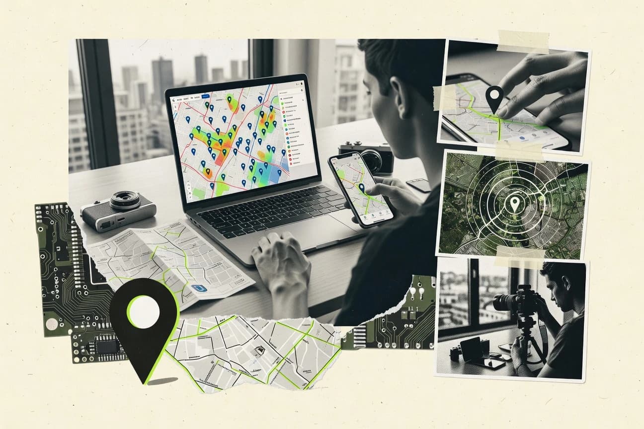
Discover the top 10 geotagging software options. Find the best tools to add location data to photos.

How we ranked these tools
Core product claims cross-referenced against official documentation, changelogs, and independent technical reviews.
Analyzed video reviews and hundreds of written evaluations to capture real-world user experiences with each tool.
AI persona simulations modeled how different user types would experience each tool across common use cases and workflows.
Final rankings reviewed and approved by our editorial team with authority to override AI-generated scores based on domain expertise.
Score: Features 40% · Ease 30% · Value 30%
Gitnux may earn a commission through links on this page — this does not influence rankings. Editorial policy
Editor’s top 3 picks
Three quick recommendations before you dive into the full comparison below — each one leads on a different dimension.
GeoSetter
Interactive map-based EXIF GPS editing with batch geotag support
Built for photographers geotagging large folders with precise EXIF GPS metadata editing.
Geoimgr
Editor pickMap-based coordinate selection for geotag placement
Built for photo teams needing quick map-based geotagging without deep metadata work.
Fotor
Editor pickMetadata updates integrated into Fotor’s photo editing and export workflow
Built for creators tagging images for sharing and editing output, not GIS-heavy projects.
Related reading
Comparison Table
This comparison table evaluates geotagging tools for adding, editing, and managing location metadata across photo libraries, including GeoSetter, Geoimgr, Fotor, Google Photos, and Adobe Lightroom Classic. It highlights key differences in supported photo formats, workflow fit for desktop or web use, and how each tool handles GPS coordinates from embedded EXIF data.
GeoSetter
desktop metadataGeoSetter reads and writes GPS EXIF metadata in image files, letting users geotag photos by adding coordinates and syncing metadata.
Interactive map-based EXIF GPS editing with batch geotag support
GeoSetter stands out for mapping and editing EXIF and IPTC GPS metadata directly from local photo files using an integrated map view. It supports importing coordinates, geotagging via manual selection on a map, and bulk updates across large photo sets. The workflow combines map navigation with filesystem-based batch processing so geotagging can happen without export roundtrips to external tools.
- +Bulk geotagging from local photo libraries with map-assisted editing
- +Direct EXIF and IPTC GPS metadata updates without format conversion
- +Interactive map workflow for manual coordinate corrections
- –Best results depend on accurate source timestamps and GPS data matching
- –Interface density makes advanced batch settings harder to navigate
- –Collaboration and cloud-based workflows are not the primary focus
Best for: Photographers geotagging large folders with precise EXIF GPS metadata editing
More related reading
Geoimgr
geotag editorGeoimgr adds geotags to photos from GPS data by creating or updating EXIF location metadata for use in photo management and sharing.
Map-based coordinate selection for geotag placement
Geoimgr focuses on applying geotags to media using location inputs and a web-based workflow. It provides tools to manage and embed geographic data into images so users can maintain location context for photos.
The experience centers on mapping-style selection for assigning coordinates rather than deep metadata automation across whole libraries. It works best for straightforward tagging tasks where visual location selection and export-ready images matter.
- +Web workflow for assigning coordinates to images
- +Map-style location selection simplifies coordinate entry
- +Outputs geotagged images suitable for downstream viewing
- –Limited visibility into complex EXIF editing beyond geotag fields
- –Batch automation and large-library tooling feel minimal
- –No clear support for advanced matching workflows like reverse geocoding
Best for: Photo teams needing quick map-based geotagging without deep metadata work
Fotor
photo editorFotor supports adding location and editing image metadata workflows that can include geolocation tagging for photo outputs.
Metadata updates integrated into Fotor’s photo editing and export workflow
Fotor stands out for combining photo editing with location-based workflows, so geotagging can stay inside a creator-focused image tool. The platform supports exporting and organizing edited images after metadata changes, which fits photo libraries that need consistent deliverables.
Geotagging is handled as a metadata task alongside common edit operations like cropping, filters, and retouching. This approach works best for users who want to tag images quickly as part of a broader visual editing pipeline.
- +Geotagging fits into an end-to-end image editing workflow
- +Metadata handling stays close to crop, filters, and exports
- +Simple interface supports quick location tagging for many photos
- –Limited advanced geotag management for large photo libraries
- –Batch geotag controls are less robust than dedicated mapping tools
- –Location search and verification options are basic for power users
Best for: Creators tagging images for sharing and editing output, not GIS-heavy projects
Google Photos
consumer platformGoogle Photos detects and stores location information for photos and can display maps and location-based browsing when GPS data exists or is linked.
Map view with location-based search driven by embedded GPS metadata
Google Photos stands out by pairing photo geotagging with automatic location detection and powerful, map-based search in one consumer-grade workflow. It preserves GPS metadata for supported image and video files and lets users view locations through the Location section and map view. Geotagging works best for existing photos that already contain GPS data, while adding accurate new geotags is limited without file-level metadata tools.
- +Automatic GPS metadata retention for many common photo and video formats
- +Location-based browsing with map view makes geotag cleanup fast
- +Search filters surface location-matched memories quickly
- –Manual geotag editing and precise location assignment are limited
- –Geotag reliability drops when original GPS metadata is missing
- –Bulk geotag management tools are not built for rigorous GIS workflows
Best for: Individuals and small teams organizing geo-tagged photo libraries
Adobe Lightroom Classic
pro photo metadataLightroom Classic reads GPS metadata and supports geotagging photos through map-based location assignment tied to the catalog.
Map module for editing and visualizing GPS coordinates on a photo library
Adobe Lightroom Classic stands out for geotagging inside a full photo development and library workflow, not as a standalone map tool. It reads and writes GPS metadata through its Metadata and Map modules, letting users search by location and place photos on a map view. Geotagging stays tightly integrated with RAW processing, batch organization, and export settings for location-aware deliverables.
- +Reads and writes GPS EXIF metadata for location-aware photo libraries
- +Map module enables visual placement and location-based organization
- +Batch metadata editing supports consistent geotag updates across many photos
- –Map view geotagging can feel less efficient than dedicated GIS tools
- –Location accuracy depends on embedded GPS data quality and time alignment
- –Workflow stays photo-centric, limiting advanced geospatial analysis options
Best for: Photographers managing mixed-location shoots and needing photo metadata automation
ExifTool
CLI metadataExifTool updates EXIF GPS fields in image files, enabling automated geotagging through scripts and command-line metadata edits.
GPSLatitudeRef and GPSLongitudeRef-aware writing of GPS coordinates
ExifTool stands out as a metadata engine rather than a GUI mapping tool, so it can read and write EXIF and related tags that hold GPS coordinates. It supports geotagging by parsing GPS-related fields, including maker note and common EXIF variants, then updating images or other media formats with those values.
Batch processing via command line makes it practical for large photo libraries where GPS data needs consistent normalization. The tool also exposes scripting-friendly behavior, but users must manage tag selection and coordinate formats manually.
- +Accurate GPS tag editing across EXIF variants and related metadata fields
- +Powerful batch geotagging with predictable command line workflows
- +Extensible output and input control for repeatable metadata pipelines
- –No built-in map UI, so coordinate prep and verification are manual
- –Command line tag syntax adds friction for non-technical photo workflows
- –Workflow complexity increases when images have inconsistent existing metadata
Best for: Technical photographers batching GPS tagging through metadata tag edits
GEO Tracker
GPS loggingGEO Tracker captures GPS tracks for later association with photos so location data can be written into image metadata.
Map-based media review for confirming and managing GPS-tagged images
GEO Tracker is distinct for tying geotagging to a location-aware workflow for collecting photos and assigning GPS data to media. The core geotagging capability centers on embedding coordinates into images and viewing location context through map-based presentation.
It also supports managing tagged items in a way that supports field documentation use cases where photos must stay tied to places. Collaboration is supported through shared access patterns for teams working on the same collection or project artifacts.
- +Map-centered workflow keeps geotagging tied to visible locations
- +Image coordinates can be embedded to preserve GPS metadata with files
- +Project-style organization supports collecting many tagged items
- –Geotagging controls feel less granular than specialized metadata tools
- –Workflow depends on consistent media import and naming practices
- –Advanced automation options are limited compared with larger platforms
Best for: Field teams needing simple photo geotagging tied to maps
Strapi
geodata backendStrapi can store geotagged marketing photo assets with structured location fields and APIs for querying location-based content.
Custom content types and APIs that model and serve geotagged records
Strapi stands out as a headless CMS built around a customizable content model, not a purpose-built geotagging suite. It supports geospatial fields in its data layer and can power map-ready location records through custom APIs.
Teams can build geotagging workflows by integrating Strapi with frontend map libraries and background services for enrichment and validation. It is best used when geotagging is part of a broader content and API delivery system.
- +Flexible content modeling for geotag entities with custom attributes
- +REST and GraphQL APIs simplify delivering location data to mapping UIs
- +Role-based access controls help protect location records and edits
- –No dedicated geotagging UI or mapping tools out of the box
- –Geospatial features rely on data modeling and integration work
- –Operational overhead increases with custom plugins and workflows
Best for: Teams building location-aware content APIs instead of full geotagging tools
Conclusion
After evaluating 8 marketing advertising, GeoSetter stands out as our overall top pick — it scored highest across our combined criteria of features, ease of use, and value, which is why it sits at #1 in the rankings above.
Use the comparison table and detailed reviews above to validate the fit against your own requirements before committing to a tool.
How to Choose the Right Geotagging Software
This buyer's guide explains how to pick geotagging software for adding location data to photos and videos, covering tools like GeoSetter, Adobe Lightroom Classic, and Google Photos. It also compares map-based editing options like Geoimgr and GEO Tracker with metadata-first tools like ExifTool and API-first platforms like Strapi. The guide focuses on features, workflows, and common failure points seen across these specific solutions.
What Is Geotagging Software?
Geotagging software writes or connects geographic coordinates to image and video files using GPS-related metadata fields. It solves problems like organizing photos on a map, preserving location context for sharing, and correcting mismatched or missing EXIF GPS coordinates. Tools such as GeoSetter and Adobe Lightroom Classic update GPS EXIF metadata directly in photo files and present a map interface for location assignment. Google Photos focuses on automatic location retention and map-based browsing when GPS metadata already exists in the media.
Key Features to Look For
The fastest path to correct results depends on how directly a tool can write GPS metadata and how reliably it supports map-assisted workflows and batch operations.
Interactive map-based EXIF GPS editing
Interactive map placement speeds up coordinate corrections because users can visually confirm where each photo should be tagged. GeoSetter provides an interactive map workflow for manual coordinate corrections and batch geotagging from local photo folders, while Geoimgr and GEO Tracker use map-style coordinate selection focused on assigning locations.
Direct write access to EXIF and IPTC GPS fields
Direct metadata writing matters when the goal is to update location fields inside the original files without an export-and-reimport roundtrip. GeoSetter updates EXIF and IPTC GPS metadata directly in image files, while Adobe Lightroom Classic reads and writes GPS EXIF metadata through its Metadata and Map modules.
Batch geotagging across large photo sets
Batch geotagging reduces manual work when hundreds or thousands of images need consistent GPS coordinate updates. GeoSetter emphasizes bulk geotagging from local photo libraries, and Adobe Lightroom Classic supports batch metadata editing tied to catalog workflows.
GPS tag normalization via scripting and command-line control
Scripting control helps when image files contain inconsistent GPS tag formats across cameras or edit pipelines. ExifTool can write GPSLatitudeRef and GPSLongitudeRef-aware coordinates across EXIF variants, making it a strong choice for repeatable metadata pipelines even without a built-in map UI.
Location-preserving library workflows with search and map view
Location search and map browsing matter for cleaning up or reviewing existing geotagged media at scale. Google Photos provides map view with location-based browsing driven by embedded GPS metadata, and Adobe Lightroom Classic supports location-based organization through its map module within a full library workflow.
Field documentation and project-style geotag review
Project-style review helps teams confirm that the right coordinates are attached to the right media during field capture. GEO Tracker offers map-based media review for confirming and managing GPS-tagged images, while GeoSetter focuses more on local batch editing and coordinate correction than on field collaboration.
How to Choose the Right Geotagging Software
Selection should match the tagging workflow to the metadata task, mapping needs, and scale of the photo library.
Match the tool to the geotagging workflow
If the job is editing coordinates inside the image files from local folders, GeoSetter is built around interactive map-based EXIF GPS editing and batch updates. If the job is keeping geotagging inside a RAW and catalog development workflow, Adobe Lightroom Classic uses its Metadata and Map modules for map-driven placement. If the job is consumer-style organization with existing GPS metadata, Google Photos focuses on location retention and map-based browsing rather than precise manual coordinate assignment.
Decide how coordinates will be assigned
For map-based coordinate placement, Geoimgr and GEO Tracker center the workflow on map-style coordinate selection for assigning locations. For controlled metadata edits across variants, ExifTool assigns coordinates by writing GPS EXIF fields using GPSLatitudeRef and GPSLongitudeRef-aware handling, which is better when coordinates come from external sources or need normalization.
Plan for scale with batch editing capabilities
For large folders where multiple photos need consistent GPS changes, GeoSetter supports bulk geotagging across local photo libraries. Adobe Lightroom Classic also supports batch metadata editing across many photos, while Geoimgr emphasizes quick map-based assignment with less emphasis on deep large-library automation.
Evaluate metadata complexity and verification needs
When coordinate accuracy depends on correct time alignment and matching GPS data to photos, GeoSetter is strongest for manual corrections but still depends on accurate source timestamps and GPS matching. When files carry inconsistent EXIF GPS variants, ExifTool’s GPSLatitudeRef and GPSLongitudeRef-aware writing helps standardize coordinates even without a map UI. When the goal is quick cleanup and browsing, Google Photos offers a location-driven map view but relies on embedded GPS metadata quality.
Choose the right platform for collaboration or APIs
For teams that need field-centric map review tied to project collections, GEO Tracker provides map-based media review and project-style organization. For teams that need location-aware content served to a front end through APIs, Strapi offers structured geotag entities with REST and GraphQL APIs and role-based access controls, even though it has no dedicated geotagging UI out of the box.
Who Needs Geotagging Software?
Geotagging software supports photo organization, metadata correctness, and location-aware workflows across photographers, creators, and location-data developers.
Photographers geotagging large folders with precise EXIF GPS metadata editing
GeoSetter fits this use case because it combines interactive map-based EXIF GPS editing with batch geotagging across local photo sets. Adobe Lightroom Classic also fits photographers managing mixed-location shoots because it reads and writes GPS EXIF metadata and ties placement to catalog workflows.
Photo teams needing quick map-based tagging without deep metadata work
Geoimgr fits teams that want map-style location selection and outputs geotagged images suitable for downstream viewing. Google Photos also fits small teams that primarily want map-based searching for photos that already include embedded GPS metadata.
Creators who want geotagging integrated into an end-to-end editing and export workflow
Fotor fits creators who handle cropping, retouching, and other edits and want geotagging as a metadata task close to exports. This approach prioritizes deliverable consistency over GIS-heavy analysis and advanced library-scale geospatial controls.
Technical teams batching GPS tagging through metadata tag edits or normalization
ExifTool fits technical photographers and metadata pipeline builders because it updates EXIF GPS fields and supports predictable command-line batch processing. It is especially suitable when GPSLatitudeRef and GPSLongitudeRef handling must be consistent across EXIF variants.
Common Mistakes to Avoid
Geotagging projects often fail when tools mismatch the workflow, metadata quality assumptions, or the need for verification across large libraries.
Choosing a map viewer when file-level GPS editing is required
Google Photos provides map view and location-based browsing driven by embedded GPS metadata, but it is limited for precise manual coordinate assignment and bulk geotag management. GeoSetter or Adobe Lightroom Classic are better when the requirement is to update GPS EXIF data inside the original files.
Underestimating timestamp and GPS data matching requirements
GeoSetter’s results depend on accurate source timestamps and GPS data matching, so mismatched time alignment can lead to incorrect coordinate assignment. ExifTool helps with coordinate correctness at the tag-writing level, but it still relies on accurate coordinate inputs.
Expecting consumer tools to replace rigorous EXIF variant handling
Google Photos can struggle when original GPS metadata is missing, and its manual editing and precise location assignment are limited. ExifTool targets EXIF GPS tag writing across variants with GPSLatitudeRef and GPSLongitudeRef-aware behavior.
Using a CMS when the goal is direct photo geotagging UI
Strapi is a headless CMS for modeling geotagged assets with APIs, and it has no dedicated geotagging UI or map tools out of the box. GEO Tracker or GeoSetter are better for direct map-assisted photo coordinate editing and media review.
How We Selected and Ranked These Tools
we evaluated every tool on three sub-dimensions with fixed weights: features at 0.40, ease of use at 0.30, and value at 0.30. The overall score is calculated as overall = 0.40 × features + 0.30 × ease of use + 0.30 × value. GeoSetter separated itself through higher feature fit for direct EXIF GPS editing plus interactive map-based batch geotagging, which is a concrete workflow combination not matched in the same way by tools that focus only on map browsing or only on scripting. Tools like ExifTool scored differently because it excels at GPS tag writing and batch metadata pipelines while lacking a built-in map UI for coordinate verification.
Frequently Asked Questions About Geotagging Software
Which geotagging tool fits bulk geotagging of whole photo folders without export roundtrips?
What option is best for quick map-based coordinate placement by visual selection?
Which tools are designed for photo metadata editing rather than a consumer library workflow?
How do Google Photos and Lightroom Classic differ in where geotagging automation is strongest?
Which tool supports geotagging as part of general image editing and export deliverables?
Which geotagging solution is most practical for technical users who need scripting and precise tag handling?
What tool fits field teams that must keep photos tied to places during collection and review?
Which option is better for teams building a geotagging workflow into a custom app and API?
Why might a user choose a local EXIF editor over a web workflow?
Tools reviewed
Primary sources checked during evaluation.
Referenced in the comparison table and product reviews above.
Keep exploring
Comparing two specific tools?
Software Alternatives
See head-to-head software comparisons with feature breakdowns, pricing, and our recommendation for each use case.
Explore software alternatives→In this category
Marketing Advertising alternatives
See side-by-side comparisons of marketing advertising tools and pick the right one for your stack.
Compare marketing advertising tools→FOR SOFTWARE VENDORS
Not on this list? Let’s fix that.
Our best-of pages are how many teams discover and compare tools in this space. If you think your product belongs in this lineup, we’d like to hear from you—we’ll walk you through fit and what an editorial entry looks like.
Apply for a ListingWHAT THIS INCLUDES
Where buyers compare
Readers come to these pages to shortlist software—your product shows up in that moment, not in a random sidebar.
Editorial write-up
We describe your product in our own words and check the facts before anything goes live.
On-page brand presence
You appear in the roundup the same way as other tools we cover: name, positioning, and a clear next step for readers who want to learn more.
Kept up to date
We refresh lists on a regular rhythm so the category page stays useful as products and pricing change.