GITNUXSOFTWARE ADVICE
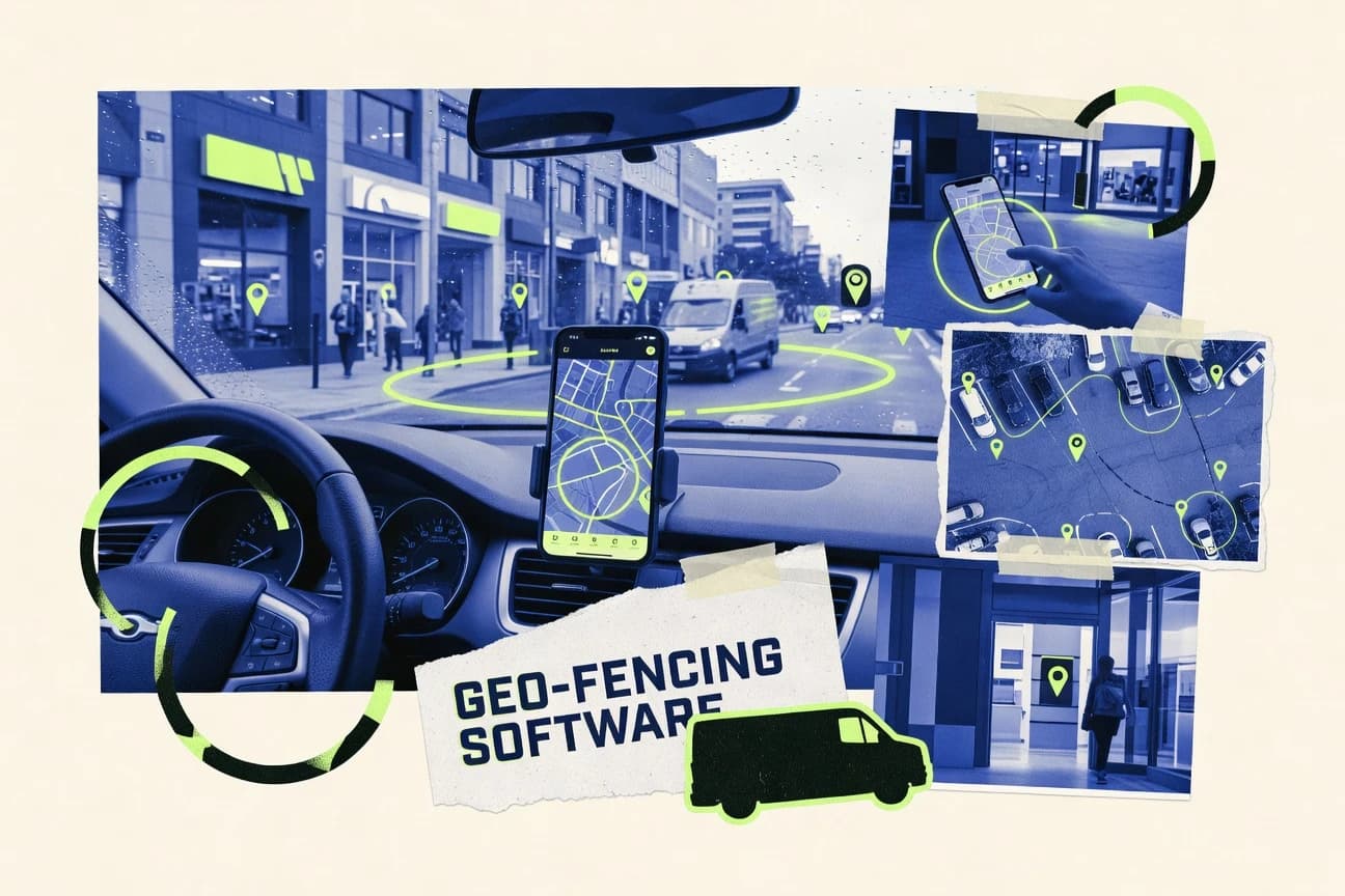
Marketing AdvertisingTop 10 Best Geo Fencing Software of 2026
Top 10 geo fencing software ranked by features and controls for location-based marketing teams, with comparisons of Verizon Connect, Airship, and CleverTap.

How we ranked these tools
Core product claims cross-referenced against official documentation, changelogs, and independent technical reviews.
Analyzed video reviews and hundreds of written evaluations to capture real-world user experiences with each tool.
AI persona simulations modeled how different user types would experience each tool across common use cases and workflows.
Final rankings reviewed and approved by our editorial team with authority to override AI-generated scores based on domain expertise.
Score: Features 40% · Ease 30% · Value 30%
Gitnux may earn a commission through links on this page — this does not influence rankings. Editorial policy
Verizon Connect is the best pick if your fleet needs governed geofence event automation that plugs into dispatch, compliance, and maintenance workflows, whereas Airship fits teams running location-triggered push and in-app programs with governed activation journeys.
Editor’s top 3 picks
Three quick recommendations before you dive into the full comparison below — each one leads on a different dimension.
Verizon Connect
Rule-driven geofence alerts linked to asset workflows using event payloads for webhook and API delivery.
Built for fits when fleets need governed geofence event automation into dispatch, compliance, and maintenance workflows..
Airship
Editor pickGeofence event triggers directly drive message campaign activation within Airship’s engagement workflows.
Built for fits when teams run push and in-app programs and need governed geofence-driven activation workflows..
CleverTap
Editor pickLocation-triggered events can activate CleverTap journeys using the same segmentation and event taxonomy as non-location signals.
Built for fits when mobile teams need geofence triggers inside event-driven journeys and audience governance..
Related reading
Comparison Table
Geo fencing software matters for converting location signals into automated actions such as alerts, audience segmentation, and targeted messaging. This ranked list targets analysts and operators who need comparable data models, integration coverage, and configuration controls, including automation throughput, sandbox testing support, and audit-ready logging, and it prioritizes platforms with the strongest implementation paths over feature checklists.
Verizon Connect
vertical specialistFleet management software with geofences, vehicle alerts, and location reporting.
Rule-driven geofence alerts linked to asset workflows using event payloads for webhook and API delivery.
Geofence configuration is built around map-based boundary definitions that work with asset location feeds, including entry trigger and exit trigger eventing. Automation can convert boundary crossings into actionable work via event-driven integrations, with event payloads designed for external systems. The fit is strongest for fleets and field operations teams that already run asset tracking and need virtual perimeter logic tied to daily execution.
A practical tradeoff is that higher accuracy depends on consistent GPS signal quality and correct device permissions for background location tracking. Verizon Connect fits best when location events must flow into operational tooling with controlled governance, not when teams only need a simple marketing geofence for a single app.
- +Polygon and radius geofences support complex facility layouts
- +Entry and exit triggers generate location events for automation
- +Event exports work with webhooks and APIs for downstream systems
- +RBAC and audit trails support controlled geofence governance
- –Best geofence results require reliable GPS signal and device permissions
- –Geofence workflows can be heavier than simple consumer geofencing tools
- –Complex setups take time to align devices, boundaries, and rules
Field operations managers
Trigger tasks on site entry
Faster dispatch execution
Fleet compliance teams
Enforce restricted area rules
Reduced compliance gaps
Show 2 more scenarios
Systems integration teams
Stream boundary events to tooling
Automated incident handling
Webhook and API integrations send boundary crossing events to ticketing and data pipelines.
Asset safety coordinators
Detect dwell at high-risk zones
Lower incident rates
Configured boundaries help monitor repeated stops in restricted locations and prompt reviews.
Best for: Fits when fleets need governed geofence event automation into dispatch, compliance, and maintenance workflows.
More related reading
Airship
enterpriseCustomer engagement platform with location triggers for targeted mobile messaging.
Geofence event triggers directly drive message campaign activation within Airship’s engagement workflows.
Airship uses location events from its geofencing capability to drive entry and exit triggers inside campaign workflows. It connects those triggers to audience segmentation logic so teams can target users with location-conditioned rules. The automation surface includes an API for provisioning and updating geofencing-driven configurations alongside messaging content.
A key tradeoff is that Airship is strongest when location events are part of a broader engagement program, not when geofencing must be a standalone location engine. It fits teams that already run push and in-app lifecycle programs and want consistent governance for location-triggered messaging.
- +Location-triggered campaign workflows connect geofence events to push execution
- +API support supports automation of geofencing and campaign configuration
- +Audience logic enables location-conditioned targeting rules
- +Analytics tied to engagement helps measure location-triggered outcomes
- –Best results require aligning geofence triggers with messaging workflows
- –Requires mobile SDK integration and background location permissions setup discipline
- –More effort than standalone geofencing tools for simple boundary alerts
Lifecycle marketing teams
Send offers on boundary entry
More in-store visits from context
Mobile growth engineering
Automate geofence configuration updates
Faster iteration for geo campaigns
Show 2 more scenarios
CRM operations teams
Control entry and exit messaging cadence
Lower unwanted notifications
Exit and entry triggers coordinate messaging rules across user audiences and frequency constraints.
Privacy and governance leads
Manage location-based consent-driven targeting
Safer compliance posture for messaging
Location-triggered activation follows consent-aware user targeting and operational governance processes.
Best for: Fits when teams run push and in-app programs and need governed geofence-driven activation workflows.
CleverTap
enterpriseCustomer engagement platform with geofencing for location-based app campaigns.
Location-triggered events can activate CleverTap journeys using the same segmentation and event taxonomy as non-location signals.
CleverTap’s geofencing use centers on converting location triggers into audience membership updates and campaign entry conditions tied to app and engagement events. The workflow depth is stronger when location signals must combine with behavioral history, such as returning user status or experiment buckets. Admin controls work best when teams already use CleverTap’s user management and campaign governance patterns, since geofences become another trigger source feeding those processes.
A tradeoff appears when geofencing must run as a dedicated operations system with strict geospatial preprocessing needs, since CleverTap’s core strength is marketing and lifecycle orchestration rather than GIS-heavy analytics. CleverTap fits when mobile-first brands need location entry and exit triggers to activate messaging, journeys, and attribution alongside non-location events.
- +Location triggers feed directly into audience segmentation and campaign entry logic
- +Event-based integration lets geofence outcomes combine with behavioral criteria
- +Webhooks and API options support downstream automation and reporting
- +Visit attribution can reuse existing tracking and identity mapping
- –Geospatial analytics depth is limited versus GIS-first location stacks
- –Background location behavior depends on mobile permissions and device constraints
- –Complex trigger logic can require careful journey orchestration discipline
- –Testing boundary crossing performance can be operationally time-consuming
Lifecycle marketing teams
Activate messages on boundary crossing
Higher relevance visit messaging
Product analytics teams
Attribution for in-store app visits
Clearer store conversion measurement
Show 2 more scenarios
CRM operations teams
Sync geofence events to systems
Automated downstream campaign updates
API and webhook flows send location-triggered outcomes to external tooling and reporting.
Growth experiment owners
Test geofence-triggered experiences
Experiment-ready location targeting
Journey entry conditions support controlled variations using shared audience rules.
Best for: Fits when mobile teams need geofence triggers inside event-driven journeys and audience governance.
Radar
API-firstGeofencing platform with location tracking, trip detection, and place intelligence APIs.
Webhook delivery of geofence entry and exit events tied to Radar-managed location boundaries for near real-time campaign activation workflows.
Radar supports geofencing based on GPS-aware location streams and lets teams define virtual perimeters that trigger location events for downstream systems. Core workflows include creating location boundaries, mapping entry and exit triggers, and routing resulting audience changes through configurable automations.
Admin controls focus on workspace governance, permissioning for access to locations and configurations, and traceability via audit logging. Integration coverage centers on a documented API for event ingestion, webhook delivery, and programmatic management of geofences and related campaign activation logic.
- +API-first geofence and trigger management with webhook delivery
- +Configurable entry and exit triggers for location boundary crossing
- +Audit logging for geofence and automation changes
- +RBAC for limiting access to locations and workflow configuration
- –Background location data quality issues can reduce boundary accuracy
- –Polygon boundary setup takes iteration to match real-world geography
- –Event volume can require careful rate handling and filtering
- –Complex deployments need stronger governance around environment separation
Best for: Fits when marketing and ops teams need API-driven geofencing with governed trigger routing.
PlotProjects
specialistLocation intelligence software for geofencing, audience targeting, and mobile engagement.
Polygon-focused virtual perimeter configuration tied to entry and exit triggers for event-driven activation.
PlotProjects configures location boundaries and triggers actions from geofence events. It focuses on polygon and radius virtual perimeters with event definitions for entry and exit.
The core operational workflow maps location events into campaign activation and audience attribution rules for field visits. Administrators can manage geofences and event subscriptions without relying on external location-processing services.
- +Supports polygon and radius geofence shapes for accurate boundaries
- +Entry and exit trigger definitions reduce manual rule stitching
- +Configurable event-to-campaign mapping for visit attribution
- +Administrative workflow keeps geofence edits tied to activation rules
- –API automation depth is less explicit than event builder capability
- –Advanced event logic can require careful configuration discipline
- –Limited visibility for location event debugging compared with log-heavy tools
- –Grouping and governance across many geofences may need process support
Best for: Fits when teams need polygon-accurate geofences and consistent visit attribution across campaigns.
GroundTruth
vertical specialistLocation marketing platform for geofenced advertising and place-based audience targeting.
Visit attribution reporting that ties geofence entry and dwell-like signals to enriched place context.
GroundTruth focuses on location enrichment and visit attribution datasets alongside geofencing workflows, which helps teams connect virtual perimeters to real-world movement. It supports geofence configuration for mobile and location-event driven automation, then routes events into downstream systems through documented integration surfaces.
The platform’s main distinctiveness is the tight coupling between boundary definitions and location intelligence that can support audience segmentation and reporting without starting from raw GPS traces. GroundTruth is often used when geofence events must be interpreted with richer place context.
- +Location enrichment supports stronger visit attribution from boundary events
- +Geofence event pipelines integrate with external marketing and analytics stacks
- +Configuration supports multiple boundary shapes and event triggers
- +Clear operational model for managing geofences at scale
- –Requires integration work to operationalize events end to end
- –Geofence governance can become complex across many teams and assets
- –Polygon workflows can add setup time compared with simple radii
- –Advanced reporting depends on using the location intelligence data products
Best for: Fits when location boundary events must map to visit attribution and audience reporting.
Geotab
vertical specialistFleet management software with vehicle geofencing, alerts, and location rules.
Triggering geofence boundary events into Geotab’s event and telemetry ecosystem through the REST API
Geotab focuses geo-fencing capability through its fleet telematics stack, linking virtual perimeters to vehicle and driver context. Geofences can be configured to generate location events for boundary crossing and to trigger operational workflows in connected systems.
Integration depth comes from Geotab’s REST API surface for location streaming, device management, and event ingestion. Admin control is handled through role-based access controls and audit visibility inside the broader Geotab administration model.
- +Geo-fences tie directly to fleet entities like vehicles and assignments
- +Event delivery supports automation through Geotab’s REST API
- +Operational governance aligns with Geotab admin and role controls
- +Works well with polygon boundaries for irregular site perimeters
- –Geofence outcomes depend on fleet-grade telemetry data quality
- –Complex geofence sets require disciplined configuration to avoid noise
- –Setup effort is higher than lighter point-based geofencing tools
- –Some marketing-centric workflows require custom integration work
Best for: Fits when fleet operators need geofencing triggers tied to vehicles and integrated execution workflows.
Samsara
vertical specialistConnected operations platform with fleet geofences, notifications, and route monitoring.
Rule-driven geo-fence events that connect to Samsara’s fleet telemetry and can be routed to integrations for automated execution.
Samsara combines geo-fencing with fleet-grade telematics so location boundaries can drive operational workflows tied to vehicles, assets, and routes. The system supports GPS-based virtual perimeters that can trigger entry and exit events, then feed those events into integrations for automated actions.
Event delivery and management are built around admin governance for device and rules lifecycle, including change visibility and controlled configuration. Fleet operators also get location history context that helps validate boundary crossings and investigate incorrect triggers.
- +Geo-fences tied to fleet devices so triggers map to real-world operations
- +Event stream and integrations support automated downstream responses
- +Strong governance for managing rules and fleet configuration at scale
- +Location history helps verify boundary crossing accuracy during investigations
- –Best fit depends on having Samsara-managed GPS devices rather than external sensors
- –Boundary logic is less suited for high-precision indoor geofencing scenarios
- –Polygon boundary workflows can require more design effort than simple radii
- –More tooling depth is needed to implement complex, multi-condition automation
Best for: Fits when fleet teams need geo-fencing events to trigger operational workflows with integration-grade control.
Motive
vertical specialistFleet management platform with geofencing for vehicles, assets, and driver operations.
Event-driven geofence triggers that route boundary crossing actions into integrations via a programmable automation layer.
Motive uses a geofencing workflow to define virtual perimeters and trigger location events for operational teams. It centers on boundary crossing logic for entry and exit actions tied to mobile device location signals and supports automation through integrations and API-based event handling. Motive also emphasizes governance for managing which users create boundaries and which systems consume resulting location events.
- +Geofence triggers support clear entry and exit boundary crossing actions
- +Workflow configuration maps well to field operations and location events
- +API-friendly event consumption fits custom automation and downstream systems
- +Admin controls support restricting geofence creation and publishing workflows
- –Finer-grained location history queries are limited versus event-driven workflows
- –Polygon boundary management can become complex at scale
- –Testing geofence behavior requires careful handling of device location permissions
- –Thick automation pipelines depend on integrating external systems via API
Best for: Fits when operations teams need dependable entry and exit triggers with controlled rollout to external systems.
Simpli.fi
vertical specialistAdvertising platform supporting geofencing, location audiences, and campaign attribution.
Audience activation wired to boundary crossing events with campaign-level geofence rule publishing.
Simpli.fi is a geofencing system aimed at location-based marketing teams that need audience targeting tied to real-world visits. It supports geofence creation with multiple boundary types and can trigger campaigns from location boundary crossing events.
Automations center on activating audiences and measuring location-driven outcomes using event integrations. Administration focuses on managing campaigns and permissions across users who configure and publish location rules.
- +Geofence triggers map directly to audience activation workflows
- +Supports multiple boundary shapes to match real world locations
- +Event-driven integration model fits marketing orchestration
- +Works well for multi-market campaigns with reusable rules
- –Higher setup effort to keep boundary events consistent
- –Live location event handling depends on connected data sources
- –Governance controls require deliberate role assignment practices
- –Polygon boundary performance can be sensitive at scale
Best for: Fits when location marketing teams run frequent audience activation from boundary crossing events.
Conclusion
After evaluating 10 marketing advertising, Verizon Connect stands out as our overall top pick — it scored highest across our combined criteria of features, ease of use, and value, which is why it sits at #1 in the rankings above.
Use the comparison table and detailed reviews above to validate the fit against your own requirements before committing to a tool.
How to Choose the Right geo fencing software
This buyer's guide covers how to choose geo fencing software tools using concrete capabilities from Verizon Connect, Airship, CleverTap, Radar, PlotProjects, GroundTruth, Geotab, Samsara, Motive, and Simpli.fi.
It maps geofence boundary creation and event triggering to the automation and integration workflows that each tool actually supports, with special attention to API delivery, governance controls, and operational alignment.
Geo-fencing software that turns boundary crossings into trackable events for activation
Geo-fencing software defines virtual perimeters such as polygon and radius boundaries, then generates location events when a device crosses an entry trigger or exit trigger.
These location events can drive operational actions for fleet teams like Verizon Connect and Samsara, or marketing activation for mobile messaging like Airship and CleverTap.
Teams use these tools to convert GPS-based movement into event streams for audience segmentation, visit attribution, ticketing, dispatch, compliance, or automation pipelines.
Evaluation criteria for geo fencing tools that produce reliable location events
Geo-fencing tools succeed or fail on how accurately they convert boundary crossing into usable events, then how reliably those events route into downstream systems.
The criteria below separate GPS and boundary handling from governance and integration mechanics so selection can match the intended workflow.
Entry and exit triggers that emit boundary crossing events
Tools must map entry and exit triggers to location events that downstream automation can consume. Verizon Connect links entry and exit triggers to operational workflows using event payload delivery, while Radar ties webhook delivery directly to Radar-managed boundaries.
Polygon and radius virtual perimeter configuration
Support for polygon boundaries matters when locations have irregular site layouts that do not fit simple circles. Verizon Connect and PlotProjects both prioritize polygon and radius shapes, while Geotab and Samsara also use polygon-capable geofence workflows for fleet perimeters.
API and webhook delivery for event ingestion and automation
Event routing depends on a programmable surface that can ingest location events and deliver outbound triggers. Radar emphasizes API-first geofence and trigger management with webhook delivery, while Geotab and Motive route geofence boundary events into their REST and programmable automation ecosystems.
Governance controls for who can publish geofence rules and view changes
Role-based access controls and audit visibility reduce the risk of accidental rule changes across many assets or teams. Verizon Connect provides RBAC and audit trails for geofence policy governance, and Radar adds audit logging plus RBAC for limiting access to locations and workflow configuration.
Mobile messaging workflow integration for location-triggered campaign activation
Marketing-first tools must convert boundary events into campaign activation and message delivery logic. Airship drives message campaign activation inside its engagement workflows from geofence event triggers, and CleverTap activates journeys using the same segmentation and event taxonomy as non-location signals.
Visit attribution and enriched place context for boundary-driven reporting
Attribution workflows need boundary events interpreted with place context and analytics outputs. GroundTruth focuses on visit attribution reporting that ties geofence entry and dwell-like signals to enriched place context, while CleverTap reuses identity mapping for visit attribution inside its event system.
Choose by event destination: operations, marketing activation, or attribution pipelines
Start by defining what must happen after a boundary crossing, because event payloads and automation hooks differ across fleet and marketing tools.
Then choose the geofence shape and governance level required by the real deployment, since polygon workflows and background location behavior can change operational cost and reliability.
Match the boundary-crossing event to the destination workflow
If the boundary crossing must trigger dispatch, compliance, or maintenance actions, select Verizon Connect or Samsara because both connect rule-driven geofence events to fleet telemetry and integration routing. If the boundary crossing must activate push or in-app messages, select Airship or CleverTap because both use geofence triggers inside their engagement workflow logic.
Pick the boundary model based on your real geography
Choose polygon-capable tools when sites have irregular building footprints and fenced areas, because Verizon Connect and PlotProjects both emphasize polygon plus radius perimeters tied to entry and exit triggers. Choose simpler radius-first configurations only when circle approximations remain accurate enough, since multiple tools note that boundary accuracy depends on how well the virtual perimeter matches real geography.
Require webhook and API surfaces if downstream systems must automate immediately
Select Radar when teams need webhook delivery of entry and exit events tied to Radar-managed boundaries for near real-time activation pipelines. Select Geotab or Motive when geofence outcomes must route into a REST API and connected systems ecosystem tied to devices and event ingestion.
Set governance requirements for multi-team and multi-asset publishing
If multiple users create and edit geofence policies, require RBAC and audit trails like Verizon Connect and Radar because governance failures can create noisy or incorrect boundary results. If the workflow concentrates rule publishing in a small team, tools that focus on event orchestration like Airship or CleverTap can reduce operational overhead but still depend on configuration discipline.
Plan for data quality and device permission constraints that affect boundary accuracy
If reliable boundary detection depends on location permissions and signal quality, expect Verizon Connect and Geotab outcomes to track fleet-grade telemetry and device behavior. If indoor or high-variance location signals matter, treat polygon workflows as sensitive to background location quality since Samsara and CleverTap both call out boundary accuracy limits tied to device and environment constraints.
Geo-fencing software buyers by execution model and operational context
Geo-fencing buyers fall into distinct execution models based on where geofence events must land: fleet operations, mobile engagement, or visit attribution reporting.
The best-fit tool depends on whether governance and telemetry are central or whether audience segmentation and campaign activation are central.
Fleet operators running vehicle and driver workflows
Choose Geotab or Samsara when geofences must attach to vehicles and trigger actions in a fleet telematics context, because both tie boundary outcomes to fleet-grade entities and event routing into integrations. Choose Verizon Connect when the priority is governed geofence event automation into dispatch, compliance, and maintenance workflows via webhook and API event payloads.
Mobile teams activating push or in-app campaigns from location triggers
Choose Airship when location triggers must directly drive message campaign activation inside its engagement workflow, because geofence events connect to push and in-app delivery orchestration. Choose CleverTap when location triggers must join its event and audience system for journeys and visit attribution reuse using the same segmentation and event taxonomy.
Marketing and ops teams that need API-driven trigger routing at scale
Choose Radar when marketing and ops want API-first geofence and trigger management with webhook delivery and audit logging so location boundaries become controlled automation inputs. Choose Simpli.fi when location marketing teams need audience activation wired to boundary crossing events with campaign-level geofence rule publishing.
Teams focused on accurate boundary-driven visit attribution and place-based reporting
Choose GroundTruth when geofence events must map to visit attribution using enriched place context rather than raw boundary events alone. Choose PlotProjects when teams need polygon-accurate geofences tied to entry and exit triggers for consistent visit attribution across campaigns.
Operations teams building custom automation around entry and exit actions
Choose Motive when dependable entry and exit triggers must route boundary crossing actions into integrations through a programmable automation layer. Choose PlotProjects when polygon boundaries and event-to-campaign mapping must stay under the same administrative workflow for visit attribution without external location-processing services.
Common failure modes when implementing geo fencing software
Geo-fencing implementations commonly fail at the seam between boundary definition, event delivery, and workflow automation.
The pitfalls below are tied to specific constraints repeatedly called out across Verizon Connect, Airship, Radar, PlotProjects, and other tools.
Using geofences that do not match real-world geography for complex sites
Polygon boundaries require iteration to match real layouts, so Verizon Connect and PlotProjects work best when teams align boundaries, devices, and rules rather than publishing rough shapes. If polygon accuracy is not tuned, boundary crossings become noisy and event-triggered automation misfires.
Overfocusing on boundary alerts without planning the downstream activation path
Airship and CleverTap require that geofence triggers align with messaging workflows and journey orchestration logic, so campaigns can underperform if triggers and audience rules are not coordinated. Radar and Verizon Connect also depend on correct event routing so webhook and API consumers must be implemented before scale-up.
Allowing uncontrolled geofence rule edits across teams
Geofence governance requires RBAC and audit visibility, because Verizon Connect and Radar both include governance mechanisms for limiting access and tracing changes. Without these controls, teams can accidentally change boundaries or triggers and create hard-to-debug event history.
Assuming boundary accuracy will hold without device permission and data-quality planning
Tools that depend on GPS streams require reliable device permissions and signal quality, and multiple fleet and mobile stacks highlight this constraint. Verizon Connect and Geotab depend on fleet-grade telemetry behavior, while CleverTap and Airship call out background location permission setup discipline that affects trigger reliability.
Treating high event volume as a configuration detail rather than an engineering concern
Event volume can require filtering and rate handling so automation remains stable, which Radar calls out in its deployment and rate considerations. PlotProjects also notes that advanced event logic can demand careful configuration discipline when scaling geofence sets.
How We Selected and Ranked These Tools
We evaluated Verizon Connect, Airship, CleverTap, Radar, PlotProjects, GroundTruth, Geotab, Samsara, Motive, and Simpli.fi on three factors: features, ease of use, and value, with features carrying the biggest share of the overall rating. Ease of use and value each contributed the same weight after features, so a tool with strong event mechanics still needed workable configuration and practical integration paths. Ratings were produced from criteria-based scoring using the capabilities and constraints described in each tool profile, and no lab testing or private benchmark experiments were used for this ranking.
Verizon Connect separated from lower-ranked tools because it pairs polygon and radius geofences with rule-driven entry and exit triggers that generate location events delivered through webhook and API event payloads. That combination raised the features factor through automation-ready event delivery while also lifting ease of use and value through RBAC governance and audit trails that reduce operational confusion.
Frequently Asked Questions About geo fencing software
Which tools support polygon and radius virtual perimeters for boundary crossing events?
How do geofence events reach marketing, dispatch, or CRM systems through APIs or webhooks?
When should a team choose an orchestration-first geofencing platform like Airship or CleverTap?
What breaks if teams need real-time audience updates from continuously updating GPS streams?
How does GroundTruth differ when geofence work must include place context and visit attribution?
Which platforms prioritize fleet telematics context for vehicles and drivers, not standalone geofencing?
What admin controls and traceability capabilities are available for governing who can change geofence policies?
How should teams evaluate SSO and security controls when integrating with corporate identity and compliance workflows?
When migrating existing geofence rules and event definitions, which tools reduce rewrite work through configuration and event routing?
What extensibility pattern fits teams that need custom event ingestion and trigger automation logic?
Tools reviewed
Primary sources checked during evaluation.
Referenced in the comparison table and product reviews above.
Keep exploring
Comparing two specific tools?
Software Alternatives
See head-to-head software comparisons with feature breakdowns, pricing, and our recommendation for each use case.
Explore software alternatives→In this category
Marketing Advertising alternatives
See side-by-side comparisons of marketing advertising tools and pick the right one for your stack.
Compare marketing advertising tools→FOR SOFTWARE VENDORS
Not on this list? Let’s fix that.
Our best-of pages are how many teams discover and compare tools in this space. If you think your product belongs in this lineup, we’d like to hear from you—we’ll walk you through fit and what an editorial entry looks like.
Apply for a ListingWHAT THIS INCLUDES
Where buyers compare
Readers come to these pages to shortlist software—your product shows up in that moment, not in a random sidebar.
Editorial write-up
We describe your product in our own words and check the facts before anything goes live.
On-page brand presence
You appear in the roundup the same way as other tools we cover: name, positioning, and a clear next step for readers who want to learn more.
Kept up to date
We refresh lists on a regular rhythm so the category page stays useful as products and pricing change.