GITNUXSOFTWARE ADVICE
Business FinanceTop 10 Best Map Overlay Software of 2026
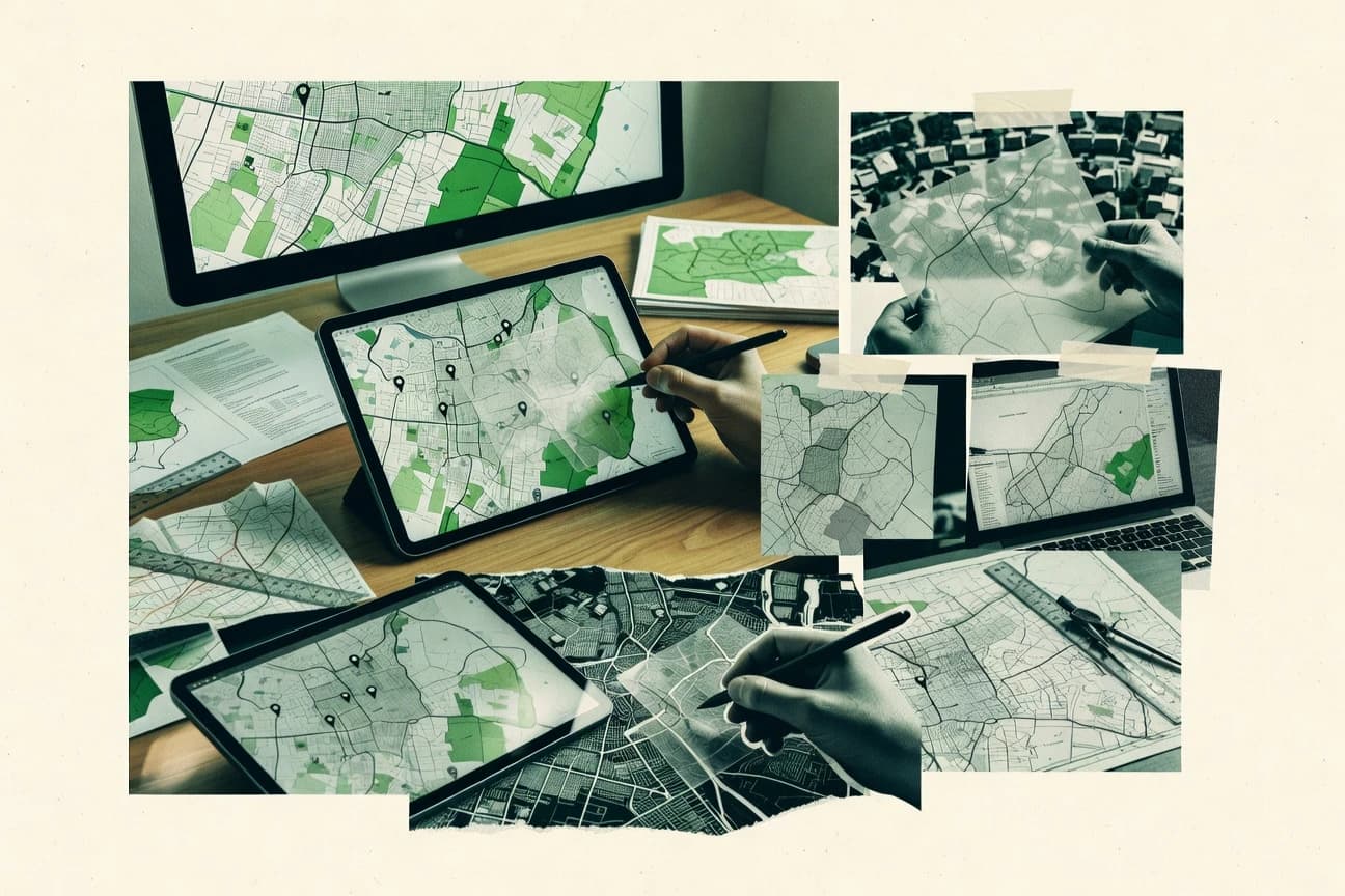
Discover the top 10 best map overlay software to create tailored visualizations. Explore features, user-friendliness, and integration – start mapping now.

How we ranked these tools
Core product claims cross-referenced against official documentation, changelogs, and independent technical reviews.
Analyzed video reviews and hundreds of written evaluations to capture real-world user experiences with each tool.
AI persona simulations modeled how different user types would experience each tool across common use cases and workflows.
Final rankings reviewed and approved by our editorial team with authority to override AI-generated scores based on domain expertise.
Score: Features 40% · Ease 30% · Value 30%
Gitnux may earn a commission through links on this page — this does not influence rankings. Editorial policy
Editor’s top 3 picks
Three quick recommendations before you dive into the full comparison below — each one leads on a different dimension.
Kepler.gl
GPU-accelerated deck.gl-based rendering for smooth rendering of large, layered overlays
Built for teams needing interactive map overlays and exploratory analytics without custom mapping code.
deck.gl
Editor pickLayer composition with DeckGL WebGL rendering and event picking
Built for engineering teams building custom interactive map overlays in web apps.
Mapbox Studio
Editor pickStyle editor for layer-by-layer cartography adjustments and overlay theming
Built for teams creating Mapbox overlays with strong visual design control.
Related reading
Comparison Table
This comparison table evaluates map overlay software that builds visualizations by layering data on interactive maps, including Kepler.gl, deck.gl, Mapbox Studio, MapLibre GL, and CesiumJS. It summarizes key differences in rendering approach, customization depth, data ingestion, and how each tool integrates with web and geospatial workflows so selection can match project requirements.
Kepler.gl
open-source vizKepler.gl renders interactive map visualizations with GPU-accelerated layers for polygons, points, and trajectories.
GPU-accelerated deck.gl-based rendering for smooth rendering of large, layered overlays
Kepler.gl stands out for building interactive web maps directly from geospatial datasets using declarative configuration and a visual UI. It supports dense exploratory workflows through layered visualization, including clustering, aggregation, and filtering across linked views.
The tool integrates with common geospatial data formats and supports custom styling so map overlays can mirror analytical needs. For overlay delivery, it focuses on embedding and sharing interactive map states rather than only producing static exports.
- +Layer-driven visualization with aggregation, clustering, and filtering for overlay exploration
- +Powerful interaction model with hover, click, and linked state across layers
- +Flexible styling and scale options for matching brand and analytical display needs
- –Large datasets can require tuning to keep interactions responsive
- –Advanced layer logic can feel technical compared with simpler overlay builders
- –Embedding and state management can be harder than exporting a single static map
Best for: Teams needing interactive map overlays and exploratory analytics without custom mapping code
More related reading
deck.gl
WebGL layersdeck.gl provides WebGL-powered map layers and visualization components for custom map overlays in web apps.
Layer composition with DeckGL WebGL rendering and event picking
deck.gl stands out with WebGL-powered geospatial visualization built for interactive map overlays. It supports high-performance point, path, polygon, and raster layers rendered as an overlay on common web map baselines.
The library offers fine-grained control over data-driven styling, picking, and hover or click interactions. Developers assemble layers programmatically, enabling custom visualization logic beyond what typical overlay widgets provide.
- +WebGL layers deliver smooth performance for large interactive datasets
- +Layer-based API covers points, paths, polygons, heatmaps, and tile rendering
- +Rich interactivity includes hover, click, and object picking support
- –Requires strong JavaScript and WebGL concepts for effective customization
- –Complex layer composition can increase development and debugging time
- –Production-grade production hardening needs engineering beyond basic overlays
Best for: Engineering teams building custom interactive map overlays in web apps
Mapbox Studio
mapping platformMapbox Studio creates and styles map layers and overlays using a visual editor for interactive web mapping.
Style editor for layer-by-layer cartography adjustments and overlay theming
Mapbox Studio distinguishes itself with a cartography-first workflow that turns raw spatial data into polished map styles. It supports interactive design of map layers, styling rules, and map assets that can be exported for use in Mapbox-based maps.
Core capabilities include configuring layer order, editing symbology, and managing metadata for reusable map components. It also integrates with the Mapbox tooling ecosystem so overlay styling and publishing work aligns with Mapbox rendering and layer pipelines.
- +Layer-level styling controls for building clear, high-contrast overlays
- +Cartography-focused tools that speed up production-ready map visuals
- +Seamless fit with Mapbox layer pipelines for consistent overlay rendering
- –Styling workflows can be complex without map styling experience
- –Best results depend on Mapbox-compatible data and style conventions
- –Advanced overlay logic often requires external configuration beyond Studio
Best for: Teams creating Mapbox overlays with strong visual design control
MapLibre GL
open-source mapsMapLibre GL is a client-side WebGL map rendering library that supports custom overlay layers.
Mapbox style specification driven vector styling with expression based layer control
MapLibre GL stands out as an open source WebGL mapping library used to render interactive vector maps and style them with Mapbox-compatible specs. It supports map overlays through layers, sources, and fine grained styling for markers, polygons, lines, heatmaps, and raster tiles.
Core overlay workflows include hit testing, popups, filters, and animated transitions for data driven symbology. It also enables integration of multiple basemap sources via tile configuration and custom projection options.
- +Vector layer styling with Mapbox GL style specification compatibility
- +Layer based overlays with filters, expressions, and hover hit testing
- +WebGL performance for large client side datasets and interactive maps
- –Overlay customization often requires JavaScript and WebGL oriented concepts
- –No built in authoring UI for non developers or drag and drop overlays
- –Complex data pipelines still require external tooling for ingestion
Best for: Teams building custom web map overlays with code-level control
CesiumJS
3D geospatialCesiumJS builds 3D geospatial map overlays with entities, primitives, and custom rendering for web visualization.
3D Tiles and terrain streaming combined with world-positioned overlay primitives
CesiumJS stands out because it renders 3D globe and terrain in the browser using WebGL and real geospatial tiles. Map overlays are handled through entities, primitives, and layers such as imagery and terrain providers. It supports rich overlays like points, billboards, polylines, polygons, and custom materials that can be positioned in world coordinates.
- +High-fidelity 3D globe rendering with WebGL and geospatial tiling
- +Flexible overlays via entities, primitives, and custom materials
- +Fast, browser-native interaction for point, line, and polygon overlays
- +Built-in support for imagery and terrain providers for background context
- –Overlay-to-data integration often needs custom math and coordinate handling
- –Learning curve is steep for advanced rendering and styling workflows
- –Performance tuning is required for large datasets and many entities
- –No turnkey UI tools for overlay authoring without additional development
Best for: Teams building interactive 3D map overlays in custom web applications
ArcGIS Online
GIS platformArcGIS Online enables creation and publication of web maps with overlay layers, symbology, and feature popups.
Web Map layer management with styling, filters, and interactive popups
ArcGIS Online stands out for map overlay workflows built on web maps, web scenes, and hosted layers that can be styled and filtered in place. It supports multi-layer overlay with feature layers, raster layers, and publishable layers that align to shared coordinate systems. Operational use is strengthened by data hosting, attribute-driven popups, and publish-subscribe style collaboration through sharing and groups.
- +Overlay multiple hosted layers with consistent symbology and visibility controls
- +Attribute-driven popups and layer filters support guided overlay inspection
- +Web maps and scenes share data across teams with group-based sharing
- +Robust data editing options for hosted feature layers support overlay iteration
- –Overlay visualization can become complex with many layers and styles
- –Advanced overlay analytics require additional configuration and tools
- –Performance and styling responsiveness can degrade with very large datasets
- –Coordinate alignment problems require careful management of spatial references
Best for: GIS teams overlaying hosted datasets for collaborative web map review
QGIS
desktop GISQGIS composes map overlays using styled layers, labeling, and print-quality layout tools.
Layer Styling and Geoprocessing via the Processing Toolbox for overlay-ready outputs
QGIS stands out by combining desktop GIS editing with geospatial overlay workflows inside one environment. It supports layering of vector and raster data, letting users style overlays and analyze spatial relationships using built-in geoprocessing tools. The software also integrates plugins and connects to many common OGC and database sources for building repeatable map overlay projects.
- +Strong overlay tooling for vector and raster layers in one workspace
- +Powerful geoprocessing for buffering, clipping, and spatial joins
- +Extensive plugin ecosystem for specialized overlay workflows
- +Supports many data sources including WMS and common spatial databases
- +Flexible symbology and labeling for clear overlay visualization
- –Interface can feel complex compared with purpose-built overlay tools
- –Some advanced workflows require GIS concepts like projections and topology
- –Large datasets can slow down when rendering complex layers
Best for: GIS teams creating precise map overlays with analysis and repeatable processing
GeoServer
OGC serverGeoServer publishes OGC web services like WMS and WFS so GIS clients can overlay geospatial data on basemaps.
SLD-driven style management for consistent, server-side overlay rendering
GeoServer stands out as an open-source map server that turns geospatial data into standards-based map services. It supports WMS, WMTS, WFS, and WCS so overlay layers can be generated, queried, and shared across GIS clients.
Core capabilities include publishable styles via SLD, robust raster and vector handling, and integration with external data stores such as PostGIS. Administrative control is centralized through a web interface plus configuration files, which suits repeatable layer delivery but requires operational knowledge.
- +Standards-first output via WMS, WMTS, WFS, and WCS
- +SLD styling enables precise cartographic control for overlay layers
- +Strong support for vector and raster data publishing workflows
- –Layer configuration and styling often require GIS and server know-how
- –Performance tuning and caching setup can be non-trivial for large overlays
- –Basic map overlays still need external client integration for best UX
Best for: Teams publishing standards-based overlay services with GIS-grade control
Google Maps Platform
managed mapsGoogle Maps Platform supports custom overlays and styled layer rendering through map APIs.
Map overlays synchronized to pan and zoom using Google Maps rendering APIs
Google Maps Platform stands out for its mature mapping stack and wide ecosystem integration, which accelerates overlay projects that need reliable basemap rendering. Developers can layer custom data using styled markers, vector-like rendering patterns, and HTML or WebGL overlays aligned to map coordinates. It also supports building location-aware experiences with geocoding, directions, and Places data that complement overlay UIs.
- +High-fidelity basemap rendering improves the visual quality of overlays
- +Flexible overlay techniques using map events and coordinate anchoring
- +Strong geospatial ecosystem with geocoding, Places, and routing to support overlay workflows
- –Overlay performance can degrade with many objects without careful batching
- –Advanced styling and interaction require more web development effort than turnkey tools
- –Cumulative API usage and data handling complexity can raise operational overhead
Best for: Teams building interactive, data-rich map overlays with custom UI and logic
Leaflet
lightweight mapsLeaflet is a JavaScript mapping library that supports overlay layers like markers, polygons, and custom panes.
GeoJSON layer support with per-feature styling and interactive events
Leaflet stands out for delivering a lightweight, open-source map overlay capability through a small JavaScript library. It supports adding interactive layers such as markers, polylines, polygons, heatmaps via plugins, and custom styling of vector overlays. Core overlay work includes tile layer management, event handling on features, and straightforward integration with external data formats like GeoJSON.
- +Lightweight JavaScript mapping engine for fast overlay rendering
- +Rich overlay primitives for points, lines, polygons, and popups
- +First-class GeoJSON support with feature-level styling and events
- +Layer controls enable toggling overlays without custom UI frameworks
- –No built-in advanced overlay analytics like clustering or time playback
- –Complex overlay workflows often require additional plugins and integration work
- –Large-scale feature performance can need custom tiling and optimization
Best for: Teams building code-driven map overlays with GeoJSON and custom interactions
Conclusion
After evaluating 10 business finance, Kepler.gl stands out as our overall top pick — it scored highest across our combined criteria of features, ease of use, and value, which is why it sits at #1 in the rankings above.
Use the comparison table and detailed reviews above to validate the fit against your own requirements before committing to a tool.
How to Choose the Right Map Overlay Software
This buyer’s guide explains how to choose Map Overlay Software for interactive overlays and production-ready map layers across Kepler.gl, deck.gl, Mapbox Studio, MapLibre GL, CesiumJS, ArcGIS Online, QGIS, GeoServer, Google Maps Platform, and Leaflet. It compares overlay authoring and integration approaches like GPU-accelerated rendering in Kepler.gl, WebGL layer composition in deck.gl, and cartography-first styling in Mapbox Studio. It also covers server-side standards publishing in GeoServer and desktop-to-export overlay workflows in QGIS.
What Is Map Overlay Software?
Map Overlay Software adds visual layers on top of map basemaps using vector layers, raster overlays, or 3D globe positioning. These tools help teams plot points, polygons, lines, heatmaps, and labels with interactive inspection tools like hover, click, popups, and filters. Some options focus on embedding interactive map states like Kepler.gl, while others focus on building custom overlay rendering in code like deck.gl. GIS teams and app developers use these tools to turn spatial datasets into actionable, coordinate-aware visualizations.
Key Features to Look For
The right Map Overlay Software depends on whether overlay performance, interactivity, styling control, and data workflow fit the end deliverable.
GPU-accelerated layered rendering for dense overlays
Kepler.gl uses GPU-accelerated deck.gl-based rendering to keep interactions smooth when multiple overlay layers are active at once. deck.gl also delivers WebGL performance for point, path, polygon, heatmap, and tile layers when large datasets are involved.
Layer-based composition with object picking and interaction events
deck.gl provides a layer-based API that supports hover and click interaction through event picking. MapLibre GL and Google Maps Platform also support interactive overlay behaviors tied to pan and zoom, which enables reliable coordinate anchoring for event-driven overlays.
Cartography-first style editing for map-ready visuals
Mapbox Studio offers a style editor for layer-by-layer cartography adjustments and overlay theming. Mapbox Studio supports layer order and symbology control so overlays look polished without rewriting core rendering logic.
Mapbox style specification compatibility and expression-driven styling
MapLibre GL supports Mapbox GL style specification compatibility for vector layer styling across overlays. MapLibre GL also uses expression-based layer control to drive data-driven symbology, filters, and hover hit testing.
3D globe overlays with terrain and world-positioned primitives
CesiumJS renders a 3D globe with terrain using WebGL and supports overlays through entities and primitives. CesiumJS also supports 3D Tiles and terrain streaming so world-positioned overlays like billboards, polylines, and polygons remain aligned to real geospatial context.
Standards-based server publishing for WMS, WFS, WMTS, and WCS
GeoServer publishes OGC web services like WMS, WMTS, WFS, and WCS to deliver overlay layers to GIS clients. GeoServer uses SLD to manage cartographic styling on the server side so overlay rendering stays consistent across consuming applications.
How to Choose the Right Map Overlay Software
A practical selection framework starts with the target deliverable, then matches rendering technology, styling workflow, and integration needs to the tool’s overlay model.
Choose the deliverable type: exploratory overlay, embedded interactive map state, or app-layer control
If the goal is exploratory overlay analysis with linked interactions, Kepler.gl supports layered visualization with clustering, aggregation, and filtering across linked views. If the goal is full control inside a custom web app, deck.gl and MapLibre GL build overlays as programmable layers tied to interaction events like hover and click.
Match rendering performance to dataset size and overlay complexity
Kepler.gl and deck.gl both rely on GPU and WebGL rendering to keep large, layered overlays responsive. For teams that want vector overlays with hit testing and animated transitions, MapLibre GL provides layer-driven styling and filter support that remains interactive on the client.
Decide how styling work will be produced and maintained
If style production is a design workflow, Mapbox Studio offers a visual style editor that manages layer order, symbology, and reusable map assets. If the styling must be portable through a styling spec, MapLibre GL and Mapbox-compatible style approaches support expression-driven control that can be maintained within a client style pipeline.
Pick the data workflow: hosted GIS layers, desktop analysis, or server-side services
If hosted datasets and collaborative review are the core requirement, ArcGIS Online supports web maps and scenes with overlay layers, attribute-driven popups, and visibility controls across shared groups. If repeatable overlay outputs and GIS-grade analysis are required before publishing, QGIS uses the Processing Toolbox for overlay-ready outputs like buffering, clipping, and spatial joins.
Use the right integration model for basemaps and coordinate anchoring
For overlays that must stay synchronized to pan and zoom using a mature basemap stack, Google Maps Platform coordinates overlay rendering with map events and supports custom HTML or WebGL overlays anchored to map coordinates. For standards-based distribution to many clients, GeoServer publishes WMS, WMTS, WFS, and WCS so basemaps stay decoupled from overlay delivery.
Who Needs Map Overlay Software?
Different overlay engines fit different delivery owners based on how overlays are authored, rendered, and shared.
Teams needing interactive overlay exploration without custom mapping code
Kepler.gl is designed for teams building interactive map overlays and exploratory analytics without custom mapping code. Kepler.gl supports aggregation, clustering, filtering, and hover or click interactions with linked state across layers.
Engineering teams building custom interactive web map overlays in an application
deck.gl fits engineering teams that need WebGL-powered layer composition for points, paths, polygons, and heatmaps with fine-grained interaction control. MapLibre GL fits teams that want Mapbox-compatible vector styling with expression-based filters, hover hit testing, and code-level overlay control.
GIS teams overlaying hosted datasets for collaborative web map review
ArcGIS Online supports web map and web scene overlays with hosted layers, attribute-driven popups, and layer filters that enable guided overlay inspection. It also strengthens collaboration through group-based sharing of overlay maps and scenes.
Teams publishing standards-based overlay services for multiple GIS clients
GeoServer is the fit for teams that need to publish OGC web services like WMS, WFS, WMTS, and WCS to deliver overlay layers broadly. GeoServer also provides SLD-driven style management so server-side rendering remains consistent across clients.
Common Mistakes to Avoid
Common failures come from mismatching overlay authoring style to the needed rendering, interaction, or publishing model across the tool set.
Choosing a code-first WebGL engine without reserving engineering time
deck.gl requires strong JavaScript and WebGL concepts for effective customization, and complex layer composition increases development and debugging time. MapLibre GL also relies on JavaScript and WebGL-oriented concepts for overlay customization, and there is no drag-and-drop authoring UI for non developers.
Expecting turnkey map authoring from a desktop GIS workflow without integration planning
QGIS provides desktop overlay composition and geoprocessing but its interface can feel complex compared with purpose-built overlay tools. QGIS also relies on projections and GIS concepts for advanced workflows, so overlay pipelines can slow when projections and topology must be handled carefully.
Overloading interactivity with extremely large datasets without performance tuning
Kepler.gl can require tuning so interactions remain responsive when datasets are dense and many layers are active. Google Maps Platform can degrade overlay performance with many objects unless batching and careful integration are planned.
Relying on standards-based publishing without designing for client-side UX
GeoServer publishes WMS, WMTS, WFS, and WCS and uses SLD for consistent server-side styling, but basic map overlay UX still needs external client integration for best results. Even with the services in place, clients must implement interaction patterns like hover, click, and popups for the desired inspection experience.
How We Selected and Ranked These Tools
we evaluated each tool on three sub-dimensions that reflect how teams experience map overlay solutions. Features carry a weight of 0.4, ease of use carries a weight of 0.3, and value carries a weight of 0.3. The overall rating is the weighted average computed as overall = 0.40 × features + 0.30 × ease of use + 0.30 × value. Kepler.gl separated itself from lower-ranked options by combining high feature breadth for layered exploratory overlay workflows with GPU-accelerated deck.gl-based rendering that supports smooth interaction performance.
Frequently Asked Questions About Map Overlay Software
Which tool is best for building interactive overlay maps directly from geospatial datasets without writing custom mapping code?
What option delivers the highest-performance interactive overlays in a web app when rendering many points or polygons?
Which workflow is most effective for creating polished overlay styling that aligns with a specific map rendering stack?
When should an open-source WebGL overlay stack be chosen instead of a proprietary mapping platform?
Which software is best for 3D overlays that track positions in world coordinates on a globe?
Which tool supports collaborative overlay workflows over hosted layers with interactive attribute popups?
Which solution is best when the deliverable must be repeatable GIS overlay outputs from desktop processing?
How do teams typically expose overlay layers to other systems using standards-based map services?
Which option is strongest when overlays must be tightly synchronized with pan and zoom while also adding custom UI logic?
What is a common integration workflow for code-driven overlays built from GeoJSON data with per-feature interactions?
Tools reviewed
Primary sources checked during evaluation.
Referenced in the comparison table and product reviews above.
Keep exploring
Comparing two specific tools?
Software Alternatives
See head-to-head software comparisons with feature breakdowns, pricing, and our recommendation for each use case.
Explore software alternatives→In this category
Business Finance alternatives
See side-by-side comparisons of business finance tools and pick the right one for your stack.
Compare business finance tools→FOR SOFTWARE VENDORS
Not on this list? Let’s fix that.
Our best-of pages are how many teams discover and compare tools in this space. If you think your product belongs in this lineup, we’d like to hear from you—we’ll walk you through fit and what an editorial entry looks like.
Apply for a ListingWHAT THIS INCLUDES
Where buyers compare
Readers come to these pages to shortlist software—your product shows up in that moment, not in a random sidebar.
Editorial write-up
We describe your product in our own words and check the facts before anything goes live.
On-page brand presence
You appear in the roundup the same way as other tools we cover: name, positioning, and a clear next step for readers who want to learn more.
Kept up to date
We refresh lists on a regular rhythm so the category page stays useful as products and pricing change.