GITNUXSOFTWARE ADVICE
Technology Digital MediaTop 10 Best Drone Processing Software of 2026
Discover top drone processing software for efficient aerial data processing.

How we ranked these tools
Core product claims cross-referenced against official documentation, changelogs, and independent technical reviews.
Analyzed video reviews and hundreds of written evaluations to capture real-world user experiences with each tool.
AI persona simulations modeled how different user types would experience each tool across common use cases and workflows.
Final rankings reviewed and approved by our editorial team with authority to override AI-generated scores based on domain expertise.
Score: Features 40% · Ease 30% · Value 30%
Gitnux may earn a commission through links on this page — this does not influence rankings. Editorial policy
Editor’s top 3 picks
Three quick recommendations before you dive into the full comparison below — each one leads on a different dimension.
Pix4Dmapper
Automated photogrammetry pipeline with georeferencing via GCPs and camera metadata
Built for survey and mapping teams needing accurate photogrammetry outputs with GIS-ready exports.
Agisoft Metashape
Editor pickDense point cloud reconstruction with adjustable depth-map and meshing parameters
Built for survey and mapping teams processing drone photogrammetry with controlled QA.
RealityCapture
Editor pickGround control point georeferencing combined with camera alignment and dense reconstruction
Built for teams needing high-accuracy photogrammetry with automation-ready processing pipelines.
Related reading
Comparison Table
This comparison table evaluates drone processing software used to turn aerial imagery into orthomosaics, 3D models, and dense point clouds. It covers tools such as Pix4Dmapper, Agisoft Metashape, RealityCapture, DroneDeploy, and OpenDroneMap, plus other commonly used options. Readers can scan key differences across photogrammetry workflows, output types, automation features, and deployment models to find the best fit for their capture and processing pipeline.
Pix4Dmapper
enterprise photogrammetryProcesses drone imagery into georeferenced orthomosaics, 3D maps, and dense point clouds using photogrammetry pipelines.
Automated photogrammetry pipeline with georeferencing via GCPs and camera metadata
Pix4Dmapper stands out for its end-to-end photogrammetry workflow that moves from image alignment to dense reconstruction and metric outputs. It supports automatic processing of orthomosaics, 3D point clouds, and textured or classified models with export formats suited to mapping and GIS. The software also includes tools for camera calibration refinement and georeferencing so results can be tied to known coordinate systems.
- +Produces orthomosaics, point clouds, and textured meshes from the same project workflow
- +Robust georeferencing using GCPs and camera metadata for metrically reliable results
- +Supports DSM and DTM generation with configurable surface outputs for mapping deliverables
- +Exports project products to common GIS and CAD pipelines
- –Dense reconstruction performance depends heavily on image quality and overlap consistency
- –Advanced processing controls require training for consistent high-accuracy outcomes
- –Project setup steps can feel heavy for small, one-off reconstructions
Best for: Survey and mapping teams needing accurate photogrammetry outputs with GIS-ready exports
More related reading
Agisoft Metashape
photogrammetry suiteBuilds 3D models, dense point clouds, and orthomosaics from drone and camera images with configurable processing steps.
Dense point cloud reconstruction with adjustable depth-map and meshing parameters
Agisoft Metashape distinguishes itself with a photogrammetry-first workflow that converts overlapping drone imagery into dense point clouds, mesh models, and orthomosaics. It provides camera calibration options, tie-point generation, and multi-view reconstruction settings aimed at producing survey-grade outputs. The software supports georeferencing using GCPs or camera positions and delivers quality control through error reports and reprojection statistics.
- +Strong photogrammetry pipeline from sparse alignment to dense cloud and mesh
- +Georeferencing supports GCP-based control and coordinate system alignment
- +Quality metrics like reprojection error help diagnose capture and processing issues
- –Dense reconstruction can require significant compute and memory
- –Effective results depend on image overlap, focus, and parameter tuning
- –Workflow setup and export configuration can feel technical for new users
Best for: Survey and mapping teams processing drone photogrammetry with controlled QA
RealityCapture
high-performance photogrammetryGenerates photogrammetry reconstructions, meshes, and textured models from large aerial image datasets with fast alignment and reconstruction.
Ground control point georeferencing combined with camera alignment and dense reconstruction
RealityCapture stands out for fast, accurate photogrammetry with automated alignment and dense reconstruction tuned for large image sets. It provides end-to-end workflows from camera pose estimation to textured mesh export, with outputs compatible with common GIS and 3D pipelines.
The tool includes control via ground control points, coordinate system support, and detailed quality filtering. It also supports batch processing through command-line usage for repeatable drone capture processing.
- +Very fast alignment and dense reconstruction for large drone datasets
- +Strong accuracy controls with ground control points and coordinate system setup
- +High-quality textured meshes with practical export for downstream use
- +Automation-friendly command-line processing for repeatable projects
- –Dense reconstruction and texturing can require active tuning for best results
- –Workflow complexity rises when mixing GCPs, coordinate systems, and scale constraints
- –File and component management can be confusing in large, multi-block jobs
Best for: Teams needing high-accuracy photogrammetry with automation-ready processing pipelines
DroneDeploy
cloud processingUploads drone imagery to create orthomosaics and 3D outputs in a web workflow for inspection and mapping teams.
Automated mapping pipeline that converts planned drone missions into orthomosaics and surface models
DroneDeploy stands out with an end-to-end drone workflow that connects flight planning, automated mapping, and post-processing output for common survey and inspection tasks. It generates georeferenced orthomosaics, digital surface models, and other deliverables from captured imagery using guided capture workflows.
Collaboration features support sharing processed results with stakeholders through project-based access and exportable data for downstream use. Its strengths center on reducing manual steps from capture to deliverable rather than offering a developer-centric processing SDK.
- +Guided capture reduces operator guesswork during flight planning and image collection
- +Automated processing outputs orthomosaics and surface models for survey-ready deliverables
- +Project sharing streamlines stakeholder review with consistent, georeferenced results
- –Advanced customization is limited compared with research-grade photogrammetry toolchains
- –Processing workflow can feel rigid when projects need nonstandard capture patterns
- –Large datasets require careful planning to avoid delays during processing
Best for: Survey and inspection teams needing fast, repeatable mapping deliverables
OpenDroneMap
open-source pipelineProcesses drone imagery into orthomosaics, point clouds, and meshes using an open-source photogrammetry toolchain.
One-click command-line processing through OpenDroneMap pipelines producing ortho, DEM, and 3D meshes
OpenDroneMap stands out for producing georeferenced maps from drone imagery using an open processing stack. It supports automated photogrammetry workflows that generate orthomosaics, digital elevation models, and textured 3D models from standard image sets.
Outputs can be consumed for GIS analysis and visualization, with optional integration for downstream tools that read common formats. The project emphasizes reproducible processing through configurable command-line runs and Docker-based deployment options.
- +Generates orthomosaics, DEMs, and textured 3D models from photo sets
- +Customizable processing pipeline via command-line options
- +Docker-based execution improves portability across machines
- –Setup and tuning require photogrammetry knowledge
- –Workflow depends on external tools and system prerequisites
- –Large projects can be slow without careful resource planning
Best for: Teams running repeatable photogrammetry pipelines with GIS-ready outputs
WingtraHub
cloud mappingProvides cloud photogrammetry processing for Wingtra drone data and delivers mapping outputs for surveying workflows.
Wingtra mission-driven processing management that ties flights to standardized outputs
WingtraHub stands out by centering drone-collection ingestion around Wingtra mission files and site workflows rather than generic import-only processing. Core capabilities include automated photogrammetry processing management, map and orthomosaic output generation, and organized storage tied to projects and flights.
It also emphasizes repeatable processing runs through standardized configurations that reduce manual rework across similar jobs. The platform targets teams that need consistent results from Wingtra hardware and want a single place to monitor processing status and retrieve outputs.
- +Wingtra-first workflow connects mission inputs to processing outputs
- +Project-based organization keeps flights, processing runs, and outputs traceable
- +Automated processing management reduces repetitive operator steps
- +Consistent map generation supports repeatable site deliverables
- –Workflow depth is strongest with Wingtra-centric datasets and tools
- –Less flexible for organizations needing custom processing pipelines
- –Advanced tuning options can remain limited compared with DIY photogrammetry stacks
Best for: Wingtra-focused teams needing managed photogrammetry processing and traceable deliverables
PrecisionHawk DataMapper
enterprise mappingManages drone data and generates mapping products from aerial imagery for infrastructure and industrial analytics workflows.
Project-centric processing and review workflow for consistent drone map deliverables
PrecisionHawk DataMapper focuses on turning drone imagery into mapped outputs with a workflow designed for ongoing site assessments. It supports photogrammetry processing with modules for flight planning inputs, image processing, and deliverable review tied to field locations.
Teams can manage large projects and export common geospatial deliverables for downstream analysis. DataMapper also emphasizes consistency across processing runs to support repeat surveys over time.
- +Photogrammetry processing workflow built for repeatable site mapping
- +Project-based organization for managing multiple flight datasets
- +Exports mapped deliverables suitable for GIS and field reporting
- –Setup and workflow tuning can be complex for first-time teams
- –Collaboration and review tools feel less modern than newer platforms
- –Limited flexibility for highly customized processing pipelines
Best for: Survey and engineering teams standardizing drone mapping workflows
Pointfuse
automation-focusedTransforms drone imagery into derived geospatial outputs with automated processing for mapping and inspection users.
Collaborative review workflow that helps validate outputs before delivery exports
Pointfuse focuses on turning drone imagery into geospatial deliverables through a processing and review workflow. Core capabilities include automated photogrammetry processing, map and model generation, and collaboration features for validation and export. The platform also supports managing projects and organizing outputs like orthomosaics and 3D models for site-centric use cases.
- +Automates photogrammetry processing into usable orthomosaics and 3D outputs
- +Project organization keeps imagery, processing steps, and deliverables traceable
- +Built-in review workflow supports validation before export
- –Less transparent control over advanced processing parameters than power tools
- –Review and export flows can feel less streamlined for high-volume teams
- –File and project management overhead increases across many sites
Best for: Teams needing guided drone-to-deliverable processing with collaborative validation
GeoSLAM Hub
point-cloud platformHosts and processes point cloud datasets from mobile scanning workflows that often integrate with drone-derived context.
Integrated SLAM processing pipeline for generating cleaned point clouds and meshes
GeoSLAM Hub centers on point-cloud and mesh production from GeoSLAM mapping systems and related capture workflows. It provides processing for SLAM survey data, project management for large datasets, and exports used for surveying, inspection, and as-built documentation.
The software emphasizes repeatable processing pipelines instead of bespoke scripting, which helps teams standardize outputs across sites. Core value is tied to converting field captures into usable 3D products with manageable post-processing steps.
- +Strong SLAM-oriented processing for 3D point clouds and meshes
- +Project-based workflow keeps multi-site datasets organized
- +Focused export outputs support surveying and inspection use cases
- +Processing pipeline reduces manual steps across repeat projects
- –Limited flexibility for custom processing workflows compared with general photogrammetry
- –Handling very large projects can demand substantial workstation resources
- –Less suited for purely aerial photogrammetry datasets without SLAM capture
- –Advanced QA controls feel narrower than broader survey toolchains
Best for: Survey teams turning SLAM capture data into 3D deliverables
Billed Cloud
construction mappingCreates derived construction site deliverables from captured aerial imagery within an end-to-end drone processing workflow.
Deliverable-to-project traceability that ties outputs to client-ready billing records
Billed Cloud focuses on drone-data billing and operational processing workflows around completed deliverables. It supports photogrammetry output management and ties processed results to project records so teams can track what shipped.
The platform also targets document-ready deliverable handling and review steps for client-facing exports. It is best used when drone processing work must connect directly to downstream billing and project documentation.
- +Links processed drone outputs to projects for traceable deliverables
- +Organizes review and export-ready assets from photogrammetry workflows
- +Helps teams maintain consistent deliverables for client handoff
- –Drone processing depth depends on external tools or defined pipelines
- –Advanced automation options are limited compared with full processing suites
- –Workflow setup requires clear mapping of outputs to deliverable types
Best for: Teams managing drone deliverables that must feed billing and handoff documentation
Conclusion
After evaluating 10 technology digital media, Pix4Dmapper stands out as our overall top pick — it scored highest across our combined criteria of features, ease of use, and value, which is why it sits at #1 in the rankings above.
Use the comparison table and detailed reviews above to validate the fit against your own requirements before committing to a tool.
How to Choose the Right Drone Processing Software
This buyer’s guide covers how to choose drone processing software for photogrammetry outputs like georeferenced orthomosaics, dense point clouds, and textured meshes. It walks through top options including Pix4Dmapper, Agisoft Metashape, RealityCapture, DroneDeploy, OpenDroneMap, WingtraHub, PrecisionHawk DataMapper, Pointfuse, GeoSLAM Hub, and Billed Cloud. Each section ties selection criteria and fit to concrete capabilities and workflow patterns from these tools.
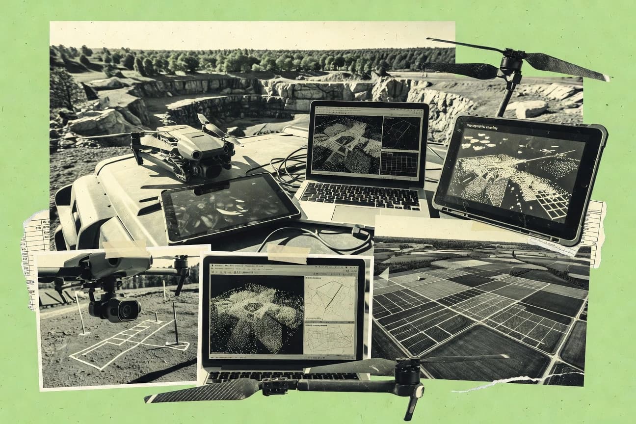
What Is Drone Processing Software?
Drone processing software turns overlapping drone or capture imagery into georeferenced mapping and 3D products such as orthomosaics, DSM or DTM surfaces, and dense point clouds. It solves the time-consuming steps of photogrammetry alignment, dense reconstruction, surface generation, and export into GIS and CAD-ready formats. Tools like Pix4Dmapper and Agisoft Metashape focus on photogrammetry workflows that build metric outputs from image sets. Web and workflow platforms like DroneDeploy and WingtraHub focus on turning planned missions or Wingtra site collections into standardized deliverables with less operator handling of reconstruction controls.
Key Features to Look For
The following capabilities matter because they directly determine whether outputs remain metrically reliable, repeatable across sites, and manageable for the dataset size being processed.
Georeferencing with GCPs and camera metadata for metric outputs
Pix4Dmapper combines automated photogrammetry pipeline behavior with georeferencing via GCPs and camera metadata to support metrically reliable mapping outputs. RealityCapture also supports ground control point georeferencing together with camera alignment and dense reconstruction.
Dense point cloud reconstruction controls
Agisoft Metashape provides dense point cloud reconstruction with adjustable depth-map and meshing parameters for tuning reconstruction quality. RealityCapture delivers fast dense reconstruction and then supports quality filtering so large projects can still produce usable dense outputs.
Orthomosaic and surface model generation for survey deliverables
Pix4Dmapper produces orthomosaics and supports DSM and DTM generation with configurable surface outputs for mapping deliverables. DroneDeploy automates mapping outputs like orthomosaics and surface models from guided capture missions.
Automation-friendly batch processing and reproducible runs
RealityCapture includes command-line processing for repeatable drone capture processing at scale. OpenDroneMap emphasizes reproducible processing through configurable command-line runs and Docker-based execution for consistent pipeline execution.
Project-centric organization tied to flights and field locations
WingtraHub ties Wingtra mission inputs to processing management and then delivers organized storage tied to projects and flights. PrecisionHawk DataMapper organizes repeatable site mapping by managing multiple flight datasets and tying review and deliverables to field locations.
Collaborative validation and review workflows before export
Pointfuse includes a built-in review workflow that supports validation before delivery exports. DroneDeploy supports project sharing so stakeholders can review processed, georeferenced results, even when advanced reconstruction customization is limited.
How to Choose the Right Drone Processing Software
Selection depends on whether the workflow needs photogrammetry-grade control, repeatable automation, or a deliverable-first pipeline tied to missions and reviews.
Start with the output type and accuracy needs
Choose Pix4Dmapper when workflows must generate orthomosaics plus dense point clouds and textured or classified models from one end-to-end project workflow. Choose RealityCapture when fast alignment and dense reconstruction for large aerial datasets matter, then rely on ground control point support for georeferenced outputs. Choose Agisoft Metashape when adjustable depth-map and meshing parameters are needed to control dense reconstruction quality.
Confirm georeferencing support matches the field control plan
For projects that rely on GCPs, Pix4Dmapper uses GCPs and camera metadata for robust georeferencing tied to known coordinate systems. For teams using ground control points with camera alignment, RealityCapture combines control point georeferencing with dense reconstruction. For workflows that cannot support manual control setup, DroneDeploy still produces georeferenced orthomosaics via guided missions but limits advanced customization.
Match compute and dataset scale to processing behavior
If dense reconstruction must be tuned and managed on a workstation, Agisoft Metashape requires significant compute and memory, especially for large dense reconstructions. If throughput for very large image sets is the priority, RealityCapture emphasizes very fast alignment and dense reconstruction with practical textured mesh export. If compute portability and standardized pipeline execution are priorities, OpenDroneMap adds Docker-based deployment and configurable command-line runs.
Pick a workflow model based on how teams run missions and handle projects
Choose DroneDeploy for guided capture workflows that convert planned drone missions into orthomosaics and surface models with less operator handling of photogrammetry parameters. Choose WingtraHub for Wingtra mission-driven processing management that organizes flights, runs, and outputs in a single place. Choose PrecisionHawk DataMapper for project-centric processing and review tied to ongoing site assessments and repeatable surveys.
Plan for collaboration, QA, and export handoff
Choose Pointfuse when validation and collaborative review before delivery exports are required, because it includes a built-in review workflow. Choose Pix4Dmapper when GIS and CAD export pipelines are central since it exports project products to common mapping workflows and supports DSM and DTM outputs. Choose Billed Cloud when processed deliverables must connect directly to billing and client handoff documentation with deliverable-to-project traceability.
Who Needs Drone Processing Software?
Drone processing software is a fit for teams that need mapping-grade deliverables, 3D reconstruction outputs, or standardized workflows tied to missions, sites, and deliverable handoff.
Survey and mapping teams producing GIS-ready photogrammetry deliverables
Pix4Dmapper fits teams needing orthomosaics, dense point clouds, and metric georeferencing via GCPs and camera metadata. Agisoft Metashape also fits mapping teams that want dense point cloud reconstruction with adjustable depth-map and meshing parameters and that use QA metrics like reprojection error.
Teams needing fast photogrammetry for large aerial datasets and automation-ready pipelines
RealityCapture is built for very fast alignment and dense reconstruction for large image sets, and it supports command-line batch processing for repeatable projects. OpenDroneMap fits organizations that want configurable command-line processing and Docker-based portability to run repeatable pipelines for ortho, DEM, and 3D meshes.
Inspection and survey teams prioritizing repeatable, guided drone-to-deliverable workflows
DroneDeploy provides a guided capture workflow that reduces operator guesswork and then automates orthomosaic and surface model generation. Pointfuse supports guided drone-to-deliverable processing with collaborative validation so outputs can be checked before export.
Organizations managing mission-driven operations or deliverables tied to clients and projects
WingtraHub fits Wingtra-focused teams that need managed cloud photogrammetry processing and traceable outputs tied to flights and standardized configurations. Billed Cloud fits teams that must tie processed outputs to project records for client-facing billing documentation.
Common Mistakes to Avoid
These mistakes show up when teams pick tools that do not align with their capture control strategy, dataset size, or workflow expectations.
Choosing a tool without a georeferencing plan
Pix4Dmapper and RealityCapture both support georeferencing with ground control points, which is necessary when deliverables must tie to known coordinate systems. DroneDeploy produces georeferenced orthomosaics from guided missions, but it limits advanced customization for nonstandard capture patterns.
Expecting dense reconstruction quality without overlap and image quality discipline
Pix4Dmapper dense reconstruction performance depends heavily on image quality and overlap consistency. Agisoft Metashape dense reconstruction also depends on image overlap, focus, and parameter tuning, which can require technical setup work.
Overlooking compute and memory requirements for dense processing
Agisoft Metashape can require significant compute and memory for dense reconstructions. OpenDroneMap can be slow for large projects without careful resource planning because it relies on a pipeline of external tools and system prerequisites.
Selecting research-grade flexibility when the team needs a mission-driven deliverable pipeline
PrecisionHawk DataMapper and WingtraHub provide project-centric processing and organized flight traceability that fits repeat surveys and standardized workflows. If a team needs fast, guided deliverables, DroneDeploy offers a rigid workflow aligned to planned missions rather than deep reconstruction controls.
How We Selected and Ranked These Tools
We evaluated every tool using three sub-dimensions that reflect practical buying priorities for drone processing work. Features carry a weight of 0.4, ease of use carries a weight of 0.3, and value carries a weight of 0.3. The overall rating is computed as overall = 0.40 × features + 0.30 × ease of use + 0.30 × value. Pix4Dmapper separated itself from lower-ranked tools by combining end-to-end photogrammetry pipeline coverage with georeferencing using GCPs and camera metadata that directly supports metric GIS-ready outputs.
Frequently Asked Questions About Drone Processing Software
Which drone processing software is best for GIS-ready orthomosaics with accurate georeferencing?
What tool produces dense point clouds and meshes with the most controllable reconstruction parameters?
Which platform is fastest for large image batches and repeatable, automation-friendly runs?
Which solution is best when drone-to-deliverable workflows need guided capture planning and rapid post-processing outputs?
What software is most appropriate for teams that need open, scriptable photogrammetry pipelines?
Which tool should be used when the capture workflow is SLAM-based rather than classic image photogrammetry?
Which option works best for Wingtra-centric operations that rely on mission files and site traceability?
Which platform is strongest for collaborative review and validation before exporting deliverables?
What software handles detailed camera calibration refinement and georeferencing quality checks for mapping accuracy?
Tools reviewed
Primary sources checked during evaluation.
Referenced in the comparison table and product reviews above.
Keep exploring
Comparing two specific tools?
Software Alternatives
See head-to-head software comparisons with feature breakdowns, pricing, and our recommendation for each use case.
Explore software alternatives→In this category
Technology Digital Media alternatives
See side-by-side comparisons of technology digital media tools and pick the right one for your stack.
Compare technology digital media tools→FOR SOFTWARE VENDORS
Not on this list? Let’s fix that.
Our best-of pages are how many teams discover and compare tools in this space. If you think your product belongs in this lineup, we’d like to hear from you—we’ll walk you through fit and what an editorial entry looks like.
Apply for a ListingWHAT THIS INCLUDES
Where buyers compare
Readers come to these pages to shortlist software—your product shows up in that moment, not in a random sidebar.
Editorial write-up
We describe your product in our own words and check the facts before anything goes live.
On-page brand presence
You appear in the roundup the same way as other tools we cover: name, positioning, and a clear next step for readers who want to learn more.
Kept up to date
We refresh lists on a regular rhythm so the category page stays useful as products and pricing change.