GITNUXSOFTWARE ADVICE
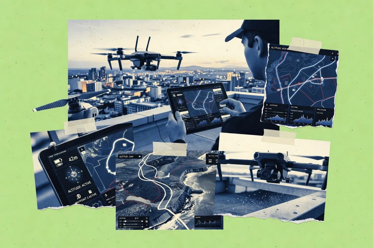
Technology Digital MediaTop 10 Best Drone Flying Software of 2026
Discover the top 10 best drone flying software to enhance your drone flights. Find tools for precision, navigation, and more – start flying smarter today.

How we ranked these tools
Core product claims cross-referenced against official documentation, changelogs, and independent technical reviews.
Analyzed video reviews and hundreds of written evaluations to capture real-world user experiences with each tool.
AI persona simulations modeled how different user types would experience each tool across common use cases and workflows.
Final rankings reviewed and approved by our editorial team with authority to override AI-generated scores based on domain expertise.
Score: Features 40% · Ease 30% · Value 30%
Gitnux may earn a commission through links on this page — this does not influence rankings. Editorial policy
Editor’s top 3 picks
Three quick recommendations before you dive into the full comparison below — each one leads on a different dimension.
DJI Pilot
Waypoint mission planning with guided automated execution and camera trigger control
Built for survey and inspection teams running repeatable DJI drone waypoint missions.
DJI Fly
Editor pickReturn-to-Home and safety check prompts integrated into the live control interface
Built for solo operators needing guided, model-aware capture control without advanced mission design.
DJI Terra
Editor pickAutomated orthomosaic and 3D reconstruction pipeline from drone photo datasets
Built for survey and inspection teams turning DJI imagery into deliverables fast.
Related reading
Comparison Table
This comparison table reviews leading drone flying and mission-planning software, including DJI Pilot, DJI Fly, DJI Terra, DroneDeploy, and Pix4Dcapture. Readers can compare capabilities for flight setup, mapping and capture workflows, mission navigation, and practical support for different drone ecosystems to find the best fit for specific use cases.
DJI Pilot
mobile appDJI Pilot provides live video, flight planning, and controller guidance for DJI drones in supported models.
Waypoint mission planning with guided automated execution and camera trigger control
DJI Pilot stands out for tightly integrating DJI aircraft flight workflows with mission planning, execution, and data capture. It supports waypoint-style routes, camera control, and on-device guidance so pilots can run repeatable survey or inspection patterns.
The app also emphasizes flight safety context through clear status display and governed control interfaces tailored to DJI drone operation. Overall, it focuses on practical mission execution rather than broad third-party robotics tooling.
- +Mission planning and waypoint workflows designed around DJI aircraft operation
- +Integrated camera and shooting control during automated flight patterns
- +Real-time flight status display supports faster corrective action in the air
- –Heavily DJI-centric workflows limit use with non-DJI flight stacks
- –Advanced customization requires more mission setup effort than simple point-and-fly
Best for: Survey and inspection teams running repeatable DJI drone waypoint missions
More related reading
DJI Fly
consumer controlDJI Fly delivers an in-app cockpit for takeoff, waypoint-style missions, camera control, and real-time telemetry.
Return-to-Home and safety check prompts integrated into the live control interface
DJI Fly stands out by pairing a guided mobile control interface with DJI drone telemetry for immediate flight, camera, and safety workflows. It supports takeoff and landing guidance, live view with standard camera controls, and routine flight functions like waypoint-style capture on supported aircraft.
The app also handles gimbal tilt control, quick photo and video modes, and flight status notifications tied to connected hardware. A larger automation toolset exists across DJI’s broader ecosystem, but DJI Fly focuses on streamlined, on-site operation.
- +Fast mobile flight workflow with responsive live view and camera controls
- +Clear safety prompts for battery, GPS, and return-to-home readiness
- +Integrated gimbal control enables stable framing during capture runs
- +Flight status notifications keep pilots aware of critical changes
- –Limited advanced mission planning compared with higher-end DJI control apps
- –Feature availability depends heavily on the connected DJI model
- –Fewer pro editing and automation tools than dedicated post workflows
Best for: Solo operators needing guided, model-aware capture control without advanced mission design
DJI Terra
mapping softwareDJI Terra processes drone imagery into 3D models and maps for survey workflows using supported DJI capture plans.
Automated orthomosaic and 3D reconstruction pipeline from drone photo datasets
DJI Terra centers on photogrammetry workflows that convert drone images into survey-ready outputs like orthomosaics, 3D models, and digital elevation products. The software streamlines DJI drone data ingestion and automates common reconstruction steps inside a guided processing flow.
It supports batch-style processing for multi-flight projects and focuses on deliverables used in mapping, inspection, and site documentation. Output export options target common GIS and visualization needs without requiring custom scripting.
- +Guided photogrammetry pipeline for consistent orthomosaic and 3D model generation
- +DJI flight data integration reduces manual import and alignment steps
- +Exports deliver mapping artifacts suited for inspection and site documentation
- –Limited flexibility for advanced reconstruction controls compared with specialist photogrammetry tools
- –Processing can be compute-heavy for large image sets on typical workstations
- –Workflow is most streamlined with DJI-centric collection and project structures
Best for: Survey and inspection teams turning DJI imagery into deliverables fast
DroneDeploy
mission planningDroneDeploy builds flight plans and captures georeferenced imagery for automated roof and site mapping workflows.
Guided mission planning with automated flight capture coverage and map generation
DroneDeploy focuses on turning drone flights into repeatable mapping workflows with automated mission planning and streamlined field collection. The platform supports photogrammetry-style outputs such as orthomosaics and 3D models with quality checks designed for operational consistency. Collaboration features help teams share results and review deliverables tied to specific flights and areas of interest.
- +Guided mission planning reduces setup effort and enforces consistent capture coverage
- +Automated map processing produces orthomosaics and 3D models for fast deliverables
- +Review and sharing tools connect captured flights to actionable visual outputs
- –Workflow setup can feel rigid for highly customized field operations
- –Deliverable tuning takes time when capture conditions vary across sites
- –Third-party integration flexibility is limited compared with broader enterprise stacks
Best for: Teams producing frequent site maps and needing standardized capture-to-deliverables workflows
Pix4Dcapture
data capturePix4Dcapture turns planned routes into consistent drone image collection with automated mission execution for mapping.
Camera trigger synchronization with automated flight missions for consistent image capture
Pix4Dcapture distinguishes itself by combining flight mission planning with tight integration into Pix4D image processing for repeatable mapping workflows. The software supports automated capture with configurable overlap targets, waypoint or grid patterns, and responsive in-flight checks. It also includes live guidance tools like camera trigger synchronization so images remain consistent across missions.
- +Automated mission planning with overlap and speed controls
- +Works smoothly with Pix4Dcapture camera trigger synchronization
- +Guided capture helps produce consistent datasets for processing
- –Setup and configuration can feel technical for first-time pilots
- –Limited flexibility compared with fully customizable mission planners
- –Monitoring mission status requires careful attention in the field
Best for: Survey teams running repeatable photogrammetry flights with Pix4D processing pipelines
Pix4Dfields
vertical analyticsPix4Dfields generates agricultural maps and analytics from georeferenced drone imagery using Pix4D processing pipelines.
Pix4Dfields processing pipeline for georeferenced orthomosaics and field-ready agronomic maps
Pix4Dfields stands out for turning drone imagery into map-ready field outputs with an emphasis on agricultural workflows. The software supports planned flight workflows, georeferencing, and photogrammetry-based reconstruction to produce actionable maps.
It focuses on creating vegetation and crop monitoring deliverables using orthomosaics and derived indices. Field-level outputs are packaged for inspection and comparison across surveys using consistent geospatial products.
- +Agriculture-focused deliverables like orthomosaics and crop monitoring outputs
- +Workflow supports georeferenced mapping for consistent field survey results
- +Survey-to-survey comparison tools streamline repeat inspections
- –Advanced settings can feel complex for first-time field users
- –Output customization for niche agronomy metrics is limited versus specialized tools
- –Processing time and compute needs can slow turnaround on large projects
Best for: Agronomy teams needing repeatable drone field mapping and crop monitoring deliverables
Pix4Dmapper
photogrammetryPix4Dmapper produces photogrammetric point clouds, orthomosaics, and 3D models from drone image sets.
Dense point cloud and surface reconstruction with accuracy-driven georeferencing tools
Pix4Dmapper stands out with a photogrammetry workflow designed to turn drone imagery into measurable 2D maps and dense 3D models. It supports common surveying outputs like orthomosaics, DSM and point clouds, plus georeferenced products driven by camera calibration and optional ground control.
The software emphasizes reconstruction quality controls and accuracy-oriented processing suitable for mapping deliverables. Export options integrate well into common GIS and measurement workflows, covering both visual outputs and spatial point data.
- +Generates orthomosaics, DSM, and dense point clouds from drone imagery
- +Accuracy-focused pipeline supports georeferencing with camera calibration and ground control
- +Quality controls for reconstruction help stabilize outputs across varied datasets
- +Flexible export of raster and point data for downstream GIS and analysis
- –Workflow complexity rises with larger projects and strict accuracy requirements
- –Processing time and hardware needs can be heavy for dense reconstructions
- –Advanced results often require careful image capture planning and preprocessing
Best for: Survey teams producing georeferenced orthomosaics and 3D models for field measurements
UgCS
enterprise missionsUgCS supports advanced mission planning, obstacle-aware routes, and telemetry monitoring for industrial drone operations.
UGCS Mission Planner with polygon and corridor survey pattern generation
UgCS stands out with a mission-planning workflow tightly aligned to professional flight execution, including automated flight control inputs and robust planning tools. It supports polygon and corridor mission planning, waypoint navigation, and geofencing concepts used to structure surveys and inspections.
The platform also emphasizes team-friendly operations with mission organization, flight logs, and post-mission review tools that help validate what was flown against what was planned. Mission planning can be reused and adapted across sites, which helps standardize repeatable drone tasks.
- +Accurate mission planning for survey and inspection workflows with polygon and corridor patterns
- +Strong mission execution tooling with clear mapping between planned tasks and flight behavior
- +Good operator support via flight logs and mission review for validation after each run
- +Reusable mission templates help standardize repeat sites and reduce setup time
- –Planning complexity can feel heavy for small teams doing occasional flights
- –Advanced automation workflows require training to avoid configuration mistakes
- –Hardware and flight-stack compatibility constraints can limit use across mixed fleets
Best for: Survey and inspection teams standardizing repeatable missions with QA traceability
Litchi
mission modesLitchi provides autonomous flight modes like waypoints and track-based camera control for supported DJI drones.
Waypoint missions with route planning and per-point actions for automated camera execution
Litchi stands out for mission control that focuses on guided, repeatable drone flights using smartphone-driven interfaces. It supports mission planning with waypoint and route logic, plus guided follow-style behaviors for consistent shots. The tool includes live flight control features that help operators adjust settings mid-mission without switching to a separate desktop workflow.
- +Waypoint missions with flexible camera and flight behaviors for repeatable results
- +Smartphone-first mission control enables real-time adjustments during flights
- +Follow-style and orbit behaviors help capture smooth dynamic footage
- –Complex missions can feel harder to configure than simple point-and-shoot workflows
- –Feature set depends on supported drone models and controller firmware compatibility
- –Advanced camera timing and settings require careful preflight verification
Best for: Operators needing smartphone-guided waypoint missions and consistent aerial camera capture
Auterion Skydio Cloud
fleet operationsAuterion Skydio Cloud enables fleet management, mission control, and mapping workflows for Skydio hardware configurations.
Skydio mission operations and fleet monitoring from the Skydio Cloud web console
Auterion Skydio Cloud stands out for managing Skydio drone autonomy workflows and fleet operations through a centralized web console. It focuses on remote tasking, mission execution, and operational monitoring for Skydio hardware.
The system supports capture workflows that translate field data into reviewable outputs for teams coordinating repeated flights. Strong administrative controls help organizations standardize missions across pilots and locations.
- +Central console for remote tasking and operational monitoring across Skydio drones
- +Autonomy-focused mission management aligned with Skydio flight capabilities
- +Fleet organization tools reduce coordination overhead during recurring field work
- +Structured capture workflows support consistent data collection and review
- –Best results depend on Skydio hardware integration and drone-specific workflows
- –Workflow setup requires more planning than generic drone mission planners
- –Limited cross-vendor flexibility for teams using mixed drone brands
- –Operational dashboards can feel dense for new pilots
Best for: Teams running repeatable Skydio drone missions needing centralized monitoring and tasking
Conclusion
After evaluating 10 technology digital media, DJI Pilot stands out as our overall top pick — it scored highest across our combined criteria of features, ease of use, and value, which is why it sits at #1 in the rankings above.
Use the comparison table and detailed reviews above to validate the fit against your own requirements before committing to a tool.
How to Choose the Right Drone Flying Software
This buyer’s guide covers how to choose drone flying software for mission planning, automated capture, and mapping deliverables using DJI Pilot, DJI Fly, DJI Terra, DroneDeploy, Pix4Dcapture, Pix4Dfields, Pix4Dmapper, UgCS, Litchi, and Auterion Skydio Cloud. It connects each tool to the exact workflows pilots use in the field and the exact outputs teams generate afterward. It also lists common failure points like mismatched drone ecosystems and misconfigured camera capture settings.
What Is Drone Flying Software?
Drone flying software helps plan flight paths, control cameras and gimbals, and execute repeatable missions with live telemetry and safety prompts. It also supports validation and post-mission workflows by organizing what was flown and mapping it to deliverables like orthomosaics and 3D models. Survey and inspection teams often use tools like DJI Pilot for waypoint mission execution and Pix4Dcapture for automated capture that feeds Pix4D processing. Operations teams running autonomy and fleet tasks often use Auterion Skydio Cloud to manage missions and monitor results across Skydio drones.
Key Features to Look For
The right features determine whether missions repeat reliably, whether pilots stay safe mid-flight, and whether captured imagery becomes usable mapping outputs.
Waypoint and route mission planning with guided automated execution
Waypoint and route planning should generate repeatable patterns that the drone can execute with minimal manual intervention. DJI Pilot excels with waypoint mission planning tied to guided automated execution and camera trigger control, and Litchi offers waypoint missions with per-point actions for automated camera execution.
Camera trigger synchronization for consistent image capture
Consistent image capture settings reduce dataset variability across missions. Pix4Dcapture focuses on camera trigger synchronization with automated flight missions, and Pix4Dmapper then turns those image sets into dense point clouds and surface reconstructions.
Safety prompts and real-time flight status tied to live telemetry
Safety workflows should be visible during flight so pilots can respond before conditions change. DJI Fly integrates return-to-home and battery, GPS, and return-to-home readiness prompts into the live control interface, and DJI Pilot provides real-time flight status display to support faster corrective action in the air.
3D mapping deliverables through automated photogrammetry pipelines
Teams need a predictable path from images to usable mapping artifacts without custom scripting. DJI Terra provides an automated orthomosaic and 3D reconstruction pipeline from drone photo datasets, while DroneDeploy delivers automated map processing that produces orthomosaics and 3D models with quality checks.
Georeferenced outputs with accuracy-oriented reconstruction controls
Accurate deliverables require tools that support camera calibration and ground control when needed. Pix4Dmapper emphasizes an accuracy-focused pipeline with dense point cloud and surface reconstruction and provides georeferenced outputs driven by camera calibration and optional ground control.
Mission organization, logging, and validation for repeatable multi-run operations
Organizations need traceability that ties planned tasks to what actually flew and what outputs were produced. UgCS provides flight logs and post-mission review tools that validate planned tasks against flight behavior, and Auterion Skydio Cloud provides a centralized web console for remote tasking and operational monitoring across Skydio missions.
How to Choose the Right Drone Flying Software
A practical choice comes from matching mission type, drone ecosystem, and the required outputs to the tool that executes the field workflow end to end.
Match the software to the drone ecosystem
DJI-focused teams should prioritize DJI Pilot or DJI Fly because these apps are built around DJI aircraft flight workflows with live controller guidance and DJI-model-aware mission controls. Mixed-fleet teams should evaluate UgCS for polygon and corridor mission patterns while recognizing that hardware and flight-stack compatibility constraints can limit cross-vendor use. Skydio-only operations should use Auterion Skydio Cloud to manage autonomy workflows from a centralized web console.
Choose a mission style that fits the deliverable
For repeatable survey routes and inspection patterns, DJI Pilot provides waypoint mission planning with guided automated execution and integrated camera trigger control. For smartphone-led capture runs, Litchi offers waypoint missions with route planning and per-point actions so operators can adjust behavior mid-flight through a smartphone-driven interface. For industrial survey patterns that require corridor or polygon planning, UgCS Mission Planner generates polygon and corridor survey pattern generation tied to structured execution.
Lock in capture consistency with trigger and gimbal controls
If image consistency is the priority, Pix4Dcapture is designed around camera trigger synchronization with automated flight missions and overlap-style mission consistency. If stable framing during capture runs matters, DJI Fly includes integrated gimbal tilt control plus quick photo and video modes that support stable capture during routine flight. Before relying on any automated run, pilots should validate camera timing and settings so capture remains consistent across mission points, which is especially crucial for Litchi advanced camera timing setups.
Plan the post-flight path to maps and 3D outputs
If the deliverable is orthomosaics and 3D models from drone imagery, DJI Terra runs an automated orthomosaic and 3D reconstruction pipeline that converts photo datasets into survey-ready outputs. DroneDeploy supports guided mission planning plus automated map processing that produces orthomosaics and 3D models with quality checks for operational consistency. Survey teams needing measurable surfaces and spatial point data should route image capture into Pix4Dmapper for dense point clouds, DSM, and georeferenced exports.
Select the right output workflow for the domain
Agronomy teams should choose Pix4Dfields because it generates agriculture-focused deliverables like orthomosaics and crop monitoring outputs using georeferenced mapping workflows for vegetation monitoring. Inspection and survey teams should choose tools that emphasize QA traceability, like UgCS with flight logs and mission review tools that validate planned tasks against flight behavior. For centralized coordination of repeated Skydio missions, Auterion Skydio Cloud should be selected so fleets can be organized and monitored from the Skydio Cloud web console.
Who Needs Drone Flying Software?
Drone flying software benefits teams that need repeatable flight execution, consistent capture for mapping, or multi-pilot operational control.
Survey and inspection teams running repeatable DJI waypoint missions
DJI Pilot is a strong fit for teams using waypoint missions because it provides guided automated execution plus camera trigger control during automated patterns. DJI Terra also fits teams that want to turn DJI imagery into orthomosaics and 3D models through an automated photogrammetry pipeline.
Solo operators who want guided, model-aware capture control without complex mission design
DJI Fly fits solo operators because it provides an in-app cockpit with takeoff and landing guidance, integrated gimbal control, and live safety prompts such as return-to-home readiness. This setup reduces the need for advanced reconstruction planning while still supporting routine waypoint-style capture on supported aircraft.
Teams that produce frequent site maps and must standardize capture-to-deliverables workflows
DroneDeploy fits teams that want guided mission planning tied to automated map processing for orthomosaics and 3D models. Its review and sharing tools connect captured flights to visual outputs tied to flights and areas of interest.
Survey teams running photogrammetry flights that depend on consistent overlap and camera capture timing
Pix4Dcapture fits teams that need automated mission execution with configurable overlap targets plus camera trigger synchronization for consistent image capture. Pix4Dmapper then supports measurable outcomes by generating orthomosaics, DSM, and dense point clouds with accuracy-driven georeferencing using camera calibration and optional ground control.
Common Mistakes to Avoid
Several recurring pitfalls come from choosing the wrong mission workflow for the required output or relying on automation without validating capture settings and ecosystem compatibility.
Choosing DJI-only tools for non-DJI flight stacks
DJI Pilot and DJI Fly are heavily DJI-centric, so these tools limit use with non-DJI flight stacks. UgCS offers polygon and corridor planning that can suit more professional survey patterns, but hardware and flight-stack compatibility constraints still apply for mixed fleets.
Running automated capture without validating camera trigger timing
Litchi can support advanced camera timing and per-point actions, but complex missions require careful preflight verification so camera execution matches planned behavior. Pix4Dcapture reduces variability by using camera trigger synchronization tied to automated flight missions so image datasets remain consistent.
Ignoring accuracy needs when georeferenced outputs are required
Pix4Dmapper provides accuracy-focused processing with georeferencing driven by camera calibration and optional ground control, which matters for measurable mapping deliverables. Large projects also increase workflow complexity and processing load for dense reconstructions, so capture planning should align with the intended accuracy targets.
Over-customizing field operations in rigid mission templates
DroneDeploy can feel rigid for highly customized field operations because guided mission planning enforces consistent capture coverage. UgCS provides more structured planning tools for polygon and corridor patterns, and it supports mission reuse through reusable mission templates that reduce setup time.
How We Selected and Ranked These Tools
we evaluated every tool on three sub-dimensions, with features weighted at 0.4, ease of use weighted at 0.3, and value weighted at 0.3. the overall rating is the weighted average of those three components using overall = 0.40 × features + 0.30 × ease of use + 0.30 × value. DJI Pilot separated itself through strong features delivery for mission execution because it combines waypoint mission planning with guided automated execution and camera trigger control, which directly supports repeatable survey and inspection patterns. That combination of mission execution capability and practical on-site guidance supports faster in-flight corrective action and keeps the workflow focused on DJI waypoint missions.
Frequently Asked Questions About Drone Flying Software
Which software best supports waypoint-based automated capture on DJI aircraft?
What tool creates mapping deliverables like orthomosaics and 3D models directly from drone imagery?
Which option integrates mission planning with image processing to keep overlap and capture consistent?
Which software is best for agricultural field mapping and crop monitoring outputs?
How do teams choose between UgCS and DJI mission apps for repeatable surveys with QA traceability?
Which tool supports corridor-style survey planning rather than only polygon or basic routes?
What software helps a pilot stay on the mobile device during guided waypoint missions without switching workflows?
Which option is suited for centralized management of autonomous Skydio fleets and remote tasking?
What common setup step is critical across photogrammetry-focused tools to improve reconstruction accuracy?
How do pilots handle flight safety workflows when running automated missions?
Tools reviewed
Primary sources checked during evaluation.
Referenced in the comparison table and product reviews above.
Keep exploring
Comparing two specific tools?
Software Alternatives
See head-to-head software comparisons with feature breakdowns, pricing, and our recommendation for each use case.
Explore software alternatives→In this category
Technology Digital Media alternatives
See side-by-side comparisons of technology digital media tools and pick the right one for your stack.
Compare technology digital media tools→FOR SOFTWARE VENDORS
Not on this list? Let’s fix that.
Our best-of pages are how many teams discover and compare tools in this space. If you think your product belongs in this lineup, we’d like to hear from you—we’ll walk you through fit and what an editorial entry looks like.
Apply for a ListingWHAT THIS INCLUDES
Where buyers compare
Readers come to these pages to shortlist software—your product shows up in that moment, not in a random sidebar.
Editorial write-up
We describe your product in our own words and check the facts before anything goes live.
On-page brand presence
You appear in the roundup the same way as other tools we cover: name, positioning, and a clear next step for readers who want to learn more.
Kept up to date
We refresh lists on a regular rhythm so the category page stays useful as products and pricing change.