GITNUXSOFTWARE ADVICE
Technology Digital MediaTop 10 Best Drone Analytics Software of 2026
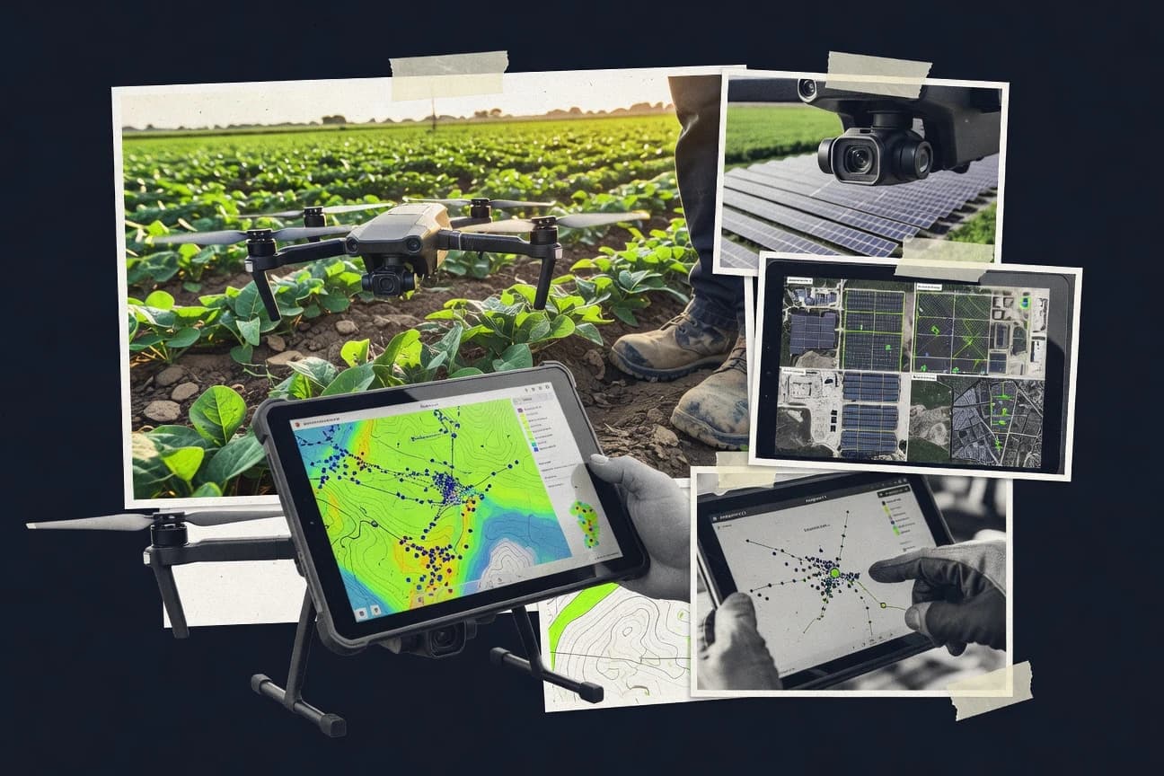
Find the best drone analytics software solutions.

How we ranked these tools
Core product claims cross-referenced against official documentation, changelogs, and independent technical reviews.
Analyzed video reviews and hundreds of written evaluations to capture real-world user experiences with each tool.
AI persona simulations modeled how different user types would experience each tool across common use cases and workflows.
Final rankings reviewed and approved by our editorial team with authority to override AI-generated scores based on domain expertise.
Score: Features 40% · Ease 30% · Value 30%
Gitnux may earn a commission through links on this page — this does not influence rankings. Editorial policy
Editor picks
Three quick recommendations before you dive into the full comparison below — each one leads on a different dimension.
DroneDeploy
Guided capture with automated processing to generate shareable maps and 2D measurement deliverables
Built for aEC and industrial teams needing reliable drone analytics with easy stakeholder review.
Pix4D
Runner UpIntegrated volume measurement from georeferenced 3D reconstructions
Built for surveying and construction teams needing accurate photogrammetry deliverables.
Agisoft Metashape
Also GreatDense point cloud generation with controllable reconstruction settings for metric-grade outputs
Built for survey teams needing high-accuracy photogrammetry and measurement outputs.
Related reading
Comparison Table
This comparison table benchmarks DroneDeploy, Pix4D, Agisoft Metashape, Propeller Aero, SenseFly eMotion, and other drone analytics platforms across the workflows they support. Use it to compare photogrammetry and mapping capabilities, processing options, collaboration and reporting features, hardware and drone compatibility, and typical constraints that affect deployment in the field.
DroneDeploy
enterprise mappingCloud platform that turns drone imagery into mapped outputs like orthomosaics, 3D models, and progress reports for inspections and construction workflows.
Guided capture with automated processing to generate shareable maps and 2D measurement deliverables
DroneDeploy stands out with an end-to-end drone to insights workflow built around guided capture and automated processing in one place. It turns mapping flights into web-based orthomosaics, 2D maps, surface models, and measurements that teams can review and share.
Its analytics focus on actionable deliverables such as progress tracking and site reporting tied to the captured imagery. Collaboration features let stakeholders comment on outputs and keep revisions tied to projects.
- +Guided flight planning produces consistent mapping coverage and fewer capture mistakes
- +Fast web delivery for orthomosaics, maps, and measurement-based site analytics
- +Project sharing and review tools reduce back-and-forth across teams
- –Advanced analysis is limited compared with specialized GIS workflows
- –Higher costs for frequent users can strain small teams
- –Export formats for downstream CAD and GIS can feel restrictive
Best for: AEC and industrial teams needing reliable drone analytics with easy stakeholder review
More related reading
Pix4D
precision photogrammetryPhotogrammetry software that generates accurate 2D maps and 3D models from drone imagery with survey-grade processing controls.
Integrated volume measurement from georeferenced 3D reconstructions
Pix4D stands out for photogrammetry pipelines that turn drone imagery into metrically accurate 2D maps, orthomosaics, and 3D models. The platform covers processing tasks like dense point clouds, textured meshes, digital surface models, and volume calculations for stockpiles.
It also supports georeferencing workflows that can integrate ground control points and coordinate systems for surveying-grade outputs. Collaboration and QA features are geared toward repeatable field-to-report production for teams that need consistent results across sites.
- +Survey-grade photogrammetry outputs including orthomosaics, DSMs, and textured 3D models
- +Volume and change workflows support construction and earthwork measurements
- +Georeferencing with coordinate systems and ground control enables accurate mapping
- –Processing setup can be complex for small teams and one-off projects
- –Higher computing demands increase hardware and time costs for large datasets
- –Advanced automation features require training to use consistently
Best for: Surveying and construction teams needing accurate photogrammetry deliverables
Agisoft Metashape
desktop photogrammetryDesktop photogrammetry and mapping tool that produces dense point clouds, orthomosaics, and textured 3D meshes from drone images.
Dense point cloud generation with controllable reconstruction settings for metric-grade outputs
Agisoft Metashape stands out with a desktop-first photogrammetry workflow that turns overlapping drone imagery into dense 3D reconstructions and accurate measurements. It supports alignment, dense point cloud generation, mesh building, and texture creation in one project pipeline.
It also includes tools for camera calibration, georeferencing with control points, and change-ready outputs like orthomosaics and digital surface models. Its strength is metric reconstruction quality, while its weakness is operational complexity versus guided, web-based analytics tools.
- +End-to-end photogrammetry pipeline for dense clouds, meshes, and textured outputs
- +Strong georeferencing using ground control points and coordinate system controls
- +Metric measurement workflows support engineering-grade surveying deliverables
- –Desktop processing and data management increase setup time and operator training
- –Requires significant hardware resources for large, high-resolution captures
- –Less workflow automation than cloud platforms focused on repeatable analytics
Best for: Survey teams needing high-accuracy photogrammetry and measurement outputs
Propeller Aero
data analyticsProcessing and analytics platform for drone data that delivers standardized 2D and 3D outputs and insights for infrastructure and asset intelligence.
Repeatable inspection workflows that connect processed deliverables to assets and reporting cycles
Propeller Aero focuses on drone analytics for field operations by turning captured imagery and sensor outputs into operational insights tied to assets and work orders. It provides automated processing pipelines, analytics views, and reporting workflows that teams can reuse across recurring inspections.
The platform emphasizes usability for non-technical stakeholders who need repeatable outputs rather than custom GIS engineering. It is best evaluated against other analytics tools by how smoothly it moves from capture to decision-ready deliverables.
- +Automates processing from drone capture to decision-ready analytics deliverables
- +Supports repeatable inspection workflows tied to assets and work context
- +Reporting and sharing outputs reduce manual cleanup for stakeholders
- –Advanced configuration options can require admin oversight
- –Less suited for highly custom analytics pipelines compared with coding-first tools
- –Depth of GIS customization may be limited for power users
Best for: Operators and asset teams needing repeatable drone analytics reports without custom pipelines
SenseFly eMotion
workflow suiteWorkflow software from SenseFly for planning, capturing, and processing drone survey data into maps and models for field and enterprise use.
Guided SenseFly drone workflow that streamlines flight processing into orthomosaics and 3D models
SenseFly eMotion stands out for turning SenseFly drone captures into fast, guided mapping outputs designed around the eBee and related workflows. It supports typical drone analytics needs like flight-to-map processing, orthomosaic and 3D model generation, and delivery of shareable results to stakeholders.
The workflow is tightly aligned with SenseFly hardware and mission planning, which reduces setup time but limits cross-vendor flexibility. For teams that already operate SenseFly platforms, eMotion provides a practical path from imagery to usable maps without building custom pipelines.
- +Tight fit with SenseFly eBee workflows for quick mapping turnaround
- +Generates orthomosaics and 3D models for common project outputs
- +Streamlined operator-to-delivery process reduces manual processing steps
- –Best results depend on using SenseFly hardware and supported missions
- –Limited flexibility for custom analytics beyond standard mapping deliverables
- –Cost becomes less attractive for organizations needing occasional processing
Best for: Field teams using SenseFly drones for rapid orthomosaics and 3D model delivery
PrecisionHawk Aerial Data Platform
inspection analyticsAnalytics platform that converts drone missions into actionable results for inspections with standardized reporting and monitoring.
Configurable field-to-office workflow management for consistent drone mapping delivery
PrecisionHawk Aerial Data Platform stands out for turning drone capture into managed workflows for mapping, inspection, and data review. It focuses on processing aerial imagery into deliverables like orthomosaics and measurements with task-based field-to-office organization.
The platform emphasizes collaboration through shared project outputs, enabling teams to review results and maintain consistency across repeated survey cycles. It also supports operational governance through integrations and configurable pipelines for organizations that manage multiple sites.
- +Workflow-driven projects connect data capture to repeatable deliverables
- +Generates mapping outputs like orthomosaics and measurement-ready datasets
- +Collaboration features support team review of shared project results
- –UI and setup require stronger operational training than basic platforms
- –Less suited for one-off pilots needing lightweight analysis tools
- –Value drops for small teams without consistent recurring survey work
Best for: Teams managing recurring drone mapping and inspection workflows across multiple sites
DJI Terra
vendor photogrammetryStandalone photogrammetry software for creating orthomosaics, 3D reconstructions, and digital surface models from DJI drone imagery.
DJI Terra photogrammetry reconstruction that generates point clouds and 3D models from captured imagery
DJI Terra stands out with tight DJI ecosystem integration for drone mission processing and fast field-to-report workflows. It supports photogrammetry reconstruction, point cloud generation, and model outputs suited for mapping and survey deliverables.
Terra focuses on organizing captures into projects, running automated processing steps, and exporting analysis-ready results for stakeholders. Its biggest constraint is that it is optimized for DJI camera and flight data rather than serving as a universal ingest hub for every third-party drone format.
- +Streamlined DJI flight-to-processing workflow reduces manual export steps
- +Automated photogrammetry and point cloud generation supports common mapping outputs
- +Project organization and batch processing help process multiple missions efficiently
- –Optimized for DJI data limits workflows with non-DJI drone captures
- –Advanced survey customization options are less flexible than top GIS-centric tools
- –Export pipelines can require extra steps for downstream enterprise platforms
Best for: DJI-centric teams needing fast photogrammetry outputs for site deliverables
Litchi
mission planningMobile app that streamlines drone mission planning and automated flight paths that feed drone capture workflows for later analytics processing.
Mission Hub that ties route, camera events, and timeline playback into one review view
Litchi focuses on mission planning and post-flight analysis for DJI drones with a workflow built around repeatable missions. It supports waypoint flights and track-based camera moves, then generates actionable playback and map-based outputs for review.
You can inspect routes, camera events, and flight parameters in a structured timeline tied to each mission. The value comes from tightening the loop between planning, execution, and analytics for DJI-centric operators.
- +Strong waypoint and track mission building for DJI aircraft and cameras
- +Post-flight mission playback with timeline-linked review of captured events
- +Route and map visualization helps pinpoint where each shot was captured
- –Analytics depth favors DJI mission data over broader multi-vendor workflows
- –Mission setup can feel technical without templates for common use cases
- –Advanced analysis depends on mission structure captured during flight
Best for: DJI-focused teams needing mission replay and map-based flight analytics
RealityCapture
high-speed 3DHigh-speed photogrammetry tool that reconstructs detailed 3D models and meshes from drone images with scalable processing.
Georeferenced reconstruction using ground control points and coordinate system workflows
RealityCapture specializes in photogrammetry for converting drone imagery into dense 3D reconstructions and accurate measurements. It supports automated workflows for alignment, dense point cloud generation, mesh reconstruction, and texturing, which fits surveying and inspection pipelines.
The software integrates control through GCPs and survey-grade coordinate handling for geospatial accuracy. It is strongest when you can process large image sets on capable hardware and need repeatable 3D outputs.
- +High-accuracy photogrammetry with strong georeferencing via GCP support
- +Dense point clouds, meshes, and texturing from drone images in one workflow
- +Optimized reconstruction performance for large aerial datasets
- +Measurement-ready outputs for surveying and inspection deliverables
- –Dense reconstructions demand strong CPU, GPU, and storage capacity
- –Workflow tuning for camera alignment and quality can be time-consuming
- –Learning curve is steep for consistent survey-grade results
- –Collaboration and web publishing features are limited versus cloud-centric suites
Best for: Surveyors and engineering teams producing measured 3D models from drone imagery
OpenDroneMap
open-source pipelineOpen-source toolchain that processes drone imagery into georeferenced outputs like orthophotos and 3D models.
Photogrammetry processing that generates orthomosaics, DEMs, and dense point clouds from drone imagery
OpenDroneMap stands out by turning drone imagery into map-ready geospatial outputs using an open photogrammetry workflow rather than a closed analytics product. It supports common drone data inputs like images plus camera and GNSS metadata and produces dense point clouds, orthomosaics, and digital elevation models.
The tool also includes integration options for publishing results as map layers through companion services, which helps teams share outputs with stakeholders. Analytics depth is achieved through derived GIS outputs that you can analyze in standard geospatial tooling.
- +Open-source photogrammetry pipeline produces orthomosaics, DEMs, and dense point clouds
- +Works with standard drone image sets and metadata for reproducible mapping workflows
- +Generates GIS-ready outputs you can analyze in QGIS and other geospatial tools
- –Not a turnkey analytics dashboard for inspections, QA scoring, or progress tracking
- –Setup and processing tuning require GIS and photogrammetry knowledge for best results
- –Sharing and collaboration depend on external tooling for review workflows
Best for: Teams needing open photogrammetry mapping outputs for GIS analysis without turnkey dashboards
Conclusion
After evaluating 10 technology digital media, DroneDeploy stands out as our overall top pick — it scored highest across our combined criteria of features, ease of use, and value, which is why it sits at #1 in the rankings above.
Use the comparison table and detailed reviews above to validate the fit against your own requirements before committing to a tool.
How to Choose the Right Drone Analytics Software
This buyer's guide helps you choose DroneDeploy, Pix4D, Agisoft Metashape, Propeller Aero, SenseFly eMotion, PrecisionHawk Aerial Data Platform, DJI Terra, Litchi, RealityCapture, and OpenDroneMap. You will get key feature checklists, buyer decision steps, and concrete pricing expectations using the published starting price points and free-plan availability stated for these tools.
What Is Drone Analytics Software?
Drone Analytics Software turns drone imagery into usable deliverables like orthomosaics, 3D models, surface models, and measurement-ready outputs tied to work or survey goals. It also organizes processing and review so teams can standardize outputs across sites instead of managing files manually. Tools like DroneDeploy emphasize guided capture and automated processing that produces shareable maps and measurement-based site analytics for stakeholder review. Tools like Pix4D and RealityCapture emphasize photogrammetry reconstruction workflows that generate survey-grade outputs and georeferenced measurement results.
Key Features to Look For
The right features determine whether you get decision-ready outputs fast, repeatably, and in the formats your downstream teams can use.
Guided capture and automated processing
Guided capture helps teams achieve consistent coverage so mapping failures drop before processing begins. DroneDeploy is built around guided flight planning plus automated processing to produce shareable maps and 2D measurement deliverables.
Survey-grade georeferencing with ground control workflows
Georeferencing with coordinate system controls and ground control points matters when you need metrically accurate deliverables for construction and surveying. Pix4D and RealityCapture support survey-grade georeferencing via ground control points and coordinate system handling.
Integrated volume and earthwork calculations
Volume measurements reduce the time from reconstruction to actionable construction quantities. Pix4D provides integrated volume measurement from georeferenced 3D reconstructions.
Dense point cloud, mesh, and textured 3D reconstruction
High-fidelity reconstructions matter for inspections that rely on measurable surfaces and detailed models. Agisoft Metashape provides dense point cloud generation plus mesh building and texture creation with controllable reconstruction settings.
Repeatable inspection workflow tied to assets and work context
Asset-connected workflows help organizations standardize reporting across recurring inspections. Propeller Aero focuses on repeatable inspection workflows that connect processed deliverables to assets and reporting cycles.
Project collaboration and stakeholder review
Collaboration features reduce back-and-forth by keeping comments and revisions attached to project outputs. DroneDeploy includes project sharing and review tools, while PrecisionHawk Aerial Data Platform supports shared project outputs for team review across repeated survey cycles.
How to Choose the Right Drone Analytics Software
Match your analytics needs to the tool's processing style, geospatial rigor, and workflow depth, then confirm the delivery model you need for your team.
Choose how you want deliverables produced
If you want a guided, end-to-end workflow that turns mapping flights into fast web delivery, choose DroneDeploy because it ties guided capture to automated processing for orthomosaics, maps, and measurement-based site analytics. If you need survey-grade photogrammetry pipelines with control over reconstruction outputs, choose Pix4D because it supports orthomosaics, DSMs, textured 3D models, and volume calculations with georeferencing workflows.
Decide how strict your georeferencing must be
If your outputs must align to survey coordinates using ground control points and coordinate systems, choose Pix4D or RealityCapture because both support georeferenced reconstruction workflows for measured 3D models. If you need metric-grade reconstruction settings and dense point cloud quality, choose Agisoft Metashape because it supports georeferencing with control points and controllable reconstruction settings.
Select the workflow depth for field-to-office operations
If you manage recurring inspections and want configurable field-to-office workflow management, choose PrecisionHawk Aerial Data Platform because it is built around task-based projects and consistent delivery across sites. If you are operating in a SenseFly hardware workflow, choose SenseFly eMotion because it is tightly aligned with SenseFly eBee capture and mission planning for fast orthomosaic and 3D model delivery.
Match mission planning and replay needs to your drone stack
If you want mission building and timeline-linked post-flight playback for DJI drones, choose Litchi because its Mission Hub ties route and camera events to mission playback and review. If you want photogrammetry reconstruction optimized for DJI data organization and batch processing, choose DJI Terra because it is built for DJI flight-to-processing and exports analysis-ready point clouds and 3D models.
Use open workflows when you need GIS-centric control over outputs
If you need open-source photogrammetry outputs like orthophotos and DEMs and you want to analyze results in GIS tools, choose OpenDroneMap because it produces dense point clouds and GIS-ready outputs that work in standard geospatial tooling. If you want high-speed, scalable photogrammetry reconstruction for large image sets with GCP support, choose RealityCapture because it optimizes reconstruction performance for dense 3D outputs while leaning on hardware capacity.
Who Needs Drone Analytics Software?
Drone Analytics Software is a fit when teams need repeatable mapping outputs, measurement-ready analytics, and a workflow that turns drone capture into decision documents.
AEC and industrial teams that need stakeholder-ready mapping and measurements
DroneDeploy fits this segment because it emphasizes guided capture and automated processing that produces shareable orthomosaics, maps, and 2D measurement deliverables with project sharing and review tools. Propeller Aero also fits because it connects processed deliverables to assets and reporting cycles for recurring infrastructure inspections.
Surveying and construction teams that must produce accurate photogrammetry and quantities
Pix4D fits because it delivers survey-grade orthomosaics, DSMs, textured 3D models, georeferencing with ground control workflows, and integrated volume calculations. RealityCapture fits when you prioritize high-accuracy measured 3D models with GCP support and scalable reconstruction performance for large aerial datasets.
Teams running dense 3D reconstruction workflows with metric-grade settings
Agisoft Metashape fits teams that want dense point cloud generation with controllable reconstruction settings for metric-grade outputs. RealityCapture also fits teams that can support CPU, GPU, and storage demands for dense reconstructions.
DJI-centric operators that want mission replay and fast photogrammetry processing
Litchi fits DJI-focused teams that need waypoint and track mission building plus timeline-linked mission playback for review of captured events. DJI Terra fits when you want DJI-optimized photogrammetry reconstruction that generates point clouds and 3D models from organized DJI imagery for site deliverables.
Common Mistakes to Avoid
Several predictable pitfalls show up across these tools because teams often mismatch workflow depth, georeferencing needs, and collaboration expectations.
Buying a guided analytics platform but expecting advanced GIS-style analysis
DroneDeploy focuses on guided capture and automated shareable outputs, but advanced analysis is limited compared with specialized GIS workflows. If your team needs deeper GIS customization, consider RealityCapture for reconstruction and then analyze using GIS tooling, or choose OpenDroneMap for GIS-ready outputs you can work with in standard geospatial tools.
Underestimating processing setup complexity for photogrammetry-first tools
Pix4D and Agisoft Metashape can require complex processing setup and additional operator training for consistent outputs. If you need a more guided, repeatable workflow, choose DroneDeploy or PrecisionHawk Aerial Data Platform instead of relying on desktop photogrammetry tuning alone.
Ignoring hardware and dataset size constraints for dense reconstruction
RealityCapture emphasizes performance for large aerial datasets but dense reconstructions demand strong CPU, GPU, and storage capacity. Agisoft Metashape also increases hardware and data management requirements for large high-resolution captures.
Assuming mission planning tools will solve analytics depth
Litchi provides mission hub replay and timeline-linked review for DJI missions, but analytics depth depends on mission structure captured during flight. For full mapping and analysis deliverables, pair Litchi planning with a reconstruction workflow in Pix4D, DJI Terra, or RealityCapture.
How We Selected and Ranked These Tools
We evaluated each drone analytics tool on overall capability, features coverage, ease of use, and value using the published strengths and constraints for mapping outputs and workflows. We separated DroneDeploy from lower-ranked options because its guided flight planning plus automated processing produces fast web delivery of orthomosaics and measurement-based site analytics that stakeholders can review. We also weighted workflow repeatability and collaboration because PrecisionHawk Aerial Data Platform and Propeller Aero both emphasize consistent field-to-office delivery and shared outputs for teams managing recurring sites.
Frequently Asked Questions About Drone Analytics Software
What’s the fastest way to go from drone capture to shareable orthomosaics and measurements?
Which tools are best when I need metrically accurate photogrammetry with survey-grade output?
How do DroneDeploy and Pix4D differ in deliverable focus for field-to-office workflows?
When should I choose Agisoft Metashape instead of a guided, web-based analytics platform?
Which software is most suitable for volume measurement from drone imagery?
What’s the most practical option for asset teams that want inspection reports tied to recurring work orders?
Which tools require a specific drone ecosystem, and how does that affect compatibility?
Which options are free to start, and what payment model should I expect from the top products?
What technical requirements tend to be the biggest factor for photogrammetry processing?
How can I troubleshoot common issues like misalignment or inconsistent results across repeated survey runs?
Tools reviewed
Primary sources checked during evaluation.
Referenced in the comparison table and product reviews above.
Keep exploring
Comparing two specific tools?
Software Alternatives
See head-to-head software comparisons with feature breakdowns, pricing, and our recommendation for each use case.
Explore software alternatives→In this category
Technology Digital Media alternatives
See side-by-side comparisons of technology digital media tools and pick the right one for your stack.
Compare technology digital media tools→FOR SOFTWARE VENDORS
Not on this list? Let’s fix that.
Our best-of pages are how many teams discover and compare tools in this space. If you think your product belongs in this lineup, we’d like to hear from you—we’ll walk you through fit and what an editorial entry looks like.
Apply for a ListingWHAT THIS INCLUDES
Where buyers compare
Readers come to these pages to shortlist software—your product shows up in that moment, not in a random sidebar.
Editorial write-up
We describe your product in our own words and check the facts before anything goes live.
On-page brand presence
You appear in the roundup the same way as other tools we cover: name, positioning, and a clear next step for readers who want to learn more.
Kept up to date
We refresh lists on a regular rhythm so the category page stays useful as products and pricing change.