GITNUXSOFTWARE ADVICE
Technology Digital MediaTop 10 Best Drone Survey Software of 2026
Explore the top 10 best drone survey software to streamline your projects. Find your ideal tool with expert picks.

How we ranked these tools
Core product claims cross-referenced against official documentation, changelogs, and independent technical reviews.
Analyzed video reviews and hundreds of written evaluations to capture real-world user experiences with each tool.
AI persona simulations modeled how different user types would experience each tool across common use cases and workflows.
Final rankings reviewed and approved by our editorial team with authority to override AI-generated scores based on domain expertise.
Score: Features 40% · Ease 30% · Value 30%
Gitnux may earn a commission through links on this page — this does not influence rankings. Editorial policy
Editor picks
Three quick recommendations before you dive into the full comparison below — each one leads on a different dimension.
Pix4D
Integrated RTK/PPK support and automated quality reports ensuring georeferenced survey-grade deliverables without extensive post-processing.
Built for professional surveyors, engineers, and mapping specialists needing centimeter-level accuracy from drone data in construction, mining, or land management..
Agisoft Metashape
Runner UpSuperior multi-view stereo reconstruction algorithms delivering survey-grade accuracy even with challenging oblique drone imagery
Built for professional surveyors, engineers, and geospatial experts requiring high-precision photogrammetric processing from drone imagery for mapping and analysis..
DroneDeploy
Also GreatReal-time 3D mapping and live deck views during flights for immediate on-site insights
Built for professional teams in construction, agriculture, and surveying needing scalable, high-accuracy drone data processing and collaboration tools..
Related reading
Comparison Table
Drone survey software serves as a critical tool for transforming aerial data into actionable insights, and this comparison table simplifies evaluating top options like Pix4D, Agisoft Metashape, DroneDeploy, DJI Terra, Propeller, and more. Readers will discover key features, use cases, and performance metrics to identify the platform best suited to their project needs.
Pix4D
specializedCloud and desktop photogrammetry software that generates precise orthomosaics, 3D models, and point clouds from drone imagery for surveying.
Integrated RTK/PPK support and automated quality reports ensuring georeferenced survey-grade deliverables without extensive post-processing.
Pix4D is a premier photogrammetry software platform that processes aerial images from drones into accurate 2D orthomosaics, 3D models, point clouds, and elevation maps. It excels in drone surveying applications like topographic mapping, volume measurements, and site inspections across industries such as construction, mining, and agriculture. The suite offers both desktop (PIX4Dmapper) and cloud-based (PIX4Dcloud) processing with robust support for ground control points (GCPs) and RTK/PPK data for survey-grade precision.
- +Exceptional accuracy with support for GCPs, RTK/PPK, and advanced calibration for survey-grade results
- +Versatile outputs including orthomosaics, DSMs, point clouds, and volume calculations
- +Cloud processing enables scalability, collaboration, and fast turnaround without high-end hardware
- –Steep learning curve for beginners due to complex advanced features
- –High pricing may deter small operations or hobbyists
- –Processing times can be lengthy for very large datasets on standard hardware
Best for: Professional surveyors, engineers, and mapping specialists needing centimeter-level accuracy from drone data in construction, mining, or land management.
More related reading
Agisoft Metashape
specializedProfessional photogrammetric tool for creating high-quality 3D models, orthophotos, and DEMs from drone photos.
Superior multi-view stereo reconstruction algorithms delivering survey-grade accuracy even with challenging oblique drone imagery
Agisoft Metashape is a professional photogrammetry software that processes aerial and terrestrial images from drones to generate high-accuracy 3D models, orthomosaics, digital elevation models (DEMs), and point clouds. It supports complex workflows including multi-camera setups, oblique imagery, and integration with ground control points for survey-grade precision. Widely used in drone surveying for applications like topography, agriculture, construction, and archaeology, it handles large datasets efficiently with advanced algorithms.
- +Exceptional accuracy with support for GCPs and centimeter-level precision
- +Comprehensive output formats including orthophotos, DEMs, meshes, and GIS-compatible files
- +Powerful batch processing and Python scripting for automation on large-scale projects
- –Steep learning curve due to complex interface and numerous parameters
- –High hardware requirements (needs powerful CPU/GPU and ample RAM)
- –Pricing is premium and node-locked, less flexible for teams without additional licenses
Best for: Professional surveyors, engineers, and geospatial experts requiring high-precision photogrammetric processing from drone imagery for mapping and analysis.
DroneDeploy
specializedCloud-based platform for automated drone mapping, real-time analytics, and volume measurements in surveying workflows.
Real-time 3D mapping and live deck views during flights for immediate on-site insights
DroneDeploy is a comprehensive cloud-based platform for drone mapping and photogrammetry, allowing users to plan autonomous missions, capture aerial data, and generate deliverables like orthomosaics, 3D models, elevation maps, and NDVI analysis. It excels in industries such as construction, agriculture, and surveying by providing tools for volume calculations, progress tracking, and annotations. The software supports a wide range of drones and integrates seamlessly with GIS systems and enterprise workflows for efficient data management.
- +Fast cloud-based processing for quick turnaround without local hardware needs
- +Intuitive mobile app for real-time mission planning and live mapping
- +Robust analytics including volume measurements, NDVI, and change detection
- –Subscription pricing escalates quickly for high-volume users
- –Heavy reliance on stable internet for uploads and processing
- –Advanced features locked behind higher-tier plans
Best for: Professional teams in construction, agriculture, and surveying needing scalable, high-accuracy drone data processing and collaboration tools.
DJI Terra
specializedComprehensive drone data processing software for 2D orthomosaics, 3D models, and reconstruction optimized for DJI drones.
Native RTK and PPK support with real-time 3D reconstruction directly from DJI drones
DJI Terra is a professional drone mapping and surveying software from DJI, designed primarily for processing data captured by DJI drones. It supports photogrammetry for generating 2D orthomosaics, 3D models, and point clouds, as well as LiDAR point cloud processing for high-precision applications. The software also includes mission planning, real-time reconstruction, and analysis tools tailored for industries like surveying, construction, mining, and agriculture.
- +Seamless integration with DJI drones and sensors for efficient workflows
- +High-accuracy outputs including RTK-enabled orthomosaics and dense point clouds
- +Versatile support for both photogrammetry and LiDAR data processing
- –Limited compatibility with non-DJI drones and sensors
- –Steep learning curve for advanced features and complex projects
- –Relatively high cost, especially for perpetual licenses or enterprise use
Best for: Professional surveyors and mapping specialists using DJI Enterprise drones who require precise photogrammetry and LiDAR processing in construction or mining.
Propeller
enterpriseAeroPoints-enabled platform for accurate site surveys, progress tracking, and cut/fill analysis in construction and mining.
AeroPoints: Autonomous RTK ground control points that deliver cm-level accuracy with minimal setup
Propeller (propeller.aero) is a cloud-based drone data platform tailored for surveying in construction, mining, and civil engineering. It processes drone-captured imagery into high-accuracy 3D models, orthomosaics, point clouds, and volume reports, enabling site monitoring and progress tracking. The software emphasizes collaboration with real-time dashboards and integrations with tools like Autodesk and Trimble.
- +Survey-grade accuracy via AeroPoints RTK ground control
- +Powerful collaboration and automated reporting tools
- +Strong integrations with industry software like Civil 3D and SiteVision
- –High subscription costs per site
- –Best results require proprietary AeroPoints hardware
- –Steeper learning curve for non-construction users
Best for: Construction and mining teams conducting frequent site surveys for earthworks, progress tracking, and volume measurements.
Bentley ContextCapture
enterpriseReality modeling software that processes massive drone imagery datasets into engineering-grade 3D reality meshes.
RealityMesh technology for generating ultra-detailed, photorealistic 3D meshes from drone imagery at massive scales without losing fidelity
Bentley ContextCapture is a professional photogrammetry software that processes drone-captured imagery, along with other aerial and ground photos, to generate highly accurate 3D reality models, point clouds, orthomosaics, and textured meshes. It excels in large-scale surveying and mapping for infrastructure, construction, and urban planning projects, leveraging advanced aerotriangulation and distributed computing for precision deliverables. The tool integrates seamlessly with Bentley's iTwin platform and other AEC workflows, making it suitable for engineering-grade drone survey outputs.
- +Exceptional accuracy and detail in 3D reconstructions from drone data
- +Scalable processing for massive datasets via distributed computing
- +Strong integration with CAD, BIM, and Bentley's infrastructure software
- –Steep learning curve with complex interface for non-experts
- –High cost prohibitive for small teams or hobbyists
- –Requires significant computational hardware resources
Best for: Large AEC firms and professional surveyors handling enterprise-scale drone mapping projects needing survey-grade precision.
RealityCapture
specializedUltra-fast photogrammetry software for generating textured 3D models from drone-captured images.
Unrivaled processing speed, reconstructing massive drone surveys in minutes rather than hours
RealityCapture is a powerful photogrammetry software designed for generating high-fidelity 3D models, textured meshes, orthophotos, and point clouds from drone-captured images or laser scans. It processes massive datasets with exceptional speed and accuracy, making it suitable for drone surveying applications like topographic mapping, volume calculations, and detailed site inspections. Acquired by Epic Games, it integrates well with Unreal Engine workflows for visualization.
- +Ultra-fast processing of large drone datasets
- +Survey-grade accuracy and high-detail outputs
- +Free for most users (under $1M revenue)
- –Steep learning curve for beginners
- –No integrated drone flight planning or cloud processing
- –Requires high-end hardware for optimal performance
Best for: Experienced photogrammetry professionals and surveyors handling complex, large-scale drone projects on powerful desktops.
Esri Drone2Map
enterpriseDesktop application that converts drone imagery into orthomosaics, DSMs, and 3D models integrated with ArcGIS.
Native integration with the ArcGIS platform for instant GIS-ready drone products
Esri Drone2Map is a specialized photogrammetry software designed for processing drone imagery into professional-grade 2D maps, 3D models, orthomosaics, and digital surface models. It offers both desktop and cloud-based processing options, enabling efficient handling of large datasets. The software excels in delivering GIS-ready outputs that integrate seamlessly with the broader ArcGIS ecosystem for advanced spatial analysis.
- +Seamless integration with ArcGIS for direct publishing and analysis
- +High-quality photogrammetry outputs including orthomosaics, DSMs, and point clouds
- +Scalable cloud processing handles large datasets efficiently
- –Steep learning curve for users unfamiliar with Esri tools
- –Pricing tied to subscription model, higher for non-ArcGIS users
- –Less flexibility for non-GIS workflows compared to standalone tools
Best for: GIS professionals and enterprise teams already using ArcGIS who require drone data integrated into spatial workflows.
Autodesk ReCap
enterpriseReality capture software for converting drone photos and laser scans into 3D models for design and analysis.
Advanced reality capture engine delivering publication-ready, survey-grade point clouds from drone imagery
Autodesk ReCap is a reality capture software designed to convert photographs, drone imagery, and laser scans into accurate 3D models, point clouds, and meshes. It excels in processing large datasets from drone surveys to create detailed digital representations for surveying, construction, and engineering applications. Seamlessly integrated with the Autodesk ecosystem, it enables efficient workflows from data capture to design and analysis.
- +Superior photogrammetry processing for high-accuracy point clouds from drone data
- +Handles massive datasets efficiently with robust cloud processing options
- +Deep integration with Autodesk tools like Civil 3D and Revit for streamlined workflows
- –Steeper learning curve compared to drone-specific survey software
- –Subscription pricing adds up without inclusion in broader collections
- –Less automated flight planning or real-time processing than specialized drone tools
Best for: Professional surveyors and AEC firms already in the Autodesk ecosystem needing precise reality capture from drone surveys.
WebODM
otherOpen-source drone mapping toolkit for generating orthophotos, point clouds, and 3D models on local hardware.
Fully self-hosted web interface allowing unlimited local processing of massive drone datasets without cloud dependency
WebODM is an open-source, web-based photogrammetry platform developed by OpenDroneMap for processing drone imagery into professional-grade geospatial products like orthomosaics, digital surface models (DSMs), point clouds, and 3D models. It enables users to perform end-to-end drone survey workflows locally on their hardware, supporting large datasets and customizable processing parameters. Ideal for surveyors seeking a cost-effective alternative to proprietary software, it emphasizes data privacy through self-hosting.
- +Completely free and open-source with no usage limits
- +High-quality outputs matching commercial tools like orthophotos and NDVI maps
- +Self-hosted for data security and unlimited scalability
- –Requires Docker setup and technical know-how for installation
- –Resource-intensive processing demands powerful hardware
- –Community support only, lacking enterprise-level handholding
Best for: Tech-savvy drone surveyors and researchers prioritizing cost savings and data control over plug-and-play simplicity.
Conclusion
After evaluating 10 technology digital media, Pix4D stands out as our overall top pick — it scored highest across our combined criteria of features, ease of use, and value, which is why it sits at #1 in the rankings above.
Use the comparison table and detailed reviews above to validate the fit against your own requirements before committing to a tool.
How to Choose the Right Drone Survey Software
This buyer’s guide is based on an in-depth analysis of the 10 drone survey software tools reviewed above. It translates the review findings—accuracy, workflows, ease of use, and value—into practical guidance for selecting the right platform for your surveying deliverables and team constraints. You’ll see specific tool examples such as Pix4D, DroneDeploy, Propeller, and Esri Drone2Map throughout.
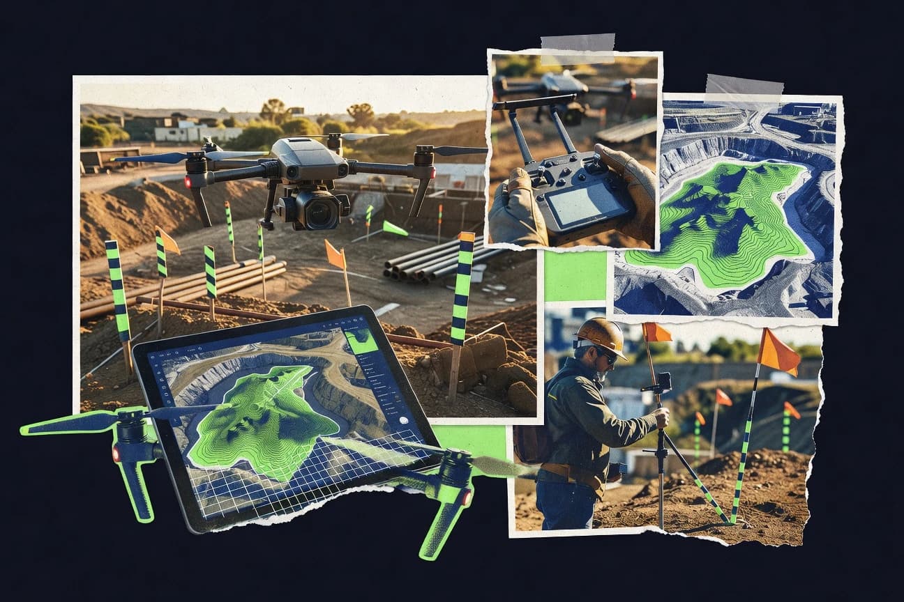
What Is Drone Survey Software?
Drone survey software takes drone imagery (and sometimes LiDAR) and turns it into survey-ready geospatial deliverables like orthomosaics, 3D models, point clouds, DSMs, and DEMs. It solves the core problems of data processing accuracy, georeferencing with RTK/PPK or GCPs, and producing consistent outputs for mapping and engineering workflows. In practice, you’ll see this category range from survey-grade photogrammetry suites like Pix4D and Agisoft Metashape to cloud automation and collaboration platforms like DroneDeploy. Specialized GIS workflows are also represented by tools such as Esri Drone2Map, which focuses on ArcGIS-ready outputs.
Key Features to Look For
Key Features to Look For
Survey-grade georeferencing (RTK/PPK and GCP workflows)
If you need centimeter-level results, prioritize tools with strong RTK/PPK and GCP support. Pix4D emphasizes integrated RTK/PPK plus automated quality reports, while Agisoft Metashape also supports GCPs for survey-grade precision.
Automated accuracy and quality reporting
Quality reporting reduces rework and helps teams trust outputs. Pix4D specifically highlights automated quality reports tied to georeferenced survey-grade deliverables.
High-fidelity photogrammetry reconstruction and multi-view performance
Some projects rely on challenging oblique imagery and complex scene geometry. Agisoft Metashape is noted for superior multi-view stereo reconstruction that maintains survey-grade accuracy even with obliques.
Real-time or near-real-time flight-to-insight mapping
For fast decisions on active sites, consider tools built around live mapping and rapid turnaround. DroneDeploy stands out with real-time 3D mapping and live deck views during flights.
Enterprise dataset scalability (distributed or ultra-fast processing)
Large surveys can bottleneck processing timelines and hardware capacity. RealityCapture is recognized for ultra-fast reconstruction on powerful desktops, while Bentley ContextCapture emphasizes scalable processing for massive datasets via distributed computing.
Ecosystem integration (CAD/BIM/GIS) and workflow fit
Your processing tool should align with the software you already use for design, analysis, and publishing. Esri Drone2Map delivers native ArcGIS integration for instant GIS-ready products, while Autodesk ReCap integrates tightly with Autodesk tools like Civil 3D and Revit.
How to Choose the Right Drone Survey Software
How to Choose the Right Drone Survey Software
Define your deliverables and required precision
List what you must produce (orthomosaics, DSM/DEM, point clouds, textured meshes, or volume reports) and the accuracy expectation that your stakeholders require. Pix4D and Agisoft Metashape are strong for survey-grade orthomosaics/3D plus point clouds, while Autodesk ReCap focuses heavily on publication-ready, survey-grade point clouds from drone imagery and laser scans.
Decide how you will georeference (RTK/PPK vs GCP vs proprietary control)
Your input data determines which software will feel seamless or painful. If you can use RTK/PPK and want automated trust signals, Pix4D is built around integrated RTK/PPK with quality reporting; for construction/mining teams using specialized control, Propeller’s AeroPoints aims at cm-level accuracy with minimal setup.
Match the processing model to your operations and IT constraints
Choose between cloud processing (quick turnaround, less local hardware) and local/self-hosted processing (data control, more technical lift). DroneDeploy is cloud-first for scalability and collaboration, while WebODM is self-hosted for maximum data control but requires Docker and technical know-how.
Align the platform to your drone/sensor environment
Some tools are optimized for specific hardware ecosystems. DJI Terra is designed primarily for processing data from DJI drones (and supports LiDAR), while Pix4D and Agisoft Metashape are broader photogrammetry platforms that can fit mixed survey workflows.
Evaluate your team’s capability and time-to-results
If you need rapid daily usability, look for high ease of use and guided workflows. DroneDeploy scores high on ease of use with intuitive mobile mission planning and live deck views, while advanced suites like Bentley ContextCapture and RealityCapture can be powerful but have steeper learning curves.
Who Needs Drone Survey Software?
Who Needs Drone Survey Software?
Professional surveyors and mapping specialists needing centimeter-level accuracy
These teams typically need strong georeferencing and consistent survey-grade outputs. Pix4D is a top choice due to integrated RTK/PPK support and automated quality reports, while Agisoft Metashape is strong for precision photogrammetry with GCPs and multi-view stereo reconstruction.
Construction and mining teams running frequent progress and earthworks surveys
When you need repeated surveys, volume reporting, and collaboration, workflow speed and site monitoring matter. DroneDeploy supports volume measurements and real-time mapping, and Propeller is tailored to construction/mining with AeroPoints for cm-level accuracy and automated reporting dashboards.
Organizations already standardized on ArcGIS or GIS publishing workflows
If publishing to GIS is the end goal, the software should integrate tightly to reduce reformatting. Esri Drone2Map provides native integration with the ArcGIS platform for instant GIS-ready products, making it especially efficient for ArcGIS-centric teams.
AEC firms and engineers working inside Autodesk or Bentley ecosystems
When your downstream tools are CAD/BIM and reality capture pipelines, integration reduces friction. Autodesk ReCap fits Autodesk-centric workflows with deep integration into Civil 3D and Revit, while Bentley ContextCapture is built for enterprise-scale reality modeling and integrates with Bentley’s iTwin workflows.
Common Mistakes to Avoid
Common Mistakes to Avoid
Buying a tool that matches your deliverables but not your georeferencing approach
If your workflow depends on RTK/PPK and repeatability, avoid tools that won’t support that cleanly for your data. Pix4D’s integrated RTK/PPK and automated quality reporting can prevent painful post-processing, while Propeller’s AeroPoints hardware pairing is designed specifically for construction/mining accuracy workflows.
Underestimating steep learning curves for advanced reality capture
Several high-precision platforms require more expertise to use effectively. Bentley ContextCapture and Agisoft Metashape both note steep learning curves, as do RealityCapture and Pix4D (to a lesser extent), so plan training time or choose a more workflow-guided option like DroneDeploy.
Assuming cloud tools will work reliably without considering upload dependency
Cloud processing can be fast, but it depends on stable internet for uploads and processing. DroneDeploy is cloud-based and explicitly calls out reliance on stable internet; if your connectivity is unreliable, consider WebODM for local processing or RealityCapture for desktop-based throughput.
Choosing “open-source savings” without accounting for operational complexity
WebODM is highly cost-effective but requires Docker setup and technical know-how, plus resource-intensive local processing. If your team wants a plug-and-play experience, avoid treating WebODM as a drop-in replacement for guided platforms like DroneDeploy.
How We Selected and Ranked These Tools
We evaluated each tool using the same review rating dimensions: overall rating, features, ease of use, and value. Tools that combined strong deliverables (orthomosaics, 3D models, point clouds/DSM/DEM) with survey-grade capability and workflow fit scored highest in the features category, while ease of use and value determined practical suitability for different teams. Pix4D ranked highest overall, and it differentiated itself through integrated RTK/PPK support plus automated quality reports that help ensure georeferenced, survey-grade deliverables. Lower-ranked tools tended to show trade-offs such as higher learning complexity, higher costs, or workflow constraints like cloud dependency or limited ecosystem support.
Frequently Asked Questions About Drone Survey Software
What’s the difference between photogrammetry and drone surveying software?
Which drone survey software is best for creating accurate 3D models and point clouds?
Is cloud-based drone survey software available in the top tools list?
Can DJI drones be used with DJI Terra for surveying workflows?
What software is best for enterprise-scale projects and collaboration?
Do I need a powerful computer to process drone data with Pix4D or RealityCapture?
Is there an open-source option for drone survey photogrammetry?
Which tools integrate well with GIS or geospatial platforms?
What’s Autodesk ReCap typically used for in a drone survey workflow?
Tools reviewed
Primary sources checked during evaluation.
Referenced in the comparison table and product reviews above.
Keep exploring
Comparing two specific tools?
Software Alternatives
See head-to-head software comparisons with feature breakdowns, pricing, and our recommendation for each use case.
Explore software alternatives→In this category
Technology Digital Media alternatives
See side-by-side comparisons of technology digital media tools and pick the right one for your stack.
Compare technology digital media tools→FOR SOFTWARE VENDORS
Not on this list? Let’s fix that.
Our best-of pages are how many teams discover and compare tools in this space. If you think your product belongs in this lineup, we’d like to hear from you—we’ll walk you through fit and what an editorial entry looks like.
Apply for a ListingWHAT THIS INCLUDES
Where buyers compare
Readers come to these pages to shortlist software—your product shows up in that moment, not in a random sidebar.
Editorial write-up
We describe your product in our own words and check the facts before anything goes live.
On-page brand presence
You appear in the roundup the same way as other tools we cover: name, positioning, and a clear next step for readers who want to learn more.
Kept up to date
We refresh lists on a regular rhythm so the category page stays useful as products and pricing change.