GITNUXSOFTWARE ADVICE
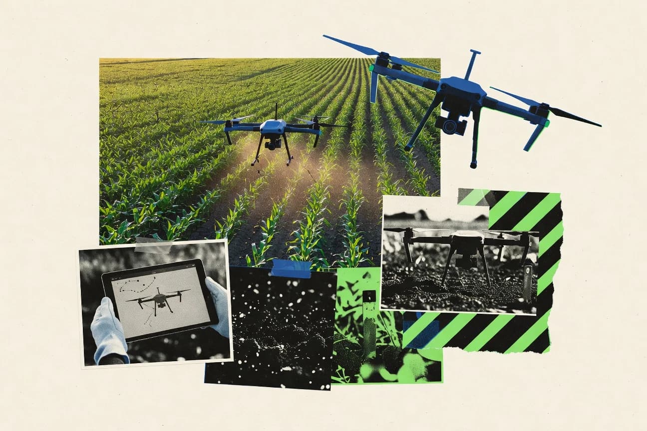
Agriculture FarmingTop 9 Best Agricultural Drone Software of 2026
Compare the top Agricultural Drone Software picks for farms. Rank leading tools like 3D Vista, Pix4Dfields, and DroneDeploy. Explore options.

How we ranked these tools
Core product claims cross-referenced against official documentation, changelogs, and independent technical reviews.
Analyzed video reviews and hundreds of written evaluations to capture real-world user experiences with each tool.
AI persona simulations modeled how different user types would experience each tool across common use cases and workflows.
Final rankings reviewed and approved by our editorial team with authority to override AI-generated scores based on domain expertise.
Score: Features 40% · Ease 30% · Value 30%
Gitnux may earn a commission through links on this page — this does not influence rankings. Editorial policy
Editor’s top 3 picks
Three quick recommendations before you dive into the full comparison below — each one leads on a different dimension.
3D Vista
Georeferenced orthomosaic and textured 3D reconstruction with measurement-ready point clouds
Built for agronomy teams needing repeatable drone reconstruction into agronomic mapping deliverables.
Pix4Dfields
Editor pickVegetation index mapping workflows driven from processed orthomosaics and field models
Built for agronomy teams needing accurate drone maps and repeatable crop monitoring outputs.
DroneDeploy
Editor pickAutomated field mapping reports with orthomosaic and vegetation index outputs
Built for agronomy teams and service providers needing consistent drone mapping deliverables.
Related reading
Comparison Table
This comparison table benchmarks agricultural drone software used for planning, capturing, and processing aerial data into field-ready outputs. It covers platforms such as 3D Vista, Pix4Dfields, DroneDeploy, senseFly Data & Results, and Agisoft Metashape, focusing on key differences in workflow, data processing, and deliverable capabilities.
3D Vista
geospatial processing3D Vista produces orthomosaics, DSMs, and maps from drone imagery with support for precision agriculture deliverables.
Georeferenced orthomosaic and textured 3D reconstruction with measurement-ready point clouds
3D Vista centers on turning drone captures into georeferenced deliverables like orthomosaics, point clouds, and textured 3D models for agricultural fields. The workflow supports importing common drone data formats, building aligned imagery into survey-grade outputs, and exporting results for field review and downstream analysis.
It also provides measurement and inspection tools aimed at extracting actionable field metrics from reconstructed geometry. The tool is positioned for repeatable processing across sites where consistent orthomosaic and 3D outputs matter more than manual photogrammetry steps.
- +Georeferenced orthomosaics and 3D models from drone imagery for field deliverables
- +Point cloud generation supports measurement workflows on reconstructed terrain
- +Exports enable integration with other surveying and mapping tools
- –Alignment and processing settings can be complex for small teams
- –Advanced outputs require careful data capture planning for best results
- –Less streamlined collaboration and review tooling than dedicated ag field platforms
Best for: Agronomy teams needing repeatable drone reconstruction into agronomic mapping deliverables
More related reading
Pix4Dfields
ag drone mappingPix4Dfields processes drone data into field-ready maps for agronomic scouting and variable-rate workflows.
Vegetation index mapping workflows driven from processed orthomosaics and field models
Pix4Dfields is built for drone-to-map workflows that turn flight imagery into agronomic outputs like orthomosaics and field models. It supports key processing steps for agriculture teams, including surface model generation and vegetation index mapping workflows tied to crop analysis.
The software also includes tools for managing projects and outputs that align with recurring field monitoring use cases across seasons. Results can be exported into formats useful for GIS review and operational decision support.
- +Produces agronomy-ready orthomosaics and field models from drone imagery
- +Supports vegetation-focused mapping workflows for crop monitoring use cases
- +Exports analysis outputs for integration with common GIS review processes
- –Processing and project setup can feel technical without mapping experience
- –Advanced agronomic tuning requires more time than basic map generation
- –Large flights can demand substantial compute resources for full processing
Best for: Agronomy teams needing accurate drone maps and repeatable crop monitoring outputs
DroneDeploy
cloud mappingDroneDeploy turns drone captures into map products and measurement layers for field operations and crop monitoring.
Automated field mapping reports with orthomosaic and vegetation index outputs
DroneDeploy distinguishes itself with an end-to-end drone-to-map workflow that turns captured survey flights into field-ready outputs for growers and agronomists. The platform supports planned missions and automated data capture, then delivers processed maps such as orthomosaics, surface models, and vegetation indices for crop monitoring.
Its collaboration tools help teams share field reports and measurements to standardize decision-making across farms and service providers. Built for recurring agriculture use cases, it emphasizes repeatable capture settings and consistent deliverables rather than raw telemetry alone.
- +Mission planning and capture guidance for consistent agricultural surveys
- +Processed outputs include orthomosaics, surfaces, and vegetation indices
- +Field report sharing supports collaboration across growers and consultants
- +Repeatable workflows help standardize measurements between flights
- –Map QA and flight parameter tuning still require training and practice
- –Advanced agronomic analysis beyond maps can be limited without add-ons
- –Processing latency can affect fast turnarounds during active scouting
- –Export flexibility may not fit every niche GIS pipeline
Best for: Agronomy teams and service providers needing consistent drone mapping deliverables
More related reading
senseFly Data & Results
drone data platformsenseFly Data & Results processes eBee drone imagery into orthomosaics and 2D maps for site and crop analysis.
Automated generation of agronomic mapping deliverables from processed drone missions
senseFly Data & Results centers on processing and reporting outputs from senseFly drone flights into agronomic deliverables. It supports post-flight photogrammetry workflows that generate maps, 2D deliverables, and higher-level insights used for field monitoring.
The tool emphasizes standardized output generation for teams that run repeat surveys and need consistent result packs. Collaboration and data organization help keep project assets traceable across campaigns.
- +Streamlined processing of drone imagery into reusable mapping outputs
- +Project organization keeps survey results structured by flight and campaign
- +Consistent reporting helps teams compare fields across repeat missions
- –Best results depend on running drones and pipelines aligned to senseFly
- –Advanced analysis setup can feel heavier than simple viewing tools
- –Export and customization options can be limiting for nonstandard workflows
Best for: Agronomy teams producing repeat field maps and consistent survey reports
Agisoft Metashape
photogrammetryAgisoft Metashape creates dense point clouds, orthomosaics, and DSMs from drone images for agriculture-grade mapping.
Dense cloud to DEM and orthomosaic generation using photogrammetric reconstruction
Agisoft Metashape stands out for producing survey-grade 3D reconstruction with dense point clouds and textured models from drone imagery. It supports photogrammetry workflows that include camera calibration, alignment, dense cloud generation, mesh building, and DEM or orthomosaic export for agricultural field mapping.
Batch processing and configurable reconstruction settings help standardize deliverables across repeat flights. The software also includes basic measurement and QA tools for checking model alignment and surface quality before exporting outputs.
- +Survey-focused photogrammetry pipeline with dense clouds, meshes, and orthomosaics
- +Camera calibration and quality checks support consistent field deliverables
- +Configurable reconstruction settings for repeatable outputs across drone missions
- –Workflow setup and parameter tuning require photogrammetry know-how
- –Processing can be slow on large image sets without strong hardware
- –Limited GIS-style editing tools compared with dedicated mapping suites
Best for: Agronomy teams generating accurate orthomosaics and DEMs from drone imagery
More related reading
OpenDroneMap
open-source mappingOpenDroneMap builds orthomosaics and 3D models from drone photos using open-source geospatial processing components.
Orthomosaic and terrain model generation from drone photos using an open photogrammetry workflow
OpenDroneMap stands out for turning drone imagery into geospatial outputs using an open, modular photogrammetry pipeline. It supports standard aerial workflows like orthomosaic generation, dense point clouds, and digital surface models from captured flight imagery.
Its strengths align with agricultural survey needs such as field mapping and measurable vegetation area and elevation models. The main limitation is that it typically requires technical setup and image preprocessing to get reliable results across varied drone and sensor conditions.
- +Produces orthomosaics, DSMs, and dense point clouds for field measurement
- +Uses open photogrammetry tooling that fits repeatable survey pipelines
- +Supports multiple input imagery formats for mixed drone workflows
- –Requires configuration and tuning to handle farm-scale imagery variability
- –Manual control can be needed to clean images and manage processing quality
- –Less tailored for agronomy-specific deliverables than specialized farm platforms
Best for: Teams generating accurate field maps from drone imagery with controlled processing pipelines
Avery Weigh-Tronix FieldView
farm platformFieldView integrates agronomy data and imagery workflows for planning and decision support in field management.
Field boundary and zone-based records that connect drone imagery to agronomy decisions
FieldView by Avery Weigh-Tronix focuses on farm data capture, mapping, and decision support built around drone and in-field imagery workflows. It centralizes field boundaries, task planning, and geospatial performance records so growers can compare results across seasons.
The platform supports ingestion of drone-derived layers for visualization and spatial analysis tied to specific management zones. Collaboration and field operations reporting help teams translate imagery into actionable agronomy actions.
- +Strong field mapping workflow that ties imagery outputs to managed zones
- +Centralized field history supports cross-season comparisons and performance tracking
- +Visual layering makes it easier to interpret spatial variability results
- –Advanced analysis workflows can require setup effort to match agronomy practices
- –Some drone-to-insights steps rely on proper file and boundary preparation
- –Export and interoperability choices can be limiting for non-Avery workflows
Best for: Teams managing multiple fields who need imagery-to-zones decision workflows
More related reading
PrecisionHawk Insights
enterprise ag analyticsPrecisionHawk Insights aggregates drone and satellite imagery for field monitoring and crop health analytics.
Field boundary reporting and repeat-flight map comparisons in a single agronomic review workflow
PrecisionHawk Insights stands out for turning drone flights into agronomic field reports through an established imaging-to-analysis workflow. The platform focuses on cloud-based processing, map generation, and review tools that help teams monitor crops, assess variability, and track changes over time.
It is built around visual inspection outputs such as orthomosaics and vegetation indices that can be overlaid with field boundaries and measurement needs. The overall value depends on whether an organization already runs repeatable drone missions and wants standardized reporting rather than custom analytics development.
- +Cloud workflow converts imagery into orthomosaics and agronomic maps for field review
- +Time-series map comparison supports tracking changes across repeat flights
- +Tools for defining field areas improve consistency of reporting outputs
- –Workflow setup and data organization can slow teams without standardized practices
- –Advanced agronomy analysis beyond map outputs is limited compared with specialist tools
- –Integration choices require operational alignment with existing drone and mission processes
Best for: Agronomy teams standardizing drone-to-report mapping with repeatable field workflows
Esri ArcGIS Drone2Map
GIS drone mappingArcGIS Drone2Map generates orthomosaics, 3D surfaces, and map outputs from drone imagery for agriculture GIS workflows.
ArcGIS Drone2Map’s ground control integration for accurate georeferenced orthomosaics
ArcGIS Drone2Map focuses on photogrammetry-to-mapping workflows for drone imagery, using Esri’s geospatial processing and deliverable alignment in one environment. It supports ground control inputs, orthomosaic and surface generation, and common GIS-ready outputs for agricultural site planning.
The tight ArcGIS ecosystem integration helps teams move from capture to spatial analysis and map sharing without stitching tools across multiple platforms. The workflow can feel rigid for non-Esri users due to its GIS-centric assumptions and project structure.
- +GIS-ready orthomosaics, point clouds, and surfaces for field analysis
- +Ground control handling supports survey-grade georeferencing workflows
- +ArcGIS integration streamlines viewing, publishing, and downstream mapping
- –Requires GIS knowledge to set up projects and validate results
- –Less flexible for highly customized photogrammetry pipelines
- –Workflow can be slower for large datasets without proper hardware
Best for: Agriculture teams standardizing drone mapping inside Esri GIS workflows
How to Choose the Right Agricultural Drone Software
This buyer's guide explains how to choose agricultural drone software for mapping deliverables, agronomic scouting, and field decision workflows. It covers 3D Vista, Pix4Dfields, DroneDeploy, senseFly Data & Results, Agisoft Metashape, OpenDroneMap, Avery Weigh-Tronix FieldView, PrecisionHawk Insights, Esri ArcGIS Drone2Map, and other reviewed tools that turn drone imagery into usable field outputs.
What Is Agricultural Drone Software?
Agricultural drone software converts drone imagery into georeferenced outputs like orthomosaics, DSMs, and vegetation index layers that support field operations. These tools solve the workflow gap between flight capture and decision-ready maps by running photogrammetry or report generation and organizing deliverables for review. Teams use this software to standardize repeat missions and produce consistent field comparisons. Examples include Pix4Dfields for vegetation index workflows and ArcGIS Drone2Map for ArcGIS-ready orthomosaics with ground control handling.
Key Features to Look For
The right feature set depends on whether the goal is survey-grade reconstruction, agronomic reporting, or zone-based decision support across repeat flights.
Georeferenced orthomosaics plus 3D outputs
Georeferenced orthomosaics and textured 3D reconstruction support precise field measurement workflows after capture. 3D Vista generates georeferenced orthomosaics and textured 3D models and exports measurement-ready point clouds for agronomy deliverables.
Vegetation index mapping for crop monitoring
Vegetation index mapping links drone imagery to crop health signals that drive scouting decisions. Pix4Dfields is built for vegetation-focused mapping workflows driven from processed orthomosaics and field models, and DroneDeploy generates orthomosaic and vegetation index outputs in automated field mapping reports.
Dense point clouds, meshes, and DEM or surface generation
Dense reconstructions like point clouds, meshes, and DSM or DEM outputs enable terrain and surface analysis beyond flat maps. Agisoft Metashape produces dense point clouds, meshes, and exports DEM and orthomosaic outputs using a survey-grade photogrammetry pipeline.
Repeatable field projects for consistent deliverables
Repeatable processing helps agronomy teams compare results across seasons without changing the workflow every time. senseFly Data & Results emphasizes standardized output generation with consistent result packs, and PrecisionHawk Insights supports time-series map comparison for change tracking over repeat flights.
Field boundaries and management zones tied to imagery
Zone-based records connect imagery-derived layers to agronomy actions and operational boundaries. Avery Weigh-Tronix FieldView centralizes field boundaries and task planning so teams can interpret imagery within managed zones, and PrecisionHawk Insights includes tools for defining field areas to standardize reporting outputs.
Ground control integration for accurate georeferencing in GIS
Ground control handling improves georeferencing accuracy for survey-grade outputs in GIS workflows. Esri ArcGIS Drone2Map integrates ground control inputs to support accurate georeferenced orthomosaics, and it is designed to move from capture to spatial analysis and map sharing inside the ArcGIS ecosystem.
How to Choose the Right Agricultural Drone Software
Choosing the right tool starts with matching the deliverable type and workflow structure to the organization’s mapping maturity and operational reporting needs.
Pick the deliverable type: agronomy maps, terrain models, or full 3D reconstruction
Teams needing orthomosaics and textured 3D reconstruction with measurement-ready point clouds should evaluate 3D Vista. Teams needing dense photogrammetry products like dense clouds, meshes, and DEM exports should shortlist Agisoft Metashape. Teams that primarily need field-ready agronomy maps and crop monitoring layers should compare Pix4Dfields and DroneDeploy because both emphasize orthomosaics and vegetation-focused outputs.
Match the workflow to the team’s photogrammetry and GIS skill level
Tools built around GIS-centric project structure fit teams already operating inside Esri workflows, and Esri ArcGIS Drone2Map expects GIS knowledge to validate results and set up projects. OpenDroneMap can work for teams that can handle technical setup and image preprocessing to get reliable results from varied drone and sensor conditions. Agisoft Metashape and OpenDroneMap both require photogrammetry know-how and parameter tuning to produce consistent results.
Decide whether standardized capture and reporting matters more than raw processing control
If standardized missions and automated field mapping reports drive operations, DroneDeploy and PrecisionHawk Insights fit because they emphasize repeatable capture settings and consistent reporting outputs. If the priority is repeatable reconstruction across sites with emphasis on measurement-ready point clouds and textured 3D outputs, 3D Vista is built for that processing repeatability. If the priority is consistent result packs from senseFly flights, senseFly Data & Results organizes deliverables by flight and campaign.
Confirm zone-based decision support if agronomy actions depend on boundaries
Teams managing multiple fields should prioritize zone-based workflows because these tools connect imagery layers to field history and managed areas. Avery Weigh-Tronix FieldView maintains field boundary and zone records and supports cross-season performance tracking. PrecisionHawk Insights supports field area definitions and overlays for consistent reporting outputs tied to field areas.
Plan for processing scale and turnaround expectations
Large image sets and fast turnaround requirements can stress any reconstruction pipeline, and Pix4Dfields notes that large flights can demand substantial compute resources for full processing. DroneDeploy highlights processing latency that can affect fast turnarounds during active scouting. ArcGIS Drone2Map can run slower for large datasets without proper hardware, so dataset size and hardware readiness should be included in the evaluation.
Who Needs Agricultural Drone Software?
Agricultural drone software is most valuable for teams that need repeatable drone-to-map outputs for agronomy planning, monitoring, or GIS-based field analysis.
Agronomy teams focused on repeatable deliverables and agronomic mapping outputs
Pix4Dfields is a strong fit for teams needing accurate drone maps and repeatable crop monitoring outputs, with vegetation index workflows driven from processed orthomosaics and field models. DroneDeploy also fits organizations needing consistent mapping deliverables and automated field mapping reports with orthomosaic and vegetation index outputs.
Teams that need survey-grade terrain and reconstruction products for measurement-grade analysis
Agisoft Metashape fits agronomy mapping projects that require dense clouds, meshes, and DEM and orthomosaic exports from a photogrammetry pipeline with camera calibration and quality checks. 3D Vista fits teams needing georeferenced orthomosaics, textured 3D reconstruction, and measurement-ready point clouds.
Organizations standardizing agronomic review across repeat flights with field boundaries
PrecisionHawk Insights fits teams standardizing drone-to-report mapping with cloud-based processing, orthomosaics and vegetation indices, and time-series map comparison in a single agronomic review workflow. Avery Weigh-Tronix FieldView fits teams managing multiple fields who need imagery-to-zones decision workflows through field boundary and zone-based records.
GIS-centric teams building drone mapping into established Esri workflows with ground control
Esri ArcGIS Drone2Map fits agriculture teams that want orthomosaics, point clouds, and surfaces aligned inside ArcGIS with ground control integration for accurate georeferenced orthomosaics. For standardized reporting on senseFly workflows, senseFly Data & Results supports automated generation of agronomic mapping deliverables and consistent reporting across repeat survey missions.
Common Mistakes to Avoid
These pitfalls show up when teams select a tool that mismatches their deliverables, workflow readiness, or required level of technical control.
Choosing a 3D or photogrammetry tool without planning for capture and parameter tuning
Agisoft Metashape and OpenDroneMap require workflow setup and parameter tuning to produce accurate outputs, and OpenDroneMap also needs technical setup and image preprocessing for reliability across farm-scale variability. 3D Vista can produce advanced outputs but alignment and processing settings can become complex for small teams.
Relying on map generation only when field actions depend on zones and boundaries
Avery Weigh-Tronix FieldView and PrecisionHawk Insights both connect imagery-derived layers to field areas or managed zones, which supports consistent agronomy decisions. Tools that emphasize mapping deliverables without boundary-driven review can force extra file and boundary preparation for zone-aligned work.
Ignoring workflow standardization needs for repeat-season comparisons
PrecisionHawk Insights provides time-series map comparison and field boundary reporting to support tracking changes across repeat flights. senseFly Data & Results emphasizes consistent result packs for comparing fields across repeat missions.
Underestimating compute and turnaround constraints for large flights
Pix4Dfields notes that large flights can demand substantial compute resources for full processing. DroneDeploy highlights that processing latency can affect fast turnarounds during active scouting and ArcGIS Drone2Map can be slower for large datasets without proper hardware.
How We Selected and Ranked These Tools
We evaluated every tool on three sub-dimensions: features, ease of use, and value. Features carry a weight of 0.4, ease of use carries a weight of 0.3, and value carries a weight of 0.3, and the overall rating is the weighted average calculated as overall = 0.40 × features + 0.30 × ease of use + 0.30 × value. 3D Vista separated itself with a concrete strength in features, because it delivers georeferenced orthomosaics and textured 3D reconstruction with measurement-ready point clouds that support precision agriculture measurement workflows. Lower-ranked options often aligned more tightly to a narrower workflow like standardized reporting or a more technical open pipeline that raises setup and tuning effort.
Frequently Asked Questions About Agricultural Drone Software
Which agricultural drone software is best for generating survey-grade orthomosaics and DEMs?
What tool should be used when the goal is georeferenced textured 3D models and measurement-ready outputs?
Which options support vegetation index mapping from drone outputs for crop variability reporting?
How do end-to-end platforms compare with reconstruction tools that require more technical setup?
Which software is strongest for repeat surveys that need consistent result packages and traceable assets?
What tool fits best for zone-based farm management that connects imagery to field boundaries?
Which solution is best when an organization needs to keep processing inside a GIS ecosystem?
What software is better for teams that want collaboration and sharing of agronomic reports?
Which tool helps diagnose or reduce common processing issues like misalignment and surface quality problems?
Conclusion
After evaluating 9 agriculture farming, 3D Vista stands out as our overall top pick — it scored highest across our combined criteria of features, ease of use, and value, which is why it sits at #1 in the rankings above.
Use the comparison table and detailed reviews above to validate the fit against your own requirements before committing to a tool.
Tools reviewed
Primary sources checked during evaluation.
Referenced in the comparison table and product reviews above.
Keep exploring
Comparing two specific tools?
Software Alternatives
See head-to-head software comparisons with feature breakdowns, pricing, and our recommendation for each use case.
Explore software alternatives→In this category
Agriculture Farming alternatives
See side-by-side comparisons of agriculture farming tools and pick the right one for your stack.
Compare agriculture farming tools→FOR SOFTWARE VENDORS
Not on this list? Let’s fix that.
Our best-of pages are how many teams discover and compare tools in this space. If you think your product belongs in this lineup, we’d like to hear from you—we’ll walk you through fit and what an editorial entry looks like.
Apply for a ListingWHAT THIS INCLUDES
Where buyers compare
Readers come to these pages to shortlist software—your product shows up in that moment, not in a random sidebar.
Editorial write-up
We describe your product in our own words and check the facts before anything goes live.
On-page brand presence
You appear in the roundup the same way as other tools we cover: name, positioning, and a clear next step for readers who want to learn more.
Kept up to date
We refresh lists on a regular rhythm so the category page stays useful as products and pricing change.