GITNUXSOFTWARE ADVICE
Consumer RetailTop 10 Best Retail Mapping Software of 2026
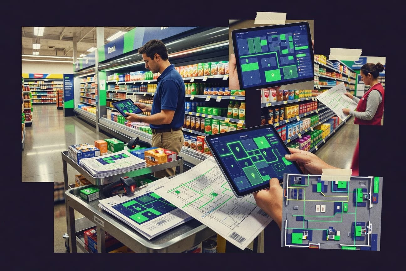
Discover the top 10 best retail mapping software. Optimize store locations, analyze foot traffic & more.

How we ranked these tools
Core product claims cross-referenced against official documentation, changelogs, and independent technical reviews.
Analyzed video reviews and hundreds of written evaluations to capture real-world user experiences with each tool.
AI persona simulations modeled how different user types would experience each tool across common use cases and workflows.
Final rankings reviewed and approved by our editorial team with authority to override AI-generated scores based on domain expertise.
Score: Features 40% · Ease 30% · Value 30%
Gitnux may earn a commission through links on this page — this does not influence rankings. Editorial policy
Editor’s top 3 picks
Three quick recommendations before you dive into the full comparison below — each one leads on a different dimension.
Mapbox
Vector-tile map styling with SDK-driven layer composition
Built for retail teams building custom store locator and territory mapping experiences.
Google Maps Platform
Places API for location enrichment and venue search across retail geographies
Built for retail teams building location search, routing, and interactive map experiences.
HERE Technologies
Address geocoding with high-quality location matching for store and delivery datasets
Built for retail teams building location-driven store, delivery, and territory maps in apps.
Related reading
Comparison Table
This comparison table maps leading retail mapping tools, including Mapbox, Google Maps Platform, HERE Technologies, Esri ArcGIS, and Waze for Cities, to the capabilities retailers need to plan and optimize store locations. Readers can compare geocoding and route planning features, location data quality, audience targeting and analytics options, and the system requirements for integrating maps into retail workflows.
| # | Tool | Category | Overall | Features | Ease of Use | Value |
|---|---|---|---|---|---|---|
| 1 | Mapbox Build interactive retail store maps and geospatial visualizations using Mapbox GL style rendering, routing integrations, and location APIs. | API-first mapping | 8.7/10 | 9.1/10 | 7.8/10 | 8.9/10 |
| 2 | Google Maps Platform Create store locator experiences, route and distance calculations, and location-based analytics using Places, Maps, and Routes APIs. | enterprise mapping | 8.2/10 | 8.6/10 | 8.1/10 | 7.8/10 |
| 3 | HERE Technologies Deploy location intelligence and mapping services for store discovery, routing, and geofencing with HERE location APIs. | location intelligence | 8.0/10 | 8.6/10 | 7.4/10 | 7.9/10 |
| 4 | Esri ArcGIS Model and analyze retail store locations and catchment areas with ArcGIS spatial tools, dashboards, and location-based workflows. | GIS analytics | 8.2/10 | 8.8/10 | 7.7/10 | 7.8/10 |
| 5 | Waze for Cities Use connected-vehicle traffic insights to support location planning by analyzing road speed and travel-time patterns. | traffic intelligence | 7.2/10 | 7.3/10 | 7.6/10 | 6.6/10 |
| 6 | TomTom Maps Integrate navigation-quality maps and location services to optimize store routing, reachability, and location matching. | mapping and routing | 7.7/10 | 8.1/10 | 7.3/10 | 7.5/10 |
| 7 | OpenStreetMap-based routing with GraphHopper Compute fast routes and distance matrices for store-to-customer optimization using GraphHopper’s routing and geocoding services. | routing API | 8.1/10 | 8.5/10 | 7.8/10 | 7.9/10 |
| 8 | OpenRouteService Provide routing and geocoding endpoints to power store location optimization workflows using OpenStreetMap-derived data. | routing and geocoding | 8.2/10 | 8.4/10 | 7.6/10 | 8.4/10 |
| 9 | Foursquare Places Enrich retail locations with venue data and place search for store locator matching and location normalization. | place data enrichment | 7.4/10 | 7.4/10 | 8.1/10 | 6.6/10 |
| 10 | Maptiler Create custom base maps and serve map tiles for store mapping workflows using Maptiler’s map rendering and hosting tools. | custom basemaps | 7.2/10 | 7.5/10 | 6.8/10 | 7.2/10 |
Build interactive retail store maps and geospatial visualizations using Mapbox GL style rendering, routing integrations, and location APIs.
Create store locator experiences, route and distance calculations, and location-based analytics using Places, Maps, and Routes APIs.
Deploy location intelligence and mapping services for store discovery, routing, and geofencing with HERE location APIs.
Model and analyze retail store locations and catchment areas with ArcGIS spatial tools, dashboards, and location-based workflows.
Use connected-vehicle traffic insights to support location planning by analyzing road speed and travel-time patterns.
Integrate navigation-quality maps and location services to optimize store routing, reachability, and location matching.
Compute fast routes and distance matrices for store-to-customer optimization using GraphHopper’s routing and geocoding services.
Provide routing and geocoding endpoints to power store location optimization workflows using OpenStreetMap-derived data.
Enrich retail locations with venue data and place search for store locator matching and location normalization.
Create custom base maps and serve map tiles for store mapping workflows using Maptiler’s map rendering and hosting tools.
Mapbox
API-first mappingBuild interactive retail store maps and geospatial visualizations using Mapbox GL style rendering, routing integrations, and location APIs.
Vector-tile map styling with SDK-driven layer composition
Mapbox stands out with a developer-first mapping stack that supports highly customized maps for retail use cases. It provides vector tile rendering, map styling control, and geospatial data integration so teams can build store locators, catchment maps, and route-aware experiences. Retail workflows benefit from rich SDKs for web and mobile plus tooling for map hosting and ongoing updates. Strong customization comes with integration effort and a more engineering-led path than template-driven store mapping tools.
Pros
- Highly customizable vector map rendering with fine-grained style control
- Strong geospatial tooling and SDKs for web and mobile retail mapping experiences
- Reliable basemap and layer composition for store locators and catchment views
- Support for routing data and map navigation experiences
Cons
- Developer-centric setup requires GIS and software integration effort
- Retail-specific workflows often need custom implementation for analytics and UI
- Large projects can require careful performance tuning across layers
Best For
Retail teams building custom store locator and territory mapping experiences
More related reading
Google Maps Platform
enterprise mappingCreate store locator experiences, route and distance calculations, and location-based analytics using Places, Maps, and Routes APIs.
Places API for location enrichment and venue search across retail geographies
Google Maps Platform stands out for its worldwide map data and reliable APIs for routing, places, and geocoding at retail scale. Retail mapping teams can build address normalization, location search, and heatmap-style visualization using Maps JavaScript and Places APIs. It also supports fleet and delivery routing through Directions API and related workflow patterns for store visits and last-mile planning. The platform’s strength is production-grade map rendering and location intelligence with strong ecosystem compatibility for web and mobile apps.
Pros
- High-quality geocoding and address parsing for store and customer matching
- Directions API enables route optimization for store runs and delivery planning
- Places API supports venue discovery and enrichment for retail location datasets
Cons
- Advanced retail-specific workflows require significant custom integration effort
- Large-scale visualization can demand careful client and API request design
- Managing region coverage and data hygiene is still the integrator’s responsibility
Best For
Retail teams building location search, routing, and interactive map experiences
HERE Technologies
location intelligenceDeploy location intelligence and mapping services for store discovery, routing, and geofencing with HERE location APIs.
Address geocoding with high-quality location matching for store and delivery datasets
HERE Technologies stands out with a strong retail cartography foundation that supports mapping, geocoding, and routing for location-aware store and delivery workflows. Core capabilities include address geocoding, route planning, traffic and travel-time insights, and tools to build interactive maps with custom layers. Retail mapping is practical for site selection, territory planning, and logistics visualization because HERE provides consistent global basemaps and location intelligence. Advanced GIS-style use cases benefit from data integration patterns that combine HERE maps with company datasets for store, customer, and delivery contexts.
Pros
- Global geocoding and address normalization for reliable store and delivery locations
- Routing and travel-time calculations support logistics planning and territory sizing
- Custom map layers work well for retail-specific overlays and data visualization
- Location intelligence services integrate cleanly with existing retail data systems
Cons
- Mapping workflows require engineering effort for complex retail dashboards
- Advanced configuration can be harder than simpler point-and-click mapping tools
- Retail-specific analytics still need additional data modeling on top of maps
Best For
Retail teams building location-driven store, delivery, and territory maps in apps
More related reading
Esri ArcGIS
GIS analyticsModel and analyze retail store locations and catchment areas with ArcGIS spatial tools, dashboards, and location-based workflows.
ArcGIS Location Analytics for trade-area modeling and store site selection analysis
Esri ArcGIS stands out with a full geospatial stack that connects data, analysis, and interactive mapping for retail decisions. ArcGIS Online and ArcGIS Enterprise support store and territory mapping, location-based analysis, and dashboard-style visualization through apps and web maps. Retail use cases benefit from geocoding, routing, proximity analysis, and spatial statistics for demand patterns, competitive clustering, and site selection workflows.
Pros
- Enterprise-grade GIS foundation supports robust retail mapping workflows
- Advanced spatial analysis tools support trade-area and site selection modeling
- Web maps, dashboards, and configurable apps speed stakeholder adoption
- Strong geocoding, routing, and proximity capabilities for store operations
- GIS data integration supports bringing retail datasets into location context
Cons
- Complex configuration can slow retail teams without GIS specialists
- Some advanced analysis requires training to avoid misleading outputs
- Managing shared maps and layers across many users adds governance overhead
Best For
Retail analytics teams needing advanced spatial modeling and governed mapping
Waze for Cities
traffic intelligenceUse connected-vehicle traffic insights to support location planning by analyzing road speed and travel-time patterns.
City reporting of real-time roadway incidents that automatically impact driver guidance
Waze for Cities stands out by using crowd-sourced incident reporting to influence navigation and road safety for city traffic management workflows. It provides a centralized way to receive and analyze reports such as hazards, crashes, and road closures while map editors and operators coordinate follow-up. The solution also supports communication of roadway events so drivers and city teams see timely, actionable updates through the Waze ecosystem. Its primary strength is rapid, community-driven awareness rather than deep retail-specific merchandising or store analytics.
Pros
- Crowd-sourced incident data updates routes with fast, real-world context
- City-specific visibility into hazards supports operational response and coordination
- Clear event reporting workflow reduces time to publish roadway changes
Cons
- Retail mapping use cases are indirect and lack store-level spatial tooling
- Limited integration depth for retail planning and analytics workflows
- Event quality depends on contributor accuracy and reporting consistency
Best For
Cities and retail ops needing traffic-aware routing for locations and corridors
TomTom Maps
mapping and routingIntegrate navigation-quality maps and location services to optimize store routing, reachability, and location matching.
Traffic-aware routing through TomTom Maps routing and travel-time capabilities
TomTom Maps stands out for map data coverage and traffic-ready routing designed for navigation and location experiences. The solution provides developer-focused map layers, geocoding, routing, and road network intelligence that supports retail store discovery, delivery travel-time estimates, and route planning. Its core strength is usable mapping primitives and location services that integrate into custom retail workflows rather than offering a standalone store-mapping dashboard.
Pros
- Strong road network and routing foundation for delivery and store visit planning
- Geocoding and map matching support accurate address-based store workflows
- Web and API-first integration fits custom retail mapping applications
Cons
- Advanced use requires engineering effort for data pipelines and integration
- Store analytics and territory dashboards are not the primary focus
- Limited native retail-specific tooling compared with dedicated mapping suites
Best For
Retail teams building custom store, delivery, and routing maps via APIs
More related reading
OpenStreetMap-based routing with GraphHopper
routing APICompute fast routes and distance matrices for store-to-customer optimization using GraphHopper’s routing and geocoding services.
Profile-based routing for multiple travel modes with configurable turn-by-turn guidance
GraphHopper delivers routing built on OpenStreetMap data with fast shortest-path and turn-by-turn directions for car, bike, and pedestrian profiles. It supports route optimization with matrices for estimating travel times and distances, plus itinerary-style directions via configurable options. The product stands out for handling routing constraints and road network behavior through its profile system rather than requiring custom mapping pipelines.
Pros
- Fast routing and directions backed by OpenStreetMap profiles
- Route matrix and distance-time calculations for planning and batching
- Flexible routing preferences like avoid roads and turn guidance options
Cons
- Complex parameter tuning can be difficult for nontechnical teams
- OSM coverage and data quality can cause uneven routing accuracy
- Advanced routing and optimizations require careful endpoint selection
Best For
Retail teams needing OSM routing for dispatch planning and store catchments
OpenRouteService
routing and geocodingProvide routing and geocoding endpoints to power store location optimization workflows using OpenStreetMap-derived data.
Isochrone API for store access polygons based on travel time or distance
OpenRouteService distinguishes itself with routing built on OpenStreetMap data and a developer-focused API for fast pathfinding. Core capabilities include driving, cycling, and walking directions, plus isochrones and route variants that support retail delivery and store catchment analysis. Retail workflows can request routes between many coordinates and turn results into map-ready outputs for planners and dashboards. The platform remains most effective when teams can integrate API responses into their own retail mapping views.
Pros
- Routing API supports car, bike, and foot profiles for retail mobility use cases
- Isochrone generation helps visualize delivery and store access areas
- Route alternatives support comparison for choosing optimal store-to-customer paths
Cons
- Map creation requires integration since core work happens through an API
- Isochrone outputs can be computationally heavy for large retail batches
- Advanced retail analytics beyond routing and catchments needs external tooling
Best For
Retail teams building custom routing maps and store catchment visuals
More related reading
Foursquare Places
place data enrichmentEnrich retail locations with venue data and place search for store locator matching and location normalization.
Place search using consumer location signals and structured POI details
Foursquare Places stands out for retail location discovery and context built from check-in and place data. It supports mapping of business listings, consumer footfall signals, and location search that helps teams find where shoppers go and how nearby places relate. Core capabilities focus on visual exploration of place information rather than running custom GIS workflows. This makes it useful for merchandising and market research mapping tasks where accurate POI context matters more than automation.
Pros
- Rich retail POI context from curated place records
- Fast place search and map exploration for new market discovery
- Useful proximity and neighborhood insights around known locations
- Good fit for visualizing retail locations and nearby points of interest
Cons
- Limited support for custom retail data models and field-level mapping
- Less suited for advanced GIS routing, overlays, and analysis workflows
- Mapping capabilities center on exploration rather than operational automation
- Dependence on third-party place data coverage for accuracy
Best For
Retail teams needing quick POI mapping for market research and discovery
Maptiler
custom basemapsCreate custom base maps and serve map tiles for store mapping workflows using Maptiler’s map rendering and hosting tools.
Offline map generation with customizable tile exports for store-area navigation
Maptiler stands out for turning geospatial datasets into ready-to-use web maps and analysis tiles with a strong emphasis on map styling and export workflows. It supports offline map generation and custom basemaps, which fits retail use cases like store catchment visualization and field routing. Core capabilities include geocoding, spatial processing, and publishing maps through interactive web outputs built from the same underlying data pipeline.
Pros
- Generates map tiles and offline maps from the same source workflows
- Flexible styling supports retail map brands and store-focused cartography
- Geospatial processing tools help transform retail datasets into maps
Cons
- Requires GIS familiarity to get consistent retail-ready outputs
- Less retail-specific automation than dedicated store planning platforms
- Publishing workflows can be complex for non-technical teams
Best For
Retail analytics teams needing custom maps and offline store field use
Conclusion
After evaluating 10 consumer retail, Mapbox stands out as our overall top pick — it scored highest across our combined criteria of features, ease of use, and value, which is why it sits at #1 in the rankings above.
Use the comparison table and detailed reviews above to validate the fit against your own requirements before committing to a tool.
How to Choose the Right Retail Mapping Software
This buyer's guide explains how to evaluate retail mapping software that supports store locators, territory and catchment mapping, and routing for store operations. It covers Mapbox, Google Maps Platform, HERE Technologies, Esri ArcGIS, Waze for Cities, TomTom Maps, GraphHopper, OpenRouteService, Foursquare Places, and Maptiler. The guide maps feature choices to real retail outcomes like address normalization, trade-area modeling, and traffic-aware travel time.
What Is Retail Mapping Software?
Retail mapping software builds interactive maps and location intelligence for retail store and delivery workflows. It solves problems like address matching, store search, territory planning, and visualizing how customers reach stores. Teams use these tools to normalize store data, compute routes, and render maps with custom overlays. Mapbox shows what fully customized store locator mapping looks like, while Esri ArcGIS shows what governed trade-area analytics looks like.
Key Features to Look For
These capabilities determine whether a retail mapping tool produces usable maps and analytics without heavy custom rework.
Vector-tile map styling for store locator UX
Mapbox supports vector-tile map styling and fine-grained style control so store locators can match retail branding and cartography needs. Maptiler also supports flexible styling and tile exports, which helps deliver consistent offline and field experiences.
Location enrichment and venue search
Google Maps Platform includes Places API for venue discovery and enrichment so retail teams can normalize and expand location datasets around store and neighborhood context. Foursquare Places provides structured POI details built from place records, which supports quick market discovery mapping.
Address geocoding and location matching
HERE Technologies emphasizes high-quality address geocoding and reliable location matching for store and delivery datasets. Google Maps Platform also supports strong geocoding and address parsing for store and customer matching at retail scale.
Routing and travel-time calculations for store operations
TomTom Maps delivers traffic-aware routing and travel-time capabilities for delivery and store visit planning. Google Maps Platform provides route and distance calculations through Directions API patterns, which supports route optimization for store runs.
Isochrones and access polygons for catchments
OpenRouteService offers an Isochrone API that generates store access polygons based on travel time or distance. OpenStreetMap-based routing with GraphHopper can also support dispatch planning and catchment-style calculations through route matrix outputs.
Trade-area modeling and spatial analytics with governance
Esri ArcGIS includes ArcGIS Location Analytics for trade-area modeling and store site selection analysis, which supports deeper retail spatial workflows. It also supports dashboard-style visualization through apps and web maps for stakeholder adoption.
How to Choose the Right Retail Mapping Software
A practical selection works by matching delivery needs like store search, geocoding quality, and catchment analytics to the tool’s native strengths.
Start with the retail map outcome
Choose tools based on whether the deliverable is a store locator, a trade-area model, a delivery routing map, or an offline field map. Mapbox fits store locator and territory mapping where vector-tile styling and SDK-driven layer composition matter. Esri ArcGIS fits trade-area modeling and store site selection when spatial analysis tools and governed mapping are required.
Validate geocoding and location matching quality for store data
Assess whether the solution normalizes messy addresses and matches store records reliably before building any dashboards. HERE Technologies focuses on address geocoding and high-quality location matching for store and delivery datasets. Google Maps Platform also provides strong geocoding and address parsing for store and customer matching.
Pick routing and access-area capabilities that align with operations
Map routing needs like store-to-customer dispatch, store visit routes, or delivery catchments to the tool’s routing primitives. TomTom Maps provides traffic-aware routing and travel-time estimates. OpenRouteService offers isochrone generation for store access polygons, while GraphHopper provides route matrices for planning and batching.
Match customization depth to available engineering and GIS resources
Developer-centric platforms require integration effort and performance tuning for multi-layer maps, so engineering capacity must match the mapping depth. Mapbox is highly customizable with vector-tile styling but typically needs software integration work for analytics and UI. Maptiler and GraphHopper also require integration work, with Maptiler expecting GIS familiarity for consistent retail-ready outputs.
Confirm analytics depth versus map exploration
Decide whether the workflow needs GIS-style spatial modeling or primarily POI context exploration. Esri ArcGIS supports advanced spatial analysis and trade-area modeling through ArcGIS Location Analytics. Foursquare Places focuses on place search and POI context exploration rather than advanced routing and analysis workflows.
Who Needs Retail Mapping Software?
Retail mapping tools target teams that convert store and customer locations into actionable routes, catchments, and spatial decisions.
Retail teams building custom store locators and territory maps
Mapbox excels for store locator and territory experiences because vector-tile map styling and SDK-driven layer composition enable highly customized cartography. Google Maps Platform also supports interactive store search and route-aware experiences for retail scale.
Retail teams that need address normalization and location intelligence in apps
HERE Technologies is built around global geocoding and address normalization that supports store and delivery location matching. Its routing and travel-time calculations support logistics planning and territory sizing inside apps.
Retail analytics teams requiring advanced spatial modeling and governed dashboards
Esri ArcGIS is a fit for trade-area modeling and site selection because ArcGIS Location Analytics supports robust retail spatial workflows. ArcGIS Online and ArcGIS Enterprise also enable web maps and dashboard-style visualization through configurable apps.
Cities and retail operations needing traffic-aware corridor guidance
Waze for Cities serves teams that need city reporting of real-time roadway incidents because hazards, crashes, and road closures automatically impact driver guidance. Its strengths focus on fast event awareness, not store-level merchandising or complex territory dashboards.
Common Mistakes to Avoid
Several predictable gaps show up when retail teams try to force a tool into a workflow it does not natively optimize.
Choosing a developer-first map stack without engineering bandwidth
Mapbox requires developer-centric setup with GIS and software integration effort for custom analytics and UI layers. Maptiler also expects GIS familiarity for consistent retail-ready outputs and can add publishing complexity for non-technical teams.
Treating map exploration tools as full routing and analytics platforms
Foursquare Places focuses on POI context exploration and place search, which limits field-level mapping customization for operational GIS routing and analysis workflows. Waze for Cities provides traffic incident awareness that impacts navigation guidance, which is indirect for store-level territory analytics.
Assuming routing APIs automatically produce catchment analytics without computation
OpenRouteService provides isochrone generation, but large retail batches can make isochrone computations heavy without planning. GraphHopper supports distance-time and matrix calculations, but complex parameter tuning can be difficult for nontechnical teams.
Underestimating data hygiene requirements for store and customer datasets
Google Maps Platform provides strong address parsing and geocoding, but managing region coverage and data hygiene remains the integrator’s responsibility. HERE Technologies can normalize addresses well, but complex retail dashboards still require additional data modeling on top of map outputs.
How We Selected and Ranked These Tools
We evaluated every retail mapping tool on three sub-dimensions. Features carried weight 0.4 because store locators, geocoding, routing, and analytics capabilities must match retail workflows. Ease of use carried weight 0.3 because configuration complexity directly affects time-to-launch for mapping dashboards. Value carried weight 0.3 because teams need practical outcomes from the selected map and routing primitives. Overall is the weighted average of those three sub-dimensions using overall = 0.40 × features + 0.30 × ease of use + 0.30 × value. Mapbox separated from lower-ranked tools because its vector-tile map styling and SDK-driven layer composition scored strongly in the features dimension, which supports highly customized retail store locator experiences.
Frequently Asked Questions About Retail Mapping Software
How do Mapbox and Google Maps Platform differ for building a retail store locator?
Mapbox supports a highly customized store locator by letting teams compose vector-tile layers with SDK-driven layer control for catchment maps and route-aware experiences. Google Maps Platform focuses on production-ready location search and enrichment using Places and Maps JavaScript, which streamlines address normalization and business discovery at retail scale.
Which tool is best for trade-area and territory modeling with GIS-grade analytics?
Esri ArcGIS is designed for governed spatial analysis, combining geocoding, routing, proximity analysis, and spatial statistics in ArcGIS Online and ArcGIS Enterprise. ArcGIS Location Analytics supports trade-area modeling and store site selection workflows that go beyond simple map rendering.
What mapping stack supports routing with traffic-aware travel time for store visits and delivery planning?
TomTom Maps provides routing and travel-time estimates that integrate into custom retail workflows for store discovery and delivery planning. Waze for Cities emphasizes rapid incident reporting such as hazards, crashes, and road closures, which can update navigation behavior for city corridors used by retail operations.
When should retailers choose HERE Technologies instead of a generic POI mapping approach?
HERE Technologies fits retail teams that need consistent geocoding and location intelligence tied to routing and logistics visualization for site selection and territory planning. It is especially useful when store and delivery datasets require high-quality address matching and route planning with integrated travel insights.
How do OpenRouteService and GraphHopper support store catchment polygons and route matrices?
OpenRouteService offers an Isochrone API that generates store access polygons from travel time or distance, which supports store catchment visuals. GraphHopper provides profile-based routing on OpenStreetMap data and also supports routing matrices to estimate travel times and distances for planner workflows.
What integration patterns work best for retail teams that already have store, customer, and delivery datasets?
ArcGIS ArcGIS Enterprise and ArcGIS Online support end-to-end pipelines by connecting company datasets to geocoding and spatial analysis in web maps and dashboards. HERE Technologies and Mapbox also integrate well by combining retailer datasets with location matching and map layers, but Mapbox requires more engineering effort to fully customize map composition.
Which option is most suitable for market research teams that want quick POI context from consumer behavior?
Foursquare Places is built for place discovery and context using check-in and structured POI details, which helps retailers map shopper destinations and nearby place relationships. It emphasizes visual exploration of place information rather than deep GIS modeling.
How can Maptiler support offline and field use for store-area navigation?
Maptiler supports offline map generation and tile export workflows so retail teams can prepare store catchment maps and field routing materials without continuous connectivity. It also helps create ready-to-use web maps from geospatial datasets with consistent styling and publishing outputs.
What common problem occurs during retail mapping builds, and how do tools address it?
Address normalization and location matching failures often break store locators and routing accuracy, especially when datasets include inconsistent formats. Google Maps Platform improves matching and enrichment through Places, while HERE Technologies focuses on high-quality address geocoding for store and delivery datasets.
Tools reviewed
Referenced in the comparison table and product reviews above.
Keep exploring
Comparing two specific tools?
Software Alternatives
See head-to-head software comparisons with feature breakdowns, pricing, and our recommendation for each use case.
Explore software alternatives→In this category
Consumer Retail alternatives
See side-by-side comparisons of consumer retail tools and pick the right one for your stack.
Compare consumer retail tools→FOR SOFTWARE VENDORS
Not on this list? Let’s fix that.
Our best-of pages are how many teams discover and compare tools in this space. If you think your product belongs in this lineup, we’d like to hear from you—we’ll walk you through fit and what an editorial entry looks like.
Apply for a ListingWHAT THIS INCLUDES
Where buyers compare
Readers come to these pages to shortlist software—your product shows up in that moment, not in a random sidebar.
Editorial write-up
We describe your product in our own words and check the facts before anything goes live.
On-page brand presence
You appear in the roundup the same way as other tools we cover: name, positioning, and a clear next step for readers who want to learn more.
Kept up to date
We refresh lists on a regular rhythm so the category page stays useful as products and pricing change.