GITNUXSOFTWARE ADVICE
Technology Digital MediaTop 10 Best Photogrammetry Software of 2026
Explore top 10 best photogrammetry software tools. Compare features, find the perfect fit, and start creating stunning 3D models today.

How we ranked these tools
Core product claims cross-referenced against official documentation, changelogs, and independent technical reviews.
Analyzed video reviews and hundreds of written evaluations to capture real-world user experiences with each tool.
AI persona simulations modeled how different user types would experience each tool across common use cases and workflows.
Final rankings reviewed and approved by our editorial team with authority to override AI-generated scores based on domain expertise.
Score: Features 40% · Ease 30% · Value 30%
Gitnux may earn a commission through links on this page — this does not influence rankings. Editorial policy
Editor’s top 3 picks
Three quick recommendations before you dive into the full comparison below — each one leads on a different dimension.
Agisoft Metashape
Depth maps for dense point clouds with adjustable accuracy, filtering, and reconstruction settings
Built for survey and mapping teams needing accurate dense reconstructions and exports.
RealityCapture
Editor pickComponent-based alignment with advanced reconstruction settings for high-detail dense model generation
Built for teams generating detailed meshes and textured models from large photo datasets.
Pix4Dmapper
Editor pickBatch processing for automated orthomosaic and point cloud generation across multiple datasets
Built for survey teams and contractors producing GIS outputs from drone photogrammetry.
Related reading
Comparison Table
This comparison table evaluates photogrammetry software used to turn overlapping images into dense point clouds, textured meshes, and georeferenced models. You can compare key factors across tools like Agisoft Metashape, RealityCapture, Pix4Dmapper, RealityScan, and OpenDroneMap, including supported workflows, typical input requirements, reconstruction outputs, and processing focus for mapping and 3D scanning.
Agisoft Metashape
desktop photogrammetryMetashape performs image alignment, dense point cloud reconstruction, and mesh and orthomosaic generation from photogrammetry imagery.
Depth maps for dense point clouds with adjustable accuracy, filtering, and reconstruction settings
Agisoft Metashape stands out for producing survey-grade outputs from dense image collections using a configurable photogrammetry pipeline. It supports structured reconstruction stages including camera alignment, sparse-to-dense point cloud generation, mesh building, and texture mapping.
The software includes tools for coordinate system handling, scale bars and markers, and exporting for common GIS and CAD workflows. Its depth-map and dense reconstruction options enable strong results across terrestrial, aerial, and close-range captures.
- +Highly configurable alignment and dense reconstruction for reliable geometry
- +Supports accurate georeferencing with camera models and coordinate systems
- +Exports dense clouds, meshes, and textures for GIS and CAD use
- –Dense reconstruction tuning requires technical knowledge for best results
- –Workflow can be slow and compute-heavy on large image sets
- –License cost can limit value for small teams
Best for: Survey and mapping teams needing accurate dense reconstructions and exports
More related reading
RealityCapture
high-performanceRealityCapture reconstructs 3D models, meshes, and textures from large-scale photo sets with fast alignment and dense reconstruction workflows.
Component-based alignment with advanced reconstruction settings for high-detail dense model generation
RealityCapture focuses on fast, accurate photogrammetry for producing dense point clouds and textured meshes from large image sets. It includes robust workflows for aligning images, filtering/reconstruction, and exporting multiple deliverable types such as meshes and orthophotos.
The software is strong in handling high-detail scenes and managing projects with clear control over accuracy and reconstruction settings. Its learning curve rises when you need consistent results across varying capture conditions and camera metadata.
- +High-performance dense reconstruction that targets detailed meshes from large photo sets
- +Strong alignment and reconstruction controls for repeatable results
- +Versatile export outputs for meshes, textures, and georeferenced products
- +Efficient workflow for iterating from sparse alignment to dense reconstruction
- –Workflow complexity increases when tuning settings for challenging imagery
- –Learning curve is steep for reliable georeferencing and scale control
- –User experience depends on correctly prepared photo and metadata inputs
- –Licensing and cost can be harder to justify for occasional hobby use
Best for: Teams generating detailed meshes and textured models from large photo datasets
Pix4Dmapper
mapping and surveyPix4Dmapper creates 3D maps and measurements by generating point clouds, dense models, orthomosaics, and textured outputs from photos.
Batch processing for automated orthomosaic and point cloud generation across multiple datasets
Pix4Dmapper stands out for its end-to-end photogrammetry workflow that goes from image alignment to dense point clouds and georeferenced outputs. It supports automation features like batch processing for repeatable survey sites and offers exports for GIS workflows using orthomosaics, DSMs, and point clouds.
The software is built around robust reconstruction pipelines that handle common field scenarios like nadir drone imagery and terrestrial captures. It is strongest when you need production-grade results and consistent processing across many datasets, not just quick one-off visualizations.
- +Production-focused photogrammetry pipeline with alignment, dense clouds, and orthomosaics
- +Batch processing for repeatable surveys across multiple projects and datasets
- +Georeferencing workflows that produce GIS-ready outputs like DSM and point clouds
- –Steeper learning curve for optimal settings and survey-grade accuracy
- –Licensing cost can be high for small teams doing occasional projects
- –GPU acceleration depends on scene size and setup for best performance
Best for: Survey teams and contractors producing GIS outputs from drone photogrammetry
RealityScan
mobile to 3DRealityScan photogrammetry processes captured images into 3D scans and models through Epic's scanning pipeline.
Mobile capture workflow that creates 3D scans directly from smartphone photography
RealityScan turns smartphone photo sets into 3D reconstructions inside an Epic ecosystem workflow. It is built for rapid capture and reconstruction with an on-device capture experience that reduces the friction of traditional photogrammetry.
The generated outputs target practical visualization and downstream use instead of deep, manual control of every reconstruction parameter. Its strongest fit is quick asset creation for non-specialist teams who want a streamlined pipeline.
- +Fast mobile capture workflow reduces the time to start a reconstruction
- +Tight integration with Epic tools makes asset handoff smoother for existing users
- +Generates usable 3D models from photos without manual photogrammetry setup
- –Limited visibility into reconstruction settings compared with pro photogrammetry suites
- –Less suitable for precise survey-grade workflows that require strict calibration control
- –Results can vary more with capture quality than desktop, parameter-driven tools
Best for: Teams creating quick 3D assets from phone photos for visualization and reuse
OpenDroneMap
open-source pipelineOpenDroneMap converts geotagged photos into dense point clouds, meshes, and orthophotos using a toolchain built from open-source photogrammetry components.
Orthophoto and map production from georeferenced drone imagery in a repeatable pipeline
OpenDroneMap stands out for turning drone photos into georeferenced outputs using open source photogrammetry pipelines built around repeatable processing steps. It supports common reconstruction stages like feature extraction, dense point cloud generation, mesh building, and orthophoto production.
The software emphasizes integration with GIS workflows through export formats for maps and point clouds and supports batch processing via its tooling. It is designed for people who want controllable command-line photogrammetry rather than a fully guided GUI experience.
- +End-to-end drone photo processing to orthomosaics and textured meshes
- +Open source pipeline with many processing parameters exposed
- +Batch processing supports repeated runs for large datasets
- +GIS-friendly outputs like orthophotos and point clouds
- +Works well on self-hosted hardware without vendor lock-in
- –Command-line workflow adds friction for non-technical users
- –Setup and dependency management can be time-consuming
- –Quality tuning often requires manual parameter adjustments
- –No single polished GUI for end-to-end guided processing
Best for: Teams needing open photogrammetry pipelines for drone-to-GIS mapping
COLMAP
research open-sourceCOLMAP estimates camera poses and produces sparse and dense reconstructions from image sets using structure-from-motion and multi-view stereo.
Hierarchical SfM with sparse reconstruction and robust camera estimation
COLMAP stands out for its focus on high-quality photogrammetry research-grade workflows and scriptable command-line processing. It supports feature extraction, sparse and dense reconstruction, camera calibration, and image undistortion to produce textured or untextured 3D models.
Its strength is flexibility for custom pipelines and reproducible experiments across SfM and MVS steps. Its main drawback is the lack of a polished, end-to-end guided interface for novices compared with dedicated production tools.
- +Strong SfM and MVS tooling for reproducible 3D reconstruction pipelines
- +Flexible command-line workflow supports automation and batch processing
- +Accurate camera calibration and sparse-to-dense reconstruction stages
- +Works well for custom research experiments and advanced troubleshooting
- –Steeper learning curve than click-through photogrammetry applications
- –Dense reconstruction quality requires careful parameter tuning and dataset prep
- –Limited built-in project management and guided processing UX
- –Texturing and export workflows can take extra post-processing steps
Best for: Researchers and technical teams building automated photogrammetry workflows
Meshroom
node-based open-sourceMeshroom builds 3D reconstructions by running AliceVision photogrammetry nodes for feature matching, depth maps, and mesh generation.
Graph-based AliceVision pipeline that lets you edit and rerun specific reconstruction stages
Meshroom stands out for its node-based photogrammetry pipeline built on AliceVision, which makes each processing step inspectable and reproducible. It supports common workflows like feature extraction, camera alignment, depth map generation, sparse and dense reconstruction, and mesh texturing.
You control parameters through the graph, so advanced users can rerun only the parts that change. It works best when input photos are consistent and you can invest time into cleanup, scale, and quality checks.
- +Node graph workflow exposes each photogrammetry stage for targeted reruns
- +AliceVision processing stack supports sparse and dense reconstruction plus texturing
- +Strong transparency for debugging misalignment and reconstruction failures
- +Free software with GPU acceleration options for faster dense steps
- –Parameter tuning is demanding for reliable alignment across varied photo sets
- –Thin UX for scaling, georeferencing, and quality control compared with commercial tools
- –Large datasets can strain storage and compute during dense reconstruction
- –Preprocessing and cleanup are often required to avoid noisy depth and artifacts
Best for: Technical users building reproducible photogrammetry pipelines without licensing costs
KOLOR Autopano Giga
panorama stitchingAutopano Giga stitches and aligns multi-image panoramas and can produce 2D outputs and 3D-related structures depending on input sets.
Autopano Giga multi-view alignment with control points for accurate photo set registration
KOLOR Autopano Giga stands out for its strong image registration and panorama stitching workflow aimed at turning overlapping photos into stable, accurate alignments. It provides tools for batch processing, control point support, and multi-view alignment that feed clean inputs into downstream 3D reconstruction pipelines.
The software excels at photogrammetry-style capture organization and initial alignment quality for textured outputs. It is less of an all-in-one reconstruction platform than dedicated photogrammetry suites, so users often pair it with separate meshing and texturing tools.
- +Robust multi-image alignment for overlapping photo sets
- +Batch workflow supports large projects with consistent processing
- +Control point tools help refine alignment when automatic matching struggles
- +Good panorama-to-3D style preprocessing for downstream reconstruction
- –Not a full photogrammetry pipeline with meshing and texturing built in
- –Manual intervention can be required for difficult scenes and low overlap
- –User interface choices can feel dated for modern reconstruction workflows
- –Compute-heavy alignment jobs can take significant time on large datasets
Best for: Photogrammetry preprocessing for teams that prioritize fast, reliable image alignment
Agisoft Metashape Cloud
cloud photogrammetryMetashape Cloud runs photogrammetry processing on cloud infrastructure to produce models, dense clouds, and orthomosaics from uploaded images.
Cloud-managed photogrammetry jobs that run Metashape-style reconstruction steps with centralized project control
Agisoft Metashape Cloud is distinct because it moves Metashape processing into a managed cloud workflow with web-based job handling. It supports the full photogrammetry pipeline from image alignment through dense point clouds to mesh generation and orthomosaics.
The platform is built around project-based jobs and remote compute so teams can scale runs without managing local GPU workstations. Processing quality is tied to Metashape-style parameter control, but the web workflow can limit how you fine-tune hardware and batch orchestration.
- +End-to-end photogrammetry pipeline from alignment to orthomosaics in cloud jobs
- +Centralized projects make collaboration and reprocessing simpler than local setups
- +Remote compute reduces GPU and storage burdens on individual machines
- +Metashape-grade parameter options support repeatable reconstruction results
- +Automated task queues help run long jobs without babysitting
- –Interactive tuning can be slower than local processing loops
- –Data transfer time and upload friction can slow initial onboarding
- –Cloud job limits can restrict very large projects and dense reconstructions
- –Costs can climb quickly for high image counts and repeated iterations
Best for: Teams needing Metashape-quality reconstruction using managed cloud compute for repeatable jobs
DroneDeploy Maps
cloud mappingDroneDeploy processes drone imagery into 2D and 3D map products using photogrammetry workflows for field survey deliverables.
End-to-end drone mission capture and photogrammetry processing workflow optimized for DJI
DroneDeploy Maps stands out for photogrammetry workflows tied directly to DJI flight planning and automated capture missions. It generates 2D maps and 3D models from collected aerial imagery using a cloud processing pipeline.
The platform emphasizes repeatable field execution with deliverables like orthomosaics, point clouds, and elevation outputs. Collaboration features support sharing results with stakeholders from within the same system.
- +DJI-first workflow for planning, flying, and processing imagery in one system
- +Automated photogrammetry processing for orthomosaics, 3D models, and surface outputs
- +Project-based review and sharing so teams can validate deliverables quickly
- –Less flexible than desktop photogrammetry tools for advanced reconstruction control
- –Cloud processing can slow iteration when you need rapid model tweaks
- –Per-user licensing can raise costs for large teams or contractors
Best for: Teams using DJI missions needing fast photogrammetry deliverables and stakeholder sharing
Conclusion
After evaluating 10 technology digital media, Agisoft Metashape stands out as our overall top pick — it scored highest across our combined criteria of features, ease of use, and value, which is why it sits at #1 in the rankings above.
Use the comparison table and detailed reviews above to validate the fit against your own requirements before committing to a tool.
How to Choose the Right Photogrammetry Software
This buyer’s guide helps you choose photogrammetry software by mapping production needs to specific tools, including Agisoft Metashape, RealityCapture, Pix4Dmapper, RealityScan, OpenDroneMap, COLMAP, Meshroom, KOLOR Autopano Giga, Agisoft Metashape Cloud, and DroneDeploy Maps. You will learn which capabilities matter for survey-grade geometry, detailed textured meshes, drone-to-GIS deliverables, and fast smartphone-to-model workflows. The guide also calls out common mistakes seen across these platforms and a practical selection framework using measurable evaluation dimensions.
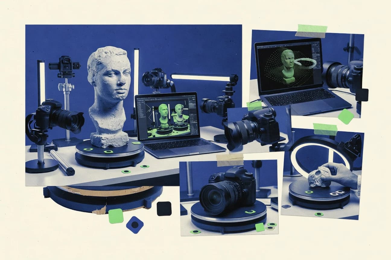
What Is Photogrammetry Software?
Photogrammetry software reconstructs 3D geometry from overlapping photographs by running camera alignment and dense reconstruction to produce point clouds, meshes, and textures. Many tools also generate georeferenced products like orthomosaics, DSMs, and elevation outputs for mapping and GIS workflows. Tools like Agisoft Metashape focus on survey-grade pipeline control from alignment to dense depth maps and mesh generation. Tools like RealityScan emphasize rapid capture from smartphone photos into usable 3D models inside an Epic ecosystem workflow.
Key Features to Look For
The right photogrammetry tool matches your required reconstruction stage control, dataset scale, and deliverable format so you spend less time reprocessing and more time using results.
Dense point cloud depth maps with adjustable reconstruction controls
Agisoft Metashape is built around depth-map generation for dense point clouds with adjustable accuracy, filtering, and reconstruction settings. This control helps teams tune geometry quality for terrestrial, aerial, and close-range datasets when export precision matters.
Component-based alignment and advanced reconstruction settings for high-detail dense models
RealityCapture uses component-based alignment and advanced reconstruction settings designed for detailed dense model generation. This approach helps you reach consistent textured meshes when you must iterate on reconstruction parameters.
Production pipelines for orthomosaics, DSMs, and GIS-ready exports
Pix4Dmapper provides an end-to-end photogrammetry pipeline that generates orthomosaics, DSMs, and point clouds with batch processing for repeatable survey sites. This is tailored for survey teams that need GIS-ready outputs across many projects and datasets.
Automated batch processing for repeated datasets and repeatable deliverables
Pix4Dmapper excels at batch processing for automated orthomosaic and point cloud generation across multiple datasets. OpenDroneMap also supports batch processing in its open pipeline, which helps when you run repeatable drone-to-GIS processing steps.
Cloud-managed photogrammetry jobs for centralized reprocessing and remote compute
Agisoft Metashape Cloud runs a Metashape-style pipeline in managed cloud jobs from alignment through dense clouds, meshes, and orthomosaics. This option reduces local GPU and storage burdens and centralizes projects for teams that reprocess frequently.
Graph or node-based pipelines for inspectable and rerunnable reconstruction stages
Meshroom uses a node-based AliceVision graph so you can inspect stages and rerun only the parts that changed. COLMAP provides scriptable command-line SfM and MVS steps that support reproducible experiments across camera estimation and dense reconstruction workflows.
How to Choose the Right Photogrammetry Software
Pick the tool whose reconstruction control model and deliverable outputs match your capture workflow and operational constraints.
Start with the deliverables you must produce
If you need survey-grade dense geometry and exports for GIS and CAD, choose Agisoft Metashape because it generates dense clouds, meshes, and textures while supporting coordinate system handling. If your core deliverable is detailed textured meshes from large photo sets, choose RealityCapture because it targets high-detail dense model generation using component-based alignment and advanced reconstruction settings.
Match dataset scale to your reconstruction workflow
RealityCapture is designed for large photo sets and efficient iteration from sparse alignment to dense reconstruction, which helps when you must manage high-detail scenes. Pix4Dmapper is optimized for production work across many survey datasets using batch processing for orthomosaic and point cloud generation.
Choose your control level for reconstruction and georeferencing
For maximum reconstruction tuning, Agisoft Metashape Cloud offers Metashape-style parameter control in centralized cloud jobs, and Agisoft Metashape offers depth-map tuning locally for dense point cloud quality. For technical control and reproducibility in custom pipelines, COLMAP provides hierarchical SfM with sparse reconstruction and robust camera estimation plus scriptable automation.
Select a workflow style that fits your team’s operations
If your team needs a streamlined process from smartphone capture to 3D scanning, RealityScan creates 3D scans directly from smartphone photography with limited manual reconstruction parameter visibility. If your team runs command-line processing on self-hosted hardware, OpenDroneMap exposes many processing parameters and supports orthophoto production from georeferenced drone imagery in a repeatable pipeline.
Plan for preprocessing and alignment when capture conditions vary
When your priority is strong image registration and panorama-to-3D style alignment before downstream reconstruction, KOLOR Autopano Giga offers multi-view alignment with control points for accurate photo set registration. When you want inspectable stage-by-stage processing and targeted reruns, Meshroom provides an AliceVision node graph that helps you debug misalignment and reconstruction failures.
Who Needs Photogrammetry Software?
Different photogrammetry tools serve different operational goals, from survey-grade mapping outputs to fast asset creation and open, scriptable pipelines.
Survey and mapping teams that require accurate dense reconstructions and exports
Agisoft Metashape is the best match because it produces survey-grade dense point clouds using depth maps with adjustable accuracy and exports dense clouds, meshes, and textures for GIS and CAD workflows. Pix4Dmapper also fits when you need production-grade orthomosaics, DSMs, and point clouds with batch processing for repeatable drone photogrammetry sites.
Teams producing high-detail textured meshes from large photo datasets
RealityCapture fits teams that generate detailed meshes and textured models from large image sets using component-based alignment and advanced reconstruction settings. RealityCapture also supports iterative workflow from sparse alignment through dense reconstruction to export multiple deliverables.
Drone-to-GIS teams that want open, parameter-exposed pipelines and self-hosted processing
OpenDroneMap is designed for geotagged drone imagery and produces orthophotos, dense point clouds, and meshes using a repeatable open pipeline with batch processing. COLMAP supports technical teams that need scriptable SfM and MVS steps for custom automation and reproducible camera calibration.
Teams focused on quick visualization assets from smartphone photos or fast DJI mission execution
RealityScan is built for rapid smartphone capture into 3D scans with minimal manual photogrammetry setup, making it suitable for non-specialist teams. DroneDeploy Maps targets DJI-first workflows with automated photogrammetry processing for orthomosaics, 3D models, point clouds, and surface outputs that teams can share with stakeholders inside the same system.
Common Mistakes to Avoid
These are the recurring failure points across the covered photogrammetry tools that lead to unusable geometry, slow iteration, or extra reprocessing work.
Assuming default reconstruction settings will work for every dataset
Agisoft Metashape and RealityCapture both rely on reconstruction tuning for best dense results, and dense quality depends on correct settings and input preparation. Meshroom and COLMAP also require careful parameter tuning and dataset prep to avoid noisy depth and reconstruction failures.
Treating alignment and reconstruction as a single step you never revisit
Meshroom’s node graph lets you rerun only the graph stages that changed, which is the right mindset for iterative alignment and dense reconstruction. RealityCapture’s component-based alignment also benefits from revisiting alignment controls when capture conditions or metadata vary.
Choosing a tool that hides reconstruction control when you need strict calibration control
RealityScan prioritizes rapid smartphone-to-3D output and provides limited visibility into reconstruction settings compared with pro suites. If you need strict calibration control for survey-grade workflows, use Agisoft Metashape, Pix4Dmapper, or RealityCapture instead of a streamlined mobile pipeline.
Using an alignment-only workflow as a complete photogrammetry solution
KOLOR Autopano Giga focuses on multi-view alignment and panorama stitching and is less of an all-in-one reconstruction platform with meshing and texturing built in. Plan to pair it with downstream meshing and texturing tools when you need full dense reconstruction outputs.
How We Selected and Ranked These Tools
We evaluated each photogrammetry software across overall capability, feature depth, ease of use, and value for the workflows each tool targets. We prioritized tools that combine reliable alignment and dense reconstruction with practical export formats like orthomosaics, point clouds, meshes, and textures. Agisoft Metashape separated itself by delivering depth-map dense point clouds with adjustable accuracy, plus coordinate system handling and exports geared toward GIS and CAD workflows. RealityCapture also separated itself through component-based alignment and advanced reconstruction settings that target high-detail dense textured models from large photo sets.
Frequently Asked Questions About Photogrammetry Software
Which photogrammetry software produces survey-grade dense reconstructions from heterogeneous image sets?
What tool is best for generating GIS deliverables like orthomosaics, DSMs, and georeferenced point clouds from drone imagery?
Which option is most suitable when you need to process large image datasets quickly with dense meshing?
How do COLMAP and Meshroom differ when you want a reproducible, scriptable photogrammetry workflow?
What should you use when you need cloud-managed photogrammetry without running reconstruction workloads on local GPUs?
Which tool is designed for quick 3D scanning from smartphone photos with minimal manual reconstruction tuning?
What software is best for photogrammetry preprocessing and stable multi-view alignment before meshing and texturing?
Which option is the most appropriate for DJI mission capture workflows tied to automated deliverable generation?
Why do some projects fail to align, and what workflow choices can help you troubleshoot alignment issues?
Tools reviewed
Primary sources checked during evaluation.
Referenced in the comparison table and product reviews above.
Keep exploring
Comparing two specific tools?
Software Alternatives
See head-to-head software comparisons with feature breakdowns, pricing, and our recommendation for each use case.
Explore software alternatives→In this category
Technology Digital Media alternatives
See side-by-side comparisons of technology digital media tools and pick the right one for your stack.
Compare technology digital media tools→FOR SOFTWARE VENDORS
Not on this list? Let’s fix that.
Our best-of pages are how many teams discover and compare tools in this space. If you think your product belongs in this lineup, we’d like to hear from you—we’ll walk you through fit and what an editorial entry looks like.
Apply for a ListingWHAT THIS INCLUDES
Where buyers compare
Readers come to these pages to shortlist software—your product shows up in that moment, not in a random sidebar.
Editorial write-up
We describe your product in our own words and check the facts before anything goes live.
On-page brand presence
You appear in the roundup the same way as other tools we cover: name, positioning, and a clear next step for readers who want to learn more.
Kept up to date
We refresh lists on a regular rhythm so the category page stays useful as products and pricing change.