GITNUXSOFTWARE ADVICE
Technology Digital MediaTop 10 Best 3D Photogrammetry Software of 2026
Top 10 3d photogrammetry software ranked for accurate 3D modeling, with tool tradeoffs for beginners and pros, including OpenDroneMap, PhotoModeler, 3DF Zephyr.

How we ranked these tools
Gitnux editors write the brief first: the topic, the inclusion rules, and the frame for what belongs.
Agents extract product evidence with provenance, then collect written reviews and transcribe video reviews and podcasts.
Framework: Features 40% · Ease 30% · Value 30%
Gitnux may earn a commission through links on this page — this does not influence rankings. Editorial policy
OpenDroneMap is the best pick for teams running repeated aerial photogrammetry jobs that need standardized, automatable geospatial outputs, whereas PhotoModeler fits when you want control-point, measurement-focused desktop results and can work within a more manual workflow.
Editor’s top 3 picks
Three quick recommendations before you dive into the full comparison below — each one leads on a different dimension.
OpenDroneMap
Containerized execution delivers reproducible photogrammetry runs across compute environments.
Best for: Fits when teams run repeated photogrammetry jobs and need standardized, automatable outputs for mapping.
PhotoModeler
Editor pickControl-point driven scaling and accuracy checks anchored in adjustment results.
Best for: Fits when teams need control-point driven photogrammetry with repeatable, measurement-focused outputs.
3DF Zephyr
Editor pickMulti-stage processing with detailed alignment and reconstruction parameters for consistent outputs across similar datasets.
Best for: Fits when teams need controlled photogrammetry reconstructions with standardized capture setups.
Comparison Table
OpenDroneMap
API-firstOpen-source photogrammetry software for processing aerial imagery into geospatial data products.
Containerized execution delivers reproducible photogrammetry runs across compute environments.
OpenDroneMap converts overlapping imagery into dense reconstruction outputs by chaining photogrammetry stages with command-driven execution and repeatable runs. It supports georeferencing workflows that use provided camera and positioning metadata, and it can generate products suitable for GIS ingestion. Exports cover common interchange formats for 3D viewing and further processing in other tools.
A key tradeoff is that quality depends heavily on upstream data prep like image overlap, camera calibration coverage, and ground control placement. OpenDroneMap fits best when an organization needs repeatable batch processing of many sites and wants to standardize the same processing parameters across runs.
- +Container-first processing makes identical runs easier across machines
- +Batch-style command workflow supports high-throughput reconstruction
- +Georeferencing inputs help generate mapped outputs without manual scaling
- +Multiple export formats enable direct handoff to GIS and DCC tools
- –Parameter tuning is required for challenging optics and weak overlap
- –UI-free workflows add setup overhead versus click-through tools
- –Large reconstructions can stress GPU and storage during dense steps
- –Advanced validation like checkpoint residual review needs external steps
Survey teams
Generate mapped site models from drones
Consistent site outputs across jobs
GIS analysts
Produce layers for spatial analysis
Faster handoff into GIS layers
Show 1 more scenario
Industrial engineering teams
Batch rebuild assets for planning
Throughput gains from batch runs
Run the same processing configuration over many sites to standardize model deliverables.
Best for: Fits when teams run repeated photogrammetry jobs and need standardized, automatable outputs for mapping.
PhotoModeler
vertical specialistDesktop photogrammetry software for measuring photographs and constructing accurate 3D models.
Control-point driven scaling and accuracy checks anchored in adjustment results.
PhotoModeler emphasizes measurement discipline with defined camera calibration steps, image alignment via bundle adjustment, and scale through control points. Dense reconstruction and texture generation support mesh and visual surfaces, while export formats enable handoff into other modeling tools. The workflow suits terrestrial photogrammetry and close-range setups where fixed capture geometry matters.
A key tradeoff is that PhotoModeler prioritizes controlled workflows over fully automated, click-and-forget reconstructions. It fits situations where teams want consistent processing behavior across repeat projects, such as documenting industrial assets from the same stations or camera viewpoints.
- +Measurement-oriented workflow with control-point scaling and adjustment
- +Documented project processing steps for repeatable runs
- +Export formats that support common CAD and GIS handoff
- +Camera calibration workflow supports consistent image orientation
- –Dense reconstruction workflow requires careful capture planning
- –Automation features are limited for fully unattended batch processing
- –Dense outputs can demand post-processing for production use
- –Interface favors survey-style users over purely artistic meshing
Survey and metrology teams
Reconstruction with checkpoint measurements
More consistent absolute accuracy checks
Industrial documentation teams
Terrestrial asset capture from stations
Faster reruns with consistent outputs
Show 1 more scenario
Engineering CAD users
Handoff of reconstructed geometry
Reduced conversion friction
Exports enable using reconstructed meshes and textures in downstream modeling workflows.
Best for: Fits when teams need control-point driven photogrammetry with repeatable, measurement-focused outputs.
3DF Zephyr
SMBWindows photogrammetry software for reconstructing textured meshes, point clouds, cameras, and measurements.
Multi-stage processing with detailed alignment and reconstruction parameters for consistent outputs across similar datasets.
3DF Zephyr’s workflow is organized around alignment first, then dense reconstruction into meshes and textures, then downstream outputs such as point clouds and textured surfaces. The tool provides camera calibration and bundle adjustment controls that affect feature matching stability when capture geometry and image overlap vary. Georeferencing depends on how control information is provided, and the results quality is tied to the precision and placement of those inputs. Format export includes common interchange targets for point clouds and meshes, which supports handoff to GIS and CAD pipelines.
A key tradeoff is that Zephyr’s strongest control depth comes with more parameter choices than simplified one-click tools, which increases the chance of inconsistent results when settings are not standardized. It fits best for teams that need repeatable processing across many scans from similar cameras and capture setups. It is less ideal when the workflow must be fully hands-off with minimal operator intervention for each dataset.
- +Fine-grained alignment and calibration controls for repeatable reconstructions
- +Configurable dense reconstruction to mesh and texture outputs
- +Supports georeferencing workflows driven by provided control inputs
- +Batch processing for consistent runs across multiple datasets
- –Parameter-heavy workflow increases the risk of inconsistent results
- –Dense reconstruction throughput varies strongly with image count and overlap
- –Automation depth is limited versus solutions with deeper API-driven pipelines
- –Georeferencing accuracy depends heavily on control input quality
Survey and geospatial teams
Convert controlled imagery into georeferenced models
Faster model handoff to GIS
Manufacturing documentation teams
Generate textured meshes from close-range photos
Accurate digital replicas for CAD
Show 1 more scenario
Research and mapping technicians
Run batch reconstructions with fixed settings
Higher throughput across field days
Batch processing reduces per-dataset setup for repeated acquisition campaigns.
Best for: Fits when teams need controlled photogrammetry reconstructions with standardized capture setups.
Agisoft Metashape
enterpriseDesktop photogrammetry software that generates 3D models, orthomosaics, point clouds, and digital elevation models.
Agisoft Metashape Pro supports detailed dense reconstruction parameter control in one project, enabling consistent throughput across many datasets.
Agisoft Metashape is a desktop photogrammetry suite focused on repeatable dense reconstruction from calibrated imagery. Feature matching, camera calibration, and bundle adjustment are handled inside one project flow, with tools for georeferencing through coordinate reference systems and ground control points.
Dense point-cloud generation feeds mesh reconstruction and texture mapping to produce exports like orthomosaics and CAD-friendly geometry formats. Automation is practical through batch processing, while pipeline control depends on consistent project organization and scripted parameter management.
- +Tight end-to-end workflow from feature matching to textured mesh export
- +Strong control over camera calibration and adjustment settings per project
- +Batch processing supports repeatable runs across many image sets
- +Georeferencing tools integrate ground control points with coordinate systems
- –Automation depends on project scripting discipline and consistent inputs
- –High-quality dense reconstruction needs careful image overlap and alignment tuning
Best for: Fits when teams need repeatable photogrammetry pipelines with dense meshes and strict georeferencing controls.
RealityScan
enterprisePhotogrammetry software for creating detailed 3D assets from photographs and scans.
Mobile-first capture and one-button reconstruction that turns overlapping photos into export-ready meshes quickly.
RealityScan converts photos into dense 3D models by running multi-view feature matching, camera calibration, and dense reconstruction workflows. It emphasizes mobile-first capture and fast iteration, with an export path aimed at downstream tools for mesh and texture work.
The workflow focuses on generating usable geometry from overlapping imagery with minimal manual steps. Output formats support common pipelines for 3D viewing and further processing.
- +Mobile capture flow reduces friction from photo acquisition to model generation
- +Automatic alignment and reconstruction steps cut manual tuning compared with desktop-only tools
- +Mesh and texture exports support common downstream viewing and refinement workflows
- +Fast iterative runs help validate image overlap and scene coverage early
- –Advanced control for calibration and reconstruction parameters is limited
- –Georeferencing workflows for survey-grade coordinate reference systems are not the primary focus
- –Large, high-detail datasets can hit throughput limits on typical hardware setups
- –Point-cloud classification and enterprise-grade asset governance are not central capabilities
Best for: Fits when mobile teams need quick dense reconstruction for scans, then refine in CAD or DCC tools.
SimActive Correlator3D
vertical specialistPhotogrammetry software for producing orthomosaics, digital elevation models, and 3D point clouds.
Correlation-driven dense matching designed for accurate, measurement-oriented results rather than purely visual reconstruction.
SimActive Correlator3D is a photogrammetry tool focused on image-based measurement and dense point generation with a workflow built around correlation. It supports photogrammetric operations like camera calibration, bundle adjustment, and dense reconstruction to produce point clouds, meshes, and textured outputs for downstream use.
Correlator3D also handles georeferencing workflows with control points to align reconstructions to real-world coordinates. Integration is strongest when the pipeline needs measurement-grade outputs and repeatable project configuration across multiple image sets.
- +Correlation-based dense matching tuned for measurement workflows
- +Camera calibration and bundle adjustment tools support repeatable quality control
- +Georeferencing with control points for coordinate-aligned results
- +Project configuration helps standardize processing across image sets
- –Dense reconstruction throughput depends heavily on image quality and overlap
- –Dense-to-mesh and texture steps require careful parameter tuning
Best for: Fits when teams need measurement-oriented photogrammetry outputs with controlled calibration and georeferencing steps.
Autodesk ReCap Photo
enterpriseCloud-based photogrammetry software for producing meshes and point clouds from photographs and drone imagery.
End-to-end ReCap Photo reconstruction workflow designed for tight export and reuse within Autodesk modeling and survey pipelines.
Autodesk ReCap Photo focuses on turning camera images into workable point clouds, meshes, and textured models inside an Autodesk-oriented workflow. The typical pipeline runs through feature matching, camera calibration, and dense reconstruction to generate deliverables that can feed downstream CAD and GIS tasks.
ReCap Photo also supports photogrammetry capture management and common export formats for sharing and inspection. Processing throughput and model cleanup still depend on how well images cover the scene and how consistently capture parameters are set.
- +Autodesk-centric handoff to Revit and Civil 3D workflows
- +Dense reconstruction output can be exported for broader toolchains
- +Consistent project flow from alignment to reconstruction results
- +Georeferenced processing supports survey-style scene placement
- –Dense reconstruction quality drops sharply with weak image overlap
- –Texturing can require additional cleanup to avoid artifacts
- –Automation is limited outside the Autodesk ecosystem
- –Large scenes can take long processing runs without tuned capture
Best for: Fits when teams need an Autodesk-aligned photogrammetry workflow for assets or as-builts with consistent image capture.
COLMAP
API-firstOpen-source structure-from-motion and multi-view stereo software for image-based 3D reconstruction.
Model building and dense reconstruction are driven by scriptable command-line pipelines around bundle adjustment and multi-view stereo.
COLMAP combines structure-from-motion with dense reconstruction in an open-source workflow focused on camera calibration and camera pose estimation. It generates sparse models with bundle adjustment and then produces dense point clouds and surfaces through multi-view stereo pipelines.
The project’s automation surface is code-first via command-line tools and scriptable processes that fit batch reconstruction and repeatable experiments. Export coverage focuses on reconstruction artifacts like point clouds and meshes that can feed downstream 3D and GIS pipelines.
- +Command-line workflow supports batch SfM and dense reconstruction runs.
- +Sparse reconstruction uses feature matching, camera calibration, and bundle adjustment.
- +Dense reconstruction includes multi-view stereo with selectable depth-map strategies.
- +Exportable outputs integrate with common 3D formats for downstream processing.
- –Quality depends heavily on overlap, image set consistency, and preprocessing.
- –Dense reconstruction and meshing require more tuning than point-and-click tools.
Best for: Fits when repeatable SfM-to-dense reconstruction is needed for research or production, with engineering time for tuning.
DroneDeploy
SMBCloud drone-mapping platform that turns captured imagery into maps, models, and inspection records.
End-to-end project workflow that couples planned drone captures with hosted 3D processing and deliverable distribution.
DroneDeploy turns drone capture into 3D outputs by running its photogrammetry pipeline inside an operations workflow built around planned flights and processed results. Dense reconstruction, mesh reconstruction, and texture mapping are handled as part of its map processing flow, with exports that fit downstream GIS and CAD work.
It also places georeferenced deliverables like orthomosaics and elevation surfaces alongside point-cloud outputs for review and measurement use. Governance and automation are shaped around managing project workspaces rather than exposing a deeply configurable photogrammetry engine.
- +Workflow ties flight planning to 3D processing and deliverable review
- +Supports dense reconstruction with textured mesh generation for visual inspection
- +Exports fit common GIS and CAD handoffs including point clouds and surfaces
- +Project-based operations reduce manual stitching and rework
- –Customization of reconstruction parameters is limited compared with developer-centric tools
- –Automation depends on DroneDeploy’s project and processing model rather than a raw API for every stage
Best for: Fits when teams want a managed drone-to-3D workflow with consistent deliverables and limited parameter tuning.
WebODM
SMBWeb-based drone mapping software that processes images into orthophotos, point clouds, meshes, and terrain models.
Ground control point-driven georeferencing that produces map-aligned outputs and scale during reconstruction.
WebODM is a web-based photogrammetry workflow built around repeatable reconstruction pipelines. It runs dense reconstruction, mesh generation, texture mapping, and orthomosaic generation from camera images inside a browser-driven UI.
The application supports georeferencing using camera calibration inputs and ground control points for scaled outputs. Export includes common deliverables like point clouds and meshes in widely used formats for downstream GIS and CAD workflows.
- +Browser workflow for running structured reconstruction steps without manual script stitching
- +Georeferencing with ground control points to produce scaled, map-ready deliverables
- +Exports point clouds, meshes, and orthomosaics in formats used by GIS and CAD tools
- +Task management supports queue-style processing for multiple reconstructions
- –Serious throughput depends on deploying workers and tuning hardware allocation
- –Quality control is limited to exposed UI checks and log review rather than interactive model editing
Best for: Fits when teams need repeatable photogrammetry outputs with a browser workflow and GIS-friendly exports.
Conclusion
After evaluating 10 3d photogrammetry software, OpenDroneMap stands out as our overall top pick — it scored highest across our combined criteria of features, ease of use, and value, which is why it sits at #1 in the rankings above.
Use the comparison table and detailed reviews above to validate the fit against your own requirements before committing to a tool.
How to Choose the Right 3d Photogrammetry Software
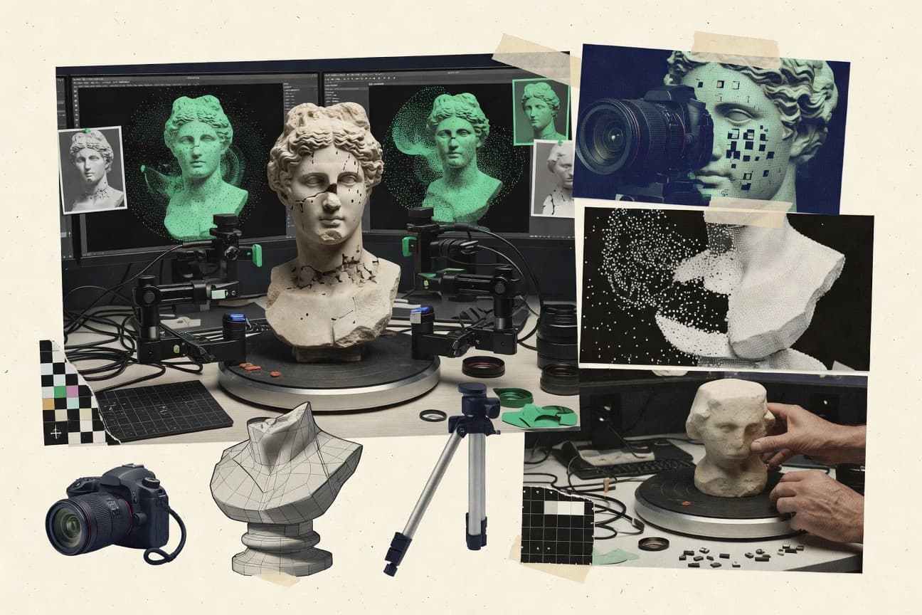
3d photogrammetry software converts overlapping images into 3D geometry through a pipeline that typically includes feature matching, camera calibration, bundle adjustment, and dense reconstruction.
This guide covers OpenDroneMap, PhotoModeler, 3DF Zephyr, Agisoft Metashape, RealityScan, SimActive Correlator3D, Autodesk ReCap Photo, COLMAP, DroneDeploy, and WebODM, focusing on how each tool structures alignment, reconstruction control, and output readiness.
3D Photogrammetry Software for image-to-mesh pipelines and measurement-grade outputs
3d photogrammetry software takes image sets and produces point clouds, meshes, and textures, then applies georeferencing when the workflow includes ground control points and coordinate reference systems.
OpenDroneMap uses container-first execution to keep repeated runs consistent across compute environments, while PhotoModeler centers on control-point driven scaling and accuracy checks tied to adjustment results.
Across the ten tools, the practical differences show up in how alignment and dense reconstruction parameters are exposed, how much automation is available for unattended processing, and how structured outputs fit into downstream CAD or GIS workflows.
What differentiates 3d Photogrammetry Software in real production pipelines
The practical differences show up in how each tool exposes dense reconstruction control, how repeatable the alignment results are across datasets, and how structured the workflow is for batch execution.
These feature points determine whether the same image set settings produce consistent meshes and textures, or whether teams spend time tuning capture overlap and parameters for every run.
Repeatable execution shape for batch jobs
OpenDroneMap uses container-first processing so identical runs behave the same across compute environments, while COLMAP relies on scriptable command-line pipelines for repeatable SfM and dense reconstruction runs. WebODM adds browser-driven structured steps but shifts throughput complexity into worker deployment.
Georeferencing controls and scale management
WebODM is built around ground control point-driven georeferencing that produces scaled, map-ready outputs, while SimActive Correlator3D includes camera calibration and bundle adjustment tools aimed at measurement-oriented workflows. PhotoModeler focuses on control-point driven scaling and accuracy checks tied to adjustment results.
Dense reconstruction parameter depth for consistent outputs
3DF Zephyr exposes detailed alignment and dense reconstruction parameters for standardized reconstructions across similar datasets, while Agisoft Metashape Pro keeps dense reconstruction parameter control within one project for consistent throughput across many datasets. RealityScan emphasizes one-button reconstruction that reduces manual tuning but limits calibration and reconstruction parameter control.
Automation coverage for unattended processing
OpenDroneMap supports batch-style command workflows that better fit high-throughput reconstruction runs, while COLMAP and 3DF Zephyr support deeper tuning that often requires engineering time or parameter discipline. DroneDeploy runs end-to-end hosted processing tied to its project model, so customization of reconstruction parameters is limited compared with developer-centric tools.
Downstream handoff with an established workflow fit
Autodesk ReCap Photo is designed for Autodesk-centric handoff into Revit and Civil 3D style survey and modeling pipelines, while Autodesk ReCap Photo also supports dense reconstruction export for broader toolchains. RealityScan and DroneDeploy focus on quickly producing export-ready meshes for refinement in CAD or DCC tools.
Choose based on workflow control depth versus standardized automation
Start by deciding where control should live: in reproducible execution containers, in per-project parameter settings, or in capture planning that compensates for limited tuning.
Then confirm whether outputs must be measurement-aligned via ground control and scaling steps, or whether the workflow can accept relative accuracy and later scaling in downstream tools.
Decide where repeatability is enforced
Select OpenDroneMap when repeated photogrammetry jobs must run with standardized behavior across compute environments using container-first execution. Select COLMAP when repeatability comes from engineering control of scriptable command-line pipelines for SfM and dense reconstruction.
Pick the level of dense reconstruction parameter exposure
Select 3DF Zephyr when multi-stage alignment and reconstruction parameters must be configured for consistent outputs across similar datasets. Select RealityScan when one-button dense reconstruction is preferred over calibration and reconstruction parameter depth.
Match georeferencing requirements to the tool’s scale workflow
Select WebODM when ground control point-driven georeferencing and map-aligned, scaled deliverables are the primary requirement. Select PhotoModeler when control-point driven scaling and adjustment-result accuracy checks drive measurement-grade outputs.
Choose the capture workflow that fits the tool’s tuning model
Select RealityScan or DroneDeploy when mobile capture and managed processing reduce parameter tuning and prioritize fast mesh generation for visual inspection. Select Metashape or SimActive Correlator3D when teams can manage overlap and tuning to maintain dense reconstruction quality for measurement-grade pipelines.
Confirm how much automation fits unattended processing
Select OpenDroneMap for batch-style command workflow automation that better supports high-throughput reconstruction runs without interactive clicks. Select DroneDeploy when automation must follow the platform’s end-to-end project and processing model rather than raw API-driven control of every stage.
Validate downstream integration expectations from the start
Select Autodesk ReCap Photo when Autodesk modeling and survey pipelines demand an Autodesk-aligned reconstruction workflow for assets and as-builts. Select COLMAP or 3DF Zephyr when outputs can flow into custom engineering pipelines that rely on tuning and scripting rather than a packaged handoff.
Who benefits from each 3d Photogrammetry Software approach
Teams should select based on whether the work centers on standardized batch throughput, measurement-driven control-point scaling, or quick capture-to-mesh generation.
The best fit depends on how often image overlap and calibration need tuning and whether georeferenced, scaled deliverables are required before handing off to CAD or GIS tools.
Operations teams running repeated mapping jobs
OpenDroneMap suits repeated photogrammetry runs that need identical behavior across machines via container-first execution and batch-style command workflows. WebODM can also fit structured browser workflows but pushes throughput into worker and hardware allocation design.
Survey and measurement workflows with control-point scaling
PhotoModeler fits measurement-focused processing that anchors scaling and accuracy checks in adjustment results and control-point workflows. SimActive Correlator3D fits correlation-driven dense matching with camera calibration and bundle adjustment quality control for measurement-oriented outputs.
Teams that must tune dense reconstruction for consistency
3DF Zephyr fits standardized capture setups that require multi-stage alignment and detailed dense reconstruction parameter configuration. Agisoft Metashape fits per-project dense reconstruction parameter control that supports consistent throughput when image overlap and alignment tuning are handled.
Mobile capture teams prioritizing speed and low friction
RealityScan supports mobile-first capture and one-button reconstruction that turns overlapping photos into export-ready meshes quickly. DroneDeploy ties flight planning to hosted processing and deliverable distribution to reduce parameter work during reconstruction.
Autodesk-centric modeling and as-built asset teams
Autodesk ReCap Photo fits Autodesk-aligned reconstruction workflows where handoff to Revit and Civil 3D style pipelines matters. ReCap Photo also provides dense reconstruction output for broader toolchains when the primary requirement is Autodesk reuse.
Common reasons 3d photogrammetry projects fail
Many failures come from misaligning software control depth with capture strategy and from assuming automation will replace dataset tuning.
Other issues come from treating georeferencing and scaling as optional, then discovering errors only after dense meshes and textures are already generated.
Treating one-click reconstruction as a substitute for capture overlap planning
RealityScan and DroneDeploy reduce manual tuning but dense reconstruction quality still drops with weak image overlap, which shows up as unstable alignment and less reliable meshes. Metashape and 3DF Zephyr expose more parameter control, but poor overlap still forces teams to retune and re-run dense reconstruction.
Skipping control-point scaling and relying on relative model size
PhotoModeler and WebODM both center scaling workflows around control points, and skipping those steps creates scale drift that appears after downstream measurement. Tools built for measurement-oriented matching, like SimActive Correlator3D, still require disciplined calibration and bundle adjustment inputs.
Overestimating unattended batch readiness without understanding parameter discipline
OpenDroneMap supports batch-style command workflows, but parameter tuning is required for challenging optics and weak overlap. 3DF Zephyr and COLMAP can be scripted for repeatability, but dense reconstruction requires more tuning than click-through tools.
Assuming georeferencing output quality will match the tool’s best-case workflow
WebODM’s ground control point-driven georeferencing supports scaled, map-aligned deliverables, but serious throughput depends on deploying workers and tuning hardware allocation. Autodesk ReCap Photo provides an Autodesk-centric handoff, but dense reconstruction quality still degrades with weak overlap and can require texture cleanup.
Using browser or hosted pipelines without a throughput model
WebODM browser workflows help structure reconstruction steps, but throughput depends on worker deployment and hardware allocation design. DroneDeploy provides managed drone-to-3D processing, but automation depends on DroneDeploy’s project model and limits reconstruction parameter customization compared with developer-centric tools.
How We Selected and Ranked These Tools
We evaluated OpenDroneMap, PhotoModeler, 3DF Zephyr, Agisoft Metashape, RealityScan, SimActive Correlator3D, Autodesk ReCap Photo, COLMAP, DroneDeploy, and WebODM using feature depth at 40%, ease of running the workflow at 30%, and value at 30%. OpenDroneMap earned the top rank because container-first processing delivers reproducible photogrammetry runs across compute environments and because batch-style command workflow supports high-throughput reconstruction.
We scored how each tool exposes dense reconstruction and alignment controls, how repeatable results are across runs, and how automation works for unattended execution. We also weighted practical pipeline fit by mapping each tool’s workflow shape to common outputs and handoff expectations, including measurement-oriented control-point scaling and georeferenced, scaled deliverables.
Frequently Asked Questions About 3d Photogrammetry Software
How does containerized execution change repeatability in OpenDroneMap compared with PhotoModeler?
Which tools handle measurement-grade scaling using control points and adjustment outputs?
When does multi-stage batch processing in 3DF Zephyr matter for throughput?
What breaks if capture overlap and calibration discipline are weak in RealityScan versus Agisoft Metashape?
How do Georeferencing workflows differ between WebODM and Autodesk ReCap Photo?
Which tool is better suited for scriptable research pipelines using SfM and dense reconstruction from code?
How do admin controls and auditability typically differ in DroneDeploy versus a self-hosted stack like WebODM?
Where does extensibility show up in OpenDroneMap compared with COLMAP?
Which tools align best with GIS deliverables like orthomosaics and elevation surfaces?
Tools reviewed
Primary sources checked during evaluation.
Referenced in the comparison table and product reviews above.
Keep exploring
Comparing two specific tools?
Software Alternatives
See head-to-head software comparisons with feature breakdowns, pricing, and our recommendation for each use case.
Explore software alternatives→In this category
Technology Digital Media alternatives
See side-by-side comparisons of technology digital media tools and pick the right one for your stack.
Compare technology digital media tools→