GITNUXSOFTWARE ADVICE
Technology Digital MediaTop 10 Best 3D Imaging Software of 2026
Find the best 3D imaging software for your projects. Compare top tools, explore features, and choose the ideal option. Start exploring now.

How we ranked these tools
Core product claims cross-referenced against official documentation, changelogs, and independent technical reviews.
Analyzed video reviews and hundreds of written evaluations to capture real-world user experiences with each tool.
AI persona simulations modeled how different user types would experience each tool across common use cases and workflows.
Final rankings reviewed and approved by our editorial team with authority to override AI-generated scores based on domain expertise.
Score: Features 40% · Ease 30% · Value 30%
Gitnux may earn a commission through links on this page — this does not influence rankings. Editorial policy
Editor’s top 3 picks
Three quick recommendations before you dive into the full comparison below — each one leads on a different dimension.
RealityCapture
Image-based Reconstruction with high-speed dense reconstruction and mesh texturing
Built for teams needing high-fidelity photogrammetry for large-scale mapping and modeling.
Pix4Dmapper
Editor pickGCP and RTK-assisted georeferencing for accurate orthomosaics and 3D reconstructions
Built for survey and engineering teams producing georeferenced maps and 3D models at scale.
Agisoft Metashape
Editor pickAgisoft Metashape Professional supports LiDAR-assisted and camera-data photogrammetry in one workflow.
Built for survey teams and imaging specialists producing accurate photogrammetric models.
Related reading
Comparison Table
This comparison table contrasts major 3D imaging and photogrammetry tools, including RealityCapture, Pix4Dmapper, Agisoft Metashape, Autodesk ReCap, Bentley iTwin Capture, and other commonly used options. It maps key differences across core workflows such as image alignment and dense reconstruction, point-cloud and mesh outputs, licensing and collaboration features, and typical hardware requirements so you can match software to your capture pipeline.
RealityCapture
photogrammetryRealityCapture creates highly detailed 3D reconstructions from photos using a fast, automated photogrammetry pipeline.
Image-based Reconstruction with high-speed dense reconstruction and mesh texturing
RealityCapture stands out for fast, accurate photogrammetry results from images, with strong reconstruction performance for both small and very large scenes. It supports dense point cloud and textured mesh generation, and it includes advanced control like camera alignment, component management, and export-ready outputs.
Its workflow also supports ground control and georeferencing so measurements can align to real-world coordinates. The tool’s main drawback is that heavy datasets and higher-quality settings can demand significant GPU and storage resources.
- +Very fast alignment and dense reconstruction on complex image sets
- +Strong photogrammetry-to-mesh and texture pipeline with export-ready outputs
- +Georeferencing and ground control workflows for metric accuracy
- +Efficient handling of large components and scene scaling
- –Resource-intensive quality settings can strain GPUs and storage
- –Advanced settings and troubleshooting require experienced users
- –Workflow complexity increases when managing multiple components
Best for: Teams needing high-fidelity photogrammetry for large-scale mapping and modeling
More related reading
Pix4Dmapper
drone mappingPix4Dmapper generates accurate georeferenced 3D models and orthomosaics from drone and camera imagery.
GCP and RTK-assisted georeferencing for accurate orthomosaics and 3D reconstructions
Pix4Dmapper stands out for turning drone, camera, or mobile capture into photogrammetric outputs using a step-based processing workflow. It produces dense point clouds, textured meshes, and orthomosaics with quality controls for GCPs, RTK metadata, and camera optimization.
The software also supports DSM generation and automated reports so survey teams can review project results consistently. Export options cover common GIS and CAD formats for downstream analysis.
- +Generates dense point clouds, meshes, and textured outputs from photogrammetry workflows
- +Supports GCP and RTK metadata for georeferenced survey-grade results
- +Quality reports help verify processing settings and output reliability
- +Exports orthomosaics, DSMs, and meshes into common GIS and CAD formats
- –Advanced controls and processing steps can feel heavy for small one-off projects
- –Dense reconstruction workloads require strong CPU and ample storage
- –Licensing costs can be high for occasional users and very small teams
Best for: Survey and engineering teams producing georeferenced maps and 3D models at scale
Agisoft Metashape
photogrammetryMetashape performs photogrammetric processing for dense point clouds, meshes, and textured models from images.
Agisoft Metashape Professional supports LiDAR-assisted and camera-data photogrammetry in one workflow.
Agisoft Metashape stands out for turning ordinary image sets into metric 3D models using a production-focused photogrammetry workflow. It supports sparse-to-dense reconstruction, camera calibration, and georeferencing to output textured meshes, point clouds, and orthomosaics.
The software includes automated processing modes plus tools for cleaning data, managing tie points, and optimizing reconstruction quality. Metashape is built for repeatable survey-like results using scripts, batch processing, and export formats that fit downstream GIS and CAD pipelines.
- +Strong dense reconstruction and textured mesh generation from standard photo inputs
- +Georeferencing tools support survey workflows and accurate spatial alignment
- +Batch processing and scripting help automate repetitive multi-project work
- +Robust exports for GIS, CAD, and visualization pipelines
- –Higher computational demands can slow workflows on modest hardware
- –Quality tuning for lighting and image quality takes hands-on experience
- –User interface can feel dense for first-time photogrammetry users
Best for: Survey teams and imaging specialists producing accurate photogrammetric models
Autodesk ReCap
point cloudReCap imports laser scan and reality-capture data to register point clouds and publish usable 3D models.
Scan and photo registration for producing aligned, georeferenced point clouds.
Autodesk ReCap stands out for turning laser scans and photogrammetry captures into clean, usable 3D point clouds that integrate with Autodesk workflows. It supports importing common scan and reality-capture formats, processing them into point clouds, and viewing results with measured navigation and cropping.
ReCap pairs strong alignment and registration workflows with downstream use in Autodesk Revit, AutoCAD, and Civil 3D for documentation and design decisions. Its value is highest when your priority is scan processing and inspection-ready point cloud visualization rather than full-blown mesh production.
- +Converts laser scans and photogrammetry into structured point clouds for downstream design
- +Supports registration workflows for aligning multiple scan stations effectively
- +Includes measurement and sectioning tools for quick inspection of capture accuracy
- –Setup and processing workflows can feel complex for small teams
- –Point-cloud output workflows can lag behind full mesh-centric reality capture tools
- –Best results depend on scan quality and consistent overlap across captures
Best for: Engineering and construction teams processing point clouds for Revit and design review
Bentley iTwin Capture
digital twiniTwin Capture streams and processes reality capture data to accelerate creation and verification of digital twins.
Automated capture-to-iTwin digital twin integration for structured delivery review
Bentley iTwin Capture stands out for converting real-world capture data into Bentley iTwin digital twins with integrated field-to-model workflows. It supports mobile image capture and point cloud processing to produce measurable 3D outputs for asset documentation.
The software emphasizes coordination with iTwin environments so teams can review and share captured results in a structured model space. It is strongest for project teams that want repeatable capture pipelines and traceable deliverables tied to iTwin digital twin use cases.
- +Field-to-iTwin workflow connects capture outputs directly to digital twin models
- +Image and point cloud processing supports practical surveying and documentation deliverables
- +Model-based review improves collaboration around consistent spatial context
- –Workflow is best when paired with Bentley iTwin ecosystems rather than standalone use
- –Capture-to-3D processing setup can feel technical for small teams
- –Value drops when iTwin downstream tooling is not part of the delivery plan
Best for: Project teams creating iTwin-linked 3D documentation from mobile imagery and scans
Trimble RealWorks
laser scanningRealWorks processes terrestrial laser scan data for registration, meshing, and deliverable generation.
Survey-style point cloud cleanup and registration validation for measurement-grade models
Trimble RealWorks stands out for its survey-grade workflow that turns captured point clouds into annotated, measurement-ready 3D models. The software supports point cloud cleanup, meshing, and texture workflows designed around inspection and as-built documentation.
It includes tools for registration validation, feature measurement, and exporting deliverables for downstream CAD and reporting. The toolset is strong for imaging pipelines, but it depends heavily on consistent data capture to achieve reliable alignment and surface quality.
- +Survey-focused point cloud processing with measurement and annotation tools
- +Mesh and surface generation workflows for inspection and documentation
- +Registration and quality validation tools support reliable deliverables
- +Export options support handoff to CAD and reporting pipelines
- –Workflow complexity increases with larger, noisier datasets
- –Usability drops when projects require advanced registration tuning
- –Texture and surface results can vary with capture consistency
- –Licensing and setup can feel heavier than lighter imaging viewers
Best for: Survey and inspection teams turning point clouds into measured 3D deliverables
Meshroom
open-source photogrammetryMeshroom builds 3D reconstructions from images using an open-source node-based workflow and AliceVision photogrammetry.
Node-based AliceVision graph that exposes each photogrammetry stage for re-running and tweaking
Meshroom is distinct for delivering photogrammetry and 3D reconstruction through a node-based workflow that is built around AliceVision. It focuses on turning overlapping photos into dense point clouds, meshes, and textured models using GPU-accelerated stages.
You can reproduce runs by reusing the same graph and parameters, which helps iterative processing. The tool is powerful for offline reconstruction but expects command-line oriented project setup and troubleshooting rather than a guided capture-to-model experience.
- +Node-based graph workflow makes reconstruction steps repeatable and inspectable
- +Dense point cloud, mesh reconstruction, and texture generation are supported
- +Integrates AliceVision photogrammetry stages with strong reconstruction controls
- +Runs with GPU acceleration for several compute-heavy steps
- +Suitable for automation through saved graphs and parameter tuning
- –Setup and parameter tuning require technical comfort
- –Failure modes can be opaque when feature matching or alignment breaks
- –Large datasets need substantial RAM, disk space, and compute time
Best for: Photogrammetry-focused makers needing controllable offline reconstruction workflows
COLMAP
open-source SfMCOLMAP reconstructs 3D scenes from images using structure-from-motion and multi-view stereo pipelines.
Incremental structure from motion with bundle adjustment and camera pose refinement
COLMAP stands out for its photogrammetry focus and tight integration of feature matching, camera estimation, and sparse or dense reconstruction in one workflow. It performs structure from motion with incremental or global strategies and exports camera poses, intrinsics, and reconstructed geometry.
Its dense reconstruction options include multi-view stereo pipelines that generate depth maps and produce textured point clouds or meshes. The project also provides tools for model viewing, format conversion, and processing dataset sequences rather than only producing single static outputs.
- +Strong SfM pipeline with robust camera pose and intrinsic estimation
- +Dense reconstruction produces depth maps and exportable point clouds or meshes
- +Open workflow supports common photogrammetry dataset formats and conversions
- +Runs on local machines without vendor lock-in for intermediate artifacts
- –Command-line driven workflow increases setup effort for new users
- –Dense reconstruction quality depends heavily on image overlap and capture settings
- –Limited built-in guidance for troubleshooting poor reconstructions
- –Requires external tools for some downstream processing and editing
Best for: Researchers and technical teams building photogrammetry pipelines from images
Open3D
point cloud toolkitOpen3D provides tools to read, visualize, and process point clouds for reconstruction and 3D geometry workflows.
Point cloud registration with ICP and global registration primitives
Open3D stands out for being an open-source toolkit that turns 3D geometry processing into a Python-first workflow. It supports reading and writing common point cloud and mesh formats, plus core operations like filtering, registration, and visualization.
Its pipeline covers point-to-mesh conversion, normal estimation, and interactive rendering for inspection and debugging. Open3D also provides sampling and segmentation building blocks that fit research-grade experiments and custom tooling.
- +Open-source Python and C++ libraries for point cloud and mesh processing
- +Built-in registration tools like ICP for aligning scans and models
- +Interactive 3D viewer supports geometry inspection and debugging
- –Workflow requires coding for many common production imaging tasks
- –No integrated project management, labeling, or annotation UI
- –Large pipelines take engineering effort to harden and automate
Best for: Researchers and developers building custom 3D imaging workflows from point clouds
Blender
3D workstationBlender supports photogrammetry and 3D reconstruction add-ons plus powerful mesh editing and rendering for captured geometry.
Cycles render engine with physically based path tracing.
Blender stands out because it combines full 3D modeling, rendering, and animation inside a single free tool with an extensive add-on ecosystem. It supports sculpting, UV unwrapping, rigging, and keyframe animation with Grease Pencil for 2D-in-3D workflows.
Cycles and Eevee provide physically based rendering and real-time viewport rendering for stills and short animations. Its dense feature set and node-based shading can slow early projects without careful learning of Blender’s interface.
- +Free, open-source suite covering modeling, sculpting, rigging, and animation
- +Cycles path-traced rendering plus Eevee real-time rendering for flexible output
- +Grease Pencil enables sketching directly into 3D scenes
- +Node-based materials and procedural workflows support repeatable shading setups
- +Large add-on library expands pipelines for specific modeling and export needs
- –Steep learning curve due to dense controls and node-centric workflows
- –Viewport navigation and performance tuning require active setup on weaker GPUs
- –UI and tool discovery can frustrate users switching from simpler 3D apps
- –Advanced pipeline features often rely on add-ons and scripting knowledge
Best for: Budget-friendly teams needing high-end 3D modeling and rendering workflows
Conclusion
After evaluating 10 technology digital media, RealityCapture stands out as our overall top pick — it scored highest across our combined criteria of features, ease of use, and value, which is why it sits at #1 in the rankings above.
Use the comparison table and detailed reviews above to validate the fit against your own requirements before committing to a tool.
How to Choose the Right 3D Imaging Software
This buyer’s guide covers practical selection criteria across RealityCapture, Pix4Dmapper, Agisoft Metashape, Autodesk ReCap, Bentley iTwin Capture, Trimble RealWorks, Meshroom, COLMAP, Open3D, and Blender. It explains what to prioritize for photogrammetry, laser scan processing, georeferenced mapping outputs, and custom reconstruction pipelines. It also highlights which tools fit repeatable production workflows versus graph-driven or code-driven experimentation.
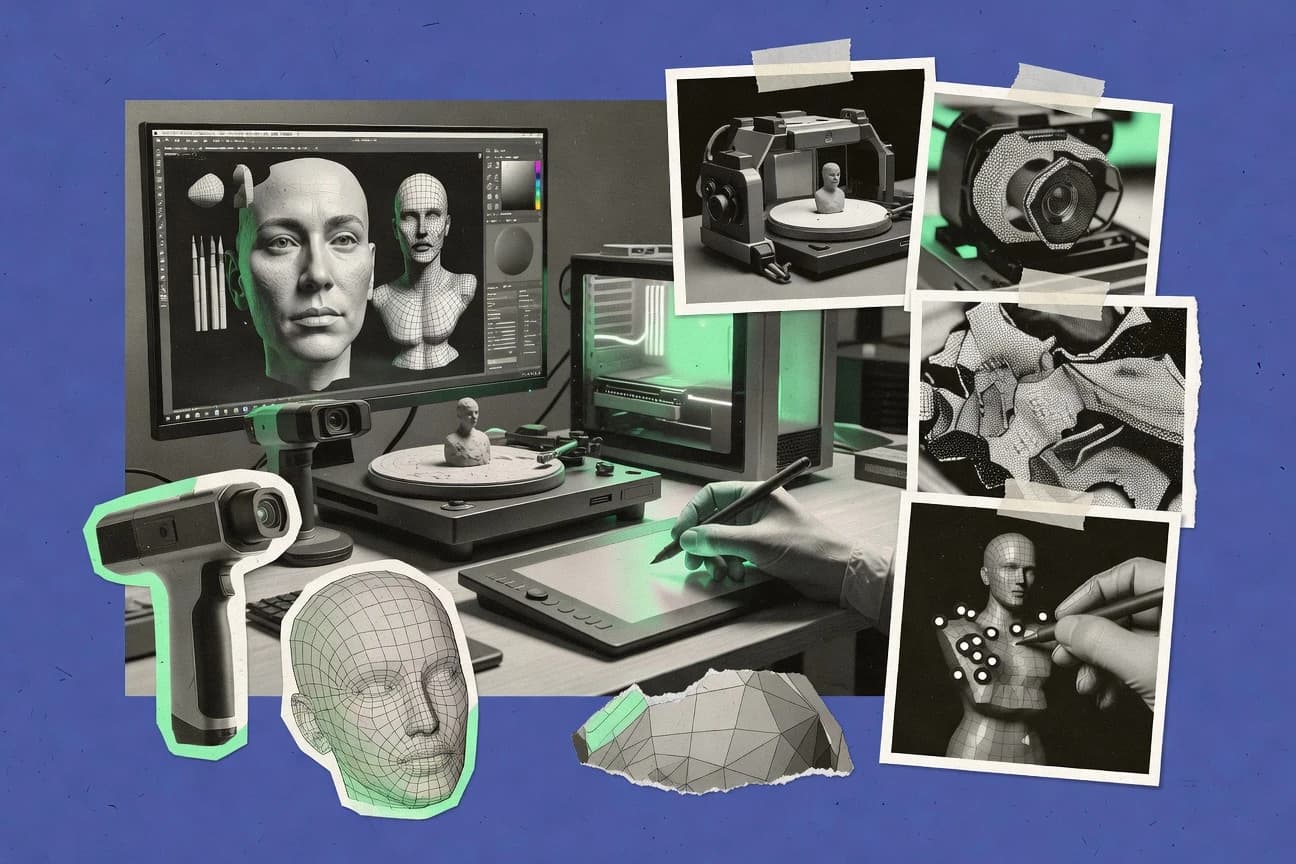
What Is 3D Imaging Software?
3D imaging software turns real-world capture data into 3D outputs like dense point clouds, textured meshes, orthomosaics, DSMs, or measurement-ready models. It solves reconstruction problems such as feature matching, camera or scan registration, dense reconstruction, and export to CAD or GIS pipelines. Teams typically use photogrammetry-focused tools like RealityCapture and Pix4Dmapper to generate metric-aligned models and map products from photos or drone imagery. Engineering and construction teams often use scan-first tools like Autodesk ReCap to produce aligned point clouds that integrate into design workflows.
Key Features to Look For
The right feature set determines whether you get export-ready geometry, survey-grade accuracy, and repeatable processing outcomes without excessive rework.
Image-based dense reconstruction and texturing
RealityCapture delivers high-speed dense reconstruction with an image-based reconstruction pipeline that produces textured mesh outputs suitable for direct downstream use. Meshroom also performs dense reconstruction and texturing, but it exposes each AliceVision stage in a node-based graph that you rerun and tune iteratively.
Georeferencing with GCP and RTK metadata
Pix4Dmapper is built for survey-grade georeferencing using GCP and RTK-assisted metadata so orthomosaics and models align to real-world coordinates. RealityCapture also supports ground control and georeferencing for metric accuracy, which matters when measurements must land in the same coordinate system across projects.
Survey-style automation with reports and consistent outputs
Pix4Dmapper generates automated reports so survey teams can validate processing settings and output reliability. Agisoft Metashape supports batch processing and scripting for repeatable survey-like results across multiple projects, which reduces manual cleanup between runs.
LiDAR-assisted or scan-and-photo hybrid workflows
Agisoft Metashape Professional supports LiDAR-assisted and camera-data photogrammetry in one workflow, which helps when imagery alone cannot deliver sufficient geometry. Autodesk ReCap focuses on scan and photo registration to create structured point clouds that you can use for inspection and design review.
Measurement-grade point cloud cleanup, registration validation, and deliverables
Trimble RealWorks provides survey-style point cloud cleanup, registration validation, and measurement-ready deliverables for as-built and inspection workflows. Autodesk ReCap supports measurement navigation and sectioning for quick inspection of capture accuracy, which helps teams catch misalignment before producing downstream deliverables.
Integration with digital twin ecosystems or downstream design tools
Bentley iTwin Capture connects field capture pipelines to Bentley iTwin digital twin environments for structured model review and traceable deliverables. Autodesk ReCap pairs point cloud registration workflows with Autodesk Revit, AutoCAD, and Civil 3D usage so captured geometry fits documentation and design decisions.
How to Choose the Right 3D Imaging Software
Pick the tool that matches your input type, required output format, and your tolerance for advanced setup versus guided production workflows.
Match the tool to your capture type
Use RealityCapture or Pix4Dmapper when your core inputs are photos or drone imagery and you need dense point clouds, textured meshes, and mesh-ready outputs. Use Autodesk ReCap when your starting point is laser scan data and your goal is clean aligned point clouds that integrate into Revit, AutoCAD, and Civil 3D workflows.
Choose the output products you must deliver
If you must deliver orthomosaics and DSM products with survey-grade georeferencing, Pix4Dmapper fits because it generates orthomosaics, DSMs, and quality reports tied to GCP and RTK workflows. If you need textured mesh reconstruction from images across small and large scenes, RealityCapture focuses on dense reconstruction and mesh texturing with export-ready outputs.
Plan for coordinate accuracy and verification
For projects that require metric alignment, prioritize GCP and RTK-assisted georeferencing in Pix4Dmapper and ground control support in RealityCapture. For point cloud alignment validation and inspection-ready models, Trimble RealWorks and Autodesk ReCap emphasize registration validation and measurement tools.
Select a workflow style you can operate reliably
Choose guided, production-oriented pipelines like Pix4Dmapper and Agisoft Metashape when your team needs repeatable results with batch processing and scripting options. Choose graph or pipeline-driven tools like Meshroom and COLMAP when you want exposed stages such as AliceVision graph reruns or incremental SfM with bundle adjustment and camera pose refinement.
Decide whether you need integrated ecosystem features or custom tooling
Pick Bentley iTwin Capture when your deliverables must link directly into Bentley iTwin digital twin environments for coordinated digital twin review. Pick Open3D when you need a Python-first toolkit for point cloud filtering, ICP registration, mesh conversion, and custom research pipelines without built-in project management.
Who Needs 3D Imaging Software?
3D imaging software supports photogrammetry and scan-to-model production for mapping, engineering documentation, inspection, research, and advanced modeling pipelines.
Mapping and modeling teams that need fast, high-fidelity photogrammetry at scale
RealityCapture fits teams needing image-based reconstruction with high-speed dense reconstruction and textured mesh outputs on complex image sets. RealityCapture’s georeferencing and ground control workflows support metric accuracy for large-scale mapping and modeling.
Survey and engineering teams producing orthomosaics and georeferenced models
Pix4Dmapper fits survey and engineering workflows because it supports GCP and RTK-assisted georeferencing for accurate orthomosaics and dense reconstruction outputs. Pix4Dmapper’s automated reports help teams verify processing settings and output reliability consistently.
Survey teams that require repeatable, batch-based photogrammetry with scripting
Agisoft Metashape fits imaging specialists producing dense point clouds, textured meshes, and orthomosaics with robust exports for GIS and CAD pipelines. Its automation via batch processing and scripting helps imaging teams run multiple projects with consistent reconstruction behavior.
Construction and engineering teams turning scan data into aligned point clouds for design review
Autodesk ReCap fits teams that need scan and photo registration for aligned, georeferenced point clouds. Its measured navigation, cropping, and downstream compatibility with Revit, AutoCAD, and Civil 3D support engineering documentation and design decisions.
Common Mistakes to Avoid
Common failures come from mismatching tool workflow style to the team’s capture reality and from underestimating compute and setup demands for dense reconstruction.
Buying a mesh-first tool when your real deliverable is point-cloud inspection and registration validation
Autodesk ReCap emphasizes scan and photo registration plus measurement and sectioning for inspection-ready point clouds that feed Revit workflows. Trimble RealWorks adds survey-style point cloud cleanup, registration validation, and measurement-grade deliverables for as-built inspection.
Skipping coordinate control even when outputs must align to real-world measurements
Pix4Dmapper’s GCP and RTK-assisted georeferencing is built for accurate orthomosaics and 3D reconstructions aligned to real-world coordinates. RealityCapture’s ground control and georeferencing workflows support metric accuracy when you manage control points across projects.
Choosing a graph or command-line reconstruction stack without time for technical troubleshooting
Meshroom uses a node-based AliceVision graph that expects technical comfort for setup and parameter tuning, and it can fail with opaque alignment problems. COLMAP runs structure-from-motion and multi-view stereo pipelines with an incremental bundle adjustment approach, and the command-line workflow increases setup effort for new users.
Expecting custom pipeline control without engineering time
Open3D provides ICP-based registration, filtering, and point-to-mesh conversion in a Python-first environment, but it lacks integrated project management and labeling UI. Blender can support photogrammetry add-ons and mesh reconstruction plus Cycles path-traced rendering, but its dense modeling and node workflows can slow early capture-to-output projects.
How We Selected and Ranked These Tools
We evaluated each tool by overall capability for 3D reconstruction or scan processing, features that directly map to dense reconstruction outputs and georeferencing needs, ease of use for the dominant workflow style, and value for production execution. We emphasized how well each tool converts inputs into deliverables like dense point clouds, textured meshes, orthomosaics, and measurement-ready models without requiring excessive manual intervention. RealityCapture separated itself through fast alignment and dense reconstruction plus an image-based reconstruction pipeline that produces textured meshes and supports ground control and georeferencing for metric outputs. Tools like Pix4Dmapper stood out for survey workflows through GCP and RTK-assisted georeferencing and automated reports, while Open3D and COLMAP emphasized pipeline control and research-oriented reconstruction building blocks.
Frequently Asked Questions About 3D Imaging Software
Which tool is best when I need fast, high-fidelity photogrammetry from large image sets?
What should I choose if my deliverable is georeferenced orthomosaics and DSMs from drone or RTK data?
Which software supports survey-style, repeatable processing with batch automation and cleanup tools?
I already have laser scans and photos. What tool should I use to align and inspect point clouds for design work?
How do I create a workflow that ends in an iTwin digital twin with traceable capture deliverables?
Which option is best for measurement-grade inspection and as-built documentation from point clouds?
What tool is best if I want a node-based photogrammetry pipeline I can rerun stage by stage?
I’m doing research and want a Python-first toolkit for point cloud processing and registration primitives.
Which tool is the right fit when my priority is 3D modeling and rendering rather than photogrammetry reconstruction?
Tools reviewed
Primary sources checked during evaluation.
Referenced in the comparison table and product reviews above.
Keep exploring
Comparing two specific tools?
Software Alternatives
See head-to-head software comparisons with feature breakdowns, pricing, and our recommendation for each use case.
Explore software alternatives→In this category
Technology Digital Media alternatives
See side-by-side comparisons of technology digital media tools and pick the right one for your stack.
Compare technology digital media tools→FOR SOFTWARE VENDORS
Not on this list? Let’s fix that.
Our best-of pages are how many teams discover and compare tools in this space. If you think your product belongs in this lineup, we’d like to hear from you—we’ll walk you through fit and what an editorial entry looks like.
Apply for a ListingWHAT THIS INCLUDES
Where buyers compare
Readers come to these pages to shortlist software—your product shows up in that moment, not in a random sidebar.
Editorial write-up
We describe your product in our own words and check the facts before anything goes live.
On-page brand presence
You appear in the roundup the same way as other tools we cover: name, positioning, and a clear next step for readers who want to learn more.
Kept up to date
We refresh lists on a regular rhythm so the category page stays useful as products and pricing change.