GITNUXSOFTWARE ADVICE
Real Estate PropertyTop 10 Best Land Management Software of 2026
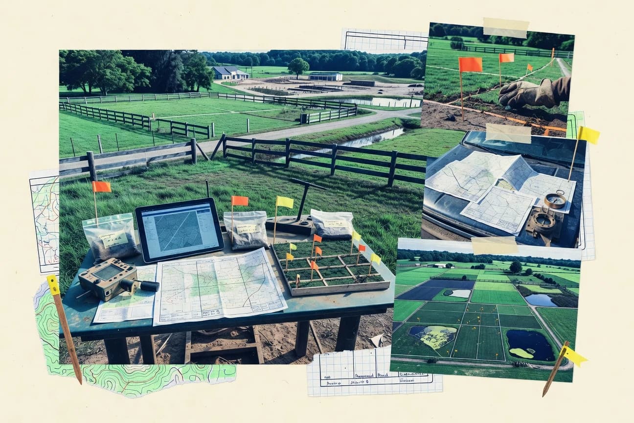
Discover the top 10 best land management software to streamline tasks. Compare features and find the perfect fit – explore now.

How we ranked these tools
Core product claims cross-referenced against official documentation, changelogs, and independent technical reviews.
Analyzed video reviews and hundreds of written evaluations to capture real-world user experiences with each tool.
AI persona simulations modeled how different user types would experience each tool across common use cases and workflows.
Final rankings reviewed and approved by our editorial team with authority to override AI-generated scores based on domain expertise.
Score: Features 40% · Ease 30% · Value 30%
Gitnux may earn a commission through links on this page — this does not influence rankings. Editorial policy
Editor’s top 3 picks
Three quick recommendations before you dive into the full comparison below — each one leads on a different dimension.
Trimble Agriculture
FarmWorks-style field mapping and work documentation linked to Trimble guidance data
Built for farms and agronomy teams standardizing operations with Trimble hardware.
Esri ArcGIS
Editor pickArcGIS Pro with geoprocessing tools for parcel validation and land use analysis
Built for regional land departments standardizing parcel data, field surveys, and reporting workflows.
Autodesk Construction Cloud
Editor pickCommon Data Environment document control for BIM-linked construction deliverables
Built for teams managing land deliverables tied to construction models and document control.
Related reading
Comparison Table
This comparison table benchmarks Land Management software options including Trimble Agriculture, Esri ArcGIS, Autodesk Construction Cloud, LandGate, and Measure. You can compare core capabilities for mapping, surveying and geospatial workflows, field data capture, project collaboration, and delivery for land management tasks. Use the results to match each platform to your specific requirements and decision criteria.
Trimble Agriculture
enterprise agronomyTrimble Agriculture manages field and crop workflows with connected farm data, mapping, and operational tools that support land management planning and tracking.
FarmWorks-style field mapping and work documentation linked to Trimble guidance data
Trimble Agriculture stands out for connecting field operations and farm assets into a single workflow built around Trimble hardware and positioning data. It supports land management tasks like planning work, recording activities, and tracking site-specific prescriptions through field boundaries and map-based views.
The solution emphasizes data interoperability, including export-ready field layers and operational records tied to machinery and guidance outputs. It is strongest for organizations that already use Trimble equipment and want consistent agronomic context across planning and execution.
- +Tight integration with Trimble guidance and farm machinery data
- +Map-driven field management with field boundaries and operational layers
- +Strong workflow support for planning and documenting field activities
- +Interoperable exports and structured records for downstream analysis
- –Best results rely on Trimble-centric hardware and data pipelines
- –Setup and data onboarding can be heavy for multi-farm deployments
- –Advanced agronomic workflows can feel complex for non-technical users
Best for: Farms and agronomy teams standardizing operations with Trimble hardware
More related reading
Esri ArcGIS
GIS platformEsri ArcGIS provides GIS mapping, land parcel workflows, and spatial data management for land management planning, analysis, and reporting.
ArcGIS Pro with geoprocessing tools for parcel validation and land use analysis
ArcGIS stands out for its end-to-end geospatial workflow, combining GIS authoring, field data capture, and web mapping in one suite. It supports land management tasks with parcel and cadastral mapping, spatial analysis, and configurable dashboards for operational oversight. ArcGIS also integrates automated reporting with web apps and location-based services, which helps teams turn surveys and plans into shareable outputs.
- +Strong parcel and cadastral mapping workflows with robust geoprocessing
- +Field data collection options that feed directly into GIS layers
- +Enterprise-grade web mapping and dashboards for land operations visibility
- +Deep integration with Esri analysis tools for compliance-style spatial checks
- –Configuration depth can slow adoption for small land teams
- –Complex permissions and data governance require admin discipline
- –Cost rises quickly with advanced apps, users, and enterprise environments
Best for: Regional land departments standardizing parcel data, field surveys, and reporting workflows
Autodesk Construction Cloud
project GISAutodesk Construction Cloud coordinates land and site deliverables with construction planning, data collaboration, and document management tied to project sites.
Common Data Environment document control for BIM-linked construction deliverables
Autodesk Construction Cloud stands out with tightly integrated construction documentation workflows built around Autodesk data ecosystems. For land management, it supports field-capture to model-linked reporting through connected BIM and project document management.
Core capabilities include issue tracking, submittals, plan reviews, and quality or safety workflows that attach evidence to assets and locations. It is strongest when land parcels and planning deliverables tie directly to construction models and regulated document sets.
- +Issue and document workflows link evidence to project context
- +Strong integration with Autodesk design and construction data
- +Quality and safety processes fit regulated land and permitting work
- –Best results require Autodesk-centered data and model workflows
- –Parcel-centric mapping and GIS analysis are not its primary strength
- –Workflow setup and governance can be heavy for small teams
Best for: Teams managing land deliverables tied to construction models and document control
LandGate
land recordsLandGate supports land and property information services with authoritative data and mapping tools used for land administration and land records workflows.
WA land mapping and search across authoritative Crown land and property records
LandGate is a government land information service focused on WA land records, mapping, and authoritative datasets. It delivers interactive spatial access and search for Crown land and land-related information through map-based discovery. Core capabilities center on property and spatial data viewing, layered mapping, and downloadable data resources for regulated workflows.
- +Strong map-first discovery for WA land information and spatial records
- +Authoritative government datasets support compliance-focused land workflows
- +Clear layering and attribute access for property and parcel context
- –Limited end-to-end case management and workflow automation
- –User interface can feel geared to information retrieval over operations
- –Fewer collaboration tools than commercial land management systems
Best for: Teams needing authoritative WA land data lookup and map-based evidence
Measure
field GISMeasure combines GIS, field data capture, and analytics for land and asset planning workflows used to manage properties and land operations.
Built-in measurement QA with task-linked findings and audit trails
Measure stands out with browser-based precision measurement and QA workflows built around land-related field data capture. It supports drawing or ingesting parcel-related maps, then linking measurements to tasks, findings, and audit trails for review.
The platform is stronger for measurement consistency and collaborative review than for deep ERP-grade land records management. It fits teams that need repeatable takeoffs and verification before approvals.
- +Browser-first measurement workflows reduce setup friction for field and office teams
- +Task and audit trail structure improves review accountability for measured results
- +Consistent measurement process helps standardize outputs across projects
- –Limited native land-records depth compared with dedicated cadastral systems
- –Advanced GIS and survey processing often requires external tools
- –Setup and configuration can be heavier for teams with many map standards
Best for: Teams needing repeatable measurement, QA, and collaborative review for land projects
QGIS
open-source GISQGIS is a desktop GIS platform that enables land parcel mapping, spatial analysis, and geodata management for land management use cases.
Vector layer styling plus rule-based cartography for consistent cadastral map production
QGIS stands out with advanced GIS data handling in a desktop workflow designed for cadastral, parcel, and land inventory mapping. It supports editing and analysis of vector layers, including parcels, boundaries, and attribute-driven land records.
The software integrates with common standards like GeoPackage and spatial data services, and it can automate repeatable tasks through processing models. For land management, its strength is turning surveying and property data into consistent maps, analyses, and deliverables without requiring proprietary GIS licensing.
- +Strong vector editing for parcel boundaries and land attribute maintenance
- +Processing toolbox enables repeatable geoprocessing workflows and batch operations
- +Large plugin ecosystem extends surveying, cadastral, and spatial analysis capabilities
- –Desktop-first design lacks built-in multi-user land registry workflows
- –Complex styling and symbology tuning can slow early adoption for non-GIS teams
- –Web publishing and role-based access require additional setup and configuration
Best for: Land offices needing parcel mapping, analysis, and reporting with GIS depth
OpenLandMap
data platformOpenLandMap provides land cover and related geospatial datasets and tooling that supports land management analysis and decision support.
Map-based land data collection and publishing workflow for parcels and boundaries
OpenLandMap stands out by focusing on land administration data collection and publishing on a map-first interface. It supports geospatial workflows for managing parcels, boundaries, and land-related records with map-based editing and visualization.
The platform emphasizes data sharing for stakeholders through curated map layers and searchable location data. Collaboration and organization features are present but are less robust for highly complex enterprise workflows than dedicated land registry systems.
- +Map-first interface supports parcel and boundary viewing during field work
- +Geospatial data editing supports practical land data updates without heavy tooling
- +Publishing-focused workflows help share land layers with stakeholders
- +Searchable location data improves findability of land records
- –Limited support for formal land registry controls and audit-grade compliance
- –Fewer advanced analytics tools than GIS suites aimed at planning
- –Customization for complex business rules can require workarounds
- –Integration options for enterprise land systems are not as extensive
Best for: Teams collecting, managing, and sharing land parcel data with map-driven workflows
GLAD
satellite monitoringGLAD delivers satellite-based monitoring insights used for land change detection workflows in land management operations.
Deforestation and land-cover change monitoring with priority outputs from satellite signals
GLAD stands out for turning satellite deforestation risk and land-cover change signals into actionable guidance for land management decisions. It focuses on forest and land monitoring workflows that help teams track habitat change, analyze risk, and prioritize field actions. Core capabilities center on geospatial analytics for land cover change, monitoring outputs that can be operationalized in land management programs, and support for collaboration around map-based evidence.
- +Satellite-driven land change monitoring supports evidence-based decisions
- +Map-centric workflows fit land management reviews and audits
- +Risk and prioritization outputs translate analysis into action
- –Geospatial setup and interpretation can slow non-technical teams
- –Limited general land-use operations beyond monitoring and prioritization
- –Collaboration tools may lag behind mapping-focused power users
Best for: Teams monitoring forest and land change to prioritize management actions
SAS Viya
analytics platformSAS Viya enables geospatial analytics and data processing that supports land management reporting and land-use modeling.
SAS Visual Analytics and governed data prep for regulated land reporting
SAS Viya stands out for turning land data into regulated analytics through a governed, enterprise analytics stack. It supports geospatial analysis, forecasting, and risk modeling using SAS data prep, visual analytics, and scalable processing.
Land teams can connect parcel datasets, satellite-derived layers, and operational records to automate reporting and decision support. Strong compliance features support audit trails and controlled access for sensitive land and infrastructure workflows.
- +Geospatial analytics supports parcel and spatial risk modeling
- +Governed analytics adds audit trails and controlled access
- +Strong forecasting and optimization for long-horizon land planning
- –Setup and administration require SAS-skilled resources
- –Licensing and deployment costs can be heavy for small teams
- –Business users may need training to build repeatable workflows
Best for: Enterprises needing governed geospatial analytics and forecasting for land programs
Google Earth Engine
geospatial analyticsGoogle Earth Engine runs large-scale geospatial analysis for land management tasks using satellite imagery, geodata, and change detection workflows.
ImageCollection API for cloud-scale time-series processing and change detection
Google Earth Engine stands out for processing massive satellite and geospatial datasets through cloud-based geospatial computation. It supports land management workflows like land cover classification, change detection, and time-series analysis using ready datasets and custom code.
Users can generate analysis-ready outputs and visualize results in the Earth Engine interface and via exports. Strong automation comes from code-driven workflows, while non-developers may need more guidance to operationalize repeatable reports.
- +Scales analysis across large satellite archives without local compute bottlenecks
- +Powerful change detection and time-series workflows with built-in Earth observation datasets
- +Code-driven reproducibility with exports for maps, rasters, and derived products
- –JavaScript or Python proficiency is required for most advanced land management automation
- –Operational reporting and role-based collaboration are weaker than purpose-built GIS platforms
- –Exports and processing plans can introduce cost complexity for frequent runs
Best for: Teams needing reproducible satellite analytics for land cover change and monitoring
Conclusion
After evaluating 10 real estate property, Trimble Agriculture stands out as our overall top pick — it scored highest across our combined criteria of features, ease of use, and value, which is why it sits at #1 in the rankings above.
Use the comparison table and detailed reviews above to validate the fit against your own requirements before committing to a tool.
How to Choose the Right Land Management Software
This buyer’s guide covers the practical selection of land management software using Trimble Agriculture, Esri ArcGIS, Autodesk Construction Cloud, LandGate, Measure, QGIS, OpenLandMap, GLAD, SAS Viya, and Google Earth Engine. You will use this guide to match tool capabilities like parcel workflows, measurement QA, governed analytics, and satellite monitoring to real land operations. It also grounds pricing expectations across tools that start at $8 per user monthly, plus options with free access like QGIS and LandGate’s core viewing.
What Is Land Management Software?
Land management software helps teams manage spatial and operational land records like parcels, boundaries, field activities, and monitoring evidence. It solves problems like turning maps and measurements into traceable workflows and turning satellite signals into prioritized actions. Teams use it to plan work, capture field or survey data, validate spatial outputs, and produce shareable reports. In practice, Esri ArcGIS uses parcel workflows and configurable dashboards, while QGIS supports parcel mapping and rule-based cartography for consistent cadastral deliverables.
Key Features to Look For
The fastest way to narrow options is to compare your land workflow to the concrete capabilities each tool delivers.
Map-driven field and boundary workflows
Map-driven workflows keep parcel context and field boundaries visible during planning and documentation. Trimble Agriculture manages field and crop workflows using field boundaries and map-based views, while OpenLandMap provides map-first parcel and boundary data collection and publishing.
Parcel and cadastral GIS validation tools
Parcel validation reduces errors in boundaries and land-use analysis before approvals. Esri ArcGIS Pro includes geoprocessing tools for parcel validation and land use analysis, while QGIS supports vector editing for parcel boundaries plus processing models for repeatable geoprocessing.
Measurement QA with task-linked audit trails
Measurement QA gives reviewers evidence tied to the exact task and findings. Measure delivers browser-based precision measurement with task-linked findings and audit trails, which supports collaborative review of measured results.
Interoperable exports for downstream land analysis
Interoperable outputs let land teams move data into other systems for reporting, compliance checks, or modeling. Trimble Agriculture emphasizes export-ready field layers and structured operational records, while Google Earth Engine supports exports of maps, rasters, and derived products from cloud-scale analysis.
Governed geospatial analytics with audit trails and controlled access
Governed analytics supports compliance-style reporting with controlled access to sensitive land and infrastructure information. SAS Viya provides governed data prep with audit trails and controlled access, while Esri ArcGIS adds enterprise-grade web mapping and dashboards that support land operations oversight.
Satellite land change detection with prioritized outputs
Satellite change detection turns large imagery archives into actionable monitoring signals. GLAD delivers deforestation and land-cover change monitoring with risk prioritization outputs, while Google Earth Engine provides time-series change detection using its ImageCollection API and Earth observation datasets.
How to Choose the Right Land Management Software
Pick the tool that matches your highest-cost workflow step, then verify it can handle your data inputs, outputs, and governance requirements.
Start with your workflow anchor
If your land management begins with machinery guidance and field operations, Trimble Agriculture fits because it links farm workflows to connected farm data and guidance outputs. If your anchor is parcel accuracy, Esri ArcGIS and QGIS fit because they support parcel and cadastral workflows using GIS processing, vector editing, and repeatable geoprocessing.
Validate how you capture and verify evidence
If you need measurement consistency with reviewer accountability, Measure provides built-in measurement QA with task-linked findings and audit trails. If your evidence is satellite-driven monitoring and you need prioritized actions, GLAD produces deforestation and land-cover change monitoring outputs, while Google Earth Engine provides scalable change detection and reproducible exports.
Match collaboration and reporting to your operating model
If you run map-centric stakeholder workflows, OpenLandMap emphasizes publishing curated map layers and searchable location data. If you run regulated reporting with controlled access, SAS Viya supports governed analytics and audit trails, while LandGate supports map-based discovery for WA land records and layered attribute access for property context.
Confirm data governance and permissions reality
If your organization needs admin discipline for permissions and data governance, Esri ArcGIS provides enterprise web mapping and dashboards but can require careful configuration. If you deploy enterprise analytics with governed data preparation, SAS Viya provides controlled access and audit trails, while Autodesk Construction Cloud focuses on document control via its Common Data Environment for BIM-linked deliverables.
Plan onboarding around your existing ecosystem
If you already use Trimble guidance and machinery data, Trimble Agriculture reduces onboarding friction through tight integration with those data pipelines. If you do not have proprietary GIS licensing needs, QGIS offers free desktop GIS for parcel mapping and analysis, while Google Earth Engine may require JavaScript or Python proficiency to operationalize advanced automation.
Who Needs Land Management Software?
Land management software fits distinct teams because the strongest tools optimize for different evidence types like field operations, parcel mapping, or satellite monitoring.
Agronomy and farm operations teams standardizing on Trimble hardware
Trimble Agriculture is designed for farms and agronomy teams that want consistent agronomic context across planning and execution. It excels because it links field and crop workflows to connected farm assets and Trimble guidance data using map-driven field management and structured operational records.
Regional land departments and survey teams managing parcel data and compliance reporting
Esri ArcGIS fits regional land departments that need parcel and cadastral mapping plus geoprocessing for land use analysis. QGIS fits land offices that need strong vector editing, rule-based cartography for consistent cadastral outputs, and repeatable processing models without per-user licensing.
Land project teams running measurement, QA, and collaborative review before approvals
Measure is built for teams that need repeatable measurement with QA and audit trails tied to tasks and findings. It supports browser-first workflows that reduce setup friction for both field and office teams.
Forest monitoring and land change programs prioritizing on-the-ground field actions
GLAD is purpose-built for satellite-based deforestation and land-cover change monitoring that outputs risk prioritization for action. Google Earth Engine fits teams that want reproducible, code-driven time-series change detection at cloud scale using its ImageCollection API.
Common Mistakes to Avoid
Common failures come from mismatching tools to the evidence type, onboarding constraints, or governance expectations of the land workflow.
Choosing a general GIS tool for operational evidence capture without audit trails
If you need measurement QA with reviewer accountability, Measure fits because it ties findings to tasks and audit trails. Using QGIS or ArcGIS without a QA workflow can leave review evidence scattered across files instead of being structured around tasks.
Buying a satellite analytics platform for collaboration-heavy land registry workflows
Google Earth Engine is optimized for cloud-scale, code-driven change detection and exports, and it requires JavaScript or Python for most advanced automation. For map-based stakeholder publishing and parcel boundary editing, OpenLandMap or QGIS is a closer match to operational collaboration needs.
Underestimating onboarding when data comes from a different ecosystem than the software expects
Trimble Agriculture performs best when teams already use Trimble hardware and the associated data pipelines for guidance-linked field management. Esri ArcGIS can also feel heavy for smaller land teams because configuration depth and governance require disciplined setup for permissions.
Ignoring governance and permissions until after implementation
SAS Viya supports governed analytics with audit trails and controlled access, which is a strong match for regulated land reporting. Esri ArcGIS provides enterprise dashboards and web mapping, but complex permissions and data governance can slow adoption if admin discipline is missing.
How We Selected and Ranked These Tools
We evaluated Trimble Agriculture, Esri ArcGIS, Autodesk Construction Cloud, LandGate, Measure, QGIS, OpenLandMap, GLAD, SAS Viya, and Google Earth Engine across overall capability, features depth, ease of use, and value. We prioritized whether each tool could support land operations with concrete workflow building blocks like parcel validation, task-linked audit trails, field boundary documentation, governed access, or satellite change detection outputs. Trimble Agriculture separated itself because it combines map-driven field management with operational records linked to Trimble guidance data, which directly connects planning and execution for field-centric land programs. We ranked lower tools when their core strengths were narrower, like Google Earth Engine’s heavier reliance on code for advanced automation or LandGate’s focus on WA land information retrieval rather than end-to-end case management.
Frequently Asked Questions About Land Management Software
Which land management software is best when my team already uses Trimble guidance and field hardware?
ArcGIS and QGIS both handle GIS mapping. What should I choose for parcel and cadastral workflows?
I need evidence-linked land deliverables tied to construction documentation. Which tool fits?
What tool should we use to access authoritative land records for WA Crown land mapping?
Which software is best for repeatable measurement, QA, and audit trails during land takeoffs?
Do I get a free option to start parcel data collection and sharing?
How do pricing models differ across the top options for per-user versus usage-based costs?
We need satellite-based deforestation risk and land-cover change guidance, not just mapping. What should we use?
Which tool helps with governed, regulated analytics and forecasting across parcel and satellite layers?
Tools reviewed
Primary sources checked during evaluation.
Referenced in the comparison table and product reviews above.
Keep exploring
Comparing two specific tools?
Software Alternatives
See head-to-head software comparisons with feature breakdowns, pricing, and our recommendation for each use case.
Explore software alternatives→In this category
Real Estate Property alternatives
See side-by-side comparisons of real estate property tools and pick the right one for your stack.
Compare real estate property tools→FOR SOFTWARE VENDORS
Not on this list? Let’s fix that.
Our best-of pages are how many teams discover and compare tools in this space. If you think your product belongs in this lineup, we’d like to hear from you—we’ll walk you through fit and what an editorial entry looks like.
Apply for a ListingWHAT THIS INCLUDES
Where buyers compare
Readers come to these pages to shortlist software—your product shows up in that moment, not in a random sidebar.
Editorial write-up
We describe your product in our own words and check the facts before anything goes live.
On-page brand presence
You appear in the roundup the same way as other tools we cover: name, positioning, and a clear next step for readers who want to learn more.
Kept up to date
We refresh lists on a regular rhythm so the category page stays useful as products and pricing change.