GITNUXSOFTWARE ADVICE
Real Estate PropertyTop 10 Best Land Valuation Software of 2026
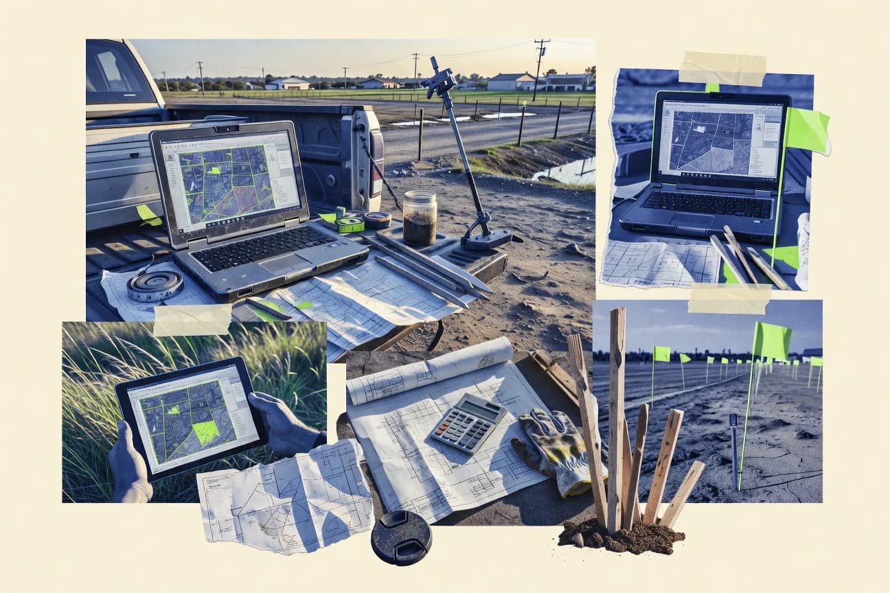
Discover the top 10 best land valuation software to streamline property assessments. Compare features & find the perfect tool today.

How we ranked these tools
Core product claims cross-referenced against official documentation, changelogs, and independent technical reviews.
Analyzed video reviews and hundreds of written evaluations to capture real-world user experiences with each tool.
AI persona simulations modeled how different user types would experience each tool across common use cases and workflows.
Final rankings reviewed and approved by our editorial team with authority to override AI-generated scores based on domain expertise.
Score: Features 40% · Ease 30% · Value 30%
Gitnux may earn a commission through links on this page — this does not influence rankings. Editorial policy
Editor’s top 3 picks
Three quick recommendations before you dive into the full comparison below — each one leads on a different dimension.
Qlik Sense
Associative data indexing with guided data exploration using Qlik selections and search
Built for valuation teams needing interactive, explainable analytics across parcel and sales data.
Tableau
Editor pickDashboard drill-through with parameterized filters for assumption-driven valuation comparisons
Built for land valuation teams needing interactive dashboards for exploratory analysis and reporting.
Microsoft Power BI
Editor pickDAX measures with what-if parameters for scenario land valuation modeling
Built for teams producing land value dashboards from existing valuation spreadsheets.
Related reading
Comparison Table
This comparison table evaluates land valuation tools alongside business intelligence and geospatial platforms such as Qlik Sense, Tableau, Microsoft Power BI, ArcGIS, and Carto. It summarizes how each option handles property data ingestion, valuation modeling workflows, mapping and spatial analysis, and report or dashboard output so buyers can match software capabilities to assessment requirements.
Qlik Sense
analyticsCreates land valuation dashboards by combining appraisal datasets, comparable-sale extracts, and geographic layers into interactive analytics.
Associative data indexing with guided data exploration using Qlik selections and search
Qlik Sense stands out for in-memory associative analytics that link valuation inputs across maps, property attributes, and regulatory fields without rigid spreadsheet chains. It supports interactive dashboards, ad hoc exploration, and governed story-driven reporting for land valuation workflows.
Strong integration paths connect external land, zoning, sales, and cost datasets into a single analytic model. The main limitation for valuation teams is that Qlik Sense does not provide turnkey land valuation calculation templates, so modeling and validation work still require custom design.
- +Associative model ties sales, zoning, and risk fields into one traceable exploration space
- +Interactive dashboards support scenario filtering for parcel-level valuation comparisons
- +Automations and APIs can operationalize valuation reporting across datasets
- –No built-in land valuation engine or standard appraisal calculation templates
- –Data modeling work increases effort for complex appraisal methodologies
- –Governance and performance tuning require disciplined app design
Best for: Valuation teams needing interactive, explainable analytics across parcel and sales data
More related reading
Tableau
data visualizationBuilds valuation models and map-based property comparisons with drag-and-drop dashboards and calculated measures for land assessment workflows.
Dashboard drill-through with parameterized filters for assumption-driven valuation comparisons
Tableau stands out for turning valuation inputs into interactive, shareable visual analysis that supports faster review cycles. Core strengths include drag-and-drop dashboards, powerful filtering and drill-down, and strong support for calculated fields used to model assumptions like valuation factors.
It integrates with geospatial data sources and can blend tables for combining parcels, zoning, comps, and market indicators. For land valuation workflows, it excels at exploratory analysis and stakeholder reporting rather than acting as a dedicated valuation engine.
- +Interactive dashboards enable parcel-level drill-down and instant scenario filtering
- +Calculated fields support repeatable valuation logic and assumption tracking
- +Data blending helps combine parcels, comps, zoning, and market datasets quickly
- +Strong visual storytelling supports easy stakeholder reviews and approvals
- +Geospatial mapping features support location-based valuation views
- –Not a dedicated land valuation system with appraisal workflow controls
- –Performance can degrade with large parcel datasets and complex calculated fields
- –Governance for valuation formulas requires disciplined design and documentation
- –Versioning and audit trails for valuation outputs are less purpose-built than appraisal tools
Best for: Land valuation teams needing interactive dashboards for exploratory analysis and reporting
Microsoft Power BI
business intelligenceTransforms land sales and assessment records into valuation dashboards with geospatial visuals and automated data refresh for appraisal teams.
DAX measures with what-if parameters for scenario land valuation modeling
Microsoft Power BI stands out for turning valuation math into interactive dashboards with drill-through and cross-filtering. It supports importing and modeling property, zoning, sales comps, and appraisal outputs, then visualizing land values by site, parcel, and time.
Power Query handles ETL for cleansing and transforming assessment spreadsheets, while DAX enables custom valuation logic and scenario measures. Shared reports work through Power BI Service with row-level security to separate stakeholder views.
- +Interactive dashboards with drill-through for parcel-level land value analysis
- +DAX supports custom valuation measures and scenario comparisons
- +Power Query streamlines ETL for comp and parcel datasets
- +Row-level security enables stakeholder-specific viewing
- +Strong integration with Excel and SQL data sources
- –No purpose-built land valuation workflows or appraisal report templates
- –Complex DAX and data modeling increase effort for advanced valuation rules
- –Geospatial analysis is limited compared with dedicated GIS appraisal tools
Best for: Teams producing land value dashboards from existing valuation spreadsheets
ArcGIS
GIS valuationSupports land valuation using GIS layers, spatial analysis, and mapping to assess comparable sales and value zones.
ArcGIS ModelBuilder for building repeatable valuation workflows across spatial datasets
ArcGIS stands out for combining GIS data management with geospatial analysis tools that support market, location, and zoning driven valuation workflows. It enables polygon and raster overlays, spatial statistics, and model building that can incorporate appraisal inputs like comparable sales and land characteristics. For land valuation, it is strongest when valuation logic needs to be visualized on maps and linked to authoritative datasets such as parcels and cadastral boundaries.
- +Parcel and boundary visualization with tight GIS data-to-map linkage
- +Spatial analysis tools support overlays, buffering, and neighborhood effects
- +Model building and scripting support repeatable valuation workflows
- –Valuation logic often requires GIS experience and configuration effort
- –Building clean comparable-sale datasets can be time intensive
- –Performance and usability can drop with very large parcel layers
Best for: Teams needing parcel-based valuation modeling with strong GIS analysis and mapping
Carto
web GISDelivers web mapping and location-based analytics for land value modeling with geocoding, spatial queries, and visualization.
Spatial joins and interactive map visualizations for connecting parcel data to valuation drivers
Carto stands out with strong geospatial data handling and map-driven analytics built for location-based workflows. It supports loading spatial datasets, joining attributes, and publishing interactive maps that can visualize land parcels and valuation-related indicators. For land valuation use cases, it can power spatial joins, proximity and buffer analysis, and dashboard-style exploration of market factors across regions.
- +Spatial data ingestion and styling for parcel and neighborhood visual analysis
- +Attribute joins and map-based filtering for linking valuations to parcel features
- +Interactive dashboards that help validate spatial patterns in valuation inputs
- –Valuation modeling still requires external logic since it lacks built-in appraisal engines
- –Geospatial setup can take time when data quality and coordinate systems vary
- –Complex valuation workflows may require custom integration beyond map configuration
Best for: Teams needing parcel visualization and spatial analytics for valuation workflows
GeoServer
open GISPublishes land valuation geospatial layers as OGC services so property assessment data can be queried and styled in appraisal GIS tools.
OGC WFS feature publishing for queryable parcel attributes in valuation applications
GeoServer stands out as a standards-first geospatial server that publishes data as Web Map Service and Web Feature Service for valuation workflows. It supports WMS, WFS, and Web Coverage Service so land parcels, cadastral layers, and derived metrics can be visualized and queried consistently.
Land valuation teams can integrate attribute-heavy parcel datasets and use styling and filtering to drive mapping views. The core value comes from interoperability across GIS clients and custom applications rather than built-in appraisal calculations.
- +Publishes land and cadastral data via WMS and WFS for client interoperability
- +Supports attribute queries with WFS for parcel-level inspection
- +Uses SLD styling for consistent cartography across valuation maps
- +Integrates with PostGIS for spatial queries and geometry handling
- +Enables custom geospatial endpoints for valuation tool integration
- –No built-in land valuation calculations like appraisal models or scoring
- –Admin setup and data publishing often require technical GIS and server skills
- –Styling and layer logic can become complex at scale
- –Performance tuning depends on database indexes and server configuration
- –Workflow automation is limited without external services or custom apps
Best for: Teams publishing parcel GIS layers for valuation dashboards and analyst queries
GeoNetwork
data catalogOrganizes and discovers property and land valuation datasets via metadata catalogs and facilitates standardized sharing across valuation teams.
Geospatial metadata cataloging with CSW-based discovery across distributed data sources
GeoNetwork stands out for its geospatial catalog focus, with metadata-driven discovery of spatial datasets that support land valuation workflows. It provides search, harvest, and sharing for maps and geodata via standard interfaces like CSW, WMS, and WFS, which helps teams assemble valuation inputs.
The software is strong for governance and reuse of geospatial layers used in property assessment. It offers limited built-in valuation modeling, so valuation calculations typically require external tools and custom integration.
- +Strong geospatial metadata management for consistent valuation datasets
- +Standards-based discovery and serving through CSW, WMS, and WFS
- +Dataset harvesting and federation support multi-source land information pipelines
- +Flexible categories and schemas help align valuation layers with local standards
- –No native land valuation calculators for appraisal scoring and outputs
- –Metadata schema configuration requires administrative effort and GIS knowledge
- –Workflow automation for valuation processes is limited without external tooling
- –Large catalogs can feel heavy without careful indexing and governance
Best for: Teams standardizing land datasets and metadata for valuation workflows
PostgreSQL
databaseRuns valuation data storage and modeling with SQL and PostGIS extensions for property attributes, comparable-sale tables, and calculation logic.
PostGIS spatial functions for parcel geometry operations and comp proximity calculations
PostgreSQL stands out by providing a mature relational database engine with advanced query features, not by being purpose-built for land valuation workflows. It can support land valuation software through robust schemas for parcels, zoning, sales comps, and appraisal calculations stored and queried in SQL.
Strong indexing, transactions, and extensible data types help teams build auditable valuation datasets and repeatable calculation views. The tradeoff is that valuation modeling, UI, integrations, and reporting still require building around PostgreSQL.
- +Powerful SQL supports repeatable valuation queries across parcel datasets
- +Spatial extensions enable geometry storage and distance-based comp analysis
- +Transactions and constraints support audit-ready, consistent appraisal data
- –No built-in valuation forms, workflows, or reports for appraisers
- –Schema and calculation design require engineering for correct appraisal logic
- –Operational tuning and maintenance can add complexity for small teams
Best for: Engineering-led valuation systems needing a reliable relational database and spatial querying
PostGIS
spatial databaseAdds spatial types and functions to valuation databases so land parcels and comparable points can be analyzed by distance, adjacency, and buffers.
ST_Intersects and spatial indexing for fast parcel overlay and proximity queries
PostGIS stands out as a spatial database extension that adds full geospatial processing inside PostgreSQL. It supports geometry storage, indexing, and spatial query functions needed for boundary-based valuation inputs and site comparisons.
It also provides robust tools for buffering, intersections, distance calculations, and network or catchment style spatial analysis. As a result, it can power land valuation workflows that depend on parcel geometries and spatial eligibility rules.
- +Native parcel geometry storage with strong support for spatial datatypes
- +Spatial indexes accelerate distance and intersection queries at scale
- +SQL functions enable buffering, overlay analysis, and proximity scoring
- +Works with PostgreSQL tooling for automation and repeatable valuation logic
- +Supports coordinate system handling for consistent area and distance calculations
- –Valuation-specific workflows require custom SQL, views, and application logic
- –Complex geoprocessing often needs developer support for schema design
- –Geocoding and survey data cleaning are not built in as valuation tools
- –Data governance and performance tuning demand database administration skills
Best for: Teams needing parcel GIS analytics and valuation rules in a spatial database
OpenStreetMap Nominatim
geocodingGeocodes parcel addresses and comparable-sale locations to support consistent land valuation matching to geographic coordinates.
Reverse geocoding that returns address components and administrative context as JSON
OpenStreetMap Nominatim is distinct because it performs geocoding and reverse geocoding using OpenStreetMap data rather than serving a valuation-specific workflow. It supports place search, address lookup, and coordinate-to-address translation with structured JSON responses that can feed valuation models.
For land valuation, it helps standardize parcel-related inputs like addresses, admin boundaries, and nearby places when combined with separate valuation logic. It does not provide appraisal templates, comp set management, or calculation engines by itself.
- +Strong geocoding and reverse geocoding with structured JSON output
- +Search supports multiple place types and administrative hierarchies
- +Works well as a data enrichment layer for external valuation systems
- +No proprietary format required because inputs use coordinates and addresses
- –Does not include land valuation calculations, comps, or report generation
- –Geocoding quality varies by region coverage and address accuracy
- –Rate limits and batch handling require extra engineering for scale
- –Limited support for parcel-level identifiers needed for many valuations
Best for: Teams enriching land records with geocodes before running valuations elsewhere
Conclusion
After evaluating 10 real estate property, Qlik Sense stands out as our overall top pick — it scored highest across our combined criteria of features, ease of use, and value, which is why it sits at #1 in the rankings above.
Use the comparison table and detailed reviews above to validate the fit against your own requirements before committing to a tool.
How to Choose the Right Land Valuation Software
This buyer’s guide explains how to evaluate Land Valuation Software tools built for parcel analysis, comparable-sale workflows, and map-driven decisioning. It covers Qlik Sense, Tableau, Microsoft Power BI, ArcGIS, Carto, GeoServer, GeoNetwork, PostgreSQL, PostGIS, and OpenStreetMap Nominatim based on the capabilities each tool supports for land valuation use cases.
What Is Land Valuation Software?
Land valuation software supports turning parcel and comparable-sale inputs into explainable valuation outputs and stakeholder-ready reporting. Many solutions emphasize analytics and mapping instead of providing appraisal math out of the box, which forces teams to design calculation logic and workflows. Tools like Tableau and Microsoft Power BI focus on interactive dashboards and scenario filtering using calculated fields and DAX measures. GIS-centric options like ArcGIS and PostGIS focus on geometry, overlays, and spatial analysis to make valuation drivers visible on maps.
Key Features to Look For
The right mix of features determines whether land valuation work stays traceable and repeatable or turns into disconnected spreadsheet steps across parcels, comps, and zoning.
Associative parcel-to-data linking for explainable exploration
Qlik Sense ties valuation inputs like sales, zoning, and risk fields into one associative exploration space using Qlik selections and guided data exploration. This design supports traceable comparisons across parcel attributes without rigid spreadsheet chains.
Dashboard drill-through and parameterized scenario filters
Tableau enables dashboard drill-through with parameterized filters so assumption-driven comparisons can be reviewed parcel by parcel. This supports faster review cycles when valuation factors change across scenarios.
Custom valuation logic with what-if measures
Microsoft Power BI uses DAX measures with what-if parameters to model scenario land valuation logic. Teams can connect imported appraisal outputs to interactive scenario reporting without building a separate valuation UI.
GIS model building for repeatable spatial valuation workflows
ArcGIS provides ArcGIS ModelBuilder to build repeatable valuation workflows across spatial datasets. This helps when overlays, buffering, and neighborhood effects must run consistently for comparable sales and value zones.
Spatial joins and interactive map visualizations
Carto supports spatial joins and map-based attribute linking so parcel features can be connected to valuation drivers and market indicators. This supports validation of spatial patterns through interactive dashboards tied to parcel geometry.
Queryable geospatial publishing and standards-based interoperability
GeoServer publishes parcel layers through OGC WMS and WFS so valuation clients can query parcel attributes at feature level using WFS. GeoNetwork complements this by providing metadata cataloging and CSW-based discovery to assemble consistent valuation datasets across teams.
How to Choose the Right Land Valuation Software
A practical way to choose is to map the required valuation tasks to the tools that cover that step with built-in linking, spatial processing, or interactive scenario reporting.
Start with the valuation workflow stage that needs the most control
If the workflow depends on exploring how comps, zoning, and risk fields relate to each other across parcels, Qlik Sense supports associative data indexing and guided exploration with Qlik selections and search. If the workflow depends on stakeholder review of assumptions and rapid scenario comparisons, Tableau supports dashboard drill-through with parameterized filters for assumption-driven comparisons.
Decide where valuation math will live
Microsoft Power BI places valuation logic in DAX measures and uses what-if parameters for scenario modeling, which suits teams producing outputs from existing spreadsheets. For engineering-led approaches, PostgreSQL provides a relational foundation for storing parcels, zoning, comparable-sales tables, and calculation views, while PostGIS adds geometry operations that can be embedded in SQL.
Validate spatial requirements and map-to-parcel traceability
If overlays, buffering, and neighborhood effects must be built as repeatable workflows, ArcGIS ModelBuilder supports repeatable spatial valuation workflows across spatial datasets. If the team needs geometry-aware valuation rules inside a database, PostGIS supports parcel buffers, intersections, and proximity operations with spatial indexes.
Confirm interoperability and dataset reuse needs
If parcel layers must be served to other applications through standard OGC endpoints, GeoServer publishes queryable parcel attributes using WFS and provides consistent map styling with SLD. If dataset discovery and governance across multiple sources is the biggest issue, GeoNetwork organizes geospatial metadata and supports CSW-based discovery so valuation inputs stay consistent.
Use geocoding only to enrich inputs, not to replace valuation logic
OpenStreetMap Nominatim provides geocoding and reverse geocoding that returns address components and administrative context in structured JSON, which supports consistent matching of parcel-related locations. For actual land valuation modeling, Nominatim works best as an enrichment layer feeding into tools like Tableau, Power BI, ArcGIS, or PostgreSQL.
Who Needs Land Valuation Software?
Different teams need land valuation software for different bottlenecks like interactive scenario review, spatial modeling, dataset governance, or database-backed calculation logic.
Valuation teams needing interactive, explainable analytics across parcel and sales data
Qlik Sense is built for associative analytics that link valuation inputs across maps, property attributes, and regulatory fields. Tableau and Microsoft Power BI also support interactive dashboards, but Qlik Sense is the stronger fit when the goal is guided exploration tied to a single associative model.
Land valuation teams that must review assumptions and compare scenarios quickly
Tableau supports dashboard drill-through with parameterized filters, which makes assumption changes easy to inspect at parcel level. Microsoft Power BI complements this by using DAX measures with what-if parameters for scenario land valuation modeling.
Teams that rely on parcel geometry, overlays, and spatial eligibility rules
ArcGIS offers ArcGIS ModelBuilder for repeatable spatial valuation workflows, which suits map-centric valuation logic. PostGIS supports geometry storage and spatial functions like ST_Intersects with spatial indexing, which suits rule-driven valuation pipelines embedded in database logic.
Teams building valuation platforms that need standards-based geospatial publishing and governed dataset discovery
GeoServer publishes parcel and cadastral layers as WMS and WFS so valuation dashboards and analyst tools can query parcel attributes. GeoNetwork supports geospatial metadata cataloging and CSW-based discovery so valuation datasets can be reused consistently across distributed sources.
Common Mistakes to Avoid
Common pitfalls come from expecting appraisal engines where tools are primarily dashboards, mapping, cataloging, or databases.
Assuming a visualization tool includes a turnkey appraisal engine
Tableau and Microsoft Power BI excel at interactive reporting and scenario logic but they do not provide purpose-built land valuation workflows or appraisal report templates. Qlik Sense also lacks built-in land valuation calculation templates, so valuation teams must design modeling and validation work in the chosen environment.
Underestimating the work needed to build clean comparable-sale datasets
ArcGIS can require time to build clean comparable-sale datasets before valuation overlays and zoning effects can be applied. Carto also needs external logic for valuation modeling, so poorly structured comps slow the whole pipeline.
Treating geocoding as a substitute for parcel identifiers and valuation rules
OpenStreetMap Nominatim provides geocoding and reverse geocoding, but it does not include comps management, valuation calculations, or report generation. Nominatim is best used to enrich inputs that will be matched and modeled elsewhere in Tableau, Power BI, ArcGIS, or PostgreSQL.
Skipping governance and design discipline for valuation formulas
Qlik Sense requires disciplined app design for governance and performance tuning when the associative model grows complex. Tableau and Power BI require disciplined documentation of calculated fields and DAX measures so valuation formulas remain consistent across reviews.
How We Selected and Ranked These Tools
we evaluated every tool on three sub-dimensions with fixed weights. Features received a weight of 0.40, ease of use received a weight of 0.30, and value received a weight of 0.30. The overall rating is the weighted average of those three values using overall = 0.40 × features + 0.30 × ease of use + 0.30 × value. Qlik Sense separated itself from lower-ranked tools by combining strong features with interactive explainable exploration through associative data indexing and guided data exploration using Qlik selections and search.
Frequently Asked Questions About Land Valuation Software
Which tool best supports interactive valuation analysis across parcel, zoning, and sales inputs?
Which option is strongest for scenario modeling and assumption-driven land value comparisons?
What software is best when parcel boundaries must drive valuation rules on maps?
Which tool should be used to publish queryable parcel layers for valuation dashboards and analyst tools?
Which platform fits geospatial analytics for proximity, buffers, and market-factor exploration?
How do teams connect valuation outputs to a governed reporting workflow for stakeholders?
Which stack works best for building an auditable valuation dataset backed by transactions and strong querying?
Which tool helps assemble valuation inputs by standardizing discovery and reuse of spatial datasets?
What common problem occurs when teams expect a GIS server to compute land values automatically?
How should teams start if the first bottleneck is geocoding and aligning parcel-related inputs?
Tools reviewed
Primary sources checked during evaluation.
Referenced in the comparison table and product reviews above.
Keep exploring
Comparing two specific tools?
Software Alternatives
See head-to-head software comparisons with feature breakdowns, pricing, and our recommendation for each use case.
Explore software alternatives→In this category
Real Estate Property alternatives
See side-by-side comparisons of real estate property tools and pick the right one for your stack.
Compare real estate property tools→FOR SOFTWARE VENDORS
Not on this list? Let’s fix that.
Our best-of pages are how many teams discover and compare tools in this space. If you think your product belongs in this lineup, we’d like to hear from you—we’ll walk you through fit and what an editorial entry looks like.
Apply for a ListingWHAT THIS INCLUDES
Where buyers compare
Readers come to these pages to shortlist software—your product shows up in that moment, not in a random sidebar.
Editorial write-up
We describe your product in our own words and check the facts before anything goes live.
On-page brand presence
You appear in the roundup the same way as other tools we cover: name, positioning, and a clear next step for readers who want to learn more.
Kept up to date
We refresh lists on a regular rhythm so the category page stays useful as products and pricing change.