GITNUXSOFTWARE ADVICE
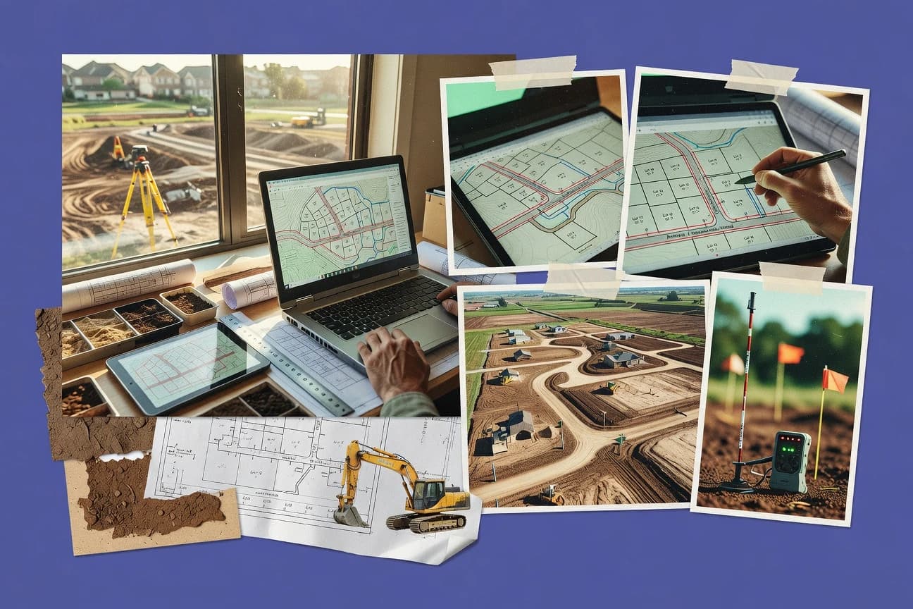
Real Estate PropertyTop 10 Best Land Developer Software of 2026
Discover top land developer software to streamline projects.

How we ranked these tools
Core product claims cross-referenced against official documentation, changelogs, and independent technical reviews.
Analyzed video reviews and hundreds of written evaluations to capture real-world user experiences with each tool.
AI persona simulations modeled how different user types would experience each tool across common use cases and workflows.
Final rankings reviewed and approved by our editorial team with authority to override AI-generated scores based on domain expertise.
Score: Features 40% · Ease 30% · Value 30%
Gitnux may earn a commission through links on this page — this does not influence rankings. Editorial policy
Editor’s top 3 picks
Three quick recommendations before you dive into the full comparison below — each one leads on a different dimension.
BuildTools
Deliverable-based workflow automation that links plan checks and submissions to project tasks
Built for land development teams standardizing permits, deliverables, and project workflow tracking.
PlanHub
Editor pickRevision-aware plan-set review that ties marks and issues to specific updates
Built for land development teams managing multi-round plan reviews and revisions at scale.
Projectmates
Editor pickIntegrated punch and issue tracking linked to project workflows and documentation
Built for land developers managing site tasks, punch items, and document workflows.
Related reading
Comparison Table
This comparison table stacks land developer software options side by side, including BuildTools, PlanHub, Projectmates, Autodesk Construction Cloud, and Autodesk BIM 360. It highlights the key capabilities each platform provides for managing land development workflows, coordinating projects, and tracking work from planning through delivery.
BuildTools
project managementBuildTools manages land development and capital project workflows with scheduling, task tracking, budget management, and document control.
Deliverable-based workflow automation that links plan checks and submissions to project tasks
BuildTools focuses on automating land development workflows with configurable rules and document-centric project control. The tool connects task execution, plan checks, and deliverable tracking to keep projects aligned from intake through submission.
It supports repeatable processes using templates and standardized checklists so teams can run similar projects consistently. Reporting consolidates project status and compliance progress across multiple workstreams.
- +Workflow automation maps land development steps into configurable project flows
- +Template-driven deliverables reduce variation across recurring project types
- +Status and compliance reporting consolidates progress for multiple workstreams
- +Tasking ties documentation and plan checks to explicit project deliverables
- –Setup requires careful configuration to match local permitting and review steps
- –Advanced customization can feel slower than straightforward checklist tools
- –Collaboration features may not fully replace dedicated document management systems
Best for: Land development teams standardizing permits, deliverables, and project workflow tracking
More related reading
PlanHub
permitting workflowsPlanHub coordinates plan review, property deliverables, and approvals using a centralized intake, workflow, and collaboration workspace.
Revision-aware plan-set review that ties marks and issues to specific updates
PlanHub stands out with a plan-set intelligence workflow that organizes approvals and changes around drawing and package data. Core capabilities include document management for subdivision and land development plan sets, markup and review coordination across stakeholders, and issue tracking tied to revision history. The system also supports recurring submissions and resubmittals, which helps teams keep versions aligned across multiple review cycles.
- +Revision-aware plan review keeps stakeholders aligned on the correct drawing set
- +Markup and issue tracking links feedback to specific documents in the workflow
- +Supports structured submission cycles for recurring review and resubmittals
- +Document organization reduces lost files across complex land development packages
- –Setup of project structures and permissions can take time for large portfolios
- –Advanced customization for unique internal processes feels limited compared to generic workflow tools
- –Bulk changes across many plan sets can require extra manual steps
Best for: Land development teams managing multi-round plan reviews and revisions at scale
Projectmates
construction collaborationProjectmates provides construction document management and issue workflows for land and development teams managing submittals, RFIs, and approvals.
Integrated punch and issue tracking linked to project workflows and documentation
Projectmates stands out with construction project controls geared to land development and tracking field-to-office work in one place. It centralizes plans, documents, schedules, and task workflows for site execution, including punch handling and issue routing.
The system supports collaboration across teams with task assignments, updates, and document sharing tied to projects and locations. Its project tracking and audit trails make it practical for keeping submissions, revisions, and jobsite communication organized.
- +Field-to-office workflows keep tasks, documents, and status updates in sync
- +Punch, issue, and task routing supports tighter closeout and follow-up
- +Central project folders reduce document sprawl across land development phases
- –Setup and project structure require careful upfront configuration
- –Advanced reporting depth can lag teams needing highly customized analytics
Best for: Land developers managing site tasks, punch items, and document workflows
Autodesk Construction Cloud
BIM + collaborationAutodesk Construction Cloud connects model-based construction workflows, field data, and document management for development projects from design through delivery.
PlanGrid-style issue tracking with model and drawing context for construction-ready feedback loops
Autodesk Construction Cloud is distinct for connecting design and construction data flows around projects and schedules. It provides cloud-based coordination for civil and construction deliverables, including plan review workflows, model-based collaboration, and issue tracking tied to project context. Land development teams can leverage document management, approvals, and construction progress linkage to reduce handoff friction across stakeholders.
- +Strong coordination between models, documents, and construction workflows for project teams
- +Issue tracking and plan review workflows keep land development decisions auditable
- +Good integration with Autodesk design and construction tools for consistent data reuse
- –Setup and governance for permissions and standards take time for new projects
- –Civil-specific workflows for land development still require process tailoring
- –Collaboration succeeds best with disciplined data hygiene across models and documents
Best for: Land development teams managing model-linked reviews and construction coordination workflows
Autodesk BIM 360
document controlAutodesk BIM 360 organizes construction project documents, issue tracking, and field coordination with audit trails for stakeholders.
Construction Issue Management workflow that assigns, tracks, and closes field-logged issues
Autodesk BIM 360 stands out for linking field documentation to BIM-based project data with structured workflows. It supports construction document management, issue tracking, and integrated permissioned collaboration for teams that already operate with Autodesk design files.
For land development use cases, it enables model and document sharing across stakeholders and captures audit trails for revisions and decisions. Its coverage is strongest when tasks map to construction and design deliverables rather than standalone GIS-heavy land planning.
- +Document control with versioning, checklists, and permissioned access for site deliverables
- +Issue management ties observations to project context and supports structured resolution workflows
- +Field-friendly collection of photos, comments, and attachments for verification and recordkeeping
- –Land development workflows often need external GIS and surveying systems to be complete
- –Core value depends on strong BIM data discipline and consistent model and document structuring
- –Navigation and permissions can become complex across multi-team, multi-project organizations
Best for: Teams managing BIM-linked document workflows for land development projects
Procore
enterprise construction ERPProcore centralizes construction project management with configurable fields, issue management, document control, and cost tracking.
Project-wide RFIs and submittals with audit trails and approval histories
Procore stands out with deep construction-first workflows, tying field updates to project controls like schedules, costs, and documents. The system centralizes jobsite communication in a structured set of modules across planning, procurement, and execution. For land developers, it supports document control, RFIs and submittals, and project-wide reporting that aligns permitting and construction evidence with delivery milestones.
- +Construction document management tied to approvals and field activity
- +RFIs, submittals, and change workflows reduce scattered email tracking
- +Strong project reporting for schedules, costs, and contract documentation
- +Integrations support pulling data into procore-linked workflows
- –Setup requires process design to avoid messy permissions and templates
- –Land development work outside construction can feel indirect
- –Some advanced reporting needs configuration and discipline from teams
Best for: Land developers managing construction evidence, documentation, and issue workflows
CoConstruct
residential buildsCoConstruct supports residential construction planning and jobsite collaboration with scheduling, documents, and client communication.
Change order workflow that links revisions to tasks, documents, and schedule updates
CoConstruct stands out for connecting preconstruction estimating inputs to ongoing job scheduling, tasks, and client updates in one workflow. It centralizes homebuilder operations like design selections, change management, and document sharing while keeping stakeholders aligned on schedule and next steps. Land-focused teams can adapt its structured job tracking to land development milestones, permitting tasks, and construction handoffs with fewer disconnected tools.
- +Client-facing project updates keep homeowners informed without email chains
- +Task and milestone tracking supports repeatable land development workflows
- +Centralized documents reduce version drift across teams and consultants
- +Change tracking ties decisions to downstream schedule impacts
- –Land development specifics like land entitlement tracking can require workarounds
- –Setup effort is higher for custom processes and nonstandard milestones
- –Reporting is less tailored for land metrics than construction dashboards
- –Estimating focus can feel secondary when most work is permitting
Best for: Land developers and builders needing client communication plus milestone task tracking
Asana
workflow managementAsana runs development task plans and approval pipelines with project templates, permissions, and progress reporting.
Timeline view for scheduling entitlements milestones with task dependencies and owner visibility
Asana stands out with workflow-first project management built around tasks, timelines, and reusable templates that translate directly into land development routines. It supports plan-to-permit tracking using custom fields for zoning data, document links, assignee workflows, and status updates that keep stakeholders aligned.
Views like boards, timelines, and calendars help teams visualize site phases and milestones without building custom software. Automations and integrations connect submissions, approvals, and reporting steps into repeatable delivery pipelines.
- +Custom fields model parcel attributes, permit types, and inspection statuses
- +Timeline view clarifies phase sequencing across entitlements and construction work
- +Automations reduce repetitive handoffs for recurring development activities
- –Advanced land-specific workflows require careful setup rather than native templates
- –Reporting for cross-project metrics needs extra configuration to stay clean
- –Document-heavy permit packages can sprawl across tasks without strict conventions
Best for: Land development teams managing permits, phases, and cross-vendor task coordination
monday.com
custom trackersmonday.com builds land development trackers for permits, design milestones, vendor tasks, and document workflows using customizable boards.
Board automations that update fields and trigger actions on status or date changes
monday.com stands out for visually building workflow systems with boards, automations, and role-based dashboards instead of using a rigid construction-specific template. Land development teams can track site pipelines, approvals, permitting milestones, leases, and vendor tasks using customizable fields, status views, and reporting.
The platform supports integrations and no-code automations that move work forward across boards when dates, statuses, or form submissions change. It fits best when development processes can be expressed as repeatable stages and linked records.
- +Custom boards for land pipeline stages, tasks, and linked records
- +Automations move items forward on status and date changes
- +Dashboards consolidate permitting, risk, and activity metrics
- +Integrations connect email, file storage, and external systems
- –Limited native land-specific functionality like survey and permitting templates
- –Advanced governance needs careful configuration to avoid inconsistent data
- –Large workflows can become complex across many interconnected boards
Best for: Land development teams managing multi-stage projects with visual workflows
Trello
lightweight boardsTrello provides simple Kanban workflows for site planning tasks, vendor coordination, and document attachments.
Butler rule-based automation for assigning, updating fields, and generating follow-up cards
Trello stands out for using a board and card system that maps well to construction workflows like site capture, permitting, and punch lists. Teams can track work through lists, due dates, labels, checklists, comments, and file attachments on each card.
Automation via Butler supports rule-based updates like assigning cards by condition and creating follow-up cards from templates. It integrates with tools such as Slack, Google Drive, and Jira to connect field updates with engineering and project coordination.
- +Board and card workflow matches land development phases from diligence to closeout
- +Checklist and due-date fields support task execution at the lot and parcel level
- +Butler automations reduce manual card movement and reminders across projects
- –No native critical-path scheduling or dependency-driven timelines for complex phasing
- –Reporting stays card-based and can become fragmented across many boards
- –Data structures in cards can make cross-site rollups harder than database tools
Best for: Land development teams managing visual task tracking across multiple sites
Conclusion
After evaluating 10 real estate property, BuildTools stands out as our overall top pick — it scored highest across our combined criteria of features, ease of use, and value, which is why it sits at #1 in the rankings above.
Use the comparison table and detailed reviews above to validate the fit against your own requirements before committing to a tool.
How to Choose the Right Land Developer Software
This buyer’s guide explains how to choose Land Developer Software for land entitlement, plan review, construction document control, and site execution. It covers BuildTools, PlanHub, Projectmates, Autodesk Construction Cloud, Autodesk BIM 360, Procore, CoConstruct, Asana, monday.com, and Trello. The guide connects buying decisions to the specific workflow capabilities each tool actually provides.
What Is Land Developer Software?
Land Developer Software centralizes land development workflows that move from permitting intake to plan-set submissions, issue resolution, and delivery closeout. These tools link work tasks to documents, revisions, and approvals so teams can reduce lost files and repeatable handoffs. BuildTools and PlanHub show what this category looks like when workflows are driven by deliverables and revision-aware plan reviews. Autodesk Construction Cloud and Procore show the same control model applied to model-linked and construction-evidence workflows for execution.
Key Features to Look For
The features below determine whether land development work stays traceable across plan sets, approvals, and jobsite execution.
Deliverable-based workflow automation for plan checks and submissions
BuildTools excels at mapping land development steps into configurable project flows where plan checks and submissions become explicit tasks. This design ties deliverables to tasking so teams can track compliance progress across multiple workstreams without relying on email status updates.
Revision-aware plan-set review with document-linked markup and issue history
PlanHub provides revision-aware plan-set review that organizes approvals and changes around drawing and package data. Its markup and issue tracking link feedback to specific documents and keep version alignment across recurring submissions and resubmittals.
Integrated punch and issue tracking tied to project workflows
Projectmates supports integrated punch and issue tracking linked to project workflows and documentation. Field-to-office workflows keep tasks, punch handling, and issue routing synchronized with document sharing and project folders.
Model and drawing context for construction-ready issue tracking
Autodesk Construction Cloud brings PlanGrid-style issue tracking into a model-and-drawing workflow so feedback stays grounded in construction-ready context. This capability supports auditable land decisions by connecting issue tracking and plan review workflows to project context.
BIM-linked document control with field-logged issue resolution
Autodesk BIM 360 focuses on construction Issue Management that assigns, tracks, and closes field-logged issues. It also provides permissioned collaboration and versioning for site deliverables, which supports teams already structuring work in BIM data.
Project-wide RFIs and submittals with audit trails and approval histories
Procore supports project-wide RFIs and submittals with audit trails and approval histories. This construction-first control model reduces scattered email tracking by tying field activity to approvals and document workflows.
How to Choose the Right Land Developer Software
The best fit comes from matching the tool’s workflow engine to the documents, revisions, and execution steps that drive the project.
Define the workflow object that drives work for the team
If deliverables and compliance steps must be the source of truth, BuildTools links plan checks and submissions directly to project tasks. If revision cycles and drawing-package changes control the work, PlanHub organizes approvals and issues around drawing and package data with revision-aware review.
Match document and markup needs to the tool’s review design
If teams need markup and issue tracking tied to specific documents across multi-round submissions, PlanHub’s document organization reduces lost files across complex land development packages. If land development is executed through model-linked coordination, Autodesk Construction Cloud connects issue tracking and plan review workflows to model and drawing context for auditable decisions.
Choose a construction evidence and closeout workflow when execution is in scope
For punch handling, Projectmates integrates punch and issue tracking linked to projects and locations so field-to-office work stays aligned. For field-logged issue resolution with permissioned collaboration, Autodesk BIM 360 provides Issue Management workflows that assign, track, and close issues.
Confirm whether RFIs and submittals need audit-grade approval history
Procore is built to manage RFIs and submittals with audit trails and approval histories tied to project workflows. This approach supports land developers who need construction documentation evidence aligned to delivery milestones rather than only task reminders.
Select the right general work-management tool only when land-specific workflows can be replicated
Asana provides timeline-based sequencing for entitlements milestones using task dependencies and custom fields for zoning and permit types. monday.com enables visually built land pipeline stages with board automations that update fields on status and date changes. Trello supports visual Kanban tracking with due dates and checklist fields plus Butler automations for follow-up card generation. CoConstruct links change order workflow to revisions, tasks, documents, and schedule updates for client communication plus milestone tracking, but land entitlement tracking can require workarounds.
Who Needs Land Developer Software?
Land Developer Software fits teams that must control documents, revisions, and execution tasks across multiple phases and vendors.
Land development teams standardizing permits, deliverables, and workflow tracking
BuildTools is designed for standardizing permits, deliverables, and project workflow tracking with configurable rules and template-driven deliverables. Its deliverable-based automation connects plan checks and submissions to explicit tasks so compliance progress is consolidated across workstreams.
Land development teams managing multi-round plan reviews and revisions at scale
PlanHub is built for plan-set review where revision history and change alignment matter across recurring submissions. Its revision-aware plan-set review ties marks and issues to specific updates and organizes document workflow for complex packages.
Land developers managing site execution tasks, punch items, and documentation workflows
Projectmates provides punch, issue, and task routing tied to project workflows and documentation. Teams that need field-to-office synchronization use it to keep tasks, schedules, and documents aligned across site execution and closeout.
Land development teams using BIM or model-linked coordination for reviews and issue resolution
Autodesk Construction Cloud supports model-linked reviews and construction coordination workflows with issue tracking tied to project context. Autodesk BIM 360 supports BIM-linked document workflows with construction Issue Management that assigns, tracks, and closes field-logged issues.
Common Mistakes to Avoid
Several repeatable pitfalls appear across land development workflows when teams pick tools that do not match their document and review realities.
Buying a checklist tool when deliverables and plan checks must be traceable
BuildTools ties plan checks and submissions to tasks through deliverable-based workflow automation, which keeps compliance traceability intact. Tools like Trello can support checklist execution, but its card-based reporting can fragment visibility when deliverable traceability must be end-to-end.
Ignoring revision-aware plan review requirements in multi-round submissions
PlanHub’s revision-aware plan-set review keeps stakeholders aligned on the correct drawing set and ties marks and issues to specific updates. Using Asana or monday.com for document-heavy permit packages without strict conventions can create sprawl and make version alignment harder.
Assuming general project management workflows will replicate land entitlement and reporting without configuration
Asana timeline views and custom fields can model entitlements milestones, but advanced land-specific workflows require careful setup. monday.com can automate status and dates, but advanced governance is required to avoid inconsistent data across interconnected boards.
Underestimating the effort needed to set up permissions and project structures
Procore requires process design to avoid messy permissions and templates, which matters when multiple teams handle construction evidence. Autodesk Construction Cloud and Projectmates also require setup and governance for permissions and project structures, and both succeed best with disciplined data hygiene and structured folders.
How We Selected and Ranked These Tools
We evaluated every tool on three sub-dimensions. Features carry weight 0.4, ease of use carries weight 0.3, and value carries weight 0.3. The overall score equals 0.40 × features + 0.30 × ease of use + 0.30 × value. BuildTools separated itself from lower-ranked options by delivering deliverable-based workflow automation that links plan checks and submissions to project tasks, which strengthened the features dimension through a direct workflow-to-compliance connection.
Frequently Asked Questions About Land Developer Software
Which land development tool best standardizes permit and deliverable workflows across repeat projects?
How do PlanHub and PlanGrid-style issue tracking differ for multi-round plan reviews?
Which tool connects site punch items and field-to-office work to documentation and task workflows?
When should teams choose Autodesk Construction Cloud or Autodesk BIM 360 for land development collaboration?
What software is best for tying RFIs and submittals to project-wide reporting for land development deliverables?
Which tool supports land development clients by linking changes and updates to schedule tasks?
How do Asana and monday.com handle entitlements milestones and cross-vendor coordination?
Which option is most suitable for simple, visual task tracking across multiple land development sites?
What common integration path helps connect field updates to engineering and project coordination across tools?
Tools reviewed
Primary sources checked during evaluation.
Referenced in the comparison table and product reviews above.
Keep exploring
Comparing two specific tools?
Software Alternatives
See head-to-head software comparisons with feature breakdowns, pricing, and our recommendation for each use case.
Explore software alternatives→In this category
Real Estate Property alternatives
See side-by-side comparisons of real estate property tools and pick the right one for your stack.
Compare real estate property tools→FOR SOFTWARE VENDORS
Not on this list? Let’s fix that.
Our best-of pages are how many teams discover and compare tools in this space. If you think your product belongs in this lineup, we’d like to hear from you—we’ll walk you through fit and what an editorial entry looks like.
Apply for a ListingWHAT THIS INCLUDES
Where buyers compare
Readers come to these pages to shortlist software—your product shows up in that moment, not in a random sidebar.
Editorial write-up
We describe your product in our own words and check the facts before anything goes live.
On-page brand presence
You appear in the roundup the same way as other tools we cover: name, positioning, and a clear next step for readers who want to learn more.
Kept up to date
We refresh lists on a regular rhythm so the category page stays useful as products and pricing change.