GITNUXSOFTWARE ADVICE
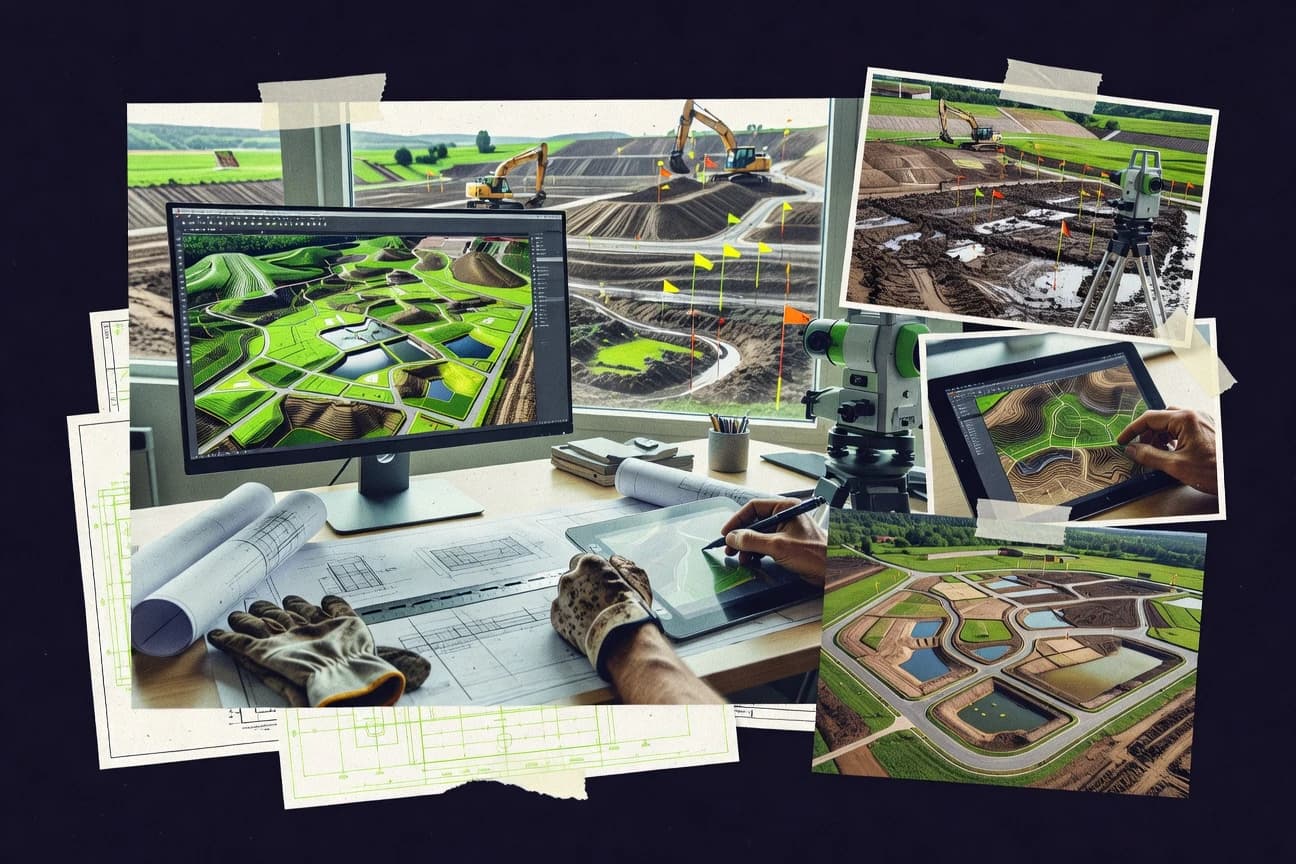
Construction InfrastructureTop 10 Best Land Design Software of 2026
Discover top land design tools. Compare features, find the best fit for your project.

How we ranked these tools
Core product claims cross-referenced against official documentation, changelogs, and independent technical reviews.
Analyzed video reviews and hundreds of written evaluations to capture real-world user experiences with each tool.
AI persona simulations modeled how different user types would experience each tool across common use cases and workflows.
Final rankings reviewed and approved by our editorial team with authority to override AI-generated scores based on domain expertise.
Score: Features 40% · Ease 30% · Value 30%
Gitnux may earn a commission through links on this page — this does not influence rankings. Editorial policy
Editor picks
Three quick recommendations before you dive into the full comparison below — each one leads on a different dimension.
Land F/X
Genius Plant Database with over 140,000 searchable species, auto-updating schedules, and regional customization
Built for professional landscape architecture firms and designers needing advanced, database-driven tools within AutoCAD workflows..
Vectorworks Landmark
Runner UpDynamic Site Model tool that generates interactive 3D terrain models with real-time grading analysis, sections, and volumetric calculations
Built for professional landscape architecture firms managing complex, large-scale site design projects that require precise BIM deliverables and detailed planting plans..
Autodesk Civil 3D
Also GreatDynamic corridor modeling that automatically updates cross-sections, volumes, and earthwork calculations with design changes
Built for civil engineers and land development professionals handling complex infrastructure projects requiring precise 3D modeling and collaboration..
Related reading
Comparison Table
For professionals in land design, selecting the right software is key to efficiency and accuracy; this comparison table examines top tools including Land F/X, Vectorworks Landmark, Autodesk Civil 3D, PRO Landscape, Lands Design, and more. It outlines features, practical use cases, and unique benefits to guide users toward the best fit for projects ranging from small residential plots to extensive development initiatives.
Land F/X
specializedProfessional CAD add-on for landscape architects providing integrated planting, irrigation, and site furnishing design tools.
Genius Plant Database with over 140,000 searchable species, auto-updating schedules, and regional customization
Land F/X is a comprehensive CAD plugin for AutoCAD and Civil 3D, tailored for landscape architects to handle planting design, irrigation systems, hardscapes, grading, and site furnishings with precision. It features extensive databases for plants, soils, and materials, automating schedules, labeling, and calculations to produce professional construction documents efficiently. By integrating advanced tools like dynamic plant palettes and hydraulic analysis, it significantly reduces design time while maintaining accuracy and compliance with industry standards.
- +Vast, customizable databases for plants (140,000+ species), irrigation components, and materials
- +Seamless AutoCAD/Civil 3D integration with automated labeling, scheduling, and error-checking
- +Powerful modules for irrigation hydraulics, grading, and photorealistic rendering
- –Steep learning curve for non-CAD users
- –Requires separate AutoCAD license, increasing total cost
- –Limited standalone functionality without host software
Best for: Professional landscape architecture firms and designers needing advanced, database-driven tools within AutoCAD workflows.
More related reading
Vectorworks Landmark
specializedBIM-enabled software for landscape design with advanced site modeling, plant databases, and hardscape tools.
Dynamic Site Model tool that generates interactive 3D terrain models with real-time grading analysis, sections, and volumetric calculations
Vectorworks Landmark is a powerful BIM-focused software designed specifically for landscape architects, offering comprehensive tools for site design, grading, planting, hardscape, and irrigation planning. It supports 2D drafting, 3D modeling, and photorealistic rendering, with an extensive database of plants and materials tailored to landscape projects. The software excels in creating construction-ready documentation and integrates seamlessly with other Vectorworks modules for collaborative workflows.
- +Extensive, region-specific plant libraries with intelligent scheduling and styling
- +Dynamic site modeling for accurate grading, cut/fill calculations, and automatic updates
- +Robust BIM tools for detailed construction documentation and interdisciplinary coordination
- –Steep learning curve due to complex interface and workflows
- –High resource demands, leading to performance issues on large projects
- –Premium pricing that may deter smaller firms or freelancers
Best for: Professional landscape architecture firms managing complex, large-scale site design projects that require precise BIM deliverables and detailed planting plans.
Autodesk Civil 3D
enterpriseCivil engineering platform for land development including grading, corridors, parcels, and stormwater analysis.
Dynamic corridor modeling that automatically updates cross-sections, volumes, and earthwork calculations with design changes
Autodesk Civil 3D is a leading civil engineering software specialized in land development design, offering tools for creating intelligent 3D models of sites, roads, parcels, and grading. It supports dynamic workflows where changes to one element automatically update related designs, facilitating efficient documentation and analysis for infrastructure projects. Integrated with BIM standards, it enables seamless collaboration across disciplines like surveying, stormwater management, and earthworks.
- +Extensive toolkit for 3D modeling of corridors, surfaces, and grading
- +Seamless integration with Autodesk ecosystem and BIM workflows
- +Advanced automation and analysis for quantities, volumes, and hydrology
- –Steep learning curve requiring significant training
- –High system resource demands and occasional performance issues
- –Subscription pricing can be prohibitive for small firms
Best for: Civil engineers and land development professionals handling complex infrastructure projects requiring precise 3D modeling and collaboration.
PRO Landscape
specializedAll-in-one landscape design software for creating 2D plans, 3D renderings, and cost estimates.
Seamless integration of 2D design, 3D visualization, and automated cost estimating in one application
PRO Landscape is a professional-grade landscape design software that enables users to create detailed 2D and 3D designs, complete with an extensive database of over 19,000 plants, hardscapes, and outdoor elements. It integrates design tools with business functions like cost estimating, proposals, and material takeoffs to streamline workflows for landscapers. Ideal for creating photorealistic renderings and client presentations, it supports everything from simple yard plans to complex commercial projects.
- +Extensive customizable plant and material library with accurate sizing and growth data
- +Integrated estimating and takeoff tools for quick quoting and bidding
- +High-quality 3D rendering and walkthroughs for impressive client presentations
- –Steep learning curve, especially for non-CAD users
- –Windows-only compatibility, no Mac or web version
- –Outdated interface compared to modern cloud-based competitors
Best for: Professional landscape architects, designers, and contractors who need robust design-to-estimate workflows in a desktop environment.
Lands Design
specializedParametric landscape plugin for Rhino with procedural terrain, vegetation, and urban design tools.
Massive, editable parametric plant database with seasonal variations and growth simulation
Lands Design is a powerful BIM plugin for Rhino and Grasshopper, specifically tailored for landscape architects to model terrains, vegetation, pavements, and urban elements parametrically. It features a vast database of over 10,000 plant species with photorealistic representations and supports automated 2D documentation, quantity takeoffs, and high-quality renders. Ideal for complex landscape projects, it integrates seamlessly with Rhino's NURBS-based modeling for precise design control.
- +Extensive parametric vegetation library with thousands of species
- +Advanced terrain editing and analysis tools
- +Automated 2D documentation and BIM workflows
- –Steep learning curve, especially for Rhino newcomers
- –Requires separate Rhino license (additional cost)
- –Windows-only compatibility limits accessibility
Best for: Professional landscape architects experienced with Rhino who need comprehensive BIM tools for detailed planting and terrain design.
Realtime Landscaping Architect
specializedUser-friendly 3D landscape design software featuring real-time editing, plant libraries, and walkthroughs.
Real-time 3D walkthroughs with dynamic lighting and terrain editing for immersive, client-ready presentations
Realtime Landscaping Architect is a powerful 3D landscape design software designed for professionals and enthusiasts to create detailed outdoor spaces including gardens, hardscapes, patios, and pools. It offers an extensive library of over 6,000 plants, customizable objects, and materials with real-time rendering for instant photorealistic visualizations. Users can produce 2D plans, 3D models, walkthroughs, and even integrate photo imaging for before-and-after presentations.
- +Intuitive drag-and-drop interface suitable for beginners and pros
- +Vast library of plants, hardscapes, and furnishings with customization options
- +Real-time 3D rendering and immersive walkthroughs for client presentations
- –High upfront cost with limited subscription alternatives
- –Windows-only compatibility, no Mac or web version
- –Lacks advanced BIM or CAD integration found in enterprise tools
Best for: Ideal for homeowners, small landscaping businesses, and designers who want an accessible, all-in-one tool for quick, professional-grade 3D landscape visualizations.
SketchUp
creative_suiteIntuitive 3D modeling tool popular for landscape conceptualization with extensions for plants and terrain.
Sandbox terrain tools for intuitive from-scratch landscape modeling
SketchUp is a popular 3D modeling software used for creating detailed models of landscapes, terrain, hardscapes, and structures in land design projects. Its intuitive push/pull tools and Sandbox feature enable quick terrain sculpting from contours, while the Extension Warehouse provides plugins for plants, irrigation, and site analysis. Though versatile across design fields, it excels in conceptual visualization rather than specialized civil engineering tasks.
- +Intuitive interface for rapid 3D modeling
- +Vast 3D Warehouse and extensions for landscape assets
- +Cross-platform compatibility with real-time collaboration in Pro
- –Limited native tools for advanced site grading and analysis
- –Performance lags with large, detailed models
- –Subscription model locks key features behind paywall
Best for: Freelance landscape designers and architects needing flexible, visual 3D modeling without heavy specialization.
VizTerra
specializedLandscape visualization software with photorealistic rendering and interactive 3D design capabilities.
Real-time photorealistic 3D rendering with dynamic lighting and 360° walkthroughs
VizTerra is a professional-grade 3D landscape design software that specializes in creating photorealistic renderings of outdoor spaces, including plants, hardscapes, terrain, and architectural elements. It features a drag-and-drop interface, extensive libraries of customizable assets, and tools for interactive walkthroughs and animations. The software integrates with tools like Google Earth for site import and supports high-quality output for client presentations.
- +Photorealistic rendering engine produces stunning, professional visuals
- +Vast library of plants, materials, and hardscapes with customization options
- +Intuitive drag-and-drop workflow speeds up design iterations
- –Steep initial learning curve for non-professionals
- –Subscription pricing can be costly for solo users
- –Limited advanced CAD/BIM integration compared to competitors
Best for: Professional landscape architects and designers who prioritize high-fidelity 3D visualizations for client proposals.
Chief Architect
specializedResidential design software with robust landscape tools for terrain, plants, and outdoor structures.
Automatic terrain-following for buildings and roofs, ensuring structures conform realistically to site topography
Chief Architect is a powerful 3D architectural design software that includes specialized tools for land design, such as terrain modeling, site grading, retaining walls, roads, and extensive landscaping libraries. It excels in integrating site plans seamlessly with residential building designs, allowing for realistic 3D visualizations of landscapes, hardscapes, and plantings. While versatile for smaller-scale projects, it is less suited for advanced civil engineering tasks like detailed cut/fill analysis or large-scale stormwater modeling.
- +Seamless integration of terrain and building design for cohesive residential projects
- +Extensive plant database and material libraries for realistic landscaping
- +High-quality 3D rendering and virtual walkthroughs for site visualization
- –Limited advanced earthwork calculations and hydrology tools compared to dedicated civil software
- –Steeper learning curve for complex terrain modeling
- –High subscription costs may not justify use for land design alone
Best for: Residential architects and landscape designers needing an all-in-one tool for home sites and small-scale land planning.
Lumion
specializedReal-time rendering engine for creating stunning landscape and architectural visualizations.
Real-time photorealistic rendering with an unmatched library of nature and landscape objects for instant scene creation
Lumion is a real-time 3D rendering and visualization software primarily used for architectural and landscape projects, allowing users to import models from tools like Revit, SketchUp, or Rhino and enhance them with photorealistic environments. It excels in quickly building immersive landscapes with extensive libraries of vegetation, terrains, water, and atmospheric effects. While not a native design tool for land modeling or grading, it transforms imported land designs into stunning animations and stills for presentations.
- +Vast library of over 10,000 drag-and-drop assets including trees, plants, and terrains
- +Lightning-fast real-time rendering for quick iterations and animations
- +Intuitive interface with movie-like effects and easy scene building
- –High hardware requirements (needs powerful GPU for smooth performance)
- –Expensive subscription model with no free tier for professionals
- –Lacks native land design tools like grading or site modeling; relies on imports
Best for: Landscape architects and designers focused on high-quality visualizations and client presentations rather than core modeling.
Conclusion
After evaluating 10 construction infrastructure, Land F/X stands out as our overall top pick — it scored highest across our combined criteria of features, ease of use, and value, which is why it sits at #1 in the rankings above.
Use the comparison table and detailed reviews above to validate the fit against your own requirements before committing to a tool.
How to Choose the Right Land Design Software
This buyer’s guide helps teams choose Land F/X, Vectorworks Landmark, Autodesk Civil 3D, PRO Landscape, Lands Design, Realtime Landscaping Architect, SketchUp, VizTerra, Chief Architect, or Lumion by mapping real workflow needs to specific tool strengths. It focuses on land modeling, planting and asset databases, documentation and analysis, and photorealistic client visualization. It also covers selection pitfalls tied directly to how each tool behaves in real projects.
What Is Land Design Software?
Land design software is used to model site geometry, plan vegetation and hardscape content, and generate deliverables like plans, sections, schedules, and visualizations. It solves the coordination problem between terrain and plant placement, between design intent and construction documentation, and between technical models and client-ready imagery. Tools like Land F/X and Vectorworks Landmark support professional landscape workflows with database-driven planting and site modeling. Civil-focused platforms like Autodesk Civil 3D prioritize dynamic grading, corridor modeling, and engineering quantity and hydrology workflows.
Key Features to Look For
The strongest land design outcomes come from matching modeling depth, database automation, and visualization fidelity to the deliverables actually required.
Plant and materials database depth with automated schedules
Land F/X stands out with the Genius Plant Database that includes 140,000+ searchable species, auto-updating schedules, and regional customization. PRO Landscape and Lands Design also provide large plant and material libraries, with PRO Landscape covering over 19,000 plants and Lands Design supporting a massive editable parametric plant database with seasonal variations and growth simulation.
Dynamic terrain modeling and grading outputs
Vectorworks Landmark uses a Dynamic Site Model tool to generate interactive 3D terrain with real-time grading analysis, sections, and volumetric calculations. SketchUp supports intuitive terrain sculpting with Sandbox terrain tools and push/pull modeling, while Autodesk Civil 3D provides intelligent 3D surfaces and grading tied to engineering workflows.
Civil-style quantities, earthworks, and corridor updates
Autodesk Civil 3D supports dynamic corridor modeling that automatically updates cross-sections, volumes, and earthwork calculations when the design changes. This same dynamic update mindset is valuable for teams that need consistent documentation across design revisions, especially when stormwater and quantity workflows are part of the deliverable set.
Irrigation planning and hydraulic analysis
Land F/X includes irrigation components plus irrigation hydraulics tooling for designing systems with engineering-grade analysis and documentation support. This makes Land F/X a direct fit for landscape architects who must integrate planting layouts with functional irrigation design rather than handling it as a separate workflow.
Parametric or BIM-oriented landscape modeling for construction-ready documentation
Lands Design brings BIM plugin capabilities into Rhino and Grasshopper with procedural terrain, vegetation, pavements, and urban elements. Vectorworks Landmark adds BIM-focused site modeling for interdisciplinary coordination and construction-ready documentation. These tools are designed to keep model changes consistent across drawings and schedules.
Real-time photorealistic visualization and client-ready walkthroughs
VizTerra offers real-time photorealistic 3D rendering with dynamic lighting and 360° walkthroughs for proposal visuals. Realtime Landscaping Architect adds real-time rendering plus immersive walkthroughs with dynamic lighting and terrain editing. Lumion accelerates presentation production through lightning-fast real-time rendering from imported models, with extensive drag-and-drop nature and landscape object libraries.
How to Choose the Right Land Design Software
The right choice comes from matching the deliverable type to the tool’s modeling engine, automation, and visualization strengths.
Start with the deliverables that must be construction-ready
If construction documentation requires database-driven planting schedules and site furnishings inside a CAD workflow, Land F/X is built for that with automated labeling, scheduling, and error-checking. If the project needs BIM-style site modeling with interactive grading analysis and volumetric calculations, Vectorworks Landmark is the more direct fit with its Dynamic Site Model tool. For civil deliverables that depend on corridor-driven quantities, Autodesk Civil 3D ties cross-sections, volumes, and earthwork calculations to design updates.
Choose the terrain workflow engine based on revision speed and analysis needs
Teams that revise alignment or grading frequently benefit from Autodesk Civil 3D because dynamic corridor modeling updates cross-sections and earthworks automatically. Teams that need fast conceptual sculpting can move quickly with SketchUp Sandbox terrain tools, but it lacks advanced native grading and analysis depth compared with civil-focused platforms. Vectorworks Landmark balances BIM deliverables with dynamic terrain analysis through its interactive 3D terrain and real-time grading features.
Confirm the vegetation strategy before committing to a tool
Land F/X targets professional vegetation work with a Genius Plant Database covering 140,000+ species plus regional customization and auto-updating schedules. Lands Design provides a parametric plant database with seasonal variations and growth simulation for modeling change over time. PRO Landscape and Realtime Landscaping Architect also provide large plant libraries, with Realtime Landscaping Architect emphasizing real-time 3D walkthrough presentations rather than enterprise BIM depth.
Decide whether irrigation and engineering behavior must be modeled inside the same software
If irrigation design and hydraulics calculations are part of the same project package as planting and site furnishings, Land F/X includes irrigation components plus powerful irrigation hydraulics modules. If the workflow emphasizes visualization for client approval first and detailed engineering behavior later, tools like VizTerra and Realtime Landscaping Architect can still support strong presentations even when advanced civil behavior is handled elsewhere.
Match visualization quality to how clients consume the work
If clients need photoreal stills and interactive walkthroughs, VizTerra provides dynamic lighting and 360° walkthrough output in a real-time rendering workflow. If the workflow prioritizes immersive editing during visualization, Realtime Landscaping Architect supports real-time 3D walkthroughs with dynamic lighting and terrain editing. If the core model originates in another authoring tool and only rendering acceleration is needed, Lumion is optimized for real-time rendering from imported models with a large drag-and-drop nature library.
Who Needs Land Design Software?
Land design software helps specific roles deliver consistent site models, plant schedules, and client visualization at the level of detail their projects require.
Landscape architecture firms needing database-driven planting, irrigation, and construction documentation in AutoCAD workflows
Land F/X fits this audience because it integrates with AutoCAD and Civil 3D and automates labeling, scheduling, and error-checking. Its Genius Plant Database includes 140,000+ species plus auto-updating schedules and regional customization, and it includes irrigation hydraulics and site furnishing design tools.
Landscape architecture teams producing BIM-style deliverables with interactive grading analysis and volumetrics
Vectorworks Landmark fits this audience because it uses a Dynamic Site Model tool that generates interactive 3D terrain with real-time grading analysis, sections, and volumetric calculations. Its BIM-focused workflow supports detailed construction documentation and interdisciplinary coordination for complex large-scale site designs.
Civil engineers and land development teams requiring corridor-driven earthwork and quantities with design-change automation
Autodesk Civil 3D fits this audience because dynamic corridor modeling automatically updates cross-sections, volumes, and earthwork calculations with design changes. It also supports advanced automation and analysis for quantities and hydrology tied to land development workflows.
Designers and contractors who need a single desktop tool for 2D design, 3D visualization, and cost estimating
PRO Landscape fits this audience because it combines 2D and 3D design with automated cost estimating and material takeoffs. It also supports high-quality 3D rendering for client presentations while keeping estimating and visualization in one application.
Common Mistakes to Avoid
Selection mistakes usually come from mismatched expectations about CAD versus BIM depth, engineering analysis coverage, and the role of visualization tools versus native modeling tools.
Picking a visualization-first tool and expecting civil-grade grading analysis
VizTerra and Lumion are optimized for photorealistic rendering and client visuals rather than native grading or engineering calculations. For dynamic earthwork and corridor-driven volumes, Autodesk Civil 3D provides the needed modeling depth and automatic updates.
Underestimating the learning curve tied to professional modeling depth
Land F/X, Vectorworks Landmark, Autodesk Civil 3D, and Lands Design all show steep learning curve characteristics because they support advanced CAD or BIM-style workflows. Realtime Landscaping Architect and SketchUp emphasize easier interactive modeling and drag-and-drop workflows, but they do not replace enterprise BIM or engineering analysis needs.
Assuming a general 3D modeler includes advanced grading and analysis out of the box
SketchUp is strong for conceptual terrain sculpting with Sandbox tools and ecosystem extensions, but it provides limited native tools for advanced site grading and analysis. Vectorworks Landmark and Autodesk Civil 3D provide dynamic site modeling and corridor-driven analysis for accurate grading, sections, and volumetrics.
Ignoring host-software dependencies that affect implementation time
Land F/X and Lands Design require a separate AutoCAD or Rhino license because they are plugins that integrate into a host workflow. That dependency can increase total setup complexity versus standalone tools like Realtime Landscaping Architect and Chief Architect.
How We Selected and Ranked These Tools
we evaluated every tool on three sub-dimensions using features weight 0.4, ease of use weight 0.3, and value weight 0.3. The overall rating is computed as overall = 0.40 × features + 0.30 × ease of use + 0.30 × value. Land F/X separated from lower-ranked tools because its features category included a Genius Plant Database with 140,000+ species plus automated labeling and scheduling and irrigation hydraulics, which directly supports faster production of construction-ready landscape documentation. Vectorworks Landmark and Autodesk Civil 3D also scored strongly on features due to dynamic site modeling and dynamic corridor-driven updates that keep grading, sections, and volumes consistent across revisions.
Frequently Asked Questions About Land Design Software
Which land design tool produces construction-ready planting and schedules directly from a CAD workflow?
What software is best for BIM-style site modeling with automated grading analysis and sections?
Which option handles intelligent infrastructure modeling with model-wide change propagation?
Which tool connects landscape design output to estimating, proposals, and material takeoffs?
What platform is most suitable for parametric vegetation and seasonal variations controlled by editable parameters?
Which software is best for fast, photoreal client visuals when the core need is rendering rather than civil modeling?
Which tool supports immersive walkthroughs with real-time lighting tied to 3D terrain edits?
What is the most practical choice for contour-based terrain sculpting and flexible landscape concepts?
Which solution best fits residential land planning where the landscape must match building geometry closely?
What integrations and cross-tool workflows matter most when importing terrain and vegetation for rendering?
Tools reviewed
Primary sources checked during evaluation.
Referenced in the comparison table and product reviews above.
Keep exploring
Comparing two specific tools?
Software Alternatives
See head-to-head software comparisons with feature breakdowns, pricing, and our recommendation for each use case.
Explore software alternatives→In this category
Construction Infrastructure alternatives
See side-by-side comparisons of construction infrastructure tools and pick the right one for your stack.
Compare construction infrastructure tools→FOR SOFTWARE VENDORS
Not on this list? Let’s fix that.
Our best-of pages are how many teams discover and compare tools in this space. If you think your product belongs in this lineup, we’d like to hear from you—we’ll walk you through fit and what an editorial entry looks like.
Apply for a ListingWHAT THIS INCLUDES
Where buyers compare
Readers come to these pages to shortlist software—your product shows up in that moment, not in a random sidebar.
Editorial write-up
We describe your product in our own words and check the facts before anything goes live.
On-page brand presence
You appear in the roundup the same way as other tools we cover: name, positioning, and a clear next step for readers who want to learn more.
Kept up to date
We refresh lists on a regular rhythm so the category page stays useful as products and pricing change.