GITNUXSOFTWARE ADVICE
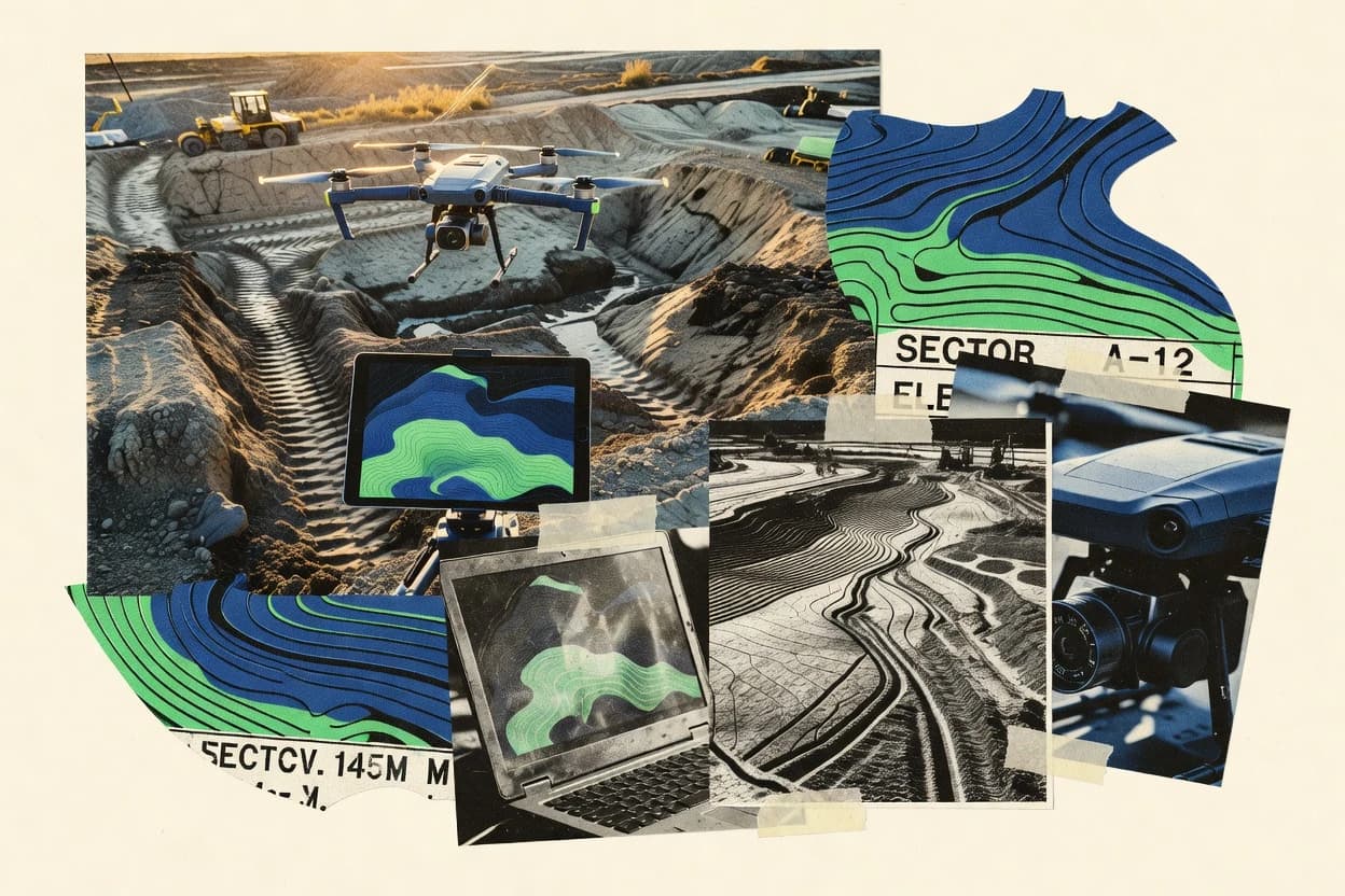
Construction InfrastructureTop 10 Best Drone Topography Software of 2026
Top 10 Drone Topography Software tools ranked for mapping accuracy. Compare DroneDeploy, Propeller Aero, and senseFly eMotion picks.

How we ranked these tools
Core product claims cross-referenced against official documentation, changelogs, and independent technical reviews.
Analyzed video reviews and hundreds of written evaluations to capture real-world user experiences with each tool.
AI persona simulations modeled how different user types would experience each tool across common use cases and workflows.
Final rankings reviewed and approved by our editorial team with authority to override AI-generated scores based on domain expertise.
Score: Features 40% · Ease 30% · Value 30%
Gitnux may earn a commission through links on this page — this does not influence rankings. Editorial policy
Editor’s top 3 picks
Three quick recommendations before you dive into the full comparison below — each one leads on a different dimension.
DroneDeploy
One-click creation of orthomosaics and topographic maps from mission-captured imagery
Built for survey and construction teams needing consistent orthomosaic and topography outputs.
Propeller Aero
Ortho and DSM production designed for surface and volume measurement deliverables
Built for construction and surveying teams needing reliable drone topography deliverables.
senseFly eMotion
Integrated mission planning and automated photogrammetry processing for georeferenced orthomosaics
Built for teams producing site maps and 3D models from senseFly missions quickly.
Related reading
Comparison Table
This comparison table evaluates drone topography software used to capture, process, and deliver geospatial outputs such as orthomosaics, digital surface models, and terrain products. It contrasts platforms that support end-to-end drone-to-map workflows, tools optimized for specific hardware ecosystems, and solutions that integrate with GIS and CAD systems. Readers can compare licensing models, processing capabilities, output formats, and collaboration features to select the best fit for survey, mapping, and infrastructure documentation.
| # | Tool | Category | Overall | Features | Ease of Use | Value |
|---|---|---|---|---|---|---|
| 1 | DroneDeploy DroneDeploy provides cloud processing for drone imagery into orthomosaics, 3D maps, and progress analytics outputs for construction sites. | cloud mapping platform | 8.6/10 | 9.0/10 | 8.4/10 | 8.2/10 |
| 2 | Propeller Aero Propeller Aero offers drone mapping processing workflows that generate orthomosaics and elevation products for infrastructure and jobsite reporting. | managed drone analytics | 8.2/10 | 8.6/10 | 7.9/10 | 7.8/10 |
| 3 | senseFly eMotion senseFly eMotion provides photogrammetry processing for drone images into mapping products used in survey and construction documentation. | enterprise photogrammetry | 8.0/10 | 8.6/10 | 7.9/10 | 7.4/10 |
| 4 | Bentley OpenBuildings Designer Bentley OpenBuildings Designer supports geospatial and reality capture data integration for construction coordination alongside terrain models. | BIM geospatial integration | 8.0/10 | 8.4/10 | 7.6/10 | 7.8/10 |
| 5 | Esri ArcGIS Reality Studio ArcGIS Reality Studio supports photogrammetry and reality capture publishing into GIS for building and managing drone-derived terrain layers. | GIS reality capture | 8.1/10 | 8.7/10 | 7.6/10 | 7.8/10 |
| 6 | Autodesk Construction Cloud Construction Cloud supports drone survey workflows through project management, coordination, and integration points for point clouds and terrain data used in civil infrastructure planning. | construction platform | 7.6/10 | 8.1/10 | 7.4/10 | 7.1/10 |
| 7 | Terrasolid Terrasolid delivers laser and photogrammetry post-processing tools for point cloud editing, classification, and ground modeling that support drone-derived topography deliverables. | point-cloud processing | 7.5/10 | 8.1/10 | 7.2/10 | 7.0/10 |
| 8 | ClearEdge 3D ClearEdge 3D provides reality capture and modeling services and software tools that process drone imagery into measurement-ready 3D models for infrastructure progress tracking. | reality capture | 8.0/10 | 8.4/10 | 7.6/10 | 7.8/10 |
| 9 | OpenTopography OpenTopography provides accessible elevation data tools and services for generating terrain products that complement drone topography surveys in infrastructure projects. | terrain data platform | 7.2/10 | 7.0/10 | 7.6/10 | 7.2/10 |
| 10 | Bentley MicroStation MicroStation supports terrain modeling and CAD-based editing of survey data and surface models derived from drone topography inputs. | CAD terrain | 7.2/10 | 7.6/10 | 6.9/10 | 7.0/10 |
DroneDeploy provides cloud processing for drone imagery into orthomosaics, 3D maps, and progress analytics outputs for construction sites.
Propeller Aero offers drone mapping processing workflows that generate orthomosaics and elevation products for infrastructure and jobsite reporting.
senseFly eMotion provides photogrammetry processing for drone images into mapping products used in survey and construction documentation.
Bentley OpenBuildings Designer supports geospatial and reality capture data integration for construction coordination alongside terrain models.
ArcGIS Reality Studio supports photogrammetry and reality capture publishing into GIS for building and managing drone-derived terrain layers.
Construction Cloud supports drone survey workflows through project management, coordination, and integration points for point clouds and terrain data used in civil infrastructure planning.
Terrasolid delivers laser and photogrammetry post-processing tools for point cloud editing, classification, and ground modeling that support drone-derived topography deliverables.
ClearEdge 3D provides reality capture and modeling services and software tools that process drone imagery into measurement-ready 3D models for infrastructure progress tracking.
OpenTopography provides accessible elevation data tools and services for generating terrain products that complement drone topography surveys in infrastructure projects.
MicroStation supports terrain modeling and CAD-based editing of survey data and surface models derived from drone topography inputs.
DroneDeploy
cloud mapping platformDroneDeploy provides cloud processing for drone imagery into orthomosaics, 3D maps, and progress analytics outputs for construction sites.
One-click creation of orthomosaics and topographic maps from mission-captured imagery
DroneDeploy stands out with its end-to-end drone data workflow from flight planning to orthomosaics and topographic outputs. The platform supports automated capture missions, then turns imagery into maps used for measurements and surveying workflows. It also enables team collaboration through shareable results and review tools for field-to-office handoff. The strongest fit is organizations that need consistent terrain mapping with repeatable processes across multiple sites.
Pros
- Automated flight planning that drives consistent mapping results across sites
- Fast generation of orthomosaics and topographic surfaces from captured imagery
- Measurement and annotation tools support field verification and QA workflows
- Sharing and review features streamline collaboration between field and office
Cons
- Topography output quality depends heavily on capture settings and coverage overlap
- Survey-grade deliverables may require additional manual QA steps
- Processing workflows can feel complex for teams using only basic mapping
Best For
Survey and construction teams needing consistent orthomosaic and topography outputs
More related reading
Propeller Aero
managed drone analyticsPropeller Aero offers drone mapping processing workflows that generate orthomosaics and elevation products for infrastructure and jobsite reporting.
Ortho and DSM production designed for surface and volume measurement deliverables
Propeller Aero stands out for turning drone imagery into engineering-ready maps built around the company’s flight, processing, and deliverable workflow. Core capabilities center on geospatial photogrammetry outputs like orthomosaics and digital surface models that support volume, change, and surface analysis. The workflow is geared toward teams that need consistent data products and clear project organization rather than highly customizable research pipelines. Deliverables focus on practical topography needs for construction and land measurement use cases.
Pros
- Produces engineering-style orthomosaics and surface models for topography workflows
- Delivers structured project outputs that reduce manual post-processing effort
- Supports practical surface and volumetric use cases from the same data pipeline
Cons
- Advanced tuning of photogrammetry parameters is limited compared with DIY stacks
- Automation depth for bespoke analysis workflows is less flexible than specialized GIS tools
- Requires consistent capture practices to avoid downstream accuracy issues
Best For
Construction and surveying teams needing reliable drone topography deliverables
senseFly eMotion
enterprise photogrammetrysenseFly eMotion provides photogrammetry processing for drone images into mapping products used in survey and construction documentation.
Integrated mission planning and automated photogrammetry processing for georeferenced orthomosaics
senseFly eMotion stands out by combining drone capture planning with automated photogrammetry processing for mapping deliverables. It supports senseFly hardware workflows and produces georeferenced outputs suitable for orthomosaics and 3D models. The software centers on operator-guided processing with quality checks, so teams can go from image data to usable terrain products without manual GIS steps. Visualization and export options align with field survey and construction documentation use cases.
Pros
- Automates photogrammetry into orthomosaics and textured 3D models
- Flight planning and processing workflow reduces manual GIS handling
- Built-in quality guidance helps detect capture gaps early
- Georeferenced outputs support survey and construction documentation
Cons
- Workflow is tightly optimized for senseFly aircraft and accessories
- Advanced processing tuning is limited versus full photogrammetry toolchains
- Export and QA customization can feel restrictive for specialized pipelines
Best For
Teams producing site maps and 3D models from senseFly missions quickly
Bentley OpenBuildings Designer
BIM geospatial integrationBentley OpenBuildings Designer supports geospatial and reality capture data integration for construction coordination alongside terrain models.
Model-based point cloud visualization and terrain context management for engineering coordination
Bentley OpenBuildings Designer stands out by combining model-based engineering workflows with survey-centric visualization for coordinating drone-derived terrain context. Core capabilities include importing point clouds, inspecting terrain and elevation surfaces, and producing civil-style deliverables that align with Bentley’s design environment. Strong project alignment comes from integrating with other Bentley data and models so topography outputs can be used directly for design review and coordination.
Pros
- Point cloud and terrain context integrate directly into design models
- Engineering-oriented inspection supports faster review of drone elevation data
- Interoperability with Bentley ecosystems helps coordinate topo and design inputs
Cons
- Drone-to-surface automation can feel limited compared to dedicated mapping tools
- Interface and workflow learning curve is higher than general CAD viewers
- Best results depend on consistent input data quality from the drone workflow
Best For
Teams needing design-ready drone topography inside Bentley modeling workflows
Esri ArcGIS Reality Studio
GIS reality captureArcGIS Reality Studio supports photogrammetry and reality capture publishing into GIS for building and managing drone-derived terrain layers.
ArcGIS pipeline publishing for reality-capture products to ArcGIS Online or Enterprise
Esri ArcGIS Reality Studio focuses on turning photogrammetry and LiDAR outputs into geospatially organized products inside the ArcGIS ecosystem. It supports multi-sensor workflows for creating dense point clouds, orthomosaics, and digital surface models from aerial imagery and related capture sources. Processing tools emphasize repeatable survey outputs, then publishing integrates with ArcGIS for mapping, QA review, and stakeholder sharing. The strongest fit is drone topography where results must connect directly to GIS data models and downstream analysis.
Pros
- Tight ArcGIS integration for publishing orthos, DSMs, and point clouds
- Multi-sensor processing supports drone photogrammetry and LiDAR workflows
- GIS-ready outputs simplify geospatial QA and downstream analysis
Cons
- Survey-grade configuration can be complex for small teams
- Desktop-centric workflow may feel heavy for rapid, ad hoc processing
- Licensing and deployment planning require GIS admin coordination
Best For
Teams producing GIS-aligned drone topography deliverables for enterprise mapping
Autodesk Construction Cloud
construction platformConstruction Cloud supports drone survey workflows through project management, coordination, and integration points for point clouds and terrain data used in civil infrastructure planning.
Point cloud visualization with collaborative markup and issue tracking inside project workflows
Autodesk Construction Cloud stands out by connecting drone-derived photogrammetry and project workflows inside a centralized construction data hub. It supports point cloud viewing, model coordination, and collaborative review processes that map survey outputs to construction tasks. The platform is strongest for teams that need repeatable data handoffs and issue-driven markup tied to project delivery. Drone topography becomes useful when it is paired with model-based coordination and managed project assets rather than treated as a standalone deliverable.
Pros
- Centralized project hub ties drone deliverables to coordination and approvals
- Strong point cloud and model review workflows for cross-discipline collaboration
- Markup and issue tracking supports iterative survey validation on site
- Integrates with Autodesk workflows that many construction teams already use
Cons
- Drone-to-action workflows can feel complex without established internal processes
- Survey-specific automation is less deep than specialist topography platforms
- Advanced visualization depends on data prep quality before upload
- Collaboration features require consistent project naming and asset management
Best For
Teams needing coordinated drone survey review inside an Autodesk-centric delivery workflow
More related reading
Terrasolid
point-cloud processingTerrasolid delivers laser and photogrammetry post-processing tools for point cloud editing, classification, and ground modeling that support drone-derived topography deliverables.
Terrasolid’s integration of photogrammetry processing with survey-grade surface generation
Terrasolid stands out for tightly integrated photogrammetry and LiDAR processing geared to geospatial survey workflows. The software supports drone-to-terrain pipelines with automated surface generation, classified outputs, and GIS-ready deliverables. Strong alignment and calibration tools help maintain consistency across projects that include control points and repeat surveys. The ecosystem fits survey teams that need dependable terrain models rather than only basic point cloud viewing.
Pros
- Workflow supports drone imagery and geospatial survey deliverables
- Robust alignment and calibration tools for consistent terrain outputs
- Generates GIS-ready surfaces with classification-friendly processing
Cons
- Setup and parameter tuning take survey experience to avoid rework
- UI can feel dense for teams used to simpler point cloud tools
- Best results rely on good control data and survey discipline
Best For
Survey teams producing repeatable terrain models with control points
ClearEdge 3D
reality captureClearEdge 3D provides reality capture and modeling services and software tools that process drone imagery into measurement-ready 3D models for infrastructure progress tracking.
Contour and measurement outputs that map directly to grading and engineering review workflows
ClearEdge 3D stands out for producing drone topography deliverables with a workflow built around rapid ground control to actionable contour and measurement outputs. The software supports point cloud generation, surface modeling, and standard grading-style deliverables such as DEMs, orthomosaics, and contour mapping. ClearEdge 3D also emphasizes QA-style reporting by aligning outputs to survey expectations and supporting repeatable exports for field and engineering review. The tool fits teams that need consistent terrain products from aerial captures without building custom processing pipelines.
Pros
- Delivers terrain products like DEMs and contours from drone captures efficiently
- Supports point-cloud driven surface modeling for measurement-focused workflows
- Enables repeatable exports suited for survey review and field handoff
- Workflow centers on topography deliverables instead of generic photogrammetry outputs
Cons
- Less flexible for advanced custom processing compared with fully open pipelines
- Best results depend on solid capture planning and consistent ground control
- File and project management can feel heavy on very large multi-site datasets
Best For
Survey and engineering teams producing recurring drone topography deliverables
OpenTopography
terrain data platformOpenTopography provides accessible elevation data tools and services for generating terrain products that complement drone topography surveys in infrastructure projects.
Open data marketplace for elevation products used to validate and enrich drone topography workflows
OpenTopography stands out by focusing on open access terrain data and measurement workflows rather than drone capture alone. It supports creating and visualizing digital elevation models from collected elevation datasets and integrating with geographic analysis pipelines. The platform also enables dataset discovery and reuse for research-grade topographic studies.
Pros
- Strong dataset discovery for terrain analysis and cross-study reuse
- Geospatial workflows integrate into common GIS analysis pipelines
- Centralized access to elevation products reduces reprocessing effort
- Facilitates reproducible research using shared topographic inputs
Cons
- Not a dedicated drone-to-orthomosaic processing suite
- Drone flight-to-model automation is limited compared with photogrammetry tools
- Output formats and precision control depend on upstream data processing
- Learning curve exists for users needing end-to-end modeling steps
Best For
Teams needing reusable elevation datasets for drone-aligned terrain analysis
Bentley MicroStation
CAD terrainMicroStation supports terrain modeling and CAD-based editing of survey data and surface models derived from drone topography inputs.
MicroStation point cloud and geometry editing within a CAD-centric project environment
Bentley MicroStation stands out as a CAD and geospatial design environment where drone-derived topography can be integrated into a controlled modeling workflow. It supports point cloud handling and mesh-based terrain work, including feature-rich manipulation and alignment for survey-grade outputs. The platform emphasizes interoperability with Bentley tools and common geospatial formats, which helps teams standardize deliverables. It is less specialized for end-to-end drone processing compared with dedicated photogrammetry and survey packages.
Pros
- Strong point cloud and mesh editing for survey-grade terrain refinement
- Precise CAD and geometry tools support consistent deliverable production
- Interoperates well with Bentley geospatial workflows for project continuity
Cons
- Not a dedicated drone photogrammetry engine for automated reconstructions
- Complex toolset can slow adoption for drone survey teams
- Workflow requires careful setup of coordinate systems and alignment
Best For
Teams needing CAD-grade terrain editing from drone point clouds
How to Choose the Right Drone Topography Software
This buyer’s guide explains how to choose drone topography software that turns flight images into orthomosaics, DSMs, DEMs, contours, and terrain surfaces. It covers tools including DroneDeploy, Propeller Aero, senseFly eMotion, Esri ArcGIS Reality Studio, Bentley OpenBuildings Designer, Autodesk Construction Cloud, Terrasolid, ClearEdge 3D, OpenTopography, and Bentley MicroStation. The guidance focuses on concrete workflow capabilities such as automated mission processing, GIS or CAD integration, and survey-grade QA outputs.
What Is Drone Topography Software?
Drone topography software processes drone imagery and related sensor data into elevation products like orthomosaics and digital surface models for terrain measurement and documentation. It solves the workflow gap between capturing aerial data and producing usable ground surfaces for surveying, grading, and construction coordination. Tools like DroneDeploy generate orthomosaics and topographic maps directly from mission-captured imagery for repeatable site mapping. Tools like Esri ArcGIS Reality Studio publish reality capture outputs into the ArcGIS ecosystem for GIS-aligned terrain layers and downstream analysis.
Key Features to Look For
The right feature set determines whether the tool produces consistent survey-ready terrain products or forces manual rework across capture settings, processing steps, and deliverable review.
One-click orthomosaic and topographic map generation
DroneDeploy is built around one-click creation of orthomosaics and topographic maps from mission-captured imagery, which reduces operator variance. ClearEdge 3D also emphasizes terrain products like DEMs, orthomosaics, and contour mapping designed for measurement workflows instead of generic photogrammetry output.
Orthomosaic and DSM production designed for volume and surface measurement
Propeller Aero produces engineering-style orthomosaics and surface models that support topography workflows like volume, change, and surface analysis. This delivery focus reduces the amount of manual post-processing needed to reach measurement-ready outputs.
Integrated mission planning plus automated photogrammetry processing
senseFly eMotion combines flight capture planning with automated photogrammetry processing so georeferenced orthomosaics and 3D models can be produced without assembling a separate pipeline. This integration helps teams detect capture gaps early through built-in quality guidance during processing.
Control-point and calibration support for consistent repeat surveys
Terrasolid includes robust alignment and calibration tools that maintain consistency across projects with control points and repeat surveys. ClearEdge 3D also centers best results on solid capture planning and consistent ground control for reliable contour and measurement outputs.
Geospatial publishing into GIS platforms for QA and analysis
Esri ArcGIS Reality Studio supports an ArcGIS pipeline publishing approach for reality-capture products to ArcGIS Online or Enterprise. This matters for teams that require GIS-ready outputs such as point clouds, orthos, and DSMs connected to geospatial QA and stakeholder sharing.
Engineering workflow integration for design review and project markup
Bentley OpenBuildings Designer focuses on model-based point cloud visualization and terrain context management for engineering coordination in Bentley workflows. Autodesk Construction Cloud ties point cloud viewing to collaborative markup and issue tracking so drone topography becomes an actionable construction review asset rather than a standalone deliverable.
How to Choose the Right Drone Topography Software
Selection should match the deliverable type, the required downstream system, and the level of processing control needed for terrain accuracy.
Start with the exact terrain deliverables needed
Teams that need consistent orthomosaic and topographic surfaces should evaluate DroneDeploy because it generates orthomosaics and topographic maps from mission-captured imagery with one-click creation. Teams focused on grading-style measurement output should evaluate ClearEdge 3D because it emphasizes DEMs, orthomosaics, and contour mapping designed for engineering review workflows.
Match the tool to the measurement workflow, not just reconstruction
For volume and surface measurement use cases, Propeller Aero focuses on producing orthomosaics and DSMs geared toward practical topography and volumetric analysis. For repeatable terrain models built around control points, Terrasolid supports survey-grade surface generation with alignment and calibration tools.
Decide where deliverables must live after processing
If terrain layers must connect directly to GIS for analysis and stakeholder sharing, choose Esri ArcGIS Reality Studio because it publishes reality-capture products into ArcGIS Online or Enterprise. If terrain context must plug into Bentley design review, choose Bentley OpenBuildings Designer because it integrates point clouds and terrain context directly into engineering models.
Pick based on processing control and capture discipline requirements
If a tighter, operator-guided workflow is the priority, senseFly eMotion combines mission planning and automated photogrammetry processing with built-in quality guidance. If the workflow requires deeper calibration and setup, Terrasolid supports alignment and calibration but demands survey experience to avoid parameter tuning rework.
Plan for collaboration and field-to-office handoff
For construction review driven by markup and issue tracking, Autodesk Construction Cloud supports point cloud visualization with collaborative markup and issue tracking tied to project workflows. For field verification and QA annotations that streamline collaboration, DroneDeploy includes sharing and review tools that support field-to-office handoff.
Who Needs Drone Topography Software?
Different teams need different depth in photogrammetry automation, terrain calibration, and integration into GIS or CAD workflows.
Survey and construction teams needing consistent orthomosaic and topographic outputs
DroneDeploy excels for repeatable terrain mapping processes because it focuses on one-click orthomosaic and topographic map generation with sharing and review features. ClearEdge 3D also fits when deliverables must be contour and measurement outputs that map directly to grading and engineering review workflows.
Construction and surveying teams needing reliable orthos and elevation products for jobsite reporting
Propeller Aero is designed around engineering-style orthomosaic and DSM production for practical surface and volumetric use cases. This delivery structure reduces manual effort compared with tools that require more custom parameter tuning to reach measurement-ready outputs.
Teams producing site maps and textured 3D models quickly from capture missions
senseFly eMotion is optimized for teams that want integrated mission planning and automated photogrammetry processing to produce georeferenced orthomosaics and textured 3D models. Built-in quality guidance supports detecting capture gaps early during processing.
Enterprise mapping teams that must publish terrain products into GIS systems
Esri ArcGIS Reality Studio targets GIS-aligned deliverables because it supports ArcGIS pipeline publishing for orthos, DSMs, and point clouds. This makes it a fit for organizations that require GIS-ready QA and downstream analysis rather than only export-and-forget reconstruction.
Common Mistakes to Avoid
Mistakes typically happen when a tool’s workflow depth does not match capture discipline, deliverable standards, or the required downstream system.
Assuming topography quality is automatic without controlling capture overlap and settings
DroneDeploy can produce topography output quality that depends heavily on capture settings and coverage overlap, so inconsistent flight planning can degrade results. ClearEdge 3D also depends on solid capture planning and consistent ground control for reliable contour and measurement outputs.
Choosing a CAD or design viewer for reconstruction instead of a processing tool
Bentley MicroStation supports CAD-grade point cloud and mesh editing but is not a dedicated drone photogrammetry engine for automated reconstructions. Bentley OpenBuildings Designer supports terrain context management in Bentley modeling workflows but automation for drone-to-surface reconstruction can feel limited compared with dedicated mapping tools.
Forgetting that some workflows are optimized for specific capture ecosystems
senseFly eMotion is tightly optimized for senseFly aircraft and accessories, so it may not fit teams expecting fully open capture-to-processing flexibility. Propeller Aero also focuses on structured deliverables and workflow organization rather than highly customizable research pipelines.
Underestimating the complexity of survey-grade GIS configuration for small teams
Esri ArcGIS Reality Studio can require complex survey-grade configuration and ArcGIS admin coordination for deployment planning. Autodesk Construction Cloud also ties drone deliverables to collaborative project processes, so poorly managed project naming and asset handling can disrupt review workflows.
How We Selected and Ranked These Tools
we evaluated every tool on three sub-dimensions. Features had a weight of 0.4. Ease of use had a weight of 0.3. Value had a weight of 0.3. The overall rating equals 0.40 × features + 0.30 × ease of use + 0.30 × value. DroneDeploy separated itself from lower-ranked tools by pairing strong features with high ease-of-workflow impact, including one-click orthomosaic and topographic map creation plus fast generation of orthomosaics and topographic surfaces from captured imagery.
Frequently Asked Questions About Drone Topography Software
Which drone topography software is best for end-to-end mapping workflows from flight to orthomosaic and topographic outputs?
DroneDeploy fits end-to-end workflows because it supports automated capture missions and one-click orthomosaic and topographic map creation from mission imagery. senseFly eMotion also covers capture planning and automated photogrammetry processing, but it is centered on the senseFly hardware workflow.
What tool is most suited for consistent orthomosaic and DSM deliverables across multiple construction or survey sites?
Propeller Aero is designed for repeatable engineering deliverables with orthomosaic and digital surface model production focused on surface and volume measurement needs. DroneDeploy supports repeatable terrain mapping across sites with shareable field-to-office review tools.
Which option best connects reality-capture outputs directly into an ArcGIS-based enterprise mapping pipeline?
Esri ArcGIS Reality Studio targets GIS-first delivery by publishing photogrammetry or LiDAR products into the ArcGIS ecosystem for QA review and stakeholder sharing. OpenTopography can complement GIS workflows by feeding reusable elevation datasets into geographic analysis pipelines.
Which software is strongest for volume analysis and surface change workflows from drone-derived data?
Propeller Aero is built around orthomosaic and DSM outputs that support volume, change, and surface analysis deliverables. Esri ArcGIS Reality Studio supports multi-sensor pipelines and publishing into ArcGIS, which helps drive downstream change detection workflows.
What tool is designed for rapid ground control and grading-style outputs like contours and measurements?
ClearEdge 3D focuses on ground control workflows that produce actionable contour maps and grading-oriented measurement outputs. It generates DEMs and orthomosaics and supports QA-style reporting aligned to survey expectations.
Which platform is better for survey-grade terrain models with control-point consistency across repeat surveys?
Terrasolid emphasizes calibration and classified surface generation for survey-grade terrain models using control points. It is built for dependable terrain models rather than basic point cloud viewing.
How do Bentley OpenBuildings Designer and Bentley MicroStation differ for working with drone-derived topography?
Bentley OpenBuildings Designer is oriented toward model-based engineering coordination by importing point clouds and inspecting elevation surfaces inside Bentley design workflows. Bentley MicroStation is a CAD-centric environment for point cloud and mesh terrain editing with stronger geometry manipulation than dedicated drone processing.
Which software supports collaborative review tied to construction workflows and issue tracking rather than standalone mapping outputs?
Autodesk Construction Cloud is built for centralized project delivery by combining point cloud viewing with collaborative markup and issue tracking. This makes drone topography useful when mapped to construction tasks and managed project assets.
What are common causes of unusable topography outputs, and which toolset is designed to address QA and quality checks?
Outputs often fail due to weak alignment, inconsistent control, or missing QA expectations between field capture and deliverable generation. Terrasolid addresses consistency with calibration and control-point-driven processing, while senseFly eMotion includes operator-guided processing with quality checks to produce georeferenced orthomosaics and 3D models.
Which software helps when teams need to reuse or enrich terrain models using open elevation datasets beyond drone capture?
OpenTopography focuses on open access terrain data and measurement workflows, supporting dataset discovery and reuse for research-grade topographic studies. It can be used to validate and enrich drone-aligned terrain analysis when additional elevation context is required.
Conclusion
After evaluating 10 construction infrastructure, DroneDeploy stands out as our overall top pick — it scored highest across our combined criteria of features, ease of use, and value, which is why it sits at #1 in the rankings above.
Use the comparison table and detailed reviews above to validate the fit against your own requirements before committing to a tool.
Tools reviewed
Referenced in the comparison table and product reviews above.
Keep exploring
Comparing two specific tools?
Software Alternatives
See head-to-head software comparisons with feature breakdowns, pricing, and our recommendation for each use case.
Explore software alternatives→In this category
Construction Infrastructure alternatives
See side-by-side comparisons of construction infrastructure tools and pick the right one for your stack.
Compare construction infrastructure tools→FOR SOFTWARE VENDORS
Not on this list? Let’s fix that.
Our best-of pages are how many teams discover and compare tools in this space. If you think your product belongs in this lineup, we’d like to hear from you—we’ll walk you through fit and what an editorial entry looks like.
Apply for a ListingWHAT THIS INCLUDES
Where buyers compare
Readers come to these pages to shortlist software—your product shows up in that moment, not in a random sidebar.
Editorial write-up
We describe your product in our own words and check the facts before anything goes live.
On-page brand presence
You appear in the roundup the same way as other tools we cover: name, positioning, and a clear next step for readers who want to learn more.
Kept up to date
We refresh lists on a regular rhythm so the category page stays useful as products and pricing change.