GITNUXSOFTWARE ADVICE
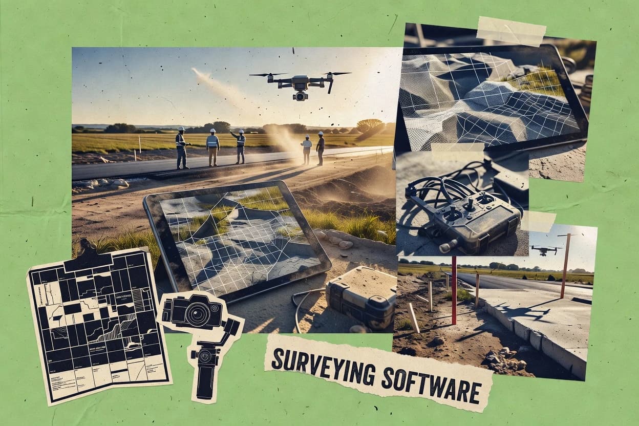
Construction InfrastructureTop 10 Best Drone Surveying Software of 2026
Top 10 Drone Surveying Software picks compared and ranked for mapping accuracy, workflows, and pricing. Explore the best options now.

How we ranked these tools
Core product claims cross-referenced against official documentation, changelogs, and independent technical reviews.
Analyzed video reviews and hundreds of written evaluations to capture real-world user experiences with each tool.
AI persona simulations modeled how different user types would experience each tool across common use cases and workflows.
Final rankings reviewed and approved by our editorial team with authority to override AI-generated scores based on domain expertise.
Score: Features 40% · Ease 30% · Value 30%
Gitnux may earn a commission through links on this page — this does not influence rankings. Editorial policy
Editor’s top 3 picks
Three quick recommendations before you dive into the full comparison below — each one leads on a different dimension.
Pix4D
Pix4D’s georeferenced photogrammetry workflow for orthomosaic and point cloud deliverables
Built for survey teams producing georeferenced orthomosaics and 3D models from drones.
DroneDeploy
Editor pickMission planning with automated capture modes that standardize deliverable generation
Built for survey teams needing repeatable, cloud-based mapping and collaborative review.
Emlid Flow
Editor pickField mission planner with coverage verification for survey-grade photogrammetry capture
Built for survey teams needing reliable drone missions with GNSS-guided field execution.
Related reading
Comparison Table
This comparison table evaluates drone surveying software options including Pix4D, DroneDeploy, Emlid Flow, Propeller Aero, and PTV Visum to support side-by-side selection. Readers can compare core capabilities such as photogrammetry and mapping workflows, flight-to-output data processing, accuracy and georeferencing support, and interoperability with common GIS and CAD pipelines. The table also highlights how each tool fits different use cases, from survey-grade deliverables to field-ready data capture and analysis.
Pix4D
photogrammetryPix4D generates photogrammetry and mapping outputs such as orthomosaics, 3D models, and volumes from drone imagery for surveying workflows.
Pix4D’s georeferenced photogrammetry workflow for orthomosaic and point cloud deliverables
Pix4D stands out for turning drone imagery into georeferenced mapping outputs with a processing workflow tuned for survey projects. The software supports photogrammetry to generate orthomosaics, 3D point clouds, and textured meshes with survey-grade georeferencing.
It also includes measurement tools for accuracy checks and QA workflows that help teams validate deliverables before handoff. Pix4D additionally supports automation for repeat processing and integration with common drone imagery and geospatial data formats.
- +Strong photogrammetry pipeline for orthomosaics, point clouds, and meshes
- +Survey-grade georeferencing and coordinate system handling for mapping workflows
- +QA and measurement tools support accuracy checks before deliverable export
- +Automation features speed repeat jobs across similar sites
- +Versatile export options for GIS and downstream analysis workflows
- –Advanced configurations can be complex for first-time survey teams
- –Processing time and compute requirements can be high on large datasets
- –Photogrammetry quality depends heavily on capture planning and overlap
Best for: Survey teams producing georeferenced orthomosaics and 3D models from drones
More related reading
DroneDeploy
cloud mappingDroneDeploy turns drone captures into geospatial deliverables with automated processing and survey project management for jobsite teams.
Mission planning with automated capture modes that standardize deliverable generation
DroneDeploy centers on end-to-end drone surveying workflows with automated flight planning and cloud processing for map outputs. Teams can generate orthomosaics, surface models, and measurement-ready reports from uploaded captures.
Collaboration features support review and approval of deliverables without moving files between tools. The platform also integrates with field data collection so operational teams can run repeatable survey missions across sites.
- +Automated mission planning produces consistent orthomosaics and surface models.
- +Cloud processing turns drone captures into measurement-ready deliverables quickly.
- +Built-in collaboration supports commenting and reviewing survey outputs.
- –Advanced customization of analysis workflows can feel limited.
- –Large datasets can create friction during upload and processing.
Best for: Survey teams needing repeatable, cloud-based mapping and collaborative review
Emlid Flow
field-to-mapEmlid Flow provides drone image processing integrated with survey-grade GNSS data capture to produce accurate maps and models.
Field mission planner with coverage verification for survey-grade photogrammetry capture
Emlid Flow stands out for turning drone survey fieldwork into a repeatable mission workflow that starts in the planning stage and ends with processed outputs. It supports mission execution using Emlid GNSS positioning and common survey flight planning with clear mapping of tasks to imagery capture.
The platform then focuses on photogrammetry-style survey deliverables and QA-style checks that help teams verify coverage before leaving the site. Its main differentiator is the end-to-end field-to-result loop tailored to survey teams rather than general drone piloting.
- +End-to-end workflow from mission planning through processed survey outputs
- +Coverage and capture checks reduce reflight risk on complex sites
- +GNSS integration improves positioning quality for survey-grade workflows
- –Photogrammetry and processing depth can lag specialist desktop suites
- –Workflow depends on compatible hardware and survey mission setup
- –Advanced editing and reporting options feel less extensive than top GIS tools
Best for: Survey teams needing reliable drone missions with GNSS-guided field execution
Propeller Aero
construction mappingPropeller Aero delivers drone-to-cloud mapping with ortho and 3D products focused on asset and construction surveying use cases.
Automated photogrammetry processing that publishes orthomosaics and surface models for review
Propeller Aero stands out for turning drone flights into survey-grade deliverables through an automated photogrammetry workflow. The platform focuses on creating orthomosaics, surface models, and other mapping outputs with an interface that supports client-friendly review and iteration.
It also fits teams that need repeatable processing from field data through publishable results rather than manual, tool-by-tool reconstruction. Collaboration and project management features help keep survey assets organized across missions.
- +Automated photogrammetry pipeline for survey deliverables
- +Clear project structure for managing multiple mapping jobs
- +Outputs include orthomosaics and surface models for field-ready review
- +Collaborative review flow supports stakeholder feedback
- –Limited depth for advanced reconstruction control compared to specialist tools
- –Dataset organization can feel rigid for highly custom workflows
Best for: Survey teams needing automated orthomosaic and surface generation with review workflows
PTV Visum
excluded-signalPTV Visum is a traffic modeling product not primarily for drone surveying photogrammetry workflows.
Advanced assignment and scenario modeling for road and public transport networks
PTV Visum stands out as a transportation planning and network modeling tool that integrates with geospatial workflows for infrastructure studies. It supports graph-based road and public transport network modeling with assignment and demand modeling used for scenario evaluation.
For drone surveying use cases, it can act as a post-survey decision layer by translating surveyed or GIS-derived inputs into validated transport and network scenarios. Core capabilities center on structured transport models rather than photogrammetry or point cloud processing.
- +Strong transport network modeling with assignment and scenario comparison
- +Detailed public transport modeling supports timetable and route structures
- +Works well when surveyed geometry feeds GIS-based network inputs
- +Structured outputs support planning workflows beyond mapping products
- –No built-in photogrammetry or point-cloud processing for drone data
- –Model setup can require domain knowledge in transport planning
- –Spatial editing for survey-derived geometry is not a primary focus
Best for: Teams converting surveyed infrastructure into transport scenarios for planning decisions
OpenDroneMap
open-source photogrammetryOpenDroneMap is an open-source photogrammetry pipeline that builds orthomosaics, textured meshes, and point clouds from drone images.
Dense point cloud and orthomosaic generation from aerial images
OpenDroneMap focuses on turning drone imagery into survey-grade outputs using an open-source photogrammetry toolchain. The workflow supports dense point clouds, digital surface models, digital terrain models, and orthomosaics generated from standard aerial image sets. It also integrates well with command-line processing and batch runs for repeatable site processing.
- +Generates point clouds, DSM, DTM, and orthomosaics from drone imagery
- +Batchable processing supports repeatable production runs across multiple sites
- +Open-source tooling enables customization of the photogrammetry pipeline
- +Works with common photogrammetry inputs and camera pose outputs
- –Command-line oriented workflows require scripting for smooth operations
- –Processing configuration often needs tuning for consistent alignment quality
- –Hardware and dataset size heavily influence run time and stability
- –Limited built-in QA reporting compared with more UI-first products
Best for: Teams running repeatable, command-driven drone photogrammetry for mapping deliverables
Agisoft Metashape
desktop photogrammetryAgisoft Metashape processes drone imagery into dense point clouds, 3D models, orthomosaics, and georeferenced outputs for surveying.
Dense point cloud generation with configurable meshing and filtering parameters
Agisoft Metashape stands out for dense image matching workflows that convert overlapping UAV imagery into georeferenced 3D models. Core capabilities include camera alignment, sparse and dense point cloud generation, mesh reconstruction, and orthomosaic or DEM production for surveying deliverables.
The software supports control points, coordinate system setup, and export formats commonly used in GIS and CAD pipelines. Processing is typically desktop-driven with a workflow geared toward repeatable photogrammetry projects rather than one-click mapping.
- +Strong photogrammetry toolchain from alignment through dense cloud and orthomosaics
- +Georeferencing with control points and coordinate system workflows for surveying outputs
- +Exports include meshes, point clouds, and orthomosaics for GIS and CAD integration
- –Dense processing can be hardware heavy on large UAV datasets
- –Achieving consistent results often requires careful capture planning and parameter tuning
- –Limited built-in collaboration compared with cloud-first mapping tools
Best for: Survey teams producing accurate orthomosaics and DEMs from UAV imagery
RealityCapture
photogrammetry engineRealityCapture is a photogrammetry engine that computes high-detail 3D reconstructions and georeferenced maps from aerial imagery.
1-click alignment and reconstruction stack optimized for large aerial image sets
RealityCapture stands out with a fast photogrammetry pipeline tuned for dense point clouds and high-fidelity reconstructions. It supports aerial image processing workflows from drone captures and can integrate ground control points for accurate georeferencing.
The software emphasizes robust alignment, scale control, and exporting results for downstream GIS and mapping tasks. Strong performance shows up most in large, high-overlap datasets where detailed textures and surfaces matter.
- +Rapid photogrammetry reconstruction for dense point clouds and detailed meshes
- +Ground control point workflows support precise scale and georeferencing
- +Flexible exports for GIS, CAD, and visualization pipelines
- –Workflow requires more user setup than guided drone mapping tools
- –Best results depend on consistent capture quality and image overlap
- –Processing large projects can be resource heavy on workstation hardware
Best for: Drone survey teams needing accurate photogrammetry output for mapping and CAD
Trimble Connect
construction collaborationTrimble Connect manages construction data including photogrammetry outputs and supports collaboration on point clouds and models.
Web-based 3D viewer review with markups and issue tracking linked to project items
Trimble Connect stands out for collaborative construction and survey workflows built around shared project control rather than just standalone photogrammetry. It supports uploading, organizing, and reviewing drone outputs with document management, 3D viewer review, and markup-based issue tracking tied to project items.
The platform also integrates with Trimble desktop and field tools to streamline capture-to-cloud handoffs for common survey and positioning processes. Teams gain a centralized place to manage deliverables, feedback, and evidence for geospatial assets.
- +Project-centric collaboration with 3D viewing and markup tied to project deliverables
- +Clear document and file organization for drone deliverables and review evidence
- +Strong integration path with Trimble capture and processing ecosystems
- –Geospatial processing depth depends on external tools, not in-browser reconstruction
- –Advanced review workflows can require training to structure projects correctly
- –Large drone datasets may feel slow without careful file management
Best for: Survey and construction teams needing shared drone data review and issue tracking
Bentley iTwin Capture
digital twin captureBentley iTwin Capture focuses on capturing and structuring reality data for digital twin workflows that can include drone-derived models.
iTwin ecosystem integration that turns drone captures into publishable, georeferenced reality models
Bentley iTwin Capture distinguishes itself with a field-capture workflow that feeds directly into the iTwin ecosystem for construction-scale digital delivery. It supports drone and terrestrial imagery capture to create georeferenced, reality-model outputs such as point clouds, meshes, and orthographic views.
The software emphasizes project-managed processing and review so survey results can be traced from acquisition to model publication. Collaboration and downstream visualization are handled through iTwin-connected data services rather than standalone survey reporting.
- +Tight iTwin integration enables direct handoff from capture to digital delivery
- +Georeferenced outputs include point clouds, meshes, and orthos for survey workflows
- +Project review tooling supports stakeholder signoff on captured results
- –Workflow benefits most when teams already use iTwin connected data and tools
- –Limited standalone reporting depth compared with survey-first processing suites
- –Less flexibility for custom photogrammetry processing than lower-level engines
Best for: Teams producing reality models for iTwin-based construction delivery and QA review
How to Choose the Right Drone Surveying Software
This buyer's guide helps teams select drone surveying software by mapping real survey workflows to specific tools like Pix4D, DroneDeploy, and Emlid Flow. It also covers desktop photogrammetry engines such as RealityCapture and Agisoft Metashape, open-source processing via OpenDroneMap, and collaboration platforms like Trimble Connect and Bentley iTwin Capture.
What Is Drone Surveying Software?
Drone surveying software converts drone imagery into survey outputs such as georeferenced orthomosaics, 3D point clouds, textured meshes, and surface models. It solves the capture-to-deliverables problem by handling photogrammetry, coordinate system setup, and export-ready mapping products for downstream GIS and CAD workflows. Survey teams use these tools to reduce rework by validating coverage and measurements before handing data to clients. Tools like Pix4D and Propeller Aero represent end-to-end survey mapping pipelines that turn UAV imagery into publishable ortho and surface outputs.
Key Features to Look For
The right set of features determines whether deliverables get produced reliably, reviewed quickly, and exported in the formats teams need for survey-grade work.
Survey-grade georeferenced photogrammetry deliverables
Look for software that produces orthomosaics plus dense outputs like point clouds and meshes with coordinate system handling for mapping workflows. Pix4D provides georeferenced orthomosaics and point clouds with survey-grade coordinate system workflows, while RealityCapture targets dense reconstructions and georeferenced maps with ground control support.
Automation for repeatable site processing
Choose tools that standardize processing steps so teams can reproduce results across multiple sites without rebuilding the workflow each time. Pix4D includes automation for repeat processing, while DroneDeploy and Propeller Aero emphasize automated processing that turns captured imagery into deliverables with less manual reconstruction work.
Mission planning and coverage verification in the capture workflow
Select platforms that help prevent bad captures by planning missions and verifying coverage before leaving the site. Emlid Flow includes a field mission planner with coverage checks, and DroneDeploy provides automated mission planning with capture modes designed to standardize deliverable generation.
Collaboration with web review, markups, and issue tracking
Pick tools with built-in stakeholder review so deliverables do not require file hopping across tools. Trimble Connect provides a web-based 3D viewer with markups and issue tracking tied to project items, and DroneDeploy supports collaboration with commenting and review of outputs.
Dense point cloud and surface model generation for mapping outputs
Ensure the tool generates dense point clouds and surface products that match survey deliverables and analysis workflows. OpenDroneMap produces dense point clouds plus orthomosaics, and Agisoft Metashape focuses on dense image matching with dense cloud generation and DEM or orthomosaic production.
Ecosystem handoff for construction-scale digital delivery
For organizations already building digital twins, select software that integrates directly into the downstream delivery ecosystem. Bentley iTwin Capture supports georeferenced reality-model outputs like point clouds, meshes, and orthographic views with review and signoff tooling through the iTwin ecosystem.
How to Choose the Right Drone Surveying Software
Start by matching output type and workflow ownership, then validate that processing depth, capture planning, and review needs align with the tool’s strengths.
Define the deliverables and georeferencing requirements
Confirm whether the workflow requires georeferenced orthomosaics plus dense outputs like point clouds or textured meshes. Pix4D is built around georeferenced photogrammetry deliverables for orthomosaics, point clouds, and meshes, and Agisoft Metashape and RealityCapture provide dense reconstructions with georeferencing workflows that rely on control points and coordinate system setup.
Decide where photogrammetry control should live
Choose a guided, survey-first pipeline if capture-to-deliverable consistency matters most to field and project teams. DroneDeploy and Propeller Aero emphasize automated photogrammetry processing and review workflows, while desktop engines like RealityCapture and Agisoft Metashape expect more user setup for alignment, matching, and reconstruction control.
Match the capture workflow to reflight risk and field constraints
If reflight prevention is the main driver, prioritize mission planning and coverage verification before data collection ends. Emlid Flow includes a field mission planner with coverage verification, and DroneDeploy provides automated mission planning with capture modes designed to standardize orthomosaic and surface model generation.
Verify review and collaboration paths for stakeholders
If multiple stakeholders need to validate deliverables and track issues, select software with web review and markups tied to project items. Trimble Connect supports web-based 3D viewer review with markups and issue tracking, while DroneDeploy supports collaboration with commenting and reviewing survey outputs.
Plan for how results enter broader GIS, CAD, and digital twin workflows
Select tools based on how the outputs plug into the next system after export or publication. Pix4D and RealityCapture offer flexible exports for GIS and downstream analysis, Trimble Connect centralizes drone deliverables for evidence and review tied to project items, and Bentley iTwin Capture supports direct digital twin handoff inside the iTwin ecosystem.
Who Needs Drone Surveying Software?
Drone surveying software fits organizations that need repeatable mapping deliverables from drone imagery, plus the review and handoff steps that make those deliverables usable for real projects.
Survey teams producing georeferenced orthomosaics and 3D models from drones
Pix4D is purpose-built for georeferenced orthomosaics, point clouds, and meshes with survey-grade coordinate handling, and it includes QA and measurement tools for accuracy checks before export. RealityCapture also fits this audience when dense reconstructions matter and ground control workflows are available.
Jobsite teams needing repeatable cloud mapping and collaboration
DroneDeploy targets repeatable, cloud-based mapping with automated mission planning and collaborative review using commenting and approval workflows. Propeller Aero fits teams that want automated orthomosaic and surface generation plus client-friendly review iteration.
Survey teams running GNSS-guided drone missions with coverage verification
Emlid Flow is designed for field-to-result surveying with an end-to-end mission planner tied to GNSS positioning and coverage checks. This matches teams that want to reduce reflight risk on complex sites by validating capture coverage before leaving.
Construction survey organizations that centralize review, markup, and evidence in a project system
Trimble Connect is best for survey and construction teams that need shared drone deliverables in a project-centric system with a web-based 3D viewer. Bentley iTwin Capture is the best fit when the end goal is reality-model publication inside the iTwin ecosystem for construction-scale digital delivery.
Common Mistakes to Avoid
Common failure modes come from choosing a tool that mismatches field execution, leaving georeferencing and QA to chance, or underestimating how dataset size and processing control affect outcomes.
Skipping capture planning and coverage checks
Teams that rely on post-processing alone risk poor alignment and incomplete coverage that increases rework. Emlid Flow and DroneDeploy reduce this failure mode by using mission planning and coverage verification or automated capture modes that standardize deliverable generation.
Treating photogrammetry output as automatically survey-ready
Survey deliverables often require accuracy checks and QA steps before export. Pix4D includes QA and measurement tools for validating deliverables before handoff, while desktop tools like Agisoft Metashape and RealityCapture still require careful parameter tuning and capture quality to maintain consistent results.
Picking a desktop engine when stakeholder collaboration is the bottleneck
When review cycles and issue tracking are the real schedule drivers, web collaboration matters more than reconstruction speed. Trimble Connect provides markup-based issue tracking linked to project items, and DroneDeploy supports commenting and review of outputs without moving files between tools.
Forgetting that advanced processing control increases setup time
Tools with deeper reconstruction control can demand more user setup, especially on large projects. RealityCapture and Agisoft Metashape can produce strong dense results but require more user setup than guided drone mapping tools, while OpenDroneMap shifts effort toward configuration and command-line operation.
How We Selected and Ranked These Tools
we evaluated every tool on three sub-dimensions. Features received a 0.4 weight, ease of use received a 0.3 weight, and value received a 0.3 weight. The overall rating is the weighted average of those three using overall = 0.40 × features + 0.30 × ease of use + 0.30 × value. Pix4D separated itself most clearly on the features dimension because its georeferenced photogrammetry workflow for orthomosaic and point cloud deliverables combined with QA and measurement tools for accuracy checks before deliverable export.
Frequently Asked Questions About Drone Surveying Software
Which drone surveying software is best for producing georeferenced orthomosaics and survey-grade 3D deliverables?
What tool supports a repeatable end-to-end mission workflow from GNSS-guided capture to QA-style coverage verification?
Which platform is designed for cloud processing plus collaborative review of survey outputs without moving files between tools?
Which software is most suitable for automation of photogrammetry processing and producing client-friendly outputs for iteration?
Which option fits teams that need command-line batch processing for dense point clouds and orthomosaics?
Which tool is strongest for fast dense reconstruction on large, high-overlap datasets?
How do survey teams typically handle georeferencing, control points, and coordinate system setup across different software?
What tool supports collaborative issue tracking tied to project items for drone survey deliverables?
Which solution is best when drone surveys must feed into construction-scale digital delivery within the iTwin ecosystem?
Can drone survey outputs be used for transportation planning and scenario evaluation rather than photogrammetry alone?
Conclusion
After evaluating 10 construction infrastructure, Pix4D stands out as our overall top pick — it scored highest across our combined criteria of features, ease of use, and value, which is why it sits at #1 in the rankings above.
Use the comparison table and detailed reviews above to validate the fit against your own requirements before committing to a tool.
Tools reviewed
Primary sources checked during evaluation.
Referenced in the comparison table and product reviews above.
Keep exploring
Comparing two specific tools?
Software Alternatives
See head-to-head software comparisons with feature breakdowns, pricing, and our recommendation for each use case.
Explore software alternatives→In this category
Construction Infrastructure alternatives
See side-by-side comparisons of construction infrastructure tools and pick the right one for your stack.
Compare construction infrastructure tools→FOR SOFTWARE VENDORS
Not on this list? Let’s fix that.
Our best-of pages are how many teams discover and compare tools in this space. If you think your product belongs in this lineup, we’d like to hear from you—we’ll walk you through fit and what an editorial entry looks like.
Apply for a ListingWHAT THIS INCLUDES
Where buyers compare
Readers come to these pages to shortlist software—your product shows up in that moment, not in a random sidebar.
Editorial write-up
We describe your product in our own words and check the facts before anything goes live.
On-page brand presence
You appear in the roundup the same way as other tools we cover: name, positioning, and a clear next step for readers who want to learn more.
Kept up to date
We refresh lists on a regular rhythm so the category page stays useful as products and pricing change.