GITNUXSOFTWARE ADVICE
Construction InfrastructureTop 10 Best 3D Topography Software of 2026
Compare and rank 3D Topography Software tools for mapping and surveying, with key features and tradeoffs for shortlist decisions.

How we ranked these tools
Core product claims cross-referenced against official documentation, changelogs, and independent technical reviews.
Analyzed video reviews and hundreds of written evaluations to capture real-world user experiences with each tool.
AI persona simulations modeled how different user types would experience each tool across common use cases and workflows.
Final rankings reviewed and approved by our editorial team with authority to override AI-generated scores based on domain expertise.
Score: Features 40% · Ease 30% · Value 30%
Gitnux may earn a commission through links on this page — this does not influence rankings. Editorial policy
Editor’s top 3 picks
Three quick recommendations before you dive into the full comparison below — each one leads on a different dimension.
AutoCAD Civil 3D
Corridor-based grading and earthwork volumes computed directly from surfaces
Built for civil engineering teams producing grading, cut-fill, and contour deliverables.
Bentley ContextCapture
Editor pickReality modeling with survey-grade accuracy and orthographic, DSM, and DTM generation from imagery
Built for survey and geospatial teams producing photogrammetric topography for earthworks planning.
Related reading
Comparison Table
The comparison table maps 3D topography workflows across mapping and surveying tools, focusing on integration depth with survey and GIS ecosystems. It evaluates each product’s data model, automation and API surface for repeatable extraction and updates, plus admin and governance controls such as RBAC, audit logs, and provisioning. The goal is to support a ranking and shortlist by showing practical tradeoffs in schema design, extensibility, and throughput for terrain datasets.
AutoCAD Civil 3D
CAD surveyCivil 3D builds and edits 3D surfaces from survey and lidar data and exports grading and topography workflows for infrastructure design.
Corridor-based grading and earthwork volumes computed directly from surfaces
AutoCAD Civil 3D stands out for integrating topographic data with a full civil engineering model, not just static surface drawing. It builds and edits TIN and surface objects from points, survey data, and alignments, then supports grading and earthwork workflows tied to those surfaces.
Labeling and style controls help teams keep contours, points, and surface analysis consistent across large projects. The software also supports downstream exchange via common CAD and GIS-friendly data formats for collaboration and verification.
- +Surface modeling from points with controllable TIN and contour generation
- +Strong alignment and grading workflows connected to topographic surfaces
- +Highly configurable surface labels, styles, and display rules
- +Robust surface analysis tools for volumes, cut-fill, and comparisons
- +Easier data reuse through corridor and feature-driven modeling
- –Modeling workflows can feel complex without civil data preparation
- –Style and label setup takes time to standardize across teams
- –Performance can degrade on very dense point clouds and large surfaces
Survey and mapping teams working on engineering projects
Converting survey points and field data into Civil 3D surfaces and then generating contours for plan production
Faster turnaround from field measurements to updated contour plans without rebuilding surface data from scratch.
Civil engineering designers creating road, grading, and utility projects
Driving grading and earthwork calculations from proposed and existing surfaces tied to alignments
More consistent earthwork volumes and grading decisions when design geometry changes.
Show 1 more scenario
Project controls and construction coordination teams
Sharing verification models and aligning civil deliverables across CAD and GIS workflows
Reduced rework caused by mismatched terrain data across review cycles.
Civil 3D supports exchange of surface and related design data for collaboration and review with other stakeholders. Teams can move between surface representations for verification while maintaining geometry that matches the civil model.
Best for: Civil engineering teams producing grading, cut-fill, and contour deliverables
More related reading
Bentley ContextCapture
photogrammetryContextCapture generates georeferenced 3D models and dense point clouds from photos and supports terrain extraction for topographic outputs.
Reality modeling with survey-grade accuracy and orthographic, DSM, and DTM generation from imagery
Bentley ContextCapture stands out for turning aerial and photogrammetry inputs into metrically consistent 3D reality models at survey-grade accuracy. It supports feature extraction workflows such as orthographic views, DSM and DTM generation, and dense point cloud outputs for topographic deliverables.
The product also emphasizes scalable processing through task management, cloud or high-performance compute options, and repeatable project templates. Integrated measurement and model conditioning tools help convert raw imagery into usable terrain surfaces for planning and earthworks.
- +Survey-grade photogrammetry workflows produce usable DSM and DTM surfaces
- +Dense point cloud and orthomosaic outputs support standard topographic deliverables
- +Scalable processing manages large image sets with repeatable project setup
- +Integrated measurement tools speed validation of model geometry
- –Dense terrain results depend heavily on image coverage and flight planning
- –Model tuning steps can require specialist survey knowledge
- –Workflow complexity rises with multi-project alignment and control data needs
Geospatial survey teams producing survey-grade terrain deliverables
Convert UAV imagery and terrestrial photogrammetry captures into a DSM, a DTM, and orthographic outputs for route planning and earthwork design
Delivery of a consistent terrain model set that supports volume calculations and alignment work with reduced manual reprocessing.
Engineering and construction teams preparing site models for planning and earthworks
Generate dense point clouds and conditioned terrain surfaces for cut and fill estimation on complex sites
A usable site surface model that supports earthwork quantities and fewer iterations between field capture and design updates.
Show 2 more scenarios
Oil, gas, and utility operators documenting terrain for asset planning and corridor studies
Create corridor-ready topographic products from repeat aerial captures to compare changes over time
Time-consistent terrain datasets that support impact assessment for routes and linear infrastructure.
Repeatable project templates support consistent processing when new captures are acquired. The resulting topographic deliverables can be regenerated from new imagery to support corridor studies and progress tracking.
GIS and mapping organizations managing large survey projects that require scalable compute
Process high-volume imagery into dense point clouds and terrain surfaces using task management and compute resources
Faster turnaround from imagery intake to dense point cloud and topographic surface deliverables with fewer workflow disruptions.
Task management and scalable compute options enable structured batch processing across multiple jobs. This helps produce consistent topographic outputs across extensive areas and datasets.
Best for: Survey and geospatial teams producing photogrammetric topography for earthworks planning
More related reading
Trimble Business Center
survey processingTrimble Business Center processes survey point clouds and generates 3D terrain models for topographic and earthwork workflows.
Terrain Modeling with volume computations for cut and fill based on survey and scan-derived surfaces
Trimble Business Center stands out for its tight workflow from field data to deliverables for survey and earthwork projects. It supports 3D point cloud and survey data processing, then produces surfaces, contours, volumes, and measurement reports in one environment.
Modeling and alignment tools help convert raw GNSS, total station, and laser scanner outputs into usable topographic terrain. The software also supports collaboration via Trimble ecosystem formats, which reduces friction between collection, processing, and downstream CAD workflows.
- +Strong surface generation from survey observations and laser scanning data
- +Accurate volume and earthwork computations from designed terrains and boundaries
- +Good alignment and registration tools for multi-scan topography workflows
- +Survey quality controls like point editing and error checks improve deliverable trust
- +Flexible export options for CAD and GIS-oriented downstream processing
- –Dense toolset creates a steep learning curve for new topography workflows
- –Some advanced processing steps require careful parameter tuning to avoid rework
- –Project organization can feel complex when managing large point cloud datasets
- –Workflow dependency on specific survey data formats can slow mixed-provider projects
Best for: Survey and earthwork teams processing GNSS, total station, and scanning into terrains
Leica Cyclone 3DR
point cloudCyclone 3DR registers laser scan data, cleans point clouds, and extracts measurements and terrain products for 3D topography.
Cyclone 3DR point cloud registration and georeferencing for consistent topographic measurements
Leica Cyclone 3DR stands out by turning captured point clouds into survey-grade 3D deliverables with strong georeferencing and measurement workflows. It supports project-based processing for registration, classification, and extraction of features such as surfaces and volumetrics.
The software also enables downstream use through exports of processed geometry and point clouds for analysis and visualization in other tools. Its fit is strongest for teams that need repeatable topography production from field scans.
- +Survey-grade point cloud processing for topography, surfaces, and measurements
- +Robust registration tools for aligning scans and maintaining georeferencing
- +Feature extraction and surface modeling workflows support practical deliverables
- +Quality-focused classification options improve extraction accuracy
- –Complex project setup slows teams without established processing standards
- –Workflow tuning is needed to consistently extract clean topographic surfaces
Best for: Survey teams producing topographic surfaces from registered point clouds
PTV SmartCabs
3D mappingSmartCabs produces 3D mapping outputs with terrain layers that support infrastructure context and route planning visualization.
Scenario-based routing visualization in 3D tied to operational movement outputs
PTV SmartCabs stands out for turning road network models into dispatch-ready 3D visualizations and operational views for logistics and mobility planning. Core capabilities include geospatial map visualization, scenario-based routing with traffic-relevant road context, and exporting route and movement outputs for stakeholder review. It supports workflow integration for planning and analysis teams that need topography-aware route evaluation rather than raw mesh generation.
- +3D map views connected to route and scenario outputs for fast planning review
- +Road network context supports practical logistics visualization instead of standalone topo rendering
- +Exportable scenario and routing results fit reporting and stakeholder workflows
- –Topology-focused tools like terrain mesh editing are not the primary strength
- –Scenario setup can feel complex for teams without GIS and routing background
- –Deep customization of 3D data pipelines is limited compared with dedicated topo systems
Best for: Transportation planning teams needing scenario-driven 3D route visualization and reporting
More related reading
SUEZ (Surface Modeling) Platform
asset modelingThe Surface Modeling platform supports 3D surface visualization for assets and construction infrastructure geometry reviews.
Surface modeling workflow for generating and refining terrain surfaces from survey inputs
SUEZ Surface Modeling Platform focuses on building and editing 3D surface models from survey and spatial inputs for asset and engineering workflows. It supports surface generation, refinement, and management tasks that are typical in topographic mapping and terrain modeling projects.
The tool emphasizes repeatable modeling operations and structured project data handling for downstream engineering use. Strong suitability shows up when teams need consistent terrain surfaces across multiple sites and processing runs.
- +Structured surface modeling workflow supports repeatable terrain creation
- +Designed for topography deliverables with clear surface management concepts
- +Model refinement operations fit iterative surveying and update cycles
- +Project organization helps keep surface variants aligned to use cases
- –Interface learning curve can slow setup for new modeling teams
- –Advanced workflows need domain familiarity with survey data preparation
- –Integration breadth for non-SUEZ pipelines can require extra handling
- –Tooling feels workflow-centric over ad hoc surface exploration
Best for: Teams producing consistent 3D terrain surfaces for engineering and monitoring workflows
CloudCompare
open-sourceCloudCompare aligns point clouds and generates triangulated surfaces for detailed topographic inspection.
CloudCompare’s iterative closest point and signed distance tools for scan comparison and change quantification
CloudCompare stands out with a desktop-driven point cloud workflow focused on measurement, filtering, and comparison. It handles 3D topography tasks using native support for dense point clouds, meshes, and scalar fields with robust tools like alignment and change detection.
The software excels at cleaning noisy scans and extracting surfaces, then producing quantitative outputs for surveying and geomatics review. Its open, menu-driven toolset supports repeatable analysis without needing custom code.
- +Strong point cloud alignment with iterative closest point workflows for surface registration
- +Comprehensive filtering tools for denoising, outlier removal, and attribute-driven extraction
- +Built-in mesh and rasterization operations support surface generation and analysis
- +Change detection tools help quantify differences between scans and DEM-like surfaces
- –Interface relies on many dialogs and parameters that slow first-time setup
- –Topo-specific workflows need more manual steps than dedicated surveying suites
- –Automation requires scripting approaches rather than simple visual pipelines
Best for: Survey and geomatics teams needing measurement-focused point cloud processing
More related reading
Pix4Dmapper
UAV mappingPix4Dmapper processes UAV imagery to produce dense point clouds and 3D terrain models for topographic outputs.
Automated generation of orthomosaics and DSM from calibrated photogrammetry
Pix4Dmapper stands out for producing dense 3D point clouds and georeferenced outputs from drone imagery using a photogrammetry workflow. It supports standard topography deliverables like orthomosaics, digital surface models, and textured 3D models, with tools for alignment, quality checks, and automated export.
The software is well suited to repeatable mapping projects that need consistent accuracy and survey-grade workflows. Processing can be scaled via project management features and hardware acceleration to handle larger image sets.
- +Dense point clouds, DSM, and orthomosaics from drone imagery
- +Georeferencing workflows support control points and accurate outputs
- +Quality reporting tools help validate alignment and reconstruction confidence
- –Project setup and parameter tuning can slow first-time mapping work
- –Large datasets can demand significant compute time and system resources
- –Advanced survey workflows require consistent GCP or GNSS inputs
Best for: Survey teams running repeatable drone photogrammetry topography projects
QGIS
geospatial GISCreates terrain layers from raster and vector sources with plugins for point cloud and surface workflows.
Python API for automating layer processing, 3D exports, and repeatable map builds.
QGIS fits teams that need repeatable topography visualization from GIS datasets, not a closed 3D viewer. It can render 3D terrain surfaces from raster and mesh inputs and supports layered map workflows with plugin-driven extensibility.
The data model stays anchored in standard GIS layers and schemas, so integration with external geospatial tooling remains straightforward through files, services, and scripted processing. Automation and integration rely on documented Python scripting and plugin hooks, which shape the API and governance depth available to administrators.
- +3D terrain rendering from raster elevation layers with style controls
- +Python scripting enables repeatable workflows across maps and exports
- +Plugin architecture supports added geoprocessing and 3D visualization behaviors
- +Layer-based data model maps cleanly to geospatial schemas and projections
- –No built-in RBAC or tenant controls for multi-admin governance
- –Admin audit logs and provisioning controls are not centralized in core
- –3D throughput depends on hardware and dataset tiling practices
- –API surface is mainly Python-centric rather than service-led automation
Best for: Fits when teams need configurable 3D terrain rendering plus scripted GIS automation.
Conclusion
After evaluating 10 construction infrastructure, AutoCAD Civil 3D stands out as our overall top pick — it scored highest across our combined criteria of features, ease of use, and value, which is why it sits at #1 in the rankings above.
Use the comparison table and detailed reviews above to validate the fit against your own requirements before committing to a tool.
How to Choose the Right 3D Topography Software
This guide helps teams choose 3D topography software for grading, terrain extraction, and earthwork deliverables using tools like AutoCAD Civil 3D, Bentley ContextCapture, Trimble Business Center, Leica Cyclone 3DR, Pix4Dmapper, QGIS, and CloudCompare.
It focuses on integration depth, the data model behind surfaces and point clouds, automation and API surface, and admin and governance controls across photogrammetry pipelines, survey processing, and GIS-driven workflows.
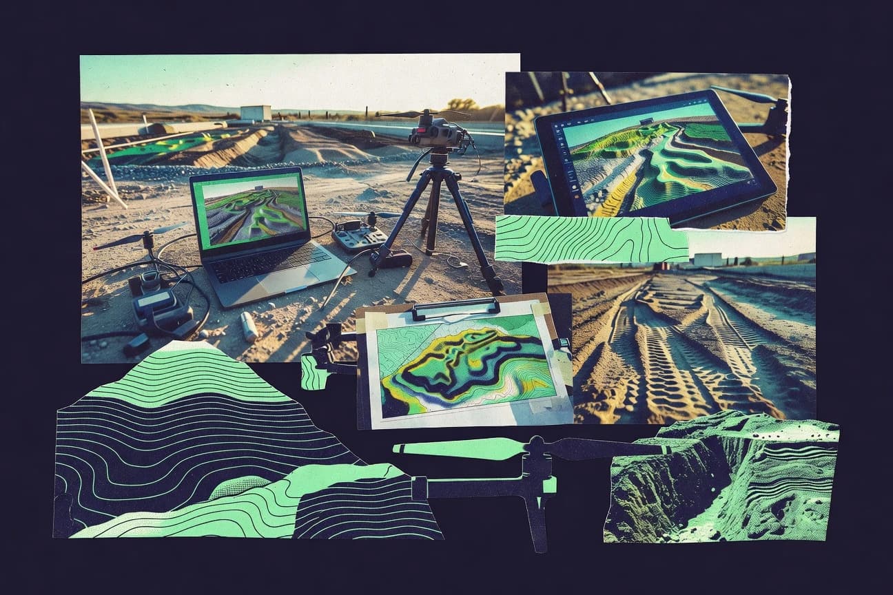
3D topography software for turning survey and imagery inputs into terrain surfaces, contours, and measurement products
3D topography software builds and edits terrain representations such as TIN surfaces, triangulated meshes, and raster-like height products from survey points, laser scans, or calibrated imagery.
These tools solve deliverable production for topography and earthworks by generating contours, performing cut and fill volume calculations, and exporting surfaces for downstream CAD and GIS workflows, with AutoCAD Civil 3D connecting directly into grading and corridor-based earthwork computations.
Survey and geospatial teams also use photogrammetry-focused tools like Bentley ContextCapture or Pix4Dmapper to generate georeferenced DSM and DTM outputs from orthomosaic-capable image processing.
Integration depth, data model control, and automation surface for predictable terrain deliverables
Evaluating integration depth means checking whether the tool can carry terrain objects through labeling, measurement, and export stages without manual rework, as seen in AutoCAD Civil 3D when surfaces feed grading and cut-fill workflows tied to corridors.
Evaluating the data model and automation surface means checking whether the tool exposes repeatable schema and pipeline controls, such as QGIS Python scripting for layered 3D terrain exports or CloudCompare’s scripting-oriented automation options for point cloud comparison.
Surface-to-measurement linkage for cut-fill volumes and earthworks
AutoCAD Civil 3D computes grading and earthwork volumes directly from surfaces using corridor-based grading, which keeps measurement tied to the same terrain object used for contours and styles. Trimble Business Center also produces volume and earthwork computations from designed terrains and boundaries for survey-driven cut and fill reporting.
Reality modeling pipeline that outputs DSM, DTM, and dense point clouds from imagery
Bentley ContextCapture and Bentley OpenBuildings Designer both emphasize survey-grade accuracy from photos with orthographic views plus DSM and DTM generation and dense point cloud outputs. Pix4Dmapper similarly automates orthomosaics and DSM generation from calibrated photogrammetry when consistent control inputs are available.
Point cloud registration and georeferencing for repeatable topographic extraction
Leica Cyclone 3DR centers on project-based registration, classification, and extraction to maintain georeferencing during topographic surface production. CloudCompare supports iterative closest point workflows, denoising filters, and signed distance tools for scan comparison and change quantification when measurement-focused processing is required.
Configuration-grade labeling, style, and display rules for consistent terrain presentation
AutoCAD Civil 3D offers highly configurable surface labels, styles, and display rules so teams can standardize contours, points, and surface analysis across large projects. SUEZ Surface Modeling Platform supports repeatable modeling operations with structured surface management so terrain variants align to use cases over multiple sites.
Automation and API surface for repeatable processing and governed exports
QGIS provides a Python scripting approach that enables repeatable layer processing and 3D exports across maps, and its plugin architecture extends 3D visualization behaviors through hooks. CloudCompare automation is scripting-oriented rather than a simple visual pipeline, which suits teams that already treat processing steps as repeatable jobs.
Admin and governance controls for multi-admin and multi-project operations
Some tools focus on terrain production rather than multi-admin governance, so QGIS is limited by lacking built-in RBAC and centralized admin audit logs and provisioning controls. AutoCAD Civil 3D’s strong project labeling and standards control supports operational consistency, while other specialized terrain platforms like SUEZ concentrate governance around structured project data handling instead of tenant-style RBAC.
A decision framework for selecting the right 3D topography workflow and control model
Start with the input and deliverable type, because AutoCAD Civil 3D and Trimble Business Center assume survey observations and designed terrains, while Bentley ContextCapture, Bentley OpenBuildings Designer, and Pix4Dmapper assume calibrated imagery. Then verify the surface representation needed for downstream work, because TIN-centered workflows can differ materially from mesh- or raster-centric outputs.
Match the tool to the source data and deliverable family
For GNSS, total station, and scanning into terrains with cut-fill volumes and measurement reports, choose Trimble Business Center. For registered point cloud processing that preserves georeferencing and extracts topography measurements, choose Leica Cyclone 3DR or CloudCompare when change detection and measurement-focused inspection are central.
Select the terrain extraction approach that fits image coverage and calibration needs
For survey-grade photogrammetry workflows that produce DSM, DTM, and orthographic outputs from imagery, select Bentley ContextCapture or Bentley OpenBuildings Designer. For automated orthomosaic and DSM outputs from drone imagery using calibrated photogrammetry, select Pix4Dmapper and plan for consistent GCP or GNSS inputs.
Validate the data model carries terrain through labeling, volumes, and export
For corridor-based grading and earthwork volumes that must stay tied to the surface used for contours, select AutoCAD Civil 3D. For consistent terrain surface creation across multiple sites with structured surface variants, select SUEZ Surface Modeling Platform.
Check automation and extensibility against the team’s integration plan
If scripted, repeatable GIS workflows and 3D terrain exports are needed, QGIS supports Python scripting and plugin-driven extensibility. If repeatable point cloud alignment, filtering, and quantitative change detection are needed, CloudCompare supports iterative closest point workflows plus signed distance tools, with automation suited to scripting.
Assess governance needs such as RBAC, audit logs, and provisioning
If governance requires RBAC and centralized admin audit logs, QGIS lacks built-in RBAC and centralized admin audit and provisioning controls in core. For teams standardizing operations through configurable labels and styles, AutoCAD Civil 3D’s configurable surface labeling and style rules reduce drift across deliverables even when tenant-style governance is not the product focus.
Which teams should pick which 3D topography tools based on workflow fit
The best pick depends on whether the pipeline starts with survey points, registered laser scans, or calibrated imagery. It also depends on whether the downstream work requires corridor-connected earthworks, photogrammetry terrain extraction, or GIS-layered automation.
Civil engineering teams producing grading, cut-fill, and contour deliverables from surfaces
AutoCAD Civil 3D fits when corridor-based grading and earthwork volumes must be computed directly from terrain surfaces with highly configurable surface labels and display rules.
Survey and geospatial teams producing photogrammetric topography for earthworks planning
Bentley ContextCapture and Bentley OpenBuildings Designer fit when survey-grade reality modeling must output orthographic views plus DSM and DTM surfaces with dense point cloud deliverables.
Survey and earthwork teams processing GNSS, total station, and scanning into terrains
Trimble Business Center fits when a tight workflow must convert survey observations and laser scanning into surfaces, contours, volumes, and measurement reports inside one environment.
Survey teams generating topographic surfaces from registered point clouds
Leica Cyclone 3DR fits when point cloud registration and georeferencing must stay consistent across projects, while CloudCompare fits when measurement-focused alignment, filtering, and scan comparison matter.
GIS and automation teams turning elevation layers and meshes into repeatable 3D terrain exports
QGIS fits when Python scripting and a plugin architecture support repeatable map builds and 3D exports anchored in GIS layer schemas.
Pitfalls that cause rework in terrain modeling pipelines and governance-heavy deployments
A common failure mode is choosing software that produces an attractive surface but does not keep measurement and earthwork logic tied to the same terrain object. Another failure mode is selecting a tool for automation needs without matching its automation and governance surface to how the organization runs processing jobs.
Selecting a tool for visualization while ignoring cut-fill volume linkage
AutoCAD Civil 3D keeps corridor-based grading and earthwork volumes computed directly from surfaces, while PTV SmartCabs focuses on scenario-based routing visualization tied to operational movement outputs and is not designed around terrain cut-fill volume production.
Assuming photogrammetry terrain results are consistent without coverage and tuning work
Bentley ContextCapture and Bentley OpenBuildings Designer depend on image coverage and require model tuning steps, and Pix4Dmapper needs consistent GCP or GNSS inputs for advanced survey workflows.
Treating point cloud extraction as a one-time step rather than a tuned, repeatable process
Leica Cyclone 3DR requires robust project setup and workflow tuning to consistently extract clean topographic surfaces, and CloudCompare’s many dialogs and parameters slow first-time setup when repeatability standards are not established.
Overestimating built-in admin governance for multi-admin deployments
QGIS has no built-in RBAC and no centralized admin audit logs and provisioning controls in core, so governance-heavy rollouts need an external process model around user roles and change control.
How We Selected and Ranked These Tools
We evaluated AutoCAD Civil 3D, Bentley OpenBuildings Designer, Bentley ContextCapture, Trimble Business Center, Leica Cyclone 3DR, PTV SmartCabs, SUEZ Surface Modeling Platform, CloudCompare, Pix4Dmapper, and QGIS using three scored areas that map to purchasing risk: features, ease of use, and value, with features carrying the most weight at 40% and ease of use and value each accounting for 30%. We then used each tool’s described capabilities such as corridor-based grading volumes in AutoCAD Civil 3D, survey-grade DSM and DTM generation in Bentley ContextCapture, and QGIS Python scripting for repeatable exports to shape the features score.
AutoCAD Civil 3D separates itself from lower-ranked options by connecting topographic surfaces to corridor-based grading and earthwork volume computations directly from surfaces, which lifts its features performance and aligns with the highest-rated overall workflow need for infrastructure grading deliverables.
Frequently Asked Questions About 3D Topography Software
Which software best connects survey points to grading and earthwork surfaces?
What tool is the most direct choice for photogrammetry-based topography from drone imagery?
Which option is strongest for registered point cloud processing into topographic surfaces?
Which software fits teams that need automated surface-based volume calculations?
How do ContextCapture and Pix4Dmapper differ for DSM and DTM generation workflows?
What should a team use to compare scans or quantify surface change across projects?
Which tools provide an API or scripting path for governance and automation?
Which product integrates with civil or CAD deliverables through shared surface and geometry formats?
What is the better fit for road-network scenario outputs versus raw topographic meshing?
Which software supports admin controls and security patterns like RBAC and audit logging?
Tools reviewed
Primary sources checked during evaluation.
Referenced in the comparison table and product reviews above.
Keep exploring
Comparing two specific tools?
Software Alternatives
See head-to-head software comparisons with feature breakdowns, pricing, and our recommendation for each use case.
Explore software alternatives→In this category
Construction Infrastructure alternatives
See side-by-side comparisons of construction infrastructure tools and pick the right one for your stack.
Compare construction infrastructure tools→FOR SOFTWARE VENDORS
Not on this list? Let’s fix that.
Our best-of pages are how many teams discover and compare tools in this space. If you think your product belongs in this lineup, we’d like to hear from you—we’ll walk you through fit and what an editorial entry looks like.
Apply for a ListingWHAT THIS INCLUDES
Where buyers compare
Readers come to these pages to shortlist software—your product shows up in that moment, not in a random sidebar.
Editorial write-up
We describe your product in our own words and check the facts before anything goes live.
On-page brand presence
You appear in the roundup the same way as other tools we cover: name, positioning, and a clear next step for readers who want to learn more.
Kept up to date
We refresh lists on a regular rhythm so the category page stays useful as products and pricing change.