GITNUXSOFTWARE ADVICE
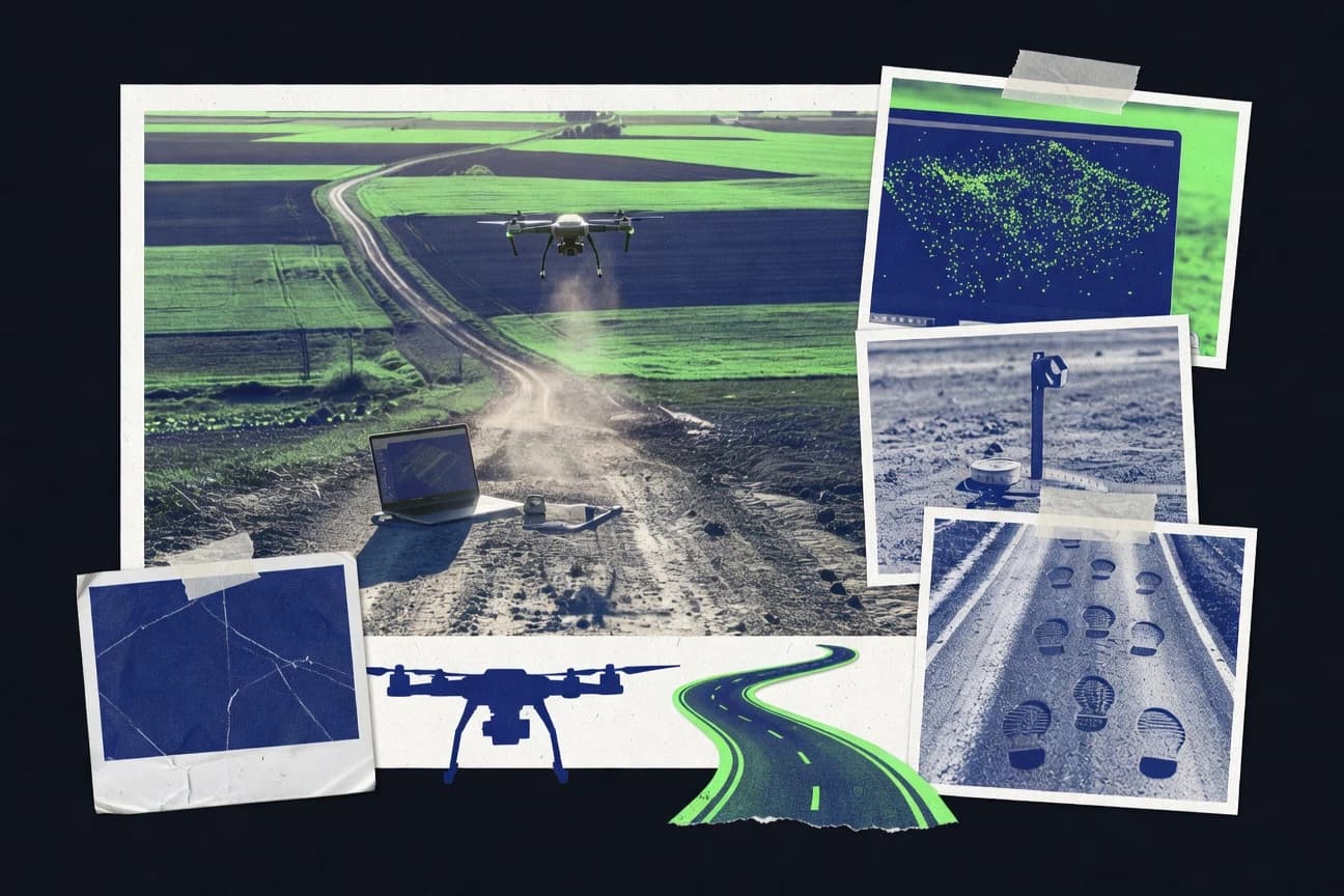
Data Science AnalyticsTop 10 Best Aerial Photogrammetry Software of 2026
Compare rankings of Aerial Photogrammetry Software for mapping and 3D modeling, covering Pix4Dmapper, Metashape, RealityCapture, plus more tools.

How we ranked these tools
Core product claims cross-referenced against official documentation, changelogs, and independent technical reviews.
Analyzed video reviews and hundreds of written evaluations to capture real-world user experiences with each tool.
AI persona simulations modeled how different user types would experience each tool across common use cases and workflows.
Final rankings reviewed and approved by our editorial team with authority to override AI-generated scores based on domain expertise.
Score: Features 40% · Ease 30% · Value 30%
Gitnux may earn a commission through links on this page — this does not influence rankings. Editorial policy
Editor’s top 3 picks
Three quick recommendations before you dive into the full comparison below — each one leads on a different dimension.
Pix4Dmapper
Quality report with point cloud and alignment diagnostics for reconstruction validation
Built for teams producing accurate orthomosaics and 3D models from drone imagery.
Agisoft Metashape
Editor pickMetashape dense cloud and orthomosaic generation with detailed reconstruction controls
Built for survey teams needing accurate aerial reconstructions with configurable processing.
RealityCapture
Editor pickGeoreferenced reconstruction pipeline with precise alignment and scalable dense modeling
Built for aerial survey teams needing high-detail photogrammetry with controlled processing.
Related reading
Comparison Table
This comparison table evaluates aerial photogrammetry tools for mapping and modeling, including Pix4Dmapper, Metashape, and RealityCapture, plus other widely used options. Each row compares integration depth, the underlying data model and schema handling, and the automation and API surface for repeatable processing pipelines. The table also documents admin and governance controls such as RBAC, audit log coverage, and provisioning and extensibility patterns to support team throughput.
Pix4Dmapper
commercial photogrammetryGenerates georeferenced orthomosaics, dense point clouds, and 3D models from aerial and drone imagery using automated photogrammetry and mapping workflows.
Quality report with point cloud and alignment diagnostics for reconstruction validation
Pix4Dmapper stands out for turning drone imagery into survey-grade outputs with a repeatable photogrammetry workflow. It produces dense point clouds, textured meshes, DSMs, and orthomosaics with options for radiometric and geometric processing.
The software integrates with common drone and camera sources and supports project templates that reduce setup time for recurring sites. Advanced tools for quality checks and measurement help validate accuracy before exporting deliverables.
- +Strong automated pipeline for dense clouds, meshes, and orthomosaics
- +Survey-oriented exports including DSM generation and measurement-ready models
- +Quality reporting tools help verify alignment and reconstruction consistency
- +Works well with standard drone imagery workflows and camera metadata
- +Relatively fast iteration with process presets for common project types
- –Compute-heavy workflows require strong hardware for large datasets
- –GCP and calibration setup can be time-consuming on complex sites
- –Manual control is limited when diagnosing severe image alignment issues
- –Result tuning often needs expertise in photogrammetry parameters
Civil engineering survey teams
Generating orthomosaics, DSMs, and dense point clouds for construction progress tracking and site mapping from drone flights
Deliverables that enable measurement and change detection across construction phases using a consistent mapping workflow.
Mining and quarry operators
Creating detailed terrain models for stockpile volume estimation and earthwork planning from aerial image surveys
Terrain models suitable for volumetric calculations and planning inputs tied to site coordinates.
Show 2 more scenarios
Government and asset management agencies
Mapping infrastructure corridors such as roads, bridges, and utility lines using orthomosaics and point clouds
Updated corridor documentation that supports inspection records and spatial analysis in GIS-based asset systems.
Pix4Dmapper supports producing orthomosaics and dense point clouds from aerial imagery to document and inspect corridor assets. Georeferenced outputs support integration into GIS pipelines for reporting and spatial analysis.
Engineering, environmental, and restoration consultants
Assessing vegetation stress, erosion, and habitat changes by building textured models and surfaces from repeated drone campaigns
Comparable georeferenced aerial products that support environmental assessment and before-after comparisons for restoration projects.
The software supports radiometric and geometric processing options that help standardize visual and surface outputs across campaign dates. Quality checks help reduce the risk of exporting models with insufficient coverage or alignment.
Best for: Teams producing accurate orthomosaics and 3D models from drone imagery
More related reading
Agisoft Metashape
desktop photogrammetryPerforms structure-from-motion photogrammetry to produce dense point clouds, meshes, orthomosaics, and geospatial outputs from overlapping images.
Metashape dense cloud and orthomosaic generation with detailed reconstruction controls
Agisoft Metashape stands out for production-grade aerial photogrammetry workflows that combine camera calibration, dense reconstruction, and accurate geospatial deliverables. It supports importing common flight imagery and running full pipelines for alignment, dense point clouds, mesh building, and orthomosaic generation.
Advanced outputs include DSM and orthomosaic products suitable for survey-style use cases with tight control over processing parameters. The software also offers automation hooks for repeatable projects across multiple datasets.
- +Full pipeline from image alignment through dense cloud, mesh, and orthomosaic
- +Strong georeferencing support with camera parameters and ground control options
- +High control over reconstruction settings for repeatable survey-like outputs
- +Automation support for batch processing multiple flights
- +Quality tools for filtering, cleaning, and exporting usable products
- –Complex parameter tuning can slow down new projects
- –Large reconstructions can demand significant system memory and GPU capability
- –Dense processing may require iterative re-runs to reach desired quality
- –UI complexity increases the learning curve for end-to-end delivery
Survey and mapping teams producing georeferenced deliverables
Process calibrated aerial imagery into orthomosaics and DSM products for site mapping and measurement workflows.
Deliverable orthomosaic and DSM products that match defined coordinate reference expectations for mapping tasks.
Aerial inspection teams managing asset documentation and periodic updates
Generate repeatable 3D reconstructions of terrain and structures from captured flight imagery for inspection records and change comparison.
Updated 3D assets and inspection-ready visual products that support documentation of site conditions over time.
Show 2 more scenarios
Geospatial analysts and research groups running high-control reconstruction experiments
Tune alignment and reconstruction parameters to study how settings affect point cloud density, mesh quality, and orthomosaic sharpness.
A controlled set of reconstructed outputs that supports technical evaluation of reconstruction quality under specific processing configurations.
Metashape provides a full photogrammetry workflow with configurable stages rather than a single one-click reconstruction step. It enables consistent reruns when different parameter sets are tested on the same or similar imagery.
Construction and civil engineering teams validating earthworks and progress
Create orthomosaics and DSM outputs from aerial surveys to support progress checks and volume or surface comparison workflows.
Georeferenced surface deliverables used to support construction QA workflows and progress verification.
Metashape converts aerial imagery into georeferenced raster and surface products that integrate into downstream civil workflows. Dense reconstruction supports detailed surface modeling when processing parameters are tightly managed.
Best for: Survey teams needing accurate aerial reconstructions with configurable processing
RealityCapture
high-performance photogrammetryComputes high-detail 3D reconstructions and orthographic products from aerial imagery using fast photogrammetry pipelines.
Georeferenced reconstruction pipeline with precise alignment and scalable dense modeling
RealityCapture stands out for fast, photogrammetry-focused processing aimed at producing dense 3D reconstructions from aerial imagery. It supports feature-rich inputs and high-output workflows, including georeferencing and reconstruction suitable for mapping and inspection deliverables.
The tool excels when projects involve large image sets and demanding detail recovery across varied terrain. It can be less forgiving when project alignment quality is inconsistent or when users lack control over settings that drive accuracy and texture fidelity.
- +Strong performance for dense reconstruction from large aerial image sets
- +Robust georeferencing workflows for mapping-grade outputs
- +High-quality texture and model detail when inputs are well aligned
- +Scales to demanding scenes with practical compute utilization
- +Workflow supports repeatable project processing for multi-job campaigns
- –Alignment and reconstruction tuning require experience for best accuracy
- –UI complexity can slow down early setup and iterative adjustments
- –Reprocessing full image sets can be time-consuming after parameter changes
Engineering survey teams producing orthomosaics and 3D models from drone missions
Process large aerial photo blocks into georeferenced dense point clouds and textured meshes for volume calculations and map outputs
Production-ready 3D datasets with usable coordinates for orthomosaics, meshing, and measurement workflows.
Construction and infrastructure asset managers performing progress and condition comparisons
Generate repeatable reconstructions from multiple aerial surveys to support change detection over time
Comparable 3D reconstructions that can be used to track site changes and support field review deliverables.
Show 2 more scenarios
Geospatial analysts working with difficult terrain and variable photo coverage
Reconstruct urban blocks, mixed surfaces, and uneven coverage areas into dense geometry for mapping and inspection
Denser geometry and more complete surfaces from scenes where coverage gaps and terrain variation would otherwise degrade models.
RealityCapture is designed for photogrammetry projects that require robust dense reconstruction from aerial inputs with complex scene content. It enables users to tune reconstruction steps that affect alignment-driven accuracy and texture fidelity.
Remote sensing and mapping specialists needing fast iteration during on-site or near-site workflows
Iteratively process aerial datasets to validate coverage, check alignment quality, and adjust inputs before final deliverables
Reduced rework by catching alignment and coverage issues earlier and converging on final dense outputs with fewer trial runs.
RealityCapture’s photogrammetry-focused processing supports fast workflow cycles for evaluating reconstructions from aerial imagery. This helps teams refine capture strategy and project settings when results do not match expected geometry.
Best for: Aerial survey teams needing high-detail photogrammetry with controlled processing
More related reading
DroneDeploy
cloud mappingProcesses drone imagery into orthomosaics and 3D outputs inside a cloud platform for surveying and inspection workflows.
Guided mapping missions that produce orthomosaics and 3D models from planned drone flights
DroneDeploy centers aerial capture and photogrammetry processing around a guided flight workflow with automated mapping outputs. The platform supports creating orthomosaics, textured 3D models, and volume estimates directly from drone imagery.
Collaboration and sharing tools help teams review results and manage projects without manually juggling multiple processing utilities. It fits organizations that want a repeatable visual data pipeline from flight planning through map delivery.
- +Guided mission planning supports consistent aerial capture for photogrammetry projects
- +Generates orthomosaics, textured 3D models, and usable measurements from drone imagery
- +Project review and sharing streamline field-to-office handoffs for stakeholders
- –Flight-to-processing workflow can feel constrained for highly customized photogrammetry setups
- –Processing performance and output detail depend heavily on capture quality and coverage
Best for: Operations teams needing fast, repeatable photogrammetry outputs from drone flights
WebODM
web photogrammetryProvides a web interface to run OpenDroneMap photogrammetry jobs and publish orthophotos, point clouds, and models.
Self-hosted web-based processing queue with configurable photogrammetry parameters and exports
WebODM stands out with a self-hostable web interface for turning drone imagery into photogrammetry outputs without requiring desktop-only tooling. It supports end-to-end processing that typically includes camera alignment, dense point generation, mesh reconstruction, and orthomosaic and textured model exports.
Its workflow is built around an accessible job queue and configurable processing options that match common aerial mapping needs. Output includes deliverables like DSM, orthophotos, and point clouds, with optional georeferencing when camera and positioning metadata are available.
- +Web-based job queue makes aerial photogrammetry processing repeatable and trackable
- +Generates orthomosaics, DSM, textured meshes, and dense point clouds from drone images
- +Configurable processing settings support different capture densities and accuracy targets
- +Self-hosted deployment enables controlled infrastructure and offline-style workflows
- –Setup and dependency management can be heavy compared with hosted photogrammetry services
- –Accuracy and quality tuning often require iterative parameter adjustments
- –Large datasets can stress compute resources and lengthen end-to-end processing
- –Less guided workflows for survey-grade QA and certification deliverables
Best for: Teams needing self-hosted drone photogrammetry outputs without custom pipeline coding
More related reading
Lidar instead avoided tool: CloudCompare
point-cloud processingSupports point-cloud processing and alignment needed after photogrammetry by cleaning, registering, and transforming point clouds.
Cloud-to-cloud alignment with iterative refinement and accurate transformation export
CloudCompare stands out for turning raw point clouds into analysis-ready geometry with fast, scriptable workflows that many photogrammetry pipelines lack. It supports aerial photogrammetry outputs by importing common point cloud formats, aligning scans, cleaning noise, and generating measurements directly from dense reconstructions.
Core capabilities include point cloud filtering, normal and color handling, segmentation, mesh generation from point clouds, and exports that integrate with GIS and CAD toolchains. The tool is strongest as a downstream processing and QA step rather than a full photogrammetry reconstruction system.
- +Advanced point cloud filtering for cleaning aerial photogrammetry noise
- +Robust alignment tools for merging overlapping reconstruction point clouds
- +Powerful mesh reconstruction from dense point clouds
- –Not an end-to-end aerial photogrammetry reconstruction application
- –GUI-centric workflows can slow down large multi-project automation
- –Settings for dense data require tuning to avoid artifacts
Best for: Teams needing strong point-cloud QA and cleanup after aerial photogrammetry
Global Mapper
GIS and terrain toolsCombines raster and terrain workflows to process photogrammetry-derived surfaces and deliver GIS-ready deliverables.
Integrated terrain and surface editing over imported point clouds and rasters
Global Mapper stands out for fast geospatial ingestion and a robust toolchain that bridges GIS processing and photogrammetry deliverables. It supports stereo-derived elevation workflows through its terrain and point cloud handling, plus mature raster and vector management for preparing orthomosaics and surfaces. Its strength is end-to-end pre-processing and post-processing around aerial datasets, including coordinate system management and cleanup-ready exports.
- +Strong coordinate system handling for aligning aerial datasets
- +Efficient raster, point cloud, and vector processing in one workspace
- +Solid tools for terrain surface generation and editing
- –Photogrammetry feature depth is less comprehensive than dedicated platforms
- –Workflows can feel technical when preparing complex outputs
- –Limited guidance for fully automating dense reconstruction pipelines
Best for: Teams needing GIS-grade preparation and surface QA for aerial photogrammetry outputs
More related reading
Terrasolid
survey processingDelivers surveying and point-cloud processing tools that support photogrammetry-derived point clouds and measurement workflows.
TerraPhoto photogrammetry processing paired with TerraScan classification and editing tools
Terrasolid centers on fast, GIS-aligned photogrammetry deliverables for survey workflows that need clean 3D terrain products. Tools like TerraScan, TerraModeler, and TerraPhoto focus on turning aerial imagery into classified point clouds, meshes, and georeferenced surfaces.
The software emphasizes survey-grade editing, filtering, and extraction so outputs align with mapping deliverables rather than only visualization. Its strongest fit appears where aerial photogrammetry results must quickly feed downstream surveying and GIS processes.
- +Survey-focused workflow for photogrammetry to terrain and mapping outputs
- +Strong point cloud and feature extraction tools for classified measurements
- +Integrated toolchain supports editing, generation, and GIS-ready deliverables
- –Workflow depth can feel complex without survey-processing experience
- –Less suited for purely exploratory photogrammetry with minimal deliverables
- –Automation options depend heavily on experienced data prep and QC
Best for: Survey and GIS teams converting aerial imagery into production-ready terrain
ContextCapture
enterprise photogrammetryGenerates detailed 3D models, dense point clouds, and orthomosaics from aerial imagery using automated reconstruction at scale.
ContextCapture automated photogrammetric reconstruction with scalable distributed processing for large datasets
ContextCapture stands out for high-throughput aerial photogrammetry workflows driven by automated processing and robust orientation pipelines. It produces dense point clouds, textured meshes, and orthorectified outputs from large image sets used in mapping and asset documentation.
The software emphasizes cloud and on-prem deployment options for scalable reconstruction jobs across varying capture geometries. Quality depends on data capture consistency and processing configuration because dense reconstruction and texturing performance are sensitive to overlap, focal calibration, and scene complexity.
- +Automated reconstruction pipeline handles large aerial image sets efficiently
- +Produces dense point clouds, textured meshes, and orthomosaics for full deliverable coverage
- +Scalable processing supports multi-machine workflows for time-critical projects
- +Strong georeferencing and camera pose estimation for mapping-grade results
- –Workflow complexity increases when tuning for difficult scenes and lighting
- –Dense reconstruction can require careful image settings to avoid artifacts
- –User setup overhead is high for teams needing quick, one-off outputs
Best for: Mapping teams needing scalable aerial photogrammetry outputs with repeatable processing
Conclusion
After evaluating 10 data science analytics, Pix4Dmapper stands out as our overall top pick — it scored highest across our combined criteria of features, ease of use, and value, which is why it sits at #1 in the rankings above.
Use the comparison table and detailed reviews above to validate the fit against your own requirements before committing to a tool.
How to Choose the Right Aerial Photogrammetry Software
This buyer’s guide covers Pix4Dmapper, Agisoft Metashape, RealityCapture, DroneDeploy, OpenDroneMap, WebODM, CloudCompare, Global Mapper, Terrasolid, and ContextCapture for aerial photogrammetry workflows that produce orthomosaics and 3D models.
It focuses on integration depth, the data model used for deliverables, automation and API surface for repeatable processing, and admin and governance controls needed for multi-project operations.
Software that turns aerial imagery into georeferenced orthomosaics, DSMs, and dense 3D models
Aerial photogrammetry software computes camera alignment and dense reconstruction from overlapping imagery to generate orthomosaics, DSMs, textured meshes, and georeferenced point clouds for mapping and inspection. These tools solve repeatability and accuracy problems by running defined processing pipelines that produce measurable outputs.
Pix4Dmapper emphasizes a survey-oriented pipeline with a quality report for alignment diagnostics. Agisoft Metashape emphasizes dense cloud and orthomosaic generation with detailed reconstruction controls for teams that manage parameter tuning.
Evaluation criteria for integration, automation, and controlled reconstruction outputs
Integration depth determines whether processing can plug into an existing capture-to-deliver workflow that already manages drone metadata, coordinate systems, and downstream GIS ingestion. Automation and API surface matter for batch throughput across many flights because manual UI repetition slows campaigns.
A clear data model and schema for project artifacts determines whether orthomosaics, DSMs, and dense clouds remain consistent across reprocessing runs. Admin and governance controls matter when teams need RBAC-aligned access to projects, auditability, and controlled configuration for multi-user operations.
Quality reporting with alignment and reconstruction diagnostics
Pix4Dmapper provides a quality report with point cloud and alignment diagnostics that helps validate reconstruction consistency before exporting deliverables. Metashape adds quality tools for filtering, cleaning, and exporting usable products that support controlled dense outputs.
Dense cloud, mesh, and orthomosaic generation within a single reconstruction pipeline
Pix4Dmapper and Agisoft Metashape both run end-to-end pipelines from alignment through dense clouds to orthomosaics. RealityCapture focuses on fast photogrammetry pipelines that produce dense reconstructions with georeferenced mapping outputs when image alignment is consistent.
Georeferencing and ground control workflows
Pix4Dmapper is survey-oriented with DSM generation and options for radiometric and geometric processing that support measurement-ready exports. Metashape offers strong georeferencing support using camera parameters and ground control options.
Automation support for batch processing and campaign repeatability
Metashape supports automation hooks for repeatable projects across multiple datasets and enables batch processing across multiple flights. OpenDroneMap and WebODM emphasize a self-hosted job queue with configurable processing options that makes job execution trackable and repeatable across many datasets.
API and extensibility surface for pipeline integration and throughput
Self-hosted job-queue tools like OpenDroneMap and WebODM support integration by running processing behind a web interface and configurable job workflows rather than a purely desktop tool. RealityCapture and ContextCapture emphasize repeatable multi-job campaign processing for large image sets where automation reduces reprocessing time after parameter changes.
Admin governance and configuration control for multi-user operations
Self-hosted deployments like OpenDroneMap and WebODM support controlled infrastructure and offline-style workflows that reduce exposure of imagery and results to external services. ContextCapture emphasizes scalable processing for multi-machine workflows, which typically benefits governance through centralized job configuration and consistent processing settings.
Distributed compute and scalable throughput for large aerial image sets
ContextCapture supports scalable distributed processing with cloud and on-prem deployment options for high-throughput reconstruction jobs. RealityCapture scales to demanding scenes by using practical compute utilization for dense reconstruction across large aerial image sets.
Step-by-step selection for controlled photogrammetry outputs and operational fit
Start by matching the reconstruction scope to the team’s deliverable chain. Pix4Dmapper, Metashape, and RealityCapture cover detailed mapping and modeling pipelines, while DroneDeploy shifts toward guided capture-to-output workflows.
Then verify integration and governance requirements by testing whether automation can run your repeatable processing with consistent configuration, and whether outputs match the downstream data model used for GIS and survey processing.
Match deliverables to the reconstruction pipeline
For orthomosaics, DSMs, dense point clouds, and textured 3D models from drone imagery, prioritize Pix4Dmapper, Metashape, or RealityCapture because each runs dense reconstruction and orthomosaic generation as part of the core workflow. If the workflow needs guided missions and fast handoffs for non-photogrammetry users, DroneDeploy produces orthomosaics and textured 3D models from planned drone flights.
Choose the tool that matches your georeferencing control needs
For survey-grade measurement exports that require DSM generation and repeatable georeferenced processing, Pix4Dmapper and Metashape provide survey-focused outputs and ground control or camera parameter support. If accuracy hinges on consistent alignment quality across many images, RealityCapture performs best when inputs are well aligned and users can control the settings that drive accuracy and texture fidelity.
Plan automation around job execution and reprocessing cost
If campaigns require batch execution across many flights, Metashape supports automation hooks, and OpenDroneMap and WebODM use a self-hosted job queue with configurable processing options. If parameter changes trigger costly full reprocessing, RealityCapture and ContextCapture both require experience to tune alignment and reconstruction settings to avoid iteration loops.
Verify integration depth for upstream capture metadata and downstream GIS formats
Pix4Dmapper integrates with standard drone imagery workflows and camera metadata and then exports measurement-ready models and orthomosaics. Global Mapper is strongest after reconstruction for coordinate system management and terrain and surface editing over imported point clouds and rasters.
Set governance for multi-user operations and internal infrastructure
For organizations that need controlled infrastructure and offline-style processing, OpenDroneMap and WebODM fit because they are self-hostable with a web-based processing queue. For high-throughput mapping jobs that require multi-machine scaling, ContextCapture supports scalable distributed processing with cloud and on-prem deployment options.
Add downstream point-cloud QA when survey workflows demand cleanup
When dense reconstructions produce noisy areas or misaligned components, CloudCompare supports point cloud cleaning, alignment, segmentation, and mesh generation from dense reconstructions. For survey teams converting photogrammetry results into production-ready terrain, Terrasolid pairs photogrammetry processing in TerraPhoto with TerraScan classification and editing tools.
Which teams benefit most from these aerial photogrammetry toolchains
Different tools fit different operational shapes, from survey parameter control to guided capture workflows and self-hosted batch processing. The best match depends on deliverable requirements and how much control the team needs over reconstruction tuning.
Integration depth and governance needs often determine whether a desktop-centric tool or a self-hosted job-queue tool becomes the operational center of gravity.
Survey teams that need measurement-ready orthomosaics and DSMs
Pix4Dmapper is built for survey-oriented exports with DSM generation and a quality report that validates point cloud and alignment consistency. Metashape supports detailed reconstruction controls and georeferencing support using camera parameters and ground control options.
Mapping teams that run large image sets and need fast dense reconstruction throughput
RealityCapture excels at dense reconstruction from large aerial image sets and supports scalable dense modeling for mapping and inspection deliverables. ContextCapture emphasizes automated reconstruction at scale and adds scalable distributed processing for large campaigns.
Operations teams that need guided capture-to-deliver workflows
DroneDeploy combines guided mission planning with automated mapping outputs that generate orthomosaics and textured 3D models from planned flights. This reduces the need to manually tune complex reconstruction parameters for recurring operational use cases.
Teams that require self-hosted processing and repeatable batch execution
OpenDroneMap and WebODM provide a self-hosted web-based processing queue with configurable photogrammetry parameters and repeatable job execution. This fits environments that need controlled infrastructure while maintaining consistent exports like orthophotos, DSM, point clouds, and textured models.
GIS and survey workflows that need post-reconstruction terrain editing and classification
Terrasolid focuses on survey processing by pairing TerraPhoto photogrammetry processing with TerraScan classification and editing tools. Global Mapper supports integrated raster and terrain workflows for coordinate system alignment and terrain surface generation after photogrammetry.
Pitfalls that break accuracy, repeatability, or operations when using aerial photogrammetry tools
Accuracy failures often come from treating alignment quality as a one-time step and ignoring how reprocessing behaves after parameter edits. Operational bottlenecks often come from choosing a workflow that forces manual tuning at the point of delivery rather than automation.
Compute bottlenecks also derail large projects when dense reconstructions are run without hardware capacity or when job execution time is not planned for multi-machine throughput.
Skipping reconstruction diagnostics before exporting final deliverables
Pix4Dmapper provides a quality report with point cloud and alignment diagnostics that helps validate reconstruction consistency. Metashape offers quality tools for filtering, cleaning, and exporting usable products, so export gating should use these checks.
Reprocessing full datasets after parameter changes without accounting for run-time cost
RealityCapture can take time to reprocess full image sets after parameter changes, so parameter tuning should be staged on smaller subsets when possible. ContextCapture and Metashape can support repeatable pipelines, but large reconstructions still demand memory and GPU capability that should be planned.
Treating georeferencing setup as a minor step on complex sites
Pix4Dmapper requires GCP and calibration setup time on complex sites, so scheduling should include field and calibration preparation. Metashape requires careful parameter tuning for configurable survey-like outputs, so omitting calibration discipline increases iteration cycles.
Relying on a photogrammetry tool for point-cloud cleanup and measurement-ready classification
CloudCompare is designed for downstream point-cloud QA with cleaning, alignment, segmentation, and mesh generation rather than full aerial reconstruction. Terrasolid provides the survey workflow pairing where TerraPhoto outputs feed TerraScan classification and editing for production-ready terrain.
Choosing a guided or web-queue workflow when highly customized reconstruction control is required
DroneDeploy can feel constrained for highly customized photogrammetry setups because its workflow centers on guided flight and automated mapping outputs. For detailed reconstruction controls, Metashape and Pix4Dmapper provide deeper parameter control suited to configurable survey outputs.
How We Selected and Ranked These Tools
We evaluated Pix4Dmapper, Agisoft Metashape, RealityCapture, DroneDeploy, OpenDroneMap, WebODM, CloudCompare, Global Mapper, Terrasolid, and ContextCapture by scoring features, ease of use, and value, with features carrying the most weight at forty percent. We weighted ease of use and value equally for thirty percent each, because operational speed and throughput directly affect how often teams can deliver reconstructions and edits.
This editorial method uses the supplied capability descriptions, standout capabilities, and explicit pros and cons for each tool rather than claims of independent lab replication. Pix4Dmapper separated from lower-ranked options because its quality report provides point cloud and alignment diagnostics that directly improved deliverable validation, which lifted both feature performance and practical ease of producing measurement-ready outputs.
Frequently Asked Questions About Aerial Photogrammetry Software
Which tool produces the most consistent survey-grade orthomosaics from drone imagery?
When dense reconstruction speed matters more than full control of processing settings, which option fits best?
What is the practical difference between Metashape and Pix4Dmapper for alignment diagnostics and validation?
Which tools support automation for repeated jobs across multiple aerial datasets?
Which platform is better for guided, operator-driven flight-to-map workflows with less processing management?
Which self-hosted options are commonly used when an organization wants a web-based photogrammetry job queue?
How do these tools handle security boundaries when processing must stay on-prem or behind controlled access?
What is the typical failure mode for RealityCapture when alignment quality is inconsistent, and how does that show up in outputs?
Which toolset best fits a workflow where photogrammetry outputs must feed GIS or survey editing immediately?
Where does CloudCompare fit if photogrammetry is already done and the priority is point-cloud QA and cleanup?
Tools reviewed
Primary sources checked during evaluation.
Referenced in the comparison table and product reviews above.
Keep exploring
Comparing two specific tools?
Software Alternatives
See head-to-head software comparisons with feature breakdowns, pricing, and our recommendation for each use case.
Explore software alternatives→In this category
Data Science Analytics alternatives
See side-by-side comparisons of data science analytics tools and pick the right one for your stack.
Compare data science analytics tools→FOR SOFTWARE VENDORS
Not on this list? Let’s fix that.
Our best-of pages are how many teams discover and compare tools in this space. If you think your product belongs in this lineup, we’d like to hear from you—we’ll walk you through fit and what an editorial entry looks like.
Apply for a ListingWHAT THIS INCLUDES
Where buyers compare
Readers come to these pages to shortlist software—your product shows up in that moment, not in a random sidebar.
Editorial write-up
We describe your product in our own words and check the facts before anything goes live.
On-page brand presence
You appear in the roundup the same way as other tools we cover: name, positioning, and a clear next step for readers who want to learn more.
Kept up to date
We refresh lists on a regular rhythm so the category page stays useful as products and pricing change.