GITNUXSOFTWARE ADVICE
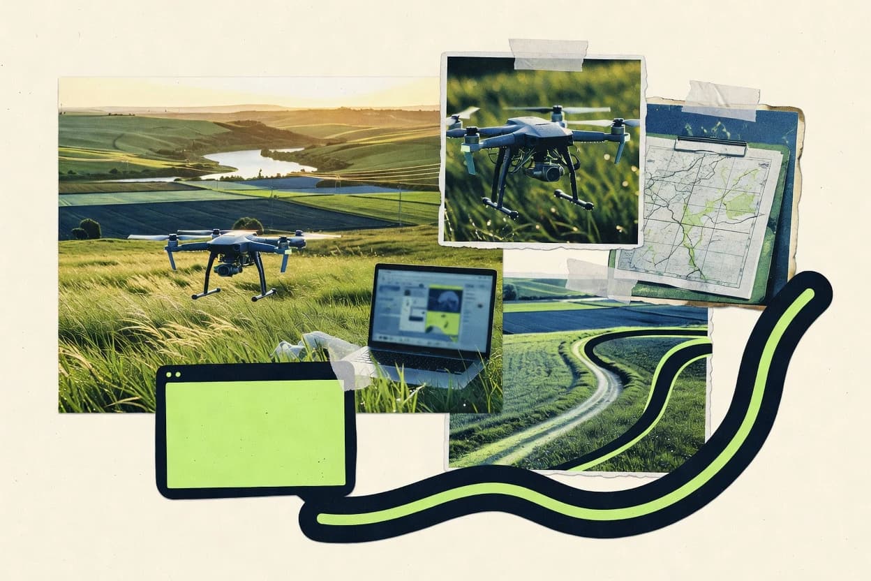
Data Science AnalyticsTop 10 Best Drone Map Software of 2026
Compare and rank top Drone Map Software for fast mapping workflows. Review picks from DroneDeploy, Pix4D, and Mapware. Explore options

How we ranked these tools
Core product claims cross-referenced against official documentation, changelogs, and independent technical reviews.
Analyzed video reviews and hundreds of written evaluations to capture real-world user experiences with each tool.
AI persona simulations modeled how different user types would experience each tool across common use cases and workflows.
Final rankings reviewed and approved by our editorial team with authority to override AI-generated scores based on domain expertise.
Score: Features 40% · Ease 30% · Value 30%
Gitnux may earn a commission through links on this page — this does not influence rankings. Editorial policy
Editor’s top 3 picks
Three quick recommendations before you dive into the full comparison below — each one leads on a different dimension.
DroneDeploy
Automated orthomosaic generation from structured survey missions
Built for survey teams needing reliable, guided drone mapping and collaborative review.
Pix4D
Editor pickPix4D Capture compatibility with field-to-processed mapping workflows and processing reports
Built for survey teams producing orthomosaics and volume measurements from drone photogrammetry.
Mapware
Editor pickProject output visualization that streamlines review of orthomosaics and 3D results
Built for teams needing repeatable drone map deliverables and quick review.
Related reading
Comparison Table
This comparison table evaluates drone map software across common workflows such as photogrammetry processing, orthomosaic and DSM/DTM generation, and cloud or on-prem delivery. It compares tools including DroneDeploy, Pix4D, Mapware, PrecisionHawk, and OpenDroneMap so readers can match capabilities to mission requirements, data pipelines, and integration needs.
DroneDeploy
cloud mappingDroneDeploy turns drone flights into mapped deliverables with automated processing for orthomosaics, 3D models, and measurements.
Automated orthomosaic generation from structured survey missions
DroneDeploy stands out with an end to end drone mapping workflow that connects flight planning, data capture, and automated map generation. It produces orthomosaics, 2D maps, and measurements from structured survey missions with defined area coverage and overlap targets. The platform also supports team review workflows by centralizing outputs and enabling stakeholders to view and verify deliverables within shared projects.
- +Mission planning, capture, and map generation stay in one guided workflow
- +Orthomosaics and survey outputs support measurements and structured deliverables
- +Central project storage simplifies sharing results with non-technical reviewers
- –Advanced customization of processing parameters can feel constrained
- –Reliable results depend on correct capture settings and consistent flight performance
- –Large projects can require careful project management to keep review fast
Best for: Survey teams needing reliable, guided drone mapping and collaborative review
More related reading
Pix4D
photogrammetryPix4D provides photogrammetry and mapping software that generates orthomosaics, DSMs, and 3D reconstructions from drone imagery.
Pix4D Capture compatibility with field-to-processed mapping workflows and processing reports
Pix4D stands out for turning drone imagery into survey-grade outputs using a guided photogrammetry pipeline. The core workflow covers automatic image alignment, dense point cloud creation, and orthomosaic or DSM generation, with measurement tools for area and volume calculations.
Quality control is supported through processing reports, GCP workflows for georeferencing, and refinement steps for improving model accuracy. Exports cover GIS-ready rasters and textured 3D products for downstream inspection and mapping tasks.
- +Photogrammetry pipeline supports alignment, dense cloud, and orthomosaic in one workflow
- +GCP and georeferencing options support accurate mapping and measurable outputs
- +Measurement tools enable area and volume calculations directly on generated surfaces
- +Quality reports and validation aids help reduce reprocessing from bad inputs
- –Advanced accuracy workflows require more expertise and careful parameter tuning
- –Large datasets can make processing timelines and hardware requirements demanding
- –Collaboration and review features are less prominent than dedicated project platforms
Best for: Survey teams producing orthomosaics and volume measurements from drone photogrammetry
Mapware
workflow platformMapware offers drone mapping workflows that include processing, data management, and measurement-ready map outputs.
Project output visualization that streamlines review of orthomosaics and 3D results
Mapware focuses on turning drone images into usable mapping outputs with a workflow built around capturing, processing, and exporting deliverables. It supports common drone mapping deliverables such as orthomosaics and 3D views, with tooling aimed at teams that need repeatable project outputs.
The product emphasizes visualization and shareable project artifacts rather than deep custom modeling pipelines. Overall, Mapware targets operational mapping needs where fast review and delivery of map products matter more than developer-grade control.
- +Straightforward project workflow for drone imagery to mapping deliverables
- +Clear visualization of outputs for faster stakeholder review
- +Export-ready artifacts for typical orthomosaic and 3D viewing use cases
- –Limited depth for advanced customization of processing parameters
- –Fewer collaboration controls than platforms built for large multi-team review
- –Less suited for highly specialized photogrammetry pipelines
Best for: Teams needing repeatable drone map deliverables and quick review
PrecisionHawk
enterprise analyticsPrecisionHawk delivers enterprise drone mapping and analytics capabilities for turning captured imagery into actionable geospatial insights.
Enterprise workflow management that standardizes mapping outputs for inspection reporting
PrecisionHawk stands out for combining drone mapping workflows with an enterprise focus on inspection-grade deliverables and team operations. The platform supports mission planning, image capture, photogrammetry, and map generation workflows geared toward construction and industrial sites. It also emphasizes multi-user usage, configurable reporting, and standardized outputs for ongoing field-to-office processes.
- +Enterprise-ready drone mapping workflow for repeatable inspection deliverables
- +Strong support for mission-to-map processing used on large field programs
- +Multi-user collaboration supports standardized reporting and review cycles
- –Setup and workflow configuration require more training than consumer tools
- –Less intuitive map editing than specialized photogrammetry-only software
- –Integration and governance needs can slow early deployments
Best for: Teams producing frequent site maps and inspection reports across multiple locations
OpenDroneMap
open source mappingOpenDroneMap is an open source photogrammetry suite that produces georeferenced orthomosaics, DEMs, and dense point clouds.
CLI-driven photogrammetry pipeline that outputs orthomosaics, DEMs, and meshes from imagery
OpenDroneMap stands out for turning raw drone imagery into georeferenced mapping outputs using open source photogrammetry workflows. It supports common inputs like images and optional georeferencing sources, then produces products such as orthomosaics, textured meshes, and digital elevation models. The software is well suited to automated processing because it can run from the command line and integrate into pipelines that handle multiple jobs.
- +Strong photogrammetry toolchain for orthomosaics, DEMs, and textured meshes
- +Command line workflow supports batching and automation across multiple mapping projects
- +Open source components enable customization of processing steps and parameters
- –Setup and parameter tuning require technical familiarity
- –User-facing visualization and editing are limited compared with full desktop mapping suites
- –Runtime and dependency management can be heavy for large image sets
Best for: Teams building automated drone photogrammetry pipelines with some engineering support
DJI Terra
desktop photogrammetryPhotogrammetry and mapping desktop software that reconstructs terrain and creates orthomosaics and 3D models from DJI drone images.
One-click orthomosaic and DSM generation from DJI photos inside a guided survey workflow
DJI Terra stands out by tying drone mapping processing to DJI flight capture, then generating survey-ready outputs from standard aerial data. The workflow supports common photogrammetry deliverables like orthomosaics, digital surface models, and textured 3D reconstructions.
It also emphasizes project templates for repeatable survey production across sites and missions. The tool’s effectiveness depends on DJI imagery quality and on the user handling ground control and coordinate alignment steps correctly.
- +Strong photogrammetry pipeline for orthomosaics, DSMs, and textured 3D models
- +DJI-centric workflow reduces configuration friction for compatible flight data
- +Project organization and export options fit common surveying deliverable needs
- –Ground control and coordinate setup can be demanding for first-time users
- –Less flexible for non-DJI inputs compared with broader photogrammetry suites
- –Advanced processing controls feel limited versus expert-focused alternatives
Best for: DJI-focused survey teams producing routine orthomosaics and DSMs
3D Mapping
geospatial publishingCreate geospatial views by publishing imagery-based reconstructions through Google Earth workflows that support map-like outputs for analysis.
Textured 3D models that integrate seamlessly with Google Earth-style viewing
3D Mapping by Google emphasizes quick visualization using captured drone imagery mapped into textured 3D scenes and elevation-aware terrain outputs. The workflow typically starts with image uploads and produces geospatially referenced results that can be explored in Google Earth style viewing.
Collaboration and sharing centers on making mapped areas viewable to stakeholders who rely on Google’s familiar map interface. Its core strength is rendering and distribution of 3D surfaces rather than advanced in-app surveying analytics.
- +Rapid upload-to-3D generation with textured surfaces for stakeholder review
- +Geospatially located outputs align with Google Earth style navigation
- +Shareable viewing experience reduces friction for non-technical teams
- –Less direct support for survey-grade measurements and QA exports
- –Limited control over processing parameters compared with pro photogrammetry tools
- –Workflow depends on Google ecosystem for viewing and collaboration
Best for: Teams needing fast 3D terrain visualization and easy sharing
AWS IoT SiteWise
analytics integrationIndustrial time-series and asset analytics that can integrate drone-derived metrics into operational dashboards for monitoring and reporting.
Asset Models that transform raw telemetry into governed, structured industrial metrics
AWS IoT SiteWise stands out by turning industrial equipment signals into organized, timestamped asset models that can be visualized and analyzed. It focuses on data collection, transformation, and hierarchy modeling rather than drone-specific photogrammetry workflows.
For drone mapping use cases, it can ingest telemetry and operational metadata, normalize it with Asset Models, and expose curated time-series for dashboards and downstream analytics. This supports operational visibility around drone surveys even when the mapping computation happens elsewhere.
- +Asset Models formalize equipment hierarchies and standardize time-series metrics
- +Data ingestion and transformations normalize telemetry for consistent analytics
- +Integrates with AWS analytics and visualization services via curated datasets
- +Helps separate drone operations metadata from mapping computation pipelines
- –No built-in photogrammetry, point clouds, or orthomosaic generation
- –More engineering effort than drone map tools for end-to-end mapping
- –Asset modeling can be heavy for small deployments with limited telemetry
- –Visualization options depend on other AWS services and configuration
Best for: Industrial teams integrating drone survey telemetry into AWS asset monitoring
Microsoft Azure Data Explorer
data analyticsFast analytics for geospatial and telemetry datasets that can store and query drone-derived attributes for dashboards and alerts.
Kusto Query Language for fast geospatial and time-series telemetry correlation
Microsoft Azure Data Explorer is strongest as a high-scale telemetry and log analytics service that also supports geospatial query patterns for mapping pipelines. It ingests time-series data streams and provides fast querying with Kusto Query Language for correlating drone position, sensor readings, and operational events.
It integrates with Azure services for storage and streaming, enabling end-to-end processing from raw telemetry to analytical datasets used by mapping front ends. It does not provide native drone mapping visualization or photogrammetry tooling, so it fits best as a backend for map-ready analytics rather than a complete mapping application.
- +High-performance time-series ingestion for continuous drone telemetry streams
- +Powerful Kusto Query Language for correlating location, sensors, and events
- +Strong Azure integration for building map-ready analytics backends
- +Geospatial-friendly query patterns for filtering and spatial aggregations
- –No built-in drone flight planning or map visualization UI
- –Kusto modeling and query design require analytics skills
- –Geospatial workflows need external tooling for raster and 3D outputs
- –Operational setup for clusters and permissions adds deployment overhead
Best for: Teams building map analytics backends for drone telemetry correlation
CloudCompare
point cloud analysisPoint cloud processing tool used to analyze and compare dense reconstructions by filtering, measuring, and alignment operations.
Cloud-to-cloud distance and deviation computations with colorized results
CloudCompare stands out as an open-source desktop point-cloud workbench built for inspecting, cleaning, and analyzing dense 3D datasets. It supports drone-derived point clouds and common LiDAR-style workflows, including filtering, registration, segmentation, and mesh and raster export.
The tool excels at geometry-driven analysis such as computing distances and generating derived point products. It is less suited to end-to-end mapping automation and report generation compared with dedicated drone mapping suites.
- +Rich point-cloud toolset for filtering, classification, and cleaning
- +Multiple cloud-to-cloud registration methods for aligning drone captures
- +Distance measurements and change analysis between aligned point clouds
- +Scriptable workflows and batch-friendly operations for repeat processing
- +Supports common exports for further CAD, GIS, and visualization steps
- –No built-in photogrammetry pipeline for turning images into clouds
- –GUI complexity slows newcomers compared with guided drone mappers
- –Coordinated map products require extra steps outside CloudCompare
- –Large datasets can stress memory and hardware without careful tuning
Best for: Teams needing detailed point-cloud cleanup and verification after drone processing
How to Choose the Right Drone Map Software
This buyer’s guide helps map teams choose drone map software for orthomosaics, DSMs, 3D reconstructions, and measurements across tools like DroneDeploy, Pix4D, DJI Terra, and PrecisionHawk. Coverage also includes pipeline and ecosystem options such as OpenDroneMap, CloudCompare, Google’s 3D Mapping workflow, Azure Data Explorer for telemetry analytics, and AWS IoT SiteWise for governed asset metrics. The guide explains which capabilities matter most, where each tool fits best, and which mistakes commonly derail projects.
What Is Drone Map Software?
Drone map software converts drone imagery into mapped deliverables like orthomosaics, digital surface models, and textured 3D scenes. It solves problems in flight-to-deliverable workflows by handling image processing, georeferencing, and output generation for stakeholders who need reviewable map artifacts. Tools such as DroneDeploy and Pix4D focus on guided photogrammetry pipelines that produce survey-ready map outputs. Enterprise and operational platforms like PrecisionHawk focus more on repeatable mission-to-map operations and standardized review cycles across multiple sites.
Key Features to Look For
The right combination of processing depth, workflow structure, and downstream usability determines whether drone imagery becomes deliverables or just an intermediate dataset.
Guided mission-to-deliverable workflow for orthomosaics
DroneDeploy runs mission planning, image capture, and automated orthomosaic generation inside a single guided workflow. DJI Terra also supports one-click orthomosaic and DSM generation from DJI photos inside a guided survey workflow.
Survey-grade photogrammetry with alignment, dense clouds, and DSM outputs
Pix4D provides an end-to-end photogrammetry pipeline that performs automatic image alignment, dense point cloud creation, and orthomosaic or DSM generation. It also adds measurement tools for area and volume calculations directly on generated surfaces.
Georeferencing and accuracy workflows using GCP support
Pix4D includes GCP workflows for georeferencing and processing reports and validation steps to reduce reprocessing. DJI Terra depends on correct ground control and coordinate alignment to produce accurate survey outputs.
Review-ready project collaboration and stakeholder visibility
DroneDeploy centralizes project storage so stakeholders can view and verify deliverables within shared projects. Mapware emphasizes visualization of project outputs for faster stakeholder review of orthomosaics and 3D results.
Enterprise workflow management and standardized reporting for multi-site programs
PrecisionHawk supports enterprise workflow management that standardizes mapping outputs for inspection reporting across multiple locations. It also adds multi-user collaboration for standardized reporting and review cycles.
Pipeline and compute integration through automation or telemetry analytics backends
OpenDroneMap is a CLI-driven photogrammetry pipeline that outputs orthomosaics, DEMs, and meshes from imagery for batch automation. Microsoft Azure Data Explorer supports Kusto Query Language for correlating drone position and sensor events, while AWS IoT SiteWise provides Asset Models that transform telemetry into governed industrial metrics.
How to Choose the Right Drone Map Software
The selection process should start with the mapping deliverables, then verify how each tool handles processing, accuracy inputs, and review workflows.
Match the deliverables to tool-native outputs
Select DroneDeploy when the deliverable target is orthomosaics plus survey measurements from structured survey missions because it automates orthomosaic generation inside guided missions. Select Pix4D when orthomosaic and DSM production must be paired with area and volume measurement tools because measurements are supported directly on generated surfaces.
Choose the right accuracy approach for the field workflow
If accurate georeferencing depends on ground control points, Pix4D supports GCP workflows for georeferencing and produces processing reports and validation steps that help reduce rework. If DJI imagery is the standard capture method, DJI Terra ties mapping processing to DJI flight capture, but ground control and coordinate alignment must be handled correctly to avoid survey errors.
Plan for stakeholder review and operational collaboration
Use DroneDeploy when cross-functional review is required because it centralizes project outputs and enables stakeholders to view and verify deliverables within shared projects. Use Mapware when stakeholders mainly need quick visualization of orthomosaic and 3D results because it emphasizes repeatable project outputs and shareable artifacts rather than deep photogrammetry control.
Decide between guided mapping suites and pipeline or backend architectures
Choose OpenDroneMap when the workflow requires automation and engineering control because it runs from the command line and can batch orthomosaic, DEM, and mesh generation across multiple jobs. Choose Microsoft Azure Data Explorer or AWS IoT SiteWise when the mapping deliverables already exist elsewhere and the goal is to correlate drone telemetry with map-ready analytics or governed asset metrics.
Add point-cloud inspection when photogrammetry output needs verification
Use CloudCompare when dense reconstructions require filtering, classification, registration, and geometry-driven analysis like distance and deviation computations between aligned point clouds. This complements suites like Pix4D or DroneDeploy when QA focuses on cleaned and aligned point-cloud evidence rather than only the final orthomosaic.
Who Needs Drone Map Software?
Drone map software serves both mapping production teams and operational analytics teams that convert drone data into decision-ready artifacts.
Survey teams needing guided orthomosaic generation plus collaborative review
DroneDeploy fits survey teams because it keeps mission planning, capture, and automated map generation in one guided workflow and it centralizes project storage for stakeholder review. Mapware also fits teams focused on repeatable deliverables and quick visualization of orthomosaic and 3D outputs.
Survey teams producing orthomosaics and volume measurements from photogrammetry
Pix4D fits survey workflows because it supports alignment, dense point clouds, orthomosaic or DSM generation, and measurement tools for area and volume calculations. DJI Terra fits DJI-centric teams producing routine orthomosaics and DSMs using DJI photos inside a guided workflow.
Enterprise construction and industrial organizations standardizing inspection deliverables across sites
PrecisionHawk fits multi-site programs because it emphasizes enterprise workflow management and standardized outputs for inspection reporting with multi-user collaboration. This segment benefits from tools that support repeatable mission-to-map processing and configurable reporting.
Engineering teams building automated pipelines or analytics backends for drone-derived outputs
OpenDroneMap fits engineering teams because it is CLI-driven and supports batching orthomosaic, DEM, and mesh outputs with open-source customization. Azure Data Explorer fits backend builders that need Kusto Query Language to correlate drone telemetry with geospatial patterns, while AWS IoT SiteWise fits teams that need Asset Models to govern telemetry-driven metrics.
Common Mistakes to Avoid
Common failures come from choosing the wrong tool depth, underplanning accuracy inputs, or expecting end-to-end mapping features from platforms that do not provide photogrammetry.
Treating a telemetry backend as a complete mapping application
AWS IoT SiteWise does not generate photogrammetry artifacts like orthomosaics or point clouds and it focuses on asset hierarchies and time-series metrics. Microsoft Azure Data Explorer also provides fast telemetry and geospatial query support but it has no native drone flight planning or map visualization UI for raster and 3D outputs.
Skipping ground control and coordinate alignment expectations
DJI Terra depends on correct ground control and coordinate setup for accurate survey outputs because it ties processing to DJI flight capture. Pix4D supports GCP workflows and validation steps, but advanced accuracy workflows require careful expertise and parameter tuning to avoid poor results.
Expecting deep photogrammetry customization from lightweight review tools
Mapware emphasizes repeatable project outputs and visualization for review, but it offers limited depth for advanced customization of processing parameters. CloudCompare can analyze and clean dense point clouds, but it lacks a built-in photogrammetry pipeline for turning images into clouds.
Building QA workflows that ignore point-cloud verification needs
CloudCompare is built for geometry-driven analysis like cloud-to-cloud distance and deviation computations with colorized results. Using only final orthomosaic visuals from Pix4D or DroneDeploy can miss the specific alignment and deviation evidence that CloudCompare provides.
How We Selected and Ranked These Tools
We evaluated each tool by scoring features, ease of use, and value, using weights of features at 0.4, ease of use at 0.3, and value at 0.3. The overall rating is the weighted average calculated as overall = 0.40 × features + 0.30 × ease of use + 0.30 × value. DroneDeploy separated itself by combining high feature coverage with strong workflow structure for mission planning, capture, and automated orthomosaic generation, which supported a more guided production experience than tools focused only on processing or only on viewing.
Frequently Asked Questions About Drone Map Software
Which drone mapping tools are best for automated orthomosaic generation from structured survey missions?
How do Pix4D and OpenDroneMap differ for survey-grade photogrammetry outputs and automation?
Which tools handle georeferencing and accuracy control most directly in the workflow?
What solution fits teams that need collaborative review of mapping deliverables across stakeholders?
Which platform is strongest for enterprise inspection workflows and standardized reporting across multiple sites?
Which tools are best for quick 3D visualization and stakeholder sharing in a familiar map interface?
Which tools work well as backends for telemetry-to-map analytics rather than full photogrammetry apps?
What is the right choice when the main task is point-cloud cleanup and deviation analysis after drone processing?
Which toolchain is best for teams that want a developer-leaning, pipeline-friendly workflow from images to outputs?
Conclusion
After evaluating 10 data science analytics, DroneDeploy stands out as our overall top pick — it scored highest across our combined criteria of features, ease of use, and value, which is why it sits at #1 in the rankings above.
Use the comparison table and detailed reviews above to validate the fit against your own requirements before committing to a tool.
Tools reviewed
Primary sources checked during evaluation.
Referenced in the comparison table and product reviews above.
Keep exploring
Comparing two specific tools?
Software Alternatives
See head-to-head software comparisons with feature breakdowns, pricing, and our recommendation for each use case.
Explore software alternatives→In this category
Data Science Analytics alternatives
See side-by-side comparisons of data science analytics tools and pick the right one for your stack.
Compare data science analytics tools→FOR SOFTWARE VENDORS
Not on this list? Let’s fix that.
Our best-of pages are how many teams discover and compare tools in this space. If you think your product belongs in this lineup, we’d like to hear from you—we’ll walk you through fit and what an editorial entry looks like.
Apply for a ListingWHAT THIS INCLUDES
Where buyers compare
Readers come to these pages to shortlist software—your product shows up in that moment, not in a random sidebar.
Editorial write-up
We describe your product in our own words and check the facts before anything goes live.
On-page brand presence
You appear in the roundup the same way as other tools we cover: name, positioning, and a clear next step for readers who want to learn more.
Kept up to date
We refresh lists on a regular rhythm so the category page stays useful as products and pricing change.