GITNUXSOFTWARE ADVICE
Aerospace DefenseTop 9 Best Drone Mission Planning Software of 2026
Compare the top Drone Mission Planning Software picks, ranked for flight routes and mapping, including DroneDeploy and Kespry. Explore options.

How we ranked these tools
Core product claims cross-referenced against official documentation, changelogs, and independent technical reviews.
Analyzed video reviews and hundreds of written evaluations to capture real-world user experiences with each tool.
AI persona simulations modeled how different user types would experience each tool across common use cases and workflows.
Final rankings reviewed and approved by our editorial team with authority to override AI-generated scores based on domain expertise.
Score: Features 40% · Ease 30% · Value 30%
Gitnux may earn a commission through links on this page — this does not influence rankings. Editorial policy
Editor’s top 3 picks
Three quick recommendations before you dive into the full comparison below — each one leads on a different dimension.
DroneDeploy
Automated grid and corridor mapping pattern generation from map area selections
Built for teams standardizing drone capture workflows into repeatable surveys.
Kespry
Editor pickAutomated mission planning that converts site boundaries into flight paths for survey capture
Built for industrial teams running repeatable drone surveys for mapping and inspection workflows.
Skydio
Editor pickAutonomy-driven waypoint missions with built-in obstacle avoidance during flight
Built for teams capturing repeatable visual inspections with Skydio drones and minimal flight management overhead.
Related reading
Comparison Table
This comparison table evaluates drone mission planning software tools used for mapping, inspection, and site intelligence workflows. It contrasts platforms such as DroneDeploy, Kespry, Skydio, Garmin Mission Planning, and Mapillary Drone Mission Tools across planning, flight execution, data capture, and output handling. Readers can use the side-by-side view to match feature sets to mission requirements and software compatibility needs.
DroneDeploy
cloud mission planningDroneDeploy provides browser-based mission planning with flight area definition, mapping run configuration, and drone launch workflow integration.
Automated grid and corridor mapping pattern generation from map area selections
DroneDeploy stands out by turning drone mission planning into a repeatable visual workflow with map-based planning and automated deliverable outputs. Its core capabilities include flight area definition, automated grid and corridor mapping patterns, and mission settings for consistent capture coverage. The platform also supports mission execution management and post-flight processing handoffs for teams that need standardized survey results.
- +Map-driven planning with clear coverage footprints and pattern controls
- +Automated mapping layouts for grids and corridors
- +Structured mission settings support repeatable field workflows
- +Streamlined handoff from plan to execution and output pipelines
- –Complex survey requirements can require more setup than simple flights
- –Advanced customization may be less direct than low-level mission configuration
Best for: Teams standardizing drone capture workflows into repeatable surveys
More related reading
Kespry
industrial inspectionSupports drone mission planning for industrial inspection workflows with automated capture planning and analytics-focused operations.
Automated mission planning that converts site boundaries into flight paths for survey capture
Kespry emphasizes mission planning for industrial drone surveying with automated flight planning and rapid site setup. The workflow centers on mapping missions by defining areas of interest, generating flight paths, and aligning them to operational constraints.
Kespry also supports data collection orchestration to move from plan to repeatable capture runs. Its strength is planning and executing acquisition missions that feed downstream photogrammetry and inspection workflows.
- +Generates flight plans from defined areas for faster survey setup
- +Supports mission workflows suited to repeatable industrial data capture
- +Planning outputs align with downstream mapping and inspection pipelines
- –Less flexible for highly customized mission logic compared with specialist tools
- –Best results depend on correct input data like boundaries and targets
- –Collaboration and review tooling can feel limited versus broader platforms
Best for: Industrial teams running repeatable drone surveys for mapping and inspection workflows
Skydio
autonomy planningEnables autonomous drone mission planning and execution with operator tools designed around obstacle-aware flight behavior.
Autonomy-driven waypoint missions with built-in obstacle avoidance during flight
Skydio stands out with mission planning built around Skydio drones and their autonomy stack, which supports hands-off waypoint capture for complex scenes. Mission planning centers on mapping routes, setting camera objectives, and generating repeatable flight paths for inspections and documentation.
The workflow emphasizes visual target tracking behavior and robust obstacle avoidance during execution rather than detailed manual control of flight physics. Planning outputs are designed to transfer directly into an operator-friendly field run for consistent results across missions.
- +Autonomy-first mission planning that leverages Skydio obstacle avoidance during execution
- +Waypoint and route setup designed for repeatable inspection runs across sites
- +Tight operator workflow that connects mission plans to field execution quickly
- –Best results depend on using Skydio drones rather than generic autopilot compatibility
- –Advanced mission customization can feel constrained versus full-feature planning suites
- –Complex scenarios may require more operational iteration than purely manual planning
Best for: Teams capturing repeatable visual inspections with Skydio drones and minimal flight management overhead
More related reading
Garmin Mission Planning
avionics planningOffers mission planning and configuration tooling for select Garmin unmanned systems used for structured patrol and task execution.
Garmin mission file generation for direct upload to Garmin autopilot systems
Garmin Mission Planning stands out by tying mission planning tightly to Garmin avionics and flight control workflows. It supports grid, waypoint, and route planning with mapping and telemetry-ready mission structures. The tool emphasizes field use with mission file management and compatibility with Garmin hardware ecosystems for execution and validation.
- +Strong compatibility with Garmin flight controllers and avionics workflows
- +Waypoint and route planning with map-based mission visualization
- +Mission file preparation designed for field execution and reuse
- –Limited standalone autonomy for non-Garmin flight stacks
- –Fewer advanced payload planning and analytics workflows than top competitors
- –Scenarios needing heavy collaboration and change tracking feel constrained
Best for: Teams planning missions for Garmin aircraft needing reliable workflow continuity
Mapillary Drone Mission Tools
capture planningProvides mapping-focused capture planning support for drone-based image collection workflows.
Mapillary-aligned mission planning that streamlines geotagged imagery handoff
Mapillary Drone Mission Tools stands out by combining drone mission setup with a Mapillary-centric capture workflow for street-level imagery. It supports mission planning that aligns flight capture with mapping needs, then channels outputs into Mapillary’s visual content pipeline. The tool set is built for consistent geo-tagged capture, progress tracking, and handoff to downstream review and upload steps.
- +Mission workflow ties directly to Mapillary capture and upload steps
- +Geolocation-aware planning supports consistent street-level coverage
- +Operational guidance helps reduce capture gaps during repeat missions
- –Planning depth depends heavily on drone and mission configuration
- –Collaboration and review features are limited versus full mission platforms
- –Workflow is optimized for Mapillary output rather than general mapping
Best for: Teams running repeat drone capture for Mapillary street-level datasets
More related reading
UAVOS
inspection mission planningMission planning and autonomous inspection workflow tooling that generates mission routes for drone operations.
Mission templates for consistent route and task configuration
UAVOS focuses on mission planning workflows for UAV operations with an emphasis on mission setup, task organization, and route generation. The tool centers on building mission plans for common survey and inspection patterns, then preparing them for execution as defined flight tasks.
It is geared toward teams that want repeatable mission templates and clearer operational structure than manual waypoint editing. The experience depends heavily on how well a specific workflow maps to the supported mission types and export paths.
- +Structured mission planning supports repeatable task setup
- +Route generation streamlines waypoint creation for typical survey runs
- +Mission organization helps keep complex flights understandable
- –Workflow fit varies by drone model and mission type
- –Planning adjustments can feel slower than direct waypoint editing
- –Limited visibility into advanced edge-case constraints
Best for: Teams running repeatable survey and inspection missions with standard flight patterns
Cyberhawk Mission Planning
enterprise capture planningOperational planning workflows for UAV capture missions with enterprise-grade reporting pipelines.
Map-based mission planning that generates route and coverage plans from imported site context
Cyberhawk Mission Planning stands out for turning mission requirements into actionable drone route plans with geospatial context. The workflow supports map-based planning, importing site data, and producing mission outputs teams can execute with minimal rework.
It also emphasizes operational compliance by structuring planning around flight activities and deliverable needs. Integration with Cyberhawk operations and analytics workflows makes it suited for repeatable industrial survey and inspection tasks.
- +Geospatial planning workflow with clear route and coverage planning outputs
- +Supports importing site context to reduce manual map setup
- +Structured mission planning aligns with repeatable industrial survey execution
- –Planning setup can be heavy for small one-off missions
- –Advanced configuration depends on experienced operators
- –UI ergonomics are optimized for operations teams, not casual planners
Best for: Industrial teams planning repeatable drone inspections with geospatial compliance needs
More related reading
DroneLink Commander
cloud mission planningCloud-based mission planning and execution control with waypoint and route planning for supported aircraft.
Live mission execution view that pairs planned waypoints with real-time telemetry feedback
DroneLink Commander stands out for mission planning tightly integrated with real-time drone control and live status monitoring from a single interface. It supports route and waypoint planning for multi-segment missions, with tools for mapping-based planning and mission parameter definition.
The workflow emphasizes using a connected controller setup to execute planned missions while reviewing telemetry and mission progress. It also includes features aimed at operational consistency across repeat flights, such as saving and reusing mission configurations.
- +Waypoint mission planning with map-based editing and clear route definition
- +Live telemetry and mission progress visibility during execution
- +Reusable mission configurations help standardize repeat flights
- +Operational workflow connects planning and execution in one tool
- –Advanced mission parameter setup can feel technical for first-time operators
- –Planning accuracy depends on correct georeferencing and coordinate inputs
- –Complex multi-drone coordination requires careful setup and validation
Best for: Teams planning repeat waypoint missions with live monitoring and control workflows
Lidar360
mapping survey planningDrone mission planning for mapping and survey workflows with project-based flight configuration tooling.
Lidar-focused coverage and flight-path planning designed for consistent scan results
Lidar360 stands out by centering drone mission planning around lidar-oriented workflows and survey deliverables. Core capabilities include mission planning for lidar data capture, import of geospatial inputs, and generation of flight paths tailored to scanning objectives. The tool focuses on practical execution details for mapping runs such as coverage planning and repeatable mission geometry.
- +Mission planning tailored for lidar survey coverage and consistent capture geometry
- +Supports importing geospatial data to shape flight areas
- +Generates flight paths aligned to scanning objectives
- –Planning complexity rises when lidar-specific parameters must be tuned
- –Less general-purpose than all-in-one mission planning suites for every workflow type
- –Workflow customization options appear narrower than broader mapping toolsets
Best for: Lidar survey teams needing repeatable capture planning without heavy setup
How to Choose the Right Drone Mission Planning Software
This buyer’s guide explains how to choose drone mission planning software for repeatable captures and industrial inspection workflows using DroneDeploy, Kespry, Skydio, and the other tools covered here. The guide focuses on mission pattern generation, geospatial import workflows, and plan-to-execution control using DroneLink Commander, Cyberhawk Mission Planning, and Garmin Mission Planning. It also highlights tool-specific fit for Mapillary street-level datasets and lidar survey geometry using Mapillary Drone Mission Tools and Lidar360.
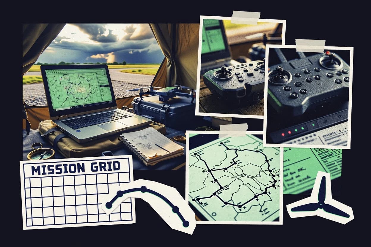
What Is Drone Mission Planning Software?
Drone mission planning software creates flight areas, routes, and repeatable capture settings so drone operators can execute consistent missions and produce reliable outputs. These tools reduce manual waypoint editing by using map-based planning, site boundary inputs, and mission templates that generate flight paths. DroneDeploy turns map selections into automated grid and corridor patterns to standardize survey workflows. Skydio centers mission planning around autonomy-driven waypoint capture with obstacle-aware execution behavior for visual inspections.
Key Features to Look For
The right feature set depends on how planning inputs convert into stable flight routes and how reliably mission plans transfer into field execution.
Automated coverage pattern generation from map area selections
DroneDeploy automatically generates grid and corridor mapping patterns from selected map areas. This feature matters for teams that need repeatable capture coverage without manually building dense waypoint lists in every mission.
Boundary-to-flight-path conversion for repeatable industrial survey runs
Kespry generates flight plans from defined areas and converts site boundaries into flight paths for survey capture. This feature matters when mission success depends on correct boundary inputs and consistent operational constraints across repeat inspections.
Autonomy-driven waypoint missions with built-in obstacle avoidance behavior
Skydio mission planning is designed around autonomy-first obstacle-aware flight execution. This feature matters when complex scenes require the operator to set camera objectives and routes while execution behavior handles obstacle-aware waypoint capture.
Garmin mission file generation for direct upload to Garmin autopilot systems
Garmin Mission Planning prepares mission file structures designed for direct upload to Garmin autopilot systems. This feature matters for teams planning missions for Garmin aircraft that require workflow continuity from planning to validation in the field.
Geospatial context import that generates route and coverage plans
Cyberhawk Mission Planning supports importing site data and producing map-based mission outputs aligned with deliverable needs. This feature matters for industrial users who must reduce manual map setup and align planning to compliance-oriented operational structure.
Plan-to-execution continuity with live telemetry and reusable configurations
DroneLink Commander combines waypoint and route planning with live mission execution visibility and telemetry feedback. This feature matters for operators who want to save and reuse mission configurations and verify mission progress against planned waypoints in one interface.
How to Choose the Right Drone Mission Planning Software
Matching planning outputs to the mission type and execution workflow delivers the fastest path to repeatable results.
Choose coverage logic that matches the mission pattern
For grid and corridor surveys driven by map area selections, DroneDeploy generates automated grid and corridor mapping patterns to standardize capture footprints. For industrial inspection workflows that start from site boundaries, Kespry converts defined areas into flight paths so survey teams can launch repeatable acquisition runs.
Match autonomy or manual control to the drone reality
For obstacle-rich inspection scenes where hands-off behavior is the priority, Skydio provides autonomy-driven waypoint missions with built-in obstacle avoidance during flight execution. For teams that need live control and telemetry visibility paired with mission plans, DroneLink Commander is built to connect planning with real-time mission progress monitoring.
Select planning depth based on operational complexity
For operations that require geospatial compliance structure and deliverable-aligned planning outputs, Cyberhawk Mission Planning centers on map-based planning, imported site context, and structured mission planning for industrial execution. For smaller one-off missions where setup overhead must stay low, Garmin Mission Planning focuses on mission file preparation and map-based waypoint and route planning for Garmin ecosystems.
Pick tooling that aligns with the downstream data pipeline
For street-level imagery capture designed to feed Mapillary’s visual content pipeline, Mapillary Drone Mission Tools aligns mission planning with geotagged imagery capture, progress tracking, and handoff steps. For lidar projects where scan geometry consistency matters, Lidar360 focuses on lidar-oriented coverage planning and flight paths that match scanning objectives.
Standardize repeat runs using templates and mission organization
For repeatable survey and inspection missions built from standard flight patterns, UAVOS provides mission templates that organize task setup and streamline waypoint creation for typical survey runs. For repeat waypoint missions that benefit from paired planning and execution visibility, DroneLink Commander keeps planned waypoints aligned with real-time telemetry during flight.
Who Needs Drone Mission Planning Software?
Drone mission planning software benefits teams that must turn map inputs into consistent flight behavior, repeatable capture geometry, and dependable handoffs to downstream processing.
Industrial survey teams running repeatable inspection captures
Kespry converts site boundaries into flight paths and supports mission workflows designed for repeatable industrial data capture that feeds downstream photogrammetry and inspection. Cyberhawk Mission Planning adds geospatial context import and structured operational compliance outputs for industrial inspection planning that must match deliverable needs.
Teams standardizing survey capture into repeatable mapping patterns
DroneDeploy excels at automated grid and corridor mapping pattern generation from map area selections. UAVOS adds mission templates that keep route and task configuration consistent for common survey and inspection patterns.
Autonomy-first visual inspection teams using Skydio drones
Skydio is designed around autonomy-driven waypoint missions and obstacle-aware execution, which reduces the need for advanced manual flight management. The planning workflow emphasizes camera objectives and repeatable waypoint routes that translate into operator-friendly field runs.
Mapping and scan operators focused on specific capture modalities
Mapillary Drone Mission Tools is built for Mapillary-aligned geotagged imagery capture with progress tracking and upload handoff. Lidar360 provides lidar-focused coverage and flight-path planning that imports geospatial inputs and generates scanning-aligned capture geometry.
Common Mistakes to Avoid
Mission planning failures typically come from choosing a tool whose planning outputs do not match the mission pattern or the execution workflow used in the field.
Building custom missions that conflict with the tool’s strengths
Teams that need automated coverage footprints should prioritize DroneDeploy instead of relying on manual waypoint-heavy workflows. Kespry fits boundary-driven industrial missions best when the site boundary and targets are entered correctly.
Expecting generic autonomy from a tool designed for a specific autonomy stack
Skydio planning delivers best results when missions are executed with Skydio drones rather than assuming generic autopilot compatibility. DroneLink Commander instead supports live waypoint planning and telemetry visibility that fits operator-centric execution.
Ignoring geospatial input readiness and coordinate quality
DroneLink Commander planning accuracy depends on correct georeferencing and coordinate inputs because live mission progress is compared to planned waypoints. Cyberhawk Mission Planning reduces manual map setup via site context import, but incomplete site data still creates avoidable rework.
Choosing general-purpose planning when the downstream pipeline requires a specialized capture workflow
Mapillary Drone Mission Tools is optimized for Mapillary output by streamlining geotagged imagery handoff and capture progress tracking. Lidar360 is built for lidar scanning objectives with lidar-focused coverage planning and consistent capture geometry that general mapping tools often do not tune for.
How We Selected and Ranked These Tools
We evaluated each drone mission planning tool on three sub-dimensions using a weighted average formula where features have weight 0.4, ease of use has weight 0.3, and value has weight 0.3. The overall rating equals 0.40 × features plus 0.30 × ease of use plus 0.30 × value. DroneDeploy separated from lower-ranked tools on features by delivering automated grid and corridor mapping pattern generation directly from map area selections, which reduces repeated manual setup across missions. Kespry and Cyberhawk Mission Planning also scored strongly by converting defined areas or imported site context into actionable route and coverage plans aligned to repeatable industrial execution.
Frequently Asked Questions About Drone Mission Planning Software
Which tool best automates grid and corridor capture planning for repeatable survey runs?
What mission planning option fits industrial photogrammetry and inspection workflows that need fast site setup?
Which software is best suited for waypoint missions that rely on autonomy and obstacle avoidance during flight?
Which option generates mission files that transfer cleanly into Garmin autopilot workflows?
Which tool is purpose-built for street-level geo-tagged datasets used in Mapillary workflows?
Which platform supports repeatable mission templates to reduce manual waypoint editing?
Which software helps teams structure compliance-focused industrial inspections using imported geospatial site context?
What mission planning tool supports live monitoring and real-time telemetry during mission execution?
Which option is best for lidar-focused scanning where flight paths must match capture geometry?
How do teams typically choose between DroneDeploy and Cyberhawk Mission Planning for different output and operational needs?
Conclusion
After evaluating 9 aerospace defense, DroneDeploy stands out as our overall top pick — it scored highest across our combined criteria of features, ease of use, and value, which is why it sits at #1 in the rankings above.
Use the comparison table and detailed reviews above to validate the fit against your own requirements before committing to a tool.
Tools reviewed
Primary sources checked during evaluation.
Referenced in the comparison table and product reviews above.
Keep exploring
Comparing two specific tools?
Software Alternatives
See head-to-head software comparisons with feature breakdowns, pricing, and our recommendation for each use case.
Explore software alternatives→In this category
Aerospace Defense alternatives
See side-by-side comparisons of aerospace defense tools and pick the right one for your stack.
Compare aerospace defense tools→FOR SOFTWARE VENDORS
Not on this list? Let’s fix that.
Our best-of pages are how many teams discover and compare tools in this space. If you think your product belongs in this lineup, we’d like to hear from you—we’ll walk you through fit and what an editorial entry looks like.
Apply for a ListingWHAT THIS INCLUDES
Where buyers compare
Readers come to these pages to shortlist software—your product shows up in that moment, not in a random sidebar.
Editorial write-up
We describe your product in our own words and check the facts before anything goes live.
On-page brand presence
You appear in the roundup the same way as other tools we cover: name, positioning, and a clear next step for readers who want to learn more.
Kept up to date
We refresh lists on a regular rhythm so the category page stays useful as products and pricing change.