GITNUXSOFTWARE ADVICE
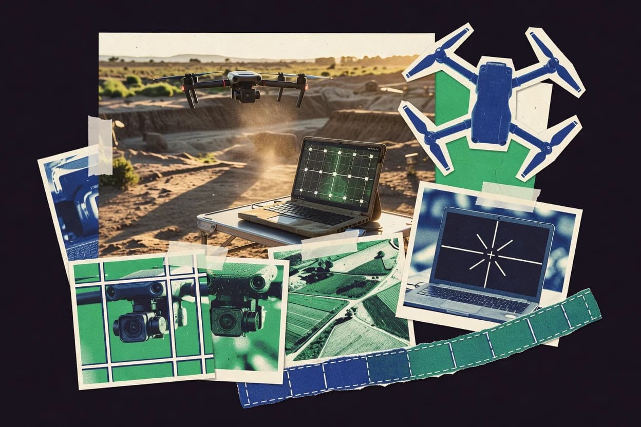
Data Science AnalyticsTop 10 Best Drone Stitching Software of 2026
Compare the top Drone Stitching Software tools with a best-of ranking for drone mapping workflows. Explore picks and features.

How we ranked these tools
Core product claims cross-referenced against official documentation, changelogs, and independent technical reviews.
Analyzed video reviews and hundreds of written evaluations to capture real-world user experiences with each tool.
AI persona simulations modeled how different user types would experience each tool across common use cases and workflows.
Final rankings reviewed and approved by our editorial team with authority to override AI-generated scores based on domain expertise.
Score: Features 40% · Ease 30% · Value 30%
Gitnux may earn a commission through links on this page — this does not influence rankings. Editorial policy
Editor’s top 3 picks
Three quick recommendations before you dive into the full comparison below — each one leads on a different dimension.
Pix4Dmapper
Automated image alignment with strong georeferencing and quality assessment
Built for survey and mapping teams needing accurate orthomosaics and 3D models.
Agisoft Metashape
Georeferencing and camera calibration workflows using ground control points and metadata
Built for teams producing accurate drone orthomosaics and 3D models with repeatable workflows.
RealityCapture
Component-based alignment and robust reconstruction tuning for large photogrammetry datasets
Built for teams producing georeferenced 3D maps and orthomosaics from drone imagery.
Related reading
Comparison Table
This comparison table evaluates drone stitching and photogrammetry software across Pix4Dmapper, Agisoft Metashape, RealityCapture, OpenDroneMap, DroneDeploy, and additional tools. It summarizes key capabilities used in production workflows, including image alignment, mesh and orthomosaic generation, processing automation, export outputs, and typical deployment options. Readers can use the matrix to match tool features to project requirements such as mapping accuracy needs, dataset scale, and integration with field and GIS pipelines.
| # | Tool | Category | Overall | Features | Ease of Use | Value |
|---|---|---|---|---|---|---|
| 1 | Pix4Dmapper Drone photogrammetry processing creates orthomosaics, surface models, and georeferenced deliverables from aerial imagery. | photogrammetry | 8.8/10 | 9.2/10 | 8.1/10 | 8.9/10 |
| 2 | Agisoft Metashape Photogrammetry workflow generates dense point clouds, meshes, and orthomosaics from drone images with survey-grade outputs. | photogrammetry | 8.5/10 | 9.0/10 | 7.8/10 | 8.5/10 |
| 3 | RealityCapture High-speed photogrammetry aligns images and reconstructs detailed meshes and orthographic views for aerial mapping. | photogrammetry | 8.2/10 | 8.8/10 | 7.8/10 | 7.9/10 |
| 4 | OpenDroneMap Open-source drone mapping pipeline computes camera alignment, point clouds, and orthophotos using Mapnik-style tiling outputs. | open source | 7.5/10 | 7.6/10 | 6.8/10 | 7.9/10 |
| 5 | DroneDeploy Cloud mapping platform processes drone imagery into orthomosaics and 2D and 3D models with project management and measurements. | cloud mapping | 8.1/10 | 8.5/10 | 8.2/10 | 7.6/10 |
| 6 | TerraScan Point cloud and ground modeling tools support drone and survey deliverables by classifying terrain and exporting mapping products. | point cloud | 7.4/10 | 8.0/10 | 6.8/10 | 7.2/10 |
| 7 | QGIS Geospatial processing and visualization tools support orthomosaic management, tiling, reprojection, and analytics pipelines. | GIS | 7.3/10 | 8.0/10 | 6.6/10 | 7.0/10 |
| 8 | ArcGIS Pro Desktop geospatial suite supports raster stitching, orthomosaic workflows, and analytics over drone-derived imagery and surfaces. | enterprise GIS | 7.5/10 | 8.4/10 | 6.8/10 | 7.0/10 |
| 9 | Bentley ContextCapture Image-based 3D reconstruction generates textured models and geospatial outputs suitable for aerial mapping deliverables. | 3D reconstruction | 7.4/10 | 8.2/10 | 6.8/10 | 6.9/10 |
| 10 | DroneMapper Cloud drone mapping platform converts aerial images into orthomosaics and 3D models for inspection and measurement. | cloud mapping | 7.2/10 | 7.6/10 | 6.8/10 | 7.2/10 |
Drone photogrammetry processing creates orthomosaics, surface models, and georeferenced deliverables from aerial imagery.
Photogrammetry workflow generates dense point clouds, meshes, and orthomosaics from drone images with survey-grade outputs.
High-speed photogrammetry aligns images and reconstructs detailed meshes and orthographic views for aerial mapping.
Open-source drone mapping pipeline computes camera alignment, point clouds, and orthophotos using Mapnik-style tiling outputs.
Cloud mapping platform processes drone imagery into orthomosaics and 2D and 3D models with project management and measurements.
Point cloud and ground modeling tools support drone and survey deliverables by classifying terrain and exporting mapping products.
Geospatial processing and visualization tools support orthomosaic management, tiling, reprojection, and analytics pipelines.
Desktop geospatial suite supports raster stitching, orthomosaic workflows, and analytics over drone-derived imagery and surfaces.
Image-based 3D reconstruction generates textured models and geospatial outputs suitable for aerial mapping deliverables.
Cloud drone mapping platform converts aerial images into orthomosaics and 3D models for inspection and measurement.
Pix4Dmapper
photogrammetryDrone photogrammetry processing creates orthomosaics, surface models, and georeferenced deliverables from aerial imagery.
Automated image alignment with strong georeferencing and quality assessment
Pix4Dmapper stands out for producing photogrammetric outputs from drone imagery with a focus on survey-grade workflows. It supports automatic alignment, dense point cloud generation, and mesh creation, then delivers metric products like orthomosaics and georeferenced outputs. The software also includes quality reporting tools such as reprojection and coverage checks, which helps validate results before exporting deliverables.
Pros
- Survey-style photogrammetry pipeline from alignment to orthomosaic
- Quality reports with alignment checks and georeferencing validation
- Flexible export options for GIS, CAD, and downstream processing
Cons
- Workflow tuning can be complex for large or mixed-quality datasets
- Computer requirements can be heavy for dense point clouds
- Advanced settings add setup overhead for non-survey use cases
Best For
Survey and mapping teams needing accurate orthomosaics and 3D models
More related reading
Agisoft Metashape
photogrammetryPhotogrammetry workflow generates dense point clouds, meshes, and orthomosaics from drone images with survey-grade outputs.
Georeferencing and camera calibration workflows using ground control points and metadata
Agisoft Metashape stands out for turning drone imagery into metrically accurate 3D models through an end-to-end photogrammetry workflow. It supports tie-point matching, bundle adjustment, dense point cloud generation, mesh building, texture mapping, and georeferencing using control points or camera metadata. The software includes tools for tiling and quality inspection that help manage large aerial datasets while keeping reconstruction settings repeatable across projects. Export options cover common deliverables like orthoimages, DSMs, and textured meshes for downstream GIS and visualization work.
Pros
- Full photogrammetry pipeline from alignment through textured mesh and ortho export
- Robust camera calibration and bundle adjustment for stable, accurate reconstructions
- Dense point cloud and mesh controls tuned for industrial aerial datasets
Cons
- Workflow tuning requires experience to avoid alignment and reconstruction failures
- High-resolution jobs can demand significant RAM and long compute times
- Large projects may need careful tiling and setting management for consistency
Best For
Teams producing accurate drone orthomosaics and 3D models with repeatable workflows
RealityCapture
photogrammetryHigh-speed photogrammetry aligns images and reconstructs detailed meshes and orthographic views for aerial mapping.
Component-based alignment and robust reconstruction tuning for large photogrammetry datasets
RealityCapture stands out for producing high-detail photogrammetry outputs from large drone image sets with fast alignment and reconstruction workflows. The software supports dense point cloud generation, mesh creation, texture baking, and orthographic exports for deliverables like orthomosaics and surface models. It also provides robust control over inputs with camera calibration handling and georeferencing options that help stabilize stitching. Typical drone stitching workflows are driven by image alignment plus reconstruction settings rather than a dedicated 2D panorama-first pipeline.
Pros
- Strong photogrammetry pipeline for dense clouds, meshes, and textured outputs
- Reliable alignment and reconstruction for large drone image sets
- Flexible georeferencing for mapping-grade stitching workflows
Cons
- Less focused on simple 2D drone panorama stitching workflows
- Project setup and quality tuning require more technical judgment
- Compute demands can slow iteration without careful parameter choices
Best For
Teams producing georeferenced 3D maps and orthomosaics from drone imagery
OpenDroneMap
open sourceOpen-source drone mapping pipeline computes camera alignment, point clouds, and orthophotos using Mapnik-style tiling outputs.
End-to-end command-line photogrammetry pipeline producing orthomosaics, DSMs, and point clouds
OpenDroneMap stands out by turning drone imagery into map-ready outputs using an open, end-to-end processing pipeline built around photogrammetry. It supports common stitching workflows that produce orthomosaics, digital surface models, and 3D point clouds from geotagged photos. The tool also offers command-line control and modular processing steps, which fits batch runs and automated production lines. Output can be configured for downstream GIS and visualization tasks via its standard geospatial formats.
Pros
- Generates orthomosaics, DSMs, and point clouds from drone images in one workflow
- Open, scriptable pipeline supports repeatable batch processing for multiple flights
- Geotag-aware reconstruction improves alignment for mapping-focused projects
- Configurable outputs for GIS and 3D use cases after export
Cons
- Command-line workflows require setup and parameter tuning for best results
- Hardware demands can be high for dense imagery and large survey extents
- Fewer interactive QA tools for real-time stitch validation than GUI-first products
- Workflow complexity increases when customizing reconstruction parameters
Best For
Mapping teams processing geotagged drone imagery into GIS-ready outputs
DroneDeploy
cloud mappingCloud mapping platform processes drone imagery into orthomosaics and 2D and 3D models with project management and measurements.
One-click cloud processing that outputs stitched orthomosaics from captured imagery
DroneDeploy stands out for turning drone capture into stitched map outputs built for field crews and recurring site monitoring workflows. The platform supports flight planning, automated image capture, and one-click processing that generates orthomosaics and 2D map views from captured imagery. It also enables measurement-style layers and export-friendly deliverables that fit typical surveying handoffs. Processing is driven by the company’s cloud workflow rather than local stitching tools, which changes how fast teams can iterate between flights.
Pros
- Automated orthomosaic stitching from planned drone missions
- Workflow includes flight planning and capture-to-map processing
- Cloud processing supports consistent outputs across projects
Cons
- Cloud-only processing can slow rapid turnarounds after reruns
- Limited control over stitching parameters compared with pro desktop tools
- Enterprise collaboration features can be heavy for small crews
Best For
Field teams needing fast orthomosaic stitching and repeatable reporting
TerraScan
point cloudPoint cloud and ground modeling tools support drone and survey deliverables by classifying terrain and exporting mapping products.
Georeferencing and control-driven drone data processing inside TerraSolid
TerraScan stands out as a photogrammetry and surveying-focused workflow tool inside TerraSolid’s ecosystem. It supports drone image processing with georeferencing and stitching steps geared toward accurate terrain and mapping deliverables. The solution emphasizes survey-grade control and export-ready outputs rather than consumer-style one-click panorama workflows. It fits teams that already use TerraSolid tools and coordinate systems for downstream GIS and CAD work.
Pros
- Survey-oriented workflow for georeferencing and mapping deliverables
- Integrates well with TerraSolid toolchains for downstream processing
- Supports control data handling suited for accurate stitching outcomes
- Generates deliverables that align with mapping and terrain use cases
Cons
- Workflow complexity increases with project control and calibration needs
- Learning curve is steeper than consumer stitchers for quick surveys
- Less suited for purely visual stitching without survey context
- Project setup time can be higher for consistent, repeatable results
Best For
Survey and mapping teams needing control-driven drone stitching accuracy
More related reading
QGIS
GISGeospatial processing and visualization tools support orthomosaic management, tiling, reprojection, and analytics pipelines.
Georeferenced raster handling with GDAL-backed raster processing and map algebra
QGIS stands out by turning drone stitching output into a full geospatial QA and delivery workflow using GIS layers. It supports raster mosaics, georeferencing, and vector-based quality checks with tools like overlay, measurements, and map algebra. Drone stitching results can be validated against ground control inputs and exported as georeferenced rasters for downstream analysis. The software also integrates with GDAL-based processing to handle many common photogrammetry and raster formats.
Pros
- Handles georeferenced raster mosaics and map algebra for stitching QA
- GDAL-based import and export covers many drone and GIS raster formats
- Layer-based visual inspection supports coverage gaps and misalignment detection
Cons
- Not a dedicated stitcher, so alignment steps often rely on external tools
- GCP workflows and projections require GIS knowledge to configure correctly
- Processing automation for batch mosaics needs scripting or model building
Best For
Teams validating and delivering drone mosaics through GIS analysis
ArcGIS Pro
enterprise GISDesktop geospatial suite supports raster stitching, orthomosaic workflows, and analytics over drone-derived imagery and surfaces.
ArcGIS Drone2Map integration enables photogrammetry stitching inside an ArcGIS production pipeline
ArcGIS Pro stands out with a full GIS geoprocessing and mapping environment that takes stitched drone imagery into production-grade spatial workflows. It supports photogrammetry workflows through integration with ArcGIS Drone2Map for stitching, then uses ArcGIS Pro tools for orthomosaics, surface modeling, and georeferenced analysis. Strong capabilities include editing, coordinate system management, attribute-rich layer handling, and exporting analysis-ready products to downstream GIS pipelines. The toolchain is powerful for teams that need mapping outputs tied to real spatial data structures.
Pros
- Deep GIS editing and geoprocessing for orthomosaic and surface refinement
- Robust coordinate system and georeferencing tools for consistent spatial outputs
- Flexible export options for analysis-ready layers and tiled imagery
Cons
- Drone stitching requires an integrated workflow using ArcGIS Drone2Map
- Complex geoprocessing setup can slow first-time mapping production
- Dataset organization and QA steps add overhead for small projects
Best For
GIS-focused teams producing orthomosaics for spatial analysis and asset management
Bentley ContextCapture
3D reconstructionImage-based 3D reconstruction generates textured models and geospatial outputs suitable for aerial mapping deliverables.
Automated large-scale photogrammetry reconstruction with georeferencing and texture generation
Bentley ContextCapture is distinct for producing photogrammetry outputs aimed at accurate 3D capture at large scales, not just quick visual stitching. It supports automated aerial image processing workflows that generate georeferenced point clouds, meshes, and textured models. The tool is commonly used to bridge drone data into GIS and engineering deliverables through robust alignment, reconstruction, and export options. Output quality depends heavily on capture geometry and camera calibration, since the software focuses on photogrammetric reconstruction rather than on-flight stitching.
Pros
- High-fidelity photogrammetry with georeferenced point clouds and textured meshes
- Strong handling of large datasets with automated processing and reconstruction steps
- Flexible export outputs for engineering and mapping workflows
Cons
- Complex setup and calibration choices can slow first-time runs
- Requires careful image capture planning to avoid alignment gaps and artifacts
- Workflow overhead can be heavy for small stitching tasks
Best For
Large survey and engineering teams needing accurate drone photogrammetry deliverables
DroneMapper
cloud mappingCloud drone mapping platform converts aerial images into orthomosaics and 3D models for inspection and measurement.
Georeferenced orthomosaic and 3D reconstruction from overlapping drone imagery
DroneMapper focuses on converting drone imagery into georeferenced orthomosaics and 3D models with a workflow oriented toward photogrammetry output. The software emphasizes automated processing from raw photos into stitched results, with export options for common GIS and mapping uses. It is positioned for users who want repeatable reconstruction without building custom pipelines. Processing quality depends heavily on capture settings and Ground Sample Distance consistency across flights.
Pros
- Automated photogrammetry pipeline for orthomosaics and textured 3D models
- Georeferenced outputs designed for mapping and surveying workflows
- Straightforward export targets for downstream GIS and visualization
Cons
- Quality is sensitive to photo overlap and consistent ground sampling distance
- Advanced configuration requires more workflow knowledge than entry tools
- Large projects can demand high compute and storage capacity
Best For
Teams producing georeferenced maps and models from consistent survey photo sets
How to Choose the Right Drone Stitching Software
This buyer's guide explains what to look for in drone stitching and photogrammetry software when the goal is orthomosaics, DSMs, and georeferenced 3D deliverables. Coverage includes Pix4Dmapper, Agisoft Metashape, RealityCapture, OpenDroneMap, DroneDeploy, TerraScan, QGIS, ArcGIS Pro, Bentley ContextCapture, and DroneMapper. Each recommendation ties directly to the tools’ stitching and reconstruction strengths, plus the workflow tradeoffs that affect production outcomes.
What Is Drone Stitching Software?
Drone stitching software processes overlapping drone imagery into spatially aligned products such as orthomosaics, DSMs, and textured or meshed surfaces. The software solves two problems at once: it aligns images into a consistent camera geometry and it reconstructs or mosaics pixel data into a georeferenced output that GIS and CAD tools can use. For survey-grade workflows, Pix4Dmapper and Agisoft Metashape run an end-to-end photogrammetry pipeline that produces orthomosaics and metric surface models. For automation-heavy teams, OpenDroneMap and RealityCapture deliver mapping-oriented orthographic views by focusing on reconstruction settings and component-based alignment.
Key Features to Look For
These features matter because stitching quality and delivery usefulness depend on alignment stability, reconstruction controls, and QA outputs that validate georeferencing before exports.
Automated alignment with strong georeferencing QA
Pix4Dmapper focuses on automated image alignment with strong georeferencing and quality assessment using alignment checks and coverage validation before exports. This prevents shipping an orthomosaic that has misalignment or weak coverage. RealityCapture also supports georeferencing options that stabilize mapping-grade stitching by driving the workflow through alignment and reconstruction settings.
Control-driven georeferencing with camera calibration workflows
Agisoft Metashape provides georeferencing and camera calibration workflows using ground control points and metadata to support metrically accurate results. TerraScan adds a survey-oriented workflow that emphasizes georeferencing and control-driven drone data processing inside TerraSolid toolchains. This matters when deliverables must align to coordinate systems used in downstream CAD and GIS work.
Dense point cloud, mesh, and texture reconstruction controls
Agisoft Metashape includes dense point cloud generation, mesh building, and texture mapping with controls for industrial aerial datasets. Bentley ContextCapture emphasizes high-fidelity photogrammetric reconstruction that produces georeferenced point clouds, meshes, and textured models at large scale. Pix4Dmapper similarly generates dense clouds and meshes before producing orthomosaics and surface products.
Component-based alignment and robust reconstruction tuning for large datasets
RealityCapture uses component-based alignment and robust reconstruction tuning for large photogrammetry datasets. This is useful when drone image sets are big and need stable alignment behavior across many frames. The same tool balances dense cloud and mesh generation with orthographic exports for mapping deliverables.
Batch automation and command-line processing for repeatable production
OpenDroneMap is designed as an open, end-to-end processing pipeline controlled via command line with modular steps for batch runs. This supports repeatable processing across multiple flights when the team wants consistent outputs. QGIS also supports large-scale mosaic validation by combining raster workflows with GDAL-backed processing and map algebra, which fits production QA even when alignment must be done elsewhere.
Integrated GIS production workflows and orthomosaic refinement
ArcGIS Pro uses ArcGIS Drone2Map integration to enable photogrammetry stitching inside an ArcGIS production pipeline and then uses geoprocessing for orthomosaics and surface modeling. QGIS complements stitching outputs with georeferenced raster handling, layer-based visual inspection, and GIS analysis tools. This matters when validation, reprojection, and delivery into spatial databases are part of the same production chain.
How to Choose the Right Drone Stitching Software
Selecting the right tool comes down to how much control the workflow needs, how the deliverables must be validated, and how the team wants to operate from capture to GIS or survey outputs.
Match the output type to the tool’s delivery pipeline
If the delivery must be survey-style orthomosaics plus metric surface models, Pix4Dmapper is built around alignment to orthomosaic with flexible exports for GIS and CAD downstream. If the goal is a full photogrammetry chain that includes textured meshes and ortho export, Agisoft Metashape supports dense point clouds, mesh building, texture mapping, and georeferencing. If the goal is georeferenced 3D mapping deliverables from large drone image sets, RealityCapture produces dense clouds, textured outputs, and orthographic views as mapping-oriented deliverables.
Choose the georeferencing approach that matches the project control environment
For projects using ground control points, Agisoft Metashape provides georeferencing and camera calibration workflows using ground control and metadata. TerraScan targets survey-grade georeferencing and control-driven processing inside the TerraSolid ecosystem, which fits teams already working with TerraSolid coordinate system and terrain toolchains. For teams focusing on map-ready outputs from geotagged imagery, OpenDroneMap uses geotag-aware reconstruction to support orthomosaics, DSMs, and point clouds.
Decide between reconstruction-first control and one-click capture-to-map automation
If the workflow needs explicit control over alignment and reconstruction behavior, RealityCapture emphasizes component-based alignment plus reconstruction tuning for large photogrammetry datasets. Pix4Dmapper also provides automated alignment plus quality reporting tools such as reprojection and coverage checks that validate before export. If the workflow needs quick repeatable orthomosaic generation driven by a cloud pipeline, DroneDeploy uses one-click cloud processing from planned missions and outputs orthomosaics and 2D views for field monitoring.
Plan for QA and validation before exporting deliverables
Pix4Dmapper includes quality reports with reprojection and coverage checks that help validate alignment and georeferencing before exports. QGIS is designed to validate and deliver mosaics through GIS analysis using georeferenced raster handling, measurements, overlay checks, and map algebra backed by GDAL processing. For teams that need interactive stitching validation in a GIS chain, ArcGIS Pro supports coordinate system management and georeferenced analysis after Drone2Map stitching.
Ensure the tool fits compute and workflow complexity constraints
For dense point clouds that can demand significant RAM and long compute times, Agisoft Metashape requires tiling and reconstruction setting management for consistency on large projects. OpenDroneMap and RealityCapture can run heavy dense imagery workloads and need parameter tuning or careful project setup to get best results. For large-scale reconstruction aimed at accurate 3D capture, Bentley ContextCapture produces high-fidelity georeferenced outputs but depends heavily on capture geometry and camera calibration choices.
Who Needs Drone Stitching Software?
Drone stitching software is for teams turning overlapping drone imagery into deliverables that are spatially consistent and usable in mapping, survey, engineering, and GIS analysis workflows.
Survey and mapping teams producing accurate orthomosaics and 3D models
Pix4Dmapper is a direct fit because it runs a survey-style photogrammetry pipeline that delivers orthomosaics and georeferenced outputs with quality reports for alignment and coverage. Agisoft Metashape is also a strong fit because it supports ground-control and camera calibration workflows with robust camera calibration and bundle adjustment for stable metric reconstructions.
Teams working at large scale who need georeferenced 3D reconstruction from big image sets
RealityCapture is built for high-speed alignment and reconstruction with component-based alignment and robust reconstruction tuning for large photogrammetry datasets. Bentley ContextCapture is built for large-scale accurate 3D capture and outputs georeferenced point clouds, textured meshes, and engineering-ready models that depend on capture geometry and calibration.
Field teams that need repeatable orthomosaics and measurements with minimal processing management
DroneDeploy is purpose-built for field crews because it provides automated capture-to-map processing with one-click cloud orthomosaic stitching from planned drone missions. DroneMapper also targets repeatable reconstruction and focuses on georeferenced orthomosaics and textured 3D models using overlapping survey photo sets.
GIS-centric teams that validate, refine, and deliver orthomosaics through geospatial workflows
ArcGIS Pro fits teams that need Drone2Map integration plus deep GIS editing, coordinate system management, and analysis-ready exports tied to spatial data structures. QGIS fits teams that want raster QA and delivery using georeferenced mosaics with GDAL-based processing and map algebra, even when the stitching step is handled elsewhere.
Common Mistakes to Avoid
The reviewed tools share recurring failure modes tied to control data, dataset quality, workflow setup, and expectations about what each tool can validate.
Expecting a dedicated 2D panorama stitching workflow from photogrammetry-first products
RealityCapture and Pix4Dmapper are driven by image alignment and reconstruction settings rather than a simple 2D panorama-first pipeline, which affects how teams should tune parameters. Choosing a geospatial reconstruction tool like Bentley ContextCapture also requires capture geometry planning because output quality depends heavily on alignment conditions.
Skipping QA steps that validate alignment coverage and georeferencing before export
Pix4Dmapper includes reprojection and coverage checks that validate results before exporting deliverables, so skipping QA by exporting immediately increases risk. QGIS provides layer-based inspection, measurements, and overlay checks for coverage gaps and misalignment detection so QA should be performed before delivery.
Underestimating the compute and RAM impact of dense point cloud jobs
Agisoft Metashape can demand significant RAM and long compute times for high-resolution jobs, so large projects need tiling and consistent setting management. OpenDroneMap and RealityCapture also have heavy dense-image hardware demands and need parameter tuning to avoid slow iteration.
Using a tool that cannot match the project’s control environment
TerraScan and Agisoft Metashape are oriented toward control-driven georeferencing, so projects with ground control points benefit when control handling is part of the workflow. OpenDroneMap works best for geotag-aware reconstruction from geotagged photos, so it can be a poor fit when a strict ground control calibration workflow is mandatory without additional steps.
How We Selected and Ranked These Tools
we evaluated every tool on three sub-dimensions. Features carry weight 0.40. Ease of use carries weight 0.30. Value carries weight 0.30. The overall rating is the weighted average computed as overall = 0.40 × features + 0.30 × ease of use + 0.30 × value. Pix4Dmapper separated itself from the lower-ranked tools by scoring strongest on features tied to automated image alignment plus quality assessment tools like reprojection and coverage checks that validate georeferencing before export.
Frequently Asked Questions About Drone Stitching Software
Which drone stitching software best suits survey-grade orthomosaics with quality checks?
Pix4Dmapper fits survey and mapping workflows because it generates metric orthomosaics and georeferenced outputs with coverage and reprojection quality reporting. Agisoft Metashape also supports survey-grade accuracy through control points, bundle adjustment, and repeatable tiled processing for large datasets.
What tool is most appropriate for fast processing from large drone image sets to 3D meshes and orthos?
RealityCapture is built for fast alignment and reconstruction on large image sets and produces dense point clouds, meshes, textures, and orthographic exports. Bentley ContextCapture also targets large-scale photogrammetric capture with automated aerial processing that outputs georeferenced point clouds, meshes, and textured models.
How do Pix4Dmapper, Agisoft Metashape, and RealityCapture differ in georeferencing workflows?
Pix4Dmapper emphasizes automated alignment plus strong georeferencing with quality assessment before exporting orthomosaics and 3D products. Agisoft Metashape focuses on georeferencing using control points or camera metadata and repeatable reconstruction settings. RealityCapture handles georeferencing through reconstruction tuning and camera calibration handling rather than a panorama-first 2D stitching pipeline.
Which solution supports automation and batch processing for production lines?
OpenDroneMap provides an end-to-end command-line pipeline with modular processing steps that fit batch runs and automated production lines. DroneDeploy automates processing through a cloud workflow that generates stitched orthomosaics and 2D map views quickly after capture.
Which toolchain is best for teams that already use an engineering GIS ecosystem?
ArcGIS Pro suits GIS-focused teams because it integrates ArcGIS Drone2Map for stitching and then uses ArcGIS Pro tools for orthomosaics, surface modeling, editing, and coordinate system management. QGIS works well for GIS analysts who need raster mosaics plus QA checks using overlays, measurements, and map algebra.
What software is strongest for control-driven surveying workflows rather than one-click consumer stitching?
TerraScan targets survey-grade control and georeferencing geared toward accurate terrain and mapping deliverables inside the TerraSolid ecosystem. Pix4Dmapper and Agisoft Metashape also support control-driven accuracy through reprojection checks, coverage reporting, and bundle adjustment using ground control points.
Which options produce map-ready GIS outputs for orthomosaics, DSMs, and point clouds?
OpenDroneMap is designed to output orthomosaics, digital surface models, and 3D point clouds from geotagged photos. ArcGIS Pro and QGIS then help validate and deliver these outputs as georeferenced rasters with GIS-based QA and export workflows.
What are common failure points in drone stitching and how do these tools mitigate them?
Poor overlap and inconsistent capture geometry often degrade alignment and reconstruction quality, and tools like Pix4Dmapper reduce risk using coverage and reprojection reporting. Agisoft Metashape mitigates reconstruction variance using bundle adjustment with control points, while RealityCapture stabilizes results through component-based alignment and reconstruction tuning.
Which software is best for getting started with repeatable stitched outputs from consistent photo sets?
DroneMapper is built around automated processing from raw photos into georeferenced orthomosaics and 3D models with export-ready outputs that favor repeatable reconstruction. DroneDeploy also supports recurring site monitoring with one-click cloud processing that produces stitched orthomosaics and measurement-style layers for field handoffs.
Conclusion
After evaluating 10 data science analytics, Pix4Dmapper stands out as our overall top pick — it scored highest across our combined criteria of features, ease of use, and value, which is why it sits at #1 in the rankings above.
Use the comparison table and detailed reviews above to validate the fit against your own requirements before committing to a tool.
Tools reviewed
Referenced in the comparison table and product reviews above.
Keep exploring
Comparing two specific tools?
Software Alternatives
See head-to-head software comparisons with feature breakdowns, pricing, and our recommendation for each use case.
Explore software alternatives→In this category
Data Science Analytics alternatives
See side-by-side comparisons of data science analytics tools and pick the right one for your stack.
Compare data science analytics tools→FOR SOFTWARE VENDORS
Not on this list? Let’s fix that.
Our best-of pages are how many teams discover and compare tools in this space. If you think your product belongs in this lineup, we’d like to hear from you—we’ll walk you through fit and what an editorial entry looks like.
Apply for a ListingWHAT THIS INCLUDES
Where buyers compare
Readers come to these pages to shortlist software—your product shows up in that moment, not in a random sidebar.
Editorial write-up
We describe your product in our own words and check the facts before anything goes live.
On-page brand presence
You appear in the roundup the same way as other tools we cover: name, positioning, and a clear next step for readers who want to learn more.
Kept up to date
We refresh lists on a regular rhythm so the category page stays useful as products and pricing change.